In-depth guide · CampingSpirit
From Queenstown along the Milford Road to the fiord, along the south coast through the Catlins and up the east coast to the foot of New Zealand’s highest mountain: almost 1,500 kilometres on which the weather changes more often than the road number.
The spirit of the route
This loop tells the story of the south of the South Island in three chapters. First Fiordland: southern beech rainforest, moss on every branch, waterfalls that burst from every rock face along the Milford Road after a shower, and keas at the Homer Tunnel testing the rubber seals of motorhomes. Then the Catlins, where wind from Antarctica sweeps across flax and sheep pasture, yellow-eyed penguins waddle over petrified tree stumps at dusk and Hector’s dolphins play in the surf. Finally Otago: Victorian limestone in Oamaru, perfectly round boulders on the beach at Moeraki, albatrosses above the peninsula – and at the end the milky turquoise Pukaki with Aoraki behind it. From the sliding door you look out in the morning on mist over a lake, in the evening on surf. In between: sandflies, four seasons in one day and roads where you meet more sheep than cars.
Stage-by-stage plan
1Stage 1: Queenstown to Glenorchy (approx. 46 km)
- The drive
- Out of Queenstown via Fernhill and Sunshine Bay, then along the fully sealed Glenorchy-Queenstown Road on the northern shore of Lake Wakatipu. The road clings to the hillside, is winding and has some blind crests, plus pull-outs with lake views. Just under an hour’s driving. If you like, continue beyond Glenorchy into the Dart Valley towards Paradise or to the Routeburn Shelter – both access roads are partly gravel.
- Highlights & must-sees
- Bennetts Bluff Lookout: the classic view up the Wakatipu to Pigeon and Pig islands and the Humboldt Mountains.
- Glenorchy Lagoon Walkway: flat boardwalk through wetland with reflections of the mountains, ideal in the early morning.
- Drive into the Rees and Dart valleys towards Paradise with views of Mount Earnslaw/Pikirakatahi.
- CampingSpirit overnight tip
-
Official campsite or RV park: Mrs Woolly’s Campground in the middle of Glenorchy: powered and unpowered sites, kitchen, hot showers, small shop next door. On the way, on the lakeshore, is the DOC Twelve Mile Delta Campsite, a basic site with toilets and lake access, good for a night before or after Queenstown; check its status and booking arrangements on the DOC website.
Free camping or nature tip (where legal): Queenstown Lakes District regulates freedom camping strictly: in Queenstown, around Glenorchy and along many stretches of the Wakatipu shore, sleeping in your vehicle is prohibited; it is only allowed in specially designated areas and only in a certified self-contained vehicle. Check the council’s current map or CamperMate – patrols and fines are routine here.
- Insider tip for campers
- Fill up and shop in Queenstown before you set off: Glenorchy has only a small petrol station with limited hours and high prices. In central Queenstown, parking for campers is scarce and partly time-limited – better to shop in Frankton on the edge of town. Skippers Road north-west of town is excluded in almost all rental agreements.
2Stage 2: Glenorchy to Cascade Creek (Milford Road) (approx. 290 km)
- The drive
- Back to Queenstown and south on SH6 along the eastern shore of the Wakatipu over the Devil’s Staircase to Kingston, then through open farmland via Five Rivers and on SH94 via Mossburn to Te Anau. The Milford Road begins at Te Anau: first along Lake Te Anau, then into the broad Eglinton Valley with its grassy flats between beech forest. A good four hours of pure driving time – if you prefer a calmer pace, spend the night in Te Anau and continue the next morning.
- Highlights & must-sees
- Devil’s Staircase: winding stretch high above the Wakatipu with a pull-out and views of the Remarkables.
- Te Anau: Punanga Manu o Te Anau, DOC’s small bird sanctuary on the lakeshore with takahē, and the Fiordland National Park Visitor Centre for up-to-date track and weather information.
- Mirror Lakes on the Milford Road: short boardwalk beside small lakes in which the Earl Mountains are reflected on still days.
- CampingSpirit overnight tip
-
Official campsite or RV park: DOC Cascade Creek Campsite on the Milford Road, about 75 km beyond Te Anau: “Standard” category, gravel access, suitable for larger vehicles too, toilets, no power; starting point of the Lake Gunn Nature Walk. Booking online via the DOC system is strongly recommended; without a reservation there is no guarantee of a site. Other DOC sites along the road include Totara, Henry Creek and Kiosk Creek. For power and showers, stay in Te Anau, for example at the Te Anau Lakeview Kiwi Holiday Park or the Te Anau Top 10 Holiday Park.
Free camping or nature tip (where legal): Everything along the Milford Road lies within Fiordland National Park: overnight stays are only permitted at the designated DOC campsites, not in lay-bys, at viewpoints or in track car parks. Rangers patrol, especially in summer.
- Insider tip for campers
- Te Anau is the last petrol station and the last supermarket before Milford Sound, and from around Te Anau Downs there is hardly any mobile coverage. Fill up, top up your water and empty your tanks at the public dump station in Te Anau (listed in CamperMate). Check the weather and road status before setting off with NZTA (Journey Planner) or at the Fiordland Visitor Centre.
3Stage 3: Cascade Creek to Manapōuri via Milford Sound/Piopiotahi (approx. 185 km)
- The drive
- From Cascade Creek over The Divide, the lowest east-west pass in the Southern Alps, down into the Hollyford Valley and up in hairpins to the Homer Tunnel (east portal at just over 900 m). The narrow tunnel, about 1.2 km long, is controlled by traffic lights in the summer peak season (waits of up to 20 minutes) and drops steeply towards Milford – low gear, lights on. Then through tight switchbacks down the Cleddau Valley to the fiord. Return on the same road to Te Anau and on to Manapōuri. Allow at least two hours each way between Te Anau and Milford without stops.
- Highlights & must-sees
- Lake Gunn Nature Walk straight from the campsite: 45 minutes through moss-draped red beech forest, before breakfast.
- Milford Sound/Piopiotahi with Mitre Peak: Foreshore Walk along the shore and a fiord cruise out to the Tasman Sea – book boats in advance.
- The Divide: climb via the Routeburn Track to Key Summit (around 3 hours return) with views of the Darran Mountains and the Hollyford.
- CampingSpirit overnight tip
-
Official campsite or RV park: At the fiord itself, Milford Sound Lodge is the only accommodation with sites for campers – around 20 powered sites, for self-contained vehicles only, usually fully booked from October to April and with a two-night minimum stay – book well in advance. Planned for this stage: Manapōuri on the lakeshore with a small holiday park (Possum Lodge), check what is offered and the season beforehand; a wider choice is in Te Anau, 20 km away, for example Fiordland Great Views Holiday Park.
Free camping or nature tip (where legal): There is no legal freedom camping in Milford Sound; the car park at the fiord is pay-and-display, time-limited and off-limits overnight. In Manapōuri and Te Anau the Southland District Council rules apply: freedom camping only at designated spots and only with a green self-contained warrant.
- Insider tip for campers
- If you spend the night at Cascade Creek, you reach the fiord in the morning ahead of the coaches from Te Anau and Queenstown – the first boats then sail almost empty. From June to November carrying snow chains may be compulsory; signs for this stand north of Te Anau, at Knobs Flat and before Milford, and ignoring them costs NZ$750 according to NZTA. Do not stop in avalanche zones; the road is closed for avalanche blasting and in severe weather. Do not feed the keas at the tunnel. In May 2026 the government introduced a bill that would allow an access charge for international visitors at Milford Sound and Aoraki/Mount Cook; check before your trip whether it applies.
4Stage 4: Manapōuri to Bluff (approx. 210 km)
- The drive
- On the Southern Scenic Route via Blackmount to Clifden and Tuatapere, then on SH99 to the coast of Te Waewae Bay, via Orepuki, Colac Bay and Riverton to Invercargill and on SH1 to the end of the road at Bluff. Quiet, well-built country roads through sheep and dairy country, often with a strong westerly on the coast. Around three hours’ driving.
- Highlights & must-sees
- Clifden Suspension Bridge: historic suspension bridge from 1899 over the Waiau River, open to walkers.
- McCracken’s Rest: viewpoint above Te Waewae Bay, with Hector’s dolphins in the surf on calm days.
- Bluff: Stirling Point with its famous signpost and the view from Motupōhue/Bluff Hill across Foveaux Strait to Stewart Island/Rakiura.
- CampingSpirit overnight tip
-
Official campsite or RV park: Bluff Camping Ground in the town: a basic, small site with power, kitchen and showers; check the season and facilities beforehand. Invercargill offers more comfort, for example the Invercargill Top 10 Holiday Park on the northern edge of town.
Free camping or nature tip (where legal): Southland District and Invercargill City Council designate individual freedom camping areas, mostly for certified self-contained vehicles only and with a maximum stay. Do not spend the night in Bluff or in the Stirling Point car parks; CamperMate shows the valid locations.
- Insider tip for campers
- In Invercargill, fill up cheaply, restock and empty your tanks: for the Catlins, Owaka is the next town with a petrol station and shop. Bluff is known for its oysters, whose season runs in the southern winter; at E. Hayes & Sons in Invercargill, Burt Munro’s legendary Indian stands among the tool shelves.
5Stage 5: Bluff to Curio Bay (approx. 130 km)
- The drive
- Back to Invercargill and on SH92, the Southern Scenic Route, via Fortrose into the Catlins. Detours on narrow side roads, partly gravel, to the Waipapa Point lighthouse and to Slope Point. The main road is sealed but hilly and winding; many farm gates, and stock may be driven along the road. A good two hours of pure driving time.
- Highlights & must-sees
- Waipapa Point with its wooden lighthouse from 1884 and sea lions in the dunes – keep at least 10 m away.
- Slope Point: short walk across sheep pasture to the southernmost point of the South Island, with trees bent by the wind; closed during lambing in spring.
- Curio Bay/Tumu Toka: Jurassic petrified forest on the tidal platform, yellow-eyed penguins (hoiho) in the evening; next door in Porpoise Bay, Hector’s dolphins in summer.
- CampingSpirit overnight tip
-
Official campsite or RV park: Curio Bay Camping Ground on the headland between Curio Bay and Porpoise Bay: sites in sheltered nooks among the flax, power at some of the sites, showers, kitchen, small shop. Book early in summer.
Free camping or nature tip (where legal): The Catlins belong to Southland District (western part) and Clutha District (eastern part), each with its own freedom camping rules. Freedom camping in coastal car parks such as Curio Bay or Slope Point is not provided for; CamperMate shows designated sites for self-contained vehicles.
- Insider tip for campers
- The penguins usually come ashore in the late afternoon and at dusk. Stay behind the markers, keep at least 10 m away, no flash photography – the species is highly endangered, and rangers or volunteers are on site. Sandflies and wind: keep the fly screens closed and eat dinner inside.
6Stage 6: Curio Bay to Otago Peninsula (approx. 250 km)
- The drive
- On along SH92 through the Catlins: Chaslands, Papatowai, Owaka, then on side roads to Nugget Point and via Kaka Point to Balclutha. From there SH1 to Dunedin and along the harbour shore on the narrow Portobello Road onto the Otago Peninsula. The access roads to the waterfalls and to Nugget Point are partly gravel and narrow. With stops, a full day; a good four hours of driving.
- Highlights & must-sees
- McLean Falls and Purakaunui Falls: two of the finest waterfalls in the Catlins, each reached by a short walk through beech and tree fern forest.
- Florence Hill Lookout above the wide curve of Tautuku Bay.
- Nugget Point/Tokatā: 20 minutes to the lighthouse above a row of rock stacks in the sea, with fur seals below and occasionally sea lions and elephant seals; at Roaring Bay a hide for watching yellow-eyed penguins.
- CampingSpirit overnight tip
-
Official campsite or RV park: Portobello Village Tourist Park in Portobello on the peninsula: powered sites, kitchen, showers, short walk to the harbour. Closer to town and larger is the Dunedin Holiday Park at St Kilda by the beach. Alternatively, in the Catlins there is the DOC Purakaunui Bay Campsite, basic and right on the beach; check the booking and payment arrangements on the DOC website.
Free camping or nature tip (where legal): Dunedin City Council allows freedom camping only at a few designated spots, mostly with a self-contained requirement and a limit on nights; the Otago Peninsula is largely excluded. Clutha District has its own locations. Check the current list in CamperMate or on the councils’ websites.
- Insider tip for campers
- The Cathedral Caves near Waipati are only accessible at low tide, lie on Māori land managed by a trust and are closed in winter (reopening around mid-October) – check tides, opening times and the fee beforehand; vehicles towing trailers or caravans are not permitted on the access road. Fill up in Owaka. On the peninsula the shore road is narrow, without crash barriers and right beside the water; for Taiaroa Head, take the high road (Highcliff Road) for the panorama instead, and drive carefully downhill.
7Stage 7: Otago Peninsula to Oamaru (approx. 165 km)
- The drive
- In the morning to Taiaroa Head at the tip of the peninsula, then back through Dunedin and north on SH1: winding over the Kilmog hills beyond the city, then flat along the coast via Palmerston and Moeraki to Oamaru. A good two hours’ driving.
- Highlights & must-sees
- Pukekura/Taiaroa Head with the Royal Albatross Centre, the only mainland colony of royal albatrosses.
- Moeraki Boulders on Koekohe Beach: spherical concretions in the sand, seen most completely at low tide.
- Oamaru: Victorian quarter of white limestone with workshops and Steampunk HQ; in the evening, little penguins at the harbour colony.
- CampingSpirit overnight tip
-
Official campsite or RV park: Oamaru Top 10 Holiday Park right by the Public Gardens: power, kitchen, showers, dump station, walking distance to the centre. In Moeraki itself there is a small holiday park in the village, good for an evening by the harbour.
Free camping or nature tip (where legal): Waitaki District designates individual freedom camping sites, mostly for self-contained vehicles and with a limited number of nights. Do not spend the night in the Moeraki Boulders car parks or at Oamaru harbour.
- Insider tip for campers
- Avoid the boulders on a rising tide – they then stand in the water and the beach becomes narrow. Yellow-eyed penguins breed at Katiki Point south of Moeraki; keep your distance. In Oamaru, use the penguin viewing hide at Bushy Beach early in the morning or in the evening, and do not go onto the beach.
8Stage 8: Oamaru to Aoraki/Mount Cook (approx. 215 km)
- The drive
- On SH83 through the Waitaki Valley via Duntroon and Kurow past the Aviemore and Benmore reservoirs to Omarama, on SH8 to Twizel and finally on SH80 along the western shore of Lake Pukaki to Mount Cook Village. Well built, often with strong crosswinds in the Mackenzie Basin. Just under three hours’ driving.
- Highlights & must-sees
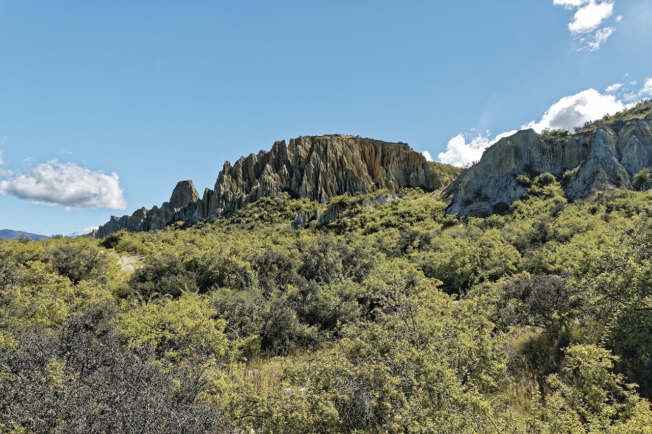
- Elephant Rocks and the Takiroa rock drawings near Duntroon.
- Peter’s Lookout at Lake Pukaki with the view across the turquoise lake to Aoraki.
- Hooker Valley Track: around 10 km return, three swing bridges, and at the end the Hooker glacier lake with icebergs and the south face of Aoraki.
- CampingSpirit overnight tip
-
Official campsite or RV park: DOC White Horse Hill Campground at the start of the Hooker Valley Track: drinking water, cooking shelter, basic toilets, no power, no showers (showers in the public shelter in the village, 2.5 km). Often fully booked in season – book online via DOC. Chemical toilets must not be emptied here; the nearest public dump station is in Twizel. With power and showers: Glentanner Park Centre at the northern end of Lake Pukaki.
Free camping or nature tip (where legal): In Aoraki/Mount Cook National Park, overnight stays outside White Horse Hill are prohibited and the car parks charge a fee. Mackenzie District has strict freedom camping rules with few designated spots on the lakeshore – only with a green warrant and after checking the location in CamperMate.
- Insider tip for campers
- Fill up, shop and empty your tanks in Twizel – there is no dump station in the national park, and rubbish must be taken back out. Walk the Hooker Valley Track early in the morning: on still days Aoraki is reflected in the pools beside the track, and the swing bridges are empty. In a north-westerly föhn, SH80 can be lashed by storm gusts; postpone your drive if so.
Camping practice & local rules
Wild camping & overnight parking
- Since the Self-Contained Motor Vehicles Legislation Act 2023, freedom camping on council land is only permitted in a certified self-contained vehicle, unless a council expressly designates an area for other vehicles too. Proof is the green warrant with sticker; it requires a fixed toilet, fresh and waste water tanks, ventilation and a rubbish bin. The transition period for private vehicles with the old blue warrant ended on 7 June 2026; since then only green warrants count for freedom camping on public land. For rental vehicles this has applied since 7 December 2024.
- If you park without a valid warrant or in a prohibited place, you risk a fine of NZ$400 per offence; for rental vehicles it is recovered via the rental company. Check for the green warrant when you book.
- Each district (Queenstown Lakes, Southland, Invercargill, Clutha, Dunedin, Waitaki, Mackenzie) has its own freedom camping bylaw with prohibited zones, designated sites and maximum stays. DOC manages its own land independently: in Fiordland and in Aoraki/Mount Cook National Park you may only stay at designated campsites, most of which can be booked online.
- Apps: CamperMate (officially supported locations, dump stations, road alerts), Rankers and WikiCamps. For DOC sites use DOC’s booking website; at sites that cannot be booked you pay on site by self-registration.
- No campfires outside designated places; observe summer fire bans (checkitsalright.nz). Take your rubbish with you, grey water only at dump stations.
Waste disposal & supplies
- Dump stations are found in almost every larger town and at all holiday parks; on this route, for example, in Te Anau, Invercargill, Oamaru and Twizel. At DOC sites such as White Horse Hill, emptying cassettes into the toilets is prohibited.
- Tap water from public supplies is drinkable; boil or filter stream and lake water (Giardia). In Fiordland and the Catlins, do not count on water points between towns.
- Gas: in New Zealand, 9 kg LPG bottles are swapped at petrol stations or refilled at gas specialists. Bottles must be tested and certified; foreign bottles are generally not refilled. Rental vehicles come with suitable bottles, and swapping them on the road is straightforward.
- Fuel: there is no petrol station between Te Anau and Milford Sound, in the Catlins only in Owaka, in the Mackenzie Basin in Twizel; Glenorchy has a small, expensive petrol station, and Mount Cook Village has only a self-service pump (card payment only). Diesel vehicles incur Road User Charges, which for rental vehicles are usually billed via the rental company.
- Power at holiday parks via New Zealand camping plugs (blue three-pin plug); rental campers have the right cable.
Vehicle size & traffic rules
- Drive on the left; at roundabouts give way to vehicles from the right. On one-lane bridges, signs (large and small arrow) show who must wait. Slow vehicles let queues pass at slow vehicle bays.
- Speed limits: maximum on open roads usually 100 km/h, in towns 50 km/h, with lower limits on some sections as signposted; vehicles over 3.5 t and vehicles towing a maximum of 90 km/h. The Milford Road is winding and narrow with many lane narrowings – plan on going much more slowly.
- Tolls: New Zealand’s toll roads are all on the North Island; there are no tolls on this route. An access charge for international visitors at Milford Sound and Aoraki/Mount Cook is in preparation (bill since May 2026) – check the status before your trip.
- Animals: sheep and cattle are driven along the road, possums cross at night, penguins in the Catlins and near Oamaru; keas at the Homer Tunnel damage rubber parts. Avoid driving at dusk if possible.
- Rental campers: a valid driving licence in English, or with a translation or an International Driving Permit, is sufficient for up to 12 months. Many rental agreements exclude gravel roads entirely or partly and restrict insurance cover; roads such as Skippers Road near Queenstown are practically always off-limits. Read the excess and exclusions before you drive.
- Winter: on the Milford Road, carrying snow chains may be compulsory from June to November (signs, fine of up to NZ$750), and stopping is prohibited in avalanche zones. Blood alcohol limit 0.5‰ (under 20: 0.0), handheld phone use while driving prohibited.
CampingSpirit packing & preparation checklist
- Effective insect repellent with DEET or icaridin and intact fly screens for the sliding door and roof hatch – the sandflies in Fiordland and the Catlins bite during the day and in swarms.
- Snow chains to fit your tyre size, test-fitted once – possibly compulsory on the Milford Road from June to November.
- Waterproof jacket, overtrousers and warm layers: Fiordland gets several metres of rain a year, and on the south coast a cold wind blows from Antarctica.
- Binoculars for penguins, albatrosses, dolphins and sea lions – keeping your distance is mandatory, but you still want to see something.
- Tide app or tide table for the Cathedral Caves, Curio Bay and Moeraki Boulders.
- Offline maps and printed DOC bookings: there is no coverage on the Milford Road and in parts of the Catlins.
As of 2026-09. Closures, fees and booking rules change: check official sources before you go.