



In-depth guide · CampingSpirit
From Ōmarama along the Waitaki hydro lakes, over Danseys Pass into the Maniototo, on the Rail Trail through gold country and back over the Lindis Pass: just under 500 kilometres through New Zealand’s driest corner, where morning frost and midday heat can come on the same day.
The spirit of the route
Central Otago doesn’t look like postcard New Zealand. Instead of rainforest, slabs of schist rock stand on golden-brown tussock hills, thyme grows wild on the slopes, and above the Maniototo stretches a sky so wide that landscape painters have made it their life’s subject. The route starts at the turquoise hydro lakes of the Waitaki, passes limestone outcrops with centuries-old Māori drawings and climbs on gravel over Danseys Pass to a high plain where the old gold-mining towns still smell of wood stoves and woolsheds. From the sliding door you see hoar frost on the poplars, merino sheep on the road and, in the evening, the dust of a single gravel road against the low sun. By day you get on the bike, roll along the old railway line through tunnels and over viaducts, and finish among Pinot Noir vines on Lake Dunstan.
Stage-by-stage plan
1Stage 1: Ōmarama to Kurow (approx. 80 km)
- The drive
- From Ōmarama, take SH83 south-east along the eastern shore of Lake Benmore via Otematata and on past Lakes Aviemore and Waitaki to Kurow. Wide road with hardly any climbs; a detour via the dam road to Benmore Dam and along the northern shore of Lake Aviemore (back to SH83 over Aviemore Dam) adds around 15 km and shows the lakes from their quiet side. Driving time about 1.5 hours.
- Highlights & must-sees
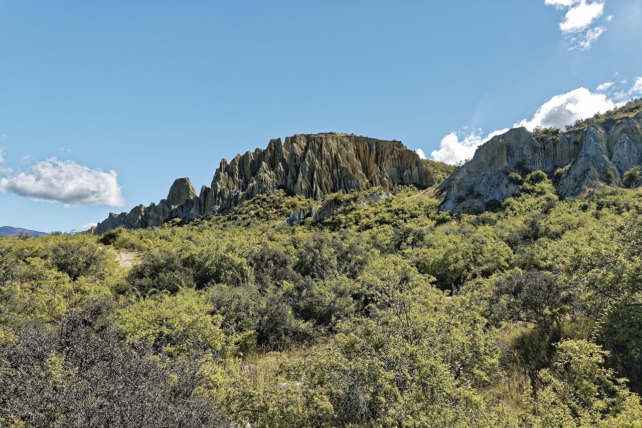
- Clay Cliffs (Paritea) near Ōmarama: furrowed columns of gravel and clay at the end of a gravel access road on private land – best before you set off in the morning, when the light comes in from the side; small fee at the gate.
- Benmore Dam with a lookout over the largest of the Waitaki hydro lakes; its earth embankment is one of the largest in the country.
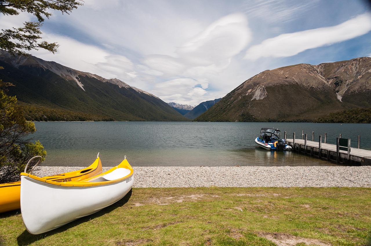
- Lake Aviemore: picnic and swimming bays on the northern shore, with warm, clear water in summer and views of the bare Waitaki hills.
- CampingSpirit overnight tip
-
Official campsite or RV park: Kurow Holiday Park on the edge of town with powered sites, kitchen and amenities, a short walk to the café and shop. If you’d rather stay by the lake, use one of the council’s Waitaki Lakes campgrounds, such as Parsons Rock on Lake Aviemore or Loch Laird near Benmore Dam: basic toilets, no power, sites without booking on a “first come, first served” basis, only with a day or season ticket bought in advance. The campgrounds are open only from the third Saturday in September to the first Sunday in May.
Free camping or nature tip (where legal): The Waitaki lake sites are not freedom camping but council campgrounds that require a ticket; anyone setting up without one is camping without permission. Outside them, the Waitaki District’s 2021 freedom camping bylaw applies: certified self-contained vehicles only, and on permitted areas no more than three nights within four weeks. The council’s online map shows which areas are prohibited; most prohibited zones, however, are on the coast between Ōamaru and Kakanui.
- Insider tip for campers
- Fill up and swap gas bottles in Ōmarama. On the lake campgrounds the speed limit is 10 km/h, open fires are banned and you must keep 10 m from the shoreline. The dump stations at the lake sites (including Boat Harbour, Falstone Creek, Parsons Rock, Sailors Cutting and Wildlife) are free to use with a ticket, otherwise for a small fee in the honesty box; there is a free public dump station at the eastern end of Ōmarama. If you come early in the season: in September and October the nights by the lake are still frosty.
2Stage 2: Kurow to Duntroon (approx. 35 km)
- The drive
- A short stage on SH83 down the broad Waitaki Valley: vineyards on limestone, irrigation channels and rows of poplars. The Takiroa limestone outcrops are right beside the road; the Elephant Rocks are about 6 km off it on a narrow sealed side road south of Duntroon. Plenty of time for cycling: the Alps 2 Ocean Cycle Trail runs parallel to the road.
- Highlights & must-sees
- Takiroa Rock Art Shelter: Māori rock drawings under a limestone overhang right on SH83, with Ngāi Tahu information panels; look, don’t touch.
- Elephant Rocks: weathered limestone boulders in a sheep paddock that became known as a setting for the Narnia film; private land with public access – close the gates and keep your distance from the animals.
- Vanished World Centre in Duntroon: a small, well-made fossil museum about the time when the Waitaki Valley was seabed; plus the Vanished World Trail, a driving loop to fossil sites and rock formations in the area.
- CampingSpirit overnight tip
-
Official campsite or RV park: Duntroon Domain, the community campground in the village: basic amenities, powered and unpowered sites, pay per night. Quiet, with a pub and café within walking distance.
Free camping or nature tip (where legal): The Waitaki bylaw applies here too: freedom camping only with a green warrant and only where it isn’t expressly prohibited. Verges in front of farmland need the owner’s permission. No overnight stays at the Elephant Rocks or at Takiroa.
- Insider tip for campers
- A great day for cycling: the Alps 2 Ocean between Kurow and Duntroon is flat, easy to ride and passes Takiroa. Fill up in Kurow – it’s the last reliable fuel station before Danseys Pass, and in the Maniototo the pumps are far apart too.
3Stage 3: Duntroon to Naseby (approx. 85 km)
- The drive
- Over Danseys Pass Road through the Kakanui Mountains: sealed at first through farmland, then long gravel sections, steep and winding on the Duntroon side, with single-lane stretches and no guard rails. Over the pass (around 935 m) and down through the Kyeburn valley to the Coach Inn and Kyeburn Diggings; the last 16 km to Naseby are also gravel. With photo stops 2.5 to 3 hours – don’t drive it in storms, wet conditions or snow (possible even in summer).
- Highlights & must-sees
- Summit of Danseys Pass with views into the Maniototo and of the Hawkdun Range.
- Danseys Pass Coach Inn: a stone inn from the gold rush of the 1860s, now a pub and accommodation, in the middle of the old goldfields.
- Naseby Forest: larch and pine forest on the edge of town with walking and mountain-bike tracks between the miners’ old water races.
- CampingSpirit overnight tip
-
Official campsite or RV park: Naseby Holiday Park (formerly Larchview) in Naseby, in the larch forest on the edge of Naseby Forest next to the swimming dam, with powered sites, kitchen and dump station, within walking distance of town. On the way, the basic DOC campsite Danseys Pass lies about 500 m past the Coach Inn on German Creek: free, open to campervans and caravans, don’t camp under the trees.
Free camping or nature tip (where legal): Naseby is in the Central Otago District, which has no freedom camping bylaw of its own; the Freedom Camping Act and the 2023 self-contained legislation apply: on council land only with a certified self-contained vehicle and not where signs prohibit camping; vehicles without certification only on areas expressly designated for them. In Oteake Conservation Park and on the pass, stick to designated DOC sites.
- Insider tip for campers
- Danseys Pass Road is excluded in many rental agreements – check beforehand, otherwise you lose your insurance cover; the sealed alternative is the detour via SH1 to Palmerston and SH85 (“Pig Route”) into the Maniototo. Large motorhomes and vehicles with trailers are better off avoiding the road altogether. Check tyre pressure, drive slowly, and expect flying stones from oncoming traffic.
4Stage 4: Naseby to Ranfurly (approx. 15 km)
- The drive
- A short hop across the Maniototo plain to Ranfurly (a good 15 minutes). The day belongs to the Otago Central Rail Trail: the old railway line runs for around 150 km from Middlemarch to Clyde on an even, gentle gradient, with a gravel surface, bridges, viaducts and tunnels. From Ranfurly you cycle through the Maniototo; Middlemarch, the southern starting point, is about 60 km away on SH87.
- Highlights & must-sees
- Rail Trail section Ranfurly – Wedderburn – Oturehua: wide plains, woolsheds and the old Wedderburn goods shed beneath the Hawkdun Range.
- Hayes Engineering Works and Homestead near Oturehua (Heritage New Zealand): a workshop with water-driven machinery where generations of farm equipment were made, plus the old general store in the village.
- Ranfurly: a small Art Deco town, rebuilt after fires in the 1930s; the old railway station is a Rail Trail information point.
- CampingSpirit overnight tip
-
Official campsite or RV park: Ranfurly Holiday Park (Motels & Cabins) in town, about 500 m from the centre right on the Rail Trail, with powered sites and amenities. Alternatively, a second night in Naseby.
Free camping or nature tip (where legal): In the Maniototo you’re safest on holiday parks and designated areas; Rail Trail car parks, station grounds and verges are not places to stay overnight. Even without a council bylaw, national law applies: if you camp freely without a self-contained certificate or despite a prohibition sign, you risk a NZ$400 fine.
- Insider tip for campers
- Bikes and shuttles are available in Ranfurly, Alexandra and Clyde; many hire companies take you and your bike to the starting point, so you don’t have to move the campervan. If you only ride one section, choose a direction with the wind at your back – the north-westerly usually blows hard. In winter there’s hoar frost on the trail in the mornings, and Naseby has an outdoor curling rink.
5Stage 5: Ranfurly to Ophir (approx. 85 km)
- The drive
- On SH85 via Wedderburn and over a low saddle to Becks, from there a side road (around 17 km each way, sealed) to St Bathans. Back to SH85 and through the Manuherikia valley via Lauder and Omakau to Ophir. A quiet, well-built road with several single-lane bridges; driving time about 1.5 hours.
- Highlights & must-sees
- Blue Lake near St Bathans: a flooded gold-mining pit with white scarps and deep blue water, loop walk about an hour; plus the 1882 Vulcan Hotel on the short main street.
- Poolburn Gorge on the Rail Trail between Lauder and Auripo: two tunnels and a high viaduct in a schist gorge – the most popular cycling section of the whole trail; bring a light.
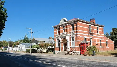
- Ophir: the 1886 post office and the Daniel O’Connell Bridge, a single-lane road suspension bridge with schist towers over the Manuherikia, completed in 1880.
- CampingSpirit overnight tip
-
Official campsite or RV park: Omakau Camp Ground in the Omakau Domain, a basic community campground a few minutes from Ophir; check facilities (power, amenities) and season in advance.
Free camping or nature tip (where legal): St Bathans is a small, protected village with houses right up to the road – don’t stay overnight here, just park. In the Manuherikia valley national rules apply; only use riverbanks and reserves where signs expressly allow freedom camping for self-contained vehicles.
- Insider tip for campers
- Ophir holds New Zealand’s cold record of −21.6 °C, while in summer temperatures in the valley climb above 30 °C. Hoar frost early in the morning, heat at midday: reserve water, sun protection and a warm duvet all belong on board at the same time. Shop in Omakau; check in advance whether you can get fuel there – you can fill up reliably in Ranfurly and Alexandra.
6Stage 6: Ophir to Clyde (approx. 40 km)
- The drive
- On SH85 through the Manuherikia valley via Chatto Creek to Alexandra, then on SH8 along the Clutha to Clyde. Flat, short, good for cycling: the last Rail Trail section, Alexandra – Clyde, is around 10 km long and suits an evening ride.
- Highlights & must-sees
- Shaky Bridge in Alexandra: a pedestrian suspension bridge over the Manuherikia from the 1870s, with the river track beside it.
- The big clock on the hillside above Alexandra and the view over the rocky landscape of the Knobby Range.
- Clyde: historic stone buildings from the gold-rush era, the end of the Rail Trail at the old station and the Clyde Dam on the edge of town.
- CampingSpirit overnight tip
-
Official campsite or RV park: Clyde Holiday Park (Clyde Holiday & Sporting Complex), the leased council campground in the Clyde Domain, close to the town centre; often full in summer. In Alexandra, Alexandra Holiday Park on the Manuherikia has plenty of sites.
Free camping or nature tip (where legal): In Alexandra and Clyde, stay on the holiday parks; in the built-up areas, sleeping in a campervan is prohibited by signs in many places. In 2025 the council decided against a freedom camping bylaw and is instead preparing a bylaw under the Reserves Act that could regulate camping on reserves – follow current signs.
- Insider tip for campers
- Alexandra is the supply town of the route: supermarkets, fuel stations and gas; look up public dump stations in CamperMate in advance. In midsummer Alexandra is one of the hottest places in the country – do your bike rides in the early morning.
7Stage 7: Clyde to Cromwell (approx. 35 km)
- The drive
- On SH8 through the Cromwell Gorge along Lake Dunstan, a fast road with truck traffic and few pull-over bays. Detour to Bannockburn over the bridge on the Kawarau arm, around 10 km extra. Driving time 40 minutes.
- Highlights & must-sees
- Lake Dunstan Trail Clyde – Cromwell: a cycle trail with boardwalks clipped to the cliff face in the Cairnmuir gorge, as a day ride with a shuttle back.
- Old Cromwell Town: stone shops, galleries and an inn, rebuilt stone by stone on the new shoreline after Lake Dunstan was filled.
- Bannockburn: Pinot Noir wineries on the Kawarau arm, such as Mt Difficulty with views over the Cromwell basin, and the loop walk through the Bannockburn Sluicings (DOC) with the miners’ channels, tunnels and stone huts.
- CampingSpirit overnight tip
-
Official campsite or RV park: Cromwell Top 10 Holiday Park with powered sites, amenities, kitchen and dump station, quietly located in a residential area.
Free camping or nature tip (where legal): Much of the land around Lake Dunstan is managed by the government agency LINZ. It designates free areas without booking, such as Bendigo (maximum 3 nights per calendar month, toilets, tents allowed), Lowburn and Pines Camp (3 nights each, no tents), and Champagne Gully and Jacksons Inlet (1 night each); fires are banned. Camping is prohibited elsewhere on the shore – follow the signs on site.
- Insider tip for campers
- After a wine tasting, New Zealand’s blood alcohol limit of 0.5 ‰ applies – better to go from campsite to winery by bike or on foot. There are public toilets and water on the Cromwell waterfront; fill up in Cromwell before heading into the sparsely populated Lindis valley.
8Stage 8: Cromwell to Ōmarama (approx. 110 km)
- The drive
- On SH8 north along Lake Dunstan via Tarras into the Lindis valley and over the Lindis Pass (around 970 m) back into the Waitaki basin to Ōmarama. A well-built pass road with long climbs and passing lanes; in winter icy patches and occasional closures for snow. Driving time just under 1.5 hours.
- Highlights & must-sees
- Tarras: a small village with a café and shop among merino paddocks.
- Lindis Pass: tussock country in gold and brown, a lookout with a short path at the summit.
- An evening soak in the wooden tubs of Hot Tubs Ōmarama with views of the Benmore Range.
- CampingSpirit overnight tip
-
Official campsite or RV park: Ōmarama Top 10 Holiday Park in town with powered sites and amenities; free public dump station at the eastern end of town. A base for the Mackenzie region to the north.
Free camping or nature tip (where legal): The lookout car park on the Lindis Pass is not an overnight spot. Around Ōmarama the Waitaki bylaw applies again (self-contained, no more than three nights in four weeks, prohibited zones as shown on the online map); the Waitaki Lakes sites on Lake Benmore require a ticket.
- Insider tip for campers
- In winter, check road conditions with NZTA before the Lindis Pass and carry snow chains. Ōmarama is a well-known gliding centre: on clear north-westerly days lee waves form over the mountains, on which glider pilots reach great heights – a look in at the airfield is worthwhile.
Camping practice & local rules
Wild camping & overnight parking
- Since the Self-Contained Motor Vehicles Legislation Act 2023, freedom camping on public land is only allowed in a certified self-contained vehicle, unless an area is expressly designated for other vehicles too. Proof is the green warrant with sticker (a fixed toilet is mandatory). For rental vehicles this has applied since 7 December 2024; for private vehicles the transition period ended on 7 June 2026. Fine: NZ$400 per offence.
- Waitaki District: 2021 freedom camping bylaw, self-contained vehicles only, on permitted areas no more than three nights in four weeks; the council’s online map shows prohibited zones. The Waitaki Lakes campgrounds on Benmore and Aviemore are council campgrounds that require a ticket, with no booking, open only from the third Saturday in September to the first Sunday in May (2026/27 season: 19 September to 2 May).
- Central Otago District: no freedom camping bylaw of its own; the Freedom Camping Act and the self-contained legislation apply. At Lake Dunstan, LINZ manages many shoreline areas and designates individual free camping areas with length-of-stay limits. Instead of a freedom camping bylaw, the council is preparing a bylaw under the Reserves Act.
- DOC land: basic campsites such as Danseys Pass are free or self-registration; many other DOC sites can now only be booked online in advance. Camping is prohibited on DOC land with special protection (urupā, breeding areas).
- Apps: CamperMate (official locations, dump stations, road reports), WikiCamps and Rankers. Observe fire bans in the dry summer (checkitsalright.nz); on the Waitaki Lakes sites open fires are banned at all times.
Waste disposal & supplies
- Dump stations: at many holiday parks, at five Waitaki Lakes campgrounds (free with a ticket, otherwise for a fee) and free at the eastern end of Ōmarama; look up other locations, for example in Alexandra and Cromwell, in CamperMate. Never empty cassettes into long drops or campground toilets.
- Water: tap water in the towns is drinkable. Don’t count on drinking water at basic lake sites and DOC campsites; boil or filter river and lake water. Plan for more water in midsummer – Central Otago is the driest region in the country.
- Gas: 9 kg LPG bottles are swapped or refilled at fuel stations and shops if they are tested and certified; foreign bottles are generally not filled. Rental vehicles have suitable bottles. On frosty nights the heater uses more than you’d expect.
- Fuel: Ōmarama, Kurow, Ranfurly, Alexandra, Clyde and Cromwell; in small places such as Otematata and Omakau, don’t rely on a pump. There’s no fuel station between Kurow and Naseby over Danseys Pass, and only a few between Cromwell and Ōmarama. Diesel vehicles pay Road User Charges, for rental vehicles usually via the rental company.
- Power at holiday parks via New Zealand camping plugs (blue three-pin plug); for larger shops, Alexandra or Cromwell are best.
Vehicle size & traffic rules
- Drive on the left; single-lane bridges with priority signs (large and small arrow) are common in the Maniototo and the Manuherikia valley. Slow vehicles let queues pass at pull-over bays.
- Speed limits: mostly 100 km/h on rural roads, 50 km/h in towns, lower on some stretches as signposted; vehicles over 3.5 t and vehicles with trailers no more than 90 km/h. Drive much more slowly on gravel – campervans brake poorly on loose surfaces.
- Tolls: there are no toll roads on this route; New Zealand’s toll roads are on the North Island.
- Animals: sheep and cattle are driven along the road, rabbits and possums cross at dusk, and farm roads have cattle stops and gates – leave gates as you found them.
- Rental campervans: many agreements exclude gravel roads entirely or partly, and Danseys Pass is a typical case; if you have damage there, you lose your insurance cover. A driving licence in English, or with a translation or an International Driving Permit, is valid for up to 12 months.
- Winter and heat: from June to September frost, ice and snow on the Lindis and Danseys passes – carry chains and check road conditions with NZTA; in summer fire risk – never park with a hot exhaust over dry grass. Blood alcohol limit 0.5 ‰ (0.0 for drivers under 20), no phones while driving.
CampingSpirit packing & preparation checklist
- A bike with wide tyres or a hired bike with shuttle – the Rail Trail, Lake Dunstan Trail and Alps 2 Ocean are gravel and fine-gravel tracks.
- A head torch for the Rail Trail tunnels in the Poolburn Gorge.
- A warm down duvet and an ice scraper: even in spring and autumn it freezes at night in the Maniototo.
- A sun hat, high-factor sunscreen and two extra water containers for hot days in the Manuherikia valley.
- A tyre pressure gauge and compressor for the gravel on Danseys Pass.
- Snow chains in the cold season for the Lindis Pass and Danseys Pass.
As of 2026-10. Closures, fees and booking rules change: check official sources before you go.