

In-depth guide · CampingSpirit
From Whalley and Clitheroe over Pendle Hill, Slaidburn and the Trough of Bowland to Lancaster, on to Morecambe Bay and back via Chipping to Ribchester: just under 290 kilometres on narrow Lancashire roads, driven on the left and with time for every sheep jam.
The spirit of the route
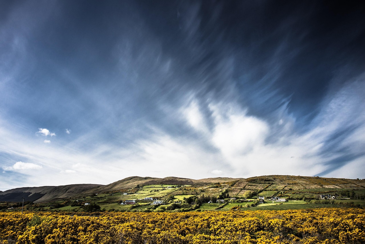
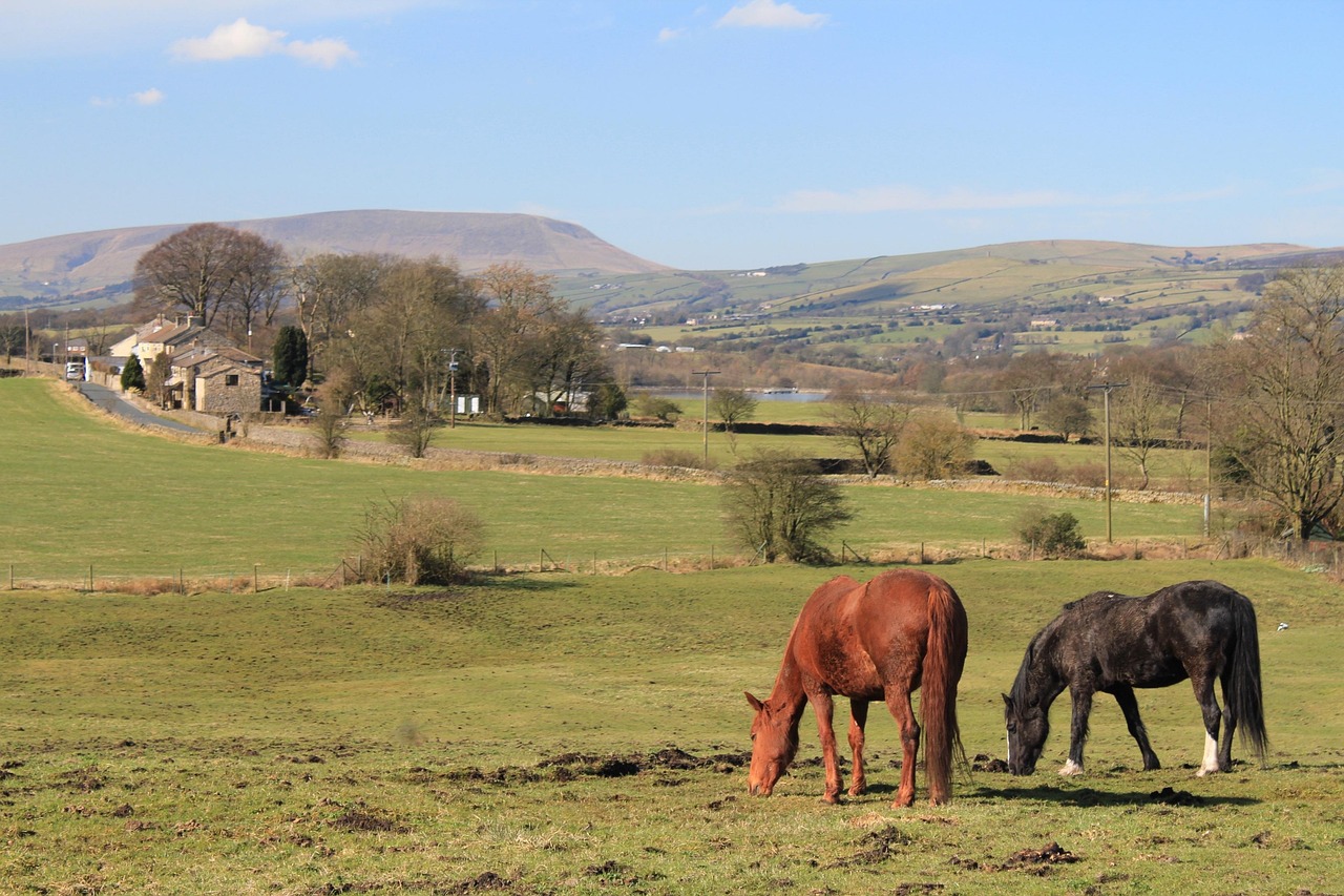
The Forest of Bowland is not a forest but high moorland, and it lies only about an hour's drive from Manchester, yet most holidaymakers never see it. Beyond Clitheroe the traffic dissolves into country lanes, drystone walls trace their way across green slopes, and from your sliding door you look out on the long back of Pendle Hill, which has lived off the reputation of the witch trials since 1612. In Slaidburn you sit in an inn with an old courtroom upstairs, in Dunsop Bridge there is a red telephone box, and the village is said to be the centre of Great Britain, and on the Trough road curlews whistle over the heather. Later the sky opens out over Morecambe Bay, the tides roll across the sands, and bitterns call from the reedbeds at Silverdale. This loop demands patience: passing places, driving on the left, rain. In return you get a corner of England where camping still tastes of country life.
Stage-by-stage plan
1Stage 1: Preston (M6) to Clitheroe via Whalley (approx. 45 km)
- The drive
- From the M6 exit at Preston take the A59 east, then cross Samlesbury and the Ribble to Whalley and continue on the A671 to Clitheroe. At first it is a fast main road with plenty of commuter traffic, then a country road that runs through the narrow centre of Whalley. Just over an hour of pure driving time; if you are coming from the south, allow for jams around Preston and on the M6.
- Highlights & must-sees
- Whalley Abbey: ruins of a Cistercian monastery (building began in 1296) with a gatehouse and gardens; the house is now a conference and visitor centre of the Diocese of Blackburn with a café, guided tours and access to the ruins only by arrangement; check opening times in advance.
- Whalley Viaduct: the long 19th-century railway viaduct with more than forty arches, easy to take in from the edge of the village.
- Clitheroe Castle: one of the smallest keeps in England, on a limestone crag above the town, with views of Pendle Hill and the Bowland Fells.
- CampingSpirit overnight tip
-
Official campsite or RV park: Clitheroe Camping and Caravanning Club Site on the edge of town near Edisford (according to map data for motorhomes and caravans). Check facilities, booking for non-members, length limit and October opening with the club beforehand. Alternative on the Ribble: Edisford Bridge Farm Camping & Caravan Site, a farm site near Edisford Bridge; ask about facilities and season yourself.
Free camping or nature tip (where legal): Ribble Valley Borough Council does not allow overnight camping in any of its car parks (notice on the council's website); this includes the car parks in Clitheroe, Whalley and Ribchester. Roadsides and lay-bys in the area are not a reliable option either.
- Insider tip for campers
- Fill up and shop in Clitheroe or Whalley before you head into the Bowland uplands: up there you will find hardly any petrol stations and only small village shops. In Whalley the village centre is narrow and lined with parked cars; in a camper you are better off parking on the edge of the village and walking the last few metres.
2Stage 2: Clitheroe to Pendle Hill and back to Clitheroe (approx. 40 km)
- The drive
- A round trip on small roads: Clitheroe – Chatburn – Downham – Pendleton – Barley at the foot of Pendle Hill, then via Newchurch in Pendle and Roughlee on through the witch country and back. Many stretches are single-track with drystone walls and passing places, some with climbs; half a day of pure driving, a full day with a hike.
- Highlights & must-sees
- Pendle Hill (557 m): hike from Barley up the Pendle Steps to the summit plateau “Big End”, roughly 3 to 4 hours there and back; in fog only with map and compass.
- Downham: estate village at the foot of the hill with a stream, church and stone houses, known from the film “Whistle Down the Wind”.
- Newchurch in Pendle and Roughlee: places linked to the witch trials of 1612; in Roughlee there is a memorial to Alice Nutter.
- CampingSpirit overnight tip
-
Official campsite or RV park: Second night at the site in Clitheroe; leave the motorhome parked and tackle Pendle Hill on foot or by bike. As far as we know there are small farm and tent sites around Pendle Hill that we could not verify; whether motorhomes are accepted is open, and the access roads are narrow. Check your vehicle length beforehand.
Free camping or nature tip (where legal): Overnight stays are not intended in the car park on the edge of Barley or in the village of Downham; follow the signs on site. Wild camping on the hill is not permitted on Access Land.
- Insider tip for campers
- Drive this loop on a weekday or early in the morning: at weekends hikers park up the small roads from Barley for half their length. Start your hike in the morning and check the weather forecast: if rain and wind roll in from the west, the gusts on the plateau are strong.
3Stage 3: Clitheroe to Caton in the Lune Valley (via Slaidburn and the Trough of Bowland) (approx. 68 km)
- The drive
- From Clitheroe to the ruins of Sawley Abbey, via Bolton-by-Bowland to Slaidburn in the Hodder Valley and on to Dunsop Bridge. There the road through the Trough of Bowland begins; it climbs to about 295 m at the pass, is steep and narrow and has to manage with passing places (we could not verify an official restriction for large vehicles, but the narrowness is real); on the other side it continues via Marshaw, Abbeystead and Dolphinholme to Quernmore and Caton. Two to two and a half hours, longer with oncoming traffic and livestock. Long or wide vehicles are better off taking the A59/A6 via Preston and Garstang to Lancaster.
- Highlights & must-sees
- Sawley Abbey: ruins of a Cistercian monastery on the Ribble, usually freely accessible.
- Slaidburn: stone village in the Hodder Valley with the inn “Hark to Bounty”, whose upper floor once served as a courtroom.
- Dunsop Bridge: the geographical centre of Great Britain (excluding islands) is placed at the Whitendale Hanging Stones, about 7 km to the north in the uplands; the village with the red telephone box proudly carries the title.
- CampingSpirit overnight tip
-
Official campsite or RV park: Crook O’Lune Caravan Park near Caton in the Lune Valley, on the A683 north-east of Lancaster (according to map data a site with motorhome pitches); check facilities, season and access for your vehicle length with the operator beforehand. For a night in Bowland itself (Slaidburn, Dunsop Bridge) we could not verify a site; if you want to stay there, search via Pitchup or the club search for small farm or CL sites and check admission and access beforehand.
Free camping or nature tip (where legal): On the Trough road and in the passing places overnight stays are not intended; expect complaints from residents and farmers. The road crosses Access Land: driving or parking off the road is forbidden.
- Insider tip for campers
- Fill up in Clitheroe, because between Slaidburn and Lancaster there is no reliable petrol station. Mobile reception is patchy in the Hodder and Wyre valleys: download maps for offline use. On the single-track sections there are cattle grids and sheep on the carriageway: drive slowly and, when livestock is about, keep the engine quiet. Allow more time for photo stops in the Trough than for the drive itself.
4Stage 4: Caton to Silverdale on Morecambe Bay (via Lancaster and Morecambe) (approx. 40 km)
- The drive
- From Caton take the A683 into the centre of Lancaster, then the coast road to Morecambe and on through Carnforth to Silverdale. Mostly well-built roads; in Lancaster there is dense city traffic with one-way streets and height restrictions; about 1 hour of pure driving time, half a day with stops.
- Highlights & must-sees
- Lancaster: castle above the Lune, where the trials of the Pendle witches took place in 1612, plus the Priory church; Ashton Memorial in Williamson Park with views over the bay. Check in advance whether the castle can be visited.
- Morecambe: seafront promenade with the Art Deco “Midland” hotel of 1933, the Eric Morecambe statue and the Stone Jetty.
- Silverdale: limestone coast, Jenny Brown’s Point with the chimney of a former copper smelter and views over the salt marshes.
- CampingSpirit overnight tip
-
Official campsite or RV park: Holgates Holiday Park near Silverdale (according to map data with motorhome and touring pitches); check facilities, opening times, access height and pitch size beforehand. Alternative on the other side of the bay: the Caravan and Motorhome Club site Meathop Fell near Grange-over-Sands (club sites are usually open to members only; check beforehand).
Free camping or nature tip (where legal): In the promenade car parks of Morecambe and on the coast near Silverdale, overnighting in your vehicle is not intended; observe signs about height limits and overnight bans. Mudflats and salt marshes are dangerous at high tide.
- Insider tip for campers
- Do not leave the camper in a multi-storey car park in Lancaster; instead park on the edge of town and take the bus into the centre, as many city car parks have height restrictions. Tide tables for Morecambe Bay belong in the glove box: the bay has one of the biggest tidal ranges in Britain, and the tide comes in faster than you can walk.
5Stage 5: Silverdale to Silverdale (round trip via Arnside) (approx. 25 km)
- The drive
- A short round trip on small roads from Silverdale to Arnside and back, with detours to the Leighton Moss reserve and to Arnside Knott. Narrow lanes with drystone walls, and in the village of Arnside plenty of parked cars; the driving time is short, the day belongs to your feet.
- Highlights & must-sees
- Leighton Moss: RSPB reedbed reserve with hides, bittern, bearded tit and red deer.
- Arnside Knott (159 m, National Trust): circular trail with views across the Kent Estuary to the Lake District mountains.
- Arnside: promenade and pier on the Kent Estuary; on spring tides the tidal wave (the “Bore”) rolls upstream here.
- CampingSpirit overnight tip
-
Official campsite or RV park: Second night on the same site near Silverdale. In Arnside itself there is parking for day visitors; we could not verify a motorhome campsite in the village.
Free camping or nature tip (where legal): The coastal strip is protected (Arnside and Silverdale National Landscape); overnighting in a vehicle outside campsites is not permitted without the landowner's permission. Car parks at the reserve and at the Knott are day car parks; read the rules on site.
- Insider tip for campers
- Do not go out onto the sands without a guide: the bay has quicksand and a fast-rising tide. Guided crossings run under the direction of the official sand guide (Queen’s Guide to the Sands); check dates with the organisers. If you want to see the Bore, look up spring tides in the tide tables and be on the promenade in good time.
6Stage 6: Silverdale to Ribchester via Garstang and Chipping (approx. 70 km)
- The drive
- From Silverdale via Carnforth to the A6 to Garstang, then east through the Wyre Valley towards Chipping, past Beacon Fell and via Longridge to the Ribble at Ribchester. Brisk on the A6, increasingly narrow from Garstang; between Chipping and Longridge some single-track roads with drystone walls. A good 2 hours of driving; larger vehicles are better off sticking to the A6 and other wider roads for longer.
- Highlights & must-sees
- Chipping: village at the foot of the Bowland Fells, with a medieval core and the church of St Bartholomew.
- Beacon Fell Country Park (266 m): circular trail on a single hill with views over the coastal plain; car parks partly chargeable.
- Ribchester: Roman site Bremetennacum with a museum and remains of the bath house; check opening times in advance.
- CampingSpirit overnight tip
-
Official campsite or RV park: Horns Inn Caravan Club CL near Goosnargh, a small Certified Location with few pitches, according to map data with around five pitches and mostly reserved for members of the Caravan and Motorhome Club; check reservations and availability beforehand. Other small farm and caravan sites lie around Longridge and Ribchester; check names and motorhome admission yourself.
Free camping or nature tip (where legal): In the Ribble Valley council car parks, including in Ribchester, overnight camping is not allowed, and at Beacon Fell the day car parks are not meant for overnight stays; signs on site apply. If you are running late, it is better to book a site than to hope.
- Insider tip for campers
- It is a good 20 minutes from Ribchester to the M6 at Preston; allow a time buffer for the return journey in rush hour. Lancashire cheese (crumbly, mildly tangy) is sold in farm shops around Goosnargh and Garstang; it is unsuitable for the journey home to Germany, because the EU generally does not allow travellers to import meat and dairy products from third countries such as Great Britain; check with customs beforehand. So enjoy it on the spot.
Camping practice & local rules
Wild camping & overnight parking
- England has no right to roam for motorhomes: overnighting in a vehicle outside campsites is only possible with the landowner's permission. The right of way on Access Land (Open Access Land) applies to walkers, not to vehicles or tents. The Forest of Bowland is a National Landscape (formerly AONB), not a national park; this gives no additional special rights for free camping.
- Ribble Valley Borough Council states that it does not allow overnight camping in any of its car parks. Parking is not camping: if you park in lay-bys at the roadside, you risk complaints from farmers and residents and may be told to move on by the police or landowners.
- On Access Land and in moorland areas the following applies: dogs on a short lead between 1 March and 31 July (ground-nesting birds) and everywhere near livestock; open fires are forbidden in the uplands, and in summer there is a risk of moorland fires. Restrictions and closure days on Access Land can be checked with Natural England.
- You can stay legally on campsites, farm sites and the small sites run by the clubs (Caravan and Motorhome Club, Camping and Caravanning Club; whether non-members can book is decided by each site). There are also membership networks such as Britstops (pubs, farm shops and breweries offering overnight stays; check the conditions). Apps and sources: park4night, Campercontact, Pitchup.
Waste disposal & supplies
- Disposal is called “Elsan point” (chemical toilet) and “waste water disposal” (grey water). Most campsites have both, public stations are rare; check by app before you set off. Drinking water is available on sites, at petrol stations and partly at public toilets; a hose with a Hozelock adapter helps with filling.
- Electricity on British sites comes via blue CEE plugs (16 A); cables of 25 metres make sense. For sockets in the camper you need an adapter to type G if you use British appliances.
- Gas: German exchange cylinders are not swapped in Great Britain. Calor cylinders (butane and propane) have their own connections; Camping Gaz is available in outdoor shops. If you are staying longer, use refillable cylinders with an adapter or two full cylinders from home. Ferries and Eurotunnel regulate the carrying of gas; read the operator's conditions beforehand.
- Shopping and fuel: in the uplands around Slaidburn and Dunsop Bridge there are hardly any shops and no reliable petrol stations; get supplies and fuel in Clitheroe or Lancaster.
Vehicle size & traffic rules
- Entry: German and other EU citizens need an electronic travel authorisation (ETA) for Great Britain, applied for online via GOV.UK, currently £20, valid for two years or until the passport expires. Without an ETA, carriage is refused. A passport is required; an ID card is not enough.
- Vehicle: carry your driving licence, registration certificate and proof of insurance. Have your insurer confirm in writing that the policy is valid for the United Kingdom, and ask whether a Green Card is required. Headlights must be adjusted or masked for driving on the left.
- Import: meat (pork, beef, lamb, goat, including sausage) and dairy products (cheese, milk, butter, yoghurt) from the EU may no longer be imported since 2025; permitted are, for example, fish, poultry, eggs and honey for personal use. Dogs: EU pet passport with microchip and rabies vaccination, plus tapeworm treatment by a vet 24 to 120 hours before arrival, entered in the passport (exceptions: direct entry from Finland, Ireland, Northern Ireland, Malta, Norway).
- Driving on the left: roundabouts clockwise, and whoever is already on the roundabout has priority. On single-track roads with passing places, whoever has the passing place on their left pulls in; if it is on the right, you wait opposite. Never park in passing places. An extra mirror makes driving along walls easier.
- Speed limits in mph, by unladen weight: motorhomes up to 3.05 t 60 on country roads and 70 on dual carriageways and motorways; over 3.05 t 50 on single carriageways and 60 on dual carriageways, 70 on motorways. Cars towing a caravan or trailer 50 on single carriageways, 60 on dual carriageways and motorways. In built-up areas usually 30. Different signs always take precedence.
- Dimensions: for motorhomes registered in Great Britain the maximum values are 12 m in length and 2.55 m in width; from 3 m in height a warning sign in the driver's cab is compulsory. Village streets, bridges and drystone walls are narrower than the measurements suggest. Heights on signs are given in feet and inches (e.g. 10’6” = 3.20 m).
- On the route there is no toll for cars and motorhomes (the M6 Toll lies off to the side), and we know of no low emission zone; check Clean Air Zones in other cities beforehand. Winter tyres are not compulsory.
- Alcohol: 0.8 per mille (80 mg per 100 ml of blood) in England, Wales and Northern Ireland; because of different limits in Scotland and the danger on the narrow roads, the rule is: abstain completely. Using a mobile phone at the wheel is forbidden, including as a hand-held navigation device.
CampingSpirit packing & preparation checklist
- Extra wing mirror or wide-angle mirror: on narrow roads with drystone walls the side clearance decides, and when driving on the left the driver sits unusually close to the wall.
- Tide table for Morecambe Bay (printed or offline on your smartphone): the tide comes in faster in the bay than you can walk.
- Ordnance Survey Explorer map OL41 (Forest of Bowland and Ribblesdale) on paper plus offline maps: reception is patchy in the uplands.
- Waterproof walking boots, rain jacket and hat: on Pendle Hill and in the Trough the weather changes within minutes, and fog takes away your orientation.
- Tick remover and long trousers for bracken and heather paths, plus a short lead for the dog (ground-nesting birds, livestock).
- Mains hook-up cable with CEE connector, at least 25 metres, and a type G adapter for British sockets.
As of 2026-10. Closures, fees and booking rules change: check official sources before you go.