



In-depth guide · CampingSpirit
From Penrith via Appleby and Kirkby Stephen, the Hartside Pass and Alston to High Force, Barnard Castle and Raby Castle, finishing in Durham: about 275 kilometres of left-hand driving over the roof of the Pennines, where more stars than street lamps shine at night.
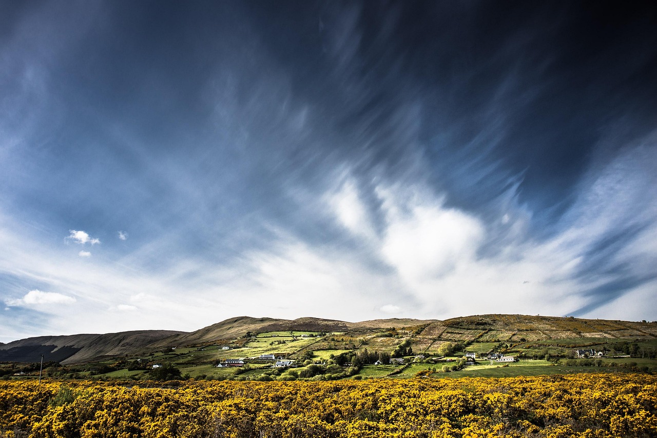
The spirit of the route
Between the Lake District and Hadrian’s Wall lies a corner of England that most people drive through and few stay in: the Eden Valley, the high moors of the North Pennines and Teesdale. Beyond Penrith the sandstone turns red, in Appleby sheep graze in front of the castle, and beyond Melmerby the A686 winds up the Hartside in hairpins, from where on a clear day you can see as far as Scotland and the fells of the Lake District. Up top it smells of heather and wet peat, curlews call, and the valley shrinks in your rear-view mirror. The B6277 carries on across the moor and down to the Tees, which thunders over the basalt edge in a single drop in the gorge at High Force. It stays dark here in the evenings: after dinner you can see the Milky Way from your sliding door, with hardly a light to disturb the sky.
Stage-by-stage plan
1Stage 1: Penrith to Appleby-in-Westmorland (approx. 35 km)
- The drive
- From Penrith (exit Junction 40 of the M6) east along the A66 through the Eden Valley: dual carriageway in places, mostly well surfaced, with lorry traffic and few built-up stretches, plus a detour to Temple Sowerby. Around 45 minutes of pure driving time; the side roads to the castles and villages are narrow and lined with drystone walls or hedges.
- Highlights & must-sees
- Brougham Castle on the River Eamont, a 13th-century castle ruin with views over the river valley; open in the main season (English Heritage), check opening times in advance.
- Acorn Bank near Temple Sowerby (National Trust): herb garden and orchard, plus a watermill trail through a patch of woodland.
- Appleby-in-Westmorland: the broad Boroughgate with its lime trees and fountain, Appleby Castle on the Eden and the station of the Settle–Carlisle line.
- CampingSpirit overnight tip
-
Official campsite or RV park: Wild Rose Park at Ormside, about 2 kilometres south-west of Appleby (access from the B6260): a large site with electric hook-up on all touring pitches, a shop and a restaurant, open all year according to the operator’s description; ask in advance about motorhome service facilities and pitch size. As alternatives, the OSM data lists smaller sites near Appleby and Dufton, including Park House Caravan Park and Grandie Caravan Park; check season and length restrictions beforehand.
Free camping or nature tip (where legal): No wild camping: England has no right to roam, and the car parks in Penrith and Appleby are not designated for overnight stays. Boroughgate in Appleby is day parking with a time limit; for the night, the campsite is your only option.
- Insider tip for campers
- In June the Appleby Horse Fair (a gathering of Travellers for horse trading) draws many thousands of visitors to the town; streets and squares are overloaded for days. If you are coming that week, book long in advance or avoid the town. Fuel and shopping: Penrith has the largest supermarkets in the region; after that the choice gets thin.
2Stage 2: Appleby-in-Westmorland to Kirkby Stephen (approx. 45 km)
- The drive
- From Appleby take the A66 south-east and then the A685 through the Eden valley to Kirkby Stephen. The B6259 into the Mallerstang valley as far as Pendragon Castle is also worth a there-and-back trip: narrow, with passing places and sheep on the road, and often difficult in winter because of snow. Around 1 hour of pure driving time including the detour.
- Highlights & must-sees
- Stenkrith Park near Kirkby Stephen: the Eden squeezes through a small limestone gorge, and the path to Hellgill Force starts here.
- Pendragon Castle in the Mallerstang valley, a ruin with views of Wild Boar Fell and the tracks of the Settle–Carlisle line.
- Nine Standards Rigg: the stone cairns on the moor above the town on the Coast to Coast long-distance footpath, on foot only (several hours there and back).
- CampingSpirit overnight tip
-
Official campsite or RV park: Pennine View Park on the edge of Kirkby Stephen, listed in the OSM data as a campsite with about 35 pitches; ask the operator about electricity, sanitary facilities and waste disposal, and reserve in advance for motorhomes. Alternatively, Chapel Farm Caravan Park lies west of Kirkby Stephen, towards Warcop; check the season in advance.
Free camping or nature tip (where legal): No legal wild camping: Mallerstang and the moors are grazing land, access land and nature reserve. Anyone who parks motorhomes on the roadside gets in the farmers’ way; “No overnight parking” signs are common.
- Insider tip for campers
- Small to medium motorhomes can manage the Mallerstang road as far as Pendragon Castle; larger ones are better parked in Kirkby Stephen, with a bike for the trip. If you want to continue south, you will find the continuation of the B6259 to Hawes in the CampingSpirit guide “Drystone walls, lakes and viaducts – by camper through the Lake District and Yorkshire Dales”. Fill up on water and food in Kirkby Stephen: on the way to Alston there are hardly any shops left.
3Stage 3: Kirkby Stephen to Alston (approx. 75 km)
- The drive
- Back along the A685 and the A66 to Penrith (about 45 km), then on the A686 through Langwathby and Melmerby and up to the Hartside Pass (around 580 m) with several hairpins; from there in wide bends down to Alston, which counts as one of the highest market towns in England. The A686 is dual carriageway in places, has long climbs and descents, and is unpleasant in fog, ice or storms. A good 2 hours in total.
- Highlights & must-sees
- Hartside Pass (around 580 m, A686): the car park at the pass with views across the Eden Valley to the fells of the Lake District and, on clear days, as far as Scotland; the café at the pass is not reliably open, so check in advance.
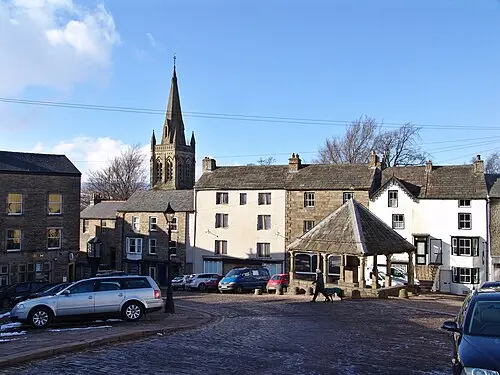
- Alston: a town of steep cobbled streets, a market cross and the station of the South Tynedale Railway (narrow-gauge line, in season only).
- Dark skies: the North Pennines National Landscape is among the darkest areas in England. Official Dark Sky Discovery Sites include the Bowlees Visitor Centre and Cow Green Reservoir (Teesdale, see stage 4); the Hartside car park is not one of the sites listed there. None of these places is intended for overnight parking.
- CampingSpirit overnight tip
-
Official campsite or RV park: Around Alston Moor, the OSM data names Tyne Willows on the edge of Alston, the Horse & Wagon Caravan Park east of Alston towards Nenthead, and the village site Garrigill Village Hall Camp Site; check with the operator in advance about facilities and suitability for motorhomes. On the west side of the pass, near Melmerby, you will find Melmerby Holiday Park and other small sites; ask in advance about autumn opening.
Free camping or nature tip (where legal): No wild camping: at the Hartside car park and in the region there is no right to stay overnight, and the pass is a gathering place for motorcycle groups and subject to sudden weather changes. The moors of the North Pennines are a protected area and partly grazing land – consideration is a must, not least because of the nesting birds.
- Insider tip for campers
- Take the descent from the Hartside in a low gear, not on the brakes. Front Street in Alston is steep and cobbled – with a large motorhome, leave the camper outside the town and use the car park at the station. Fill up with fuel in Penrith: Alston has only a small choice.
4Stage 4: Alston to Middleton-in-Teesdale (via High Force) (approx. 40 km)
- The drive
- From Alston straight along the B6277 via Garrigill and the moor at Yad Moss down to Langdon Beck and on to High Force, Bowlees and Middleton: about 31 kilometres. Nenthead (one of the highest villages in England, around 460 m) lies off the route on the A689 and is a detour from Alston, which makes the stage a good 40 kilometres long. The B6277 is narrow to dual carriageway in places, with sheep wandering freely and long descents, and is temporarily impassable in snow and ice. Around 1 hour without stops, a good 1.5 hours with the Nenthead detour.
- Highlights & must-sees
- Nenthead (detour from Alston via the A689): former lead mines in the North Pennines Geopark, with an information centre and walking trails.
- High Force: the Tees drops about 21 m over an edge of Whin Sill dolerite into a gorge; access is on private land of the Raby Estate and is charged for, open during the day, shorter hours in winter.
- Low Force and Wynch Bridge near Bowlees: small steps in the Tees and one of the oldest suspension bridges for pedestrians in England.
- CampingSpirit overnight tip
-
Official campsite or RV park: Near Middleton-in-Teesdale, the OSM data names Daleview Holiday Park and Leekworth Caravan and Camping Park; check both sites in advance for motorhome pitches, electricity and season. Higher up the valley is the smaller farm site Low Way Farm Camping Site.
Free camping or nature tip (where legal): No wild camping: the Upper Teesdale National Nature Reserve and the Raby Estate do not tolerate overnight stays in car parks or on tracks, and a parking fee applies at the High Force car park. On the moor above Langdon Beck there are no pitches available for motorhomes.
- Insider tip for campers
- Drive the B6277 as early as possible, before walkers and motorcycles fill the car park at High Force. For Cauldron Snout and Cow Green (Dark Sky Discovery Site) you need plenty of time and a walk; the small access road to the reservoir is unsuitable for larger motorhomes. Before setting off, fill up with water and diesel in Penrith or Alston: filling stations are rare.
5Stage 5: Middleton-in-Teesdale to Barnard Castle (approx. 30 km)
- The drive
- Along the B6277 down the Tees valley via Romaldkirk and Cotherstone to Barnard Castle: mostly well surfaced, a quiet country road with stone bridges and villages. Around 45 minutes, half a day with stops.
- Highlights & must-sees
- Barnard Castle: the castle ruin above the Tees and the Bowes Museum, a French-style palace with the mechanical “Silver Swan” (check opening times in advance).
- Egglestone Abbey: ruin of a Premonstratensian monastery on the Tees, a little south-east of Barnard Castle.
- Romaldkirk and Cotherstone: villages with a green, a church and stone houses.
- CampingSpirit overnight tip
-
Official campsite or RV park: Near Barnard Castle, according to the OSM data and club directories, are the Barnard Castle Camping and Caravanning Club Site (motorhomes permitted, with a motorhome service point; season roughly the end of February to the end of October, check conditions for non-members with the club in advance) and the Teesdale Barnard Castle Club Campsite of the Caravan and Motorhome Club (access for non-members should likewise be checked in advance). Other sites are Doe Park Caravan Site, Bowfield Farm and Ivy Hall Farm Campsite; check autumn opening in advance.
Free camping or nature tip (where legal): No wild camping: overnight stays are not permitted in car parks in Barnard Castle; the town has daytime time limits and charges. Motorhomes may park during the day in the larger car parks; watch for height restrictions.
- Insider tip for campers
- The main street in Barnard Castle (Galgate and Market Place) is narrow and full on market days; park at the edge and walk. For filling and emptying, use a campsite’s service point or ask locally; public Elsan points in Teesdale are not known.
6Stage 6: Barnard Castle to Bishop Auckland (via Raby Castle) (approx. 30 km)
- The drive
- Along the A688 eastwards to Staindrop and Raby Castle (about 11 km) and on along smaller roads to Bishop Auckland (about 15 km). Mostly well surfaced with a few narrow points in the villages; around 45 minutes of pure driving time.
- Highlights & must-sees
- Raby Castle in Staindrop: a castle of the Neville family with a deer park; the castle is open only in season (roughly March to October), the park and walled gardens for longer. Check opening times in advance.
- Auckland Castle in Bishop Auckland, former residence of the Bishops of Durham, with the Spanish Gallery and the Mining Art Gallery.
- Bishop Auckland: the market place and Auckland Castle with its Deer House in the park.
- CampingSpirit overnight tip
-
Official campsite or RV park: No motorhome site is known in Bishop Auckland itself. It is better to plan the night in Barnard Castle (back the way you came) or at the site near Durham on the next stage; check electricity, waste disposal and season there in advance.
Free camping or nature tip (where legal): No wild camping: the Raby grounds and the deer park are private land, and parking is restricted to the designated visitor car parks. Sleeping in the vehicle is expressly not permitted there.
- Insider tip for campers
- The visitor car park at Raby Castle is free of charge according to the operator; it does not state any rules for motorhomes, so ask in advance about length and height. Bishop Auckland is a quiet stopover; it is only about 20 km to Durham, so that is the natural place to end the day.
7Stage 7: Bishop Auckland to Durham (approx. 20 km)
- The drive
- From Bishop Auckland along the A688 via Spennymoor and then on main roads into the city of Durham: short, but on the last kilometres urban, with traffic lights and roundabouts. Around 30 minutes. Do not drive onto the peninsula itself.
- Highlights & must-sees
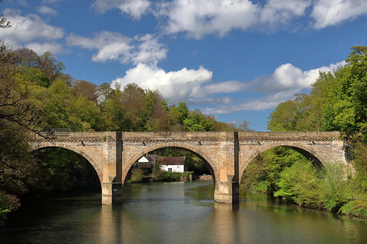
- Durham Cathedral and Castle on the peninsula in the Wear: World Heritage Site, with a Norman cathedral; check admission and opening times in advance.
- The riverside path along the Wear around the peninsula with views of the cathedral.
- Finchale Priory, a monastery ruin in a bend of the river north of the city.
- CampingSpirit overnight tip
-
Official campsite or RV park: Finchale Abbey Touring Park north of Durham on the Wear, with about 47 pitches according to the OSM data; check electricity and waste disposal in advance. Alternatively Strawberry Hill Caravan and Camping Park south-east of the city. Reserve both in advance.
Free camping or nature tip (where legal): No wild camping: Durham does not allow overnight stays on streets or in car parks. Park & Ride facilities on the outskirts are for day visits.
- Insider tip for campers
- The Durham peninsula is traffic-calmed, and a daily road user charge (Road User Charge, recorded by number-plate camera) applies for access via Silver Street; check exemptions and payment with Durham County Council in advance. Leave the camper at the campsite or a Park & Ride and take the bus.
Camping practice & local rules
Wild camping & overnight parking
- England has no right to roam: sleeping in your vehicle outside campsites is possible only with the landowner’s permission. Parking is allowed where it is not prohibited, but camping behaviour such as chairs, awnings, levelling legs or grey water is taboo everywhere. “No overnight parking” signs are common in the region.
- Large parts of the area lie within the North Pennines National Landscape (formerly AONB) and the Geopark; in addition there are protected areas, access land and grazing land. Do not leave the surfaced paths, keep dogs on a lead during the breeding season of the moorland birds (spring to summer) and close field gates.
- You can stay overnight legally on campsites, on small farm sites or on sites of the Caravan and Motorhome Club (Certificated Locations, CLs) and the Camping and Caravanning Club. Useful apps: park4night, Campercontact, the clubs’ sites; in October many sites are closed, so phone ahead.
- The same applies to a stargazing evening as at other times: overnight parking at viewpoints and at Dark Sky Discovery Sites is not permitted. Plan the evening on a campsite in a dark corner of the site and keep the lights inside the vehicle dimmed.
Waste disposal & supplies
- Waste disposal: chemical toilet at the campsite or at an Elsan station; public stations are rare in Teesdale and Alston Moor. Empty grey water only at drain points, never into street drains.
- Drinking water: fresh water at campsites and filling stations; in the villages of the high moors the supply is thin.
- Gas: German exchange cylinders are not swapped in Great Britain, and British cylinders (Calor, Camping Gaz) have different connections. Bring enough gas for the whole trip or use a permanently installed tank cylinder with a suitable filler connection. Rules for gas cylinders apply on ferries and in the tunnel; check with the operator in advance.
- Shopping: Penrith, Kirkby Stephen, Barnard Castle and Bishop Auckland have supermarkets; between Alston and Middleton there are hardly any shops. Fill up with fuel before crossing the Pennines.
Vehicle size & traffic rules
- Entry: Great Britain is not in the EU; EU citizens need an electronic travel authorisation (ETA), which can only be applied for through GOV.UK or the official app. Since 8 April 2026 it costs £20 per person and is valid for two years or until the passport expires. You also need your passport, vehicle registration document and proof of insurance; ask your insurer whether a Green Card is needed.
- Pets: the EU pet passport is recognised; a microchip and rabies vaccination are required, and for dogs also a tapeworm treatment by a vet 24 to 120 hours before arrival, entered in the passport. Meat and dairy products from the EU may no longer be brought in since 2025.
- Driving on the left: roundabouts are driven clockwise, and whoever is already on the roundabout has priority. Drive with particular care after the ferry or tunnel. On narrow roads with passing places, whoever has the passing place on their side stops. Mask or adjust headlights for left-hand traffic, speeds in mph.
- Speed limits (as per GOV.UK, check in advance): motorhomes up to 3.05 t unladen weight count as cars, with 60 mph on single carriageways and 70 mph on dual carriageways and motorways. Above 3.05 t unladen weight it is 50 mph on single carriageways, 60 mph on dual carriageways and 70 mph on motorways. Cars with a caravan or trailer drive at 50 mph on single carriageways, 60 mph on dual carriageways and motorways. The unladen weight is in the vehicle registration document; built-up areas and roadworks have their own signs.
- Dimensions: for motorhomes registered in Great Britain the upper limit is 12 m in length and 2.55 m in width; for heights of 3 m or more, a notice in the driver’s cab is mandatory. On the narrow side roads and in the villages every centimetre counts. Driving licence category B up to 3.5 t.
- Alcohol limit: in England 80 mg per 100 ml of blood (in Scotland 50 mg); in practice the rule is: better not to drink at all. Using a mobile phone at the wheel is prohibited.
- Tolls and zones: there are no tolls and no Low Emission Zone on the route; in Durham there is a daily road user charge for access to the peninsula via Silver Street (number-plate camera, payment in advance or within 24 hours). Separate payment rules apply for the journey there via the Dartford Crossing or the M6 Toll; check in advance.
- Winter: winter tyres are not compulsory, but the passes (Hartside, B6277) are temporarily closed or impassable in snow and ice; travel from November to March only with caution.
CampingSpirit packing & preparation checklist
- Levelling ramps and water canisters – pitches on the moor are often on uneven ground, and fresh water is scarce in the villages of the Pennines.
- Warm clothing, a rain jacket and walking boots: on the Hartside and at Nine Standards Rigg the weather changes within minutes.
- Red-light head torch and a star chart or app: red light protects your night vision while stargazing and does not disturb others.
- British gas adapter or enough gas for the whole trip: German exchange cylinders do not work.
- Printed ETA confirmation and copies of ID, plus pet papers: mobile coverage in the Pennines is patchy.
- Binoculars: curlews, lapwings, black grouse on the moor and red kites in the Eden Valley.
As of 2026-10. Closures, fees and booking rules change: check official sources before you go.