
In-depth guide · CampingSpirit
From Bethlehem’s Moravian old town via Hawk Mountain, Jim Thorpe and the Boulder Field into the Poconos, down to the Delaware and up to the waterfalls of Ricketts Glen and Worlds End: around 720 kilometres of coal country, broadleaf forest and gorges.
The spirit of the route
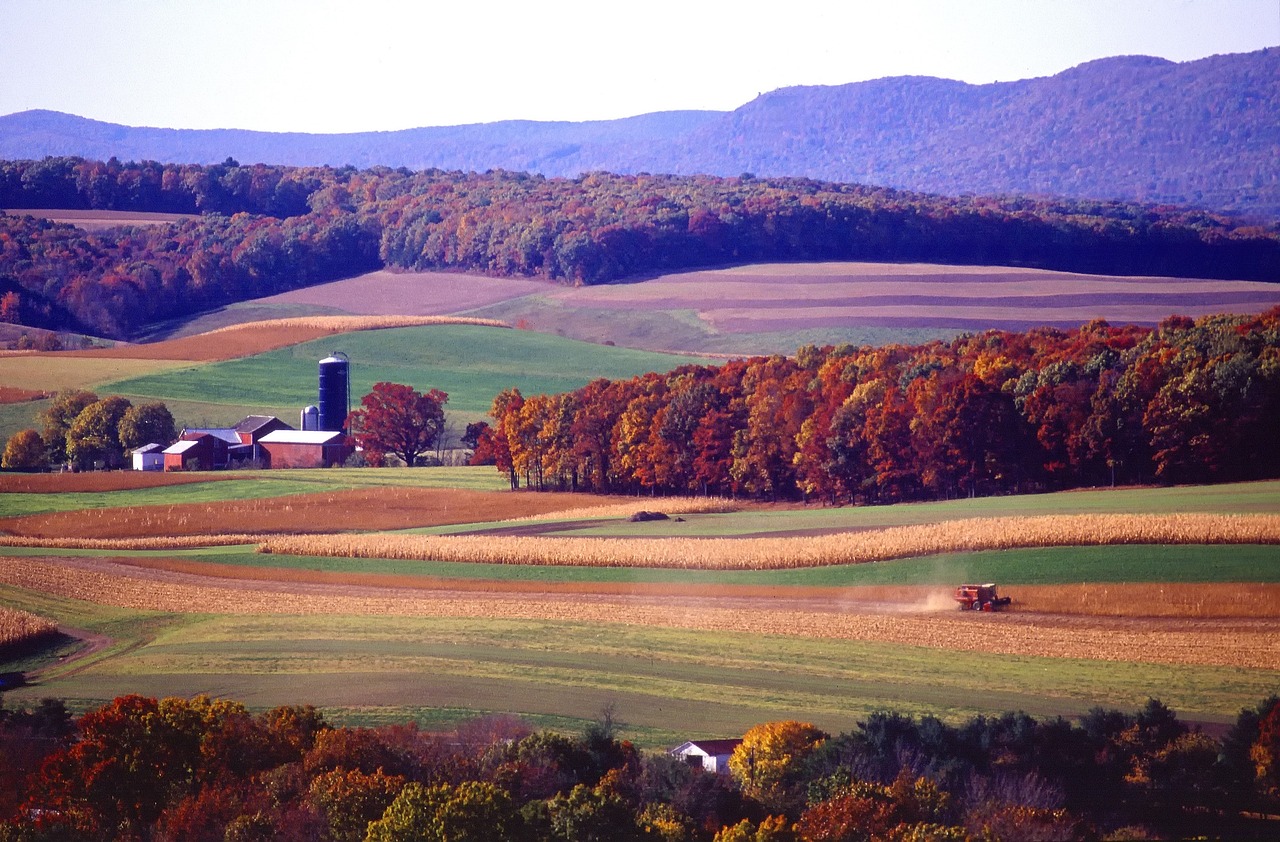
Eastern Pennsylvania tells its story in layers. Down in the Lehigh Valley, the rusting blast furnaces of Bethlehem Steel stand beside the stone houses that Moravian settlers built in the 18th century. Above them rises the Kittatinny Ridge, where in autumn people sit on the rocks with binoculars, counting hawks. Beyond it the anthracite region begins: canals, railway lines and mining villages where time stood still after the last coal train left. Then the Poconos open up, a high plateau of lakes, bogs and forest that burns red and yellow in October. From the sliding door you see mist over Lake Jean in the morning, in the evening you hear the creek beneath the hemlock and know that somewhere in the undergrowth a black bear is inspecting exactly the same camp. The journey ends in the Loyalsock valley, where the road narrows and your phone falls silent.
Stage-by-stage plan
1Stage 1: Philadelphia to Bethlehem and Blue Rocks (Lenhartsville) (approx. 155 km)
- The drive
- Philadelphia is only the starting point: from the northern edge of the city (Mid-County or Fort Washington interchange), the Northeast Extension of the Pennsylvania Turnpike (I-476) runs north through rolling farmland, then from Lehigh Valley you take US-22 to Bethlehem – around 90 kilometres, a little over an hour. The Turnpike is cashless (see Practicalities). After your visit to the town, head west on I-78 along the Blue Mountain ridge to Lenhartsville, another 65 kilometres or so. I-78 is one of the busiest truck routes in the Northeast: keep right, keep your distance and expect spray in the rain.
- Highlights & must-sees
- Historic Moravian Bethlehem: founded by Moravians in 1741, the settlement has been part of the UNESCO World Heritage Site “Moravian Church Settlements” since 2024. Walk along Church Street and Main Street to Central Moravian Church, the Gemeinhaus and the walled God’s Acre; down by Monocacy Creek lies the Colonial Industrial Quarter with the waterworks of 1762.
- SteelStacks: on the Bethlehem Steel site, the decommissioned blast furnaces tower over a cultural campus; the Hoover-Mason Trestle, an elevated pedestrian walkway on an old ore railway, takes you along the furnaces at eye level. Concerts and a light installation in the evening, Musikfest in August.
- National Museum of Industrial History on the edge of SteelStacks: machinery, steel and the textile industry of the Lehigh Valley; check opening times in advance.
- CampingSpirit overnight tip
-
Official campsite or RV park: There is no state park campground in the Lehigh Valley, so the route continues west to Blue Rocks Family Campground near Lenhartsville, a private site right next to the Blue Rocks Boulder Field, a sea of sandstone boulders at the foot of the ridge. Sites with water and electricity, bathhouse, dump station; check seasons and lengths with the operator. The public alternative for the following evening is Locust Lake State Park near Barnesville, north of the route.
Free camping or nature tip (where legal): Overnight parking is prohibited in Bethlehem, Allentown and the SteelStacks car parks; rest areas on I-78 and the Turnpike are for breaks only. If you want to stay overnight in the region without a campground, you need the explicit permission of the landowner, for example through Harvest Hosts on farms and wineries.
- Insider tip for campers
- Bethlehem’s parking garages are too low for motorhomes. Large vehicles are best parked in the ground-level visitor car parks around SteelStacks; from there walk across the Fahy Bridge (Minsi Trail Bridge) to the old town, a good 15 minutes. On Musikfest days in August these spaces are taken – arrive early in the morning or give that date a miss.
2Stage 2: Lenhartsville to Jim Thorpe (approx. 75 km)
- The drive
- A short country-road stage: via PA-143 and PA-895 to the foot of the Kittatinny Ridge, then up the narrow Hawk Mountain Road, with short steep ramps, to the sanctuary. Afterwards via Drehersville, the Schuylkill valley and US-209 through Lehighton to Jim Thorpe – valley roads, mining towns, a few tight town passages. Pure driving time just under two hours; with Hawk Mountain, a full day.
- Highlights & must-sees
- Hawk Mountain Sanctuary near Kempton: founded in 1934, it is considered the world’s first refuge for birds of prey. From August to December, broad-winged and red-tailed hawks, goshawks, bald eagles and falcons migrate along the ridge; in mid-September, thousands of broad-winged hawks pass on good days. From the visitor centre a short, surfaced path leads to the South Lookout; the North Lookout is about 1.5 kilometres away over rock steps. A fee is charged for the trails; pets are not allowed, even on a lead (the exception is the Appalachian Trail east of the visitor centre), and the trails close at dusk – check the rules in advance on hawkmountain.org.
- Jim Thorpe: in the 19th century the former Mauch Chunk was a hub of the coal trade. The Asa Packer Mansion, the Stone Row terrace and the Old Jail Museum, where men associated with the Molly Maguires were hanged in 1877, lie within a few hundred metres of each other; on the edge of town stands the mausoleum of Olympic champion Jim Thorpe, after whom the town was renamed in 1954.
- Lehigh Gorge Scenic Railway: excursion trains from the 1888 station into the Lehigh Gorge, in October with autumn colours and the crowds to match. Check timetable and tickets in advance.
- CampingSpirit overnight tip
-
Official campsite or RV park: Mauch Chunk Lake Park: a Carbon County park about 6 kilometres west of Jim Thorpe on a reservoir, with a campground (tent and RV sites, camping cottages, bathhouse with showers), swimming beach, canoe hire and hiking trails. Check with the county whether sites have electricity and whether there is a dump station, as well as lengths and season; book early for autumn weekends.
Free camping or nature tip (where legal): Hawk Mountain is day-use only; the trails close at dusk and camping is prohibited. The surrounding State Game Lands are closed to camping. In Jim Thorpe, overnight stays in the riverside car parks are prohibited.
- Insider tip for campers
- From Mauch Chunk Lake Park, the Switchback Trail follows the bed of the 1827 Gravity Railroad – one of America’s first railways – mostly downhill to Jim Thorpe. By bike you avoid hunting for a parking space in town, which becomes a test of patience on October weekends. Visit Hawk Mountain on weekdays and early: the car park at the visitor centre is small and fills quickly on peak migration days.
3Stage 3: Jim Thorpe to Hickory Run State Park (approx. 70 km)
- The drive
- The morning belongs to the Lehigh Gorge, ideally by bike. Then drive via PA-93 up onto the plateau towards Hazleton, to the hamlet of Eckley and on via Weatherly, White Haven and PA-534 to Hickory Run State Park. Winding but well built; pure driving time around 1.5 hours. Around Hazleton the landscape is shaped by spoil heaps and the edges of strip mines.
- Highlights & must-sees
- Lehigh Gorge Trail (part of the D&L Trail): the former railway line follows the Lehigh River for around 40 kilometres from White Haven to Jim Thorpe through Lehigh Gorge State Park, with fine gravel and a gentle downhill gradient heading south. Outfitters in Jim Thorpe run shuttles to White Haven; the Glen Onoko access lies just north of town. The former Glen Onoko Falls Trail is permanently closed.
- Eckley Miners’ Village: a mining village (patch town) laid out in 1854 and run by the Commonwealth of Pennsylvania as an open-air museum. Miners’ double houses, homes of the foremen and the mine doctor, two churches and a reconstructed coal breaker; some houses are still lived in. In 1968 the village served as the set for the film “The Molly Maguires”. Opening times are seasonal, check in advance.
- Hawk Falls in Hickory Run State Park: a short walk from PA-534 to a waterfall over rock steps, ideal for arriving in the evening.
- CampingSpirit overnight tip
-
Official campsite or RV park: Hickory Run State Park Campground: a large campground in the forest, many sites with electricity, bathhouses with showers, dump station. Book through the Pennsylvania State Parks portal; the season usually runs from spring into autumn, check dates on the park’s page.
Free camping or nature tip (where legal): North of Lehigh Gorge State Park lie State Game Lands and private forest – overnight stays there are not permitted. There are no primitive backpacking sites along the Lehigh; paddlers stay only at designated outfitter sites.
- Insider tip for campers
- On some weekends water is released from the Francis E. Walter Dam for whitewater trips; the gorge then fills with rafters and the access points with buses. Check the dates with the outfitters and plan bike rides for days without a release. White Haven has the last large petrol stations before the park.
4Stage 4: Hickory Run State Park to Dingmans Ferry (approx. 110 km)
- The drive
- In the morning take the unpaved Boulder Field Road to the boulder field, then I-80 east across the Pocono Plateau to Stroudsburg and US-209 north into the Delaware Water Gap National Recreation Area. On the Pennsylvania side, US-209 runs parallel to the river through forest and old farm meadows; hardly any towns, hardly any petrol stations. Pure driving time around two hours.
- Highlights & must-sees
- Boulder Field: a flat field of sandstone and conglomerate boulders without any vegetation, formed by frost shattering at the edge of the last glaciation, a National Natural Landmark since 1967. The access is a narrow gravel road with potholes – leave trailers at the campground; large motorhomes should only drive it when the road is dry.
- Bushkill Falls: a privately run site with eight waterfalls in a gorge, reached by boardwalks and stairs; admission charged, closed in winter. Large car park, also for motorhomes.
- Delaware Water Gap NRA, Pennsylvania side: Dingmans Falls and Silverthread Falls lie on a short boardwalk trail by the visitor centre – the access road, visitor centre and trail have at times been completely closed for bridge replacement and trail rehabilitation, including to pedestrians; check the current status on nps.gov. Independently of this, Raymondskill Falls further north is the highest waterfall in Pennsylvania; the creek below the falls is closed from May to September, the path to the viewpoints is not. The New Jersey side of the park is covered in the CampingSpirit guide from the Delaware Water Gap through the Pine Barrens to Cape May.
- CampingSpirit overnight tip
-
Official campsite or RV park: Dingmans Campground: a campground owned by the National Park Service on US-209 south of Dingmans Ferry, run by a concessioner. Sites in the forest and by the river, some with water and electricity, bathhouse, dump station. Season and booking through the operator; check lengths beforehand.
Free camping or nature tip (where legal): In the Delaware Water Gap NRA, overnight stays outside designated sites are prohibited, including in car parks and lay-bys on US-209. The primitive riverbank sites are intended only for paddlers on multi-day canoe trips and cannot be reached by vehicle.
- Insider tip for campers
- Fill up and shop in Stroudsburg or East Stroudsburg before entering the park; there is practically nothing on US-209 until Milford. Commercial traffic is restricted on US-209 within the park, but motorhomes are allowed. The side roads to the waterfalls are narrow – get there early at weekends.
5Stage 5: Dingmans Ferry to Promised Land State Park and Lake Wallenpaupack (approx. 75 km)
- The drive
- Via PA-739 up onto the plateau, briefly west on I-84 and via PA-390 into Promised Land State Park, surrounded by Delaware State Forest. In the afternoon, a detour via PA-390 and PA-507 to Lake Wallenpaupack and back to camp. Forest, bogs and lakes, well-built roads with long climbs; total driving time under two hours.
- Highlights & must-sees
- Promised Land State Park: two lakes at around 550 metres, lakeshore trails, canoe hire and log cabins from the Civilian Conservation Corps era. The neighbouring Bruce Lake Natural Area in Delaware State Forest gives you access on foot to a raised bog and a glacial lake.
- Lake Wallenpaupack: dammed in 1926 for a hydroelectric plant, one of the largest lakes in Pennsylvania. On the south shore, the loop trail in the Shuman Point Natural Area leads through forest to rocky shores with lake views.
- Hawley at the north-eastern end of the lake: a small town with rows of brick buildings; in nearby White Mills, the Dorflinger Glass Museum shows cut crystal from the local glassworks.
- CampingSpirit overnight tip
-
Official campsite or RV park: Promised Land State Park: Pickerel Point on the shore of the main lake with electric and full-hookup sites as well as camping cottages; part of it is open year-round. The Lower Lake Campground (Beechwood, Northwoods and Rhododendron areas, some with electricity) has a dump station at the entrance; Deerfield and Pines are simpler areas without electricity, summer only. The Rhododendron area is pet-free. Book through the Pennsylvania State Parks. Alternatives on the lake: the campgrounds of the Ironwood Point and Wilsonville recreation areas; check operation, facilities and season in advance.
Free camping or nature tip (where legal): Delaware State Forest has designated roadside campsites with a fire ring and picnic table, but no water or waste facilities; permit and reservation through the Pennsylvania State Parks and Forests portal, seven nights maximum. Some can only be reached with four-wheel drive, others are walk-in tent sites. Wild camping at boat ramps, swimming spots or along the shore road of Lake Wallenpaupack is prohibited.
- Insider tip for campers
- Promised Land lies in the heart of Pennsylvania’s densest bear country: at night, cool box, grill, rubbish and dog food go inside the vehicle, not under the awning. From mid-October the lakes are often already quiet, but that is when the autumn colours on the plateau are at their best – book weekends at that time months in advance.
6Stage 6: Promised Land State Park to Ricketts Glen State Park (approx. 180 km)
- The drive
- The longest stage: via I-84 and I-81 past Scranton, then on US-6 through the valley of Tunkhannock Creek and along the Susquehanna to Tunkhannock, continuing on country roads through hills and farmland to Dushore and on PA-487 south to the park. Around three hours of pure driving time. According to the park management, PA-487 between Red Rock and the Lake Jean area is very steep; heavy trailer rigs and large motorhomes avoid this climb and approach from the north via Dushore.
- Highlights & must-sees
- Steamtown National Historic Site in Scranton: steam locomotives in the historic Lackawanna railway yard, with roundhouse and turntable. RV parking available; check opening times on nps.gov.
- Tunkhannock Viaduct in Nicholson (on US-11, short detour): the Lackawanna railway’s 1915 reinforced-concrete viaduct across the Tunkhannock Creek valley, one of the largest concrete bridges in the world when it was completed.
- Lake Jean on arrival: swimming beach and lakeshore path by the campground, beavers and great blue herons in the evening.
- CampingSpirit overnight tip
-
Official campsite or RV park: Ricketts Glen State Park Campground on Lake Jean: wooded sites, some with electricity, bathhouses with hot showers, dump station. Most of it is open from roughly April to December, some sites also in winter; check details on the park’s page and book through the Pennsylvania State Parks (online or 888-727-2757). Booked up early on autumn weekends.
Free camping or nature tip (where legal): The surrounding State Game Lands are closed to camping. The car park at the Lake Rose trailhead and the car parks on PA-118 are for day visitors only; overnight stays there are penalised.
- Insider tip for campers
- Dushore has the last supermarkets and petrol stations before the park. If you are planning the Falls Trail hike the next morning, park the vehicle ready for hiking the evening before and set off early – from late morning on autumn weekends the trailhead car parks are full.
7Stage 7: Ricketts Glen State Park to Worlds End State Park (approx. 55 km)
- The drive
- After the hike, take PA-487 north to Dushore, then US-220 to Laporte, the small county seat of Sullivan County, and PA-154 into the valley of Loyalsock Creek. Quiet country roads across the plateau, winding at the end with steep sections down into the canyon. Driving time a little over an hour.
- Highlights & must-sees
- Falls Trail in Ricketts Glen State Park: the loop through Ganoga Glen and Glen Leigh passes 21 named waterfalls, the highest being Ganoga Falls at around 29 metres. As a loop with the Highland Trail it is about 11.5 kilometres, with steep stone steps, wet rocks and roots; allow three to four hours. In winter the Falls Trail is closed except to suitably equipped ice climbers and hikers who sign in and out at the park office; check the rules on the park’s page.
- Eagles Mere: a 19th-century summer resort on the plateau, with a lake and a path all the way round the shore; a short detour from US-220.
- Worlds End State Park: here Loyalsock Creek has carved an S-shaped gorge. The Canyon Vista viewpoint can be reached by road, the High Rock Trail climbs steeply over rocks to viewpoints above the river, and the long-distance Loyalsock Trail crosses the park.
- CampingSpirit overnight tip
-
Official campsite or RV park: Worlds End State Park Campground: a smaller site on the valley floor by Loyalsock Creek on PA-154, about half the sites with electricity, bathhouse with showers, dump station, closed in winter; some sites are unsuitable for longer vehicles. Book through the Pennsylvania State Parks; note the length limits when booking.
Free camping or nature tip (where legal): The adjoining Loyalsock State Forest has designated roadside campsites for vehicles, by permit and reservation only and with a maximum stay. If you are continuing west from here, the CampingSpirit guide to the Pennsylvania Wilds sets out the rules for Allegheny National Forest and the forests along Pine Creek.
- Insider tip for campers
- There is practically no mobile coverage in the Loyalsock valley; save maps and your reservation confirmation offline beforehand. Just before the park, the 1850 Forksville Covered Bridge spans Loyalsock Creek – a photo stop, but do not drive through it with a motorhome; observe the height and weight limits.
Camping practice & local rules
Wild camping & overnight parking
- Eastern Pennsylvania has neither BLM land nor national forest. Overnight stays in your vehicle are practically only possible at designated sites; towns and townships in the Lehigh Valley and the Poconos prohibit it on streets and in car parks, and state parks carry out night patrols.
- State forests (here Delaware, Weiser and Loyalsock State Forest): vehicle camping only at designated roadside campsites, with a permit and reservation through the Pennsylvania State Parks and Forests and with a maximum stay (seven nights in Delaware State Forest). Primitive backpack camping is allowed without a permit for one night in one place, but not with vehicle access, not in Natural Areas and at a distance from roads and water. Check the rules with DCNR.
- State Game Lands, Hawk Mountain Sanctuary and the Delaware Water Gap NRA do not allow wild camping. In the national park area, riverbank sites are exclusively for paddlers.
- Reservations: Pennsylvania State Parks online or by phone (888-727-2757), up to eleven months in advance. Most state park campgrounds close in late autumn; book early for weekends during the October foliage season.
- Hunting: in autumn and winter, state forests and State Game Lands are hunting grounds, now also on certain Sundays. Wear blaze orange on hikes outside the state parks; check dates with the Pennsylvania Game Commission.
- Apps and websites: Pennsylvania State Parks portal, nps.gov/dewa, iOverlander, Campendium, The Dyrt and Harvest Hosts; Park4Night is hardly used here.
Waste disposal & supplies
- Dump stations: at the large state park campgrounds (Promised Land at the entrance to the Lower Lake Campground, Hickory Run, Ricketts Glen, Worlds End), at Dingmans Campground and at private sites. Roadside campsites in the state forests have no water or waste facilities at all. Check status in advance; water lines are shut off in late autumn.
- Drinking water: tap water is safe to drink; taps in the state parks are usually only on in season. Filter or boil creek water in Ricketts Glen and Worlds End before use.
- Empty grey water and chemical toilets only at dump stations; draining into the forest or creeks is prohibited and penalised.
- Propane: petrol stations, DIY stores and campgrounds fill US cylinders; European cylinders are generally not filled. Rental vehicles have permanently installed US tanks.
- Buy firewood only locally and do not transport it over long distances. Eastern Pennsylvania lies within the spotted lanternfly quarantine zone: before every onward journey, check vehicle, bikes, awning and camping furniture for egg masses and insects.
- Shopping and fuel: large supermarkets in Bethlehem, Lehighton, Hazleton, Stroudsburg, Hawley, Scranton and Tunkhannock; in the Delaware valley, around Ricketts Glen and in the Loyalsock valley, long stretches without a petrol station. Dushore is the last place to stock up in the north.
- Electricity: state park sites with hookups usually offer 30 or 50 A (120 V); many sites have no electricity, and generators are only allowed at the signposted times.
Vehicle size & traffic rules
- Speed limits: Turnpike and some interstates up to 70 mph, otherwise mostly 55–65 mph; country roads 45–55 mph, through towns 25–35 mph. The same limits apply to trailer rigs. Handheld devices at the wheel are banned in Pennsylvania (Paul Miller’s Law); hands-free calls only.
- Pennsylvania Turnpike (here the Northeast Extension I-476): completely cashless. With E-ZPass, including from other states, you pay considerably less than with Toll By Plate, where the bill goes to the registered keeper. In the east, vehicles are recorded at gantries at full speed. Toll class depends on axles and weight – trailer rigs pay more. For rental vehicles, clarify the toll arrangement in advance; bridges across the Delaware into New Jersey are also tolled.
- Gradients: PA-487 between Red Rock and Ricketts Glen is very steep – trailer rigs and large motorhomes approach via Dushore. Hawk Mountain Road, Boulder Field Road and the roads into the Loyalsock valley also call for low gears and engine braking rather than riding the brakes.
- Heights: parking garages in Bethlehem and Scranton are too low for motorhomes; covered bridges and old railway underpasses have low clearances and weight limits. Use navigation with an RV profile.
- Black bears: Pennsylvania has a large population, especially in the Poconos. At night store food, cool box, rubbish and toiletries in the closed vehicle, clean the grill after eating and put rubbish in the bear-proof containers. Never feed bears – it is prohibited.
- Ticks: for years Pennsylvania has reported a particularly high number of Lyme disease cases. Tuck long trousers into your socks, use repellent and check yourself after every hike; treat dogs too.
- Autumn colours and weather: on the plateau around Ricketts Glen and Worlds End usually late September to early October, in the Poconos early to mid-October, later in the Lehigh Valley. DCNR publishes a weekly fall foliage report in autumn. Summer thunderstorms bring flash floods in the gorges; from November, snow and ice on the plateau.
- Emergency: 911. Mobile coverage is patchy in the Delaware valley and often non-existent in Ricketts Glen and the Loyalsock valley.
CampingSpirit packing & preparation checklist
- Binoculars with 8x or 10x magnification and a seat cushion: you sit on the rocks of Hawk Mountain for hours, and without binoculars the raptors remain dots in the sky.
- Bike rack and sturdy bikes with wide tyres: the Lehigh Gorge Trail and Switchback Trail are gravel paths, and in Jim Thorpe the bike stands in for a parking space.
- Hiking boots with grippy soles, plus microspikes in late autumn: the stone steps on the Falls Trail in Ricketts Glen are permanently wet and slippery.
- Lockable, odour-proof boxes for food and rubbish: bear safety here means leaving nothing outside.
- Tick tweezers, permethrin for clothing and repellent with DEET or picaridin: ticks are widespread along the entire route.
- E-ZPass transponder or a clarified toll arrangement with the rental company: on the Turnpike it saves money and processing fees.
As of 2026-10. Closures, fees and booking rules change: check official sources before you go.