
In-depth guide · CampingSpirit
From Independence Hall via Valley Forge, the Amish farms of Intercourse and Strasburg, Hershey and Harrisburg to the Gettysburg battlefield, the midpoint of the Appalachian Trail at Pine Grove Furnace and back through the Cumberland Valley to Lancaster: around 700 kilometres of America’s founding and Civil War history between fields and forest.
The spirit of the route
South-east Pennsylvania is a land of rhythms: the clatter of hooves on the hard shoulder, the whistle of a steam locomotive between tobacco barns, the rush of the Susquehanna beneath long bridges. The route begins in the brick lanes of Philadelphia, where independence was declared in 1776, and leads via the winter encampment of Valley Forge into rolling country of cornfields, white fences and windmills over wells. In the morning you look out of the sliding door at Amish families driving to work in black buggies and at washing lines full of blue and purple shirts. Beyond Harrisburg things turn more serious: more than a thousand monuments stand on the fields of Gettysburg, and on the edge of South Mountain the air smells of oak leaves and the cold ash of old ironworks. At Pine Grove Furnace the Appalachian Trail crosses its midpoint, and in autumn the Cumberland Valley blazes in red and yellow.
Stage-by-stage plan
1Stage 1: Philadelphia to French Creek State Park (approx. 85 km)
- The drive
- From downtown, head west on the I-76 (Schuylkill Expressway) – one of the most congested roads in the country, so drive it outside rush hour. From King of Prussia take the US-422 and minor roads to Valley Forge National Historical Park, then continue on the US-422 to Pottstown and south on the PA-100 and country roads to French Creek State Park. From Valley Forge onwards the roads are hilly, winding and partly narrow, but easily drivable for motorhomes and trailer rigs. Pure driving time is around 1.5–2 hours; with sightseeing in the city it is a full day. Plenty of filling stations; the last large supermarkets are in Pottstown.
- Highlights & must-sees
- Independence National Historical Park: Independence Hall, where the Declaration of Independence was adopted in 1776 and the Constitution in 1787, and opposite it the Liberty Bell Center. Timed tickets are issued for Independence Hall in season; the bell is accessible without a ticket; check details on nps.gov. Nearby are Elfreth’s Alley, one of the oldest inhabited streets in the USA, and the Reading Terminal Market hall for lunch.
- Valley Forge National Historical Park: winter encampment of the Continental Army in 1777/78 with reconstructed log huts, the National Memorial Arch and Washington’s Headquarters in the Isaac Potts House. The Encampment Tour is a signposted driving loop with large car parks; the Joseph Plumb Martin Trail is a loop for cycling and walking through the grounds.
- Hopewell Furnace National Historic Site right next to French Creek State Park: a fully preserved 18th- and 19th-century ironworks with blast furnace, waterwheel, ironmaster’s house and workers’ houses – the opening of the iron theme that returns at Caledonia and Pine Grove Furnace.
- CampingSpirit overnight tip
-
Official campsite or RV park: French Creek State Park: a large forest campground in several loops in the north of the park, sites with and without electricity, shower blocks, dump station. Open seasonally; book through the Pennsylvania State Parks and Forests reservation system (online or by phone) and check the permitted vehicle length per site when booking. There is no public campground in Philadelphia itself, and camping is prohibited in Valley Forge NHP.
Free camping or nature tip (where legal): Philadelphia prohibits sleeping in vehicles on streets and in public car parks, and large vehicles are towed. Valley Forge closes its car parks at night. There is no legal free-camping option in the Greater Philadelphia area.
- Insider tip for campers
- Don’t drive into Old City with a motorhome: the streets are narrow and the parking garages have height restrictions. The NPS directs motorhomes and buses to the Callowhill Bus Center (Callowhill Street between 2nd and 3rd Street); check conditions and fees beforehand with the Philadelphia Parking Authority or on discoverphl.com. More relaxed: leave your vehicle at one of SEPTA’s large park-and-ride lots on the edge of the city (observe the day-parking rules) and take the regional rail into town.
2Stage 2: French Creek State Park to Strasburg (approx. 80 km)
- The drive
- Take the PA-23 via Morgantown and New Holland into the heart of Lancaster County, then the PA-772 to Intercourse, the PA-340 (Old Philadelphia Pike) to Bird-in-Hand and minor roads to Strasburg. Gently rolling farmland, many junctions and village through-roads, speeds mostly 35–55 mph. Horse-drawn buggies use every road, often on wide hard shoulders – drive with anticipation, keep a large distance and overtake only with a clear view. Pure driving time is around 1.5 hours, with stops a whole day. It is about 20 kilometres further to the campground in the south of the county.
- Highlights & must-sees
- Intercourse and Bird-in-Hand: the two best-known villages of the Amish and Old Order Mennonites, with farm shops, quilt and furniture workshops, pretzel bakeries and farmers’ markets. If you want a buggy ride along the farm lanes, you will find several operators on the PA-340. Photos of people, especially portraits, are unwelcome – landscapes and buggies from behind are fine.
- Strasburg Rail Road: steam railway on one of the oldest short lines in the USA (since 1832), with rides through the fields to Paradise and back; opposite is the Railroad Museum of Pennsylvania, with one of the largest collections of historic locomotives in the country. Timetables are seasonal; trains are often booked out in autumn and before Christmas.
- Covered bridges: Lancaster County has almost 30 historic covered bridges, many on quiet minor roads between Bird-in-Hand and Strasburg. Park on the bank for photos – never drive through with a motorhome or trailer rig, as height and weight are severely restricted.
- CampingSpirit overnight tip
-
Official campsite or RV park: Muddy Run Recreation Park near Holtwood in the south of Lancaster County: a publicly accessible recreation park on the reservoir of a pumped-storage power station, with a campground, sites with and without electricity and showers. Check the season, current operation, dumping facilities and permitted lengths directly with the campground beforehand. Around Bird-in-Hand and Strasburg there are also numerous private family campgrounds with full hookups – book early in autumn and on public holidays.
Free camping or nature tip (where legal): Lancaster County is almost entirely private land; sleeping at the roadside or in the car parks of shops or attractions is prohibited without explicit permission. On farms only by arrangement with the owner – some farms and wineries offer pitches through platforms such as Harvest Hosts.
- Insider tip for campers
- Buggies travel at night with lamps and the orange slow-moving-vehicle triangle, but they are hard to see – slow down at dusk. On Sundays work rests and many Amish shops are closed, but there are churchgoers’ buggies on the road in the morning. Farm stands with honesty boxes usually take cash only, so bring small notes. Horse manure on the road is normal – bicycle and motorhome tyres will thank you for steering around it.
3Stage 3: Strasburg to Gifford Pinchot State Park (approx. 115 km)
- The drive
- Take country roads north-west to the Susquehanna at Columbia and Marietta, then the PA-743 through Elizabethtown to Hershey. From there take the I-283 and I-83 across the Susquehanna and south towards Lewisberry to Gifford Pinchot State Park. First hilly farm roads, then expressways; the bridges over the river are wide and unproblematic. Pure driving time is around 2 hours. Filling stations and supermarkets in Elizabethtown, Hershey and along the I-83.
- Highlights & must-sees
- Chickies Rock County Park near Columbia: quartzite cliffs high above the Susquehanna with a wide view upstream; a short path from the car park on the PA-441. Down by the river runs the Northwest Lancaster County River Trail, ideal for a bike ride to Marietta.
- Hershey: the chocolate town that Milton Hershey built around his factory from 1903, with street lamps shaped like Hershey’s Kisses on Chocolate Avenue. Hershey’s Chocolate World offers a free ride through chocolate making; The Hershey Story tells the company’s history, and Hershey Gardens has a large rose garden.
- Gifford Pinchot State Park: a lake with boat rental, a shoreline loop trail and a swimming beach; named after the first head of the US Forest Service and later governor of Pennsylvania.
- CampingSpirit overnight tip
-
Official campsite or RV park: Gifford Pinchot State Park: campground on Pinchot Lake with many sites with electricity and some with full hookups, shower blocks and dump station, plus cabins and yurts. Open seasonally (roughly spring to autumn); book through Pennsylvania State Parks and Forests. For Hershey, this campground is a quiet public alternative to the large private resorts around the amusement park.
Free camping or nature tip (where legal): In Hershey, sleeping in the car parks of Chocolate World and Hersheypark is not permitted; the car parks are patrolled. There is no public land for dispersed camping in the Harrisburg area.
- Insider tip for campers
- Chocolate World has separate areas for large vehicles – follow the attendants and arrive early in the day, as it gets very busy at weekends and in the school holidays. Expect traffic jams in the Hershey area in summer and around Halloween and Christmas (Hersheypark Christmas Candylane).
4Stage 4: Gifford Pinchot State Park to Gettysburg (approx. 95 km)
- The drive
- Take the I-83 back to Harrisburg and, after sightseeing, the US-15 south via Dillsburg to Gettysburg. The US-15 is a four-lane road, speeds 55–65 mph, with the last stretch through orchards at the foot of South Mountain. Pure driving time is around 1.5 hours. In Harrisburg the streets along the river are narrow and often lined with parked cars; with a large vehicle, park in the car parks on the Riverfront or City Island. Filling stations in Harrisburg, Dillsburg and Gettysburg.
- Highlights & must-sees
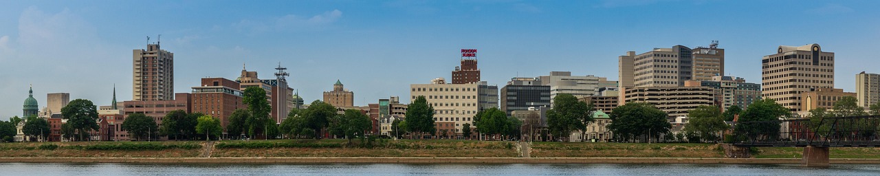
- Pennsylvania State Capitol in Harrisburg: a 1906 capitol with a dome modelled on St Peter’s Basilica, a marble staircase and murals; free guided tours, bring ID.
- City Island and Walnut Street Bridge: the old iron bridge over the Susquehanna is now a footpath to the island in the middle of the river – with a view back to the Capitol. North of the city, the Rockville Bridge, one of the longest stone-arch railway bridges in the world, crosses the river; it is easy to see from the US-22/322.
- National Civil War Museum in Harrisburg’s Reservoir Park: an overview of the entire Civil War – good preparation for Gettysburg the next day.
- CampingSpirit overnight tip
-
Official campsite or RV park: There is no campground in Gettysburg National Military Park. Around the town there are several private campgrounds with full hookups and shower blocks, including Artillery Ridge on Taneytown Road near the battlefield, as well as campgrounds on the Emmitsburg Road, the Baltimore Pike and the US-30 West. Nearest public campground: Caledonia State Park, around 25 kilometres west on the US-30 (see stage 5). Book early for the anniversary of the battle in July and for autumn weekends.
Free camping or nature tip (where legal): Sleeping on the roads and in the car parks of the Military Park is prohibited; the park’s avenues are closed at night. In the town of Gettysburg, sleeping in vehicles on streets and in car parks is not permitted.
- Insider tip for campers
- Along the US-15 between Dillsburg and Gettysburg there are fruit growers with farm shops – apples and cider in autumn; Gettysburg is the centre of apple growing in Pennsylvania. If you arrive in the evening, put off the drive onto the battlefield until the next morning: the light over the fields is at its most beautiful then and the car parks are empty.
5Stage 5: Gettysburg to Caledonia State Park (approx. 65 km)
- The drive
- First the National Military Park’s Auto Tour: around 24 miles (just under 40 kilometres) with 16 stops in the order of the three days of battle, on narrow, partly one-way avenues with low speed limits. Some sections are tight and winding and awkward for large motorhomes or trailer rigs – follow the NPS signs and advice, and if in doubt leave the trailer rig at the campground. Stop only in designated pull-offs or, on one-way roads, on the right with all wheels on the roadway, never on the verge or grass. Afterwards take the US-30 (Chambersburg Pike, part of the Lincoln Highway) west via Cashtown into the forest of South Mountain. Pure driving time is around 2 hours; with sightseeing it is a long day.
- Highlights & must-sees
- Gettysburg Museum and Visitor Center: museum, the cyclorama painting of Pickett’s Charge and the film about the battle; its own car park (Lot C) with a good 50 oversize spaces for buses and motorhomes; parking is free throughout the park. Licensed Battlefield Guides will ride along in your own vehicle on request – in a motorhome the most pleasant way to understand the field. The battlefield itself has no entrance fee; the museum, film and cyclorama require tickets.
- Little Round Top, Devil’s Den and the line on Cemetery Ridge with the High Water Mark: the scenes of the second and third days. After several years of restoration, Little Round Top has been accessible again since 2024, with new paths and enlarged car parks.
- Soldiers’ National Cemetery: the cemetery where Abraham Lincoln delivered the Gettysburg Address in November 1863. Next door, reachable only by shuttle from the Visitor Center, is the Eisenhower National Historic Site with the president’s farmhouse.
- CampingSpirit overnight tip
-
Official campsite or RV park: Caledonia State Park on the US-30 between Gettysburg and Chambersburg: two camping areas, Hosack Run and Chinquapin Hill, in the forest by Conococheague Creek, sites with and without electricity, shower blocks, dump station. Open seasonally; book through Pennsylvania State Parks and Forests. In the park stand the remains of Thaddeus Stevens’ ironworks, which Confederates burned down in 1863 on their way to Gettysburg.
Free camping or nature tip (where legal): In the neighbouring Michaux State Forest, overnight stays with a vehicle are only permitted at designated roadside campsites with a permit (see stage 6); free camping at the roadside or in forest car parks is prohibited.
- Insider tip for campers
- The park’s avenues are open at set times during the day and closed at night – start the Auto Tour in the morning. The Visitor Center has drinking water but no dump facilities; empty your grey water at the campground before battlefield day. The Appalachian Trail crosses the US-30 right at Caledonia State Park – a short section heading north makes a lovely evening walk.
6Stage 6: Caledonia State Park to Pine Grove Furnace State Park (approx. 30 km)
- The drive
- Take the PA-233 north straight through Michaux State Forest: two lanes, winding, with climbs up to the summit near Big Flat and back down to Pine Grove Furnace. Hardly any traffic, lots of wildlife crossings, no filling stations and no mobile signal over long stretches. Pure driving time is under an hour – deliberately a short day with time for hiking and swimming.
- Highlights & must-sees
- Appalachian Trail Museum and halfway marker: Pine Grove Furnace State Park lies at roughly the midpoint of the approximately 3,500-kilometre trail from Georgia to Maine; the exact midpoint shifts every year due to reroutes, and a sign marks it nearby. The small museum in an old mill tells the story of the first thru-hikers. At the General Store, hikers traditionally attempt the Half Gallon Challenge – half a gallon of ice cream in one go.
- Pole Steeple: a short, steep climb from Laurel Lake to a quartzite outcrop with a view over the Pine Grove valley and the forests of South Mountain – especially in October.
- Fuller Lake and the Pine Grove blast furnace: the lake is a flooded ore quarry with a swimming beach; next to it stand the 18th-century blast furnace and the Ironmaster’s Mansion, now a hostel for hikers.
- CampingSpirit overnight tip
-
Official campsite or RV park: Pine Grove Furnace State Park, Charcoal Hearth Campground: a forest campground on the slope above the park, sites with and without electricity, toilets and showers, and dump station; open seasonally, closed in winter. Book through Pennsylvania State Parks and Forests; some sites are short and uneven, so check the length when booking.
Free camping or nature tip (where legal): Michaux State Forest: roadside camping with a vehicle is only permitted at designated campsites and always requires a permit – two individual sites by the road and four rustic camping areas with 27 sites in total, without electricity, water, dump facilities or rubbish collection. Book through the Pennsylvania State Parks and Forests reservation system or by phone on 888-727-2757, up to eleven months in advance; a maximum of seven nights, followed by a 48-hour break. In winter only a few sites are open, and forest roads are not cleared. Campfires are prohibited when the wildfire danger is high and from 1 March to 25 May unless permitted.
- Insider tip for campers
- Fill up with fuel and water before driving through the forest. The sandstone paths around Pine Grove are covered with leaves in autumn and slippery – wear sturdy shoes. The peace of the place is only interrupted by thru-hikers passing through in late summer: if you offer them fruit or cold drinks, you are practising “trail magic” and will hear the best stories of the trip.
7Stage 7: Pine Grove Furnace State Park to Colonel Denning State Park (approx. 85 km)
- The drive
- Take country roads over the northern edge of South Mountain to Boiling Springs, then to Carlisle and west on the US-11 and PA-641 through the Cumberland Valley to Newville; from there take the PA-233 north to the foot of Blue Mountain and Colonel Denning State Park. The valley is broad and fertile, with limestone soils, barns on stone foundations and trout streams. Speeds mostly 45–55 mph. Pure driving time is around 1.5 hours. Filling stations and large supermarkets in Carlisle.
- Highlights & must-sees
- Boiling Springs: a village around Children’s Lake, which is fed by a powerful limestone spring; the Appalachian Trail runs right through the village along the lakeshore, and on Yellow Breeches Creek fly fishermen stand waist-deep in the water.
- Carlisle: a colonial town with a market square and Dickinson College. The U.S. Army Heritage and Education Center has an open-air exhibition ranging from trenches to vehicles, with a large car park. From 1879 to 1918 the grounds of Carlisle Barracks were home to the Carlisle Indian Industrial School, a difficult chapter of assimilation policy; access to the military site only after a security check.
- Flat Rock Trail in Colonel Denning State Park: a steep, rocky climb (yellow blazes), mostly through Tuscarora State Forest, to a rock slab on the ridge of Blue Mountain with a view over the entire Cumberland Valley – allow half a day there and back.
- CampingSpirit overnight tip
-
Official campsite or RV park: Colonel Denning State Park: a small forest campground on Doubling Gap Lake with sites with and without electricity, toilets and showers, and dump station, open seasonally; book through Pennsylvania State Parks and Forests. Few long sites – check the length beforehand. Alternative in the valley: keep Pine Grove Furnace as your base and drive the valley as a day trip.
Free camping or nature tip (where legal): In the neighbouring Tuscarora State Forest the same rules apply as in Michaux State Forest: vehicle camping only at designated sites with a permit. State Game Lands are for hunting; camping is generally not permitted there.
- Insider tip for campers
- The Cumberland Valley Rail Trail links Shippensburg and Newville along an old railway line – flat, through fields, ideal with the bike off the rear rack. In summer and autumn Carlisle hosts large classic car and auto shows at the fairgrounds; campgrounds and roads are full then, so check the dates.
8Stage 8: Colonel Denning State Park to Lancaster (approx. 140 km)
- The drive
- Back to Carlisle, then on the PA-74 via Dillsburg to York and east on the US-30 (Lincoln Highway) across the Susquehanna at Wrightsville and Columbia to Lancaster. The PA-74 is a hilly country road; the US-30 is four-lane from York. Pure driving time is around 2.5 hours. If you are in a hurry, take the I-81, I-83 and PA-283 – or the Turnpike, but then with tolls (see Practicalities).
- Highlights & must-sees
- York: the Continental Congress met here in 1777/78 while Philadelphia was occupied by the British. Central Market Hall in the centre is an 1888 market hall with local stalls; parking for large vehicles on the edge of downtown.
- The Susquehanna between Wrightsville and Columbia: the Veterans Memorial Bridge crosses the broad, shallow river on concrete arches; at this spot in June 1863 militia burned down the bridge of the time to stop the Confederates from crossing east – a few days before Gettysburg.
- Lancaster Central Market: one of the oldest continuously operating farmers’ markets in the USA, in an 1889 market hall, with Amish and Mennonite stalls, open on Tuesdays, Fridays and Saturdays. The city centre is tight – park motorhomes on the edge and go in on foot or by bike.
- CampingSpirit overnight tip
-
Official campsite or RV park: Muddy Run Recreation Park in the south of Lancaster County (see stage 2) or one of the private campgrounds around Strasburg and Bird-in-Hand; this closes the loop. If you are heading back to Philadelphia, you can add a last night at French Creek State Park.
Free camping or nature tip (where legal): In Lancaster, York and Columbia, sleeping in vehicles on streets and in public car parks is prohibited. Supermarket car parks only with the store’s permission; many stores in Lancaster County explicitly forbid it.
- Insider tip for campers
- Lancaster Central Market only opens on Tuesdays, Fridays and Saturdays, from early morning, and closes in the afternoon – plan your departure afterwards. On the US-30 between Lancaster and Paradise, outlets, theatres and restaurants line the road; on Saturdays the traffic backs up. For the journey home to Philadelphia, the Turnpike from Lancaster–Lebanon is fast but tolled.
Camping practice & local rules
Wild camping & overnight parking
- Pennsylvania has no BLM or National Forest land in this part of the state. Free overnight stays in a vehicle are practically only possible at designated sites; cities such as Philadelphia, Lancaster and Harrisburg prohibit it on streets and in car parks.
- State Forests (here Michaux and Tuscarora): vehicle camping only at designated roadside campsites with a permit and a reservation through Pennsylvania State Parks and Forests, for a maximum of seven nights. Primitive backpack camping is allowed without a permit for one night in one place, but not with vehicle access, not in Natural Areas, and no closer than 200 feet to forest roads and 100 feet to water.
- Rest areas and service plazas on the Turnpike are for breaks, not camping; observe the maximum parking time on the signs. Supermarket and department-store car parks only with the store’s consent.
- Reservations: Pennsylvania State Parks and Forests online or by phone (888-727-2757), up to eleven months in advance; most state park campgrounds are open seasonally. Book in good time for autumn weekends in October.
- Hunting: in autumn and winter, State Forests and State Game Lands are hunting grounds – since the lifting of the Sunday hunting ban, also on Sundays set by the Game Commission. Wear blaze orange when hiking and check hunting seasons with the Pennsylvania Game Commission.
- Apps: iOverlander, Campendium, The Dyrt and Harvest Hosts (farms and wineries); Park4Night is not widely used here.
Waste disposal & supplies
- Dump stations: in French Creek, Gifford Pinchot, Caledonia, Pine Grove Furnace and Colonel Denning state parks and at all larger private campgrounds. The Michaux roadside sites have no supply or disposal facilities at all.
- Drinking water: tap water is drinkable; in the state parks from taps, often turned off in winter. The Gettysburg Visitor Center has drinking water but no dump facilities.
- Empty grey water and chemical toilets only at dump stations; draining into the forest or streams is prohibited and penalised in state parks.
- Propane: filling stations, DIY stores and campgrounds fill US cylinders; European cylinders are generally not filled. The Turnpike tunnels lie west of Carlisle, outside the route.
- Buy firewood only locally and do not transport it over long distances; Pennsylvania protects its forests from introduced pests. The south-east lies in the quarantine zone for the spotted lanternfly – before moving on, check your vehicle, bikes and awning for egg masses.
- Shopping: large supermarkets in Pottstown, Lancaster, Elizabethtown, Hershey, Harrisburg, Gettysburg, Carlisle and York. Amish farm stands for fruit, vegetables, bread and eggs – mostly cash only, closed on Sundays.
Vehicle size & traffic rules
- Speed limits: up to 70 mph on the Turnpike and some interstates, otherwise mostly 55–65 mph; country roads 45–55 mph, through towns and villages 25–35 mph. In Pennsylvania the same limits generally apply to trailer rigs.
- Phones at the wheel: in Pennsylvania, using handheld devices while driving is prohibited (Paul Miller’s Law), and violations are fined. Hands-free calls only.
- Pennsylvania Turnpike: completely cashless. With E-ZPass (including from other states) you pay considerably less than with Toll By Plate, where the bill goes to the registered keeper; rates rise regularly. The eastern section already uses Open Road Tolling: the toll booths have been removed and tolls are recorded at full speed at gantries; the western section is being converted step by step. Toll class depends on axles and weight – trailer rigs pay more. With rental vehicles, clarify the rental company’s toll arrangements in advance, otherwise administration fees are added.
- Amish buggies: buggies and farm vehicles carry the orange slow-moving-vehicle triangle. Overtake only with plenty of lateral clearance and a clear view, don’t sound your horn and don’t tailgate – horses shy. On school routes, children on scooters and bicycles are out in the morning and afternoon.
- Bridges and heights: covered bridges in Lancaster County and underpasses of old railway lines have low clearances and weight limits; use navigation with a motorhome profile and heed the signs. Parking garages in Philadelphia, Harrisburg and Lancaster are mostly too low for motorhomes.
- Weather: summer thunderstorms with heavy rain and flash floods, the remnants of tropical storms in autumn, snow and ice on South Mountain in winter. Many state park campgrounds close in late autumn.
- Ticks: Pennsylvania has reported particularly high numbers of Lyme disease cases for years; check yourself after every hike. Emergency: 911. Mobile coverage in Michaux and on the PA-233 is patchy.
CampingSpirit packing & preparation checklist
- E-ZPass transponder or sorted toll arrangements: on the Turnpike it saves considerable money and billing hassle compared with Toll By Plate.
- Cash in small notes: Amish farm stands, buggy rides and honesty boxes rarely take cards.
- Bike with rear rack: for Old City in Philadelphia, Valley Forge, the River Trail near Columbia and the Cumberland Valley Rail Trail – and so you can leave the motorhome outside cramped city centres.
- Tick repellent, tick tweezers and long trousers: the forests and meadows of South Mountain are tick areas with a high risk of Lyme disease.
- Blaze orange vest or hat: in autumn Michaux and the Game Lands are hunting grounds, including along the Appalachian Trail.
- Hiking boots with good tread and a head torch: for Pole Steeple, Flat Rock and an evening stretch on the Appalachian Trail.
As of 2026-10. Closures, fees and booking rules change: check official sources before you go.