

In-depth guide · CampingSpirit
From the gorge of the Delaware via the highest point in New Jersey, Princeton and the sandy pine forests of the Pine Barrens to the coast – Barnegat, Atlantic City, Ocean City, Wildwood and Cape May: around 750 kilometres through the underrated Garden State.
The spirit of the route
Most people know New Jersey from the Turnpike, as an industrial backdrop between New York and Philadelphia. Turn off, and you find something else: the Delaware cutting through a ridge at the Water Gap, deciduous forest above the Old Mine Road and, from the obelisk on High Point, a view across three states. Then it turns flat and quiet. The Pine Barrens are almost 4,500 square kilometres of pitch pine, white sand and rivers the colour of black tea, with 18th-century ironworks villages and cranberry bogs in between. From the sliding door you see mist over Lake Absegami in the morning, and at night no light but the stars – an hour’s drive from Atlantic City. At the end comes the coast: boardwalks, lighthouses, gulls over the dunes and, in Cape May, the colourful wooden houses with their porches, where summer lingers on into October.
Stage-by-stage plan
1Stage 1: New York (outskirts) to Delaware Water Gap / Worthington State Forest (approx. 130 km)
- The drive
- From the George Washington Bridge or from northern New Jersey, head west on I-80: first suburban traffic and business parks, then hills and forest from Rockaway, and finally the Kittatinny Ridge with the notch of the Delaware. The interstate runs straight through the Water Gap; the last exit on the New Jersey side is Exit 1 (Millbrook/Flatbrookville). From there you follow the Old Mine Road north to Worthington State Forest – narrow, winding, with no shoulder and very tight in places. Pure driving time around 1.5–2 hours, considerably more on Friday afternoons. Plenty of filling stations along I-80; in New Jersey an attendant serves you, self-service is prohibited.
- Highlights & must-sees
- Resort Point Overlook on the Pennsylvania side: if you briefly cross the bridge to Delaware Water Gap (PA), the overlook on PA-611 gives you a view of the gap with Mount Tammany opposite. The small town itself has cafés and a long-standing jazz scene.
- Mount Tammany (Red Dot Trail): a short, steep and rocky climb from the Dunnfield Creek parking area to a rock outcrop high above the river; return via the Blue Dot Trail. At weekends the parking areas fill early and are too tight for large vehicles – come on a weekday and early in the morning.
- Sunfish Pond via the Appalachian Trail: around 6 kilometres each way from Dunnfield Creek to a glacial lake on the ridge, one of the quietest places on the route. Take water; there are no supplies along the way.
- CampingSpirit overnight tip
-
Official campsite or RV park: Worthington State Forest Campground: state campground on meadows on the bank of the Delaware, on the Old Mine Road north of I-80. Basic sites without electricity, restrooms with showers; check facilities, season dates and permitted vehicle length when booking. Reservations via the New Jersey State Parks’ NJOutdoors portal; non-residents pay higher overnight fees. Alternative on the PA side: Dingmans Campground in the Delaware Water Gap National Recreation Area.
Free camping or nature tip (where legal): In the Delaware Water Gap National Recreation Area, overnight stays outside the campgrounds and the designated canoe riverside sites are prohibited; parking areas and pull-outs on the Old Mine Road are patrolled. There is no dispersed camping in the New Jersey State Forests.
- Insider tip for campers
- Sections of the Old Mine Road are at times closed or reduced to alternating one-way traffic because of repairs or storm damage – check the status before you go under “Current Conditions” on nps.gov/dewa. From Worthington you can reach Millbrook Village, a small 19th-century village; from there the Millbrook-Blairstown Road leads back into the hinterland. Get fresh water and groceries in the towns along I-80 before setting off.
2Stage 2: Worthington State Forest to High Point State Park (approx. 85 km)
- The drive
- Instead of the northern part of the Old Mine Road (narrow, sections closed at times, check status with the NPS), go via Millbrook and Blairstown (NJ-94) to Newton and north on US-206 through Stokes State Forest; then via NJ-23 to High Point. Two-lane country roads through deciduous forest, farmland and small lakes, speeds 40–50 mph, several climbs on the Kittatinny Ridge. Pure driving time around 1.5 hours. Filling stations and supermarkets in Newton and Sussex.
- Highlights & must-sees
- Stokes State Forest: Sunrise Mountain Road leads to the pavilion on Sunrise Mountain with a wide view to the east; the road is narrow and winding and unsuitable for large motorhomes and rigs with trailers – better to park at the bottom or go by bike. At Tillman Ravine a small stream rushes through hemlocks.
- High Point Monument: an obelisk from 1930 at around 550 metres, the highest point in New Jersey. From the top you look out over the valleys of New York and Pennsylvania and, when the air is clear, as far as the Catskills; the tower opens seasonally.
- Lake Marcia: clear spring-fed lake at the foot of the monument with a lifeguarded beach in summer; during the autumn colours in early to mid-October the ridge glows red and yellow.
- CampingSpirit overnight tip
-
Official campsite or RV park: Sawmill Lake Camping Area in High Point State Park: forest campground by a small lake, sites for tents and trailers without electric or water hook-ups at the site, toilets and water taps; check showers and dump facilities in advance, narrow access. Open seasonally. Alternative in Stokes State Forest (Lake Ocquittunk or Steam Mill). Reservations via NJOutdoors.
Free camping or nature tip (where legal): No legal free camping in the state park or in Stokes State Forest; parking areas at the monument and at the trailheads close in the evening. The Appalachian Trail shelters are reserved for long-distance hikers.
- Insider tip for campers
- High Point State Park charges a parking fee per vehicle from about Memorial Day to Labor Day, higher for vehicles with out-of-state plates; check current amounts and times with the state park. If you want to pop into New York, you can reach Port Jervis at the tri-state corner in a quarter of an hour – larger supermarkets and cheaper diesel than in the park.
3Stage 3: High Point State Park to Brendan T. Byrne State Forest (via Princeton) (approx. 230 km)
- The drive
- South on US-206: through Sussex County, across I-80 at Netcong and on via Somerville; sections are four-lane, with traffic lights and town centres in between. From Princeton, take US-206 and NJ-70 or NJ-72 into the Pine Barrens; within a few kilometres the landscape changes from horse paddocks to pine forest and sand. Pure driving time around 4 hours; plan the day around the stop in Princeton. Filling stations everywhere.
- Highlights & must-sees
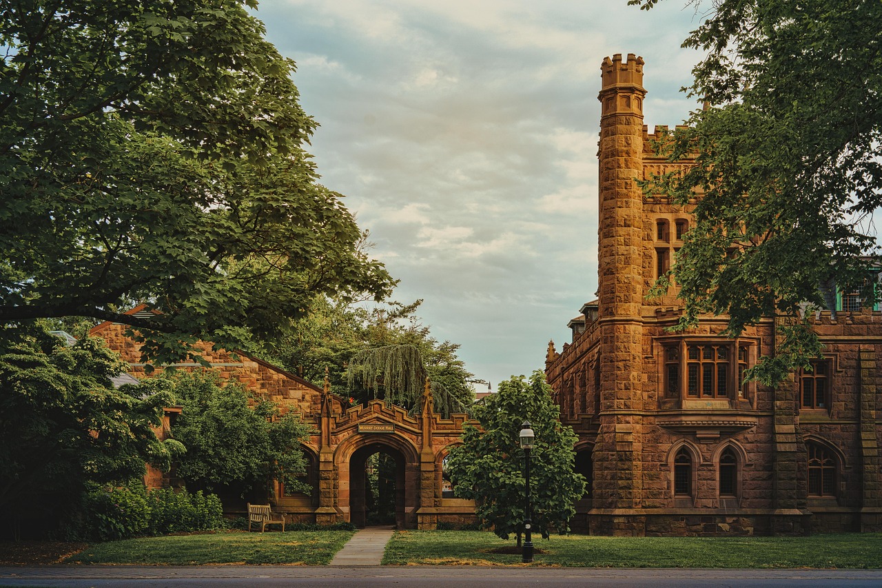
- Princeton: university town with Nassau Hall, where the Continental Congress briefly met in 1783, Gothic college buildings and Nassau Street. Parking in the town centre is scarce and unsuitable for large vehicles – park on the outskirts.
- Princeton Battlefield State Park: meadow and colonnade at the site of the battle of 3 January 1777, shortly after Washington’s crossing of the Delaware; simple parking area on Mercer Road.
- Delaware and Raritan Canal: the towpath along the canal south of the university is flat, shady and ideal for a bike ride to Lake Carnegie.
- CampingSpirit overnight tip
-
Official campsite or RV park: Brendan T. Byrne State Forest Campground: pine forest campground on the edge of the Pine Barrens near New Lisbon, sites without hook-ups, restroom building with showers, some cabins; check length limits and dump facilities when booking. Reservations via NJOutdoors. The former campground on Bull’s Island on the Delaware has been permanently closed since 2012; there is no state campground around Princeton.
Free camping or nature tip (where legal): There is no public land at all for free camping around Princeton; many municipalities prohibit sleeping in vehicles on the street. In the Pine Barrens, stay overnight only at designated sites.
- Insider tip for campers
- Brendan T. Byrne State Forest is home to Whitesbog Village, a cranberry pickers’ village where the cultivated blueberry was bred in the early 20th century – there is a blueberry festival there in June. Sand roads in the forest are off limits for motorhomes: you get stuck within seconds, and towing is expensive.
4Stage 4: Brendan T. Byrne State Forest to Bass River State Forest (approx. 90 km)
- The drive
- On NJ-72 and US-206 through the pine forest to Atsion, then via NJ-542 along the Mullica River to Batsto and on to New Gretna and Bass River State Forest. Dead-straight, almost empty country roads, speeds 45–50 mph, pitch pines and oaks on either side. Deer often cross, especially at dusk. Pure driving time around 1.5 hours. Filling stations only in Hammonton, on NJ-72 and in New Gretna – fill up beforehand.
- Highlights & must-sees
- Atsion: an ironmaster’s mansion from 1826 on US-206, behind it Atsion Lake with a swimming beach in summer and the bank of the Mullica where canoes put in. The water is dark from iron and tannins, but clean.
- Batsto Village in Wharton State Forest: an ironworks and later glassworks village with mansion, sawmill, workers’ houses and visitor centre. Wharton is New Jersey’s largest state forest; short trails and the long-distance Batona Trail start from Batsto Lake.
- Mullica River: a calm canoe route through cedar swamps, with outfitters in the area; early in the morning you hear Pine Barrens tree frogs and see ospreys.
- CampingSpirit overnight tip
-
Official campsite or RV park: Bass River State Forest: New Jersey’s oldest state forest, campsites around Lake Absegami with a swimming beach, sites without hook-ups, restroom buildings with showers, plus lean-tos and cabins; check dump facilities and length in advance. Alternative: Atsion Family Campground in Wharton State Forest on Atsion Lake. Both via NJOutdoors.
Free camping or nature tip (where legal): Wharton and Bass River have primitive campsites (such as Godfrey Bridge, Hawkins Bridge, Mullica River) – these are not free sites but require a permit from the forest office, and they lie on deep sand roads that can only be driven with four-wheel drive and ground clearance. Free camping is prohibited in the Pine Barrens.
- Insider tip for campers
- The sand roads of the Pine Barrens look firm and are not: churning sand after dry spells, deep puddles after rain. With a motorhome, stay on asphalt; to reach fire towers and ghost towns, go by bike or on guided tours instead. The wildfire risk is high – fires only in the campground rings, and observe any bans.
5Stage 5: Bass River State Forest to Barnegat Light and back (approx. 130 km)
- The drive
- North on the Garden State Parkway to NJ-72 at Manahawkin, across the causeway bridge onto Long Beach Island and along Long Beach Boulevard to the northern tip. The island is around 30 kilometres long and narrow, speeds in town 25–35 mph, with queues from the bridge on summer weekends. Return the same way. Pure driving time around 2.5 hours for the whole day. Toll plazas on the Parkway; only a few filling stations on the island.
- Highlights & must-sees
- Barnegat Lighthouse State Park: “Old Barney”, a red-and-white tower from 1859 at Barnegat Inlet, 217 steps to the gallery; the tower opens seasonally, check current times with the state park. Below it, a boardwalk leads onto the stone jetty, where eiders and seals turn up in winter.
- Maritime Forest Trail in the state park: a short loop through one of the last coastal forests on the island, with holly, cedar and cherry.
- Long Beach Island: wooden houses, fish shops and small beaches between Barnegat Light, Surf City and Beach Haven; the island municipalities’ beaches require a beach tag in summer.
- CampingSpirit overnight tip
-
Official campsite or RV park: Back at Bass River State Forest (second night) – there is no public campground on Long Beach Island. Private campgrounds with full hook-ups are on the mainland near Manahawkin; in summer, book weeks ahead.
Free camping or nature tip (where legal): On Long Beach Island, sleeping in vehicles on streets and beach car parks is prohibited, and the municipalities enforce it. No free camping option.
- Insider tip for campers
- Beach tags are mandatory in the Long Beach Island municipalities in summer until Labor Day (starting between late May and mid-June depending on the municipality); daily and weekly tags are sold at stands at the beach entrances or at the municipal offices, and outside the season the beach is free. Don’t leave the motorhome at a beach entrance; use the designated parking areas of the state park.
6Stage 6: Bass River State Forest to Belleplain State Forest (approx. 120 km)
- The drive
- South via US-9 and the Garden State Parkway: a short detour to the Edwin B. Forsythe National Wildlife Refuge in Oceanville, then via the Atlantic City Expressway connectors briefly into Atlantic City, on across the bridges to Ocean City and via the Parkway and NJ-347 or county roads into Belleplain State Forest. Flat marshland, many bridges, city traffic from Atlantic City onwards. Pure driving time around 2.5 hours. Plenty of filling stations.
- Highlights & must-sees
- Edwin B. Forsythe National Wildlife Refuge: the Wildlife Drive is a one-way gravel road of around 13 kilometres through salt marsh with the Atlantic City skyline in the background; tens of thousands of geese and ducks in autumn, ospreys and herons all year. Entrance fee per vehicle; check the road’s condition beforehand.
- Atlantic City: the first boardwalk in the USA (1870), casinos and Absecon Lighthouse, New Jersey’s tallest lighthouse with 228 steps. For a short visit, a walk along the boardwalk is enough; parking garages have height limits.
- Ocean City: family resort with a boardwalk and no alcohol sales in town; the boardwalk is good for cycling in the morning.
- CampingSpirit overnight tip
-
Official campsite or RV park: Belleplain State Forest: campsites around Lake Nummy among pines and oaks, sites without hook-ups, restroom buildings with showers, plus lean-tos and cabins; around 35 kilometres from Cape May and thus the state-run base for the southern tip. Reservations via NJOutdoors; check dump facilities and length when booking.
Free camping or nature tip (where legal): Atlantic City and Ocean City prohibit sleeping in motorhomes on streets and in car parks; casino car parks are not overnight spots. There is no legal free camping option in the Cape region.
- Insider tip for campers
- Beaches in Atlantic City are free; in Ocean City you need beach tags in summer. Drive the Wildlife Drive in the Forsythe Refuge in the late afternoon: low light, lots of birds, and the marsh wind makes the insects more bearable than in the forest. In high summer, greenhead flies bite in the marsh.
7Stage 7: Belleplain State Forest to Cape May (approx. 60 km)
- The drive
- South via county roads and the Garden State Parkway; the Parkway ends at milepost 0 in Cape May. Detour into the Wildwoods via NJ-47 or Rio Grande; in Wildwood and Cape May, narrow streets, many traffic lights and pedestrians. Pure driving time around 1.5 hours. Fill up before town; filling stations are scarce in Cape May.
- Highlights & must-sees
- Wildwood: around 3 kilometres of boardwalk, wide free beaches and the 1950s Doo Wop motels with neon signs; in North Wildwood stands the Victorian Hereford Inlet Lighthouse with its garden.
- Cape May: entire streets of Victorian wooden houses with porches and turrets, a National Historic Landmark District; the Washington Street Mall is pedestrianised. With a motorhome, park outside and go into the old town by bike or shuttle.
- Cape May Point State Park: Cape May Lighthouse from 1859 with 199 steps (admission via the town’s preservation organisation), dune and pond trails and, in autumn, a platform for the hawk count when falcons and hawks migrate over the peninsula. At nearby Sunset Beach the wreck of the concrete ship SS Atlantus lies in the water.
- CampingSpirit overnight tip
-
Official campsite or RV park: There is no state campground in Cape May itself; several private campgrounds with full hook-ups lie north of town near Erma and Cape May Court House and book up quickly in high season. If you want to stay state-run, keep overnighting at Belleplain State Forest and come as a day trip. After the ferry to Delaware: Cape Henlopen State Park near Lewes with hook-up sites, reservations via Delaware State Parks.
Free camping or nature tip (where legal): Cape May and the Wildwoods prohibit sleeping in vehicles on streets and in car parks and patrol at night. The parking areas at the state park and at Sunset Beach close in the evening.
- Insider tip for campers
- Looking ahead: the Cape May–Lewes ferry crosses Delaware Bay in around 85 minutes and takes motorhomes – under 13 ft 6 in (around 4.1 metres) high; at most two 5-gallon propane cylinders, secured upright, valves closed, fridge switched off gas, rules on cmlf.com. Low vehicles and trailers should avoid travelling around high tide, otherwise they ground on the ramp. From around 18 ft (5.5 metres) overall length, bookings are made to the exact foot, and vehicles over 8 ft 6 in wide can only be booked by phone; reserve in summer and on autumn weekends. You often see dolphins from the ferry.
Camping practice & local rules
Wild camping & overnight parking
- New Jersey has no public land for dispersed camping. Overnight stays are only permitted at designated sites; even the primitive campsites in Wharton and Bass River require a permit. Coastal towns such as Atlantic City, Ocean City, the Wildwoods, Cape May and the Long Beach Island municipalities prohibit sleeping in vehicles and will tow.
- In the Delaware Water Gap National Recreation Area, camping is only permitted at campgrounds and at designated riverside sites for canoeists; rangers patrol parking areas on the Old Mine Road and at the trailheads.
- Service areas on the Garden State Parkway and the New Jersey Turnpike are for rest breaks, not camping. Supermarket and department store car parks only with explicit permission from the store; some municipalities prohibit it altogether.
- Reservations: New Jersey State Parks and Forests via the NJOutdoors portal, with a service fee per booking; non-residents pay higher overnight fees, and in parks with a seasonal parking fee (such as High Point) vehicles with out-of-state plates pay more. Check current amounts with the park service.
- Federal lands: since 2026, visitors without US residency pay higher fees and surcharges at some US national parks; check current amounts on nps.gov. In the Delaware Water Gap, seasonal parking fees are charged at some swimming areas, and the Forsythe Refuge charges an entrance fee per vehicle; the America the Beautiful Pass is valid there.
- Ticks and mosquitoes: New Jersey is among the states with the most Lyme disease cases; the deer tick and the lone star tick are widespread in forest, meadows and dune grass. Check yourself after every hike. Mosquitoes are active in the Pine Barrens and the marsh from May to October, greenheads on the coast in July.
- Apps: iOverlander, Campendium, The Dyrt and Recreation.gov; Park4Night is not widely used here.
Waste disposal & supplies
- New Jersey’s state campgrounds generally have no electric, water or sewer hook-ups at the site; there are water taps and restroom buildings, but not a dump station everywhere. Before each stage, check where you can dump, and arrive with the waste tank empty and the fresh water tank full.
- Private campgrounds near Manahawkin, Cape May Court House and Erma offer full hook-ups and some also accept visitors for dumping only, for a fee.
- Empty grey water and chemical toilets only at dump stations; in the Pine Barrens the groundwater lies just below the sand and feeds a huge drinking water aquifer.
- Propane: filling stations, hardware stores and campgrounds fill US cylinders; European cylinders are generally not filled.
- Fuel: New Jersey is the only US state where self-service fuelling is prohibited; an attendant serves you. Diesel and petrol are usually cheaper than in New York and Pennsylvania – fill up before the detour to the PA side and before the ferry.
- Shopping: larger supermarkets along I-80, in Newton, Princeton, Hammonton, Manahawkin, Rio Grande and Cape May Court House; in the Pine Barrens and on the Old Mine Road there is almost nothing.
Vehicle size & traffic rules
- Speed limits: interstates and the Garden State Parkway mostly 55–65 mph, country roads 40–50 mph, island towns 25–35 mph. Phones at the wheel hands-free only; seat belts compulsory in all seats. If you come across emergency vehicles at the roadside, you must change lanes or slow down considerably.
- Garden State Parkway: tolls at main toll plazas and many on- and off-ramps; E-ZPass is also valid in New York, Pennsylvania and Delaware and is cheaper than the cash rate. Cash is currently still accepted; check the rules for driving without a transponder with the New Jersey Turnpike Authority in advance. The truck ban north of Exit 105 applies to commercial trucks over 10,000 pounds; private motorhomes may use the whole Parkway. With rental vehicles, clarify the toll arrangements beforehand.
- Bridges and tunnels near New York: the Holland and Lincoln tunnels and the lower level of the George Washington Bridge are closed to motorhomes with propane systems; with gas on board, use the upper level of the George Washington Bridge, close the valves and check the Port Authority’s current rules. The bridges over the Delaware (I-80 at the Water Gap) are tolled in the direction of Pennsylvania.
- Beach tags: in Ocean City, Cape May and on Long Beach Island, paid beach tags are mandatory in summer; in Atlantic City and the Wildwoods the beach is free. The requirement usually applies from Memorial Day to Labor Day; outside the season the beach is free.
- Hurricane season: 1 June to 30 November, peaking August to October; plus nor’easters in autumn and winter. When storm warnings are issued, the barrier islands are evacuated and the ferry is cancelled; follow the evacuation routes (blue signs).
- Wildfire: in the Pine Barrens a fire ban applies during dry periods, including at campgrounds; follow the notices of the New Jersey Forest Fire Service.
- Emergencies: 911. Mobile coverage is good on the coast, weak or absent in places in the Pine Barrens and on the Old Mine Road.
CampingSpirit packing & preparation checklist
- Tick tweezers, tick repellent and long, light-coloured clothing: New Jersey is Lyme country, and on every stage you walk through grass and undergrowth.
- Mosquito screens for door and windows plus repellent with DEET or picaridin: the Pine Barrens and the marsh are mosquito country from May to October.
- E-ZPass transponder (or the rental company’s toll arrangement): saves time and surcharges on the Garden State Parkway, at the Delaware bridges and at the ferry.
- Large fresh water container and a sufficiently long sewer hose: the state campgrounds have no hook-ups at the site, and taps are often far away.
- Bicycles: for Cape May, Princeton, the boardwalks and the sand roads of the Pine Barrens that are off limits for motorhomes.
- Binoculars: for the raptor migration in Cape May, geese in the Forsythe Refuge and the view from the High Point Monument.
As of 2026-10. Closures, fees and booking rules change: check official sources before you go.