



In-depth guide · CampingSpirit
A loop through two countries: from Whitehorse along the glaciated mountains of Kluane to Tok in Alaska, over the Chilkat Pass down to the fjord at Haines, by ferry to Skagway and over the White Pass back into the Yukon.
The spirit of the route
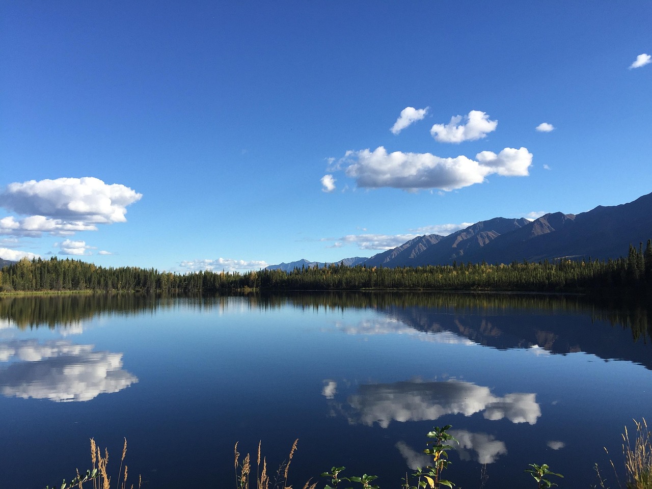
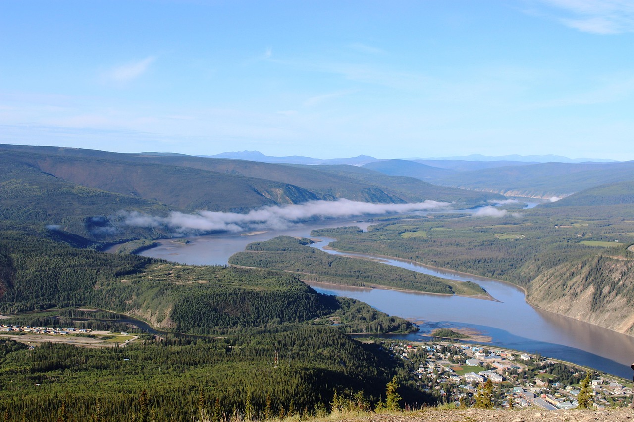
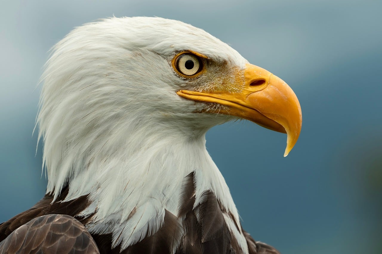
Beyond Haines Junction the Kluane Ranges stand like a wall beside the road, and behind them lies the largest non-polar icefield in the world, which from the highway you can only sense. At Kluane Lake the wind drives glacial dust from the Slims River across the turquoise water, and on the slopes of Thechàl Dhâl Dall sheep move through the grass as white dots. After that the Alaska Highway turns rough: frost heaves, patches, long straights through spruce forest all the way to the border. On the way back the route turns south, across the treeless plateau of the Chilkat Pass, where in June patches of snow still lie beside the road, and then down through countless bends into the rainforest along the Chilkat River. In the evening in Haines the air smells of salt and seaweed, bald eagles sit on the sandbars, and from the sliding door you look at mountains rising straight out of the sea. Three border crossings, two passes, one ferry – and a great deal of silence in between.
Stage-by-stage plan
1Stage 1: Whitehorse to Haines Junction and Kathleen Lake (approx. 185 km)
- The drive
- West on the Alaska Highway (Yukon Hwy 1): a well-built two-lane paved road through open pine and spruce forest, across the Takhini River and past the Champagne burn areas, with the Kluane Ranges filling the windscreen towards the end. In Haines Junction, 27 km south on the Haines Highway (Hwy 3) to Kathleen Lake. A little over 2 hours of driving time.
- Highlights & must-sees
- Da Kų Cultural Centre in Haines Junction: shared building of the Champagne and Aishihik First Nations and Kluane National Park, with an exhibition, park information, hiking advice and campground bookings.
- Champagne: small settlement on the old Dalton Trail that the highway runs past – view the First Nation's cemetery and buildings respectfully, from the road only.
- Kathleen Lake: clear mountain lake in the national park with a lakeshore trail, boat launch and views of King’s Throne; the trail up King’s Throne is steep and long, while the short lakeshore trail suits your arrival evening.
- CampingSpirit overnight tip
-
Official campsite or RV park: Kathleen Lake Campground (Parks Canada, Kluane National Park): 38 unserviced sites, no pull-throughs, for motorhomes and trailers up to about 30 feet (around 9 m); drinking water taps, pit toilets, firewood, bear-proof bins. Some sites are allocated first come, first served at the kiosk, the rest can be booked through the Parks Canada reservation system. Season roughly mid-May to mid/late September. Longer vehicles: Pine Lake Campground (Yukon Government) just before Haines Junction on the Alaska Highway, bookable via yukon.goingtocamp.com.
Free camping or nature tip (where legal): In Kluane National Park overnight stays are only permitted at the campground. Outside the park the Yukon rule for public land applies: camping without a permit, but at least 45 m from the centre line of the Alaska Highway (30 m on other roads). Around Haines Junction there is a lot of Settlement Land of the Champagne and Aishihik First Nations – camping there only with permission.
- Insider tip for campers
- Fill up the tank and the propane in Whitehorse and shop for the whole Canadian section; Haines Junction has fuel stations and small shops, but limited choice. Staying in the national park requires a Parks Canada admission or a Discovery Pass – check current fees on parks.canada.ca. At Kathleen Lake, ask at the kiosk for the sites with long, level driveways.
2Stage 2: Kathleen Lake to Kluane Lake (Congdon Creek) (approx. 115 km)
- The drive
- Back to Haines Junction and north-west on the Alaska Highway: over a summit at Bear Creek Summit, then down to the southern end of Kluane Lake, the largest lake in the Yukon. The road follows the west shore, with bends along the slope, speed mostly 90 km/h. Around 1.5 hours of driving time, a full day with hikes.
- Highlights & must-sees
- Soldiers Summit: short trail to the spot where the Alaska Highway was officially opened on 20 November 1942, with information panels and a wide view over Kluane Lake.
- Parks Canada's Thechàl Dhâl Visitor Centre (Sheep Mountain) at the southern end of the lake: spotting scopes and advice on the Dall sheep on the slope opposite, starting point for hikes into the Slims valley; open seasonally.
- Slims River and Kluane Lake: since the Kaskawulsh Glacier diverted its meltwater in 2016, the Slims River has largely dried up – in wind, plumes of dust drift across the delta, and the lake level has dropped considerably.
- CampingSpirit overnight tip
-
Official campsite or RV park: Congdon Creek Campground (Yukon Government) on the west shore of Kluane Lake: with around 100 sites one of the largest government campgrounds in the Yukon, with pull-through sites, pit toilets, cooking shelter, firewood and beach; no hook-ups, no reservations. Because grizzlies feed on soapberries here in summer, tents are only allowed in the tent area behind the electric fence; all other sites are for hard-sided vehicles only – follow the notices at the kiosk.
Free camping or nature tip (where legal): Along Kluane Lake there are pull-outs and gravel areas on the shore; some lie on Settlement Land of the Kluane First Nation. On public land observe the 45-metre rule on the Alaska Highway, and when the wind blows off the Slims delta choose a sheltered spot. No free overnight stays in the national park itself (west side of the Slims).
- Insider tip for campers
- Binoculars or a spotting scope pay off at Thechàl Dhâl: the sheep often stand high on the slope. At Congdon Creek, put food, cool box and rubbish inside the closed vehicle at night – the campground is known for its bear activity. Fill up with fresh water beforehand at Kathleen Lake or in Haines Junction.
3Stage 3: Congdon Creek to Snag Junction (near Beaver Creek) (approx. 190 km)
- The drive
- North-west via Destruction Bay and Burwash Landing. Beyond Burwash begins the roughest section of the Alaska Highway in the Yukon: permafrost ground, frost heaves, dips and patches, often with roadworks on gravel. The road crosses the Donjek and the White River, and the Wrangell and St. Elias Mountains draw closer in the west. About 3 hours of driving time, speed according to the road surface.
- Highlights & must-sees
- Destruction Bay: small village on Kluane Lake, named after a storm that destroyed the road builders' camp in 1942; fuel station and rest area by the lake.
- Burwash Landing: Kluane First Nation community with the Kluane Museum of Natural History (seasonal) and an old log church on the lakeshore.
- Donjek River Bridge: view into the wide, braided glacial riverbed with gravel bars stretching to the icy peaks on the horizon.
- CampingSpirit overnight tip
-
Official campsite or RV park: Snag Junction Campground (Yukon Government) about 20 km before Beaver Creek: small campground, pit toilets, firewood, no hook-ups and no drinking water. To stop earlier: Lake Creek Campground (Yukon Government) between Burwash and Beaver Creek. In Beaver Creek itself there are private RV parks with power and showers.
Free camping or nature tip (where legal): North of Burwash the country gets lonelier; old road sections and gravel pits on public land are suitable for the night, 45 m from the centre line of the road. No fires during fire bans, and avoid leaving tracks in bog and on permafrost.
- Insider tip for campers
- Fill up in Destruction Bay or Burwash Landing – between Burwash and Beaver Creek you cannot count on any fuel station. Frost heaves are marked with small red flags, but not all of them: at every row of flags ease off the accelerator immediately, with a trailer even earlier. Carry water for two days.
4Stage 4: Snag Junction to Tok (Alaska) (approx. 200 km)
- The drive
- Through Beaver Creek, Canada's westernmost community – the Canadian border post there only checks entries, there is no exit control – and some 30 km further to the border and the US border post at Alcan. In Alaska the road is called AK-2, distances are in miles, speed mostly 55 to 65 mph. Through the lakes and wetlands of the Tetlin National Wildlife Refuge to Tok. About 2.5 hours of driving time plus the border check.
- Highlights & must-sees
- Border at Mile 1221: a cut through the forest following the 141st meridian exactly, with a photo stop at the border sign.
- Tetlin National Wildlife Refuge Visitor Center just past the border: viewing deck over lakes and the Nutzotin Mountains, information on migratory birds, moose and wildfires (seasonal).
- Tok: supply hub at the junction with the Tok Cutoff, with the Alaska Public Lands Information Center, which provides information on roads, fires and campgrounds throughout eastern Alaska.
- CampingSpirit overnight tip
-
Official campsite or RV park: Tok River State Recreation Site by the river just before Tok, or Moon Lake State Recreation Site west of Tok: basic state campgrounds, first come, first served, toilets, drinking water depending on the season. Along the way in the refuge: Deadman Lake Campground and Lakeview Campground (U.S. Fish and Wildlife Service), small, free lakeside campgrounds without hook-ups – the access road to Lakeview is narrow and only suitable for smaller vehicles.
Free camping or nature tip (where legal): Alaska has no statewide ban on free camping, but land ownership is decisive: on general state land, according to Alaska DNR, camping in one place is permitted for up to 14 days; Native land and private land only with permission. In the Tetlin Refuge, use the designated sites and avoid pull-outs signed “No Overnight Parking”.
- Insider tip for campers
- Do not take fresh fruit, vegetables, meat or firewood across the border, and declare everything you carry honestly: restock only in Tok. In summer Alaska is one hour behind the Yukon – change your clock. In Tok, fill up with fuel and propane, take on water and empty your tanks at one of the dump stations; fuel here is usually cheaper than in the Yukon.
5Stage 5: Tok to Haines Junction (return) (approx. 490 km)
- The drive
- Back the same way across the border at Beaver Creek and along Kluane Lake to Haines Junction – realistically two driving days with a night in between. In this direction the Kluane Ranges lie ahead in the morning light, and you already know the frost heaves.
- Highlights & must-sees
- Re-entry into Canada at Beaver Creek – the border crossing on the Alaska Highway is open around the clock.
- A second chance at Kluane Lake: in the evening on the gravel beach at Congdon Creek or near Destruction Bay, when the wind drops and the lake goes calm.
- Side trip from Haines Junction: the Auriol Trail or the Dezadeash River Trail on the edge of town, for your legs after two days of driving.
- CampingSpirit overnight tip
-
Official campsite or RV park: Night in between at Lake Creek, Snag Junction or Congdon Creek (all Yukon Government), then Pine Lake Campground (Yukon Government) near Haines Junction with beach, cooking shelter and boat ramp; some of the sites can be reserved via yukon.goingtocamp.com. Alternatively Kathleen Lake again.
Free camping or nature tip (where legal): The same rules apply on the way back: on Yukon public land 45 m from the centre line of the Alaska Highway, no overnight stays on Settlement Land without permission, and none in the national park outside the campgrounds.
- Insider tip for campers
- On entering Canada, import limits apply to food, alcohol and tobacco; poultry, eggs and dairy products are often restricted because of animal disease rules – buy fresh supplies only in Haines Junction. Fill up in Haines Junction before the Haines Highway: it is around 245 km to Haines without a reliable fuel station.
6Stage 6: Haines Junction to Million Dollar Falls (approx. 90 km)
- The drive
- South on the Haines Highway (Yukon Hwy 3), past Kathleen Lake and along the eastern edge of the national park. A wide, well-built road, gently rolling, with little traffic. A short drive of just over an hour – the day belongs to the lakes and trails along the roadside.
- Highlights & must-sees
- Rock Glacier Trail: short trail, partly boardwalked, onto a rock glacier of debris and ice with a view over Dezadeash Lake.
- Dezadeash Lake: long, shallow lake with a gravel beach and picnic area; often mirror-calm in the evening, with loons calling across the water.
- Million Dollar Falls: wooden stairs and platforms above the falls and cascades of the Takhanne River, a few steps from the campground.
- CampingSpirit overnight tip
-
Official campsite or RV park: Million Dollar Falls Campground (Yukon Government) right on the Takhanne River: just over 30 sites in the forest (no pull-throughs, no reservations), boardwalks to the viewpoint at the falls, cooking shelter, pit toilets, firewood; no hook-ups and no drinking water. Alternative: Dezadeash Lake Campground (Yukon Government), a small campground right on the lakeshore.
Free camping or nature tip (where legal): Along the Haines Highway in the Yukon there are gravel areas on public land, where the 30 m distance from the centre line of the road applies. For long stretches the west side of the road belongs to the national park – no free overnight stays there. A good 10 km south of Million Dollar Falls, British Columbia begins.
- Insider tip for campers
- The campgrounds on the Haines Highway have no drinking water: fill your tank in Haines Junction. In the evening, park up with an eye on the weather forecast for the Chilkat Pass – up there it can snow even in summer, and dense cloud cuts the visibility.
7Stage 7: Million Dollar Falls to Haines (Alaska) (approx. 155 km)
- The drive
- Through the BC section up to the Chilkat Pass (a little over 1,000 m): treeless plateau, tundra and snowfields, often wind and fog. Then to the Canadian border post at Pleasant Camp and the US post at Dalton Cache, after which the road winds down through many bends into the valley of the Klehini and Chilkat River and through coastal rainforest to Haines on the Lynn Canal. Around 2.5 hours of driving time plus the border.
- Highlights & must-sees
- Chilkat Pass: plateau on the edge of Tatshenshini-Alsek Park with wide views over tundra and glaciated peaks; in early summer patches of snow beside the road.
- Alaska Chilkat Bald Eagle Preserve between roughly Mile 18 and 24 of the Haines Highway: viewing area at the Council Grounds on the Chilkat River. In summer individual eagles sit on the sandbars; in late autumn thousands gather here at the ice-free stretches with the late salmon.
- Haines: Fort William H. Seward with its white officers' houses above the harbour, the Sheldon Museum and views across the fjord to the Chilkat Mountains.
- CampingSpirit overnight tip
-
Official campsite or RV park: Chilkat State Park south of Haines at the end of a narrow, steep road: sites in the forest above the fjord with views of glaciers, toilets, drinking water depending on the season – unsuitable for large motorhomes. Chilkoot Lake State Recreation Site north of Haines on the Chilkoot River: in summer with salmon and very active brown bears. In Haines there are private RV parks with hook-ups and a dump station; Portage Cove State Recreation Site on the edge of town is intended for tents only.
Free camping or nature tip (where legal): Around Haines there is a lot of private and Native land, and overnight stays in car parks in town are not provided for. On BC Crown land along the Haines Highway camping is generally allowed for up to 14 days unless signed otherwise; Tatshenshini-Alsek Park has its own rules. The state sites are the simple, legal solution.
- Insider tip for campers
- The Pleasant Camp and Dalton Cache border posts are not staffed around the clock and are closed at night – check current opening hours with CBSA and CBP and mind the time zones: in summer Alaska is one hour behind the Yukon. On the Chilkoot River, watch bears only from your vehicle or the roadside, never stand between a bear and the river, and do not stop on the road. Fill up and shop in Haines.
8Stage 8: Haines to Skagway and over the White Pass to Whitehorse (approx. 180 km)
- The drive
- By Alaska Marine Highway ferry across the Lynn Canal to Skagway (crossing around one hour), one night there. Then on the South Klondike Highway (AK-98, Yukon Hwy 2) steeply up to the White Pass, across the border at Fraser and through a landscape of lakes and rock to Carcross and Whitehorse – 2 to 3 hours of driving time, allow two days. If the ferry is not available for vehicles, the only option is the overland route back via Haines Junction (around 400 km to Whitehorse); Skagway can then be done as a side trip from Carcross.
- Highlights & must-sees
- Skagway: Broadway with its gold-rush wooden facades and the visitor centre of the Klondike Gold Rush National Historical Park in the old railway depot; in summer large cruise ships are often in port.
- White Pass: steep climb with views of the narrow-gauge line of the White Pass & Yukon Route; at the top, the rock and lake landscape of the Tormented Valley with stunted trees and moss.
- Bove Island Viewpoint on the Windy Arm of Tagish Lake, and Carcross with its wooden railway station and the Carcross Desert – this section is described in detail in the CampingSpirit guide to the Klondike Highway.
- CampingSpirit overnight tip
-
Official campsite or RV park: Dyea Campground (Klondike Gold Rush National Historical Park, NPS) about 15 km from Skagway on the Taiya River, at the start of the Chilkoot Trail: basic sites in the forest, pit toilets, no hook-ups; the access road is narrow, winding and partly gravel, unsuitable for large motorhomes – check the reservation system and length limit on nps.gov. In Skagway: the municipal Pullen Creek RV Park by the harbour, with hook-ups. On the way to Whitehorse: Conrad Campground (Yukon Government) on the Windy Arm south of Carcross.
Free camping or nature tip (where legal): Around Skagway free overnight stays are practically impossible: narrow valley, municipal land, national park and private land. On the Yukon side around Carcross there is a lot of Settlement Land of the Carcross/Tagish First Nation – only with permission; on public land the 30-metre rule applies.
- Insider tip for campers
- Book the ferry in advance via FerryAlaska.com and state your vehicle length, including bike rack, exactly – fares depend on length. The ferry does not sail daily, and the terminal in Skagway has already been closed for weeks at a time because of damage – check the timetable and status on FerryAlaska.com before your trip; private fast ferries only carry passengers. The descent from the White Pass to Skagway is very steep: use a low gear and spare your brakes. The Fraser border post is not open around the clock.
Camping practice & local rules
Wild camping & overnight parking
- Yukon: camping on public land is permitted without a permit, at least 30 m from the centre line of the road, 45 m on the Alaska Highway. On private land and on First Nations Settlement Land (including Champagne and Aishihik, Kluane, Carcross/Tagish) only with permission. In Kluane National Park only at the campground.
- Yukon Government campgrounds (Pine Lake, Congdon Creek, Lake Creek, Snag Junction, Dezadeash Lake, Million Dollar Falls, Conrad): self-registration at the kiosk, payment in cash on site (2026: CAD 20 per night) or cheaper by voucher or online reservation (CAD 18) where offered. Fees apply from 1 May to 30 September; after that no fee, but no services. Maximum 14 nights in 28 days, quiet hours 11 pm to 7 am, gas-powered generators only 9–11 am and 5–8 pm.
- Kluane National Park (Parks Canada): Kathleen Lake is the only vehicle campground in the park, partly bookable through the Parks Canada reservation system, partly first come, first served. Admission or a Discovery Pass is required for your stay in the park; check fees on parks.canada.ca.
- British Columbia (Haines Highway at the Chilkat Pass): on Crown land camping is usually permitted for up to 14 days in one place unless signed otherwise; protected areas such as Tatshenshini-Alsek Park have their own rules.
- Alaska: no statewide ban on free camping, but mind land ownership – on general state land up to 14 days in one place, Native land and private land only with permission. State Recreation Sites (Tok River, Moon Lake, Chilkat State Park, Chilkoot Lake) are mostly first come, first served with limited length of stay; in October many have no water or are closed. Since 2026, visitors without US residency have in some cases faced higher fees and surcharges at US national parks – check current amounts on nps.gov.
- Bears: grizzlies/brown bears and black bears along the whole route, especially at Congdon Creek (berry season) and on the Chilkoot River (salmon). At night put food, cool box, dishes, rubbish and toiletries inside the closed vehicle or in bear-proof lockers; carry bear spray on your body, ready to hand. Apps: iOverlander, Campendium, Park4Night (few entries in the north); road conditions on 511yukon.ca and 511.alaska.gov.
Waste disposal & supplies
- Fuel stations: Whitehorse, Haines Junction, Destruction Bay, Burwash Landing, Beaver Creek, Tok, Haines, Skagway and Carcross. Haines Junction–Haines (around 245 km) without a reliable fuel station; between Burwash and Beaver Creek don't rely on any station. Rule of thumb: refuel from half a tank.
- Drinking water: the Yukon Government campgrounds have no drinking water; Kathleen Lake (Parks Canada) has drinking water taps. Fill tanks in Whitehorse, Haines Junction, Tok, Haines or Skagway; filter and boil stream and lake water.
- Waste disposal: sani-dumps at private RV parks and fuel stations in Whitehorse, Haines Junction, Beaver Creek, Tok, Haines and Skagway, usually for a fee. The government campgrounds have no disposal facilities; never release grey water onto the ground – the smell attracts bears.
- Propane in Whitehorse, Haines Junction, Tok, Haines and Skagway. North American fittings; European gas bottles are usually not refilled, rental motorhomes have built-in tanks.
- Shopping: large supermarkets only in Whitehorse; Haines Junction, Tok, Haines and Skagway have smaller, more expensive shops. Before each border crossing, use up fresh supplies rather than buying new ones.
- Mobile coverage: no signal over long stretches between towns, almost none at all at the Chilkat Pass and north of Burwash; bring offline maps and a satellite messenger.
Vehicle size & traffic rules
- Speed limits: in the Yukon and BC in km/h (Alaska Highway mostly 90, in places 100), in Alaska in mph (mostly 55, in places 65). There are no separate limits for motorhomes or vehicles towing trailers. In the Yukon, headlights on in daytime too; in Alaska slow vehicles must pull over at the next safe turnout as soon as five or more vehicles are queuing behind them.
- Frost heaves: especially between Burwash Landing and the border and east of Tok; marked with flags or “Bump” signs, but not consistently. Roadworks with gravel, dust and a pilot car are normal in summer.
- Border crossings: for entry into Canada by land, a passport is sufficient for Germans – the eTA is only required when entering by air (i.e. when flying to Whitehorse). For the USA, a passport and entry authorisation (ESTA or I-94); check current rules on cbp.gov. Beaver Creek/Alcan is open around the clock, Pleasant Camp/Dalton Cache (Haines Highway) and Fraser/Skagway are not – check hours with CBSA and CBP.
- Food and equipment at the border: fresh fruit, vegetables, meat and poultry are restricted in both directions; do not take firewood across the border. Declare everything, including bear spray, alcohol and larger amounts of cash. Rental agreements must expressly permit travel in both countries.
- Time zones: Yukon UTC−7 all year, Alaska UTC−8 in summer (UTC−9 in winter) – after entering Alaska in summer it is one hour earlier. Always read border and ferry opening times in the respective local time.
- Haines–Skagway ferry (Alaska Marine Highway): not daily; book vehicles in advance via FerryAlaska.com or by phone (1-800-642-0066), stating the overall length exactly. If the service is suspended – for instance because of damage to the terminal in Skagway, which has already led to closures lasting weeks – the alternative is the overland route via Haines Junction; check the status before planning. No tolls, no low-emission zones; winter tyres strongly recommended from September.
CampingSpirit packing & preparation checklist
- Bear spray with holster, buy it in Whitehorse – it is not allowed in air luggage, belongs on every hike and must be declared at the border.
- Binoculars or a spotting scope for Dall sheep at Thechàl Dhâl, bald eagles on the Chilkat River and bears on the Chilkoot River – watch from a distance instead of driving closer.
- Fresh water container (20 l) and water filter: no Yukon Government campground has drinking water.
- Tyre repair kit with 12 V compressor and a windscreen chip repair kit – roadworks on gravel and frost heaves north of Burwash take their toll on tyres and windscreen.
- Rain gear and warm layers: at the Chilkat Pass it can snow in summer, and in Haines and Skagway it often rains for days.
- Folder with passport, ESTA confirmation, vehicle documents, the rental company's border authorisation and ferry booking – ready to hand at three border crossings rather than in the storage locker.
As of 2026-10. Closures, fees and booking rules change: check official sources before you go.