

In-depth guide · CampingSpirit
From Polla via Teggiano and Monte Cervati around the Alburni to the caves of Castelcivita and the Gole del Calore: about 270 kilometres through a southern Italy without the sea, with stalactites, bean fields and villages where the motorhome stays at the edge of town.
The spirit of the route
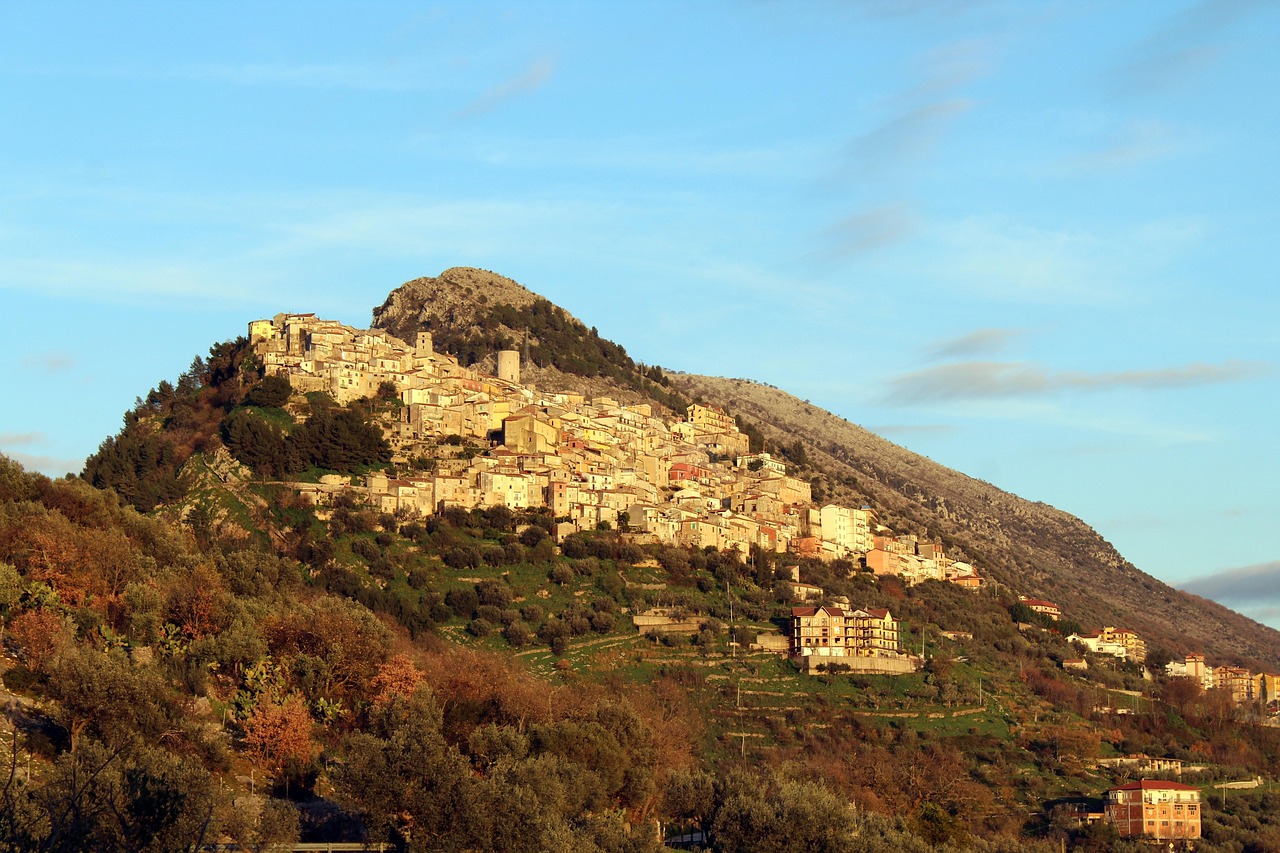
If you only know the Cilento from the coast, you miss its back side. Behind the beaches the land rises into limestone massifs, and between them lies the Vallo di Diano, a high plain so flat and wide that the Tanagro seems almost to hesitate as it crosses it. From the sliding door you see the humps of the Alburni on the left and Monte Cervati on the right, still snowy in spring, yellow and dry under oaks and beeches in summer. The villages cling to the slopes, with castles, domes and lanes no motorhome fits through. Beneath the karst the river keeps flowing: at Pertosa you enter by boat, and at Castelcivita you walk through dripstone halls at a constant 18 degrees. There is little traffic, little signage in English and plenty of Sunday lunchtimes when the village bar is the only place to meet. Whoever arrives here brings time – and a small stock of Italian.
Stage-by-stage plan
1Stage 1: Polla to Pertosa-Auletta (approx. 15 km)
- The drive
- Leave the A2 at Polla, then follow the SS19 and the valley road along the Tanagro northwest to Auletta and Pertosa. Well-built country road without any notable gradients, about 25 minutes of driving. The last stretch to the cave is winding; even so, check the length and height of your vehicle with the operator beforehand.
- Highlights & must-sees
- Grotte di Pertosa-Auletta: the visit begins with a short boat trip (about 200 metres) on the underground river, with the guides pulling the boat along a rope. After that, the standard route takes you about a kilometre on foot through dripstone halls; a longer route also leads to the underground waterfall. Inside it stays cool and damp all year round, so bring a jacket and sturdy shoes.
- Museo speleo-archeologico in Pertosa: finds from the Bronze Age pile-dwelling settlement discovered at the cave entrance.
- The Tanagro itself: where it emerges from the mountain, a walk along the bank below the cave is worthwhile.
- CampingSpirit overnight tip
-
Official campsite or RV park: In the immediate surroundings of Pertosa-Auletta, campsites and motorhome pitches are thin on the ground; no sites are listed there in the OpenStreetMap dataset. Expect small aree di sosta or agricampeggi in the villages, and check the current situation on CamperOnline or park4night. In front of the cave there is a paid car park that is also designed for coaches; whether and where motorhomes may park there is best clarified with the operator beforehand.
Free camping or nature tip (where legal): Overnighting in the cave car park is not intended; the area belongs to the foundation that runs the cave. As a day stop for the guided tour the car park is convenient – you are better off spending the night on a designated site or asking an agriturismo for a pitch on the farm.
- Insider tip for campers
- Book the tour in advance online or by phone, especially at weekends in spring and in August; the cave closes for a few weeks in winter to give its wildlife a rest, and in the low season there are days off. Times change, so check with the operator, the MIdA foundation. Arrive 20 minutes before the start. The Cilento coast is covered by the CampingSpirit guide “Lemons, temples and Saracen towers”; here the cave is the opening to the hinterland.
2Stage 2: Pertosa-Auletta to Teggiano (approx. 35 km)
- The drive
- Back onto the valley road and via Polla and Atena Lucana to Sala Consilina, then across the plain to Teggiano, which sits on a hill above the valley. Wide roads, little traffic, and at the end the steep approach into the upper town. About 45 minutes of pure driving time.
- Highlights & must-sees
- Sala Consilina: the lively centre of the valley with an old upper town, castle ruins and churches, good for shopping and a lunch break.
- Teggiano: medieval walls, the cathedral of Santa Maria Maggiore with the pulpit (ambone) by Melchiorre da Montalbano, and the Castello Macchiaroli, which is associated with the Sanseverino family and is now mainly an events venue; whether you can get in depends on the programme.
- Museo Diocesano in the former church of San Pietro in Teggiano, with sacred art, silverware and liturgical vestments of the Diocese of Teggiano-Policastro; opening hours differ between summer and winter.
- CampingSpirit overnight tip
-
Official campsite or RV park: For Teggiano and Sala Consilina no motorhome site is listed in the OSM data. If you are not parked on municipal land, you will find small aree di sosta in the towns or can ask at agriturismi; check the operator and season on CamperOnline beforehand, as many sites close in winter.
Free camping or nature tip (where legal): Use the designated parking areas at the foot of the old town of Teggiano. In the upper town parking is difficult and partly reserved for residents. Camping-style behaviour (chairs, awning) is prohibited here too under Italian law.
- Insider tip for campers
- Park below the centre and walk up. The lanes of the old town are off limits for motorhomes, and turning round is hardly possible. Shop in Sala Consilina if you can; market days vary from town to town.
3Stage 3: Teggiano to Sanza (approx. 40 km)
- The drive
- From Teggiano via Padula-Buonabitacolo and Sassano south to Sanza at the foot of the Cervati. The valley floor is flat; from Sassano the road climbs in bends, and the road through Sanza is narrow. A good 1 hour of driving.
- Highlights & must-sees
- Certosa di San Lorenzo in Padula (UNESCO World Heritage Site): only a short stop of two hours at most, with the huge cloister. The coast is covered by the CampingSpirit guide “Lemons, temples and Saracen towers”.
- Sassano: small village on the edge of the valley with a view across the plain to the Alburni.
- Sanza: mountain village with steep lanes at the foot of Monte Cervati, a starting point for hikes.
- CampingSpirit overnight tip
-
Official campsite or RV park: In Padula, CamperOnline lists a fenced pitch area at a B&B (Il Tiglio) with about 24 places, electricity, fresh water and disposal, open all year and with a shuttle to the Certosa; it is missing from the OSM dataset and the details are not officially confirmed, so call ahead. Around Sanza and in the upper Vallo di Diano you are left with aree di sosta or agriturismi; no sites are entered there in the OSM dataset. Many businesses are small and open only seasonally.
Free camping or nature tip (where legal): Around Sanza the area belongs to the Cilento, Vallo di Diano e Alburni National Park. Wild camping is not allowed in the park; parking in car parks is permitted only where signs do not forbid it.
- Insider tip for campers
- The road through Sanza is narrow; do not drive deep into the lanes on arrival. Fill up with fuel and water in the valley plain, because from here on petrol stations become rare.
4Stage 4: Sanza to Monte San Giacomo (Monte Cervati) (approx. 25 km)
- The drive
- Back to the plain and along the provincial road to Monte San Giacomo, then up the SP 72/b towards the Cervati. About 13 kilometres of paved mountain road to a lay-by without services, after that on foot only. The road is narrow and winding; there is no summit road in the proper sense, and the summit (about 1,899 m) is a hikers’ peak.
- Highlights & must-sees
- Rifugio Cervati (about 1,600 m): about an hour and a half on foot from the lay-by along the Sentiero dell'Acqua che Suona; open beech woods and pastures.
- Summit of Monte Cervati, at about 1,900 m the highest mountain in Campania, with views as far as the Gulf of Policastro in clear weather.
- Historic ascent route from Sanza via the Madonna della Neve: according to hiking guides about 10 kilometres, around 1,300 metres of ascent and a good five hours each way, for experienced hikers only.
- CampingSpirit overnight tip
-
Official campsite or RV park: There is no room for motorhomes up at the top. Spend the night beforehand in the valley near Monte San Giacomo or Sanza on designated areas. Ask the park or the municipality in advance which areas are currently usable.
Free camping or nature tip (where legal): Free camping is forbidden in the park; parking in lay-bys is allowed for the hike, but sleeping in the vehicle at trailheads may be prohibited locally. Prohibition signs apply.
- Insider tip for campers
- The gravel access tracks are not for a motorhome: from Sanza a bumpy unpaved track about 11 kilometres long (high ground clearance needed) leads to a chapel, but not directly to the rifugio. From Piaggine, after about 5 kilometres you continue on the unpaved, poor SP 388; it is considered passable only from June to November. Start the hike early, because in high summer thunderstorms build up in the afternoon. Take enough water.
5Stage 5: Monte San Giacomo to Corleto Monforte (approx. 60 km)
- The drive
- Back north via Sala Consilina and Polla, then from Auletta on country roads up to the Alburni and on to Corleto Monforte. The climb is long with many bends, and the roads are narrow and often not in the best condition. About 1.5 to 2 hours of driving.
- Highlights & must-sees
- Monti Alburni: karst massif with beech forests, dolines and caves, highest peak Monte Panormo (1,742 m).
- Corleto Monforte: quiet mountain village on the edge of the massif, a starting point for hikes onto the high plateau.
- Viewpoints over the Tanagro valley and the plain in clear weather.
- CampingSpirit overnight tip
-
Official campsite or RV park: There are only a few pitches in the Alburni area; agriturismi and small aree di sosta in Corleto Monforte or the neighbouring villages are usually the only option. Check availability before you set off; in winter much is closed.
Free camping or nature tip (where legal): The plateau belongs to the national park. Free camping is forbidden; you may stay overnight on sites or where parking is allowed and no prohibition sign stands. Mind the wildfire risk in summer: fires and barbecues are prohibited.
- Insider tip for campers
- On this stage, do not drive with a trailer or with vehicles over 7 metres. The approach to Corleto Monforte is tight; if in doubt, park on the main road and continue on foot. Carry snow chains or winter tyres from November to April.
6Stage 6: Corleto Monforte to Castelcivita (approx. 55 km)
- The drive
- From Corleto Monforte down into the valley and around the massif via Sicignano degli Alburni to Castelcivita in the Calore valley. The route is varied: first bends, then wider roads. A good 1.5 hours of driving.
- Highlights & must-sees
- Grotte di Castelcivita: cave about 4.8 kilometres long, visitable only on a guided tour, around 18 °C inside. The standard tour lasts about an hour.
- The village of Castelcivita with its river and the walking trail along the Calore.
- Oasi WWF Persano on the Sele: wetland for birdwatching, to the northwest in the plain and a real detour.
- CampingSpirit overnight tip
-
Official campsite or RV park: According to OpenStreetMap data there is the Agricampeggio Pugliese near Castelcivita (picnic and camping area); facilities and season are not confirmed. Call ahead and clarify electricity and disposal.
Free camping or nature tip (where legal): At the cave entrance there is a car park; overnighting there is not usual and may be prohibited. On the Calore, local rules apply for swimming and parking; mind the signs.
- Insider tip for campers
- In the winter months the cave is open by reservation only; outside that period there are fixed tour times, with more at weekends. Check times and whether a reservation is required with the operator beforehand. Bring a fleece jacket and sturdy shoes. There is no mobile reception inside.
7Stage 7: Castelcivita to Roccadaspide (approx. 20 km)
- The drive
- Via Controne, known for its beans, through vineyards and olive groves to Roccadaspide. The route is winding and easy to drive. About 30 minutes.
- Highlights & must-sees
- Controne: growing area of the Fagiolo di Controne IGP, with opportunities to taste and buy in the village.
- Roccadaspide: old town with a castle and panoramic views over the Calore valley.
- Short walks around the villages, waymarked by the park.
- CampingSpirit overnight tip
-
Official campsite or RV park: In the Roccadaspide area, according to OSM data, there are a few agricampeggi and picnic areas with a pitch; checking beforehand is necessary, as the data are not confirmed.
Free camping or nature tip (where legal): The national park applies here too. Observe prohibition signs and local ordinances.
- Insider tip for campers
- Buy beans, olive oil and cheese directly from the producers; many farms sell from the farm. The road through Roccadaspide may be closed during events.
8Stage 8: Roccadaspide to Felitto (Gole del Calore) (approx. 20 km)
- The drive
- South to Felitto through hilly countryside. The roads are narrow but without tunnels. About 30 minutes.
- Highlights & must-sees
- Gole del Calore near Felitto: gorge with crystal-clear water, walking trails and, in summer, swimming spots.
- Felitto: known for fusilli, traditionally rolled by hand.
- Terraced gardens and viewpoints.
- CampingSpirit overnight tip
-
Official campsite or RV park: According to OSM data the Oasi Gole del Calore near Felitto is listed as a campsite and offers a place to camp; please ask directly about opening times and facilities.
Free camping or nature tip (where legal): Free camping is prohibited in the park. Swim only where allowed; take your rubbish with you.
- Insider tip for campers
- Go into the gorge early, before the day visitors arrive. The water is cool even in summer. Fill up with fuel in the plain before the journey home.
Camping practice & local rules
Wild camping & overnight parking
- Italian law (Codice della Strada, Art. 185) separates parking from camping: a motorhome may stand and stay overnight wherever parking is allowed, as long as only its wheels touch the ground. Chairs, tables, awning, levelling jacks and grey water are prohibited.
- The Cilento, Vallo di Diano e Alburni National Park covers almost the whole route; free camping and open fires are forbidden, and in summer there is an increased risk of wildfire. Individual municipalities issue additional ordinances; signs apply.
- In the hinterland there are hardly any classic campsites, but there are agriturismi, agricampeggi and small aree di sosta, which often open seasonally. Check park4night, CamperOnline and Campercontact and call ahead.
Waste disposal & supplies
- Servicing and disposal is called “camper service” or “carico e scarico” in Italy. In the hinterland stations are rare; take care of water and cassette before climbing into the mountains.
- Tap water is mostly drinkable; look for “acqua potabile”. In summer there may be water restrictions in small villages.
- Gas: German exchange bottles are not exchanged. GPL petrol stations fill with an Italian adapter, often only through the staff. Arrive with full bottles.
Vehicle size & traffic rules
- Speed limits: motorhomes up to 3.5 t 90 km/h outside built-up areas (up to 110 km/h on upgraded expressways), 130 km/h on motorways; over 3.5 t 80 km/h outside built-up areas, 100 km/h on motorways. Vehicles with trailers 70 km/h outside built-up areas and 80 km/h on motorways. Dipped headlights outside built-up areas, even in daytime.
- Tolls: the A2 Salerno–Reggio Calabria is toll-free; on the A3 north of Salerno a toll is charged. Country roads in the hinterland are toll-free.
- ZTL (Zona a Traffico Limitato) also exist in small old towns; cameras are common, and fines often arrive months later by post. Mind the signs.
- Dimensions: width 2.55 m and height 4.00 m apply generally; in mountain villages lanes and archways are often much narrower.
- Winter equipment is required on many routes from 15 November to 15 April; mind the signage. A warning panel is mandatory for projecting loads. Alcohol limit 0.5; mobile phone only with a hands-free kit.
CampingSpirit packing & preparation checklist
- Fleece jacket and sturdy shoes: it stays cool and wet in the caves of Pertosa and Castelcivita.
- Levelling ramps: small pitches and farm pitches are often uneven.
- Head torch and walking poles for the Cervati and the Alburni, which are confusing terrain without waymarking.
- Italian gas adapter and two full bottles, because GPL petrol stations are rare in the hinterland.
- Offline maps and the phone numbers of the sites; network coverage in karst valleys is patchy.
- Water canister and sun protection for hiking days on shadeless karst terrain.
As of 2026-10. Closures, fees and booking rules change: check official sources before you go.