

In-depth guide · CampingSpirit
From Feldkirch through the Walgau and the Brandnertal into the Montafon, over the Arlberg into the Paznaun to the Bielerhöhe and back to the Großes Walsertal: around 530 kilometres through southern Vorarlberg, on which you currently approach the Silvretta from the Tyrolean side and experience the Vorarlberg ramp by cable car and tunnel bus.
The spirit of the route
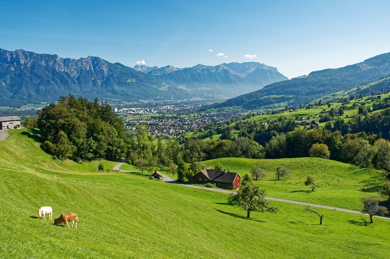
Southern Vorarlberg is a land of valleys that all end at a rock wall sooner or later. Beyond Feldkirch the Walgau opens out into orchard meadows and industrial villages, then the Rätikon and the Verwall close in, and every side valley has its own character: the Brandnertal with the turquoise Lünersee below the Schesaplana, the Montafon with baroque churches, mining galleries and Maisäß settlements, the Großes Walsertal with steep hay meadows that are still raked by hand. In the morning you see the Zimba in the first light from the sliding door, in the evening you hear cowbells and the rushing of the Ill. Add to that the Illwerke reservoirs, which lie like fjords between three-thousanders, and the Arlberg as the weather divide between the Rhine and the Inn. The Silvretta-Hochalpenstraße is expected to remain closed on the Vorarlberg side for several more years – so you drive round the outside, over the Arlberg into the Paznaun, and still stand on the Bielerhöhe when Piz Buin glows in the evening light above the Silvrettasee.
Stage-by-stage plan
1Stage 1: Feldkirch to Nenzing (Walgau) (approx. 20 km)
- The drive
- From Feldkirch’s old town through the Felsenau narrows on the Ill to Frastanz and along the regional road through the Walgau to Nenzing. A wide, flat valley road with village through-roads and roundabouts; the A14, which requires a vignette, runs parallel. Pure driving time is barely half an hour – the day belongs to Feldkirch.
- Highlights & must-sees
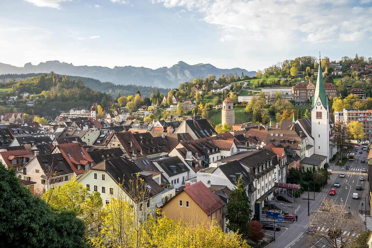
- Schattenburg above the old town: one of the best-preserved castles in Vorarlberg, with a museum and a view over the rooftops to the mountains of Liechtenstein.
- Feldkirch old town with the arcades of the Marktgasse, the Katzenturm and the late Gothic cathedral of St. Nikolaus.
- Nenzing as the gateway to the Gamperdonatal (Nenzinger Himmel): the narrow private toll road is not suitable for motorhomes; for walkers there is a shuttle service from Nenzing in summer – check times in advance.
- CampingSpirit overnight tip
-
Official campsite or RV park: Alpencamping Nenzing on the slope above the village: a large site open all year with terraced pitches, electricity, very good sanitary facilities and service point, plus a wellness area. If you arrive in Feldkirch the evening before: Waldcamping Feldkirch in the Gisingen district, a municipal site with electricity and sanitary facilities, well connected to the old town by bus or bike; check the season in advance.
Free camping or nature tip (where legal): Under Vorarlberg’s Campsite Act there is no state-wide ban on camping, but municipalities can determine by ordinance where tents, caravans and similar mobile accommodation may and may not be set up, and mayors can prohibit it by official notice. In the densely populated Walgau you will find no tolerated spots in nature – use the sites. A simple alternative is the small municipal motorhome area in Düns on the sunny terrace above the Walgau (few pitches, electricity and service point according to the municipality).
- Insider tip for campers
- Feldkirch’s old town is traffic-calmed, and the multi-storey car parks have height restrictions. Leave the camper at the site and take the bus or bike. Filling up in Austria: under the fuel price regulation, fuel prices may only rise once a day at 12 noon, while reductions are possible at any time – so it is rarely more expensive in the morning than in the afternoon.
2Stage 2: Nenzing to Brand (Brandnertal) with Lünersee (approx. 35 km)
- The drive
- Through the eastern Walgau via Nüziders to Bludenz, then at Bürs into the Brandnertal: the regional road climbs in a few hairpins via Bürserberg to Brand (a good 1,000 m) and continues to the valley station of the Lünerseebahn. Well built, narrower and steeper in the upper section, with a lot of day-trip traffic in summer. Just under an hour’s driving.
- Highlights & must-sees
- Bludenz old town with arcades, the Oberes Tor and the Laurentiuskirche on the hill; the Muttersbergbahn takes you up the local mountain with a view into the Klostertal.
- Lünerseebahn up to the Lünersee at almost 2,000 m, a reservoir below the Schesaplana – the circular path around the lake takes just under two hours.
- Bürser Schlucht at the valley entrance: a short gorge path with rock formations, good as an evening walk.
- CampingSpirit overnight tip
-
Official campsite or RV park: AlpinSpot Brand is a motorhome area in the village with a service point; check electricity, season and lengths with the operator in advance. There are small farm sites in Bürserberg, such as Heidi’s Camping am Burtschahof. For more comfort, stay at the valley entrance at Camping Sonnenberg in Nüziders (electricity, sanitary facilities, quiet hillside location).
Free camping or nature tip (where legal): Overnight stays are not intended in the car park at the Lünerseebahn or at the walkers’ car parks in the Brandnertal; the municipalities direct campers to motorhome areas and campsites. The Lünersee lies in high-alpine terrain – tents and camping are off limits there.
- Insider tip for campers
- Drive to the Lünerseebahn early: parking at the valley station is limited, and the cable car only runs in the summer season. In summer, scheduled buses run through the Brandnertal to the valley station – check the timetable in advance; with a large vehicle it is the more relaxed choice. Buy groceries in Bludenz before the climb, as the choice in the valley is small.
3Stage 3: Brand to Schruns/Tschagguns (Montafon) (approx. 50 km)
- The drive
- Back to Bludenz and along the Silvrettastraße into the Montafon via Lorüns, Vandans and St. Anton im Montafon to Schruns. A wide valley road along the Ill; the detours to Bartholomäberg (a mountain road with gradients and narrow village through-roads) and into the Silbertal (a narrower valley road to the village) are manageable for medium-sized motorhomes, with long vehicles only when traffic is light. With detours, about an hour and a half.
- Highlights & must-sees
- Parish church of Bartholomäberg on the sunny terrace above Schruns: a baroque church with a view of the Zimba and the Rätikon, surrounded by traces of medieval mining.
- Kristberg above the Silbertal, reached by the Kristbergbahn: the miners’ chapel of St. Agatha is considered the oldest church in the Montafon, and in the village of Silbertal a museum tells the story of mining.
- Schruns with the Montafoner Heimatmuseum and the Hotel Taube, where Ernest Hemingway spent two winters in the mid-1920s.
- CampingSpirit overnight tip
-
Official campsite or RV park: Aktivcamping Montafon between Schruns and Tschagguns, within walking distance of the centre; ask about facilities and season in advance. A little further up the valley is Waldcamping Batmund near St. Gallenkirch with electricity, sanitary facilities and service point – handy if you are heading for Gargellen and Partenen the next day.
Free camping or nature tip (where legal): In the Montafon several municipalities have restricted camping outside sites, and the Maisäß and alpine pasture tracks are mostly closed to traffic. Cable car and walkers’ car parks are for parking, not for overnight stays. Plan on proper sites – the choice in the valley is good.
- Insider tip for campers
- The road to Bartholomäberg branches off in Schruns and is busy on summer weekends – drive on a weekday and don’t park at the church square at the top for long. If you collect baroque churches: the pilgrimage church in Tschagguns is only a bridge away from Schruns.
4Stage 4: Schruns to Gargellen, Partenen and back to St. Gallenkirch (approx. 60 km)
- The drive
- Up the valley to St. Gallenkirch, then into the Gargellental: over around 9 kilometres the valley road climbs, with a few narrow sections and avalanche galleries, to Gargellen at a good 1,400 m. Back into the main valley and via Gaschurn to Partenen (a good 1,000 m), the end of the drivable valley: the Vorarlberg ramp of the Silvretta-Hochalpenstraße with its hairpins is closed after mudslides and is expected to stay closed for several years because of the construction work – check the current situation before your trip. About an hour and a half of driving.
- Highlights & must-sees
- Gargellen: a Walser village at the head of the valley below the Madrisa, starting point for walks to the alpine pastures on the Swiss border.
- Vermuntbahn from Partenen followed by the tunnel bus through an Illwerke gallery to the Bielerhöhe: the replacement for the closed road, daily in the summer season with a lunch break; bicycles only uphill and only with an online reservation.
- Vermuntsee and Silvrettasee from above: if you go up by cable car you can walk round the Silvrettasee and return by tunnel bus; you can reach the Vermuntsee below by road only from the Tyrolean side.
- CampingSpirit overnight tip
-
Official campsite or RV park: Waldcamping Batmund near St. Gallenkirch or NOVA Camping in the Gortipohl district, both with electricity, sanitary facilities and service point. There are no campsites in Gargellen or Partenen themselves; check the sites’ season dates in advance.
Free camping or nature tip (where legal): In the inner Montafon, overnight stays are not intended in the cable car car parks or at the Vermuntbahn. The car park at the Vermuntbahn valley station may be closed because of the construction work; you then park during the day at the Tafamuntbahn car park opposite – check the current situation on the Silvretta-Bielerhöhe website.
- Insider tip for campers
- The last descent by tunnel bus is in the late afternoon, and operations pause at midday – note the return time before you set off walking. You can also skip the day with the cable car and drive your own vehicle to the Bielerhöhe from the Tyrolean side two days later. Fuel is cheaper in Schruns and St. Gallenkirch than in Gaschurn.
5Stage 5: St. Gallenkirch to Pettneu am Arlberg (via the Arlberg Pass, Zürs and Lech) (approx. 105 km)
- The drive
- Down the valley to Bludenz and through the Klostertal via Braz, Dalaas and Klösterle to Stuben, then up in hairpins to the Arlberg Pass (around 1,790 m) and down via St. Christoph to St. Anton and Pettneu. A short detour from Stuben over the Flexen Pass (around 1,770 m) with its galleries to Zürs and Lech, and back the same way. Gradients of up to around 13 % at the pass, otherwise well built. About two and a half hours of pure driving time.
- Highlights & must-sees
- Klostertal with the viaducts of the Arlbergbahn, which crosses the ravines high above the road, and the village of Stuben, where skiing history was written.
- Arlberg Pass and St. Christoph with the hospice on the watershed between the Rhine and the Danube.
- Lech only briefly: the parish church of St. Nikolaus and the banks of the Lech; more on Lech, the Hochtannberg and the Bregenzerwald can be found in the CampingSpirit guide “Lakeshores, cheese cellars and Walser mountains” covering Lake Constance, the Bregenzerwald and the Allgäu.
- CampingSpirit overnight tip
-
Official campsite or RV park: Arlberglife Camping (Arlberg-Panoramacamping) and Campingplatz Arlberg (EuroParcs) near Pettneu in the Stanzertal, both with electricity and sanitary facilities, a good base for the detour into the Paznaun. If you want to stay in the Klostertal: Alpencamping Klösterle, Arlberg Camping near Wald am Arlberg, Camping Erne in Dalaas or the site at the Hotel Traube in Braz.
Free camping or nature tip (where legal): On the Arlberg Pass, in Zürs and in Lech, overnight stays outside sites are effectively ruled out: car parks charge fees or are closed to motorhomes, and Lech manages traffic strictly. From the Arlberg Pass onwards Tyrolean law applies, and there camping outside campsites is prohibited in principle.
- Insider tip for campers
- Vehicles with trailers are better off taking the Arlberg Tunnel (special toll) instead of the pass; check in advance whether trailer bans apply on the pass and follow the signs. Drive downhill in second or third gear. In winter and in the shoulder seasons the pass can be closed at short notice because of snow, and snow chains are then often compulsory.
6Stage 6: Pettneu to Ischgl, Galtür, Bielerhöhe and back to Pettneu (approx. 135 km)
- The drive
- Down the valley to Pians, under the Trisanna Bridge into the Paznaun and along the wide valley road via See and Kappl to Ischgl and Galtür (almost 1,600 m). From Galtür the Silvretta-Hochalpenstraße climbs moderately on the Tyrolean side with a few hairpins to the Bielerhöhe (around 2,030 m); it is currently drivable down as far as the Vermuntsee. Back the same way. Around three hours of pure driving time.
- Highlights & must-sees
- Trisanna Bridge of the Arlbergbahn with Schloss Wiesberg at the entrance to the Paznaun – a photo stop on the valley road.
- Alpinarium Galtür: museum and documentation centre in the avalanche protection wall built after the avalanche disaster of 1999.
- Bielerhöhe and Silvrettasee: circular path around the reservoir (a good two hours) with views of Piz Buin and the Silvretta Glacier.
- CampingSpirit overnight tip
-
Official campsite or RV park: Second night in Pettneu – so the day goes by without repacking. As an alternative, above Galtür on the Zeinisjoch there is a small campsite at Haus Zeinissee; check access, pitch size and season with the operator beforehand. Ischgl is quiet in summer but has no campsite.
Free camping or nature tip (where legal): In the Paznaun Tyrolean camping law applies: camping outside campsites is prohibited in principle, and on the Bielerhöhe you are in high-alpine terrain on the state border – overnight stays in the car parks are not intended there. During the day, park in the designated parking areas.
- Insider tip for campers
- While construction work is under way on the Vorarlberg side, the Tyrolean approach is toll-free – check the current situation. Normally the high alpine road is a toll road with a winter closure from about the end of October to the beginning of June; trailers have so far not been permitted there – check opening and rules on the Silvretta-Bielerhöhe website before you go. Fuel is cheaper in Pians and Landeck than in Ischgl.
7Stage 7: Pettneu to Großes Walsertal (near Blons) (approx. 70 km)
- The drive
- Via St. Anton onto the Arlberg Schnellstraße and through the Arlberg Tunnel, around 14 kilometres long (special toll), to Langen, then on the expressway or the Klostertal regional road to Bludenz. At Thüringen into the Großes Walsertal: the Walserstraße winds along the slopes above the Lutz with gradients, tight bends and short galleries, and buses and tractors often come the other way. A good hour and a half.
- Highlights & must-sees
- Propstei St. Gerold: a Benedictine provostry on a spur above the valley with church, garden and a view over the mountain hay meadows.
- Biosphere park house in Sonntag: information on the UNESCO Biosphere Park Großes Walsertal, plus mountain cheese from the valley dairy.
- Seilbahn Sonntag-Stein up to the sunny side, starting point for easy walks across flower-rich mountain hay meadows.
- CampingSpirit overnight tip
-
Official campsite or RV park: Camping Großwalsertal on the valley floor between Blons and Sonntag, a small site with electricity and sanitary facilities on the Lutz, in a quiet location in the middle of the biosphere park. Agree opening times and vehicle length in advance – the access is narrow for very large motorhomes.
Free camping or nature tip (where legal): The Großes Walsertal has been a UNESCO biosphere park since 2000, with core zones and nature reserves such as the Gadental; overnight stays outside the campsite are not intended there. Driving bans apply on alpine tracks, and walkers’ car parks are not places to sleep.
- Insider tip for campers
- Vehicles up to 3.5 t pay the Arlberg Tunnel toll at the toll station, in advance in the ASFINAG toll shop or as a digital section toll; above 3.5 t it is charged via the GO-Box. In the Walsertal itself there are only a few filling stations – fill up in Bludenz. If you want to continue towards Damüls and the Bregenzerwald, take the Faschinajoch.
8Stage 8: Großes Walsertal to Feldkirch (approx. 55 km)
- The drive
- Out of the valley with a detour via Raggal and Marul, or up the valley to Buchboden, then down to Ludesch and through the Walgau back to Feldkirch, optionally via the sunny terrace on the Jagdberg with Düns and Schnifis. The side roads are narrow and steep, the valley road in the Walgau wide. About an hour and a half.
- Highlights & must-sees
- Old parish church of St. Martin in Ludesch with Gothic wall paintings and a winged altarpiece.
- View over the Walgau from the Jagdberg near Schnifis and Düns – in the late afternoon with the Schattenburg against the light.
- To finish, Feldkirch once more: an evening stroll through the arcades and up to the Schattenburg.
- CampingSpirit overnight tip
-
Official campsite or RV park: Waldcamping Feldkirch in Gisingen for the last night, or the municipal motorhome area in Düns above the Walgau with a few pitches and a view over the valley. If you are continuing to Switzerland or Liechtenstein, you are at the border within a few minutes of Feldkirch.
Free camping or nature tip (where legal): In the Walgau, too, the Vorarlberg Campsite Act with municipal ordinances applies; on lakeshores and in protected areas, prohibitions under nature conservation law apply in addition. Stay on sites.
- Insider tip for campers
- Before moving on, empty grey water and the cassette at the campsite and fill up with water. If you drive through Liechtenstein into Switzerland, you need the Swiss vignette for motorways there; the main road via Schaanwald and Buchs is vignette-free.
Camping practice & local rules
Wild camping & overnight parking
- Vorarlberg: the Campsite Act has no state-wide ban, but municipalities can determine by ordinance where tents, caravans and similar mobile accommodation may or may not be set up, and mayors can prohibit it by official notice – if in doubt, ask the municipality; at lakes and in protected areas, prohibitions under nature conservation law apply in addition. Violations are administrative offences.
- Tyrol (Paznaun, Stanzertal): camping outside campsites is prohibited in principle. In protected areas, heavy additional fines under nature conservation law may apply.
- Parking is not camping: a short rest stop in a permitted car park is usually tolerated, but chairs, table, awning or levelling ramps turn it into camping. In forests, staying after dark and pitching tents are only permitted with the owner’s consent under the Forestry Act. Many cable car, pass and walkers’ car parks have no-camper signs.
- Protected areas on the route: UNESCO Biosphere Park Großes Walsertal with core zones, high-alpine areas at the Lünersee and the Bielerhöhe. Useful apps: Campercontact, park4night, plus the websites of Vorarlberg Tourismus, Montafon, Brandnertal and Paznaun.
Waste disposal & supplies
- Service points are mainly offered by campsites and some motorhome areas such as in Brand and Düns; public stations are rare. Many sites let passing travellers use their service point for a fee – ask first.
- Tap water is drinkable almost everywhere in Vorarlberg and Tyrol; at alpine pasture fountains look out for signs. Empty grey water and cassettes only at stations, never into streams or drains.
- Gas: German exchange cylinders are not exchanged in Austria. Refillable cylinders and gas tanks can be filled at LPG filling stations, but the network in the valleys is thin – arrive with two full cylinders. At 2,000 m and on cold nights the heating uses more gas, even in summer.
- Electricity on the sites via CEE plugs; on terraced sites such as in Nenzing or in the Montafon a 25 m cable is useful.
Vehicle size & traffic rules
- A vignette is required for vehicles up to 3.5 t on motorways and expressways, here the A14 in the Walgau and the S16 Arlberg Schnellstraße. 2026 is the last year in which the vignette is also available as a sticker; from 2027 it will only be digital; the 1-day vignette is only available digitally. If you buy online as a consumer in the ASFINAG web shop or app, you must allow for the 18-day withdrawal period; bought at a sales outlet it is valid immediately. Regional roads through the Walgau, Montafon, Klostertal and Paznaun are toll-free.
- Special toll: the Arlberg Tunnel costs a separate toll in addition to the vignette, payable at the toll station or as a digital section toll. Vehicles over 3.5 t pay the distance-based GO toll on motorways and expressways via the GO-Box, which is also used to charge the Arlberg Tunnel toll. The Silvretta-Hochalpenstraße is a private toll road owned by Illwerke; while the Vorarlberg side is closed, the Tyrolean approach is toll-free during the construction work.
- Speed limits: motorhomes up to 3.5 t 50 km/h in built-up areas, 100 on open roads and 130 km/h on motorways; over 3.5 t 70 on open roads and 80 km/h on motorways. Lower limits apply to vehicles with trailers depending on weight.
- Dimensions: height 4.0 m, width 2.55 m, length 12 m for motorhomes, 18.75 m for vehicle-and-trailer combinations. Trailers have so far not been permitted on the Silvretta-Hochalpenstraße; vehicles with trailers are better off taking the Arlberg Tunnel instead of the Arlberg Pass. The Gargellental, Silbertal, Bartholomäberg and Großes Walsertal have narrow sections; look out for signs on length and weight.
- Winter equipment is compulsory from 1 November to 15 April in wintry conditions, and the obligation to carry snow chains applies to vehicles over 3.5 t depending on registration. On the Arlberg snow is possible as early as October, and where snow-chain signs are posted, chains must be fitted.
- Projecting loads, for example on a rear rack: up to 1 m a red cloth, beyond that a white 25 × 40 cm board with a red reflective border. Alcohol limit 0.5 per mille, mobile phone only with a hands-free kit, high-visibility vests within reach for all occupants.
CampingSpirit packing & preparation checklist
- Fleece, rain jacket and hat in your daypack – at the Lünersee and the Bielerhöhe at around 2,000 m it gets cold quickly even in summer, and cable cars and the tunnel bus only run at set times.
- Digital vignette bought in good time (note the withdrawal period for online purchases), a ticket or digital section toll for the Arlberg Tunnel – or, over 3.5 t, a GO-Box.
- Levelling ramps, steps 2–3 – many pitches in Nenzing, in the Montafon and in the Walsertal are on slopes.
- Snow chains to fit your tyres if you cross the Arlberg in early summer or autumn.
- Binoculars for marmots and chamois at the Bielerhöhe and the mountain hay meadows in the Walsertal.
- White 25 × 40 cm warning board with a red border for the rear rack if bikes project more than 1 m.
As of 2026-10. Closures, fees and booking rules change: check official sources before you go.