
In-depth guide · CampingSpirit
From Mount Maunganui along the coast via Maketū and Whakatāne to Ōpōtiki, then inland on SH38 over gravel through Te Urewera to Lake Waikaremoana and down to Wairoa: around 520 kilometres of driving on the left between surf and rainforest.
The spirit of the route
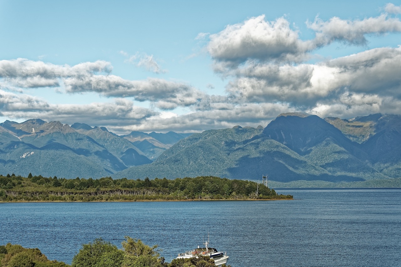
East of Tauranga the Bay of Plenty grows quieter. The dunes of Pāpāmoa run for kilometres, anglers stand in the evening light at the Kaituna river mouth near Maketū, and out at sea off Whakatāne lies Whakaari, whose plume of steam you can see from the sliding door on clear days. This is where the ancestors’ canoes landed, and where the ancestral house Mataatua stands once more on the spot where it was built, after more than a hundred years at exhibitions and in museums on three continents. Then the road turns into Tūhoe country: pine plantations, a logging town, and suddenly gravel, mist in the hollows, giant ferns and rimu growing out over the road. Hours without oncoming traffic. At the end Waikaremoana opens up, the “sea of rippling waters”, deep and cold beneath the Panekire bluffs. A route that asks for time, respect and a full tank.
Stage-by-stage plan
1Stage 1: Mount Maunganui to Pāpāmoa (approx. 20 km)
- The drive
- Tauranga and Mount Maunganui only as a short prelude: from the harbourside quarter on the peninsula to the foot of Mauao, then on Maunganui Road and Pāpāmoa Beach Road parallel to the coast to the south-east. The drive is flat, urban and slow-going in summer; roundabouts follow in quick succession and, with traffic on the left, are driven clockwise. Pure driving time barely half an hour.
- Highlights & must-sees
- Mauao: the Base Track circles the extinct volcanic cone in around 45 minutes on a level path right above the surf; if you want the summit, you climb steeply on steps and paths and get the view over the harbour, Matakana Island and the long coast to the east from the top.
- Pāpāmoa Hills Cultural Heritage Regional Park: a track leads up to terraced hills of former pā with a wide view across the plain to Motiti Island – the car park is on Poplar Lane, inland of the town.
- Pāpāmoa Beach in the evening: a broad, flat sandy beach with no buildings at the water’s edge, ideal for a long walk before the first night.
- CampingSpirit overnight tip
-
Official campsite or RV park: Papamoa Beach Top 10 Holiday Resort right behind the dunes: powered sites, kitchens, bathrooms, dump station for guests, beach access with no road in between. If you would rather stay by Mauao: Mount Maunganui Beachside Holiday Park at the foot of the mountain, central and booked out early in peak season. Book both in advance for the summer holidays.
Free camping or nature tip (where legal): Tauranga City Council only allows freedom camping on signposted areas in individual reserves and only for certified self-contained vehicles, for no more than two nights at the same place in a calendar month; the car parks at Mauao, on Marine Parade and at the beach accesses are not overnight spots. Designated areas, maximum stays and prohibited zones change – check the council map or CamperMate on the spot. Without a green warrant the only option is the holiday park.
- Insider tip for campers
- Around Mount Maunganui parking with large vehicles is a struggle on summer weekends; come early in the morning while there are still spaces at Mauao. Do a big shop and swap gas bottles in Tauranga or Bayfair – the choice gets noticeably smaller further east.
2Stage 2: Pāpāmoa to Whakatāne via Maketū and Matatā (approx. 95 km)
- The drive
- From Pāpāmoa either on the tolled Tauranga Eastern Link (SH2) towards Paengaroa or toll-free on the old main road through Te Puke. At Paengaroa head north to the Kaituna river mouth at Maketū, back to SH2 and east through kiwifruit orchards and pasture. From Pikowai the road runs right along the coast beneath steep slopes, then past the lagoons at Matatā into the wide Rangitāiki Plains and on to Whakatāne. A good 1.5 hours of pure driving time.
- Highlights & must-sees
- Maketū: according to tradition the Te Arawa canoe landed here; a memorial on the shore recalls it. Add to that the broad estuary of the Kaituna river mouth with wading birds and the beach at Newdicks Beach east of the town.
- Matatā lagoons: wetland between road and beach with reeds, pūkeko and stilts; short shoreline paths from the car park in the town.
- The coastal drive between Pikowai and Matatā: pōhutukawa on the slopes, the surf on your left, and on clear days the plume of steam over Whakaari far out at sea.
- CampingSpirit overnight tip
-
Official campsite or RV park: Riverside Whakatāne Holiday Park by the river, a few minutes’ walk from the centre: powered sites, kitchen, bathrooms. Along the way are Pikowai Campground right on the beach (basic) and Thornton Beach Holiday Park at the mouth of the Rangitāiki – both good alternatives if the day on the coast runs longer.
Free camping or nature tip (where legal): From Matatā the Whakatāne District Council Freedom Camping Bylaw 2024 applies. Only a few designated areas are open, including the McAlister Street Carpark in central Whakatāne – exclusively for vehicles with a valid self-containment certificate, for no more than three consecutive nights at the same place within four weeks. Prohibited areas include the Awatarariki fan at Matatā and all reserves under the Reserves Act. Further west (Maketū) the rules of Western Bay of Plenty District Council apply.
- Insider tip for campers
- In Maketū a pie from the local bakery is part of the deal. There is no toll booth on the Tauranga Eastern Link: your number plate is recorded and you pay online within five days of the trip – with a rental vehicle, find out beforehand how the rental company charges for it.
3Stage 3: Whakatāne to Ōhope via the Kōhī Point Walkway (approx. 10 km)
- The drive
- A day on foot: the camper stays in Whakatāne or is moved to Ōhope in the morning. The road from Whakatāne to Ōhope runs short and steep over the ridge down to the beach; no problem for motorhomes, use a low gear on the way down.
- Highlights & must-sees
- Mataatua wharenui (Te Mānuka Tūtahi Marae, Muriwai Drive): the richly carved meeting house of Ngāti Awa was built here in the 1870s, taken to Sydney for an exhibition in 1879, then spent decades in London (at times in storage at the Victoria and Albert Museum), stood for around 70 years in the Otago Museum in Dunedin and was returned to Ngāti Awa in 1996. Today the marae focuses mainly on its own events; ask Te Rūnanga o Ngāti Awa in advance whether tours are offered, and follow the marae protocols.
- Kōhī Point Walkway (part of Ngā Tapuwae o Toi): around 5.5 km from Whakatāne over the cliffs to Ōhope West End, past the old pā Kapū-te-rangi and through pōhutukawa forest; from the Kōhī Point lookout there is a view of Whakaari. The descent to Ōtarawairere Bay cannot be passed from the west at high tide – check the tides.
- Whakaari/White Island as a view only: the active volcanic island lies around 50 km off the coast; there have been no landings since the 2019 eruption. It is best seen from Kōhī Point, from the Wairaka statue at the river mouth or from the beach at Ōhope.
- CampingSpirit overnight tip
-
Official campsite or RV park: Ōhope Beach Top 10 Holiday Park at the eastern end of the beach: powered sites, kitchens, bathrooms, pools, direct beach access; in high demand well in advance for the summer holidays. If you stay in Whakatāne, spend a second night at Riverside Whakatāne Holiday Park and take the bus back.
Free camping or nature tip (where legal): In Ōhope the bylaw designates two areas for self-contained vehicles: West End Road (car park and reserve) and Maraetōtara Reserve – each only with a green warrant, for no more than three consecutive nights in four weeks. Prohibited are Muriwai Drive (by the Mataatua marae), the Kōhī Point Scenic Reserve as well as Ocean Road and several foreshore reserves. There are night-time checks; the fine is NZ$400.
- Insider tip for campers
- Walk the walkway in one direction and return on the Bay Hopper bus; the stop in Ōhope is by the shop at the beach (timetable at the Whakatāne visitor centre). Take water and sun protection, as some sections are exposed above the coast.
4Stage 4: Ōhope to Ōpōtiki via Ōhiwa Harbour (approx. 45 km)
- The drive
- From Ōhope east along the beach to Port Ōhope at the harbour entrance, back and on side roads along the southern shore of Ōhiwa Harbour with its mangroves and oyster beds to SH2; then east along the coast via Waiotahe to Ōpōtiki. Sealed, quiet, around 1 hour of pure driving time.
- Highlights & must-sees
- Ōhiwa Harbour: a shallow tidal harbour with seagrass beds, wading birds and the pā hill in Onekawa Te Mawhai Regional Park on the western side – a short climb with a view over harbour and islands.
- Ōhiwa oysters straight from the grower: by the harbour an oyster farm sells fresh produce from the water on its doorstep – opening hours vary with the season.
- Hukutaia Domain near Ōpōtiki: a small forest reserve with the ancient pūriri Taketakerau, to which the bones of the dead were once entrusted; a loop track leads through dense coastal forest.
- CampingSpirit overnight tip
-
Official campsite or RV park: Ōpōtiki Holiday Park on the edge of town: powered sites, bathrooms, kitchen, a short walk into town. Quieter and on the water: Ohiwa Family Holiday Park on the eastern shore of Ōhiwa Harbour, with powered sites and a beach – book in advance.
Free camping or nature tip (where legal): At Ōhiwa Harbour, Ōhiwa Harbour Wharf Carpark, Uretara East and West and Goodwins Landing are prohibited zones; the Eastern End of Harbour Road and the Port Ōhope Reserve, by contrast, are designated for self-contained vehicles. The Ōpōtiki District begins on the eastern shore: its bylaw only allows freedom camping in the marked areas of four reserves (on this route Te Ahiaua Reserve/Pipi Beds near Waiotahe), mostly for no more than three nights in four weeks, without booking; Ōhiwa Spit, the Ōhiwa boat ramp and Bryan’s Beach are prohibited.
- Insider tip for campers
- Ōpōtiki is the starting point for the East Cape via SH35 – that coast is covered in the CampingSpirit travel guide to the East Cape and through Hawke’s Bay. Here, instead, the route heads back west. Shop once more in Ōpōtiki before heading inland; the Motu Trails start in town, and the Dunes Trail offers a flat cycle path along the coast.
5Stage 5: Ōpōtiki to Murupara via Tāneatua (approx. 140 km)
- The drive
- On SH2 back west and through the Waimana valley to Tāneatua, the gateway to Tūhoe country. On via Awakeri and Te Teko into the Rangitāiki Plains and on the country road via Galatea south along the river to Murupara on the edge of the Kaingaroa plantations. Sealed, lots of logging trucks, around 2 hours of pure driving time.
- Highlights & must-sees
- Tāneatua: a small town on the Whakatāne River; Tūhoe country begins here, and the road to Ruatoki leads into the valley towards Te Urewera. View marae only from the road.
- Awakeri Hot Springs: thermal pools with a campground on SH30, good for a break or as an alternative to driving on.
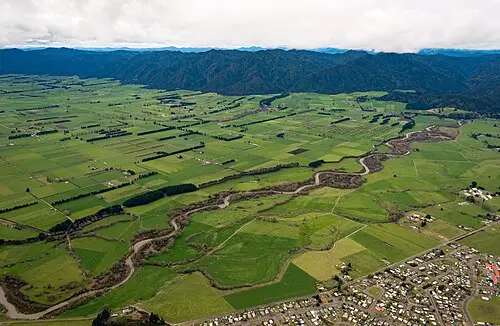
- Rangitāiki Plains near Galatea: open pastureland in front of the dark chain of the Ikawhenua Range – the last wide plain before the mountain forest.
- CampingSpirit overnight tip
-
Official campsite or RV park: Murupara itself offers hardly any camping; better to stay the night beforehand at Awakeri Hot Springs (powered sites, thermal pools) or to drive on into Whirinaki Te Pua-a-Tāne Conservation Park near Minginui. There you will find basic campsites, such as Mangamate Campsite, run by Te Rūnanga o Ngāti Whare (the gate on the access road is locked at night, so plan arrival and departure around it), and the DOC Sanctuary campsite; water only from the stream (boil it). Check access, opening times and booking with DOC or Ngāti Whare.
Free camping or nature tip (where legal): Between Whakatāne and Murupara there is no designated council freedom camping area along the route; forestry roads in the plantations are private land and mostly closed. Do not stay overnight on marae land or farm driveways.
- Insider tip for campers
- Fill up in Whakatāne, Te Teko or at the latest in Murupara and buy food for three days; after that there is no reliable supply until Lake Waikaremoana. Before setting off, check the condition of SH38 on NZTA Journeys and the weather on MetService.
6Stage 6: Murupara to Lake Waikaremoana (Āniwaniwa) via Ruatāhuna (approx. 120 km)
- The drive
- Beyond Murupara SH38 climbs to Te Whaiti and soon turns into a gravel road (formally this section is not a state highway but a road maintained by NZTA, though it is generally called SH38): for a long stretch, around 70 to 75 km, between Te Whaiti, Ruatāhuna and the lake there is no seal – narrow, winding, steep, with potholes, corrugations, dust in summer and mud after rain. Little traffic, but logging trucks and locals who know the road. Allow 3 to 4 hours for the good 100 km on SH38, more with the detour to Minginui.
- Highlights & must-sees
- Whirinaki Te Pua-a-Tāne Conservation Park (turn-off at Te Whaiti to Minginui): one of the densest podocarp forests in the country, with rimu, mataī, kahikatea and tōtara; the track from the car park on River Road leads through the Te Whaiti-nui-a-Toi canyon to the Whirinaki waterfall.
- Ruatāhuna: a remote valley in the heart of Tūhoe country, marae and pasture between forested slopes – not a tourist place; visitors drive through respectfully.
- Mōkau Falls right on SH38 around 10 km before Āniwaniwa: the stream plunges over a rock ledge below the road – a short stop at the car park beyond the bridge over Mōkau Stream.
- CampingSpirit overnight tip
-
Official campsite or RV park: Waikaremoana Holiday Park in Home Bay near Āniwaniwa: 32 powered sites, kitchen and dining room, bathrooms, washing machines, dump stations, small shop and petrol/diesel; book online through the DOC booking system. Power hook-up only with a valid electrical WOF for the vehicle. Simpler and right on the shore: Mokau Landing Campsite around 10 km north-west of Āniwaniwa, a large meadow between rainforest and lake, reached on a narrow gravel access road; you pay on arrival at the Te Urewera Visitor Centre (Te Kura Whare) next to the holiday park. The DOC Campsite Pass is not valid in Te Urewera.
Free camping or nature tip (where legal): Te Urewera is not council land and no longer a national park; the districts’ freedom camping bylaws do not apply here. You may only stay overnight on the designated campsites of Te Uru Taumatua – lay-bys, clearings and forest tracks along SH38 are not places to sleep.
- Insider tip for campers
- On gravel drive at no more than 60–70 km/h, considerably slower on crests and bends, keep to the middle of your lane and move left early for oncoming traffic. Keep your lights on so you can be seen in the dust. Check the spare tyre, jack and wheel brace beforehand. There is no mobile coverage on large parts of the route.
7Stage 7: Lake Waikaremoana to Lake Waikaremoana (walking day) (approx. 25 km)
- The drive
- Short drives along the eastern shore between Home Bay, Āniwaniwa and Onepoto, partly on gravel; the rest of the time on foot or by the water.
- Highlights & must-sees
- Te Urewera Visitor Centre (Te Kura Whare) next to the holiday park in Home Bay: information on Te Urewera, the tracks, road conditions and the rules, plus payment for the campsites – your first stop at the lake.
- Lake Waikareiti Track: from the road at Āniwaniwa uphill through beech forest to the still Lake Waikareiti with its islands, around 2 hours there and back. Shorter: the path to Papakorito Falls, where the Āniwaniwa stream drops around 20 m over a rock face.
- Lake Waikaremoana Great Walk only as a pointer: the multi-day trek from Onepoto over the Panekire bluffs to Hopuruahine requires hut or campsite bookings and a boat transfer or vehicle relocation; as a day trip, the first steep climb from Onepoto is worth it for the view over the lake.
- CampingSpirit overnight tip
-
Official campsite or RV park: Second night at Waikaremoana Holiday Park or at Mokau Landing. The lake was formed around 2,200 years ago by a huge landslide near Onepoto that blocked the valley; at night it is very dark and quiet here.
Free camping or nature tip (where legal): Still only designated campsites. Dogs are banned throughout Te Urewera, as are open fires and fireworks; jet skis and houseboats are not allowed on the lake. Take your rubbish back out – disposal on site is very limited.
- Insider tip for campers
- Trout fishing only with a Fish & Game licence, bought online in advance – it is not sold at the lake. Against sandflies on the shore, wear long sleeves and use repellent; the lake water is cold even in summer.
8Stage 8: Lake Waikaremoana to Wairoa (approx. 65 km)
- The drive
- From the lake on SH38 via Onepoto and past the hydro lakes at Tuai down into the Wairoa valley, via Frasertown to Wairoa on SH2. This section is largely sealed, but winding and, after the storms of recent years, has repair patches, roadworks traffic lights and at times closures lasting days for repairs – check the status beforehand; around 1.25 hours of pure driving time.
- Highlights & must-sees
- Onepoto: a look back at the Panekire bluffs and the landslide dam that holds back the lake.
- Lake Whakamarino near Tuai: a small reservoir of the Waikaremoana hydro scheme, a quiet shore for a break.
- Wairoa: a river town at the mouth, with the old Portland Island lighthouse on the riverbank – from here SH2 leads north towards Gisborne or south to Napier.
- CampingSpirit overnight tip
-
Official campsite or RV park: Riverside Motor Camp by the river in Wairoa: powered sites, bathrooms, dump station. If you are continuing to the coast, you will find the next sites on the Māhia Peninsula and in Hawke’s Bay – see the CampingSpirit travel guide to the East Cape and through Hawke’s Bay.
Free camping or nature tip (where legal): In the Wairoa District, self-contained vehicles may stay overnight on council land except in prohibited zones; dump stations include those at War Memorial Park and Riverside Motor Camp. Follow the signage and the council map.
- Insider tip for campers
- After the gravel, wash the camper and check the tyres and underbody before returning it. Fill up and top up water in Wairoa; towards Napier SH2 is hilly with few services.
Camping practice & local rules
Wild camping & overnight parking
- Self-Contained Motor Vehicles Legislation Act 2023: freedom camping in vehicles on council land is only allowed in a certified self-contained vehicle (green warrant, fixed toilet), unless a council expressly sets other rules. This has applied to rental vehicles since 7 December 2024 and to private vehicles since the end of the transition period on 7 June 2026. The fine is NZ$400.
- Whakatāne District (Freedom Camping Bylaw 2024): only designated areas for vehicles with a valid certificate – McAlister Street Carpark, West End Road (Ōhope), Maraetōtara Reserve, Eastern End of Harbour Road/Port Ōhope Reserve – for no more than three consecutive nights at the same place in four weeks. Prohibited areas include Muriwai Drive, Kōhī Point Scenic Reserve, Ōhiwa Harbour Wharf Carpark, the Awatarariki fan at Matatā and all reserves under the Reserves Act. Fine NZ$400.
- Other councils along the route: Tauranga City (signposted areas only, max. two nights at a place in a calendar month), Western Bay of Plenty, Ōpōtiki (four reserves only, mostly max. three nights in four weeks) and Wairoa each have their own rules with prohibited zones and maximum stays. The maps on the council websites and the signage on site are what counts.
- Te Urewera: under the Te Urewera Act 2014 the area is no longer a national park but a legal person in its own right, with its own rights and duties – one of the first natural areas in the world with this status. It is governed by the Te Urewera Board, and the tracks, huts and campsites are looked after by Te Uru Taumatua, the Tūhoe organisation. Their rules apply: overnight stays only at designated sites, no dogs, no open fires, take your rubbish out; hunting only with a permit, drone flights to be cleared in advance with Te Uru Taumatua. Several backcountry huts have been removed – check the current map.
- Marae and private land: marae grounds are only entered by invitation, in Whakatāne, Tāneatua and Ruatāhuna as elsewhere. Much of the land along the route is privately owned Māori land; access to beaches or rivers is not automatically public.
- Apps: CamperMate (with council data, dump stations, closure notices) and WikiCamps show holiday parks, campsites and freedom camping areas; bylaws change, so if in doubt open the council page.
Waste disposal & supplies
- Dump stations: at the holiday parks in Pāpāmoa, Whakatāne, Ōhope and Ōpōtiki for guests, at Waikaremoana Holiday Park and in Wairoa (War Memorial Park, Riverside Motor Camp). CamperMate shows public stations in Tauranga and Whakatāne; Ōpōtiki District Council runs a dump station on SH2 at Waiotahe (just north of the Settlers Hall, around 11 km before Ōpōtiki). No disposal between Ōpōtiki and the lake – enter Te Urewera with empty tanks.
- Drinking water: drinkable in the coastal towns and at holiday parks. At basic campsites in Whirinaki and Te Urewera water is untreated or absent – boil it or bring a supply for several days.
- Gas: the standard is 9 kg LPG bottles, which are swapped or refilled at service stations and hardware stores; only bottles with a valid test date are refilled. European bottles and connections do not fit. The widest choice is in Tauranga and Whakatāne.
- Fuel: no problem on the coast. Heading inland, fill up in Whakatāne or Te Teko; Murupara is the last town with basic services. Waikaremoana Holiday Park sells petrol and diesel but is not a regular service station – do not rely on it as a reserve. Diesel rental vehicles usually include the road user charges in the bill.
Vehicle size & traffic rules
- Driving on the left: roundabouts are driven clockwise and traffic from the right has priority. At one-lane bridges the large white arrow shows who has right of way; there are several on SH38 and around Ōhiwa Harbour.
- Speed limits: 100 km/h outside built-up areas, 50 km/h in towns, many winding sections at 80 or 60 km/h. Vehicles over 3.5 t and vehicles towing a trailer no more than 90 km/h. There is no separate limit on gravel, but 100 km/h is never appropriate there.
- Tolls: the Tauranga Eastern Link (SH2 Pāpāmoa–Paengaroa) and Takitimu Drive in Tauranga are tolled, with no toll booths. Your number plate is recorded and you pay online within five days; both can be avoided on toll-free alternative roads.
- SH38 and your rental agreement: some rental agreements exclude gravel roads wholly or partly from insurance cover or name specific roads explicitly. Before booking, check whether SH38 through Te Urewera is allowed; without approval the lake can only be reached from Wairoa on the largely sealed southern section of SH38 (there and back). Trucks may not tow heavy trailers on the gravel section; the road is not recommended with a caravan.
- Animals and road conditions: cattle, sheep and horses on the road, logging trucks on the bends, possums at night. Road status on NZTA Journeys, weather on MetService; after heavy rain, slips are possible on SH38.
- Alcohol and phones: for drivers aged 20 and over the limit is 0.05% blood alcohol, below that zero. Phones only in a fixed cradle, seatbelts compulsory in all seats. Emergency number 111 – often without signal on SH38. Foreign driving licences are valid for up to twelve months if they are in English or presented with an approved translation or an International Driving Permit.
CampingSpirit packing & preparation checklist
- Tyre pressure gauge and repair kit: corrugations and sharp gravel on SH38 take their toll on tyres, and help is hours away.
- An extra 20-litre water container: there is no reliable drinking water between Murupara and the lake.
- Binoculars: for Whakaari from Kōhī Point and for the wading birds at Ōhiwa Harbour and in Maketū.
- Insect repellent and long-sleeved clothing: sandflies on the shore of Lake Waikaremoana and in the river valleys of Whirinaki.
- Offline maps and a printed booking confirmation: there is hardly any mobile coverage on SH38 and at the lake.
- Tide table: for Ōtarawairere Bay on the Kōhī Point Walkway and for walks around Ōhiwa Harbour.
As of 2026-10. Closures, fees and booking rules change: check official sources before you go.