In-depth guide · CampingSpirit
From Cluj-Napoca through the Turda Gorge into the karst country of the Apuseni, to the Roman gold mines of Roșia Montană, the star fortress of Alba Iulia, and on via the Dacian fortresses and Hațeg Country to the foot of the Retezat: around 830 kilometres on valley roads, mountain passes and gravel tracks through western Transylvania.
The spirit of the route
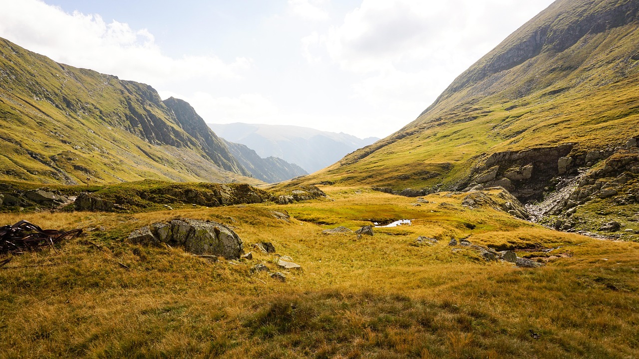
Western Transylvania is the Romania of stone. Beyond Turda the Arieș cuts its way through limestone and schist, wooden houses with steep shingle roofs cling to the slopes, and at the roadside Moți farmers sell blueberries and wooden tubs. Up on the Padiș Plateau the streams vanish into the ground, cowbells ring in clearings between spruce forest and sinkholes, and in the evening the air smells of woodsmoke from the stâne, the shepherds’ huts. From the sliding door you look out on limestone cliffs, haystacks and, at the end, the dark granite ridges of the Retezat. In between lie two thousand years of history in a small space: Habsburg salt mines, Roman gold galleries, the sacred terraces of the Dacians, a Gothic castle straight out of a picture book and a church built from Roman tombstones. This route demands slowness: potholes, horse carts, gravel tracks and bear country – and rewards you with evenings when nothing can be heard but the shepherds’ dogs.
Stage-by-stage plan
1Stage 1: Cluj-Napoca to Turda (Cheile Turzii) (approx. 45 km)
- The drive
- From Cluj-Napoca head south over the Feleac ridge on the DN1/E60, or faster on the A3 motorway, to Turda; both are well built, with heavy lorry traffic on the DN1. From Turda take minor roads west via Mihai Viteazu to the eastern end of the Turda Gorge; the last few kilometres are narrower and partly patched. A good hour’s driving without stops.
- Highlights & must-sees
- Cluj-Napoca in brief: the view from Cetățuia Hill over the old town, and the art museum in the Baroque Bánffy Palace on Piața Unirii – the CampingSpirit guide to Maramureș and Bukovina covers the city in more detail.
- Salina Turda: the former salt mine with the huge Rudolf Chamber, an underground lake, rowing boats and a Ferris wheel; inside it is around 10 to 12 °C all year round.
- Cheile Turzii: a limestone gorge around three kilometres long with walls up to 300 m high, a nature reserve with an entrance fee; the path along the Hășdate stream is partly secured with cables and slippery after rain.
- CampingSpirit overnight tip
-
Official campsite or RV park: Camping Cheile Turzii at the eastern end of the gorge next to the mountain hut, with pitches for motorhomes, toilets and showers, and electricity (information at turism-cheile-turzii.ro); full and noisy with day-trippers from Cluj at summer weekends. Quieter is the small Dutch-run site De Oude Walnoot on the southern edge of Turda, with only a few pitches. Check the season and facilities of both sites in advance.
Free camping or nature tip (where legal): The Turda Gorge is a nature reserve: overnighting in the visitor car park and camping outside the campsite area are not permitted. In Turda itself the car parks at the Salina are intended for day visitors; at night it is better to move to one of the campsites.
- Insider tip for campers
- For the Salina use the main entrance at the Salina-Durgău visitor centre; the second entrance on Strada Salinelor lies among narrow residential streets. Come early: from midday at weekends there are long queues. Use the large supermarkets and filling stations in Turda, as the choice thins out in the Arieș valley.
2Stage 2: Turda (Cheile Turzii) to Gârda de Sus (Arieș valley) (approx. 130 km)
- The drive
- Via Buru into the Arieș valley and up the river on the DN75 via Lunca, Baia de Arieș and Câmpeni to Albac and Gârda de Sus. The DN75 is surfaced but narrow and winding for long stretches, with patches, subsidence along the riverbank and long passages through villages; timber lorries like to take the middle of the road on bends. Beyond Câmpeni the valley narrows and the villages are scattered widely across the slopes. Around 3 hours’ pure driving time.
- Highlights & must-sees
- Detour to Rimetea (Torockó) beneath the rocky crown of Piatra Secuiului: a village of Hungarian character with whitewashed houses; the climb to the summit takes a good two hours.
- Câmpeni, the main town of the Moți Country, with monuments to Avram Iancu, leader of the Moți in the 1848 revolution; his birthplace in nearby Vidra is a memorial.
- The bends of the Arieș between Albac and Gârda, with scattered farmsteads, haystacks and wooden churches on the slopes – stop for photos only at wide pull-outs.
- CampingSpirit overnight tip
-
Official campsite or RV park: In Gârda de Sus several small meadow sites and guesthouses with camping areas are listed in OSM, including Camping la Danut on the edge of the village; a few kilometres further up the valley is Camping Arieșeni. Expect simple meadows with toilets and showers, electricity not everywhere, and waste disposal often only by arrangement. If you visit Rimetea, Camping Gyopár and Albamont there are an alternative. Ask about facilities and season in advance.
Free camping or nature tip (where legal): The upper Arieș valley lies within the Apuseni Nature Park; camping is only permitted at designated places. Riverside meadows are almost always private property, and many guesthouses take campers for a fee – asking is better than simply parking up. Lay-bys on the DN75 are unsuitable for overnighting because of timber traffic and rockfall.
- Insider tip for campers
- Fill up, get cash and do your shopping in Câmpeni: after that there are only village shops and few filling stations until the Vârtop Pass. At weekends and on public holidays herds of livestock are on the road in the Moți villages, including behind blind bends.
3Stage 3: Gârda de Sus to Padiș Plateau (via Scărișoara and Chiscău) (approx. 130 km)
- The drive
- From Gârda de Sus take the narrow, surfaced mountain road with steep sections up to the Scărișoara Ice Cave and back. Then follow the DN75 via Arieșeni to the Vârtop Pass (a good 1,150 m) and down in long hairpins into the Crișul Negru basin to Ștei, then via Nucet and Chiscău to Pietroasa. From Pietroasa the mountain road climbs steeply through the Boga valley onto the Padiș Plateau; depending on the section it is asphalt, patchwork or gravel, with tight hairpins and few passing places. With the cave visits, a full day.
- Highlights & must-sees
- Scărișoara Ice Cave (Ghețarul Scărișoara): stairs take you down an almost 50 m deep shaft to a block of ice that has grown over thousands of years; inside the cave it is around 0 °C.
- Bear Cave at Chiscău (Peștera Urșilor): discovered in 1975 during marble blasting, with halls of dripstone and skeletons of cave bears; visits by guided tour only, photography restricted.
- The Padiș Plateau in the evening: karst meadows, swallow holes and sinkholes, shepherds with their flocks and wide views over the Bihor and Vlădeasa mountains.
- CampingSpirit overnight tip
-
Official campsite or RV park: On the plateau a camping area is listed at the Padiș hut: a meadow, spring water, at best basic toilets, no electricity, no water supply or waste disposal. In Poiana Glăvoi, formerly the classic tent site, camping was banned by the environmental authority in 2019; ask the nature park administration on site or at the hut whether, and where, you may stay there again. Plan two nights so that a whole day remains for Cetățile Ponorului. If the climb is too rough for you, guesthouses in and around Pietroasa let campers stay on their grounds – phone ahead.
Free camping or nature tip (where legal): Padiș lies in the heart of the Apuseni Nature Park; camping and sleeping in the vehicle outside the designated zones are not permitted, and rangers patrol in season. Fires only at marked fireplaces. Bears live here: leave nothing edible outside at night and take your rubbish with you.
- Insider tip for campers
- The roads on the plateau and towards Ic Ponor, Arieșeni or Casa de Piatră are in places rough forest roads; construction work is under way on the Padiș–Ic Ponor section – check roadworks and possible closures in advance with the Bihor or Cluj county council. With a large motorhome or a caravan outfit, only drive up via Pietroasa in dry weather and come back the same way; after heavy rain, don’t go at all. Fill up with water and empty the cassette before the climb.
4Stage 4: Padiș Plateau to Roșia Montană (approx. 165 km)
- The drive
- In the morning walk to Cetățile Ponorului, then take the same mountain road down to Pietroasa and via Ștei back to the DN75, over the Vârtop Pass to Arieșeni and through the Arieș valley to Câmpeni. From there via Abrud and, for the last few kilometres, up a narrow village road to Roșia Montană. Around 4 hours’ driving – a long day; if you do the hike, start early or spend a second night on the plateau.
- Highlights & must-sees
- Cetățile Ponorului: three huge collapse sinkholes and a cave portal over 70 m high through which the Ponor stream disappears; from Poiana Glăvoi around 1.5 hours each way, with stairs and ladders at the viewpoints – not in the wet.
- The Vârtop Pass with views back to the Bihor Mountains, a ski area in winter, with blueberries sold at the roadside in summer.
- Abrud, an old mining town in the “Golden Quadrilateral” of the Apuseni, with faded townhouses on the market square.
- CampingSpirit overnight tip
-
Official campsite or RV park: Roșia Montană has no campsite in the village; some guesthouses take motorhomes, so ask in advance. Near Bucium, below the basalt rocks of the Detunata, a small site is listed in OSM as Pension Camping Detonata. If you prefer a proper campsite, drive on to Aurel Vlaicu the next day.
Free camping or nature tip (where legal): The mining area around Roșia Montană is criss-crossed with old spoil heaps, adits and tailings ponds; do not park off firm surfaces, and keep away from mine entrances. The car park at the mining museum is meant for visitors, not for the night.
- Insider tip for campers
- Fill up again and top up with water in Câmpeni or Abrud. The village streets in Roșia Montană are narrow and steep: leave a large motorhome down at the museum and explore the village on foot.
5Stage 5: Roșia Montană to Aurel Vlaicu (via Alba Iulia) (approx. 120 km)
- The drive
- Via Abrud and Bucium on the DN74 through the Ampoi valley to Zlatna and on to Alba Iulia: winding, with potholes and crests in places, and industrial wasteland from the mining era in the Ampoi valley. From Alba Iulia via Sebeș onto the A1 towards Deva as far as Aurel Vlaicu. About 2.5 hours’ driving.
- Highlights & must-sees
- Roșia Montană, a UNESCO World Heritage Site since 2021: Roman gold galleries beneath the village, a mining museum with access to part of the tunnels, plus the Tăul Mare and Tăul Brazi reservoirs from the Habsburg era.
- Detunata Goală near Bucium: basalt columns like organ pipes, with a short footpath from the road.
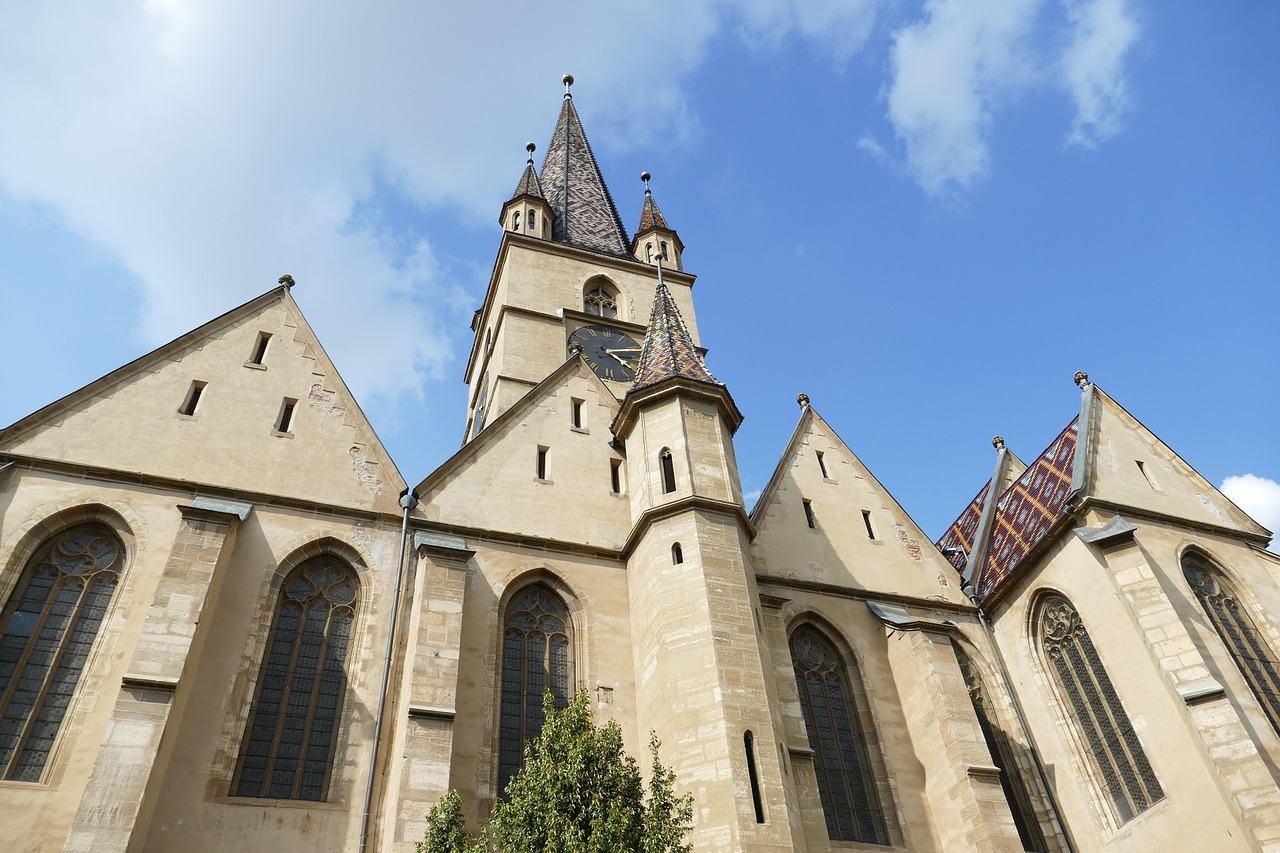
- Alba Iulia: the seven-pointed star fortress of Alba Carolina (18th century) with Baroque gates, the Romanesque-Gothic Roman Catholic cathedral and the Orthodox Coronation Cathedral of 1922.
- CampingSpirit overnight tip
-
Official campsite or RV park: Camping Aurel Vlaicu in the village of the same name between Sebeș and Orăștie, right at the A1 exit, Dutch-run, with electricity, toilets and showers, and water supply and waste disposal (campingaurelvlaicu.ro); usually open from spring to autumn, check the season in advance. In the village the birthplace of the aviation pioneer Aurel Vlaicu is a memorial.
Free camping or nature tip (where legal): In Alba Iulia the car parks around the fortress charge fees and are not intended for overnighting; access restrictions apply within the fortress area. In the flat country along the Mureș, free camping is only possible with the landowner’s consent – the campsites along the A1 are the better solution.
- Insider tip for campers
- In Alba Iulia park outside the ramparts and walk in through one of the gates; the fortress is extensive and free to enter, only the museums charge admission. In the season from May, especially at weekends, a changing of the guard in historical uniforms takes place at 12 noon; check dates with the town. The A1 is covered by the rovinieta.
6Stage 6: Aurel Vlaicu to Costești (Sarmizegetusa Regia) (approx. 60 km)
- The drive
- Via the A1 or the DN7 to Orăștie, then south into the valley of the Grădiștea stream to Costești. Beyond Costești the road to the Dacian capital becomes narrow, winding and wooded, with few passing places; unpleasant for large motorhomes and caravan outfits. From the car park it is around half an hour uphill on foot to the sanctuary. Pure driving time a good 1.5 hours.
- Highlights & must-sees
- Sarmizegetusa Regia, a UNESCO World Heritage Site as part of the Dacian Fortresses of the Orăștie Mountains: capital of the Dacian king Decebalus, with remains of walls, the paved Sacred Way and the circular sanctuaries of andesite and limestone.
- The fortresses of Costești-Cetățuie and Costești-Blidaru above the valley, both reached on steep footpaths and much quieter than the capital.
- Orăștie, with the medieval fortified church in the centre and a small museum on the Dacian period.
- CampingSpirit overnight tip
-
Official campsite or RV park: In Costești several simple sites and holiday complexes by the river are listed, including Camping Sargetia-Costești (sargetia-costesti.ro); meadows with toilets and showers, electricity rather the exception. If you don’t want to drive into the forest, stay a second night at Camping Aurel Vlaicu and do the detour as a day trip.
Free camping or nature tip (where legal): The Dacian fortresses lie in the Grădiștea Muncelului–Cioclovina Nature Park; camping and fires are prohibited outside designated places, and there is no overnighting at the car park by the fortress. Bears regularly roam these forests.
- Insider tip for campers
- Restoration work is under way at Sarmizegetusa Regia and opening days are restricted at times – check works and opening days before setting off, or you may find yourself at a closed gate after almost 20 km of mountain road from Costești. The access road has been closed several times in the past after storm damage. Take sturdy footwear and water for the walk.
7Stage 7: Costești to Sarmizegetusa (via Hunedoara, Hațeg and Densuș) (approx. 120 km)
- The drive
- Back to Orăștie and on the A1 to Simeria, then south to Hunedoara. From there take country roads through the hilly Hațeg Country to Hațeg, then minor roads to Densuș and via Totești to Sarmizegetusa. The roads are surfaced, narrow in the villages and with bumps; in Hunedoara heavy town traffic and the industrial wasteland of the former steelworks. Around 2.5 hours’ driving.
- Highlights & must-sees
- Corvin Castle in Hunedoara (Castelul Corvinilor): the Gothic castle of the Hunyadi family above the Zlaști stream, with a wooden bridge, Knights’ Hall and wall walks.
- The Church of St Nicholas in Densuș, one of the oldest stone churches in Romania, built from Roman spolia from Ulpia Traiana – tombstones and columns are visibly set into the masonry.
- Ulpia Traiana Sarmizegetusa: capital of the Roman province of Dacia, with forum, amphitheatre and museum, right on the edge of the village.
- CampingSpirit overnight tip
-
Official campsite or RV park: Camping Zamolxe in Sarmizegetusa, a few minutes’ walk from the Roman ruins, with tent and motorhome pitches, electricity, toilets and showers (zamolxe-sarmisegetusa.ro); ask in advance about the season and space for larger vehicles. If you want to visit the castle in the evening, the Cinciș reservoir south-west of Hunedoara is an alternative, with simple sites on the shore.
Free camping or nature tip (where legal): Hațeg Country is a UNESCO Geopark but not a national park; free camping on farm tracks is not expressly prohibited by law, but on private land only with permission. Do not park near flocks of sheep: the livestock guardian dogs defend their territory, against campers too.
- Insider tip for campers
- At Corvin Castle, motorhomes should use the larger car parks before the bridge and not drive into the narrow streets of the old town; come early, as coaches arrive from late morning. Fill up and shop in Hațeg; towards the Retezat there are only village shops.
8Stage 8: Sarmizegetusa to Retezat National Park (Râușor and Cârnic) (approx. 60 km)
- The drive
- Via Clopotiva to Râu de Mori and up the Râușor valley to the Râușor access point, the last few kilometres narrow and wooded. Back down the valley and via Sălașu de Sus and Nucșoara to the Cârnic access point at the end of the road; from Nucșoara narrow, partly patched and rough in its upper section. Around 2 hours’ driving in total; take the mountain roads slowly.
- Highlights & must-sees
- Hațeg Geopark along the way: sites of the dwarf dinosaurs of Hațeg Country, including the dinosaur eggs of Tuștea, and the Geopark visitor centre in Hațeg.
- Hike from the Cârnic access point to the Pietrele hut (around two hours), the starting point for the glacial lakes and peaks of the northern side.
- The national park visitor centre in Nucșoara, with information on trails, weather and bears.
- CampingSpirit overnight tip
-
Official campsite or RV park: At the Cârnic access point there is a designated national park camping zone (Popasul Cârnic), very basic, suitable for small motorhomes; more comfortable are the sites in the valley between Râu de Mori, Sălașu de Sus and Nucșoara listed in OSM, including Retezat Base Camp and Camping Countryside Retezat. The national park also designates camping areas at the Râușor access point. Ask about facilities and season in advance.
Free camping or nature tip (where legal): In Retezat National Park camping is only permitted in designated zones, open fires are prohibited, dogs must be kept on a lead at all times, and vehicles may only use the public access roads. A visitor fee is charged; tickets are available at the Nucșoara visitor centre and at the access points. The Retezat is one of the areas with the highest bear density in Romania: lock food away in the vehicle and leave nothing outside at night.
- Insider tip for campers
- Start day hikes early, as thunderstorms build up in the afternoon in summer. To head back west or to the A1, take the DN66 via Hațeg to Simeria; if you want to continue south, you can drive via Petroșani and the Jiu Gorge or towards the Transalpina – both are covered in the CampingSpirit guide to the Transfăgărășan and Transylvania.
Camping practice & local rules
Wild camping & overnight parking
- Romania has no nationwide ban on sleeping in a motorhome, but no right to roam either. On private land – and that means almost all the meadows along the Arieș and Mureș – you need the owner’s consent; local prohibition signs apply. If you spend the night in a car park, you are only parking: awnings, chairs and tables belong on campsites.
- Protected areas on this route: Apuseni Nature Park (with Padiș, Scărișoara and Cetățile Ponorului), Turda Gorge Nature Reserve, Grădiștea Muncelului–Cioclovina Nature Park with the Dacian fortresses, and Retezat National Park. The same applies everywhere: camping only in designated zones, fires only at marked places, dogs on a lead; rangers carry out checks, and visitor fees are charged.
- Bears: many brown bears live in the Apuseni, in the Orăștie Mountains and above all in the Retezat. Feeding them is prohibited and punished with heavy fines; store food and rubbish odour-proof in the vehicle, don’t leave barbecue or food scraps outside, don’t walk alone through the forest at dusk, and if you encounter a bear, withdraw calmly. The authorities warn of bear sightings in villages via RO-Alert on your mobile phone; emergency number 112.
- Dogs: at every stână (shepherds’ hut) there are livestock guardian dogs that confront hikers and unfamiliar dogs. Keep your distance, don’t run away, stand still and wait until the shepherd calls the dogs off; take a stick to lean on. Stray dogs are also found at rest areas. Your own dogs need an EU pet passport and rabies vaccination and stay on a lead in the protected areas.
- Useful apps: park4night and Campercontact; read reviews by date, because small meadow sites open and close from year to year, and many guesthouses take motorhomes by arrangement.
Waste disposal & supplies
- Water supply and waste disposal are available almost only at campsites; public service points are very rare. On this route Turda and Aurel Vlaicu are the reliable points – there is no waste disposal on the Padiș Plateau or at the Retezat. Never drain grey water in karst areas: whatever flows into a swallow hole comes out again in springs that villages drink from.
- Drinking water: in Cluj, Turda and Alba Iulia tap water is generally drinkable. In the mountains it comes from springs and wells, and in karst it is quickly contaminated; fill up at campsites or filter, and keep containers of bottled water in reserve.
- Gas: German exchange cylinders are not swapped. Autogas (GPL) is available at larger filling stations in Cluj, Turda, Alba Iulia, Deva and Hunedoara, but hardly at all in the Arieș valley and Hațeg Country. Bring an adapter set for refillable cylinders and arrive with two full cylinders.
- Fuel and cash: between Câmpeni, the Vârtop Pass and Ștei, and in the Retezat valleys, filling stations and cash machines are scarce. Meadow sites, guesthouses, cave tours and village shops often accept only cash in lei.
Vehicle size & traffic rules
- Rovinieta: the electronic vignette is compulsory on all national roads, not just the A1, A3 and A10 motorways – so also on the DN75, DN74 and DN1. It is linked to the number plate and checked by camera; it is sold through the TollRo system (etoll.ro and app), at authorised sales points and at border crossings. Rates are graded by emission standard (electric, Euro 6, Euro 4–5, Euro 3 and older). Whether a motorhome is classed as a car (category A) or as a goods vehicle up to 3.5 t (category B) depends on its registration. Goods vehicles over 3.5 t pay a distance-based toll via TollRo instead of the rovinieta; check how a motorhome over 3.5 t is classified with CNAIR or on etoll.ro before entering the country. County and forest roads such as the climb to Padiș are toll-free.
- Speed limits for cars: 50 in built-up areas, 90 outside built-up areas, 100 on expressways and on national roads designated as European routes, 130 km/h on motorways. Motorhomes over 3.5 t: 80 outside built-up areas, 90 on expressways/European routes, 110 km/h on motorways; vehicles with trailers: 80 outside built-up areas, 90 on expressways, 120 km/h on motorways. The ADAC gives the values for over 3.5 t for motorhomes up to 3.5 t as well – if you want to be on the safe side, stick to them. In the first year after passing the driving test, 20 km/h less in each case.
- Road conditions: the motorways and the DN1 are good; the DN75 in the Arieș valley and the DN74 through the Ampoi valley are narrow and winding, with patches and potholes. The access roads to Padiș, the Scărișoara cave, Sarmizegetusa Regia and the Retezat access points are mountain roads with few passing places, partly gravel; forest roads across the Padiș Plateau are unsuitable for large motorhomes and caravan outfits, and after rain for small ones too. Roadworks with traffic-light single-lane sections and closures after storms do occur – check the current situation with Infotrafic or the county councils, and don’t drive at night.
- Blood alcohol limit 0.0: absolute ban on alcohol at the wheel; high levels are a criminal offence. Dipped headlights are compulsory outside built-up areas, also during the day. Mobile phones only with a hands-free kit. Winter tyres are compulsory when there is snow or ice on the road; on the Vârtop Pass, the Padiș Plateau and at the Retezat this can be the case from October. A fire extinguisher and two warning triangles are mandatory; carry a first-aid kit and high-visibility vest.
- Traffic: unlit horse carts, herds of cows and sheep, and timber lorries are part of everyday life in the Apuseni Mountains. There are no environmental stickers; in the centres of Cluj and Alba Iulia and at Corvin Castle, park on the outskirts.
CampingSpirit packing & preparation checklist
- Warm jacket, hat and non-slip shoes for the caves: in the Scărișoara Ice Cave it is around 0 °C and the stairs are damp and icy; the Salina Turda and the Bear Cave are cool.
- Head torch and sturdy hiking boots for Cetățile Ponorului, the Turda Gorge and the path to the Pietrele hut – ladders, cables and wet limestone.
- Odour-proof food box and strong rubbish bags, plus bear spray to hand for hikes in the Apuseni and Retezat; check the transit countries’ import rules for the spray in advance.
- Full-size spare wheel, compressor and tyre repair kit: gravel on the Padiș Plateau and potholes on the DN75 and DN74 are hard on tyres and rims.
- Water filter and 20-litre container: on the plateau and at the Retezat there is only spring water and no waste disposal.
- Cash in lei in small notes for meadow sites, cave tours, protected-area visitor fees and farm shops.
As of 2026-10. Closures, fees and booking rules change: check official sources before you go.