


In-depth guide · CampingSpirit
Around 825 km from Lillehammer through the Gudbrandsdal to the Rondane peaks, across the Dovrefjell with its musk oxen, to the mining town of Røros and Lake Femunden, and back on the Nasjonal turistveg Rondane via Atnsjøen and Venabygdsfjellet – a loop above the tree line of eastern Norway.
The spirit of the route
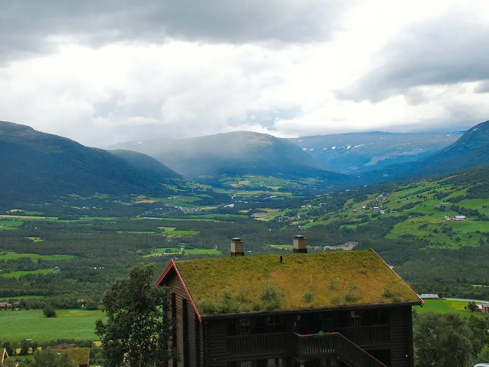
Up here Norway is not about fjords but about open space. Beyond Ringebu the road climbs out of the birch forest, and suddenly the fell lies open before you: grey-green carpets of lichen, dwarf birch, cairns, and above them the rounded, bare domes of the Rondane, which turn rust-red in the evening and then blue-violet. From the sliding door you see cotton grass in the wind, a stream meandering between bog hummocks and, with luck, a reindeer herd on the horizon. On the Dovrefjell musk oxen stand in the grass like boulders, and at Hjerkinn you look through a glass front at Snøhetta. Then come the mines: wooden houses, slag heaps and the white church of Røros, where miners dug copper out of the rock for three centuries. It is a quiet route, cool even in July, with morning mists over Lake Femunden and evenings when you do nothing but watch the light move across the plateau.
Stage-by-stage plan
1Stage 1: Lillehammer to Ringebu (approx. 60 km)
- The drive
- From Lillehammer take the E6 north into the Gudbrandsdal, along the Lågen via Øyer and Tretten to Fåvang and Ringebu. Much of the E6 here has been newly rebuilt, wide and fast, with a few long tunnels; if you prefer a quieter drive, take the old valley road on the other side of the river for some sections. Pure driving time is just over an hour – enough time for Lillehammer in the morning.
- Highlights & must-sees
- Maihaugen in Lillehammer: one of Norway’s great open-air museums, with farms, a stave church and craftsmen’s houses from the Gudbrandsdal.
- The 1994 Olympic ski jumps at Lysgårdsbakken: take the steps or the chairlift up for a view over Lillehammer and Lake Mjøsa.
- Ringebu stavkyrkje: one of the largest surviving stave churches, its core dating from the early 13th century, with its red 17th-century tower on the slope above the valley.
- CampingSpirit overnight tip
-
Official campsite or RV park: Elstad Camping lies in the valley south of Ringebu near the E6, around 3 km from the village; check facilities and season on the site’s website. If you spend the first night in Lillehammer: Lillehammer Turistsenter on the northern edge of town has electricity, water, showers, toilets and waste disposal according to OpenStreetMap data; Lillehammer Camping is on the shore of Lake Mjøsa south of the centre.
Free camping or nature tip (where legal): In the Gudbrandsdal almost all land on the valley floor is cultivated land (innmark) – meadows, pastures, farm driveways. The right to roam does not apply there, and signs at lay-bys on the E6 often prohibit overnight stays. Plan the first night at a campsite.
- Insider tip for campers
- In Lillehammer, top up gas, water and supplies before you leave and use the Vinmonopolet: higher up on the fell the shops are small and the opening hours short. The stave church in Ringebu has its own car park on the slope; with a long vehicle or a caravan, park down in the village instead and walk the short way up.
2Stage 2: Ringebu to Mysuseter (Rondane) (approx. 70 km)
- The drive
- Continue up the valley on the E6 via Vinstra and Kvam to Otta, where the Otta river flows into the Lågen. From Otta a steep, winding mountain road with hairpins climbs out of the valley over a good 10 km to Mysuseter on the western side of the Rondane, high above the valley floor. In heavy vehicles plan on low gears for the descent. Pure driving time just under 1.5 hours.
- Highlights & must-sees
- Kvitskriuprestin above Otta: earth pyramids of glacial moraine material with stone caps on top, a short walk from the car park.
- Spranget beyond Mysuseter: gateway to Rondane National Park, Norway’s first national park, established in 1962; from here it is about 6 km on a wide track to the DNT hut Rondvassbu on Rondvatnet.
- View of Rondeslottet, at a good 2,170 m the highest peak in the Rondane, and the Smiubelgen ridge from the paths around Rondvassbu.
- CampingSpirit overnight tip
-
Official campsite or RV park: A motorhome site is listed in OpenStreetMap near Mysuseter; check fees, facilities and season on site. For full service, sleep down in the valley: Otta Camping og Motell on the edge of Otta or Sæta Camping by the river south of the town.
Free camping or nature tip (where legal): Around Mysuseter there are many cabins and summer farms; the roadsides are not pitches, and at the hiking car parks signs often point out parking fees and rules for overnight stays. In the national park itself, driving off the roads is prohibited; hikers may camp, but the camper stays on designated sites.
- Insider tip for campers
- The road from Mysuseter over Tjønnbakken to Spranget is a private toll road (bomveg) – check payment and the period it is open on site; in winter, car access ends below Spranget. During the summer season there was most recently a ban on overnight parking at the Spranget car park; if you are staying the night, park in Mysuseter and take the bus or the bike. If you don’t want to drive up, take the bike: from Mysuseter to Spranget and on to Rondvassbu is a beautiful but steadily climbing ride.
3Stage 3: Mysuseter to Hjerkinn (approx. 95 km)
- The drive
- Back to Otta and on the E6 through the upper Gudbrandsdal via Dovre to Dombås, where the E136 branches off towards Romsdal. Beyond it the E6 climbs onto the Dovrefjell, through open birch woods and across the Fokstumyra bog up to the treeless plateau around Hjerkinn at around 1,000 m. Well built, but exposed to the wind on the fell. Pure driving time just under 1.5 hours.
- Highlights & must-sees
- Fokstumyra Nature Reserve north of Dombås: a wetland with a nature trail, in early summer one of Norway’s best-known birding areas.
- Viewpoint Snøhetta on Tverrfjellet near Hjerkinn: the Villreinsenter pavilion with its glass front facing the Snøhetta massif, around 1.5 km on foot from the car park.
- Hjerkinn with the old Hjerkinn church and the Dovre Line railway station up on the fell.
- CampingSpirit overnight tip
-
Official campsite or RV park: Snøhetta Camping right in Hjerkinn on the E6, according to OpenStreetMap data for tents, caravans and motorhomes, with electricity, water, showers and toilets; a good base for the musk ox safari the next morning. Alternatives in Dombås: Domaas Gård Hyttetun & Caravancamp or Ljoshaugen Camping in the village.
Free camping or nature tip (where legal): A large part of the fell around Hjerkinn belongs to Dovrefjell-Sunndalsfjella National Park; the former Hjerkinn firing range was protected in 2018 and largely incorporated into the national park; it is being restored to nature. Driving off the roads is prohibited, and car parks are for parking, not camping. The access road to the car park at Tverrfjellet is a gravel road from the E6; the car park is not an overnight spot.
- Insider tip for campers
- Hjerkinn has a waste disposal station (tømmestasjon) – one of the few between Dombås and Oppdal. On the E6 across the Dovrefjell, convoy driving or a short-notice closure can be ordered in storms and snowfall, even in autumn; check the Statens vegvesen traffic reports before you set off.
4Stage 4: Hjerkinn to Oppdal (Magalaupe) (approx. 55 km)
- The drive
- A short stretch across the plateau to Kongsvoll Fjellstue, then the E6 descends through the narrow Drivdalen: rock walls, scree slopes, the Driva deep in the gorge beside the road and the Dovre Line on the other side of the valley. A steady gradient, a few tight bends; use engine braking on the way down. Driving time under an hour; the day belongs to the safari.
- Highlights & must-sees
- Musk ox safari: guided walks in small groups from Kongsvoll, Hjerkinn and Oppdal, usually several hours long, with binoculars, to the herds on the fell.
- Kongsvoll Fjellstue, one of the old royal staging posts on the pilgrim route across the Dovrefjell, with NTNU university’s botanical alpine garden.
- Magalaupet: the Driva has carved potholes and a narrow gorge into the rock; photo spot from the bridge below the E6.
- CampingSpirit overnight tip
-
Official campsite or RV park: Magalaupe Camping lies in Drivdalen around 12 km before Oppdal, right by the gorge; according to OpenStreetMap data with electricity, water, showers, toilets, waste disposal and Wi-Fi. Around Oppdal, Granmo Camping by the river a few kilometres south of the town and Halsetløkka Oppdal Camping north-east of the centre offer more sites.
Free camping or nature tip (where legal): In Drivdalen the valley floor is narrow, lay-bys on the E6 are not meant for overnight stays, and the fell areas belong to the national park. A wild camping spot is neither necessary nor sensible here – the campsites are close together.
- Insider tip for campers
- Never approach musk oxen closer than 200 m – that is the usual guideline, and more distance never hurts: the animals look sluggish but can attack suddenly and run surprisingly fast. If an animal comes towards you or snorts, back away slowly. Near the herds, dogs belong on a short lead or should stay behind. The guided safari is the safe choice – book in good time, as groups fill up quickly in high summer.
5Stage 5: Oppdal to Røros (approx. 190 km)
- The drive
- On the E6 to Ulsberg, then on the Rv3 through high-lying Kvikne, via Tynset into the Østerdal and on the Rv30 via Tolga and Os to Røros. A long but relaxed stage on mostly well-built country roads through forest, bogs and high valleys, with little traffic and many elk warning signs. Pure driving time around 3 hours.
- Highlights & must-sees
- Kvikne: the mining village with its old church and the farm where Bjørnstjerne Bjørnson was born.
- Tolga and Os: wooden churches and old farms in the upper Glomdal, good places to stop by the river.
- First view of Røros: slag heaps, the wooden houses of the miners’ streets and the stone tower of the Bergstadens Ziir church.
- CampingSpirit overnight tip
-
Official campsite or RV park: Røros Camping (formerly Håneset Camping) is on the edge of town, just under 2 km from the centre; according to OpenStreetMap data for tents, caravans and motorhomes, with electricity, water and showers. Closer to the old town, two motorhome car parks are listed, including the Bobilparkering at the Røros IL sports club – check fees and rules on site.
Free camping or nature tip (where legal): The forests and bogs along the Rv3 and Rv30 are extensive, but forest roads are mostly closed or private, and driving off public roads is prohibited. A legal car park without a no-parking sign may be used for an overnight stay, but camping behaviour is not allowed – established sites are the better choice on this stage.
- Insider tip for campers
- Tynset has large supermarkets, petrol stations and a Vinmonopolet – the last good shopping stop before Røros. The old town of Røros is narrow and crowded on market days; leave the camper at the site and walk. In the evenings, at a good 600 m and in a cold-air hollow, it can get chilly here even in summer.
6Stage 6: Røros to Femunden and back (approx. 70 km)
- The drive
- From Røros on narrow minor roads through bog and pine country south-east to the northern end of Lake Femunden at Synnervika, around 35 km each way. Partly narrow road with passing places, quiet and without through traffic for the last few kilometres. A good hour each way.
- Highlights & must-sees
- Røros old town: a UNESCO World Heritage Site since 1980, with Smelthytta, the mining museum in the reconstructed smelting works, and the Bergstadens Ziir church from 1784.
- Femunden: Norway’s third-largest lake, shallow, clear and surrounded by pine forest; beyond it the rock and lake wilderness of Femundsmarka National Park.
- MS Fæmund II: in summer the old lake steamer runs from the northern end at Synnervika via several landings, such as Jonasvollen, to Elgå – a trip across the lake without being at the wheel yourself; bikes can come along.
- CampingSpirit overnight tip
-
Official campsite or RV park: Second night at Røros Camping or the motorhome car park in town. If you want to sleep by the lake: Johnsgård Turistsenter and Sømådalen Camping are on the western shore of Lake Femunden, Femund Lodge on the eastern shore near Elgå – all with a longer drive; check facilities and season in advance.
Free camping or nature tip (where legal): At Lake Femunden, camping in a tent is possible in undeveloped nature under the right to roam, and canoeists use the islands and shoreline spots. This does not apply to motorhomes: shore paths and boat ramps are not pitches, and the car park at the landing is for the boat’s passengers. Additional protection rules apply in Femundsmarka National Park.
- Insider tip for campers
- Check the departure times and season of MS Fæmund II in advance – the boat only runs in summer and calls at several landings. In Røros a guided tour of the old town is worthwhile; Olavsgruva, the mine museum around 13 km east of town, can only be visited on a guided tour, is reachable by camper and stays only a few degrees above freezing all year round: bring a jacket and sturdy shoes.
7Stage 7: Røros to Folldal (approx. 125 km)
- The drive
- On the Rv30 back via Os and Tolga to Tynset, then on the Rv3 to Alvdal and on the Rv29 west up the Folldal. Wide valleys, pine forest, later open fell again with views of the eastern side of the Rondane. Pure driving time around 2 hours.
- Highlights & must-sees
- Aukrustsenteret in Alvdal: museum for the illustrator and author Kjell Aukrust, creator of the Flåklypa universe.
- Folldal gruver: the former copper mine with guided tours of the tunnels and the buildings of the mining settlement.
- The view from the Rv29 fell across the Folldal to the Rondane peaks in the south and the Snøhetta massif in the west.
- CampingSpirit overnight tip
-
Official campsite or RV park: Grimsbu Turistsenter lies east of Folldal at the Fv27 turn-off, at the start of the Nasjonal turistveg Rondane, and has a waste disposal station; Brendryen Camping is also in the valley east of Folldal. Check facilities and season directly with the site.
Free camping or nature tip (where legal): The Folldal is summer-farm and farmland; only park on gravel areas along the Rv29 where parking is allowed and not prohibited by signs. Further south on the Fv27 there are rest areas along the scenic route, meant for stopping and looking, not as camping areas.
- Insider tip for campers
- Fill up in Tynset or Alvdal before the mountain road the next day: there are hardly any petrol stations on the roughly 100 km over the Fv27 and Venabygdsfjellet. Take care of water and waste disposal in Grimsbu – according to Nasjonale turistveger, the toilets at the route’s rest areas are not built for emptying motorhome toilets, and doing so there is expressly prohibited.
8Stage 8: Folldal to Lillehammer via Atndalen and Venabygdsfjellet (approx. 160 km)
- The drive
- On the Fv27, the Nasjonal turistveg Rondane, via Strømbu and Kjøllen down into upper Atndalen to Atnsjøen, via Atnbrua to Enden and on over Venabygdsfjellet, where the road climbs to around 1,060 m. Beyond, steeply down over Ringebufjellet to Frya on the E6 and down the valley to Lillehammer. The Fv27 is narrow but paved; driving time a good 2.5 hours without stops.
- Highlights & must-sees
- Sohlbergplassen above Atnsjøen: rest area with a viewing platform at the spot from which Harald Sohlberg studied the Rondane for his painting “Vinternatt i Rondane”.
- Atnbrufossen: waterfall on the Atna below Atnsjøen, with the small Vannbruksmuseum and a short riverside path.
- Venabygdsfjellet: a wide fell plain with summer farms and a view back to the Rondane – in clear weather the finest farewell to the route.
- CampingSpirit overnight tip
-
Official campsite or RV park: Back in Lillehammer: Lillehammer Turistsenter or Lillehammer Camping on Lake Mjøsa. If you split the stage, along the scenic route you will find Skogli hytteutleie og Camping Atna near Atnbrua (according to OpenStreetMap with electricity, water, showers and waste disposal) or Rondetunet friluftsenter; towards Ringebu there is Friisvegen Turistsenter Måsåplassen on Ringebufjellet and, down in the valley, Elstad Camping. As a variant, the Fv219 runs from Enden through lower Atndalen past Sollia church to Atna, with Atna Camping at the end.
Free camping or nature tip (where legal): The rest areas of the Nasjonal turistveg are built for stopping, looking and taking a break; overnight stays are not intended there. On Venabygdsfjellet much of the summer-farm land is privately owned. If you want to stay wild, look for a legal car park without a no-parking sign and keep at least 150 m from cabins and houses; driving off the road is prohibited.
- Insider tip for campers
- Nasjonale turistveger lists waste disposal stations in Grimsbu, Venabygd and Hjerkinn – empty your cassette and grey water there, not at the rest areas. The Fv27 is open all year; the connecting section over Ringebufjellet to Frya can be closed briefly in bad winter weather. Reindeer and sheep like to stand on the road on the fell: slow down, especially at dusk.
Camping practice & local rules
Wild camping & overnight parking
- The right to roam (allemannsretten, friluftsloven) allows camping in a tent on uncultivated land (utmark), at least 150 m from inhabited houses and cabins and as a rule for up to two nights in the same place; on the high fell away from paths, longer too. On cultivated land (innmark) – meadows, pastures, farmyards and summer farms – you need the owner’s permission.
- Motorhomes are not automatically covered: spending the night in a vehicle counts as parking and is only allowed where parking is permitted and not prohibited by signs. Driving off public roads is prohibited under the Motorferdselsloven, and forest and summer-farm roads often have barriers or toll machines (bomveg). Awnings, tables and chairs belong on the campsite.
- The Rondane, Dovrefjell-Sunndalsfjella, Dovre and Femundsmarka national parks have their own protection rules, such as keeping dogs on a lead during certain periods and taking special care around wild reindeer during calving. From 15 April to 15 September open fires in woods and countryside are generally prohibited; on the fell there is hardly any wood anyway.
- Musk oxen on the Dovrefjell: keep at least 200 m away, never get between animals and the herd, keep dogs away. The animals are wild and have injured hikers before.
- You can stay overnight legally at campsites, municipal motorhome car parks (bobilparkering) and farm pitches. Useful apps: park4night, Campercontact; the Nasjonale turistveger maps show rest areas and waste disposal stations.
Waste disposal & supplies
- Waste disposal stations in Norway are called “tømmestasjon”. On this route you will find them at many campsites and, according to Nasjonale turistveger, in Grimsbu, Venabygd and Hjerkinn; toilets at rest areas are not meant for motorhome cassettes. In late autumn some stations close because of frost.
- Tap water is of good quality; streams on the fell are usually clean, but grazing livestock and reindeer are everywhere – better to boil or filter before drinking.
- Gas: Norway uses propane in its own cylinder systems; German exchange cylinders are not swapped and foreign cylinders are rarely refilled. Arrive with two full cylinders or use a Norwegian rental cylinder with a matching regulator. Autogas cannot be reliably obtained in the highlands – don’t count on refillable tank cylinders.
- You will find petrol stations and larger supermarkets in Lillehammer, Otta, Dombås, Oppdal, Tynset and Røros; in between, especially on the Fv27, Rv29 and around Lake Femunden, there are only a few stations. Wine and spirits are sold only by the Vinmonopolet; beer up to 4.7% is available in supermarkets until 8 pm on weekdays and until 6 pm on Saturdays, not on Sundays.
Vehicle size & traffic rules
- Speed limits: 50 km/h in built-up areas, generally 80 km/h outside them, and 90 to 110 km/h on upgraded sections of the E6 as signposted. Vehicles over 3.5 t and car-caravan combinations a maximum of 80 km/h, caravans without their own brakes a maximum of 60 km/h. Average speed checks and speed cameras are common, and fines are very high. Dipped headlights are compulsory around the clock.
- Tolls: no vignette; toll stations record the number plate automatically (AutoPASS), on this route for example on the newly upgraded E6 sections in the Gudbrandsdal (Øyer–Tretten and Frya–Sjoa). Owners of foreign vehicles receive the bill by post; registering with Epass24 is voluntary but speeds up billing. Private toll roads (bomveg) into the fells, such as to Spranget, charge separately; how to pay is shown at the barrier. Vehicles over 3.5 t fall into tariff group 2 (base rate usually twice as high); motorhomes in vehicle class M1 over 3.5 t pay the rate for vehicles up to 3.5 t (group 1) only with a valid AutoPASS agreement and a toll tag, otherwise group 2. A toll tag is only mandatory for vehicles over 3.5 t that are registered to a company or used mainly for commercial purposes, not for privately used motorhomes – check the details with AutoPASS before your trip.
- Winter closures and weather: the Fv27 is passable all year, and the section over Ringebufjellet to Frya can be closed briefly in severe weather; private fell roads such as the one to Spranget and the gravel access road to Viewpoint Snøhetta are only open in the summer half of the year. On the E6 across the Dovrefjell, convoy driving or a short-notice closure is ordered in storms; other fell roads such as the Rv29 can also be closed temporarily in severe weather. Check the current situation with Statens vegvesen (in Norway, phone 175).
- Winter equipment: suitable tyres are compulsory in snow and ice; vehicles over 3.5 t need winter tyres from 15 November to 31 March and must carry chains. On the fell at around 1,000 m snow often falls as early as September or October – plan on chains and all-season or winter tyres even for lighter motorhomes.
- Blood alcohol limit 0.2‰, mobile phones at the wheel only hands-free, carry a hi-vis vest and warning triangle. Dimensions: width up to 2.55 m; on the Fv27 and the minor roads to Lake Femunden there are narrow sections and passing places (møteplass). Wildlife crossings: elk in the forests of the Gudbrandsdal and Østerdal, reindeer on the fell, sheep on the road everywhere.
CampingSpirit packing & preparation checklist
- Good binoculars – for the musk oxen at 200 m and more, for wild reindeer on the fell and for the birds at Fokstumyra.
- Warm layers, hat, gloves and a windproof jacket: on the Dovrefjell and at Tverrfjellet temperatures are often in single figures even in July, and the wind whistles across the plateau.
- Mosquito net and repellent – essential on still evenings at Atnsjøen, at Lake Femunden and on the Fokstua bogs.
- Snow chains to fit your tyre size and an ice scraper, as soon as the trip extends into September or October.
- A Norwegian gas regulator or adapter for a rental cylinder, plus two full cylinders of your own when you arrive.
- A bike or e-bike for the toll road to Spranget and the track to Rondvassbu, for Røros old town and short rides on Venabygdsfjellet.
As of 2026-10. Closures, fees and booking rules change: check official sources before you go.