


In-depth guide · CampingSpirit
Around 675 km from the silver mines of Kongsberg via Heddal and the industrial World Heritage site of Rjukan, along the Telemark Canal to Dalen and Eidsborg and through the Setesdal via Hovden up to the high plateau of the Suleskar road – southern Norway's interior between factory history, wooden churches and reindeer fells.
The spirit of the route
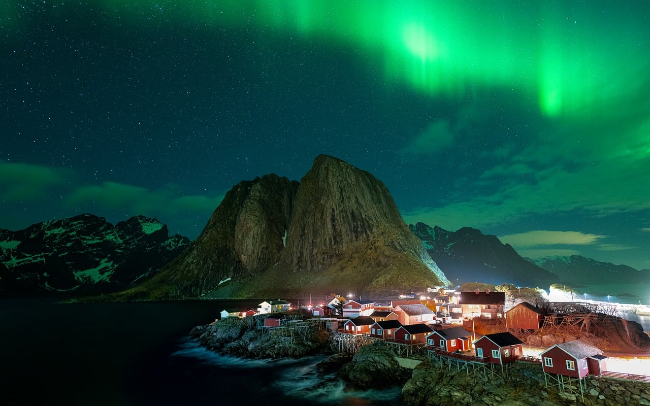
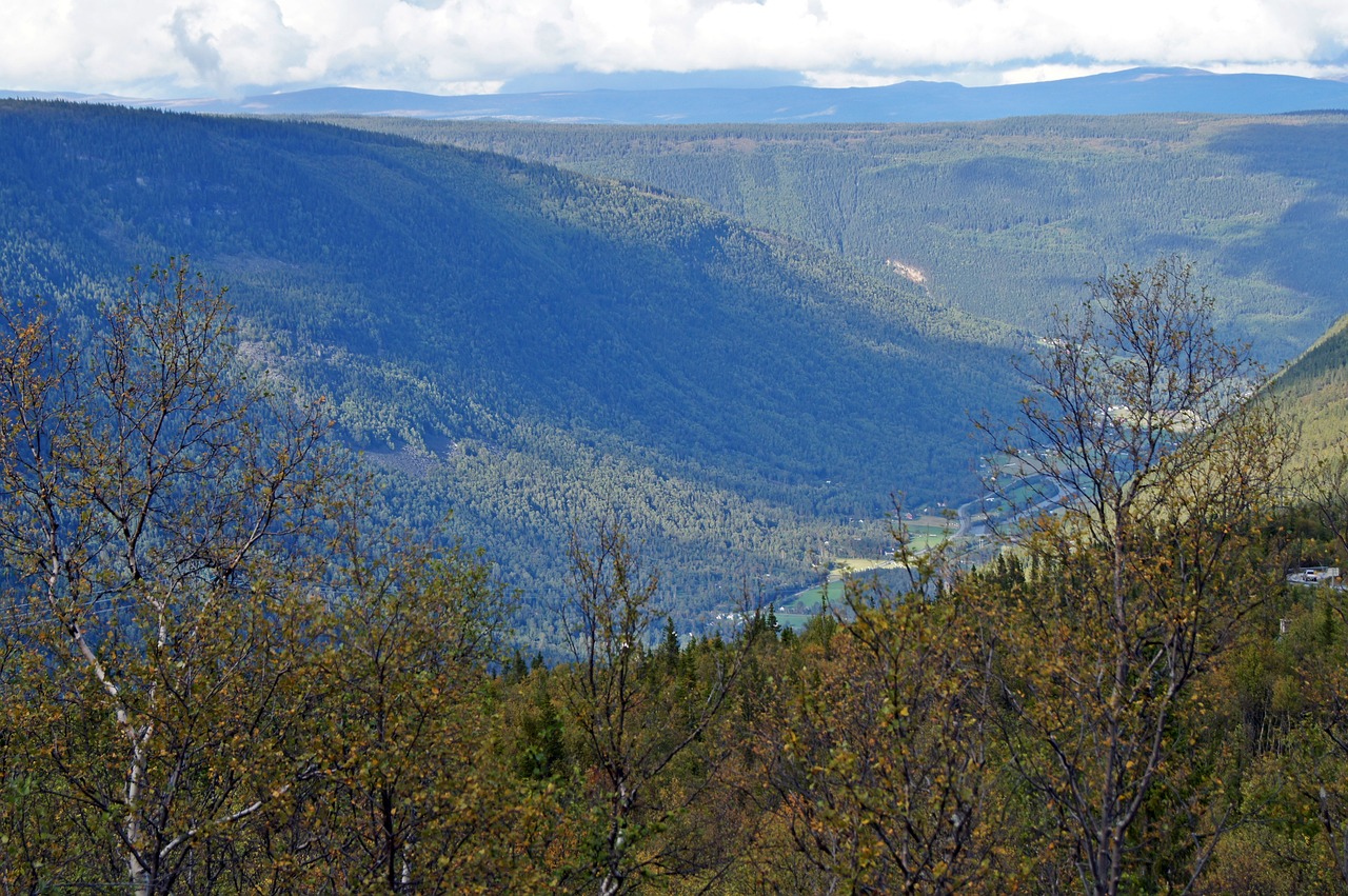
Telemark is Norway without the fjords, and that is exactly what makes it so distinctive. In the morning the Måna roars through the gorge below Vemork; in the evening the camper stands by a quiet lake reflecting pines and red boathouses. In between are stave churches of tarred wood, granite lock staircases and factory halls where Norway became an industrial nation. Above it all watches the bare cone of Gaustatoppen. From the sliding door you see the canal boats working their way up chamber by chamber at Vrangfoss one day, and the heath-covered slopes of the Setesdal with silver birches and sheep on the road the next. The further west you go, the barer the land becomes, until beyond Brokke only rock, meltwater lakes and the territory of the wild reindeer remain. This route rewards slow travel: short stages, museums when it rains, swimming when the sun shines and evenings by the water that never get dark in high summer.
Stage-by-stage plan
1Stage 1: Kongsberg to Notodden (via Heddal) (approx. 45 km)
- The drive
- From Kongsberg west on the E134 through wooded hills and over the Meheia ridge to Notodden, then a few kilometres further to Heddal and back to the Heddalsvatnet. The E134 is well built but carries heavy lorry traffic; within Kongsberg some roundabouts are tight. Pure driving time just under an hour – enough time for the mines in the morning.
- Highlights & must-sees
- Kongsberg silver mines: mining history since the 17th century in the Norsk Bergverksmuseum in town and, in season, by mine train into the mountain at Kongens gruve near Saggrenda.
- Kongsberg kirke: one of Norway's largest Baroque churches, financed with silver money, with a pulpit altar and boxes for the mining officials.
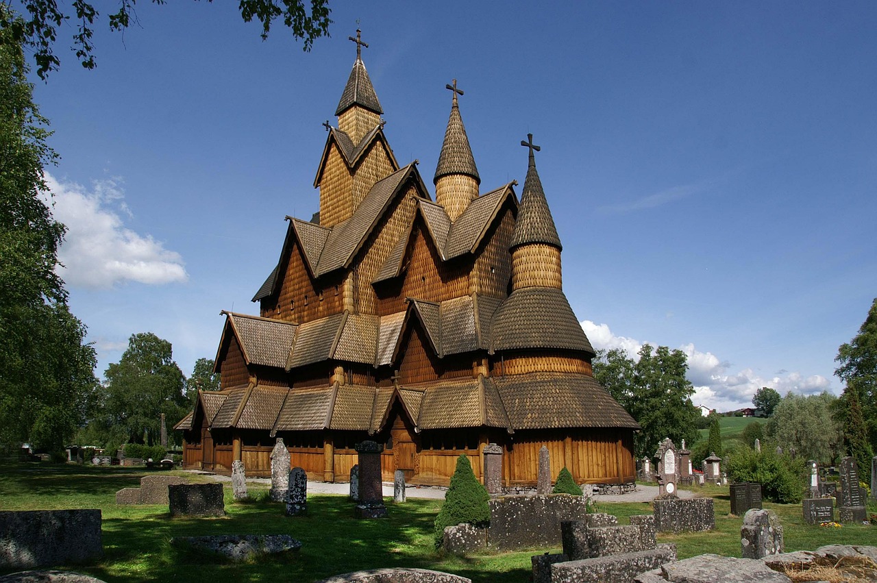
- Heddal stavkyrkje: Norway's largest stave church, from the 13th century, with tiered roofs and an external gallery; next to it the Heddal Bygdetun with old farmsteads.
- CampingSpirit overnight tip
-
Official campsite or RV park: Notodden Camping lies on the Heddalsvatnet on the western edge of town, near the E134 and a few minutes from the stave church; according to OpenStreetMap data it has electricity, water and sanitary facilities. Check facilities, water and waste disposal and season on the site's website. North-west of Kongsberg, away from the E134, there is also Max Kro & Camping.
Free camping or nature tip (where legal): Around Kongsberg and Notodden the valley floor is almost entirely cultivated land (innmark), housing or industry – here the right of public access does not cover overnight stays. Overnight camping is not intended at commuter car parks or at the stave church car park in Heddal; plan the first night at the campsite.
- Insider tip for campers
- Inside, Kongens gruve is cool and damp all year round: bring a jacket and sturdy shoes even in July. Kongsberg and Notodden have larger supermarkets, petrol stations and a Vinmonopolet – stock up here for the days on the fell. In Heddal use the large visitor car park on the E134, not the access road right up to the church.
2Stage 2: Notodden to Rjukan (approx. 95 km)
- The drive
- From Notodden north via Gransherad to Tinnoset at the southern end of the Tinnsjø, then around 35 km along the lake and up into the narrow Vestfjorddal to Rjukan. Narrow and winding in places, with rock walls right next to the carriageway; several short tunnels before Rjukan. Pure driving time just under two hours.
- Highlights & must-sees
- Tinnoset and the Tinnsjø: this is where the railway ferries of the Rjukanbanen docked, carrying fertiliser and heavy water across the lake; the ferry landing and railway installations are part of the Rjukan–Notodden World Heritage site.
- Rjukanbanen station at Mæl at the northern end of the Tinnsjø: an old ferry terminal with exhibitions on industrial history.
- Rjukan itself: Norsk Hydro's workers' town in the narrow valley, with factory villas, workers' housing and the sun mirror (Solspeilet) high above the market square, which directs light into the shady town in winter.
- CampingSpirit overnight tip
-
Official campsite or RV park: Rjukan Hytte og Caravanpark lies east of town in the valley near Miland, with electricity according to OpenStreetMap data; Langefonn Caravanpark is another option in the valley. In Rjukan itself there are municipal motorhome parking areas (bobilparkering), for example in the Rjukan Næringspark and on Såheimsveien – handy for Vemork and Krossobanen; check fees and facilities on site.
Free camping or nature tip (where legal): On the Tinnsjø the shore is largely private or built up with holiday homes; the few rest areas are small. In the Vestfjorddal there is simply no room. You can stay legally and in a relaxed way at the Rjukan motorhome parking areas.
- Insider tip for campers
- Rjukan lies so deep in the valley that from autumn to spring the sun does not reach the town centre – in the afternoon it gets cool early. Rjukan is a good place to refuel and shop; heading west over the Hardangervidda and on the route via Tuddal there are no supplies for a long way.
3Stage 3: Rjukan to Rjukan (Vemork, Krossobanen, Gaustatoppen) (approx. 45 km)
- The drive
- A base day with short drives: west up the valley to the Vemork gorge, back into town to the Krossobanen valley station and up the steep mountain road towards Tuddal to the Stavsro hikers' car park at around 1,100 m. The road to Stavsro has a few tight hairpins and is busy at weekends.
- Highlights & must-sees
- Vemork: the former hydroelectric power station above the gorge houses the Norsk Industriarbeidermuseum, which tells the story of the 1943 heavy water sabotage.
- Krossobanen: Norway's oldest passenger cable car, built by Norsk Hydro in 1928 so that the workers could reach the light during the sunless winter; at the top, on Gvepseborg, paths start out onto the Hardangervidda.
- Gaustatoppen (1,883 m): from Stavsro around 4.3 km and a good 700 m of ascent on a broad, stony path; at the top a view over a large part of southern Norway. Allow a full day including the drive, ascent and descent.
- CampingSpirit overnight tip
-
Official campsite or RV park: Second night at the same site in Rjukan or in the valley – that way you drive to the sights without moving your gear. If you want to stay closer to Gaustatoppen, the Gausta area has motorhome pitches at the mountain resorts; check conditions in advance.
Free camping or nature tip (where legal): According to Visit Norway, the Stavsro car park charges a fee, is short of space in high season and is paid by app or machine; parking at the roadside is prohibited and vehicles are towed. Overnight stays are not the purpose of the area – even if apps suggest otherwise, the signs on site apply. Alternatively, in season a shuttle bus runs from Gaustablikk.
- Insider tip for campers
- Start early for Gaustatoppen: until 9 am there are usually still spaces at Stavsro; by midday traffic backs up on the access road. In wind and fog the summit is cold and the rocks slippery – bring a hat and gloves even in summer. For Vemork, the museum says to park at the car park by the Vemork bridge and walk across the suspension bridge around 800 m uphill to the museum (about 20 minutes); buses are not allowed across the bridge, and with a large motorhome do not try to use narrow side roads instead.
4Stage 4: Rjukan to Ulefoss (approx. 130 km)
- The drive
- Over the mountain road past Stavsro down to Tuddal, on to Sauland in Hjartdal and via the E134 back to Notodden, then on country roads via Gvarv on the Norsjø to Ulefoss. The route via Tuddal is narrow, steep and has passing places (møteplass); for caravan combinations and long motorhomes the detour back via the Tinnsjø is more relaxed. Pure driving time around two and a half hours.
- Highlights & must-sees
- Tuddal: a mountain-farm village in the high valley below the eastern side of Gausta, with an old farm ensemble and a view of the summit from the other side.
- Gvarv and Bø: fruit-growing and horticultural village on the Norsjø, with fruit stalls by the road in late summer.
- Ulefoss: lock staircase in the village, the manor house Ulefos Hovedgård and the iron foundry that has been working here since the 17th century.
- CampingSpirit overnight tip
-
Official campsite or RV park: Norsjø Ferieland lies on the eastern shore of the Norsjø near Akkerhaugen, a little north of Ulefoss, with electricity, water and sanitary facilities according to OpenStreetMap data; a large family site with a bathing beach. Closer to the canal route is Telemark Kanalcamping near Lunde. Check season and facilities on the sites' websites.
Free camping or nature tip (where legal): Around the Norsjø and in the Bø area the land is almost entirely cultivated, with orchards and fields. At the locks, parking is intended for visitors, not for the night. Here you can stay legally and quietly at campsites.
- Insider tip for campers
- Bø and Notodden are larger shopping towns with a Vinmonopolet. The Tuddal route is slippery on the hairpins when wet – use a low gear downhill and give sheep on the road time.
5Stage 5: Ulefoss to Vrådal (approx. 80 km)
- The drive
- From Ulefoss a short hop to Vrangfoss, then west to Lunde and on via country roads along the Flåvatn and the canal lakes towards Kviteseid and to Vrådal at the northern end of the Nisser. Quiet, partly winding roads through forest, fields and small villages, with few narrow sections. Pure driving time just under two hours.
- Highlights & must-sees
- Vrangfoss: the largest lock complex on the Telemark Canal, with five chambers and a lift of around 23 m – at its best when one of the historic canal boats is passing through.
- Lunde: locks and canal village, starting point for cycling and paddling trips along the canal from Skien to Dalen, completed in 1892, with 18 lock chambers over around 105 km.
- Kviteseid: an old stone church and the Kviteseid Bygdetun by the lake, an open-air museum with Telemark wooden houses.
- CampingSpirit overnight tip
-
Official campsite or RV park: Nedre Strand Hytteutleie og Familiecamping lies on the Nisser near Vrådal, with electricity, water and sanitary facilities according to OpenStreetMap data; Løyne Camping is an alternative further south on the Nisser. Book in high summer and check season dates.
Free camping or nature tip (where legal): Around Vrådal, on the Nisser and on the Vråvatn there are lakes and forests in abundance, but shore areas are often holiday-home plots or cultivated land. In public car parks without a prohibition sign, spending the night in the vehicle counts as parking and is generally possible – without awning, table and chairs, and not in front of houses or farm entrances.
- Insider tip for campers
- For the view from above at Vrangfoss, take the footpath to the upper chambers. If you want to paddle, you will find rental outfits on the canal and on the lakes near Lunde and Kviteseid – an inflatable kayak travels well in a motorhome.
6Stage 6: Vrådal to Dalen (via Eidsborg) (approx. 50 km)
- The drive
- From Vrådal west on narrow, winding country roads through forest and lake country to Dalen at the western end of the Bandak, then up the steep hairpin road to Eidsborg and back down into the valley in the evening. The climb to Eidsborg has tight hairpin bends; with a caravan or a large motorhome drive slowly and with foresight. Pure driving time a good hour.
- Highlights & must-sees
- Dalen Hotel: the wooden hotel in dragon style at the end of the canal, opened in 1894 and a destination of the canal boats – worth seeing from outside and from the landing stage too.
- Eidsborg stavkyrkje from the 13th century, whose walls are clad in wooden shingles, and right next to it the Vest-Telemark Museum with exhibitions on the old whetstone quarrying and life in the mountain village.
- Ravnejuvet: viewpoint above the sheer gorge above Dalen, where the updraught blows light objects back up.
- CampingSpirit overnight tip
-
Official campsite or RV park: Buøy Camping Dalen lies on a peninsula on the edge of the village where the river flows into the Bandak, with electricity, water and sanitary facilities according to OpenStreetMap data. Dalen Bobilcamp offers motorhome pitches with electricity and water in the village; Bandak Camping lies further east on the lake.
Free camping or nature tip (where legal): Around Dalen the valley floor is narrow and built up. On the plateau above Eidsborg there are hikers' car parks; overnight stays there are only permitted in areas where parking is allowed and not prohibited by signs, and not on mountain pastures (innmark).
- Insider tip for campers
- The road up to Eidsborg is narrow: keep your distance from oncoming traffic on the hairpins and pull in at passing places. When a canal boat docks in Dalen, the village centre is full for a short while – park at the campsite and walk.
7Stage 7: Dalen to Hovden (approx. 110 km)
- The drive
- From Dalen via Eidsborg north to Åmot in Vinje, then west on the E134 through Vinje to Haukeligrend and there south on the Rv9 into the Setesdal to Hovden. The E134 is wide, with lorry traffic and gradients; the Rv9 towards Hovden crosses the high fell with heath, lakes and snow poles along the edge. Pure driving time around two hours.
- Highlights & must-sees
- Vinje: home of the poet Aasmund Olavsson Vinje, with memorials and old farms on the Vinjevatn.
- The high fell between Haukeligrend and Hovden: a wide, treeless plateau with lakes, and in high summer cotton grass and snowfields right up to the road.
- Hovden: a mountain settlement on the Hartevatn with hiking trails into the Setesdalsheiene and the Badeland water park for a rainy day.
- CampingSpirit overnight tip
-
Official campsite or RV park: Hovden Fjellstoge lies north of the village centre and, according to OpenStreetMap data, runs a campsite; further south in the valley is Byklestøylane Camping. If you want to stop earlier, on the E134 around Haukeligrend and Edland you will find Velemoen Camping, Tallaksbru Camping and Flothyl Camping. Check facilities and season with the sites; in Hovden winter sports dominate.
Free camping or nature tip (where legal): The fell around Hovden is undeveloped (utmark) and part of the habitat of the wild reindeer in the Setesdal Vesthei. In public car parks without a prohibition sign you may spend the night in the vehicle; keep your distance from cabins and do not drive off the road into the terrain. In late summer many car parks are taken by hunters.
- Insider tip for campers
- Fill up and shop in Hovden: heading south in the Setesdal the shops are small, and on the Suleskar road there are no supplies at all. If you do not want to or cannot continue over the Suleskar road, at the end of the trip drive back east via Hovden and Haukeligrend on the E134.
8Stage 8: Hovden to Suleskard (via Bykle, Valle and Brokke) (approx. 120 km)
- The drive
- On the Rv9 down the Setesdal via Bykle and Valle to Brokke, then west on the Fv450 up hairpins onto the plateau and across the fell to Suleskard. The Rv9 is well built; the Fv450 is narrower, with gradients, passing places and no supplies of any kind. The road is closed every year from 1 November up to and including 20 May to protect the wild reindeer. Pure driving time a good two and a half hours.
- Highlights & must-sees
- Bykle kyrkje: a small 17th-century wooden church with rose painting, and below it the old footpath Byklestigen on the rock face above the river.
- Valle and Rysstad: Setesdal farms, the Setesdalsmuseet in Rysstad and the valley's silversmithing tradition at Sylvartun near Nomeland.
- Fv450 over the Setesdalsheiene: the high mountain road between the Setesdal and Sirdal with meltwater lakes, boulder fields and reindeer country.
- CampingSpirit overnight tip
-
Official campsite or RV park: Suleskard Fjellsenter at the western end of the pass road offers accommodation and pitches; check facilities and season in advance. In the Setesdal there are Valle Camping in Valle, Flateland Camping a few kilometres north and the Sanden Såre Bobilpark north of that – useful if you want to drive the pass road early in the morning.
Free camping or nature tip (where legal): The Fv450 runs through the Setesdal Vesthei–Ryfylkeheiane protected landscape area, habitat of one of the largest wild reindeer herds in southern Norway. Park only in designated car parks; driving off the road is prohibited, do not disturb herds, keep dogs on a lead. In car parks without a prohibition sign a quiet night counts as parking and is generally permitted.
- Insider tip for campers
- Check in advance with Statens vegvesen or AutoPASS whether the Fv450 is open and whether a toll applies – in Norway tolls are generally charged via the number plate. Fill up in Valle. From Suleskard the roads lead down into the Sirdal and towards the Lysefjord; the fjord coast is covered in the CampingSpirit guide to Hardanger, Lysefjord and Sørlandet.
Camping practice & local rules
Wild camping & overnight parking
- The right of public access (allemannsretten, friluftsloven) allows camping in a tent on uncultivated land (utmark), at least 150 m from inhabited houses and cabins and usually for up to two nights in the same place; on the high fell away from paths, longer too. On cultivated land (innmark) – meadows, pastures, orchards, farmyards and mountain pastures – you need the owner's consent.
- Motorhomes are not covered across the board: spending the night in a vehicle counts as parking and is only permitted where parking is allowed and not prohibited by signs. Driving off public roads is prohibited under the Motorferdselsloven; forest and mountain-pasture tracks often have barriers or toll machines (bomveg). Awnings, tables and chairs belong on the campsite.
- From 15 April to 15 September open fires in forests and countryside are generally prohibited. In the Setesdal Vesthei–Ryfylkeheiane protected landscape area and on the Hardangervidda separate protection rules apply, with particular consideration for wild reindeer; keep dogs on a lead and do not disturb herds.
- You can stay overnight legally at campsites, at municipal motorhome parking areas (bobilparkering) such as in Rjukan and Dalen and at farm pitches. At hikers' car parks such as Stavsro below Gaustatoppen, the fees and signs apply, not what apps say. Useful apps: park4night, Campercontact.
Waste disposal & supplies
- In Norway disposal stations are called “tømmestasjon”. On this route they are mainly at campsites and at the motorhome areas in the larger towns; toilets at rest areas are not meant for motorhome cassettes. There are none on the Suleskar road. In late autumn some stations close because of frost.
- Tap water is of good quality; fill up at campsites. Streams on the fell are mostly clean, but sheep and reindeer are everywhere – better to boil or filter before drinking.
- Gas: Norway uses propane in its own cylinder systems; German exchange cylinders are not swapped and foreign cylinders are only rarely refilled. Arrive with two full cylinders or use a Norwegian rental cylinder with a matching regulator. Autogas (LPG) is not reliably available in the interior – do not count on refillable tank cylinders.
- You will find petrol stations and larger supermarkets in Kongsberg, Notodden, Rjukan, Bø, Hovden and Valle; in between, especially via Tuddal, on the high fell along the Rv9 and on the Fv450, little to nothing. Wine and spirits are sold only by the Vinmonopolet, for example in Kongsberg, Notodden and Bø; beer up to 4.7% is available in supermarkets until 8 pm on weekdays, until 6 pm on Saturdays and not on Sundays.
Vehicle size & traffic rules
- Speed limits: 50 km/h in built-up areas, generally 80 km/h outside them, and more on upgraded sections of the E134 where signed. Vehicles over 3.5 t and combinations a maximum of 80 km/h, caravans without their own brakes a maximum of 60 km/h. Average-speed checks and speed cameras are widespread, and fines are very high. Dipped headlights are compulsory around the clock.
- Tolls: no vignette; toll stations record the number plate automatically (AutoPASS), on this route among other places on upgraded sections of the E134. Owners of foreign vehicles receive the invoice by post; registering with Epass24 is voluntary but speeds up billing. Private toll roads (bomveg) into the fells charge separately. Vehicles over 3.5 t fall into tariff group 2 (base rate usually twice as high); motorhomes in vehicle class M1 over 3.5 t pay the rate for vehicles up to 3.5 t (group 1) only with a valid AutoPASS agreement and a toll tag, otherwise group 2. A toll tag is only mandatory for vehicles over 3.5 t that are registered to a company or used mainly for commercial purposes, not for privately used motorhomes – check the details with AutoPASS before your trip.
- Winter closures and weather: the Fv450 Brokke–Suleskard is closed every year from 1 November up to and including 20 May to protect the wild reindeer; then the only options are the return via Hovden and Haukeligrend or down the Setesdal to the south. On the E134 over the Haukelifjell and on the Rv9 on the high fell, convoy driving or short-notice closures are ordered in storms. Check the current situation with Statens vegvesen (phone 175 within Norway).
- Winter equipment: in snow and ice suitable tyres are compulsory; vehicles over 3.5 t need winter tyres from 15 November to 31 March and must carry chains. On the fells around Hovden, Haukeli and Gausta snow often falls as early as September or October – plan on chains and all-season or winter tyres for lighter motorhomes too.
- Alcohol limit 0.2 per mille, mobile phones at the wheel only with a hands-free kit, carry a hi-vis vest and warning triangle. Dimensions: width up to 2.55 m; via Tuddal, up to Eidsborg and on the Fv450 there are narrow sections, hairpin bends and passing places (møteplass). Wildlife crossings: elk in Telemark's forests, reindeer on the fell, sheep on the road everywhere; collisions with wildlife must be reported to the police.
CampingSpirit packing & preparation checklist
- Warm jacket and sturdy shoes for Kongens gruve and Gaustatoppen: the mine is cool and damp even in high summer, and the summit is windy.
- Walking poles and a head torch – for the stony Gaustatoppen path and for late returns from the fell.
- Inflatable kayak or SUP for the canal lakes around Lunde, the Nisser near Vrådal and the Bandak.
- Binoculars for wild reindeer on the Suleskar road and elk at dusk by the Telemark lakes.
- Mosquito net and repellent – essential on still evenings by the canal and on the Hartevatn.
- Snow chains to fit your tyre size and a Norwegian gas regulator or adapter for a rental cylinder, as soon as the trip extends into September or October.
As of 2026-10. Closures, fees and booking rules change: check official sources before you go.