


In-depth guide · CampingSpirit
From the ferry at Souda to the lagoons of Balos and Elafonisi, via Paleochora, Rethymno and Preveli to the Libyan Sea at Matala, then via Knossos and the Lasithi Plateau to the palm forest of Vai: around 720 kilometres across Greece’s largest island.
The spirit of the route
Crete greets you at dawn on the ramp in Souda, after a night on the ferry deck, and just beyond the port the White Mountains rise. The island is longer, steeper and more contradictory than the map suggests: in the west, turquoise-and-pink lagoons and rocky gorges; in the south, the Libyan Sea, which beyond Plakias and Matala is almost always a little rougher than the north coast. In between, mountain villages where the lane is exactly one vehicle wide, goat bells, thyme and sage, kafenia serving raki with your coffee. From the sliding door you see Venetian harbour walls, Minoan wall remains under pines, the stone stumps of the mills on the edge of the Lasithi Plateau and finally date palms above a sandy beach at the far eastern tip. If you drive early, wait out the midday in the shade, stock up on water and park up in the evening at campsites under tamarisks, you will experience Crete at its own pace.
Stage-by-stage plan
1Stage 1: Chania (Souda ferry port) to Kissamos (approx. 45 km)
- The drive
- From the Souda ferry port, around 7 km west around Chania and onto the northern highway (VOAK, National Road 90) towards Kissamos: for long stretches two lanes with a wide hard shoulder, no central reservation, along the bay of Kolymbari and across the base of the Rodopou peninsula. On Crete, slower vehicles usually move onto the hard shoulder to let others overtake – don’t copy this abruptly, but expect it. Just under an hour’s driving.
- Highlights & must-sees
- Venetian harbour of Chania with its lighthouse, the Firkas bastion and the lanes of Topanas – before you set off or at the end of the trip.
- Moni Gonias monastery near Kolymbari, right by the sea at the foot of the Rodopou peninsula.
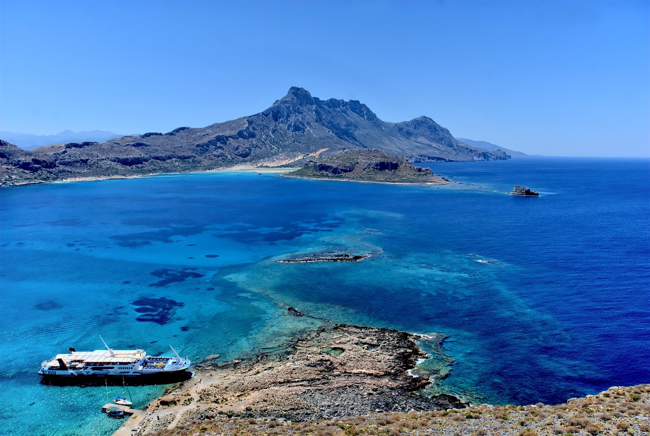
- Boat trip from Kissamos port (Kavonisi) to the fortress island of Imeri Gramvousa and the Balos lagoon – plan an extra day for it.
- CampingSpirit overnight tip
-
Official campsite or RV park: Camping Mithimna near Drapanias and Camping Nopigia in the village of the same name lie a few kilometres east of Kissamos right on the shingle beach, with electric hook-ups, sanitary facilities and shady pitches; ask in advance about the season and service points. If you want to see Chania first: Camping Hania in Agioi Apostoloi, around 4 km west of the town, with a city bus connection.
Free camping or nature tip (where legal): Wild camping is prohibited in Greece (Law 5170/2025, €300 per person): an awning, table, chairs, barbecue or lowered levelling jacks outside licensed campsites count as camping. Parking a motorhome correctly, including spending the night in the vehicle, is permitted under Road Traffic Law 5209/2025 as long as no local ban applies. Along the coast at Kissamos and Falasarna, many places have no-motorhome signs.
- Insider tip for campers
- Balos in your own camper: from Kaliviani a rutted gravel track of around 9 km crosses the Gramvousa peninsula; there is a fee at the car park, followed by a steep, shadeless footpath of a good 20 minutes down to the lagoon – considerably longer on the way back in the midday heat. The track is unsuitable for large motorhomes, and many rental agreements exclude gravel roads and underbody damage. The boat from Kissamos is the more relaxed choice; leave the camper at the port or on the campsite.
2Stage 2: Kissamos to Paleochora via Elafonisi (approx. 100 km)
- The drive
- From Kissamos south into the Topolia valley: at Topolia the road passes through a short, single-lane rock tunnel – wait for oncoming traffic. Then via Elos through chestnut forests and downhill to the south-western tip at Elafonisi; the last kilometres are narrow but surfaced. From there back to Kefali and via Strovles and the Selino uplands down to Paleochora. A good 2.5 hours of pure driving time, lots of bends, hardly any petrol stations.
- Highlights & must-sees
- Topolia gorge with the cave chapel of Agia Sofia, reached by steps directly from the road.
- Elafonisi: a shallow, pink-tinged sandy lagoon and the island just offshore, reachable on foot through knee-deep water – before 10 am or from late afternoon.
- Chrysoskalitissa monastery on a rock above the sea, a few kilometres before Elafonisi.
- CampingSpirit overnight tip
-
Official campsite or RV park: Camping Paleochora lies on the north-eastern edge of the village in an olive grove, a few steps from the shingle beach; Grammeno Camping is around 5 km west on a small peninsula with two coves. Electricity and sanitary facilities are standard; check the season, vehicle length and service points with the site in advance.
Free camping or nature tip (where legal): Elafonisi is a Natura 2000 site: since 2023 vehicles are no longer allowed into the protected zone; parking is on the designated areas around 500 to 600 m from the beach, and overnight stays there are not intended. The dunes with prickly juniper and sea daffodils are fenced off – stay on the paths and don’t take any sand or shells.
- Insider tip for campers
- Fill up the tank and the water in Kissamos; there are hardly any supplies in the hinterland. The coastal track from Elafonisi directly to Krios is unsuitable for motorhomes – take the detour through the mountains. In Paleochora the road through the village is narrow; park the camper on the edge of town and explore the peninsula with its sandy and shingle beaches on foot.
3Stage 3: Paleochora to Rethymno (approx. 135 km)
- The drive
- North via Kandanos through the Selino valley to the north coast at Tavronitis, then on the VOAK past Chania, through the Apokoronas region and along the coast at Georgioupoli to Rethymno. Winding and leisurely as far as the coast, then faster, but with the typical hazards of the northern highway: junctions without acceleration lanes, tractors, overtaking across the centre line. Around 2.5 hours.
- Highlights & must-sees
- Lake Kournas, Crete’s only natural freshwater lake, a few kilometres south-west of Georgioupoli in a basin beneath the mountains.
- Fortezza of Rethymno, the Venetian fortress with a mosque above the old town and the coast.
- Rethymno old town with Venetian loggias, minarets and the Rimondi Fountain.
- CampingSpirit overnight tip
-
Official campsite or RV park: Camping Elizabeth in Missiria, around 4 km east of the centre on a long sandy beach, with electricity, sanitary facilities and shade; into the centre by bike along the beach promenade or by bus. Check the season and service points in advance.
Free camping or nature tip (where legal): Parking rules for motorhomes apply on the town beach and the seafront road in Rethymno, and camping behaviour is penalised. In built-up areas, motorhomes up to 7.5 m may park wherever cars are allowed to; longer vehicles for a maximum of 24 hours at a time.
- Insider tip for campers
- Rethymno’s old town is off-limits for campers: narrow one-way lanes, delivery traffic, hardly anywhere to turn. The northern highway between Chania and Heraklion has been upgraded to a motorway section by section since the concession began in early 2026; the contractual construction period is around five years. Expect roadworks, diversions and narrowed lanes – check the current situation before you drive.
4Stage 4: Rethymno to Plakias via Preveli (approx. 60 km)
- The drive
- From Rethymno south via Armeni and Koxare through the Kourtaliotiko gorge with its sheer rock walls, then at Asomatos to Preveli monastery and back to Plakias. A well-built mountain road with a few tight bends; the last kilometres to the monastery are narrow but surfaced. About 1.5 hours.
- Highlights & must-sees
- Minoan necropolis of Armeni in an oak forest right by the road.
- Piso Moni Preveli monastery on the cliffs, with a museum and a memorial to the Second World War resistance.
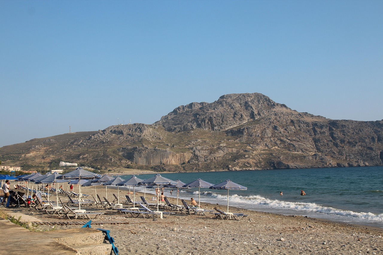
- Preveli beach: a footpath from the car park above down to the mouth of the Megalos Potamos with the palm grove in the river valley.
- CampingSpirit overnight tip
-
Official campsite or RV park: Camping Apollonia at the entrance to Plakias, a few minutes’ walk from the beach: shady pitches, electricity and sanitary facilities. Ask about facilities and the season in advance; Plakias is the base camp for the south coast between Preveli and Agia Galini.
Free camping or nature tip (where legal): The Preveli palm grove is protected and was badly damaged by a fire in 2010; fires, tents and overnight stays on the beach are prohibited. Park in the car park above during the day only.
- Insider tip for campers
- Make the descent to Preveli early in the morning: the way back is a steep climb without shade, and it gets very hot there at midday. Sturdy shoes and at least 1.5 litres of water per person. The Kotsifou and Kourtaliotiko gorges funnel the wind like a nozzle – close the awning and roof vents before parking.
5Stage 5: Plakias to Matala (approx. 80 km)
- The drive
- Via Lefkogia and Asomatos to Spili, then south-east via Akoumia and Agia Galini into the Messara plain with its greenhouses and olive groves, via Tympaki and past the palace of Phaistos to Matala. Winding mountain roads at first, wide and straight on the plain. A good 1.5 hours.
- Highlights & must-sees
- Spili: Venetian fountain with a long row of lion heads in the village centre.
- Minoan palace of Phaistos on a hill above the Messara, plus the villa of Agia Triada a few kilometres further on.
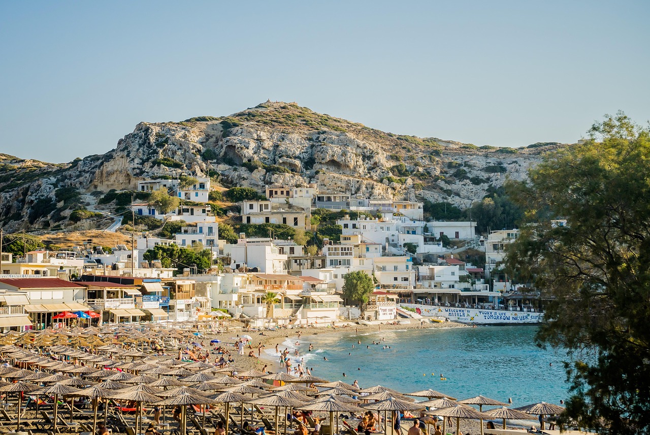
- Caves of Matala: Roman burial chambers carved into the sandstone cliffs, later a hippie meeting place; admission charged.
- CampingSpirit overnight tip
-
Official campsite or RV park: Matala Camping lies right behind the beach at the entrance to the village: simple, with shade under tamarisks, electricity and sanitary facilities. As an alternative along the way: Camping No Problem in Agia Galini. Ask about service points in advance.
Free camping or nature tip (where legal): On the beach and the rocky coast of Matala and in the bay of Kommos (a Natura 2000 site and loggerhead turtle nesting ground), overnight stays outside the campsite are not possible. Don’t go onto the beach at night with lights.
- Insider tip for campers
- The road through Agia Galini is steep and narrow; only drive as far as the upper car park. In the Messara there are supermarkets and petrol stations at normal prices in Tympaki and Moires. Visit Phaistos early in the morning; during heatwaves in recent summers the Ministry of Culture has closed major sites over midday.
6Stage 6: Matala to Gouves via Heraklion and Knossos (approx. 90 km)
- The drive
- Via Pombia to Moires and Agia Deka, then on the north–south road Heraklion–Messara over the pass at Agia Varvara down to Heraklion. The road has been upgraded section by section for years; alongside new stretches, narrow, winding sections with heavy lorry traffic remain. On the outskirts to Knossos, then on the VOAK east to Gouves. About 2 hours.
- Highlights & must-sees
- Gortyn near Agia Deka: Roman city with the Basilica of Titus and the Law Code of Gortyn inscription.
- Palace of Knossos, quietest at opening time in the morning.
- Heraklion Archaeological Museum with the original frescoes from Knossos and the Phaistos Disc.
- CampingSpirit overnight tip
-
Official campsite or RV park: Creta Camping in Kato Gouves, around 17 km east of Heraklion right by the sea: a large site with electricity and sanitary facilities (ask about service points in advance), a good base for the city, Knossos and Lasithi. Scheduled buses run to Heraklion from the main road.
Free camping or nature tip (where legal): In the greater Heraklion area and on the hotel coast between Gouves and Malia, wild parking overnight is frowned upon; many car parks have no-parking signs. Use the campsite for overnight stays.
- Insider tip for campers
- Don’t drive the camper into central Heraklion: heavy traffic, narrow one-way streets, multi-storey car parks with height restrictions. Knossos has a car park on the access road that fills up early in summer. If you arrive in or depart from Heraklion by ferry from Piraeus, you’ll find the port right by the old town; the approach is signposted – allow for queues before the evening ferries.
7Stage 7: Gouves to Sissi via the Lasithi Plateau (approx. 75 km)
- The drive
- From Gouves via Gonies and the Kera Kardiotissa monastery up to around 900 m at the Seli Ambelou saddle, then down onto the Lasithi Plateau and along the ring road via Tzermiado, Agios Georgios and Psychro. Back via Kera and down through Krasi and Mochos to the coast at Malia and on to Sissi. Tight hairpins with crash barriers right at the edge, house corners and balconies in the villages; small motorhomes have a clear advantage. Around 2.5 hours.
- Highlights & must-sees
- Seli Ambelou: the row of old stone windmill stumps on the pass with views over the plateau.
- Dictaean Cave near Psychro, by tradition the birthplace of Zeus – a steep path from the car park, damp and slippery inside the cave.
- Krasi with its mighty old plane tree above the spring on the village square.
- CampingSpirit overnight tip
-
Official campsite or RV park: Camping Sissi on the western edge of Sissi, on the rocky coast between Malia and Milatos: electricity, sanitary facilities, pool; quieter than the neighbouring hotel resorts. Check facilities and the season in advance.
Free camping or nature tip (where legal): The plateau is pasture and farmland, and the farm tracks belong to the farmers. Overnight stays in the car parks at the Dictaean Cave are not intended; during wildfire periods the authorities may close access to mountain areas.
- Insider tip for campers
- Don’t leave the camper standing on the through road in the plateau villages – buses and tractors need the full width. Tzermiado has a bakery, kafenia and a petrol station. On the plateau it is cool in the evenings even in summer; in autumn fog can roll in.
8Stage 8: Sissi to Vai via Agios Nikolaos and Sitia (approx. 135 km)
- The drive
- Via Neapoli to Agios Nikolaos, then on the coast road winding high above the Gulf of Mirabello – with long views, but tight hairpins and a risk of falling rocks – via Pachia Ammos to Sitia and on past Toplou monastery to Vai. The VOAK is being newly built between Neapoli and Agios Nikolaos; the first sections are being opened gradually, and on the remaining stretches you should expect construction traffic. A good 2.5 hours.
- Highlights & must-sees
- Agios Nikolaos with Lake Voulismeni in the centre and a detour to Kritsa to the frescoed church of Panagia Kera.
- Toplou monastery, fortified on a bare plateau east of Sitia, with an icon collection.
- Palm forest of Vai with the Cretan date palm Phoenix theophrasti, and the excavation of Itanos a few kilometres to the north.
- CampingSpirit overnight tip
-
Official campsite or RV park: In the far east there is no official campsite on the route. The nearest option is Camping Koutsou in Koutsounari east of Ierapetra, around 1.5–2 hours’ drive from Vai via Sitia and Lithines to the south coast. If you are taking the ferry from Sitia to Piraeus the next morning (only a few departures a week), park correctly in town the evening before and spend the night in the vehicle without camping behaviour; vehicles over 7.5 m may stand in built-up areas for a maximum of 24 hours at a time, and local bans take precedence.
Free camping or nature tip (where legal): The Vai palm forest is strictly protected: parking only in the paid car park and only during the day; tents and overnight stays are prohibited. The same applies to Itanos and the bay of Kouremenos near Palekastro, where there are no-parking signs in many places.
- Insider tip for campers
- Fill up and do your shopping in Sitia; there are hardly any supplies between Sitia and Vai. Agios Nikolaos has a cramped centre with steep one-way streets; park on the edge of town. For the return trip to the ferry in Heraklion, allow a good 2.5 hours from Sitia on the northern highway.
Camping practice & local rules
Wild camping & overnight parking
- Wild camping is prohibited in Greece (Law 5170/2025): outside licensed campsites, anything that extends beyond the outline of the vehicle counts as camping – awning, table, chairs, barbecue, lowered levelling jacks, washing line. On the spot you face €300 per person, including on beaches, in forests and at archaeological sites.
- Parking is governed by Road Traffic Law 5209/2025 (Art. 38), clarified by a 2026 circular from the Hellenic Police: in built-up areas, motorhomes up to 7.5 m may park without a time limit wherever cars may park, longer motorhomes and caravans for a maximum of 24 hours at a time. Outside built-up areas, parking is permitted in designated areas or on the right-hand edge of the road unless prohibited. According to the police, staying in a correctly parked vehicle, including at night, is not an offence; local bans take precedence.
- Balos, Gramvousa, Elafonisi, Kommos, Preveli and Vai lie in Natura 2000 sites or are specially protected; at Elafonisi, vehicle access to the protected zone is closed. Many formerly popular beach spots now have no-motorhome signs.
- Apps: Campercontact and park4night (read entries critically; many older wild-camping spots are now prohibited). Almost all campsites on Crete are on the coast and are often open only from April to October – ask the site directly about the season.
Waste disposal & supplies
- On Crete, service points are practically only available at campsites; public stations are very rare. Empty the cassette and grey water at a site every two to three days, even if you’re not staying there – ask first.
- Water is scarce on Crete: several municipalities declared water emergencies in recent dry summers, and on campsites tap water is often non-potable. Buy drinking water in 6-litre bottles from the supermarket, use the fresh-water tank sparingly and never drain grey water at the roadside.
- Heat: in July and August, 35 °C and above is common, often more in the south and in the Messara; plus a wildfire risk into October. Allow 3–4 litres of drinking water per person per day and start hikes before 10 am.
- Gas: German exchange cylinders are not swapped. LPG (autogas) is available at a few petrol stations in Chania, Rethymno and Heraklion, less often in the east; refillable tanks usually take the Italian dish adapter. Board the ferry with full cylinders and declare them at check-in as the ferry company requires.
Vehicle size & traffic rules
- Speed limits: motorhomes up to 3.5 t follow the same limits as cars, 90 km/h outside built-up areas, more or less on the northern highway depending on the section – watch the signs. In built-up areas a general limit of 30 km/h has applied since January 2026, 50 km/h on multi-lane or physically separated main roads. Motorhomes over 3.5 t and vehicles with trailers drive slower. The northern highway (VOAK) is accident-prone because it lacks a central reservation and has many junctions; drive especially carefully in the evenings and after festivals.
- The VOAK is the west–east highway along the north coast, not a north–south road: between Chania and Heraklion, the upgrade to a concession motorway (concessionaire GEK Terna) has been under way since early 2026; work is also in progress between Hersonissos and Neapoli and between Neapoli and Agios Nikolaos, and between Kissamos and Chania it has two lanes with a hard shoulder. North and south are linked by mountain roads such as Heraklion–Messara, which is being renewed section by section. Crete is toll-free so far; toll stations are planned once the concession section is complete. Check the current situation before your trip.
- Ferry: Piraeus–Chania (Souda port) runs daily, Piraeus–Heraklion several times a day in season, mostly overnight; Sitia (Piraeus–Cyclades–Dodecanese line) and Kissamos (connection via Kythira to Gythio) are served only a few times a week. The fare depends on vehicle length and sometimes height – give exact dimensions and book early in summer. The vehicle deck is usually not accessible during the crossing: take medication, water and charging cables to your cabin and turn off the gas.
- Alcohol: 0.5 per mille, stricter for new drivers and professional drivers. Phones at the wheel only with a hands-free kit; the new Road Traffic Law provides for high fines and driving bans.
- Wildfire season (May to October): on days of high fire risk (levels 4 and 5 on the daily civil protection map), access to forests, gorges and mountain areas may be closed; barbecues and open fires outdoors are then prohibited. Heed SMS warnings via 112. Goats and sheep on the road are an everyday occurrence in the mountains, especially around bends.
CampingSpirit packing & preparation checklist
- A large fresh-water container (10–20 l) and a supply of drinking water for the west around Elafonisi and the east beyond Sitia, where there are hardly any supplies.
- A sun sail or shade net for your pitch and thermal screens for the windscreen – the midday sun in the Messara and on the south coast heats up the habitation area considerably.
- Sturdy walking boots for the descents to Balos and Preveli and into the Dictaean Cave; water shoes for the sharp rock at Matala and the path to Elafonisi island.
- A reversing camera or a second person to guide you when manoeuvring: in the villages on the Lasithi Plateau and in the Selino hinterland every centimetre counts.
- A fire extinguisher and fire blanket within reach rather than in a storage locker – wildfire season lasts into October.
- A small cool bag for the ferry night with water, food and medication, as the vehicle deck is closed during the crossing.
As of 2026-10. Closures, fees and booking rules change: check official sources before you go.