



In-depth guide · CampingSpirit
From Saugatuck to Mackinaw City: a good 700 kilometres along the eastern shore of Lake Michigan, where you sweep sand out of the sliding door in the morning and watch the sun set over a freshwater sea in the evening.
The spirit of the route
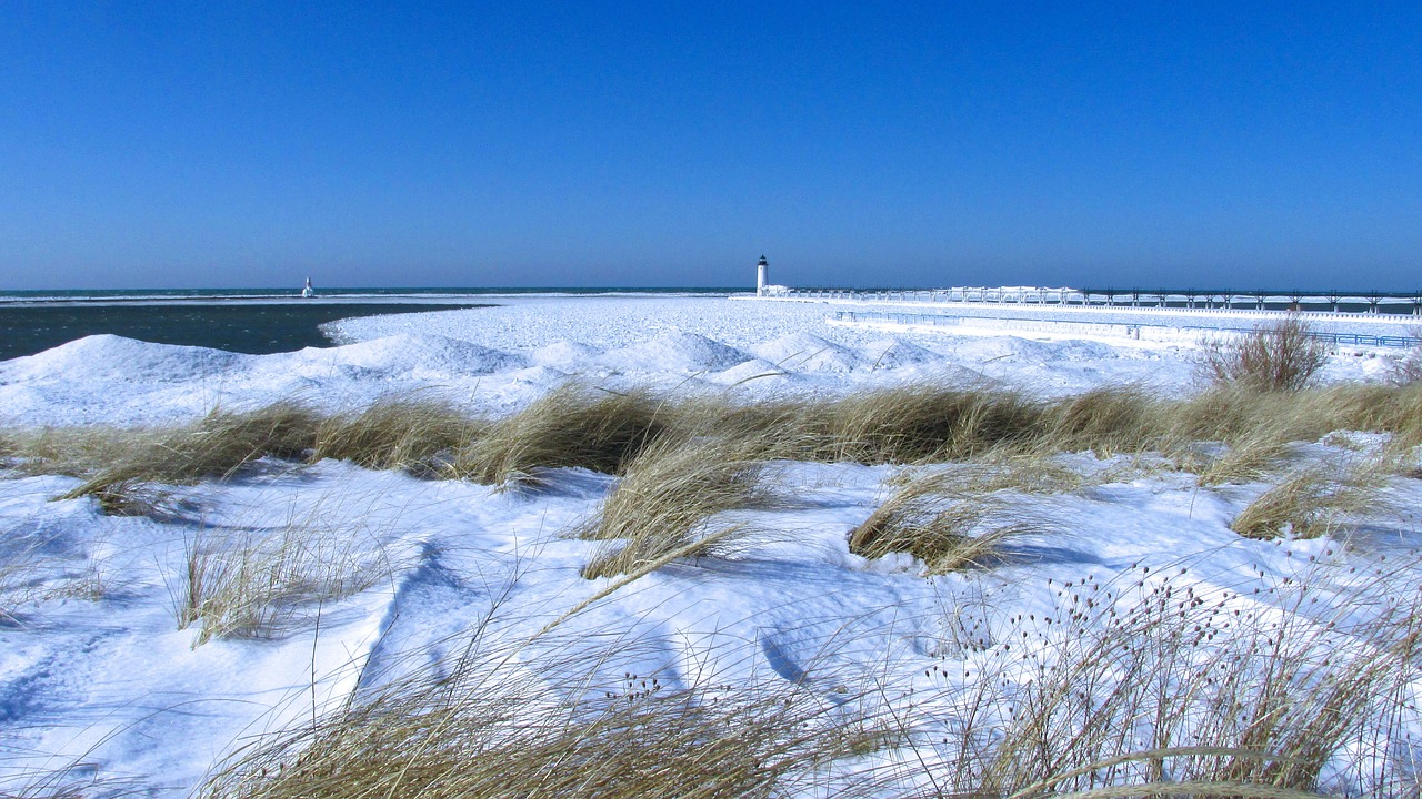
Lake Michigan looks like a sea, yet smells of nothing but water and pines. No salt on your skin, no tide, but waves, currents and a horizon with no far shore. From the open sliding door you look out on white drifting dunes, red-and-white lighthouses at the end of long breakwaters and forests of beech, hemlock and birch that turn yellow and red in October. Every evening campers, anglers and families gather on the piers to watch the sun disappear into the water – on the west coast it is a ritual. In between lie little harbour towns with fudge shops and fish smokehouses, cherry orchards on the Leelanau Peninsula and the bluffs of Sleeping Bear, where you look 100 metres straight down to the beach. The route is leisurely, with short stages and plenty of barefoot time. It still needs planning: in summer the state parks are booked up months in advance, and in 2026 the Tunnel of Trees is only partly passable after flood damage.
Stage-by-stage plan
1Stage 1: Saugatuck to Grand Haven (approx. 60 km)
- The drive
- From Saugatuck and neighbouring Douglas, head north on the Blue Star Highway (a county road parallel to I-196), through orchards and blueberry farms to Holland. From Holland either take US-31 (four lanes, quick, lots of traffic lights in Holland itself) or the slightly slower Lakeshore Avenue, a two-lane road through woods and holiday-home settlements that runs above the dunes to just before Grand Haven. Pure driving time a good hour. In Saugatuck the streets by the harbour are narrow and packed with parked cars in summer; large motorhomes are better parked on the edge of town while you walk in.
- Highlights & must-sees
- Saugatuck: Mount Baldhead, a wooded dune with a long wooden staircase up to a view over the Kalamazoo River, with a path down the other side to Oval Beach. In summer the hand-cranked Saugatuck Chain Ferry crosses the river – a short bit of fun for pedestrians and bikes. If you want peace and quiet, hike through woods and dunes to the beach in Saugatuck Dunes State Park (day use only, no camping).
- Holland: “Big Red”, the red lighthouse at the entrance to Lake Macatawa, is best photographed from the beach of Holland State Park on the north side of the channel. In town, Windmill Island Gardens, with the De Zwaan windmill moved here from the Netherlands, and the Tulip Time Festival in May recall the Dutch founders.
- Grand Haven: The South Pier with two red lighthouses and the historic catwalk is the town’s evening meeting place; on summer evenings the Musical Fountain, a water show with music and lights, plays by the harbour.
- CampingSpirit overnight tip
-
Official campsite or RV park: Grand Haven State Park: sites on asphalt and sand right between the beach and the Grand River, practically all with electricity, modern shower buildings, dump station. You are packed in tightly, but at night you hear the surf and see the lighthouses. Alternative: Holland State Park with two areas, the Lake Macatawa Campground (on the lake, somewhat quieter) and the Beach Campground (on the beach, asphalt). A little further north, P. J. Hoffmaster State Park near Muskegon has sites in the dune forest. For all of them: book through the DNR reservation system up to six months ahead – summer weekends often go on the first day of booking – and you also need a Recreation Passport for the vehicle.
Free camping or nature tip (where legal): In densely populated Ottawa and Allegan County there is no legal free camping. Beach car parks, town parks and state park car parks are closed to overnight stays, and rangers and town police check. If you cannot get a site, fall back on private campgrounds inland or on county parks.
- Insider tip for campers
- Grand Haven, Holland and Saugatuck are full on summer weekends. Come midweek or from mid-September, when the parks have free sites and the beaches are empty. The piers are deadly in heavy waves: if you slip on wet concrete, you can barely get out of the water along the smooth sheet-pile walls. In storms and under a red flag, stay on the beach.
2Stage 2: Grand Haven to Mears (Silver Lake) (approx. 100 km)
- The drive
- North on US-31, a four-lane road largely without intersections, past Muskegon. If you have time, exit at Muskegon for Muskegon State Park and take the Scenic Drive north along the dunes. From Whitehall and Montague the landscape becomes more rural: orchards, asparagus fields around Hart and Shelby, small lakes behind the dunes. Exit at Shelby Road or Hart, then take back roads to Mears and Silver Lake. Pure driving time around 1.5 hours.
- Highlights & must-sees
- P. J. Hoffmaster State Park: The Gillette Sand Dune Visitor Center explains the coastal dune system; from there the Dune Climb Stairway, a long wooden staircase, leads up one of the park’s highest dunes with a view over forest and lake.
- Silver Lake Sand Dunes: Between Silver Lake and Lake Michigan lie around 2,000 acres of open drifting dunes, divided into three zones: a pedestrian area that runs down to the water, the ORV area of around 450 acres where off-road vehicles, dune buggies and quads may drive, and an area for Mac Wood’s Dune Rides, which have been taking visitors through the sand in open vehicles since the 1930s. The ORV area has its own rules: every vehicle on the dunes needs an ORV licence, an ORV Trail Permit and a Recreation Passport as well as an orange safety flag; the area is open from 1 April to 31 October – check opening hours with the DNR beforehand. Needless to say, you do not drive a motorhome in.
- Little Sable Point Lighthouse: Built in 1874, the unpainted brick tower stands alone on the beach south of Silver Lake and at sunset is one of the most beautiful photo subjects on the coast. Tower climbs are seasonal through the local lighthouse association.
- CampingSpirit overnight tip
-
Official campsite or RV park: Silver Lake State Park: modern campground on the landward side of Silver Lake, opposite the dunes, sites with electricity, shower buildings, dump station. In summer the campground is loud and full of ORV riders and families; if you want quiet, come outside the school holidays. Alternatives around the lake are private campgrounds in Mears and Hart, a number of them with full hook-ups.
Free camping or nature tip (where legal): East of US-31 the Huron-Manistee National Forest begins. Dispersed camping outside designated sites is allowed there without a permit unless signs prohibit it: a maximum of 16 days in the same place within 30 days, at least 200 feet (about 60 m) from water; check current fire bans with the forest administration beforehand. The forest roads are sandy – with large motorhomes, stay on surfaced roads.
- Insider tip for campers
- Even if you only want to watch: the sand at the edge of the ORV area is soft, and more than one motorhome driver has got stuck turning on the verge. Park on firm ground in Mears. Buy asparagus and cherries straight from the growers at the farm stands around Hart and Shelby – asparagus in May and June, cherries in July.
3Stage 3: Mears to Manistee (approx. 125 km)
- The drive
- Via Pentwater and US-31 to Ludington (a good 45 minutes), then north on M-116 through forest and along the dunes to the end of the road in Ludington State Park. Back to Ludington and north on US-31 to Manistee, around 45 minutes through forest and fields. With the hike to the lighthouse, a full day. Ludington is home to the dock of the SS Badger, the coal-fired car ferry to Manitowoc in Wisconsin – an option for the return west without crossing Chicago.
- Highlights & must-sees
- Big Sable Point Lighthouse: The black-and-white tower from 1867 stands in the north of Ludington State Park. It can only be reached on foot or by bike via a sand road of just under three kilometres, closed to cars, from the Pines Campground. Tower climbs are seasonal, for a fee, through the local lighthouse association.
- Ludington State Park: Between Lake Michigan and Hamlin Lake lie beach, dunes, forests and the Sable River, on which you can float in a rubber ring from the dam to the lake. The Skyline Trail, a short path with wooden stairs along the crest of a dune, offers views of both bodies of water.
- Manistee: The Riverwalk along the Manistee River leads to the beach and the North Pierhead Light with its catwalk; in the old town, brick buildings from the logging era recall the town’s former wealth.
- CampingSpirit overnight tip
-
Official campsite or RV park: Ludington State Park: three modern areas, Pines, Beechwood and Cedar, with several hundred sites with electricity between them, shower buildings, dump station. One of Michigan’s most popular state parks – for summer weekends, booking early is a must. For Manistee: Orchard Beach State Park north of town on a wooded bluff above the lake, modern sites with electricity, showers, dump station. Because of erosion the beach can no longer be reached from the park; what remains is a viewing platform on the slope. Take the barriers at the edge of the bluff seriously.
Free camping or nature tip (where legal): In the Pere Marquette State Forest and the Huron-Manistee National Forest east of Ludington and Manistee there are numerous basic state forest campgrounds and dispersed camping. For dispersed camping on state forest land the DNR requires a Camp Registration, which you fill in beforehand and display at your site; the length of stay is limited. Check the details on the DNR website.
- Insider tip for campers
- The sand road to Big Sable Point Lighthouse is wide and flat, but hot and shadeless in the midday sun. Go in the early evening, take water and return along the beach. Fresh water and a dump station are available in Ludington State Park; in Ludington itself there are large supermarkets and cheap petrol stations on US-10.
4Stage 4: Manistee to Empire (Sleeping Bear Dunes) (approx. 100 km)
- The drive
- From Manistee take M-110 to Onekama, then head north on M-22, the winding coastal road. Between Arcadia and Elberta it runs high above the lake along steep slopes, with tight bends and few pull-outs. On via Frankfort, Benzonia and Beulah to Honor and along the Platte River into the national park area. Pure driving time a good two hours. M-22 is easy enough to drive in a motorhome, but at weekends it is full of cyclists and day-trippers.
- Highlights & must-sees
- Arcadia Overlook (Inspiration Point): Viewpoint on M-22 south of Arcadia with a wide view of the lake and the Arcadia lake landscape. The car park is small; large motorhomes are better off stopping on the verge where permitted.
- Point Betsie Lighthouse: The white lighthouse with a red roof north of Frankfort stands right on the beach, surrounded by dune grass. Museum and tower are open seasonally.
- Empire Bluff Trail: Around 2.5 kilometres there and back through beech forest up onto a bluff above the lake, with a view north to the Sleeping Bear Dunes and South Manitou Island. At the end, a boardwalk to sit on.
- CampingSpirit overnight tip
-
Official campsite or RV park: Platte River Campground (Sleeping Bear Dunes National Lakeshore): 179 sites, 96 of them with electricity, vehicles up to 40 ft, drinking water, showers, dump station; some walk-in sites for tents. From May to October by reservation only via Recreation.gov – book early. Ten minutes from Platte River Point, where the river flows into the lake. You can get the national park pass at the visitor center in Empire.
Free camping or nature tip (where legal): In the national park, overnight stays outside the designated campgrounds are prohibited, and car parks at trailheads and on the beach are off limits at night too. The only legal free camping is in the Pere Marquette State Forest east of Honor and Interlochen, with a Camp Registration under DNR rules, or at basic state forest campgrounds such as the Platte River State Forest Campground.
- Insider tip for campers
- The national park pass for Sleeping Bear is valid per vehicle and is sold at kiosks, at the visitor center in Empire and online; the America the Beautiful annual pass is also accepted. Since 2026 some national parks charge surcharges for visitors without US residency and have a different annual pass – check current prices on nps.gov. Collected stones, shells and driftwood stay in the park.
5Stage 5: Empire to Northport (approx. 90 km)
- The drive
- From Empire take M-109 to the Pierce Stocking Scenic Drive, the Dune Climb and Glen Haven, then via Glen Arbor onto M-22 north. Beyond Glen Arbor the road runs through forest, past Glen Lake and Little Traverse Lake to Leland, then on through cherry and apple orchards and vineyards on the west coast of the Leelanau Peninsula to Northport. Pure driving time around 1.5 hours; with the Scenic Drive and a dune hike, a full day.
- Highlights & must-sees
- Pierce Stocking Scenic Drive: The one-way road of around 12 kilometres runs at 20 mph across the dune plateau to twelve stops. At the Lake Michigan Overlook (Stop 9) you stand on a sand edge about 140 metres above the lake. The descent is steep, and anyone who makes it down to the shore often needs an hour to climb back up. Trailers are prohibited on the drive and are left in the car park at the entrance; clearance height 13 ft 6 in (4.1 m). Generally open to vehicles from late May to late October.
- Dune Climb: The steep sand slope on M-109 is the classic way into the dunes. If you keep going, the Dunes Trail takes you over just under 3 kilometres of sand to Lake Michigan – three to four hours there and back, no shade, take water.
- Glen Haven and Leland: Glen Haven has a restored general store and the former Sleeping Bear Point life-saving station (Maritime Museum). In Leland lies Fishtown, a cluster of weathered fishing shanties at the river mouth with a fish smokehouse; ferries leave from here for the Manitou Islands.
- CampingSpirit overnight tip
-
Official campsite or RV park: Leelanau State Park (northern tip of the peninsula): basic campground right on the water next to the Grand Traverse Lighthouse, sites without electricity, vault toilets, drinking water, short walks to the pebble beach. Quiet, with dark night skies. Alternative in the national park: D. H. Day Campground near Glen Arbor, around 85 sites in the woods, without electricity and without showers (showers at Platte River Campground), drinking water, vault toilets, dump station; many sites only for shorter vehicles – check length when booking. From mid-May to mid-October by reservation only via Recreation.gov.
Free camping or nature tip (where legal): There is no public forest for dispersed camping on the Leelanau Peninsula. Beach and harbour car parks in Leland, Northport and Glen Arbor are closed at night. Without a reservation, your only option is to ask at the state parks early in the day about cancellations.
- Insider tip for campers
- On the Pierce Stocking Scenic Drive the parking bays at the overlooks are built for cars. Drive early in the morning or late in the afternoon, when motorhomes can find space too. Leland is cramped – park on the edge of town and walk to Fishtown. Cherries are sold at farm stands along M-22 in July, apples and cider in autumn.
6Stage 6: Northport to Charlevoix (approx. 130 km)
- The drive
- On M-22 along the east coast of the Leelanau Peninsula via Suttons Bay to Traverse City, along Grand Traverse Bay with a view of the Old Mission Peninsula. From Traverse City take US-31 north, via Elk Rapids and Eastport, past Torch Lake to Charlevoix. The road is mostly two-lane, flat and well built; in Traverse City expect heavy traffic at rush hour and in July during the National Cherry Festival. Pure driving time a good 2.5 hours.
- Highlights & must-sees
- Old Mission Peninsula: A detour on M-37 through cherry orchards and wineries to Mission Point Lighthouse at the tip of the peninsula, around 60 kilometres there and back from Traverse City.
- Torch Lake: The long, narrow lake east of US-31 shimmers turquoise in the sun; views from the pull-outs along the road between Eastport and Charlevoix.
- Charlevoix: The “Mushroom Houses”, stone houses with organic roof shapes that the architect Earl Young built in the town, lie in a small neighbourhood near the harbour. The channel between Lake Michigan and Round Lake is spanned by a US-31 drawbridge that opens regularly for sailing boats.
- CampingSpirit overnight tip
-
Official campsite or RV park: Fisherman’s Island State Park south of Charlevoix: basic campground with sites in the woods and some right on the beach, without electricity, vault toilets, drinking water. Quiet setting, stony beach with Petoskey stones. Alternatives with electricity: Young State Park on Lake Charlevoix near Boyne City (modern sites, showers) or Traverse City State Park (close to town, on East Grand Traverse Bay, beach reached via a footbridge over US-31).
Free camping or nature tip (where legal): East of Traverse City and around Kalkaska stretches the Pere Marquette State Forest, with basic state forest campgrounds and dispersed camping under DNR rules. Directly on the coast between Traverse City and Charlevoix there is no legal free camping.
- Insider tip for campers
- Traverse City has large supermarkets, petrol stations and repair shops – the last major supply stop before Petoskey. Fill up with water and gas here if you are heading for basic sites such as Fisherman’s Island or Leelanau. For the Mushroom Houses in Charlevoix, leave the motorhome at the harbour; the houses are privately occupied, so only look at them from the street.
7Stage 7: Charlevoix to Mackinaw City (approx. 120 km)
- The drive
- On US-31 along Little Traverse Bay to Petoskey, then on M-119 to Harbor Springs. M-119 north of there, the “Tunnel of Trees”, is a very narrow road with no centre line and no shoulder, with tight bends under a canopy of maple and beech – fundamentally unsuitable for large motorhomes and rigs with trailers. Important for 2026: after washouts caused by flooding in April and at the end of June, M-119 (as of September 2026) is closed to through traffic until further notice between Terpening Road and Robinson Road (Good Hart) and between Island View Road and Cross Village; the detour runs on back roads. For motorhomes the simplest option is US-31 to Pellston and then on to Mackinaw City, a good 1.5 hours from Petoskey; according to the tourist office, Cross Village can be reached via State Road north of Harbor Springs. Check the status with MDOT (MiDrive) before you set off.
- Highlights & must-sees
- Petoskey: The old town on the bluff above Little Traverse Bay, with Bayfront Park. On the beach you can find Petoskey stones, fossilised coral with a honeycomb pattern that shows up best when wet. On state land and the Great Lakes bottomlands anyone may take up to 25 pounds (just over 11 kg) a year; in Sleeping Bear national park, on the other hand, collecting is prohibited.
- Harbor Springs: Small harbour with wooden houses and sailing boats; the southern section of M-119 offers lovely views over the bay – drivable in a small vehicle as far as the closure at Terpening Road.
- Mackinaw City: Old Mackinac Point Lighthouse and the reconstructed fort Colonial Michilimackinac stand right on the Straits of Mackinac. A little west of town lies Headlands International Dark Sky Park, where you can watch the starry sky over the lake at night.
- CampingSpirit overnight tip
-
Official campsite or RV park: Wilderness State Park west of Mackinaw City: modern Lakeshore and Pines areas with electricity, showers and dump station, many sites close to the shore, quiet and dark. Further south, Petoskey State Park between Petoskey and Harbor Springs has two modern campgrounds (Dunes and Tannery Creek) on the beach of Little Traverse Bay – a good base for a day in Petoskey.
Free camping or nature tip (where legal): In the Mackinaw State Forest south and east of Mackinaw City there are basic state forest campgrounds and dispersed camping with a Camp Registration under DNR rules. In Mackinaw City itself, overnight stays on streets and in car parks are not allowed.
- Insider tip for campers
- Looking ahead: the Mackinac Bridge (toll, charged by axles and vehicle class) takes you to the Upper Peninsula, which is covered in a separate guide; Mackinac Island can only be reached by passenger ferry from Mackinaw City, and cars are banned on the island. The ferry companies have large car parks where motorhomes can stand during the day; ask about the fees on site.
Camping practice & local rules
Wild camping & overnight parking
- In Michigan’s state parks and in Sleeping Bear Dunes national park, overnight stays are only allowed on designated sites; day-use areas, beach car parks and trailheads are closed at night. Towns such as Holland, Grand Haven, Traverse City and Petoskey check regularly at night, as do the rangers.
- Legal free camping is possible on state forest land (Pere Marquette, Mackinaw State Forest) and in the Huron-Manistee National Forest. On state forest land the DNR requires a Camp Registration for dispersed camping, displayed visibly at your site; the length of stay is limited. In the national forest you may stay a maximum of 16 days within 30 days in the same place, at least 200 feet (about 60 m) from water; check fire bans beforehand. Many forest roads are sandy.
- Recreation Passport: Every vehicle in a state park (campers included) must have the Recreation Passport. Michiganders pay for it with their vehicle registration; visitors from other states and abroad buy a day pass or a non-resident annual pass at the park entrance or online. Check prices on michigan.gov beforehand.
- State park reservations through the Michigan DNR system up to six months ahead; the popular parks on the coast (Ludington, Holland, Grand Haven, Traverse City, Petoskey) book up quickly. For Sleeping Bear (Platte River, D. H. Day) you book at Recreation.gov.
- Rip currents and structural currents: Lake Michigan claims lives every year, especially on beaches next to piers and breakwaters. Heed National Weather Service wave warnings, respect the flag systems on state park beaches (red means no swimming) and do not go out on piers in heavy waves. If you are caught in a current, swim parallel to the shore.
- Useful apps: iOverlander, Campendium, The Dyrt, Recreation.gov and the Michigan DNR websites. Road conditions and closures from MDOT MiDrive.
Waste disposal & supplies
- Almost all modern state park campgrounds have electricity, showers and dump stations; full hook-ups (water, sewer) are rare. Basic sites such as Leelanau, Fisherman’s Island or D. H. Day have drinking water and vault toilets but no electricity.
- Grey water may not be released onto the ground in Michigan, not even on state forest land; dispose of waste water only at dump stations.
- Drinking water: at all campgrounds; at basic sites from a hand pump or a tap without a hose connection. By mid-October at the latest many parks turn the water off, and some areas close. Check the status on site.
- Gas: Propane is refilled at hardware stores, petrol stations and farm equipment dealers; connections are US standard, and European cylinders are not filled. Rental vehicles have built-in tanks.
- Do not transport firewood over long distances (pests such as the emerald ash borer); buy it locally, at many campgrounds right at the entrance.
Vehicle size & traffic rules
- Speed limit on freeways mostly 70 mph, on some sections (including parts of US-31) 75 mph; lower, separately signposted limits apply to trucks. By law, cars and pickups towing travel trailers may drive at the posted limit, but with a heavy rig a calmer pace is still advisable. On two-lane highways mostly 55 mph, some sections 65 mph, in towns 25–35 mph. Slower vehicles let queues pass at pull-outs.
- Phone ban: Since 2023 it has been illegal in Michigan to hold a mobile phone while driving; hands-free use only.
- Tolls: No motorway tolls on the west coast; the only tolls are the Mackinac Bridge and, further north, the International Bridge to Canada.
- There are no low-emission zones. Turning right on red is allowed unless a sign prohibits it.
- Dimensions and lengths: Many state park sites are designed for large motorhomes, but lengths vary from site to site – check when booking. The Pierce Stocking Scenic Drive does not allow trailers; the Tunnel of Trees (M-119) is unsuitable for large vehicles and partly closed in 2026.
CampingSpirit packing & preparation checklist
- Non-resident Recreation Passport and national park pass – otherwise no access to the state parks or Sleeping Bear.
- Water shoes and a wetsuit: Lake Michigan often only reaches 18–22 °C in August, and after westerly winds it cools sharply along the east shore.
- Doormat with a coarse grid and a hand brush: dune and beach sites bring a lot of sand into the vehicle.
- Head torch with red light for dark-sky nights at Headlands and Wilderness State Park.
- Insect repellent and a mosquito net for the sliding door – in June and July mosquitoes and biting flies are numerous at the forest sites.
- Water container (20 l) and drinking-water-safe hose for basic sites such as Leelanau or Fisherman’s Island.
As of 2026-09. Closures, fees and booking rules change: check official sources before you go.