




In-depth guide · CampingSpirit
From Milwaukee via the Kettle Moraine Scenic Drive, Madison, the Swiss village of New Glarus and Taliesin into the unglaciated valleys along the Kickapoo River, along the oldest rail trail in the USA to the Dells and the quartzite cliffs at Devil’s Lake: around 950 kilometres of hills, farms and lakes.
The spirit of the route
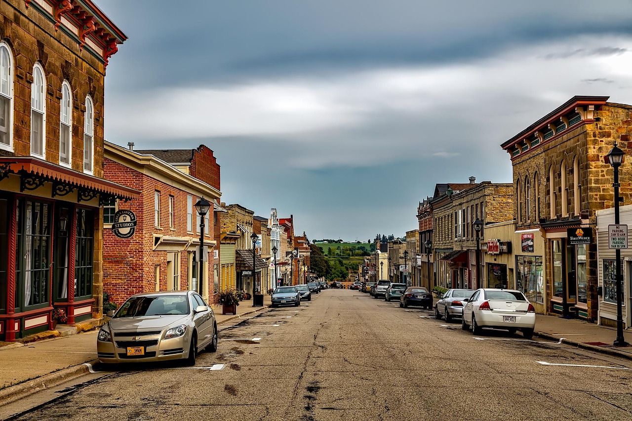
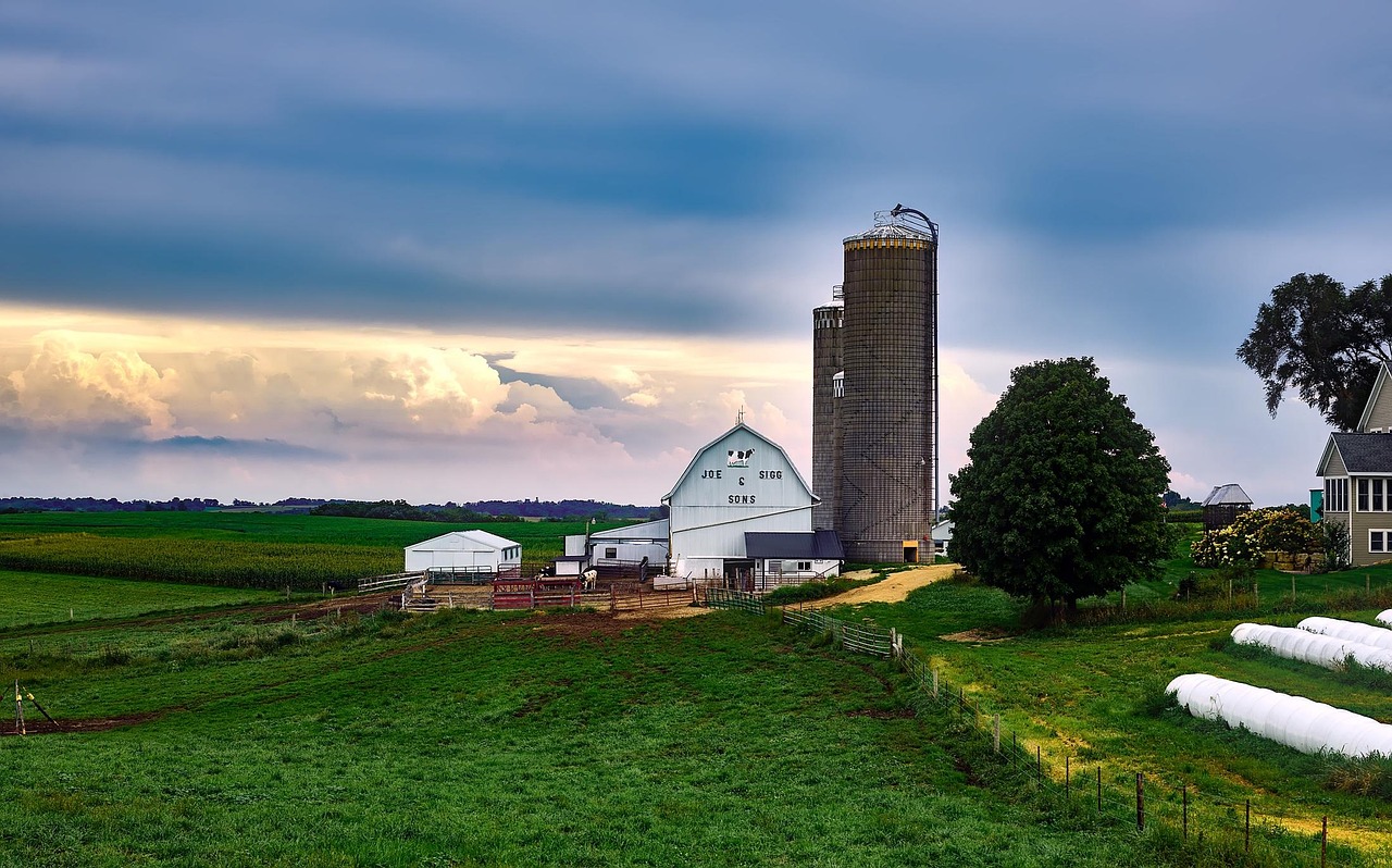
Wisconsin is not flat, even if it looks that way from the interstate. In the east, the ice left behind ridges, kettles and kettle lakes, through which a road marked with green acorn signs winds its way. In the southwest, by contrast, the last ice age made a detour: in the Driftless Area, streams have carved a maze of steep valleys, sandstone outcrops and limestone ridges, topped by red barns, silos and old tobacco sheds. In the morning you look out of the sliding door at mist over the Kickapoo River, hear the clatter of an Amish buggy on the asphalt and smell freshly mown hay. In between lie Frank Lloyd Wright’s hillside house, the Cornish stone cottages of the lead miners, a village that still knows Swiss German, and Friday-night fish fry at the supper club. At the end come sandstone gorges at the Dells and a clear lake between 150-metre quartzite walls.
Stage-by-stage plan
1Stage 1: Milwaukee to Kettle Moraine State Forest – Northern Unit (approx. 95 km)
- The drive
- Leave Milwaukee northbound on the I-43 and from Saukville head west on the WI-33 and WI-28, or more relaxed, take the US-45 and from Kewaskum follow country roads into the Northern Unit. Four lanes with commuter traffic as far as the city limits, then fields, dairy farms and the first wooded moraine ridges. Pure driving time around 1.5 hours; the day really belongs to the city on the lakeshore. Petrol stations and large supermarkets in the suburbs and in West Bend.
- Highlights & must-sees
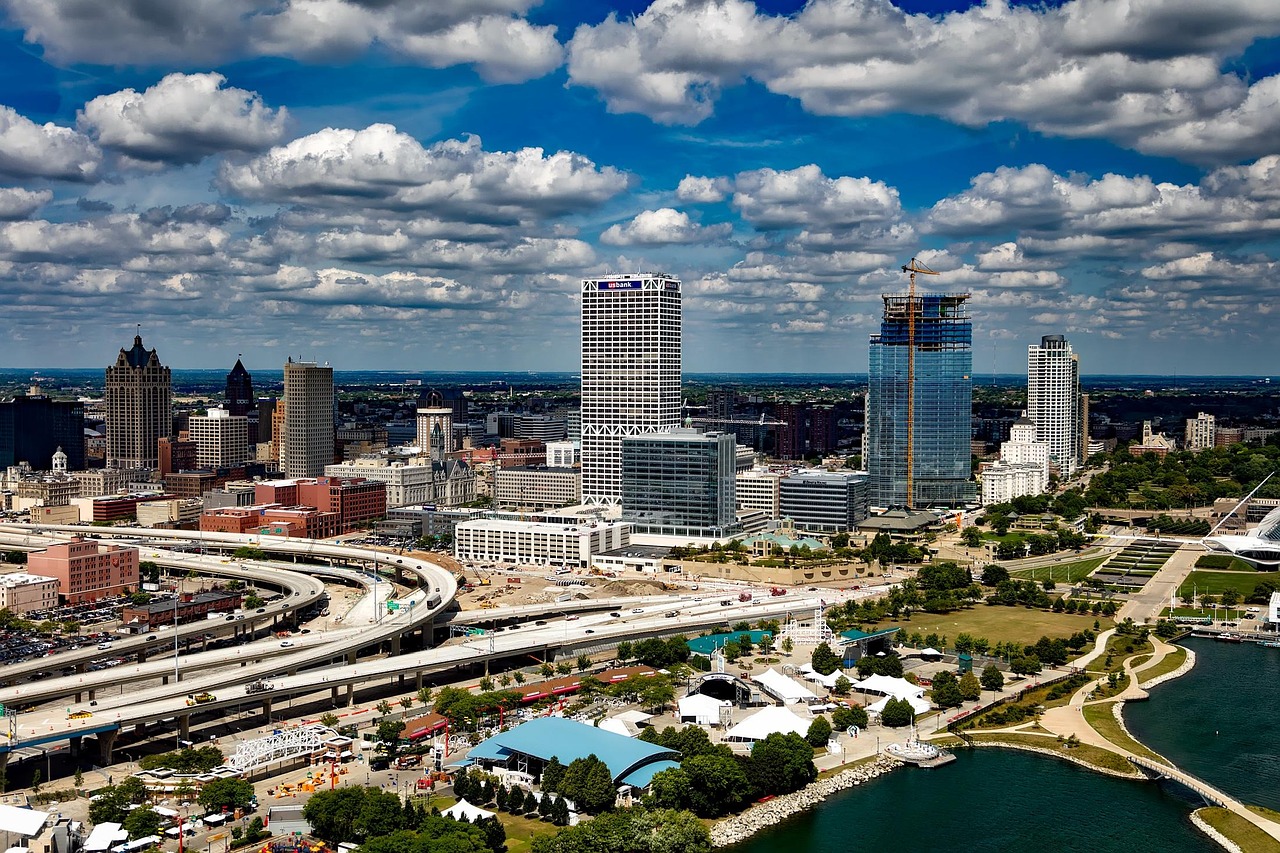
- Milwaukee lakefront: the Milwaukee Art Museum with Santiago Calatrava’s movable wing roof, Lakeshore State Park on a man-made peninsula and the shoreline paths along Lake Michigan. Add to that the Harley-Davidson Museum on the Menomonee River and the old warehouses of the Historic Third Ward.
- Henry S. Reuss Ice Age Visitor Center on the WI-67 near Dundee: exhibition and trails to kames, eskers and kettles – this is where you understand how the Kettle Moraine got its name. Check seasonal opening hours.
- Parnell Tower in the north of the forest: a wooden observation tower on a moraine hill with views over the wooded hill country, in October with maple and oak leaves in red and orange.
- CampingSpirit overnight tip
-
Official campsite or RV park: Mauthe Lake Campground in the Kettle Moraine State Forest – Northern Unit: around 135 sites, about 50 of them with electric hook-ups, shower building, dump station, open year-round, right on the small Mauthe Lake with a swimming area. Alternative in the same forest: Long Lake Campground with around 200 sites, showers and dump station, only from early May to mid-October. Reservations via wisconsin.goingtocamp.com; check the DNR park page for notices about construction work before booking. For a night in the city: Wisconsin State Fair Park RV Park in West Allis.
Free camping or nature tip (where legal): In the Northern Unit, overnight stays are only allowed on the campgrounds; the shelters on the Ice Age Trail are reserved for backpackers with a reservation. Milwaukee and its suburbs prohibit sleeping in vehicles on streets and in car parks.
- Insider tip for campers
- It is best to buy the Vehicle Admission Sticker (a sticker behind the windscreen) at the very first park as a 12-month pass for vehicles with out-of-state plates – with eight stages almost entirely in state parks and state forests, it pays off after just a few days. In Milwaukee most multi-storey car parks have height restrictions; there are open car parks along the lakefront, but on festival weekends at Henry Maier Festival Park there is hardly any space.
2Stage 2: Kettle Moraine State Forest – Northern Unit to Kettle Moraine State Forest – Southern Unit (approx. 150 km)
- The drive
- The Kettle Moraine Scenic Drive links the two forest areas over around 185 kilometres (115 miles) and is marked with green signs bearing an acorn symbol. It follows lettered county roads over the moraine ridges: two lanes, winding and hilly, but without difficult gradients, speed mostly 45–55 mph. Watch for the acorn signs at junctions; they are small and stand at the roadside. Pure driving time around 3.5 hours; with Holy Hill and breaks, a full day. Petrol stations in Kewaskum, West Bend, Hartford and Dousman.
- Highlights & must-sees
- Holy Hill near Hubertus: the Carmelite basilica on the highest hill in the Kettle Moraine; from the tower (open seasonally) the view reaches as far as the Milwaukee skyline on clear days. Large visitor car park, very busy at weekends in October.
- Old World Wisconsin near Eagle: open-air museum of the Wisconsin Historical Society with farmsteads of German, Norwegian, Finnish and other immigrants, relocated here from all over the state. Open seasonally, check dates.
- Southern Unit: hiking trails on the Scuppernong section and the Ice Age Trail along the moraine crest; Lapham Peak State Park near Delafield has an observation tower with views over the lake district.
- CampingSpirit overnight tip
-
Official campsite or RV park: Ottawa Lake Campground in the Kettle Moraine State Forest – Southern Unit north of Eagle: wooded sites on a small lake with a swimming beach, some with electric hook-ups, showers and dump station. Alternatives in the same forest: Pinewoods Campground (also with electric sites) and Whitewater Lake Campground at the southern end of the Scenic Drive. Reservations via wisconsin.goingtocamp.com, up to eleven months in advance; book summer weekends early.
Free camping or nature tip (where legal): The Southern Unit has the same rule: camping only on the campgrounds, overnight stays at trailhead car parks are prohibited. There is no national forest and no BLM land in southeastern Wisconsin.
- Insider tip for campers
- Drive the Scenic Drive on a weekday if you can: on autumn weekends it is full of day-trippers and motorcycles. If you only want to drive one section, take the northern part between Kewaskum and Holy Hill – that is where the moraine landscape is most distinct. In Wisconsin’s state parks, only buy firewood that comes from within 10 miles or is DNR-certified (protection against the emerald ash borer); best buy it at the campground.
3Stage 3: Kettle Moraine State Forest – Southern Unit to New Glarus (approx. 135 km)
- The drive
- Via the I-94, or more quietly via the US-18, west to Madison, which sits on a narrow isthmus between Lake Mendota and Lake Monona. Then on the US-18/151 and the WI-69 south through Green County into dairy and cheese country with gentle hills. Pure driving time around 2 hours. Plenty of petrol stations and supermarkets in the Madison area; in New Glarus a small grocery shop.
- Highlights & must-sees
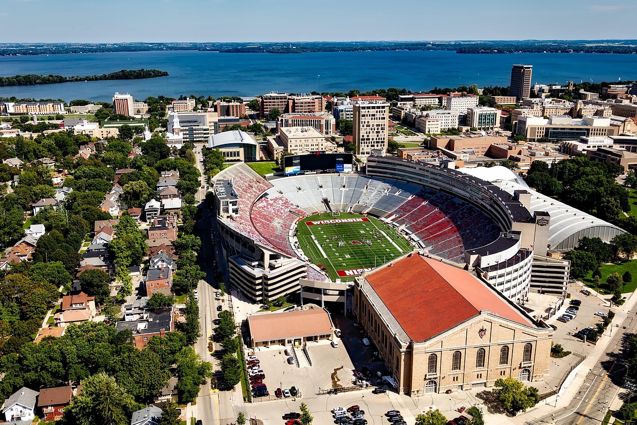
- Wisconsin State Capitol in Madison: granite dome at the end of State Street, free guided tours, observation deck in summer. On Saturdays from spring to autumn the Dane County Farmers’ Market fills the area around Capitol Square, one of the largest farmers’ markets in the USA – with fresh cheese curds that squeak when you bite into them.
- Memorial Union Terrace of the University of Wisconsin: lakeside terrace on Lake Mendota with its colourful sunburst chairs; reachable on foot via State Street.
- New Glarus: founded in 1845 by emigrants from the canton of Glarus, with chalet façades, Swiss flags, bakeries and the New Glarus Swiss Historical Village. The New Glarus Brewing brewery on the hill above the village has a visitor area; its beer is sold only in Wisconsin.
- CampingSpirit overnight tip
-
Official campsite or RV park: New Glarus Woods State Park just south of the village on the WI-69: small wooded park with 18 sites for tents, pop-up campers and small motorhomes plus 14 walk-to tent sites, basic facilities without a dump station; check when booking whether there are electric sites, tight for large motorhomes. Better with full hook-ups: Lake Kegonsa State Park southeast of Madison (family campground with electric sites, showers, dump station) or the Dane County park Lake Farm on Lake Waubesa with electric sites.
Free camping or nature tip (where legal): Madison prohibits overnight stays in vehicles on streets and in municipal car parks, and Green County has no public land for free camping either.
- Insider tip for campers
- Madison’s isthmus centre is hard work for large vehicles: narrow one-way streets, multi-storey car parks with height restrictions, and the market on Saturdays. Better to park on the edge of town and go in by bike or bus. From New Glarus the Sugar River State Trail runs south on an old railway line – here too, cyclists aged 16 and over need the State Trail Pass.
4Stage 4: New Glarus to Spring Green (approx. 110 km)
- The drive
- On the WI-39 west via Hollandale to Mineral Point: two lanes, hilly, through pastures and small woods. Then on the US-151 to Dodgeville and on the WI-23 north over the crest of Military Ridge and down into the valley of the Wisconsin River. Beyond Dodgeville the road becomes more winding, with longer descents. Pure driving time around 2 hours. Petrol stations in Mineral Point, Dodgeville and Spring Green.
- Highlights & must-sees
- Mineral Point: from the 1820s to the 1840s, miners from Cornwall came to dig lead ore and built stone houses into the slopes of Shake Rag Street. The Pendarvis Historic Site of the Wisconsin Historical Society shows some of them; in the town there are galleries and pasties, the miners’ filled pastries.
- Governor Dodge State Park north of Dodgeville: sandstone outcrops, two lakes and the short path to Stephens Falls; a good foretaste of the Driftless Area.
- Taliesin near Spring Green: Frank Lloyd Wright’s home and studio on the hillside above the Wisconsin River, part of the UNESCO World Heritage since 2019. Seasonal tours from the Frank Lloyd Wright Visitor Center on the WI-23, book in advance. In the evening, the American Players Theatre: Shakespeare and classics in an open-air theatre in the woods, season roughly from June into the autumn.
- CampingSpirit overnight tip
-
Official campsite or RV park: Governor Dodge State Park: two campgrounds, Cox Hollow and Twin Valley, with electric sites, showers and dump station; a large park with hiking trails and swimming beaches, around 30 kilometres south of Spring Green. Closer to the theatre: Tower Hill State Park on the Wisconsin River with its reconstructed 19th-century shot tower – a very small, basic campground, hardly suitable for large vehicles. Reservations via wisconsin.goingtocamp.com.
Free camping or nature tip (where legal): On the sandbars and islands of the Lower Wisconsin State Riverway you may camp free of charge for a few nights – but that is canoe camping, not a pitch for your vehicle. There is no legal free-camping option for motorhomes around Spring Green.
- Insider tip for campers
- The American Players Theatre performs in almost any weather; bring a rain poncho, a seat cushion and insect repellent, and the path from the car park to the stage is a steep footpath. If you drive back to the campground after the evening performance, watch for deer on the WI-23 – deer collisions are very common in Wisconsin. The House on the Rock south of Spring Green is a privately built curiosity that counts as a landmark; the car park is big enough for motorhomes.
5Stage 5: Spring Green to Wildcat Mountain State Park (approx. 160 km)
- The drive
- On the US-14 west via Richland Center and through the Kickapoo Valley at Readstown to Viroqua, then to Westby and on the WI-27 and WI-33 via Cashton to Ontario. This is where the real Driftless Area begins: the road alternates between ridge-top drives with wide views and descents into narrow valleys, with crests, blind bends and short, steep downhill stretches. Pure driving time around 3 hours. Petrol stations in Richland Center, Viroqua and Westby; in Amish country much is closed on Sundays.
- Highlights & must-sees
- Richland Center: birthplace of Frank Lloyd Wright, with the A. D. German Warehouse he designed, a brick building with a Maya-style frieze.
- Viroqua and Westby: Viroqua has a lively Main Street and a large food co-op with regional produce; all around stand the long tobacco sheds with hinged slatted walls, a reminder of the tobacco growing of Norwegian immigrants. Westby shows its Norwegian heritage in its bakeries and the ski jump on the edge of town.
- Amish country around Cashton: farms without power lines, buggies at the roadside and small farm shops with baked goods, furniture and baskets, often with the sign “No Sunday Sales”. Do not take photos without permission, and certainly no portraits.
- CampingSpirit overnight tip
-
Official campsite or RV park: Wildcat Mountain State Park near Ontario: family campground on the ridge with showers, dump station and 20 cart-in sites without electricity (luggage carried by handcart up to around 120 metres), plus a separate horse campground. According to differing sources, electricity is available at only a few sites or none at all – check when booking. The access road is steep and has a sharp dip; large motorhomes and long rigs easily scrape. Alternative in the valley: the La Farge village campground with electric hook-ups and dump station.
Free camping or nature tip (where legal): In the Kickapoo Valley Reserve near La Farge there are around 25 basic sites without water or toilets, without reservations but only with a permit from the visitor center or the self-registration stations; about half can be reached by vehicle, not suitable for large motorhomes. There is no real boondocking in the Driftless Area.
- Insider tip for campers
- Amish buggies travel slowly, often with just a lantern or reflective tape instead of the orange triangle; expect them beyond crests and bends, overtake slowly with plenty of distance and do not use your horn – horses shy. Horse droppings on the road are normal here. Fill up with fuel and water in Viroqua; mobile coverage in the valleys is patchy, so download offline maps.
6Stage 6: Wildcat Mountain State Park to Wilton (Elroy-Sparta State Trail) (approx. 70 km)
- The drive
- In the morning on the WI-131 south through the Kickapoo Valley to La Farge and back, then on the WI-131 north to Wilton on the Elroy-Sparta State Trail. A short but winding route through wooded valleys, past sandstone outcrops and small bridges. Pure driving time around 1.5 hours; the day belongs to the canoe or the bike.
- Highlights & must-sees
- Kickapoo River: one of the most meandering rivers in the USA, slow and shallow, between fern-covered sandstone walls. The classic canoe route starts in Ontario; outfitters shuttle boats and paddlers back. After heavy rain the river rises quickly.
- Kickapoo Valley Reserve near La Farge: around 3,500 hectares of forest and valley meadows that became a protected area after the abandoned La Farge dam project; visitor center, hiking trails and rock overhangs.
- Elroy-Sparta State Trail: opened in 1967 as the first rail trail in the USA, around 52 kilometres (32.5 miles) on crushed limestone with three railway tunnels. Tunnel 1 (around 500 metres) lies between Kendall and Wilton, Tunnel 2 (of similar length) between Wilton and Norwalk, and the longest, Tunnel 3 at around 1.2 kilometres, between Norwalk and Sparta. The tunnels are unlit and wet and closed from 1 November to 30 April.
- CampingSpirit overnight tip
-
Official campsite or RV park: Wilton village campground a few blocks south of the trail at the end of East Street; basic sites, some with electricity, ideal as a base for the tunnels. More sites in Norwalk and Elroy directly on the trail. With state-park comfort: Mill Bluff State Park near Camp Douglas among the mesas along the I-90/94, a small campground; check facilities and lengths in advance.
Free camping or nature tip (where legal): Overnight stays in vehicles are not allowed at trail car parks or in the villages; the village campgrounds are cheap and the right choice.
- Insider tip for campers
- Only ride through the tunnels with strong front and rear lights and a jacket – it is cool inside, and water drips from the ceiling. Signs at the portals ask you to walk your bike. Cyclists aged 16 and over need a State Trail Pass (day or annual pass, online from the DNR or at self-pay stations). The restored depot in Kendall houses the trail headquarters with a small railway museum; there is parking there and trail passes are sold.
7Stage 7: Wilton to Wisconsin Dells (approx. 90 km)
- The drive
- On the WI-71 via Kendall to Elroy, then on the WI-82 to Mauston and on the I-90/94, or parallel on country roads, to Wisconsin Dells. Beyond Elroy the hills flatten out and the land becomes sandier, with pines and potato fields. Pure driving time around 1.5 hours. Plenty of petrol stations in Mauston and Lake Delton.
- Highlights & must-sees
- Upper Dells of the Wisconsin River: sandstone walls, mushroom rocks and narrow side gorges; Witches Gulch and Stand Rock can only be reached on the boat tours from Wisconsin Dells. Departures are seasonal, limited in late autumn.
- Mirror Lake State Park: a narrow, sheltered lake between sandstone cliffs, ideal for canoeing and paddleboarding. In the park stands the Seth Peterson Cottage, a small house by Frank Lloyd Wright that you can rent and visit on certain days.
- Rocky Arbor State Park north of town on the US-12: a short loop trail through an old riverbed between mossy sandstone walls, a quiet contrast to the water-park bustle of the Dells.
- CampingSpirit overnight tip
-
Official campsite or RV park: Mirror Lake State Park: several campground areas in the pine forest, some sites with electricity, showers and dump station; just a few minutes from the bustle of the Dells, yet quiet. Rocky Arbor State Park has a small campground that is open only in summer. Both via wisconsin.goingtocamp.com; book early in summer.
Free camping or nature tip (where legal): Wisconsin Dells and Lake Delton prohibit overnight stays in vehicles on streets and in car parks; the car parks of the boat tours and water parks are patrolled too.
- Insider tip for campers
- Parking large vehicles on Broadway in Wisconsin Dells is difficult; the boat tours have their own car parks by the river. Mirror Lake is a no-wake lake without motorboat waves – canoe hire in the park. In the evening, eat at one of the area’s supper clubs; Friday is traditionally fish fry, Saturday prime rib, with a Brandy Old Fashioned on the side.
8Stage 8: Wisconsin Dells to Madison (approx. 110 km)
- The drive
- On the US-12 south to Baraboo, then via the WI-123 to the north shore of Devil’s Lake and through the park to the south shore. Then on the WI-113 via the Merrimac ferry across Lake Wisconsin and via Lodi to Madison. Around Devil’s Lake the access roads are steep, with tight bends on the south side. Pure driving time around 2 hours, a full day with a hike and Circus World; best to spend the night at Devil’s Lake and drive on to Madison the next morning.
- Highlights & must-sees
- Circus World in Baraboo: museum on the site of the former winter quarters of the Ringling Brothers, who founded their circus in Baraboo in 1884; a collection of circus wagons and, in summer, performances under the big top. Seasonal opening hours.
- Devil’s Lake State Park: a clear lake between quartzite walls around 150 metres high, Wisconsin’s most visited state park. The East Bluff with Devil’s Doorway and the steep Balanced Rock Trail over talus are the classics; the Ice Age Trail runs along the ridge.
- Merrimac ferry: the small car ferry on the WI-113 across Lake Wisconsin is free and runs around the clock in season from spring until the lake freezes; the crossing takes about seven minutes, expect waits on summer weekends.
- CampingSpirit overnight tip
-
Official campsite or RV park: Devil’s Lake State Park: three campgrounds with over 400 sites: Quartzite (year-round) and Northern Lights with many electric sites, Ice Age without electricity only; showers and dump stations are closed from roughly mid-October to mid-April. Fully booked far in advance at weekends from spring to autumn – reserve early via wisconsin.goingtocamp.com. For the last night in Madison: Lake Farm County Park or Lake Kegonsa State Park.
Free camping or nature tip (where legal): At Devil’s Lake and in the Baraboo Hills, overnight stays outside the campgrounds are prohibited; the car parks at the bluffs are closed at night. The waiting lane for the Merrimac ferry is not a place to stay overnight either.
- Insider tip for campers
- On summer and autumn weekends the car parks at Devil’s Lake are full by mid-morning; arrive early or hike on a weekday. The Balanced Rock Trail is a rock staircase – sturdy shoes and both hands free; dogs must stay on a lead in the park. North of Baraboo, the International Crane Foundation shows all the world’s crane species, a quiet detour for wildlife lovers.
Camping practice & local rules
Wild camping & overnight parking
- Southern and southwestern Wisconsin have no BLM land and no national forest; dispersed camping is practically impossible on this route. State parks and state forests only allow overnight stays on designated campgrounds; shelters on the Ice Age Trail are for backpackers with a reservation. The county forests in the north with free camping lie far off this route.
- Exceptions for paddlers: you may camp for a few nights on sandbars and islands of the Lower Wisconsin State Riverway; the Kickapoo Valley Reserve has basic sites with a permit. Both are back-to-nature camping, not vehicle camping.
- Cities such as Milwaukee, Madison, Wisconsin Dells and Baraboo prohibit sleeping in vehicles on streets and in public car parks. Interstate rest areas are for taking a break; camping there is prohibited and the length of stay is limited – follow the signs. Supermarket and department store car parks only with the store’s permission.
- Vehicle Admission Sticker: in all state parks, state forests and recreation areas – including the campgrounds – every vehicle needs a sticker. There are daily and 12-month passes, at higher prices for vehicles with out-of-state plates (current fees from the DNR); available online in the DNR shop, at park offices and at kiosks by credit card. The sticker goes on the inside of the windscreen; if you pay without one, you pay a surcharge.
- Reservations: Wisconsin State Parks via wisconsin.goingtocamp.com or by phone, up to eleven months in advance. Devil’s Lake, Mirror Lake and the Kettle Moraine book up quickly on summer and autumn weekends; village and county campgrounds have their own systems.
- Apps: Campendium, iOverlander, The Dyrt and the Wisconsin State Parks booking site; Park4Night is hardly used here.
Waste disposal & supplies
- Dump stations: on almost all state park campgrounds (Mauthe Lake, Long Lake, Ottawa Lake, Governor Dodge, Lake Kegonsa, Wildcat Mountain, Mirror Lake, Devil’s Lake) and on many village campgrounds such as La Farge. Primitive sites in the Kickapoo Valley Reserve have neither water nor toilets.
- Drinking water: taps on the campgrounds; tap water is drinkable, and some pumps in parks are shut off in late autumn.
- Empty grey water and chemical toilets only at dump stations; draining onto the ground is prohibited, and in the karst valleys of the Driftless Area wastewater quickly reaches the groundwater.
- Propane: petrol stations, farm supply stores, DIY stores and many campgrounds fill US cylinders; European cylinders are usually not filled. There are no tunnels with a propane ban on the route.
- Electricity: electric sites in state parks with varying amperage (stated when booking); not every campground has them, and at Wildcat Mountain or New Glarus Woods they are scarce or absent.
- Shopping: large supermarkets in Milwaukee, West Bend, Madison, Dodgeville, Richland Center, Viroqua, Tomah and Wisconsin Dells; cheese and cheese curds at the Green County cheese factories and at almost every petrol station. In Amish country there are hardly any shopping options on Sundays.
Vehicle size & traffic rules
- Speed limits: interstates mostly 70 mph, four-lane highways 65 mph, two-lane country roads mostly 55 mph, through towns 25–35 mph. There are no separate limits for motorhomes and rigs, but the Driftless roads with their crests and descents force you to drive considerably slower anyway.
- Tolls: Wisconsin has no toll roads. If you arrive via Chicago, you drive on the tolled Illinois Tollways (E-ZPass or I-PASS, otherwise pay online afterwards); with rental vehicles, clarify the toll arrangement in advance.
- Phones at the wheel: writing and reading messages is prohibited; in work zones, at utility work sites and at emergency scenes, as well as 500 feet before them, any hand-held phone use is prohibited (except for emergency calls). The move-over law applies to emergency, breakdown and maintenance vehicles with warning lights.
- Slow vehicles: Amish buggies, tractors and farm machinery are on all country roads in the Driftless Area, often without conspicuous markings and at night with only a lantern. Overtake carefully and with plenty of distance, do not use your horn.
- Wildlife: Wisconsin has one of the highest numbers of deer collisions in the USA, mainly with white-tailed deer at dusk and during the autumn rut. Drive more slowly at night.
- Weather: from May to August severe thunderstorms, hail and tornado warnings are possible; in the narrow valleys streams rise quickly after heavy rain. From mid-October nights are frosty and many campgrounds shut off the water; the tunnels on the Elroy-Sparta Trail are closed from 1 November.
- Emergency: 911. Mobile coverage is patchy in the valleys of the Driftless Area and along the Kickapoo River.
CampingSpirit packing & preparation checklist
- A strong head torch or front and rear bike lights, plus a rain jacket: in the unlit, dripping tunnels of the Elroy-Sparta Trail you otherwise cannot see your hand in front of your face.
- Tick remover, tick protection and repellent: ticks carrying Lyme disease are widespread in Wisconsin’s forests, and by the lakes and on the Kickapoo mosquitoes join them in summer.
- Wheel chocks and levelling ramps: many pitches in the Driftless Area and at Wildcat Mountain are on a slope.
- Waterproof dry bag for phone and documents: for the canoe trip on the Kickapoo and paddling on Mirror Lake.
- Sturdy hiking boots with good tread: the Balanced Rock Trail and the bluffs at Devil’s Lake lead over sharp-edged quartzite talus.
- A cool box with room for cheese: cheese curds, Swiss cheese from Green County and bread from the Amish farm shops need to stay fresh all the way to the campground.
As of 2026-10. Closures, fees and booking rules change: check official sources before you go.