

In-depth guide · CampingSpirit
Around 520 km from Umag via the hill towns of Grožnjan and Motovun, Poreč, Rovinj, Pula and Cape Kamenjak to Labin, along the coast road to Opatija, over the bridge to Krk and by ferry to Cres and Lošinj – peninsula and islands in a single arc.
The spirit of the route
Istria has two faces, and you often see both from the same pitch. Below, the sea, smooth-polished limestone, pine forest down to the waterline, Venetian bell towers above harbour towns. Above, “green Istria”: hills with vineyards and olive groves, red earth, villages on hilltops where in the evening only the swallows are still loud and in autumn people go hunting for truffles. Then the landscape grows rougher: Labin on its rocky ridge, the steep coast beneath the Učka massif, the old villas of Opatija. Over the bridge to Krk, by ferry across to Cres, where dry-stone walls run over bare slopes and griffon vultures circle above the cliffs. In the morning you open the sliding door, and between the pines lies the Kvarner Gulf, grey-blue in the first light, the islands behind it like staggered stage sets. A journey in short stages, with plenty of time for the water.
Stage-by-stage plan
1Stage 1: Umag to Motovun (approx. 60 km)
- The drive
- From Umag along the coast road to Novigrad, then inland via Buje and on narrow minor roads to Grožnjan, continuing through the Mirna valley to Motovun. The first 15 km are flat along the coast, after that hilly with tight bends; the last kilometres to Grožnjan are narrow, and oncoming traffic means pulling over. Around 1.5 hours of pure driving time.
- Highlights & must-sees
- Savudrija lighthouse north of Umag: built in 1818 and one of the oldest lighthouses still in operation on the Adriatic; rocky shore for swimming right next to it.
- Novigrad: old town on a peninsula with remains of the town wall, a lapidarium and a waterfront promenade by the small fishing harbour.
- Grožnjan: artists' village on a hilltop ridge with studios, galleries and a summer academy for young musicians; views across the Mirna valley to the sea.
- CampingSpirit overnight tip
-
Official campsite or RV park: Motovun Camping lies at the foot of Motovun's hill – a small, terraced site with electricity, toilets and showers, and water and waste disposal; few pitches, so book ahead in season. If you start on the coast, you'll find the large sites Park Umag, Stella Maris and Finida near Umag (all fully equipped, season roughly April to October).
Free camping or nature tip (where legal): Wild camping is prohibited throughout Croatia (see Camping in practice). Inland there are fewer checks than on the coast, but overnight stays at viewpoints and in the car parks of Grožnjan and Motovun are still not allowed.
- Insider tip for campers
- In Grožnjan and Motovun, motorhomes stay in the car parks on the edge of town; the old towns are closed to traffic or too narrow. The route of the former Parenzana narrow-gauge railway (Trieste–Poreč) is now a cycling and walking trail and passes both places – a good stretch for a day without driving. In autumn (roughly October/November), konobas in the Mirna valley serve dishes with white truffle.
2Stage 2: Motovun to Rovinj (approx. 70 km)
- The drive
- From Motovun via Karojba and Višnjan to Poreč, then south via Vrsar and around the end of the Limski kanal to Rovinj. Hilly country roads with little traffic as far as Poreč, then coastal traffic; the road around the Lim Fjord goes inland past its head. Around 1.5 hours.
- Highlights & must-sees
- Poreč: the Euphrasian Basilica (UNESCO World Heritage) with 6th-century Byzantine gold mosaics, and the Roman main axis, the Decumanus, through the old town.
- Limski kanal: a narrow sea inlet around 10 km long between wooded slopes; viewpoint with stalls on the road above, mussel and oyster farming below.
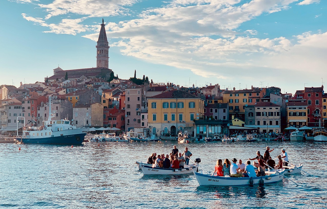
- Rovinj: old town on the former island with the Church of St Euphemia at the top and the steep lane Grisia; the Zlatni rt (Punta Corrente) forest park south of town.
- CampingSpirit overnight tip
-
Official campsite or RV park: South of Rovinj lie the Maistra sites Polari and Veštar, north of town Amarin – all with electricity, toilets and showers, and water and waste disposal, season roughly April to October. Near Poreč there are, among others, Bijela Uvala and Zelena Laguna south of town.
Free camping or nature tip (where legal): Rovinj and Poreč check coastal car parks rigorously; sleeping in your motorhome outside campsites is not allowed, and many car parks carry explicit overnight bans for motorhomes.
- Insider tip for campers
- The best way into Rovinj's old town is on foot or by bike from the campsite; parking with room for motorhomes is scarce and expensive in season. For the Lim Fjord, a boat trip from Rovinj or Vrsar is worthwhile, because the shore itself is hardly accessible.
3Stage 3: Rovinj to Premantura (Cape Kamenjak) (approx. 55 km)
- The drive
- From Rovinj inland via Bale onto the A9 motorway (Istrian Y, tolled) or parallel on the D21 country road south to Pula, then via Medulin to Premantura at Istria's southern tip. Flat country with olive groves and stone walls, city traffic in Pula. Around 1 hour.
- Highlights & must-sees
- Pula: the 1st-century amphitheatre (Arena), one of the best preserved in the Roman world, plus the Temple of Augustus on the forum and the Arch of the Sergii.
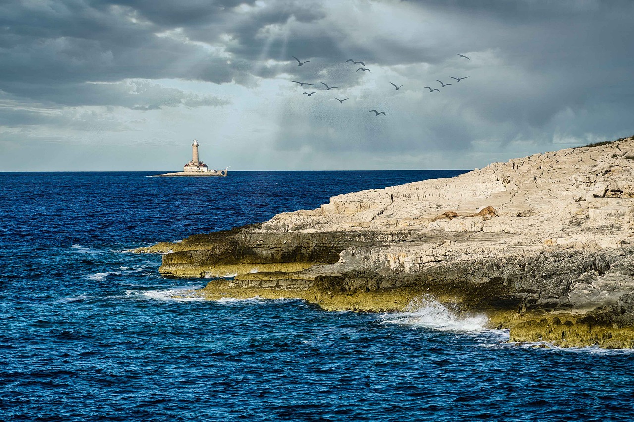
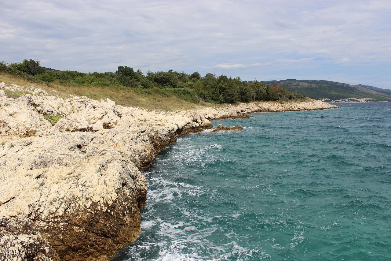
- Cape Kamenjak (Rt Kamenjak): protected headland with rocky coves, maquis and dinosaur footprints in the shoreline rock; views of the Porer lighthouse off the coast.
- Fažana north of Pula: departure point for boats to Brijuni National Park.
- CampingSpirit overnight tip
-
Official campsite or RV park: In Premantura, Arena Stupice and Arena Runke lie right before the cape, near Medulin Arena Medulin; near Pula Arena Stoja on a peninsula with a rocky shore. Facilities include electricity, toilets and showers, and water and waste disposal; season mostly spring to autumn.
Free camping or nature tip (where legal): Kamenjak is a protected area: overnight stays are prohibited there. Motor vehicles pay an entrance fee in season, campers considerably more than cars; the gravel tracks are narrow, dusty and ill-suited to large motorhomes (check current prices and rules with the protected-area administration).
- Insider tip for campers
- Take the bike from the campsite for Kamenjak: from Premantura the coves are 20 to 40 minutes away, and the gravel tracks are dusty and shadeless in the heat – bring water. In Pula it's better to park motorhomes on the outskirts and take the bus into the centre.
4Stage 4: Premantura to Labin / Rabac (approx. 60 km)
- The drive
- From Premantura back towards Pula and on the D66 north-east via Barban and through the Raša valley to Labin, then steeply down to Rabac. The D66 is well built, with a bridge over the bay in the Raša valley; the descent to Rabac has hairpins and gradients. Around 1 hour 15 minutes.
- Highlights & must-sees
- Labin: old town on a rocky ridge with Venetian palazzi, a town museum with a reconstructed mine gallery and the Fortica viewpoint above the Kvarner Gulf.
- Raša: 1930s miners' town with a church shaped like an upturned mine cart.
- Rabac: former fishing village below Labin with pebble coves and a shoreline path.
- CampingSpirit overnight tip
-
Official campsite or RV park: In Rabac, Camping Oliva lies right in the village; south of it on the coast, Marina near Sveta Marina and, further south, Tunarica – all with electricity, toilets and showers, and water and waste disposal. Check the season and the minimum stay in high season beforehand.
Free camping or nature tip (where legal): The nationwide ban applies here too; the coastal car parks in Rabac are closed to motorhomes at night or paid with time limits.
- Insider tip for campers
- The road to Sveta Marina is narrow and winding, with oncoming traffic on hairpins – better to drive in the morning. You don't drive into Labin's old town; instead you park below in the new district of Podlabin and walk up.
5Stage 5: Labin to Opatija (approx. 55 km)
- The drive
- From Labin on the D66 via Plomin along the steep coast beneath the Učka massif via Brseč, Mošćenička Draga and Lovran to Opatija. Winding, in places with a rock face on one side and a drop on the other, but well built; narrow and busy in the Riviera towns. Around 1.5 hours. The alternative via the A8 motorway and the Učka Tunnel is faster, but tolled and without sea views.
- Highlights & must-sees
- Plomin: old little town on a rocky spur above the bay of the same name, with a church and views to Cres.
- Mošćenice: hill village above Mošćenička Draga with a town gate, an old olive mill and views over the Kvarner Gulf; stepped path down to the pebble cove.
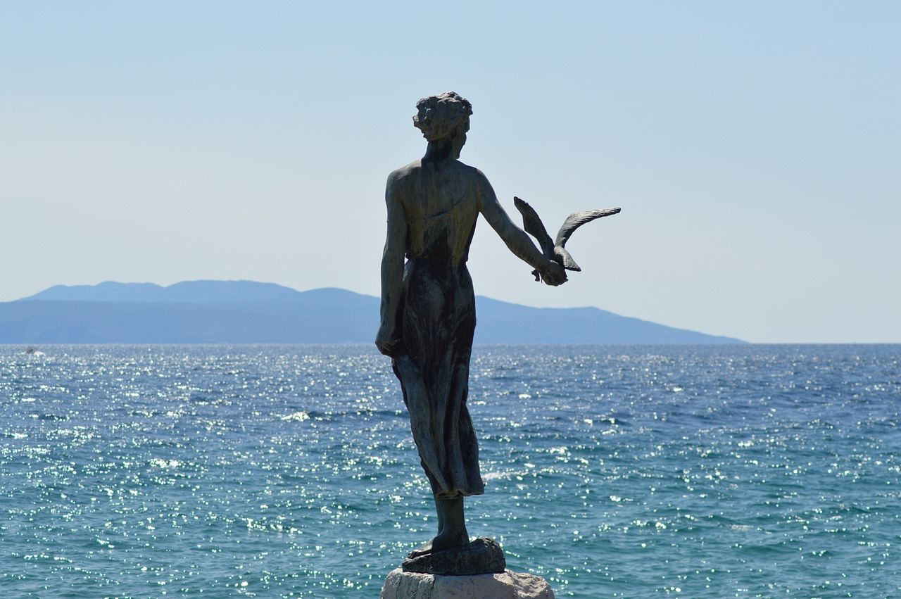
- Lungomare: around 12 km of waterfront promenade between Volosko and Lovran, past the Austro-Hungarian villas and the park of Villa Angiolina in Opatija.
- CampingSpirit overnight tip
-
Official campsite or RV park: Autocamp Medveja lies between Lovran and Mošćenička Draga in a bay by the sea; Camping Opatija is at Ičići south of Opatija. Both have electricity, toilets and showers, and water and waste disposal; the pitches are partly small and terraced, so state your length when booking.
Free camping or nature tip (where legal): On the Opatija Riviera there are practically no legal places to stay overnight outside the campsites; the municipal wardens and police check regularly.
- Insider tip for campers
- Driving through Opatija in a motorhome isn't worth it: the main road is narrow and there is no parking for long vehicles. From the campsite you can reach Opatija on foot along the Lungomare or by bus. In October, Lovran celebrates Marunada, the sweet chestnut festival.
6Stage 6: Opatija to Krk (town) (approx. 60 km)
- The drive
- From Opatija via the Rijeka bypass (A7 motorway, toll-free in sections) or the coast road to Kraljevica, over the Krk Bridge onto the island and on the D102 south to the town of Krk. The bridge is toll-free; during bora it is closed to high-sided vehicles and vehicles with trailers. Around 1 hour.
- Highlights & must-sees
- Vrbnik: village on a cliff on the east coast, home of the white wine Žlahtina; narrowest lane and views across the Velebit mountains.
- Krk (town): Frankopan castle, cathedral and town walls by the harbour.
- Košljun: Franciscan monastery on a tiny island in the bay of Punat, reachable by water taxi.
- CampingSpirit overnight tip
-
Official campsite or RV park: On the edge of Krk town lie Krk Premium Camping Resort and the motorhome stopover Camper Area Felix; in Punat Camping Pila near the village, plus Camping Ježevac on the western edge of Krk town. Electricity, toilets and showers, and water and waste disposal available; the stopover is a cheaper alternative for short stays.
Free camping or nature tip (where legal): On Krk the wild-camping ban is enforced especially at swimming coves and in the harbour towns; many coves have barriers or height restrictions.
- Insider tip for campers
- For the ferry to Cres the next morning, Krk town is ideal: Valbiska harbour is around 12 km away. The approach to Vrbnik is steep; don't drive into the village itself but park in the car park at the top by the village entrance. Baška, with the Church of St Lucy in Jurandvor (where the glagolitic Baška tablet was found), is a worthwhile detour with bends over a pass.
7Stage 7: Krk to Mali Lošinj (approx. 72 km)
- The drive
- From Krk to Valbiska, by ferry (Jadrolinija, around 25 minutes) to Merag on Cres, then on the island road D100 south along the island's spine to Osor and over the swing bridge onto the island of Lošinj to Mali Lošinj. The D100 is mostly wide enough, but winding and exposed to wind; occasionally narrow through villages. Around 1.5 hours plus waiting time at the ferry.
- Highlights & must-sees
- Osor: small stone town on the Kavuada channel that separates Cres from Lošinj; cathedral, sculptures in the lanes and summer concerts.
- Mali Lošinj: harbour town with captains' houses and the Museum of Apoxyomenos, an ancient bronze statue recovered from the sea off Lošinj.
- Veli Lošinj: smaller harbour next door with a church and a dolphin research centre; shoreline path through pine forest from Čikat.
- CampingSpirit overnight tip
-
Official campsite or RV park: Camping Čikat lies in pine forest on Čikat bay near Mali Lošinj, with electricity, toilets and showers, and water and waste disposal. On the way are Camping Bijar near Osor and Autokamp Slatina in Martinšćica on the west coast of Cres.
Free camping or nature tip (where legal): The same ban applies on Cres and Lošinj; the islands are also a protected area for griffon vultures and dolphins, and wild camping at coves is penalised.
- Insider tip for campers
- The Osor swing bridge opens twice a day for boats (according to local information at 9 am and 5 pm); traffic then stops for a while. In high season vehicles queue at Valbiska, so arrive early in the morning; tickets are available at the harbour, online or via the Jadrolinija app, and the price depends mainly on vehicle length.
8Stage 8: Mali Lošinj to Brestova (mainland) (approx. 90 km)
- The drive
- Back via Osor on the D100 north, detour to Lubenice, then via the town of Cres to the ferry port of Porozina at the northern tip and by ferry (Jadrolinija, around 20 minutes) to Brestova on the mainland between Brseč and Plomin. Winding island road over bare plateaus, Lubenice via a narrow spur road. Around 2 hours plus ferry.
- Highlights & must-sees
- Lubenice: village on a 378 m high cliff above the west coast of Cres, with Sveti Ivan cove below, reachable only on foot.
- Cres town: Venetian harbour with a loggia, town gate and clock tower.
- Beli: village in the north of the island with a visitor and rehabilitation centre for griffon vultures (Javna ustanova Priroda; check opening times beforehand); dry-stone walls and an old stone arch at the village entrance.
- CampingSpirit overnight tip
-
Official campsite or RV park: In Cres town, Camping Kovačine lies on the shore south-west of the harbour, with electricity, toilets and showers, and water and waste disposal – ideal for catching the ferry in the morning. On the mainland, the sites from stage 5 (Medveja, Opatija) are half an hour from Brestova.
Free camping or nature tip (where legal): Lubenice and Beli only have small car parks; overnight stays there are neither intended nor allowed.
- Insider tip for campers
- The road to Lubenice is narrow; at the top you park before the village. The road to Beli is narrow with hairpins – better skipped in motorhomes over 7 m. Lake Vrana (Vransko jezero) in the middle of the island supplies Cres and Lošinj with drinking water; swimming and access are prohibited there.
Camping practice & local rules
Wild camping & overnight parking
- In Croatia, camping and sleeping in a motorhome outside registered campsites is prohibited nationwide; this also applies to car parks, harbours, coves and forest tracks. Unlike in Italy, there is no distinction between parking and camping that would allow wild camping.
- Checks are carried out by the police and municipal wardens (komunalno redarstvo), on the coast and the islands in season often at night too; fines range, depending on the regulation and municipality, from a few hundred to over a thousand euros. Many car parks also carry signs banning motorhomes overnight.
- Protected areas such as Cape Kamenjak, Učka Nature Park, the griffon vulture areas on Cres and the Lim Fjord have their own access and stay rules; vehicles stay in the marked car parks.
- Official motorhome stopovers are rare in Istria and Kvarner; the gaps are filled by campsites, many of which offer short stays and stopover prices in the low season. Apps: park4night, Campercontact and the website of the Croatian Camping Union (camping.hr).
Waste disposal & supplies
- Water and waste disposal is available almost only at campsites; some sites also let passing vehicles empty for a fee. Public service points are rare.
- Never empty grey water or the cassette into nature or storm drains: on the karst ground everything seeps into the groundwater and the sea.
- Tap water in Istria and Kvarner is drinkable; on the islands water is scarce in high summer – fill up and shower sparingly.
- Gas: German exchange cylinders are not exchanged. LPG (“autoplin”) is available at many filling stations; for refillable cylinders and gas tanks, usually bring the Dish adapter (as in Italy). Arrive with two full cylinders.
- Since 2023 the euro has been the national currency and Croatia part of the Schengen Area – Slovenia does, however, intermittently reintroduce checks at its border with Croatia, so keep your ID to hand. Card payment is widespread; carry cash for fish stalls and konobas.
Vehicle size & traffic rules
- Speed limits: motorhomes up to 3.5 t 50 in built-up areas, 90 outside, 110 on expressways, 130 km/h on motorways; over 3.5 t and vehicles with trailers 80 outside built-up areas, 90 km/h on motorways.
- Tolls: the Istrian Y (A9 Umag–Pula, A8 Kanfanar–Učka Tunnel–Matulji) is operated by the concession company Bina Istra; the Učka Tunnel is a separate, noticeably expensive toll section. Motorhomes higher than 1.90 m above the front axle fall into category II. Payment is by cash, card or ENC transponder; Croatia is gradually switching to barrier-free toll collection – check the current status for the Istrian Y beforehand. The Učka Tunnel has had a second tube since 2024. The Krk Bridge has been toll-free since 2020.
- Ferries: Valbiska–Merag and Brestova–Porozina are operated by Jadrolinija; prices mainly by vehicle length; tickets at the harbour, online or via the app – in season a ticket does not guarantee a place on a specific sailing, so arrive early. Each crossing takes around 20 to 25 minutes. Sailings are cancelled in bora or storms.
- Bora: the north-easterly downslope wind leads to closures of the Krk Bridge and the coast roads for high-sided vehicles and vehicles with trailers; the Croatian Automobile Club HAK provides current information.
- Blood alcohol limit 0.5, for drivers under 25 and professional drivers 0.0; phone at the wheel only hands-free. In winter time (end of October to end of March), dipped headlights are required during the day too. From 15 November to 15 April, winter equipment may be mandatory, relevant on Učka and in the hinterland.
- Hi-vis vests for all occupants, a warning triangle and a first-aid kit are mandatory; loads projecting beyond the rear, such as bikes on the rear rack, must be marked – the red-and-white 50 × 50 cm warning panel is the safe solution. Fines for traffic offences in Croatia are high.
CampingSpirit packing & preparation checklist
- Water shoes and a snorkel set: the coast of Istria and Kvarner is mostly rock and pebbles, with sea urchins in the shallow coves.
- Bikes for Cape Kamenjak, the Parenzana trail and the Lungomare – at many destinations the motorhome can go no further.
- Long pegs and storm guy lines: bora and jugo reach the pine-forest sites without warning, and the ground is stony.
- Dish adapter for gas cylinders and refillable cylinders, because German exchange cylinders are not exchanged.
- A shade sail or awning side wall: there is hardly any shade on Kamenjak, Cres and the plateaus.
- A folding cool box for olive oil, cheese and truffle products from the Mirna valley.
As of 2026-09. Closures, fees and booking rules change: check official sources before you go.