
Trollstigen
Åndalsnes, Norway
Eleven hairpin bends up a sheer mountainside, with a viewing platform at the top. Usually open late May to October.
Trollstigen (“Troll’s Path”) is a famous mountain road near Åndalsnes in Rauma municipality, western Norway. It winds up the mountainside in eleven hairpin bends and was opened by King Haakon VII on 31 July 1936 after eight years of construction. The gradient is around 10%. Wikipedia gives a pass height of about 850 m and a plateau with a car park and viewing balconies at 700 m.
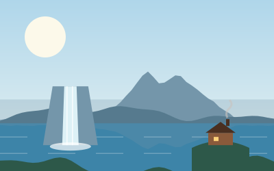
From the balconies you look over the bends and the 320 m high Stigfossen waterfall. Lonely Planet lists Trollstigen under the region “The Western Fjords”.
Practical for motorhome travellers: vehicles longer than 12.4 m are prohibited on the route. The road is closed in late autumn and winter; the usual season runs from mid-May to October or November, depending on the weather. According to FjordNorway, the road was closed on weekdays from 7 am to 6 pm for up to four weeks from 28 September 2026 on the Åndalsnes side, while the plateau remained reachable from Valldal. Check current opening and vehicle restrictions with the Norwegian Public Roads Administration before you go.
- Nearest town
- Åndalsnes, Norway
- Category
- Scenic viewpoints
- GPS
- 62.4566, 7.6697
- Editor's pick
- ★
Hours, fees and access change. Confirm with the operator or park before you go.
Good to know
Best time to go
Cold, short days in November–April. Mountain passes on this route are usually open June–October. (Estimate from long-term temperature averages, terrain and pass seasons)
Getting there
- Norway: Electronic tolls by number plate. Automatic toll roads and toll rings; many routes include car ferries. Motorway limit for cars: 110 km/h.
- Trollstigen (852 m). Usually open June–October; outside that window the road can be closed by snow. Alternative: Go round via the E136 through Åndalsnes and Dombås.
- Trollstigen (Norway). Size limits for motorhomes and trailers (length 12 m). Alternative: Go round via the E136 through Åndalsnes and Dombås.
Featured in these trip guides



Nearby








Campsites nearby
- Trollstigen Camping & GjestegårdCampsite5 km from TrollstigenTentsCaravansWi-Fi
- Trollveggen CampingCampsite6 km from TrollstigenTentsCaravansElectricityDrinking waterShowersToiletsWaste disposal
- Trollstigen-ResortCampsite7 km from TrollstigenTentsCaravansShowersToilets
- Mjelva Camping & HytterCampsite10 km from TrollstigenTentsCaravansElectricityDrinking waterShowersToiletsWaste disposal
- Skoglund Camping ICampsite23 km from TrollstigenTentsCaravansElectricity
- Valldal CampingCampsite25 km from TrollstigenTentsCaravansElectricityWi-Fi
All campsites in Norway · Campsite data: © OpenStreetMap contributors, ODbL 1.0 · Updated October 3, 2026
FAQs
Where is Trollstigen?
Trollstigen is in Åndalsnes, Norway, at GPS 62.4566, 7.6697. It is about 41 km from Molde.
Can you camp near Trollstigen?
Yes. The nearest campsite listed in OpenStreetMap is Trollstigen Camping & Gjestegård, about 5 km away; within 25 km there are 19 campsites and motorhome stopovers.
Which road trips pass Trollstigen?
Trollstigen is a stop on these CampingSpirit trip guides: Norway’s fjords: Bergen to the Atlantic Road and Spray, hairpins and glacier water – by motorhome from Ålesund via the Atlantic Road, Trollstigen and Geirangerfjord to the Nordfjord.
What is there to see near Trollstigen?
Places worth a stop nearby: Ørnesvingen (46 km), Flydalsjuvet (49 km), Dalsnibba (50 km) and Atlanterhavsveien (64 km).
When is the best time to visit Trollstigen?
Cold, short days in November–April. Mountain passes on this route are usually open June–October. (Estimate from long-term temperature averages, terrain and pass seasons)