
Col du Galibier
Briançon, France
2,642 m on the Route des Grandes Alpes and a Tour de France classic. Usually open June to October.
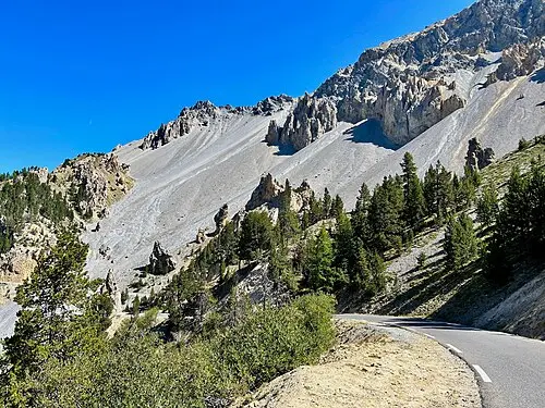
The Col du Galibier is an Alpine pass at 2,642 metres in the French Alps, on the border of the Savoie and Hautes-Alpes departments. The D902B road links Saint-Michel-de-Maurienne with Briançon, via the Col du Télégraphe and the Col du Lautaret. It is considered the eighth-highest paved mountain road in the Alps.
The pass is a Tour de France classic and often its highest point. The tunnel at 2,556 metres was the only passage at the top until 1976; it was restored until 2002, and a road over the summit was built in the meantime. The reopened tunnel is single-lane and controlled by traffic lights.
Practical notes: the pass is closed in winter. In summer 2026 the road was also closed to cars on a few mornings and reserved for cyclists (29 June, 16 July, 4 August). Check before you drive whether the road is open. We have no confirmed details on vehicle sizes and gradients.
- Nearest town
- Briançon, France
- Category
- Scenic viewpoints
- GPS
- 45.0640, 6.4078
- Editor's pick
- ★
Hours, fees and access change. Confirm with the operator or park before you go.
Good to know
Best time to go
The most pleasant months are usually June–September. Cold, short days in December–March. Mountain passes on this route are usually open June–October. (Estimate from long-term temperature averages, terrain and pass seasons)
Getting there
- France: Motorway tolls. Tolls on most autoroutes; the limit drops to 110 km/h in rain. Motorway limit for cars: 130 km/h.
- Col du Galibier (2,642 m). Usually open June–October; outside that window the road can be closed by snow. Alternative: Go round via the Maurienne and Fréjus valleys.
Sources
Featured in these trip guides

Nearby




Campsites nearby
- Camping Municipal d'ArsineCampsite5 km from Col du GalibierTentsCaravansElectricityDrinking waterShowersToiletsWaste disposal
- Camping de FontcouverteCampsite11 km from Col du Galibier · 80 pitchesTentsCaravansDrinking waterShowersToiletsDogs allowed
- Camping des Deux GlaciersCampsite12 km from Col du GalibierTentsCaravansElectricityShowersToiletsWi-Fi
- Valle StrettaCampsite20 km from Col du Galibier · 250 pitchesCaravansElectricityDrinking waterShowersToiletsWaste disposalDogs allowed
- Pian del ColleCampsite21 km from Col du GalibierTentsCaravansMotorhomesElectricityDrinking waterShowersToiletsWaste disposalDogs allowedWi-Fi
- Aire de camping car - Les 2 alpesMotorhome stopover23 km from Col du Galibier · 28 pitchesMotorhomesElectricityDrinking waterToiletsWaste disposalDogs allowed
All campsites in France · Campsite data: © OpenStreetMap contributors, ODbL 1.0 · Updated October 3, 2026
FAQs
Where is Col du Galibier?
Col du Galibier is in Briançon, France, at GPS 45.0640, 6.4078. It is about 11 km from Valloire.
Can you camp near Col du Galibier?
Yes. The nearest campsite listed in OpenStreetMap is Camping Municipal d'Arsine, about 5 km away; within 25 km there are 33 campsites and motorhome stopovers.
Which road trips pass Col du Galibier?
Col du Galibier is a stop on these CampingSpirit trip guides: Route des Grandes Alpes: Lake Geneva to the Riviera.
What is there to see near Col du Galibier?
Places worth a stop nearby: La Grave and the Meije (8 km), Col de la Croix de Fer (24 km), Alpe d’Huez hairpins (27 km) and Casse Déserte, Col d’Izoard (38 km).
When is the best time to visit Col du Galibier?
The most pleasant months are usually June–September. Cold, short days in December–March. (Estimate from long-term temperature averages, terrain and pass seasons)