Route Napoléon
The Route Napoléon runs from Golfe-Juan on the coast via Grasse, Castellane, Digne, Sisteron and Gap to Grenoble. It follows the path of Napoleon's return in 1815 into the Alps.
- Region
- Provence-Alpes-Côte d'Azur to Isère
- Length
- about 300–325 km
- Start / end
- Golfe-Juan / Grenoble
- Suggested time
- 2 days
- Best season
- May to September
What should you know before visiting Route Napoléon?
Tolls and vignettes for a car: about €30 (France). Mountain passes: Col du Galibier (2,642 m, usually open June–October).
- The route is about 300 to 325 km long, depending on the source, and crosses several départements. Two days are a realistic plan for motorhomes; one source names May to September as the best time.
- The bends between Saint-Vallier-de-Thiey and Castellane are the tightest section. Fill up before Castellane, as fuel stations are scarce until Digne-les-Bains.
- Mountain passes can hold snow or ice into April depending on the year. In autumn fog is common around Digne. Check road conditions beforehand.
The drive
Napoleon landed at Golfe-Juan on 1 March 1815 and marched into the Alps with about 1,000 men. The road was officially inaugurated as the Route Napoléon in 1932. The usual stages are Golfe-Juan, Cannes, Grasse, Saint-Vallier-de-Thiey, Castellane, Digne-les-Bains, Sisteron, Gap, Corps and Grenoble. The Prairie de la Rencontre lies near Laffrey. The Col Bayard near Gap is at 1,246 m. The road uses the N85 and sections of the D1085, D4085 and D6085. Take care in the short tunnels near Sisteron.
Planning
The tightest bends, with banked road surface, lie between Saint-Vallier-de-Thiey and Castellane, and the road can stay damp in the shade of the cliffs until late morning. Fill up before Castellane, since fuel stations become scarce between the gorges and Digne-les-Bains. Mountain passes can hold snow or ice into April, and morning fog is common in autumn around Digne. In early March Golfe-Juan holds an annual reenactment of the landing.
Camping
In Castellane, accommodation and campsites often fill weeks ahead in July and August. For motorhomes French rules apply: park like a car where allowed, but no camping gear on the road. Away from the road, overnighting needs the landowner's permission, and camping can be restricted in forests, protected areas and coastal zones. Prohibition signs apply. Plan your nights at campsites, for example around Castellane and the Verdon gorges, and book ahead in summer.
FAQs
How long is the Route Napoléon?
Depending on the source, about 300 to 325 km from Golfe-Juan to Grenoble. With stops in Grasse, Castellane, Digne, Sisteron and Gap, two days is reasonable for a motorhome.
When can the route be driven?
The best period is usually May to September. Passes can hold snow or ice into April depending on the year. Check current road conditions beforehand with the départements or the traffic service.
Where can I refuel along the way?
Fill up before Castellane, since fuel stations become scarce between the gorges and Digne-les-Bains. Beyond that, top up in larger towns along the way rather than waiting for a low tank.
How much are the tolls on Route Napoléon?
Tolls and vignettes for a car: about €30 (France). Estimate with typical rates; motorhomes pay more, and vehicles over 3.5 t often pay by distance.
Places to see

 © Christian David · CC BY-SA 4.0
Aiguille du Midi
A cable car climbs to 3,842 m, face to face with Mont Blanc. Bring warm layers, even in August.

 © Bonzon · CC BY-SA 4.0
Col du Galibier
2,642 m on the Route des Grandes Alpes and a Tour de France classic. Usually open June to October.

 Photo by Paul Underwood on Unsplash
Gorges du Verdon
One of Europe’s deepest canyons, with turquoise water below. The Route des Crêtes is narrow, so large…

 © avu-edm · CC BY 3.0
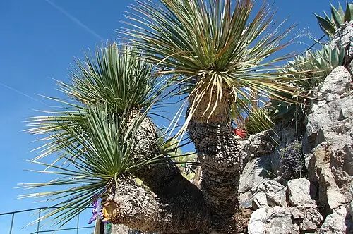
Èze village
A medieval village clinging to a rock 400 m above the sea, with a cactus garden at the top.

 © Raimond Spekking · CC BY-SA 4.0
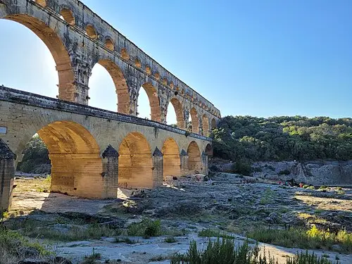
Pont du Gard
A three-tier Roman aqueduct bridge over the Gardon river. You can swim below it in summer.
 © DiskoDieter · CC BY-SA 4.0
Mont Ventoux
The bare limestone summit of Provence at 1,910 m. The top road is closed in winter.

 © MERLEJP · CC BY-SA 4.0
Plateau de Valensole
Purple rows of lavender to the horizon from late June to mid-July. Stay on the edges: the fields are…
 © Bernard DUPONT from FRANCE · CC BY-SA 2.0
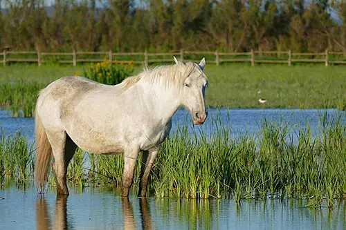
Camargue wetlands
Lagoons with pink flamingos, white horses and black bulls in the Rhône delta. Bring binoculars and repellent.
Campsites nearby
Trip guides

 Photo by Hongbin on Unsplash
Route des Grandes Alpes: Lake Geneva to the Riviera
 © JasonDFR · CC BY-SA 4.0
Provence: lavender, gorges and Roman bridges
 © Bernard DUPONT from FRANCE · CC BY-SA 2.0
Camargue and Roman Provence

 © avu-edm · CC BY 3.0