
Palouse Falls
Washtucna, WA
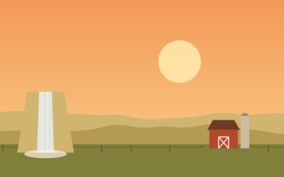
Washington’s state waterfall drops about 200 feet into a basalt bowl carved by Ice Age floods. The viewpoints are a short walk from the parking area; stay behind the fences.
Palouse Falls is the official waterfall of Washington State (since 2014), in the south-east of the state, about 54 miles north of Walla Walla and reached via Highway 261. The Palouse River drops almost 200 feet (about 60 metres) into a rocky basin; Lonely Planet gives 198 feet. The falls sit in a dry, rugged valley and are barely noticeable from a distance.
Palouse Falls State Park is a day destination with views from the canyon rim. Older descriptions mention a poorly marked, steep route into the gorge and warn that people die there each year after falling. Stay on marked paths and keep away from the edge. Check in advance whether descents are closed.
The park requires a Discover Pass. Lonely Planet mentions a small campground with 11 primitive tent sites; its current status is unclear and should be checked in advance (as of October 2026).
- Nearest town
- Washtucna, WA
- Category
- Nature & parks
- GPS
- 46.6638, -118.2272
- Editor's pick
- ★
Hours, fees and access change. Confirm with the operator or park before you go.
Good to know
Best time to go
The most pleasant months are usually May–June and September. Still fine, with some compromises, in July–August and October. Cold, short days in December–February. (Estimate from long-term temperature averages, terrain and pass seasons)
Featured in these trip guides

Nearby









Campsites nearby
- Ayer Boat Basin CampgroundCampsite9 mi from Palouse FallsTentsCaravansToiletsDogs allowedFree
- Riparia Recreation Area CampgroundCampsite9 mi from Palouse FallsTentsCaravansToiletsFree
- Little Goose Landing CampingCampsite12 mi from Palouse FallsTentsCaravansToilets
- Devils Bench CampgroundCampsite16 mi from Palouse Falls · 6 pitchesTentsCaravansToiletsDogs allowedFree
- Windust Park CampgroundCampsite19 mi from Palouse Falls · 24 pitchesTentsCaravansToiletsWaste disposalDogs allowedFree
- Willow Landing CampgroundCampsite23 mi from Palouse FallsTentsCaravansToilets
All campsites in Washington · Campsite data: © OpenStreetMap contributors, ODbL 1.0 · Updated October 3, 2026
FAQs
Where is Palouse Falls?
Palouse Falls is in Washtucna, WA, at GPS 46.6638, -118.2272. It is about 26 mi from Dayton.
Can you camp near Palouse Falls?
Yes. The nearest campsite listed in OpenStreetMap is Starbuck / Lyons Ferry Marina KOA, about 5 mi away; within 25 mi there are 11 campsites and motorhome stopovers.
Which road trips pass Palouse Falls?
Palouse Falls is a stop on these CampingSpirit trip guides: The Palouse: wheat hills and a hidden waterfall.
What is there to see near Palouse Falls?
Places worth a stop nearby: Steptoe Butte (51 mi), Lake Lenore Caves (83 mi), Dry Falls (84 mi) and Ginkgo Petrified Forest State Park (85 mi).
When is the best time to visit Palouse Falls?
The most pleasant months are usually May–June and September. Still fine, with some compromises, in July–August and October. (Estimate from long-term temperature averages, terrain and pass seasons)