
Dry Falls
Coulee City, WA
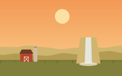
The skeleton of a waterfall 3.5 miles wide and 400 feet high, created by Ice Age floods. The overlook and visitor center are on SR-17 in Sun Lakes-Dry Falls State Park; the center opens in the warmer months.
Dry Falls is the cliff edge of a former waterfall near Coulee City, Washington, in Sun Lakes-Dry Falls State Park on State Route 17. The cliff is about 400 feet (roughly 120 meters) high and 3.5 miles (about 5.6 kilometers) wide; according to Wikipedia the waterfall was around ten times the size of Niagara Falls. It formed during the Missoula Floods at the end of the last Ice Age.
The park lies about 3 miles west of Coulee City and covers 3,774 acres (about 1,530 hectares). A visitor center built in 1965 sits above Dry Falls and has exhibits on the area's geology. Important: according to Washington State Parks, the visitor center is closed all of 2026 for renovation, including its restrooms and parking lot (as of October 2026; check before you drive out).
For overnight stays there is the privately run Sun Lakes Park Resort on Park Lake, with an RV park, cabins and a golf course. The resort is leased from the state; please check season and hours in advance.
- Nearest town
- Coulee City, WA
- Category
- Nature & parks
- GPS
- 47.6071, -119.3640
- Editor's pick
- ★
Hours, fees and access change. Confirm with the operator or park before you go.
Good to know
Best time to go
The most pleasant months are usually May–June and September. Still fine, with some compromises, in July–August and October. Cold, short days in December–February. (Estimate from long-term temperature averages, terrain and pass seasons)
Featured in these trip guides



Nearby

 © Earth Science and Remote Sensing Unit, NASA Johnson Space Center · Public domain
Lake Lenore Caves
 © Steamboat Rock State Park · CC BY-SA 4.0
Steamboat Rock State Park

 © brewbooks from near Seattle, USA · CC BY-SA 2.0
Grand Coulee Dam

 © Thayne Tuason · CC BY-SA 4.0
Ginkgo Petrified Forest State Park
Campsites nearby
- Sun Lakes - Dry Falls State Park Bretz CampgroundCampsite1 mi from Dry FallsTentsCaravansElectricityDrinking waterShowersToiletsWaste disposal
- Sun Village ResortMotorhome stopover4 mi from Dry FallsMotorhomes
- Coulee Lodge ResortMotorhome stopover4 mi from Dry FallsTentsMotorhomes
- Jameson Lake CampgroundCampsite13 mi from Dry FallsTentsCaravansToilets
- Steamboat Rock State Park CampgroundCampsite21 mi from Dry FallsTentsCaravansElectricityShowersToiletsWaste disposal
- Barker Canyon Camping AreaCampsite22 mi from Dry FallsTentsCaravansToilets
All campsites in Washington · Campsite data: © OpenStreetMap contributors, ODbL 1.0 · Updated October 3, 2026
FAQs
Where is Dry Falls?
Dry Falls is in Coulee City, WA, at GPS 47.6071, -119.3640. It is about 16 mi from Soap Lake.
Can you camp near Dry Falls?
Yes. The nearest campsite listed in OpenStreetMap is Sun Lakes - Dry Falls State Park Bretz Campground, about 1 mi away; within 25 mi there are 18 campsites and motorhome stopovers.
Which road trips pass Dry Falls?
Dry Falls is a stop on these CampingSpirit trip guides: Coulee Corridor: Grand Coulee Dam to Dry Falls and Waves of wheat, Ice Age falls and basalt canyons – by camper through eastern Washington from Spokane to Lake Chelan.
What is there to see near Dry Falls?
Places worth a stop nearby: Lake Lenore Caves (10 mi), Steamboat Rock State Park (21 mi), Grand Coulee Dam (30 mi) and Ginkgo Petrified Forest State Park (54 mi).
When is the best time to visit Dry Falls?
The most pleasant months are usually May–June and September. Still fine, with some compromises, in July–August and October. (Estimate from long-term temperature averages, terrain and pass seasons)