

In-depth guide · CampingSpirit
From the Saar Loop at Mettlach via the Völklingen Ironworks, Saarbrücken and the Bliesgau Biosphere Reserve into the Palatinate Forest and on to Bad Bergzabern: around 355 kilometres of industrial heritage, orchard meadows and red sandstone castles.
The spirit of the route
Saarland is small, yet it still surprises you. At Mettlach the Saar squeezes itself into an almost closed loop, at Völklingen the rust-red blast furnaces of a disused ironworks stand in the valley like cathedrals, and in the Bliesgau orchids bloom on the dry grassland in early summer while fruit hangs in the orchard meadows. Then the Palatinate Forest begins, the largest continuous forest area in Germany. From your sliding door you see red sandstone cliffs crowned by castle ruins, and meadow valleys where mist hangs in the morning. It smells of pine resin, wet moss and wood fires from the hiking huts. The roads are twisty but never alpine, the villages have their own motorhome parking areas, and in the evening there is Saumagen, Dubbeglas or Gefillde Klees, depending on which side of the state border you are sitting on. This loop is not a high-mountain route but a trip for food lovers and walkers who bring time with them.
Stage-by-stage plan
1Stage 1: Mettlach (Saarschleife) to Völklingen (approx. 50 km)
- The drive
- From Mettlach take the B51 through the Saar valley via Merzig and Dillingen to Saarlouis, then on towards Völklingen. Mostly well built, with traffic lights and sometimes 30 km/h limits in the towns; hardly any climbs. About one hour of pure driving time, a whole day with sightseeing. The detour from Mettlach to the Cloef near Orscholz is not included in the kilometres.
- Highlights & must-sees
- Saar Loop at Orscholz: the Cloef viewpoint with its view of the river loop and the Treetop Walk in the Cloef Atrium. There are fewer visitors in the morning; the walk stays closed in thunderstorms, gales or ice. Mettlach and the Moselle stretch before it are covered in the CampingSpirit travel guide to the Middle Rhine and Moselle.
- Saarlouis: the fortress town founded by Louis XIV in 1680, with a chessboard layout, the Großer Markt and remains of the fortifications.
- Merzig: the Wolfspark in the Kammerforst on the edge of town (open all year, dogs are not allowed in) and the old town on the Saar, a good place for a break along the route.
- CampingSpirit overnight tip
-
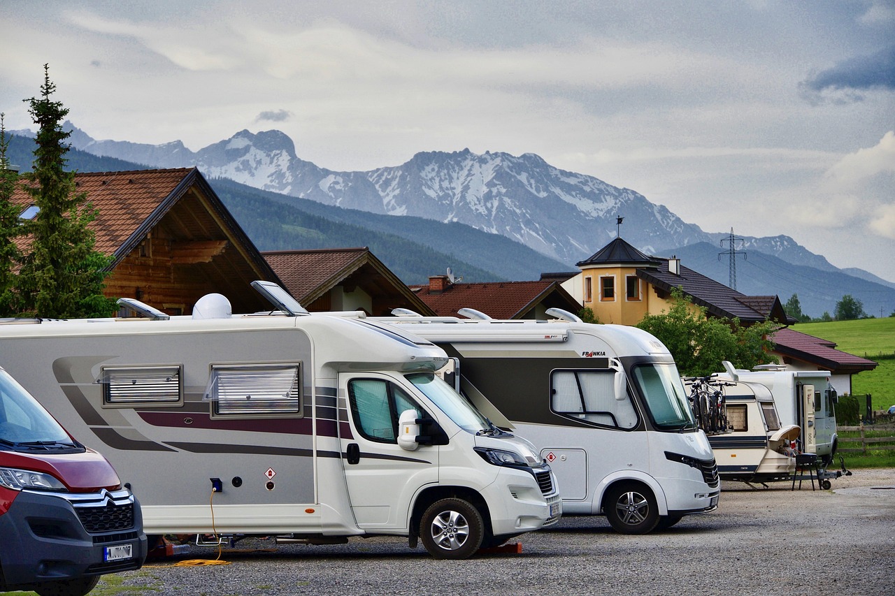
Official campsite or RV park: Motorhome parking area at the Völklingen Ironworks, right at the World Heritage Site: a small site with a good ten spaces, electricity, water and waste disposal, but no toilets or showers. Check the operator, fee, maximum stay and opening times before you arrive, using a Stellplatz app or the ironworks. Alternatively there is the small parking area at the Völklingen outdoor pool with only a few spaces. If you want to stay near the Saar Loop viewpoint: a motorhome car park at the Gesundheitszentrum Saarschleife is listed in Orscholz; check facilities and fee in advance.
Free camping or nature tip (where legal): Like the whole of Germany, Saarland has no right to wild camping. As a rule, one night on public car parks is tolerated to recover your fitness to drive, if no sign forbids it. Overnighting is not intended at the Cloef car park and the hiking car parks at the Saar Loop, and nature conservation rules apply. Further north, a detour off the route, there is a motorhome harbour in Losheim am See.
- Insider tip for campers
- If you want to see the ironworks on the day you arrive, go in the late afternoon when the tour groups thin out; check opening times in advance. Fill up in Saarlouis or Dillingen rather than in Völklingen. The old-town lanes of Saarlouis are narrow, so park on the edge of town and walk the few minutes.
2Stage 2: Völklingen to Saarbrücken (approx. 15 km)
- The drive
- Just a short hop down the Saar on the B51 or the A620: about 20 minutes of pure driving time, comfortable before the rush hour. In central Saarbrücken the streets are narrow and some underpasses are low; park the motorhome early at your site.
- Highlights & must-sees
- Völklingen Ironworks: the ironworks, added to the UNESCO World Heritage List in 1994 and shut down in 1986; a tour takes in the blast furnace group, the blowing engine hall and the “Paradies” nature area, with vegetation growing wild between steel parts. Visit in the morning of this stage, before you drive on to Saarbrücken.
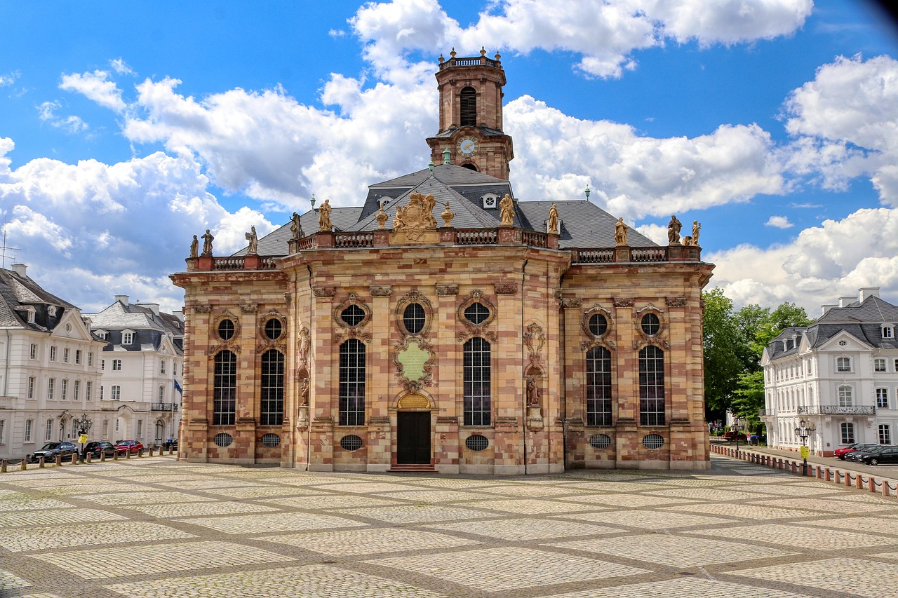
- Saarbrücken: the St. Johanner Markt, the Baroque Ludwigskirche by the master builder Friedrich Joachim Stengel and the palace with its modern central block.
- Spicherer Höhen on the edge of the city: a memorial to the 1870 battle, today a quiet viewpoint over Saarbrücken.
- CampingSpirit overnight tip
-
Official campsite or RV park: Campsite “Am Spicherer Berg” on the edge of Saarbrücken: a city campsite with electricity, sanitary facilities and cassette toilet disposal, which according to directory entries is open only from the end of March to the end of October; check opening times and prices in advance. Alternatively the Camping-Car Park operator’s parking area with around 30 spaces, electricity, water and waste disposal; you pay not at a reception but via a terminal or the operator’s app. Check the current status and payment method in advance.
Free camping or nature tip (where legal): In Saarbrücken, overnighting on streets and municipal car parks outside the designated sites is not intended; checks do happen. Simple sites, for example at the Fechinger Schwimmbad or the Güdinger Rennbahn, are listed in directories but come with no firm assurance; ask the city or urlaub.saarland in advance whether they may be used.
- Insider tip for campers
- Leave the motorhome parked and use the Saarbahn and city buses. By bike you reach the city centre from the campsite without searching for parking. Saarbrücken lies right on the French border; a detour to Lorraine is half an hour away, but different toll and environmental rules apply there.
3Stage 3: Saarbrücken to Homburg (Saar) (approx. 75 km)
- The drive
- From Saarbrücken on country roads through the Bliesgau to Gersheim and the Bliesbruck-Reinheim Cultural Park on the border, then via Blieskastel and Kirkel to Homburg. Well-built country roads with village sections and a few short climbs; a good two hours of pure driving time, a long day with visits. The kilometres are a guide only; the distance depends on which places you visit.
- Highlights & must-sees
- Blieskastel: the Baroque old town on the slope above the Blies; above the town on the Blieskasteler Berg stands the Gollenstein, a Neolithic menhir a good 6.5 m high, regarded as the largest menhir in Central Europe.
- Bliesgau Biosphere Reserve: orchard meadows, limestone dry grassland with orchids and the Blies floodplains, best explored on a bike ride along the Bliesradweg.
- European Cultural Park Bliesbruck-Reinheim on the border with France: the Celtic princess’s grave and the remains of a Roman settlement, both reconstructed in the landscape.
- CampingSpirit overnight tip
-
Official campsite or RV park: Motorhome parking area at the KOI Bad in Homburg: a small site with around five spaces, electricity, water and waste disposal, where the number of spaces is limited. Alternatively the Caravanplatz Mühlenweiher in Kirkel, a large site with electricity and sanitary facilities for motorhomes and caravan rigs, and the motorhome park in Bexbach with about three dozen spaces. On the way in the Blies region, the campsites in Habkirchen and Walsheim are worth a visit; check facilities and opening times by phone in advance.
Free camping or nature tip (where legal): In the Bliesgau Biosphere Reserve, as in all protected areas: do not leave the paths, and do not overnight with your vehicle outside the sites. Simple village sites in the region are a matter for asking the municipality; watch for signs.
- Insider tip for campers
- Plan in the Schlossberghöhlen in Homburg: a labyrinth of red sandstone passages under the Schlossberg, which can only be seen on a guided tour and stays at about 10 °C inside all year round. A warm jumper is worthwhile; check the opening times with the operator in advance. The Roman Museum in the Schwarzenacker district shows excavated Roman house remains mostly in the open air and is therefore better suited to dry weather.
4Stage 4: Homburg (Saar) to Dahn (approx. 70 km)
- The drive
- From Homburg via Zweibrücken and Pirmasens on federal and country roads to the southern edge of the Palatinate Forest at Dahn. Beyond Pirmasens the roads wind in short bends through meadow valleys and forest, with noticeable climbs. A good hour and a half of pure driving time; set your navigation to motorhome dimensions.
- Highlights & must-sees
- Zweibrücken: the Rosengarten, one of the great rose gardens of Europe, with its main bloom in early summer.
- Hornbach: the monastery town on the Schwarzbach, whose Benedictine abbey was founded in the 8th century by Saint Pirmin; a quiet town centre with half-timbered houses.
- Dahner Felsenland: the first red sandstone cliffs on the edge of town and the view of the rock towers above the valley. The Altdahn castle group and the Felsenpfad are covered in the CampingSpirit travel guide to the German Wine Route and through the Palatinate Forest.
- CampingSpirit overnight tip
-
Official campsite or RV park: Camping Büttelwoog in Dahn: a quiet campsite in a meadow valley with electricity and sanitary facilities. On the edge of town there is also the motorhome parking area at the Felsland Badeparadies with about ten spaces, a convenient starting point for walks into the town. Alternatively Campingplatz Neudahner Weiher and Campingplatz Moosbachtal in the surrounding area. Stopover in Hornbach: Wohnmobilstellplatz Klosterstadt Hornbach with electricity, water and waste disposal.
Free camping or nature tip (where legal): In the Palatinate Forest, driving and leaving vehicles in the forest is only allowed with the consent of the forest owners, so forest tracks are off limits. Forest car parks are for parking to go hiking, not for sleeping; checks by the forestry and public order offices do happen. Wild camping is also prohibited in the Dahner Felsenland; at most one night is tolerated to recover fitness to drive.
- Insider tip for campers
- Fill up and shop in Pirmasens or Zweibrücken: in Dahn and the villages around it the choice is small and petrol stations are rare. If you plan several nights, top up water and supplies beforehand.
5Stage 5: Dahn to Hauenstein (approx. 30 km)
- The drive
- From Dahn on country roads to the village of Erlenbach with Berwartstein Castle and on through the Wasgau to the B10 and Hauenstein. Winding country road with short climbs and narrow village sections; drive carefully when meeting oncoming traffic. Around one hour of pure driving time.
- Highlights & must-sees
- Berwartstein Castle near Erlenbach: an inhabited rock castle with passages cut into the stone and guided tours.
- German Shoe Museum in Hauenstein: the history of the shoe industry that long shaped the town, right down to machines and lasts from the factory.
- Hike in the Wasgau: easy circular routes from Dahn or Hauenstein to rock formations and viewpoints, waymarked by the Pfälzerwald-Verein.
- CampingSpirit overnight tip
-
Official campsite or RV park: Motorhome parking area at the German Shoe Museum in Hauenstein: about 16 spaces, electricity, water and waste disposal, within walking distance of the town. Alternatively the Naturcampingplatz am Berwartstein near Erlenbach, not far from the castle, with electricity and sanitary facilities; check opening times in advance.
Free camping or nature tip (where legal): Around Berwartstein, day-parking rules apply to the car parks of the castle and the hiking trails; overnighting is not intended. In Hauenstein the parking area at the Shoe Museum is the simplest solution.
- Insider tip for campers
- Berwartstein Castle is privately owned, with its own opening and tour times; find out in advance. Bring a jacket: it is cool and damp in the rock passages.
6Stage 6: Hauenstein to Elmstein (via Annweiler and Johanniskreuz) (approx. 55 km)
- The drive
- From Hauenstein on the B10 to Annweiler am Trifels, through the Wieslauter valley to Eußerthal and up to the Johanniskreuz crossing in the heart of the Palatinate Forest, then on down to Elmstein. The roads are twisty, the forest dense, the climbs noticeable. A good hour and a half of pure driving time.
- Highlights & must-sees
- Trifels Castle above Annweiler: the imperial castle of the Staufer era, where the imperial regalia were kept; from the car park you walk up. Alongside stand the ruins of Anebos and Scharfenberg, and all three can be combined into a circular hike.
- Eußerthal: the Cistercian monastery founded in the 12th century in the quiet Wieslauter valley.
- Johanniskreuz: a crossroads in the centre of the Palatinate Forest with a hiking car park, a place to eat and the starting point of Pfälzerwald-Verein trails.
- CampingSpirit overnight tip
-
Official campsite or RV park: Small motorhome parking area in Elmstein with a few spaces and waste disposal, without electricity; also the Naturfreundehaus Elmstein with room for motorhomes and the Gasthaus-Pension Waldesruhe with pitches at the house. In Annweiler: motorhome pitches at the Markwardanlage by the spa park with about ten spaces and water; Eußerthal also has a motorhome parking area. Check facilities and waste disposal options in advance.
Free camping or nature tip (where legal): The Palatinate Forest is a biosphere reserve: in the scattered core zones you must stay on the paths, and camping or leaving motorhomes outside approved sites needs a permit throughout the area. Overnighting at forest car parks is not intended. In the forest and within 100 metres of it, fire is forbidden without permission from the forestry office, including barbecue fires; in Rhineland-Palatinate there is also a ban on smoking in the forest from 1 March to 31 October.
- Insider tip for campers
- Drive the stage in this order: Trifels early, Eußerthal at midday, Johanniskreuz in the afternoon. Pfälzerwald-Verein hiking huts are only staffed on certain days; bring cash. Mobile reception is patchy in the forest, so download the map beforehand.
7Stage 7: Elmstein to Lambrecht (Pfalz) (approx. 15 km)
- The drive
- A short stage through the Speyerbach valley: from Elmstein via Neidenfels to Lambrecht, mostly country road in a narrow meadow valley. A good half hour of driving time; the rest of the day belongs to hiking or cycling.
- Highlights & must-sees
- Elmsteiner Tal and Spangenberg castle ruin: a path through the forest to the castle, one of the valley’s hiking classics.
- Neidenfels with the castle ruin of the same name above the Speyerbach.
- Lambrecht: the cloth-makers’ town in the valley with half-timbered houses and old factory buildings; from May to October the Kuckucksbähnel, the heritage railway of the Neustadt Railway Museum between Neustadt and Elmstein, runs on selected days, mostly Sundays, with a connection to Lambrecht.
- CampingSpirit overnight tip
-
Official campsite or RV park: Motorhome parking area Lambrecht with about seven spaces, electricity, water and waste disposal, within walking distance of the town. Further options in Neustadt an der Weinstraße: the large motorhome parking area with around 40 spaces on the edge of town.
Free camping or nature tip (where legal): The Speyerbach valley and the slopes of the Haardt are a landscape and nature conservation area; overnighting at hiking car parks is not intended. The parking area in Lambrecht is the simplest solution.
- Insider tip for campers
- Ride the Kuckucksbähnel if it runs on your travel dates: the operating days change from year to year, and you will find the timetable at the Neustadt Railway Museum. For hikes, circular routes from Elmstein or Lambrecht are suitable, and you can walk them without moving the vehicle.
8Stage 8: Lambrecht (Pfalz) to Bad Bergzabern (approx. 45 km)
- The drive
- From Lambrecht on the B39 to Neustadt an der Weinstraße, then on the B38 or the A65 southwards along the edge of the Haardt and via Landau on the B48 to Bad Bergzabern. Well built and mostly flat; around 50 minutes of pure driving time. The Wine Route itself is covered in the CampingSpirit travel guide to the German Wine Route and through the Palatinate Forest.
- Highlights & must-sees
- Bad Bergzabern: the Renaissance palace of the Dukes of Pfalz-Zweibrücken and the Gasthaus “Zum Engel” of 1579, a Renaissance building with rich façade decoration.
- Kurpark and Schlosspark, quiet spaces for a short final walk.
- Guttenberg castle ruin to the south: a ruin on the edge of the Wasgau with a view as far as the French border.
- CampingSpirit overnight tip
-
Official campsite or RV park: Motorhome parking area “In den Schlossgärten” in Bad Bergzabern with electricity, water and waste disposal, within walking distance of the palace. Naturfreundehaus Bethof with a campsite at the forest edge; alternatively the motorhome parking area at the Weingut Geiger in Dierbach with around 30 spaces, electricity and waste disposal. Arrive early during the grape harvest and on festival weekends.
Free camping or nature tip (where legal): Wild camping is also prohibited in the southern Palatinate. During the grape harvest, note that farm tracks belong to the winegrowers, and parked motorhomes block the grape trailers.
- Insider tip for campers
- Bad Bergzabern is only a few kilometres from Alsace. If you drive on, check the French low-emission zones (ZFE) with the Crit’Air sticker in advance and fill up on gas beforehand, because German exchange cylinders are not swapped in France.
Camping practice & local rules
Wild camping & overnight parking
- Wild camping is prohibited in Saarland and Rhineland-Palatinate, as in the whole of Germany. As a rule, one night in the vehicle is tolerated to recover your fitness to drive, on public car parks without a prohibition sign and without camping behaviour: no chairs, no awning, no barbecue.
- Together with the Northern Vosges, the Palatinate Forest forms a cross-border UNESCO biosphere reserve, and the Bliesgau has its own. Under the biosphere reserve regulation for the Palatinate Forest, a permit is required for camping, setting up camp and leaving motorhomes outside approved sites, as well as for driving and parking away from public roads and car parks; in the core zones you must stay on the paths. In addition, motor vehicles may only drive and stand in the forest with the consent of the forest owners. Forest car parks are hiking car parks, not places to sleep.
- Reliable ways to find legal sites are the Stellplatz directories of Saarland-Tourismus and Pfalz-Tourismus, as well as apps such as park4night, Campercontact and the Stellplatz databases of the trade magazines. Many municipalities run their own sites with electricity and waste disposal.
- In dry spells there is a risk of forest fires in the woods. In Rhineland-Palatinate, no fire may be lit in the forest or within 100 metres of it without permission from the forestry office, and from 1 March to 31 October smoking in the forest is prohibited. Saarland has its own forest rules; watch the signs.
Waste disposal & supplies
- The density of motorhome parking areas is high: Saarland lists town and municipal sites, in the Palatinate Forest places such as Elmstein, Lambrecht and Hauenstein run their own facilities, and winegrowers’ pitches add to this around the Wine Route. Disposal of cassette toilet and greywater is possible at sites with a service point and at campsites, but not at every simple parking area.
- The operator Camping-Car Park works with a terminal and app; payment is by card or digital, with no reception. Check before you arrive whether your payment method is accepted.
- Water from public networks is drinking water. Fountains and spring sources on hiking trails in the Palatinate Forest are not always marked as drinking water, so watch the signs.
- Gas: grey exchange cylinders are available at petrol stations, DIY stores and campsites; LPG is only sold at selected petrol stations, so search beforehand with a fuel app. If you drive on to France: German cylinders are not swapped there.
Vehicle size & traffic rules
- Speed limits: motorhomes up to 3.5 t 100 km/h outside built-up areas, on the motorway no fixed limit (recommended 130 km/h at most); over 3.5 t 80 outside built-up areas and 100 km/h on the motorway. Towing combinations 80 km/h, with a 100 km/h approval 100 km/h on the motorway. In villages 30 km/h often applies.
- Low-emission zones: as far as we know, there are no low-emission zones in Saarland or along the Palatinate route. If you turn off into France, check the ZFE rules and the Crit’Air requirement for Strasbourg and other cities before you set off.
- No tolls for motorhomes on German motorways and federal roads. Some railway underpasses and village roads have height, width or weight restrictions; set your navigation to motorhome dimensions.
- Winter tyres are mandatory in wintry road conditions; on the heights of the Palatinate Forest it can be icy between November and March.
- Alcohol limit 0.5 per mille, 0.0 during the probationary period and under 21. You may only use your phone at the wheel in a holder and without touching it.
CampingSpirit packing & preparation checklist
- Hiking boots with a grippy tread: the red sandstone is slippery when wet, especially on rock steps and castle paths.
- Hiking map of the Pfälzerwald-Verein at 1:25,000: reception is patchy in the forest, and the club’s waymarks are the backbone of navigation.
- Bikes or e-bikes with a rear rack: the Saarradweg, the Bliesradweg and the valley cycle routes in the Palatinate Forest link places without you having to move the motorhome.
- Cash in small notes and coins for honesty boxes, municipal sites and the Palatinate Forest huts.
- Warm jacket or fleece for the Schlossberghöhlen in Homburg (around 10 °C) and the rock passages of the castles, which stay cool.
- Tick remover and tick card: meadows, forest edges and orchard meadows in the Bliesgau and the Palatinate Forest are tick country.
As of 2026-10. Closures, fees and booking rules change: check official sources before you go.