

In-depth guide · CampingSpirit
From Prien via Herreninsel, Seebruck and Traunstein to Lake Waging, on to Laufen and Tittmoning, then via Inzell and Ruhpolding to Reit im Winkl and back under the Kampenwand to Lake Chiemsee: around 310 kilometres on country roads that never run straight for long.
The spirit of the route
The Chiemgau is the region where Bavaria looks at its friendliest: a flat, wide lake, the Chiemgau Alps behind it, and meadows, onion domes and timber balconies in front. On this loop, water and mountains take turns. In the morning mist hangs over Lake Chiemsee, and at midday the boats carry you to Herreninsel, where cars are not allowed. Further east it gets quieter: Lake Waging is considered one of the warmest swimming lakes in the area, and in the Rupertiwinkel, which belonged to the Archbishopric of Salzburg until 1816, you will find town squares with colourful façades and castles above the Salzach. Beyond Traunstein the road climbs into the mountains: the speed-skating rink in Inzell, forests around Ruhpolding, three small lakes before Reit im Winkl. The evenings smell of wood smoke and freshly cut grass, and from your sliding door you can see the Kampenwand and the Kaisergebirge. If you have room in your calendar, stay one night longer at every stretch of water.
Stage-by-stage plan
1Stage 1: Prien am Chiemsee to Gstadt am Chiemsee (approx. 20 km)
- The drive
- A short opening stage along the west and north shores of Lake Chiemsee: from Prien via Rimsting and Breitbrunn to Gstadt, mostly on the district road by the lakeside, partly between orchards and reeds. Roads through the villages are narrow, and in summer traffic backs up at the bathing spots. Driving time is only about 40 minutes; the day belongs to the islands and the water, not the steering wheel.
- Highlights & must-sees
- Chiemseebahn in Prien: this narrow-gauge steam railway has linked the town with the harbour in Prien-Stock since the 19th century, and the boats to the islands leave from there. Check the timetable and operating days with the operator in advance.
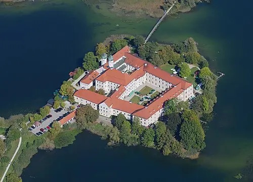
- Herreninsel: Neues Schloss Herrenchiemsee, begun by Ludwig II from 1878 on the model of Versailles and never completed, with its Hall of Mirrors and the King Ludwig II Museum; cars are not allowed on the island, so you go on foot.
- Gstadt: landing stage for Fraueninsel with Frauenwörth Abbey, fishermen’s houses and pottery shops; boats also leave from Prien-Stock.
- CampingSpirit overnight tip
-
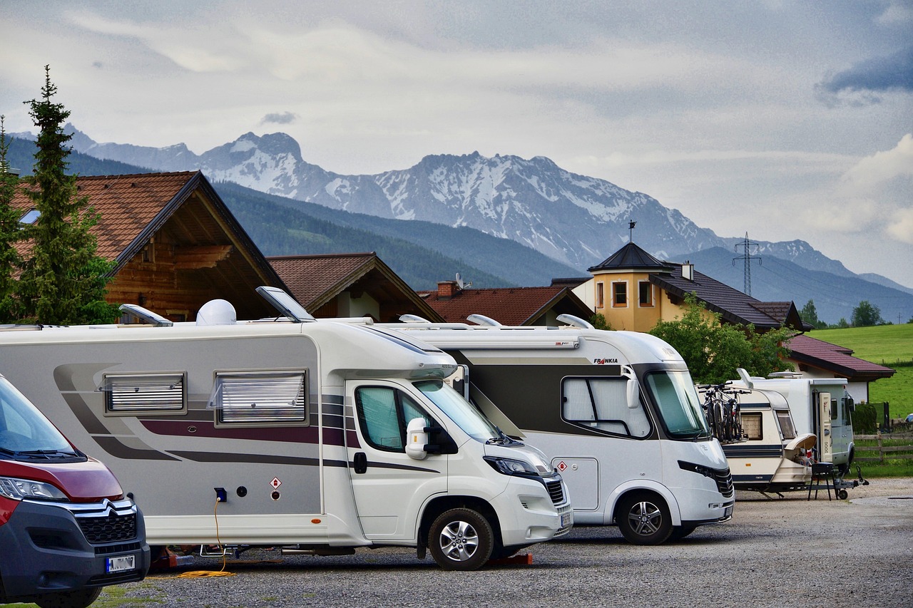
Official campsite or RV park: In Prien-Harras, Panorama Camping Harras lies right on the lake; Prien also has a motorhome aire (“Beilhack West”). Around the lake, pitches are often taken early in high season, so book ahead. Check opening times, electricity and waste disposal in advance.
Free camping or nature tip (where legal): On Lake Chiemsee, overnighting in your vehicle outside the campsites is largely unwelcome; lakeside car parks and protected areas are often closed at night or patrolled. The protected reed shore, the bathing meadows and the harbour car parks are not places to stay. Expect fines if you camp instead of park.
- Insider tip for campers
- For the island trip, leave the motorhome on a campsite pitch or at the aire and take the Chiemseebahn or the bus to the harbour: the car parks at the landing stages fill up quickly and are partly unsuitable for motorhomes. Bicycles can be taken on the boats, and on Herreninsel there is a circular route on foot. The last return sailing is firm, so allow time.
2Stage 2: Gstadt am Chiemsee to Seebruck (approx. 20 km)
- The drive
- Onwards along the north shore: from Gstadt via Gollenshausen to Seebruck, where the Alz leaves the lake. The road is mostly well built but winding; at weekends and in bathing weather traffic queues before Seebruck. Driving time is about 30 minutes. A detour leads from Seebruck north to Seeon Abbey, around 10 kilometres each way.
- Highlights & must-sees
- Seebruck: lakeside promenade and the Alz bridge, plus the Bedaium Roman Museum, which recalls the Roman road fort and settlement that stood here at the lake’s outflow.
- Seeon Abbey: a former Benedictine monastery on a peninsula in Lake Seeon, founded in the 10th century, now a cultural and conference venue with a church; a walk around the lake is possible.
- Seebruck harbour: sailing boats, fish smokehouses and beer gardens with a view of the Chiemgau mountains.
- CampingSpirit overnight tip
-
Official campsite or RV park: There are several campsites around Seebruck, including Chiemsee Strandcamping in Chieming on the east shore and Chiemgau Camping Lambach in Lambach (municipality of Seeon-Seebruck) north of the lake. Farms also offer pitches; check facilities, season and minimum stay in advance.
Free camping or nature tip (where legal): On the promenade and at the harbour car parks in Seebruck, overnighting is generally not intended; signs and local municipal rules take precedence. In the landscape and bird protection area by the lake, vehicles are strictly off limits in the reeds and meadows.
- Insider tip for campers
- Seebruck is the best point to park the motorhome and explore the lake on foot or by bike: the lakeside cycle path runs in both directions, and bikes can be hired in the village. For the Seeon Abbey detour take your bike or drive early, otherwise coaches fill the car parks. Sort out fresh water and waste disposal beforehand at your campsite, not at the harbour.
3Stage 3: Seebruck to Traunstein (approx. 35 km)
- The drive
- From Seebruck via Chieming and the state road east into the Traunstein area and on to Traunstein. The route is mostly wide and flowing; through Chieming and Traunstein there are 30 km/h zones in the towns and tight spots at market squares. Driving time is just under an hour.
- Highlights & must-sees
- Chieming: lido and lakeside promenade on the east shore of Lake Chiemsee, a quieter place than Prien, with a view across the water to the peaks.
- Traunstein: large town square with fountain, town hall and the houses of the salt-works town; the parish church of St Oswald is a short walk away.
- Brine pipeline: Traunstein was a station on the salt pipeline, which from the early 17th century carried brine from Bad Reichenhall to Traunstein and was later extended to Rosenheim; information boards and educational trails along the pipeline can be found in and around Traunstein.
- CampingSpirit overnight tip
-
Official campsite or RV park: In Traunstein itself, pitches are limited; you can head instead to Siegsdorf (Alpencamp Siegsdorf), to the Wohnmobilstellplatz Bergen (Chiemgau) with around ten pitches, or to Campingplatz Wagnerhof in Bergen. Check all details in advance; sites near town are small and not always suited to long vehicles.
Free camping or nature tip (where legal): In Traunstein, overnighting in public car parks is not expressly permitted; the town square and multi-storey car parks are not places to stay. On the edge of town, woods and river meadows are protected areas, and access by motor vehicle is prohibited.
- Insider tip for campers
- Stroll across the town square in the morning and use the car parks on the edge of town instead of the multi-storeys with height limits. Fill up with fuel and gas in Traunstein before heading into the mountains: petrol stations and LPG are rare in the uplands. The Traunstein weekly market is a good place for regional supplies; check dates in advance.
4Stage 4: Traunstein to Waging am See (approx. 25 km)
- The drive
- A short stage on state and district roads east to Lake Waging: around 25 kilometres, mostly hilly and easy to drive, with moderate gradients. Driving time is about 40 minutes; the rest of the day belongs to the lake. On the edge of Waging there are several bathing access points and car parks for day visitors.
- Highlights & must-sees
- Lake Waging: considered one of the warmest swimming lakes in the region, with shallow shores, sunbathing meadows and jetties; a cycle and footpath runs around the lake.
- Lake Taching: a smaller neighbouring lake, darker and calmer thanks to its peaty water, with access points in Taching.
- Waging: village centre with parish church, café terraces and a view over the lake; excursions to Tettenhausen on the north shore and to Petting on the east shore are worthwhile.
- CampingSpirit overnight tip
-
Official campsite or RV park: There are several sites on Lake Waging, including Strandcamping Waging am See, Campingplatz Gut Horn between Waging and Tettenhausen, Campingplatz Schwanenplatz, Campingplatz Tettenhausen and, near Petting, Ferienpark Hainz am See and the Wohnmobilstellplatz am Schneiderhof. On Lake Taching there is Seecamping Taching. Booking is advisable in summer; check electricity, waste disposal and season in advance.
Free camping or nature tip (where legal): Around the lakes, wild camping is not intended: shore zones, reeds and moorland meadows are partly protected, and car parks at the bathing spots are patrolled in summer. On farms in the Rupertiwinkel you can stay if you register in advance; look for “motorhome on the farm” in brochures and aire portals.
- Insider tip for campers
- Stay two nights so you can experience the lake once without the vehicle: a circuit of Lake Waging takes a whole day on foot, or a few hours by bike. Swimming in the lake is unsupervised and at your own risk; watch for bathing zones, boat traffic and the rules of the site operator.
5Stage 5: Waging am See to Tittmoning (approx. 55 km)
- The drive
- From Lake Waging via Petting to the Salzach at Laufen and on downstream to Tittmoning. The route runs through flat to rolling country, alternating between state and district roads; Laufen and Tittmoning have narrow old-town lanes that are best explored on foot. Driving time is about 1.5 hours, a full day with sightseeing.
- Highlights & must-sees
- Laufen an der Salzach: old town with collegiate church (a Gothic hall church), town hall and the Shipping Museum; the bridge links to Oberndorf bei Salzburg on the Austrian side, where the Silent Night Chapel recalls the Christmas carol.
- Salzach loop near Laufen: high river banks and floodplain forest in the bend of the river, with walking trails and viewpoints over the Salzach.
- Tittmoning: long town square in the Inn-Salzach style with town gates, and above it the castle, once the summer residence of the Salzburg archbishops. In the castle, the Rupertiwinkel Museum (folk art and crafts; visits by guided tour only) and the Tannery Museum (free entry during opening hours) show the region; the castle grounds are freely accessible. The Rupertiwinkel passed from Salzburg to Bavaria in 1816.
- CampingSpirit overnight tip
-
Official campsite or RV park: In Laufen the town runs a small motorhome aire with only a few pitches; check facilities and rules in advance on the town’s website. Near Tittmoning, the aire at Huberhof (Ollerding) and Camping Seebauer offer pitches; further farms and sites lie in the surrounding area. Check site size, season and access heights in advance.
Free camping or nature tip (where legal): On the Salzach and in the floodplain forests, vehicles are banned from the countryside, and nature reserves and flood plains are patrolled. In car parks in Laufen and Tittmoning only parking is allowed, not camping; local rules and signage take precedence.
- Insider tip for campers
- In Laufen and Tittmoning, leave the vehicle on the edge of town and walk into the old town; the old-town lanes are narrow and partly subject to height or weight limits. If you want to walk across to Oberndorf, take your passport or ID card, even though checks are usually not made; Germany temporarily checks the border with Austria. Check flood warnings in advance if you are by the river at high water.
6Stage 6: Tittmoning to Inzell (approx. 60 km)
- The drive
- From Tittmoning back south via Kirchanschöring and Waging to Siegsdorf and Inzell. The land is flat at first; from Siegsdorf the road climbs into the Alpine foothills. State and district roads, well built, with roads through villages and roadworks in summer. Driving time is about 1.5 hours; Siegsdorf is worth a stop on the way.
- Highlights & must-sees
- Siegsdorf: the South-East Bavarian Natural History and Mammoth Museum, which shows a mammoth skeleton found near Siegsdorf and explains the Ice Age in the Chiemgau; in season it is open daily, in winter different hours apply.
- Inzell: the Max Aicher Arena with its speed-skating rink, venue for international competitions; in summer a destination for cyclists and walkers.
- Frillensee and moorland near Inzell: a small mountain lake in the forest, reachable on footpaths and cycle routes.
- CampingSpirit overnight tip
-
Official campsite or RV park: In Inzell you will find Camping Lindlbauer and the Wohnmobilstellplatz Am Hausernhof; in Siegsdorf, Alpencamp Siegsdorf. Access roads are partly narrow; check opening times, electricity and sanitary facilities in advance.
Free camping or nature tip (where legal): In the Chiemgau, wild camping is regarded as not intended: protected areas, woods and hiking car parks are off limits to vehicles, and often closed at night. Municipalities patrol and issue warning and fines. If you want nature, use pitches on farms and campsites.
- Insider tip for campers
- Plan in the museum at Siegsdorf before the mountains start dictating the weather: it is a good rainy-day option. In Inzell, cyclists, walkers and skaters come together; on Saturdays and during events, car parks are scarce. Fill up in Traunstein or Siegsdorf; after that, petrol stations are sparser.
7Stage 7: Inzell to Reit im Winkl (approx. 40 km)
- The drive
- From Inzell via Ruhpolding on the Alpine Road (B305) to Reit im Winkl. The road climbs moderately as far as Seegatterl and is wide and well built, but has bends, forest sections and, in winter, snow and ice. Driving time is about an hour, half a day with stops for the lakes and the village.
- Highlights & must-sees
- Ruhpolding: the parish church of St George with its onion dome in the village centre, the Holzknechtmuseum (woodcutters’ museum) and the Chiemgau Arena, where Biathlon World Cup events take place.
- Weitsee, Mittersee and Lödensee: three small mountain lakes along the B305, with lakeside paths, lay-bys and views of the surrounding mountains.
- Reit im Winkl: timber houses, the Weiße Traun and a view of the Kaisergebirge; a footpath leads from Seegatterl to the Winklmoosalm.
- CampingSpirit overnight tip
-
Official campsite or RV park: In Reit im Winkl you will find the large Wohnmobilpark Reit im Winkl with several hundred pitches, and also Campingplatz Litzelau. In Ruhpolding there is a short-stay motorhome aire in the village centre with around twelve pitches: two nights at most, no electricity, water or waste disposal, and no camping behaviour allowed. For services and waste disposal, go to Campingplatz Ortnerhof, around two kilometres away, which also offers pitches. Check facilities, season and fees in advance.
Free camping or nature tip (where legal): Along the B305, the lay-bys at the lakes are intended as hiking car parks, and overnighting is not allowed; Seegatterl, Winklmoosalm and the lakes lie partly in protected areas. Prohibition signs and checks are common.
- Insider tip for campers
- Stop early at the three lakes, before the lay-bys are full. A private toll road leads to the Winklmoosalm; check the fee and vehicle restrictions for motorhomes in advance. The car park at Seegatterl is more relaxed: a circular walk of a good nine kilometres starts from there, and buses run to Seegatterl. Fill up with water and empty your waste before moving on, as aires with waste disposal are thin on the ground in the mountains.
8Stage 8: Reit im Winkl to Prien am Chiemsee (approx. 55 km)
- The drive
- From Reit im Winkl north via Unterwössen and Marquartstein (a detour to Schleching is possible), then along the foot of the Kampenwand to Aschau im Priental and back to Prien via Bernau. The first kilometres are winding, after that it becomes wider and flatter. Driving time is about 1.5 hours; with the cable car and a Kampenwand hike, a full day.
- Highlights & must-sees
- Kampenwand (1,669 m): a striking rock ridge above the Priental, reached by the Kampenwandbahn from Hohenaschau; two summits with a summit cross, and the ridge is exposed and only for sure-footed walkers.
- Marquartstein Castle: a castle set above the valley of the Tiroler Achen, with views of the Hochplatte and the Chiemgau Alps.
- Bernau am Chiemsee: beach and promenade, with a view of the islands and the Alpine panorama on the way back to Prien.
- CampingSpirit overnight tip
-
Official campsite or RV park: In Aschau im Chiemgau you will find Alpen Camping Aschau with a motorhome aire; in Bernau the Wohnmobilhafen Chiemsee and the Wohnmobilstellplatz am Tenniszentrum Bernau, and in Schleching a small motorhome aire. Check opening times, fees and waste disposal in advance, and book early in high season.
Free camping or nature tip (where legal): At the foot of the Kampenwand, hiking car parks are intended for day visitors; overnighting is prohibited. In the Priental and on the lakeshore, protected areas and municipal bylaws apply; signs take precedence.
- Insider tip for campers
- Start the Kampenwand early: the cable car quickly fills up in good weather, and the clouds often come at midday. As a rule, visibility and weather are best in the morning; take a rain jacket and sturdy shoes. On the way back, a last stop at Lake Chiemsee is worthwhile, ideally in the evening when the light lies golden over the water.
Camping practice & local rules
Wild camping & overnight parking
- In Germany, a motorhome on a public car park legally counts as a parked vehicle as long as you are only restoring your fitness to drive, in practice one night and without camping behaviour: no chairs, tables, awning, levelling supports or wedges, and no grey water on the ground. Anything beyond that is camping, and outside campsites and aires it is not allowed.
- In the Chiemgau, Bavarian nature and forest law also applies: woods, meadows and protected areas may not be entered with motor vehicles, and Lake Chiemsee with its reed belt and shore zones, as well as the lakes in the Rupertiwinkel, are protected. Municipalities ban overnighting at lakeside car parks and at mountain railways through local rules; signs take precedence, and fines are set by the district offices and municipalities.
- Spa tax and visitor contributions per person and night are customary, including on aires; in many places the guest card brings benefits on mountain railways, buses and swimming pools. In Ruhpolding and Inzell, overnight guests receive the free “Chiemgau Karte”, with free entry to the Mammoth Museum and the Holzknechtmuseum, mountain railways and buses, among other things; ask at check-in whether your site takes part.
- Useful tools: park4night, Campercontact and aire guides; user information on fees and facilities is often out of date, so phone if in doubt.
Waste disposal & supplies
- Services and waste disposal are available at most campsites and aires; fresh water is usually charged for in 100-litre portions. Empty grey water and the cassette only at the station, not into drains or public toilets.
- Tap water in Germany is drinkable throughout; wells and springs at alpine pastures, cemeteries and hiking trails are often not approved for drinking, so heed the signs.
- Gas: grey exchange cylinders (5 kg and 11 kg) are available at petrol stations and DIY stores; refillable cylinders and gas tanks are filled at LPG stations, which are rare in the mountains. Fill up beforehand in Traunstein or near the A8 motorway.
Vehicle size & traffic rules
- Speed limits: motorhomes up to 3.5 t drive 50 km/h in built-up areas and 100 km/h outside them, and on the motorway the recommended speed of 130 km/h applies. Motorhomes over 3.5 t up to 7.5 t drive 80 km/h outside built-up areas and 100 km/h on the motorway; over 7.5 t the limits are 60 km/h outside built-up areas and 80 km/h on the motorway. Car-and-caravan combinations: 80 km/h outside built-up areas, and 100 km/h on the motorway only with the appropriate approval. Roads through villages often have 30 km/h limits and speed cameras.
- Low-emission zones: to the best of current knowledge there is no low-emission zone on this route; if you arrive via Munich, you will need the green sticker there.
- Tolls: there is no vignette for motorhomes in Germany; the lorry toll does not usually apply to motorhomes. Toll roads in the mountains, such as the access road to the Winklmoosalm, are private: check the fee and vehicle restrictions in advance.
- Border crossings to Austria at Laufen (bridge to Oberndorf) and near Reit im Winkl (towards Kössen): in the Schengen area there are no permanent checks, but Germany carries out temporary checks on the border with Austria, which are repeatedly extended; carry ID. On Austrian motorways and expressways you need a vignette up to 3.5 t (digital or as a sticker, the sticker is being phased out), and above that the GO toll; country roads do not require a vignette. Buy the vignette only in the official ASFINAG shop or at sales points.
- Winter tyres apply situationally: in snow, ice or black ice, tyres with the Alpine symbol are mandatory, and M+S-only tyres are not enough. In the Chiemgau snow can lie from October, and in winter mountain-pass roads and toll roads are partly closed or passable only with chains. Rear carriers: the number plate and rear lights must be visible. Alcohol: 0.5 per mille, and 0.0 for novice drivers and under-21s. Phone at the wheel only with a hands-free kit.
CampingSpirit packing & preparation checklist
- Bicycles and bike locks: around Lake Chiemsee, Lake Waging and along the Salzach there are cycle paths that are quicker and more relaxed than any search for parking.
- Rain jacket and a warm layer: in the Chiemgau the weather changes quickly; thunderstorms and fog often arrive in the afternoon or morning.
- Sturdy walking boots for the Kampenwand and alpine pastures: the ridge is exposed, paths are stony and wet meadows are slippery.
- Bath towel and bathing shoes: lakes such as Lake Waging invite a swim, and shores are partly stony or muddy.
- ID and cash: for crossing the border to Oberndorf and for pay machines, alpine huts and small aires that do not take cards.
- Mosquito and tick protection: on the lakeshore and in the floodplains there are many mosquitoes in summer, and in meadows and woods also ticks.
As of 2026-10. Closures, fees and booking rules change: check official sources before you go.