


In-depth guide · CampingSpirit
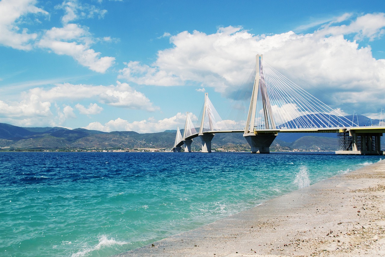
From Preveza through the undersea tunnel to Lefkada, to the cliff beach of Porto Katsiki, on to Vasiliki and Nidri, then to the ruins of Nikopolis and the lagoons of the Amvrakikos Gulf as far as the stone bridge at Arta: around 395 kilometres of Ionian coast between limestone cliffs, olive groves and lagoons.
The spirit of the route
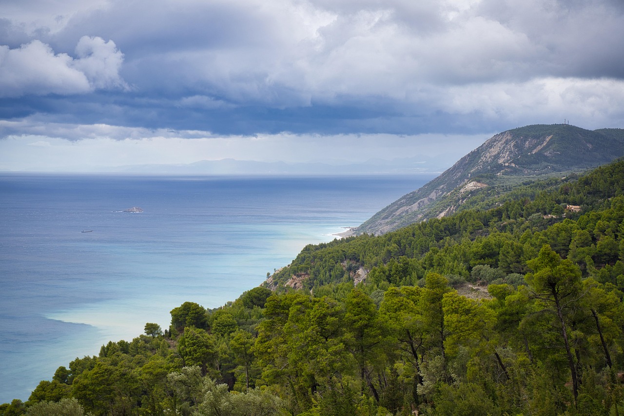
Lefkada is an island you can reach by motorhome without a ferry. Beyond Preveza the road dips under the Aktio strait, then the Gyra lagoon with its salt pans lies on your left, and in Lefkada town you roll across the floating bridge, which swings aside for boats. The west coast is the counterpart to the quiet east side: white limestone cliffs, turquoise sea, roads pressed into the hillside in hairpin bends, and storm clouds that turn red over the water in the evening. Around Nidri you drive between cypresses and olive trees, with views out to the islands of Meganisi and Skorpios. On the mainland the landscape turns flat and wide: Nikopolis, the victory city of Augustus, lies among olive groves, and in the Amvrakikos Gulf pelicans (and, with a bit of luck, flamingos) stand in lagoons behind which the Pindus rises like a blue wall. In between: fish tavernas, small ferries, the smell of salt and many hours at the wheel in low gears.
Stage-by-stage plan
1Stage 1: Preveza to Lefkada town (approx. 35 km)
- The drive
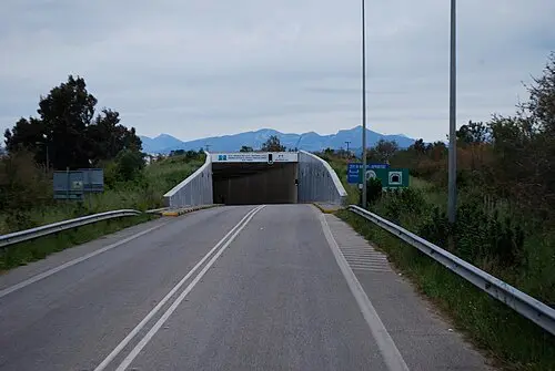
- From Preveza through the Preveza–Aktio undersea tunnel (1.57 km, toll; motorhomes over 2.20 m in height usually pay the higher class, so check the rate beforehand) to Aktio. Continue south on the well-built coastal road past the airport, then take the causeway and the floating bridge at the Agia Mavra fortress onto the island. The bridge swings open for boats and the road is closed briefly. Boat operations were recently interrupted several times because of maintenance and expired safety certificates, and at times road traffic was routed over a makeshift ferry arrangement; ask for the current situation on site. A good hour of pure driving time.
- Highlights & must-sees
- Agia Mavra (Santa Maura) fortress at the entrance to the island, with a view over the lagoon: a medieval stronghold, later extended by the Venetians and Ottomans, with a long bridge walkway to the island.
- Gyra lagoon and salt pans beside the causeway: waterbirds in autumn and winter, good light in the evening.
- The old-town lanes of Lefkada town with the colourful metal façades from the earthquake era, Agios Spyridon square and churches with icons of the Heptanese School.
- CampingSpirit overnight tip
-
Official campsite or RV park: According to OSM data, Camping Kariotes Beach lies on the east coast a few kilometres south of Lefkada town (check location, facilities and opening times before you travel). In high season, enquire beforehand; motorhomes over 7 m are not welcome everywhere.
Free camping or nature tip (where legal): Wild camping is banned throughout Greece. In Lefkada town, parking by the canal and at the marina is limited, and local bans take precedence; overnighting on the quay is not recommended. During the day, park on the edge of town and walk into the old town.
- Insider tip for campers
- Fill up and shop in Preveza or Lefkada town if you can: beyond Nidri and on the west side there are only a few petrol stations and very small supermarkets. If your schedule is tight, allow a time buffer for the bridge and causeway – when the bridge is operating, queues build up in both directions.
2Stage 2: Lefkada town to Porto Katsiki (west coast) (approx. 50 km)
- The drive
- Via Tsoukalades and the plateau towards Athani or, more scenically, via Agios Nikitas and the coast road to Kathisma and on south. Many hairpin bends, narrow sections with guard rails, and commercial vehicles and rental cars in convoy; on the last kilometres to Porto Katsiki beach the road drops steeply, and the paid car park at the top is limited and already full by late morning in summer. Allow a good two hours of pure driving time.
- Highlights & must-sees
- Agios Nikitas: a village in a bay with a pebble beach and walking paths to coves and viewpoints.
- Kathisma: a long beach with clear water, surfers in the south and heavy swell when it is windy.
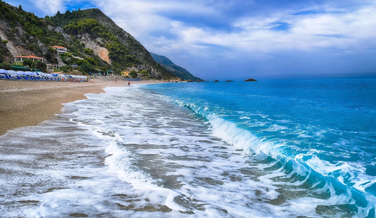
- Porto Katsiki: white cliffs, around 100 steps down to the pebble beach (figures vary); from above you look along the coast towards Cape Lefkatas.
- CampingSpirit overnight tip
-
Official campsite or RV park: According to its OSM entry, Camping Kathisma lies on the west coast near Kathisma (tents and motorhomes; check facilities, electricity and season before you travel). There is no campsite right at Porto Katsiki.
Free camping or nature tip (where legal): The car park above Porto Katsiki is meant for day visitors and is overcrowded in high summer. At night and with camping behaviour, the €300 per person fine that applies throughout Greece is a risk; checks are possible during the season. The coastal edge around Cape Lefkatas is fragile and heavily eroded.
- Insider tip for campers
- Drive the west coast before 10 a.m. or only in the late afternoon: the passing places are tight, and a motorhome over 7 m needs the whole width in the bends. Alternatively, leave the motorhome at the site near Kathisma and make the day trip by rented scooter or taxi. Egremni (about 15 km from Vasiliki) is reached by a long staircase of roughly 350 to 400 steps; after the 2015 earthquake it was unusable for a long time. The car park is a little way above; you cover the rest on foot – check access and condition beforehand.
3Stage 3: Porto Katsiki to Vasiliki (approx. 25 km)
- The drive
- From Porto Katsiki back to the main road and via Agios Petros and the mountain village of Komilio into the Vasiliki valley; the route is easy to drive but twisty. The village lies at the end of a wide bay. Around 45 minutes of pure driving time.
- Highlights & must-sees
- Vasiliki: a windsurfing and kitesurfing spot; the afternoon wind (known locally as “Eric”) arrives reliably in summer.
- Harbour promenade with tavernas and the ferries to the neighbouring islands.
- View over the bay of Vasiliki from the slopes above the village.
- CampingSpirit overnight tip
-
Official campsite or RV park: According to its OSM entry, Vasiliki Beach Camping lies near Vasiliki (check location and facilities before you travel). Book in high season; the site gets windy in the afternoon.
Free camping or nature tip (where legal): Motorhomes are not welcome at the harbour or in the beach car parks in summer; local bans take precedence. The alternative is the campsite.
- Insider tip for campers
- In summer, boats run from Vasiliki to the neighbouring islands (Ithaca, Kefalonia), mostly as passenger connections; check beforehand whether vehicles can come along. For notes on the crossing with a motorhome, see the CampingSpirit guide “Tannenwald, Höhlenseen und Odysseus’ Heimat – mit dem Camper über Kefalonia und Ithaka”. Check the timetable and vehicle length in advance.
4Stage 4: Vasiliki to Nidri (approx. 35 km)
- The drive
- Through the interior of the island, past Sivros and Karya: the road climbs in bends onto a plateau, is narrow in places and runs through olive groves. On the east side, descend to Nidri on the strait facing the islands. Motorhomes over 7.5 m can have trouble in some village centres. A good hour.
- Highlights & must-sees
- Karya: a mountain village known for lace embroidery, with a plaza under old plane trees.
- Nidri waterfalls (Dimosari gorge): a short walk to the bathing pools, more of a trickle in summer, with noticeably more water in spring.
- Nidri: boat trips to Meganisi, Skorpios and Madouri; view over the bay of Vlycho.
- CampingSpirit overnight tip
-
Official campsite or RV park: According to OSM data, Camping Dessimi Beach and Camping Santa Maura lie south of Nidri on the bay of Desimi, and Camping Poros Beach further south near Poros; check location and facilities (electricity, sanitation, fresh water/waste disposal) before you travel. Nidri itself is overcrowded in summer.
Free camping or nature tip (where legal): In and around Nidri, parking is difficult in summer; local bans take precedence. Camping behaviour at the harbour or in bays outside the campsites is banned.
- Insider tip for campers
- Set off early in the morning for the waterfalls, while it is still cool and quiet. Fill up with water and empty the cassette at sites that allow this for passing travellers; dumping waste wild is banned everywhere.
5Stage 5: Nidri to Preveza (approx. 50 km)
- The drive
- Back north along the coast road on the east shore, through Lefkada town and over the floating bridge, then the causeway, Aktio and the tunnel to Preveza. Allow some buffer time because of the bridge; otherwise a good hour.
- Highlights & must-sees
- Preveza: harbour promenade, old town with Ottoman and Venetian remains, Agios Andreas fortress.
- Nikopolis Archaeological Museum at the edge of the excavation site, a few kilometres north of the town (finds from the victory city).
- Evening light over the Aktio strait, boats and ferries.
- CampingSpirit overnight tip
-
Official campsite or RV park: According to OSM entries, Camping Monolithi and Camping Panorama lie north of Preveza on the Ionian coast, and Camping Kalamitsi is also to the north but closer to the town (check location, facilities and season before you travel).
Free camping or nature tip (where legal): Parking at Preveza harbour is time-limited, and overnighting with camping behaviour is banned. Local bans take precedence.
- Insider tip for campers
- Shop and fill up in Preveza before heading north to the lagoons: there are only small villages there. For the town’s market offerings, ask locally about market days.
6Stage 6: Preveza to Preveza (Nikopolis, Aktio, Vonitsa) (approx. 60 km)
- The drive
- First north to the ruins of Nikopolis (about 8 km), then back through the tunnel to Aktio and along the south shore of the gulf to Vonitsa; return the same way. Flat, good roads; parking in Vonitsa is tight. A good 1.5 hours of pure driving time; the route is somewhat longer depending on detours.
- Highlights & must-sees
- Nikopolis: stadium, theatre, odeon, city walls and early Christian basilicas, founded by Octavian after the victory at Actium in 31 BC.
- Victory Monument of Augustus (Octavian monument) with a view over the bay.
- Vonitsa: Venetian-Ottoman castle, harbour with tavernas and a view over the lagoon.
- CampingSpirit overnight tip
-
Official campsite or RV park: Back at the same site in the Preveza area (Monolithi or Panorama). No campsite is known in Vonitsa itself.
Free camping or nature tip (where legal): In Vonitsa, watch for no-parking signs along the harbour promenade; overnight, as everywhere in Greece, camping behaviour is banned.
- Insider tip for campers
- Nikopolis is spread out, so allow at least two hours, plus the museum. Take sturdy footwear, sun protection and water – in summer there is hardly any shade.
7Stage 7: Preveza to Preveza (Arta and Koronisia) (approx. 140 km)
- The drive
- From Preveza briskly north on the Ionia Odos to Arta (stone bridge over the Arachthos); then south via Kommeno along the lagoons of the Amvrakikos Gulf to Koronisia. The Rodia and Tsoukalio lagoons lie in the surrounding area. The road to the village is asphalted, but the farm tracks and dykes at the lagoons often are not, and become impassable after rain. The return route runs via Arta again. A good 3 hours of pure driving time.
- Highlights & must-sees
- Arta: 17th-century stone arch bridge over the Arachthos with the legend of the walled-in woman, the Parigoritissa monastery and the castle.
- Amvrakikos Gulf: Rodia and Tsoukalio lagoons with observation points for pelicans (the rare Dalmatian pelican breeds near Koronisia) and, with a bit of luck, flamingos; more birds in autumn and winter than in high summer.
- Koronisia: a fishing village on a group of islets in the gulf, linked to the mainland by an asphalted road; tavernas serving fish and the Byzantine church of the Nativity of the Virgin.
- CampingSpirit overnight tip
-
Official campsite or RV park: Back at the site near Preveza. No campsite is known in the Arta and Koronisia area.
Free camping or nature tip (where legal): The Amvrakikos Gulf is a national park and Ramsar site; overnighting in the protected area and camping behaviour are not permitted. Park at observation points only in the designated areas.
- Insider tip for campers
- Binoculars and patience pay off: the birds are most active early in the morning and in the evening. Our advice: keep your distance, stay on the paths and leave drones on the ground – in protected areas they often require a permit. Fill up with fuel in Arta or Preveza.
Camping practice & local rules
Wild camping & overnight parking
- Wild camping is banned in Greece (Law 5170/2025); the fine is €300 per person. Anything that goes beyond the outline of the vehicle counts as camping: awning, table, chairs, barbecue, extended levelling jacks, washing line.
- Parking is governed by the Road Traffic Act 5209/2025 (Art. 38), clarified by a police circular from 2026: within built-up areas, motorhomes up to 7.5 m may park without a time limit, while longer motorhomes and caravans may park for 24 hours at most at a stretch; outside built-up areas, in designated areas or at the right-hand edge of the carriageway without a time limit, provided no ban applies. According to the police, staying in a correctly parked vehicle, including at night, is not an offence. Local bans take precedence.
- On Lefkada the campsites are scattered along the east and west coasts; in high summer they are full, and in the low season many are closed. Beyond them, the only option is parking in line with road traffic law; checks are possible during the season.
- The Amvrakikos Gulf (national park and Ramsar site) and the lagoons near Preveza are protected: overnighting, fires and disturbing the birds are banned, and you must not leave the paths.
- Useful apps: park4night and Campercontact, with user reports on parking spots and waste disposal, plus the daily fire-risk map from the Greek civil protection authority.
Waste disposal & supplies
- Service and waste-disposal stations are rare in Greece and mostly located on campsites; ask before you arrive whether passing travellers may also dump waste.
- Empty grey water and the cassette only at the station; wild dumping at beaches and harbour car parks is a main source of complaints and new bans.
- In summer, tap water is chlorinated in many places or not designated as drinking water; buy drinking water in large bottles at the supermarket and use tank water sparingly.
- Gas: German exchange cylinders are not exchanged. Autogas (LPG, “υγραέριο”) is easier to find on the mainland around Preveza than on Lefkada – fill refillable tanks beforehand and bring an adapter set.
Vehicle size & traffic rules
- Speed limits for motorhomes up to 3.5 t: 30 km/h in built-up areas as a rule, 50 km/h on multi-lane or physically separated main roads; 90 km/h outside built-up areas. Lower values apply to vehicles over 3.5 t and to vehicle combinations, and 80 km/h on motorways.
- Tolls: the Preveza–Aktio tunnel is a toll route; two-axle vehicles over 2.20 m in height pay Class 3 on toll routes, a good double the car rate. On the Ionia Odos (A5), toll stations may apply depending on the section; have a card ready.
- Floating bridge at Lefkada town: it swings open for boats, and road traffic stops. Operation was recently restricted several times because of maintenance and expired certificates, or replaced by a temporary solution; ask on site for the current status and allow a time reserve.
- Blood alcohol limit 0.5, and 0.2 for novice and professional drivers; phones at the wheel only with a hands-free kit. If a load projects beyond the rear, clear marking is required – the red-and-white warning panel is the safe choice.
- Island roads: scheduled buses and delivery vans effectively have priority in tight spots. Sound your horn before blind bends and use passing places; after rain the limestone roads are slippery, and rockfall is to be expected on the west coast.
- Earthquakes: Lefkada lies in one of the most active earthquake zones in Europe (quakes in 2003 and 2015). Take warnings about rockfall and closed paths seriously; check the condition of the steps before descending to beaches.
CampingSpirit packing & preparation checklist
- Binoculars and an identification guide or a bird app for the lagoons of the Amvrakikos Gulf: pelicans, herons and, with a bit of luck, flamingos are often far away.
- Level 2–3 levelling ramps for the sloping pitches at beaches and harbours – to be used only on campsites, not when parking elsewhere.
- A reversing camera or radios for a spotter: at narrow village entrances and in the bridge queue you often have to reverse.
- Sturdy footwear and sun protection for Nikopolis and the steep steps down to Porto Katsiki; at least two litres of water per person.
- Water shoes for the pebble beaches and a sun-sail or shade solution that works without levelling jacks or an awning when you are not on a campsite.
- Two 10-litre jerrycans or one collapsible can for fresh water if you find no campsite between Vasiliki and Nidri.
As of 2026-10. Closures, fees and booking rules change: check official sources before you go.