



In-depth guide · CampingSpirit
From the Venetian fortresses of Corfu Town via the dunes of Issos, the Kaiser's Throne and the coves of Paleokastritsa up to Pantokrator: an island loop of around 325 kilometres in six stages, on which the narrow village roads cost more time than the distances.
The spirit of the route
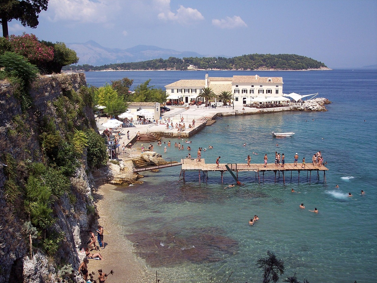
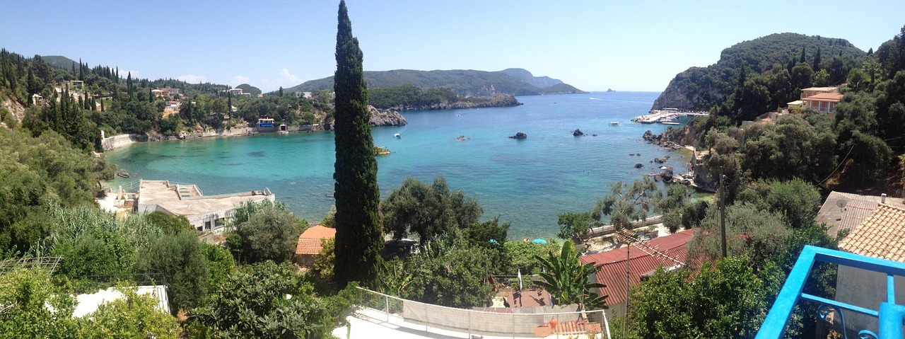
Corfu is greener than you would expect of a Greek island. Millions of olive trees, many of them planted in Venetian times, cover the hills, with cypresses standing between them like dark exclamation marks. Even arriving by ferry shows you the island in a single line: the Old Fortress on its rock, behind it the bell towers of the old town, far to the north the bare dome of Pantokrator and, opposite, the Albanian mountains. As you drive, the coasts change character – calm water and fishing villages in the east, sand, lagoon and juniper dunes in the south, steep limestone coves in the west, where the evening stays light for a long time. Through the sliding door you smell pine resin, grilled fish and sometimes the smoke of a wood-fired oven in the village. The island is small, but not fast: hairpins, buses and narrow stretches set the pace, and that is a good thing.
Stage-by-stage plan
1Stage 1: New Port, Corfu Town to Dassia (approx. 15 km)
- The drive
- Arrival at the New Port of Corfu Town: depending on the season, direct ferries from Italy come in from Brindisi (around 7 hours), Bari (around 9–11 hours), Ancona (around 20 hours) and Venice (just under 26 hours), with the Venice and Ancona lines running only a few times a week; from Igoumenitsa, ferries shuttle across several times a day all year round in 1 to 1.5 hours. From the port, take the coast road north through Gouvia to Dassia – slow-moving traffic with scooters, vans and buses near town, then a well-built two-lane road. Just under half an hour's driving.
- Highlights & must-sees
- Corfu old town (UNESCO World Heritage Site): lanes (“kantounia”) lined with Venetian houses, the church of Agios Spyridon with its red bell tower and the arcades of the Liston on the Spianada.
- Old Fortress on the headland in front of the town, reached by a bridge over the moat, with views from the clock tower over the town and the strait.
- New Fortress above the Old Port – from the battlements you see the roofs of the old town and the ferries coming and going.
- CampingSpirit overnight tip
-
Official campsite or RV park: Two campsites lie close together north of town: Dionysus Camping Village on Dafnila Bay near Dassia, a terraced site under old olive trees with pool, electricity, sanitary facilities and service point, and Camping Karda Beach in Dassia, around 100 m from the beach, also under olive trees, with pool and playground. Both work as a base for the town and the tour to the south. Ask in advance about opening seasons and pitch sizes for long vehicles.
Free camping or nature tip (where legal): Wild camping is prohibited in Greece (Law 5170/2025, €300 per person); anything outside the outline of the vehicle counts as camping – awning, table, chairs, barbecue, levelling jacks, washing line. Parking correctly and staying in the vehicle is permitted under Road Traffic Code 5209/2025 (Art. 38), but local bans take precedence. At the port and in town this is not a sensible option: parking space is scarce and there is hardly any for long vehicles.
- Insider tip for campers
- Don't drive into the old town with the camper – most of the lanes are closed to cars anyway, and the streets around the edge are narrow and parked up. From Dassia the blue town buses run regularly to the centre. If you are coming from Igoumenitsa and want to see the south first, you can instead take the less frequent, shorter ferry to Lefkimmi (just under an hour) and start the loop there.
2Stage 2: Dassia to Dassia (loop to the south) (approx. 105 km)
- The drive
- Through Corfu Town to the south, up to Gastouri and the Achilleion, then down to the east coast and along the coast road through Benitses and Moraitika to Messongi. From here, the main road takes you into the flat, agricultural end of the island: turn-offs to the Korission Lagoon and Issos, then on via Lefkimmi to Kavos. Return on the same main road. Narrow in Gastouri and through the villages, otherwise straightforward; a good 2.5 hours of pure driving time.
- Highlights & must-sees
- Achilleion in Gastouri: the palace that Empress Elisabeth of Austria had built around 1890 and that Kaiser Wilhelm II later bought, with terraced garden and statues of Achilles. The palace has been under restoration for years and is closed until further notice; check in advance whether the gardens or outdoor areas are accessible.
- Korission Lagoon and the dunes of Issos: a brackish lagoon with waterbirds, backed by sand dunes with an old juniper forest – one of the few near-natural stretches of coast on the island.
- Lefkimmi with the river channel through the middle of the village where fishing boats are moored, and Cape Asprokavos south of Kavos.
- CampingSpirit overnight tip
-
Official campsite or RV park: No campsite is listed in the south of the island in current directories – which is why this stage is planned as a loop, with the night again at Dionysus Camping Village or Camping Karda Beach near Dassia.
Free camping or nature tip (where legal): The dunes of Issos, the Korission Lagoon and Arkoudilas are Natura 2000 sites. During the fire season, protected areas, forests and parks on Corfu are closed to people and vehicles all day when the wildfire risk is very high or at alert level (category 4–5 on the daily fire risk map), and most of them from 1 pm when the risk is high (category 3). Spending the night in a beach car park is not an option here.
- Insider tip for campers
- Some of the access roads to the lagoon and to the beach car parks near Issos are sandy tracks: in a heavy motorhome, stay on firm ground and don't drive into soft sand. Check the civil protection fire risk map (civilprotection.gov.gr) in the morning before setting off for the dunes or forest. In Benitses the narrow road through the village runs right along the water – at midday buses stand here.
3Stage 3: Dassia to Paleokastritsa (approx. 60 km)
- The drive
- Across the middle of the island to Sinarades, then the steep, winding road down to Agios Gordios and back up again; on to Pelekas on the ridge above the west coast and via Gialiskari and Liapades to Paleokastritsa. Lots of hairpins with double-digit gradients, and narrow stretches in the villages without passing places. Around 2 hours of pure driving time.
- Highlights & must-sees
- Agios Gordios: a long sandy bay below steep slopes, with the free-standing rock pinnacle of Ortholithos at its southern end.
- Kaiser's Throne above Pelekas: the viewpoint where Wilhelm II watched the sunset over the west coast, with a panorama across the island as far as the town.
- Ermones Bay and the slopes of Ropa with olive and cypress groves on the way north.
- CampingSpirit overnight tip
-
Official campsite or RV park: Camping Paleokastritsa lies on the access road at the entrance to Paleokastritsa, on terraces under olive trees, with electricity and sanitary facilities; a supermarket and tavernas are nearby. Some terraces are narrow and steep – with a long vehicle, ask in advance for a suitable pitch.
Free camping or nature tip (where legal): No wild parking on the west coast: the beach car parks in Agios Gordios, Glyfada and Paleokastritsa are small and full in summer, and the police carry out checks. The camping ban applies whether or not there is a sign.
- Insider tip for campers
- The road to the Kaiser's Throne is short and narrow, with hardly any room to turn at the top: park larger motorhomes in the village of Pelekas and walk the last few minutes. The access road to Myrtiotissa is a very steep track – not for campers. Take the descent to Agios Gordios in a low gear and let the brakes cool down before climbing back up.
4Stage 4: Paleokastritsa to Sidari (approx. 45 km)
- The drive
- From Paleokastritsa north via Lakones (very tight hairpins, small vehicles only) or, more relaxed, back via the main road and Skripero; on to Krini below Angelokastro, then through hills with olive groves via Magoulades to Arillas and Agios Stefanos and along the north-west coast via Avliotes and Peroulades to Sidari. Narrow country roads, little traffic outside the village centres; 1.5 to 2 hours.
- Highlights & must-sees
- Monastery of the Theotokos on the Paleokastritsa headland, founded in the 13th century, with an inner courtyard and views of the coves; boat trips to the grottoes leave from the bay.
- Angelokastro: a Byzantine castle on a rocky summit above the sea near Krini, a short, steep footpath from the car park; seasonal opening hours.
- Afionas with the footpath to the double bay of Porto Timoni, and the pale cliffs at Cape Drastis near Peroulades.
- CampingSpirit overnight tip
-
Official campsite or RV park: Dolphin Camping near Sidari Bay, around 150 m from the beach: a small, quiet site with sanitary facilities, washing machine, bar and restaurant. Ask in advance about electricity, service point and the season.
Free camping or nature tip (where legal): Porto Timoni and the forest areas in the north-west are on the list of areas closed when the wildfire risk is high. Overnight stays are not intended at the cliffs of Cape Drastis or the Canal d’Amour; the dirt tracks along the cliff edges are unsurfaced and in places at risk of collapse.
- Insider tip for campers
- The road to the monastery at Paleokastritsa ends with hairpins at a small car park – with a large motorhome, park down at the bay and walk up. Parking at Angelokastro is limited, so come in the morning. For Cape Drastis, leave the camper up in Peroulades and walk to the viewpoint.
5Stage 5: Sidari to Ipsos (approx. 55 km)
- The drive
- Along the north coast via Roda and Acharavi to Kassiopi, then on the narrow, winding north-east coast road with detours to Agios Stefanos East and Kalami, and on via Nissaki to Ipsos. From Kassiopi it is winding and narrow, with rock on one side and a drop on the other; buses and coaches come towards you on the bends. A good 2 hours.
- Highlights & must-sees
- Canal d’Amour in Sidari: sandstone rocks washed out by the water with narrow channels, free of crowds in the early morning.
- Kassiopi with the ruins of the medieval castle on the headland and the shore path around the capes.
- Kalami with the White House, where Lawrence Durrell lived in the 1930s, and the view across the channel to Albania.
- CampingSpirit overnight tip
-
Official campsite or RV park: Overnight at Dionysus Camping Village or Camping Karda Beach near Dassia, only a few kilometres south of Ipsos; we could not confirm an open campsite in Ipsos itself. If you want to stay on the north coast: Roda Beach Camping in Roda, with pool and restaurant – check the season in advance.
Free camping or nature tip (where legal): The north-east coast is densely built up and the car parks in the coves are tiny. Wild parking is practically out of the question here; the Erimitis area near Agios Stefanos East is also one of the areas closed when there is a fire risk.
- Insider tip for campers
- The side roads down to Agios Stefanos East and Kalami are steep and end at small car parks with no room for long vehicles to turn – with a large motorhome, park on the main road and walk. In Kassiopi, leave the camper on the edge of the village; the centre is narrow. Fill up and shop in Acharavi.
6Stage 6: Ipsos to Dassia via Pantokrator (approx. 45 km)
- The drive
- From Ipsos via Pyrgi up through hairpins to Spartylas, on to Strinylas and along the last, just under 5 km long, narrow mountain road, steep towards the end (partly concrete slabs), to the summit of Pantokrator (around 900 m), the highest point on the island. Back the same way and along the coast to Dassia. Two lanes but winding as far as Strinylas; the summit road is single-track with few passing places. Around 1.5 hours of pure driving time.
- Highlights & must-sees
- Summit of Pantokrator with the monastery and the panoramic view over the whole island, to Epirus and Albania.
- Strinylas: a mountain village with a plane-tree square and tavernas, the starting point for hikes to the summit.
- Spartylas with its stone houses on the hillside and the view over Ipsos Bay.
- CampingSpirit overnight tip
-
Official campsite or RV park: Last night at Dionysus Camping Village or Camping Karda Beach near Dassia, around 15 minutes from the New Port – handy for an early ferry to Igoumenitsa or Italy.
Free camping or nature tip (where legal): The summit car park only has room for a few vehicles, and the masts and the monastery leave hardly any space. Overnight stays there are neither intended nor sensible; on days of high fire risk, avoid the forest tracks on Pantokrator.
- Insider tip for campers
- Don't drive the summit road in a large motorhome: park in Strinylas and walk up. Before leaving for the ferry, empty your tanks at the campsite and fill up with fuel – keep gas cylinders closed during the crossing, and give the exact vehicle length including rear rack when booking.
Camping practice & local rules
Wild camping & overnight parking
- Wild camping is prohibited in Greece (Law 5170/2025); the fine is €300 per person. Anything that extends beyond the outline of the vehicle counts as camping: awning, table, chairs, barbecue, extended levelling jacks, washing line.
- Parking is governed by Road Traffic Code 5209/2025 (Art. 38), clarified by a police circular from 2026: in built-up areas, motorhomes up to 7.5 m may park without a time limit, longer motorhomes and caravans for a maximum of 24 hours at a time; outside built-up areas, on designated spaces or at the right-hand edge of the road without a time limit, unless a ban applies. According to the police, staying in a correctly parked vehicle, including at night, is not an offence. Local bans take precedence.
- On Corfu during the fire season, Natura 2000 sites, forests and parks – including the Korission dunes, the Issos juniper forest, Arkoudilas, Mon Repos, Porto Timoni and Erimitis – are closed to people and vehicles, mostly from 1 pm when the wildfire risk is high (category 3) and all day when the risk is very high or at alert level (category 4–5); the port authority announces the closures. Open fires and outdoor barbecues are prohibited during the fire season.
- Useful apps: park4night and Campercontact, with user reports on parking spots and service points; plus the daily fire risk map from the Greek civil protection agency.
Waste disposal & supplies
- On Corfu, water and waste services are practically only available at campsites, most of which are in the north and on the east coast around Dassia and Ipsos. The south has no infrastructure at all – set off with an empty cassette and a full fresh-water tank.
- Only empty grey water and the cassette at a service point; illegal dumping at beaches is one of the main reasons for complaints and new bans.
- In many places on Corfu tap water is chlorinated or brackish, and in dry summers supply in the north is tight. Buy drinking water in large bottles at the supermarket and use tank water sparingly.
- Gas: German exchange cylinders are not swapped. Autogas (LPG, “υγραέριο”) is easy to find on the mainland, for example in Igoumenitsa; there are fewer stations on the island – it is best to fill refillable cylinders before the crossing and bring an adapter set (usually Dish, as in Italy).
Vehicle size & traffic rules
- Speed limits: since January 2026 generally 30 km/h in built-up areas, 50 km/h on multi-lane or physically separated main roads (watch the signs); outside built-up areas 90 km/h for motorhomes up to 3.5 t. Lower limits apply to vehicles over 3.5 t and vehicles with trailers. There is no motorway on Corfu – on the island roads, 30–60 km/h is the realistic travelling speed.
- There are no tolls on the island. If you continue on the mainland: two-axle vehicles over 2.20 m high pay class 3 on Greek motorways, a good twice the car rate; since 2026 the Egnatia Odos has been operated by the private concessionaire Nea Egnatia Odos, and the EgnatiaPass discounts have been dropped.
- Ferry: give the exact length and height including rear rack and roof box when booking; close gas cylinders during the crossing. Some shipping lines offer seasonal “camping on board” on the Italy routes.
- Blood alcohol limit 0.5, 0.2 for new and professional drivers; mobile phone at the wheel only with a hands-free kit. If a load sticks out beyond the rear, a warning panel is mandatory. Fines were raised significantly in 2026.
- On the mountain roads, service buses effectively have priority: sound your horn before tight hairpins, wait in passing places in good time and give way to vehicles driving uphill.
CampingSpirit packing & preparation checklist
- Collapsible water containers (2 × 10 l) – you buy drinking water in bottles, and there is nowhere to refill on the way south.
- Sand ladders – the access roads to the Korission Lagoon and to some beach car parks are sandy.
- Levelling ramps, level 2–3, for the terraced, sloping pitches under olive trees in Dassia and Paleokastritsa.
- Reversing camera or a pair of handheld radios for whoever is guiding you – in the villages and on the Pantokrator road you will often be manoeuvring in reverse.
- Mosquito nets for the door and roof hatch – evenings by the lagoon and in the olive groves bring plenty of mosquitoes.
- Light hiking shoes for Angelokastro, Porto Timoni and the footpath up Pantokrator.
As of 2026-10. Closures, fees and booking rules change: check official sources before you go.