


In-depth guide · CampingSpirit
Around 525 km from the ferry terminal at Igoumenitsa via the bays of Sivota and Parga, the lakeside city of Ioannina, the stone villages of Zagori on the Vikos Gorge, Konitsa and Metsovo to the rock monasteries of Meteora and on to Trikala in Thessaly.
The spirit of the route
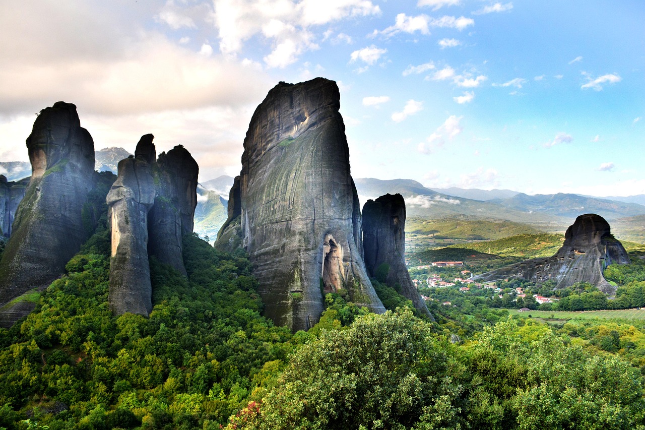
Roll off the ferry in Igoumenitsa at night and by morning you still have the Ionian Sea outside the sliding door, turquoise between pines and olive-covered slopes. Two days later you are standing at 1000 metres in a village of grey limestone, slate roofs and plane trees on the square, and below the rim of the cliff the Vikos Gorge opens up so deep that you only hear the river when the wind drops. Epirus is Greece without sunloungers: arched bridges from the 18th and 19th centuries, mule tracks of stone steps, sheepdogs, beech forest, bear tracks in the mud. Over the Pindus you reach Metsovo, where woodsmoke and smoked cheese hang in the air, and then descend into Thessaly, where sandstone towers rise out of the plain and monks have built their monasteries on them since the 14th century. In the evening in Kastraki the rocks turn orange, and the bell of a monastery carries all the way down to your pitch.
Stage-by-stage plan
1Stage 1: Igoumenitsa to Parga (approx. 70 km)
- The drive
- From the ferry port of Igoumenitsa take the coast road EO6/EO18 south, turn off via Plataria to Sivota, then continue through the hinterland (Perdika, Karteri) to Parga. Winding, well-surfaced minor roads through olive groves with short steep sections down to the bays. Around 1.5 hours without swimming stops. The spur roads down to the beaches of Sivota and the route through Parga are narrow and packed with parked cars in summer.
- Highlights & must-sees
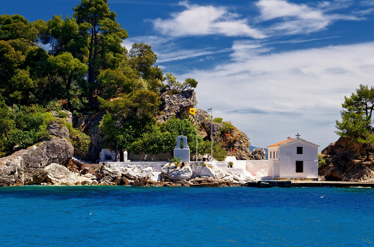
- Sivota: bay with offshore islets, shallow turquoise water and beaches such as Bella Vraka with its sandbar to the island.
- Plataria: quiet bay with a beach promenade and several campsites – a good first stop after the night ferry.
- Parga: Venetian castle above the harbour, a row of colourful houses, footpath over to Valtos beach.
- CampingSpirit overnight tip
-
Official campsite or RV park: In Plataria, Camping Kalami Beach, Elena’s Beach and Camping Nautilos sit right on the bay; near Parga there is Valtos Camping on Valtos beach and Enjoy Lichnos on Lichnos Bay – with electricity, sanitary facilities and usually service points, mostly seasonal from around April/May to October; check opening times and pitch sizes in advance. Near Igoumenitsa there is also Camping Drepanos on the lagoon.
Free camping or nature tip (where legal): Wild camping is prohibited in Greece. Simply parking, on the other hand, is permitted under the new highway code (in built-up areas motorhomes up to 7.5 m long with no time limit, longer motorhomes and caravans for a maximum of 24 hours; for details see the practical section). On the beach there are still checks as soon as chairs, awning or washing line are out. In Sivota and Parga many beach car parks are signposted as closed to motorhomes at night.
- Insider tip for campers
- The route through Parga is a bottleneck for large motorhomes: park up on the bypass or at the campsite and go on foot or by boat (water taxis between Valtos and the harbour). You will find supermarkets and filling stations in Igoumenitsa on the main road out of town – stock up before you move on.
2Stage 2: Parga to Ioannina (approx. 110 km)
- The drive
- From Parga into the Acheron valley to Glyki, then via Paramythia on the EO18/EO5 up to Ioannina. First a lowland road through fields and citrus groves, then a winding climb over the mountain range towards the Ioannina plateau. Around 2 hours. Alternatively, it is quicker via the Ionia Odos (A5) and the Egnatia (A2), but then with tolls.
- Highlights & must-sees
- Necromanteion of Acheron near Mesopotamos: ancient oracle of the dead on the bank of the river that in mythology led to the underworld.
- Springs of the Acheron near Glyki: wade upstream through the gorge in ice-cold water, water shoes essential.
- Ioannina: Kastro with the Fethiye Mosque and the tomb of Ali Pasha, lakeside promenade on Lake Pamvotida, boat to the island of Nissi.
- CampingSpirit overnight tip
-
Official campsite or RV park: On the shore of Lake Pamvotida in Ioannina is the Limnopoula campsite with electricity and sanitary facilities, around half an hour on foot from the old town. According to user reports the site was open in summer 2026, including service point; opinions differ on cleanliness and the water quality of the lake (algae in late summer). Check opening times in advance.
Free camping or nature tip (where legal): According to user reports in apps, campers regularly spend the night at the car park by the Acheron springs in Glyki; this is at most parking, not camping, and can be prohibited at any time. In Ioannina the lakeside promenade and the car parks by the Kastro are not places to stay overnight.
- Insider tip for campers
- The old town of Ioannina is narrow and busy for motorhomes; park at the campsite or in the large car parks on the lakeshore outside the centre. At the Acheron the mornings are quiet – coach groups arrive from midday. The Perama cave with its stalactites is a few kilometres from the lake.
3Stage 3: Ioannina to Monodendri (Central Zagori) (approx. 40 km)
- The drive
- From Ioannina on the EO20 towards Konitsa; after around 15 km turn off into Zagori via Asprangeli and Kipi to Vitsa and Monodendri. Narrow, winding mountain road with climbs, passing only at lay-bys, partly single-track in Kipi and through the villages. Around an hour. Motorhomes over approx. 7 m should avoid village centres and drive the side roads to the viewpoints only in daylight and on dry roads.
- Highlights & must-sees
- Stone bridges of Kipi: the triple-arched Plakidas Bridge (Kalogeriko) and the Kokkoris Bridge, both right on or close to the road.
- Agia Paraskevi monastery near Monodendri: built into the cliff face of the Vikos Gorge, a few minutes on foot from the village square.
- Oxya viewpoint: at the end of a narrow spur road above Monodendri, a view straight down into the deepest point of the Vikos Gorge.
- CampingSpirit overnight tip
-
Official campsite or RV park: We know of no regular campsite for motorhomes in Central Zagori; accommodation here means guesthouses and pensions. The practical base is the campsite in Ioannina, around an hour away. Check the apps in advance for new options.
Free camping or nature tip (where legal): The municipal car park in Monodendri is signposted as a day car park; according to the sign, overnight stays are not welcome there, even if user reports say otherwise. The Vikos and Aoos gorges belong to the Northern Pindus (Vikos-Aoos) National Park – camping outside authorised sites is prohibited there.
- Insider tip for campers
- The final approach to the car park in Monodendri is steep and paved with stone slabs that become very slippery when wet; vehicles over around 7 m have come to grief there. At weekends and in high season coaches arrive – get there early. The road to the Oxya viewpoint has very little turning space at the end.
4Stage 4: Monodendri to Papingo (approx. 55 km)
- The drive
- Back to the EO20, north via Kalpaki and then right to Aristi; beyond Aristi cross the bridge over the Voidomatis and climb the mountainside in a chain of hairpins to Megalo Papingo. The climb is narrow and steep with hardly any passing places; oncoming traffic on the hairpins means manoeuvring. Around 1.5 hours. Megalo and Mikro Papingo are linked by a narrow road; in the villages themselves there is no room for motorhomes.
- Highlights & must-sees
- Voidomatis near Aristi: river with very clear, cold water, riverside path to the chapel and swimming spots.
- The “Ovires” near Papingo: rock pools scoured out by the river, right by the road between the two villages.
- View of the cliffs of the Astraka towers above Papingo; from Mikro Papingo the path leads to the Astraka mountain hut and to Drakolimni.
- CampingSpirit overnight tip
-
Official campsite or RV park: There is no campsite in Papingo. If you do not want to go back to Ioannina, continue to Konitsa (stage 5). Some parking areas are listed in apps; check location and overnight rules in advance.
Free camping or nature tip (where legal): The villages of Zagori lie within the national park and are protected ensembles; overnight stays in the car parks at the entrance to Papingo are frowned upon. No fires, no grey water disposal – water and forest are particularly protected here.
- Insider tip for campers
- Drive the climb to Papingo in the morning, when there is still little traffic, and park at the entrance to Megalo Papingo; the walk to the Ovires is short. Access for large vehicles may be restricted locally by signs – watch the signage before Aristi. The classic gorge hikes Monodendri–Vikos or Vikos–Papingo each take a long day; arrange a taxi from the villages to get back to your vehicle.
5Stage 5: Papingo to Konitsa (approx. 35 km)
- The drive
- Back down the hairpins to Aristi, via Klidonia to the EO20 and north to Konitsa. Be sure to descend in a low gear; then a wide valley road through the Konitsa basin. Around 45 minutes.
- Highlights & must-sees
- Klidonia bridge over the Voidomatis, starting point for kayak and rafting trips on the river.
- Konitsa stone bridge: the high single arch over the Aoos at the mouth of the gorge.
- Hike from the bridge car park through the Aoos Gorge to the Stomiou monastery, a good hour each way.
- CampingSpirit overnight tip
-
Official campsite or RV park: In and around Konitsa, simple camping options and motorhome pitches are listed in the apps; whether they exist, their facilities and seasons change, so check in advance. Service points are rare in the region – bring full fresh water tanks and an empty cassette.
Free camping or nature tip (where legal): The car park by the Aoos bridge is at the entrance to the national park; camping is prohibited there, while sleeping in the vehicle is sometimes tolerated according to user reports – follow the rules on site.
- Insider tip for campers
- Konitsa has supermarkets and filling stations – the last good supply point before the long drive via Ioannina to Metsovo. The minor road via Vovousa to Metsovo is scenic but narrow, remote and often impassable in winter; with a large motorhome take the main route.
6Stage 6: Konitsa to Metsovo (approx. 110 km)
- The drive
- On the EO20 back to Ioannina, then on the Egnatia Odos (A2) east through the Pindus tunnels to the Metsovo exit. The Egnatia is a wide, modern motorway with many tunnels and bridges; afterwards a short mountain road leads up into the town. Around 1.75 hours.
- Highlights & must-sees
- Metsovo: Aromanian mountain town at around 1150 metres with stone houses, wooden balconies and the village square under plane trees.
- Averoff Gallery with Greek painting of the 19th and 20th centuries, and the folk museum in the Tositsa House.
- Smoked “Metsovone” cheese and wines from the mountain vineyards of the surrounding area.
- CampingSpirit overnight tip
-
Official campsite or RV park: We know of no regular campsite near Metsovo; parking areas on the edge of town are listed in the apps. If you need electricity and sanitary facilities, continue to Kalambaka (stage 7) on the same day and visit Metsovo as a day trip.
Free camping or nature tip (where legal): Around the Aoos reservoir near Metsovo and in the Valia Calda forest (Pindus National Park) the camping ban applies; in public car parks outside the town simply parking with no time limit is permitted, provided no signs say otherwise.
- Insider tip for campers
- The lanes of Metsovo are steep and narrow: park in the car parks at the entrance to the town and go on foot. On the Egnatia there are toll stations between Igoumenitsa, Ioannina and Metsovo; cash and card payment are usual at the stations. In the long tunnels use dipped headlights and keep your distance; in crosswinds slow down on the bridges.
7Stage 7: Metsovo to Kalambaka / Kastraki (approx. 60 km)
- The drive
- On the old EO6 pass road over the Katara Pass at around 1700 metres and then down through the Malakasi valley to Kalambaka. Long hairpins; use engine braking on the descent. From late autumn to spring the pass may be closed or snow-covered – in that case take the Egnatia to the Malakasi/Panagia exit instead. Around 1.5 hours.
- Highlights & must-sees
- Katara Pass: one of the highest road passes in Greece, with views across the ranges of the Pindus.
- First view of the Meteora rocks from the Pinios valley before Kalambaka.
- Kastraki: village right beneath the rocks, starting point of the footpaths up to the monasteries.
- CampingSpirit overnight tip
-
Official campsite or RV park: In Kastraki are the campsites Vrachos (Camping Kastraki), The Cave and Meteora Garden with electricity, sanitary facilities and service point, and views of the rocks; most are open all year or almost all year. Check opening times and pitch sizes in advance.
Free camping or nature tip (where legal): The car parks at the monasteries and at the Meteora viewpoints are not places to stay overnight; checks do happen. With campsites within walking distance there is no reason to wild camp here.
- Insider tip for campers
- The route through Kalambaka is narrow but passable for motorhomes; the main road to Kastraki is better than the lanes of the old town. Kalambaka has large supermarkets and filling stations. In the evening walk up to the viewpoint above Kastraki rather than driving the motorhome to the cramped car parks on the ring road.
8Stage 8: Kastraki to Trikala (approx. 45 km)
- The drive
- The Meteora ring road loops past the monasteries (winding, narrow, lots of coach traffic at weekends) and back to Kalambaka; then on the EO6 across the Thessalian plain to Trikala. Around 1.25 hours of pure driving time plus time for visiting the monasteries.
- Highlights & must-sees
- Great Meteoron and Varlaam: the two largest monasteries, with museum, kitchen and a climb up steps; Stephanos and Roussanou can be reached from the road almost at ground level.
- Agia Triada monastery: on the free-standing rock tower, climb of around 140 steps, view down over Kalambaka.
- Trikala: fortress with clock tower, the old Varousi quarter, the Lithaios river with cafés on its banks, and the 16th-century Kursum Mosque.
- CampingSpirit overnight tip
-
Official campsite or RV park: We know of no campsite in Trikala itself; the simple solution is a second night at the campsites in Kastraki. Check the apps in advance for motorhome pitches in and around Trikala.
Free camping or nature tip (where legal): In public car parks in Trikala simply parking is permitted, camping is not; on the plain along the Pinios, riverbank areas are not automatically places to stay overnight.
- Insider tip for campers
- Each monastery has a closing day: in the summer half of the year (April to October), according to the monastery administration, most recently Great Meteoron was closed on Tuesdays, Roussanou on Wednesdays, Agia Triada on Thursdays, Varlaam and Agios Nikolaos on Fridays and Agios Stefanos on Mondays; in winter some close on additional days. Admission to each monastery is cash only (most recently €5). Dress code: shoulders covered, long trousers for men, skirts below the knee for women (wraparound skirts are available at the entrance). Times change on public holidays without notice – check in advance.
Camping practice & local rules
Wild camping & overnight parking
- Wild camping has long been prohibited in Greece: tents and camping are only allowed on authorised campsites, and the police and, on the coast, the port police can impose fines. In national parks such as Vikos-Aoos and Northern Pindus their own protection rules apply on top.
- The new highway code (Law 5209/2025, Art. 38) and a police clarification from 2026 treat motorhomes like other vehicles when parking: in built-up areas motorhomes up to 7.5 m long with no time limit, longer motorhomes and caravans for a maximum of 24 hours at a stretch; outside built-up areas on designated areas or at the roadside with no time limit, provided no parking ban applies. Camping (awning, table, chairs, levelling ramps, grey water) remains prohibited. Local signs and municipal bans take precedence.
- Brown bears and wolves live in Epirus; never leave food or rubbish outside, and keep your distance from sheepdogs. In summer the forest fire risk is high – open fires and outdoor barbecues are prohibited, and on days of the highest fire risk forest areas may be closed.
- Useful apps: park4night and Campercontact, with user reports on car parks, water points and checks; always check how current they are in advance.
Waste disposal & supplies
- Service points are practically only found on campsites; public disposal stations are rare in Epirus and Thessaly. Many campsites also let passing travellers use their disposal facilities for a fee – ask.
- Empty grey water and cassette only at the station; illegal dumping is one of the main reasons for new bans on the coast.
- Tap water is usually drinkable, but on the coast often heavily chlorinated. The Zagori villages have village fountains with spring water; do not use water from fountains marked “μη πόσιμο” (not drinkable).
- Gas: German exchange cylinders are not swapped. Autogas (LPG, “υγραέριο”) is widespread in Greece and easy to find at filling stations in Igoumenitsa, Ioannina and Trikala; in the mountains it is sparse. Bring an adapter set (usually Dish, as in Italy).
Vehicle size & traffic rules
- Speed limits for cars and motorhomes up to 3.5 t: in built-up areas 30 km/h as a rule since January 2026 (50 km/h on multi-lane or physically separated main roads, watch the signs), outside built-up areas 90 km/h, on expressways 110 km/h, on motorways 130 km/h; with a light trailer 80, 90 and 100 km/h respectively. Lower limits apply to vehicles over 3.5 t and heavier combinations – watch the signs. Since 2026 fines have been considerably higher. On the mountain roads of Zagori and over the Katara Pass, 30–50 km/h is the realistic travelling speed.
- Tolls: the Egnatia Odos (A2/E90) from Igoumenitsa via Ioannina and Metsovo eastwards is a toll road; since January 2026 it has been run by the private concessionaire Nea Egnatia Odos (GEK Terna/Egis), tolls have been raised and the discount subscriptions (EgnatiaPass) abolished. Depending on height and number of axles, motorhomes may fall into a higher toll class than cars (the threshold on Greek motorways is usually 2.20 m height). Payment at the toll stations is by cash or card.
- Ferry: ferries run to Igoumenitsa from Ancona, Bari, Brindisi and Venice; some operators offer seasonal “camping on board” on the open deck. State vehicle length and height exactly when booking, and keep gas cylinders closed during the crossing.
- Blood alcohol limit 0.5, 0.2 for novice and professional drivers; mobile phone at the wheel only with a hands-free system. If a load projects beyond the rear (bike rack), a warning board is required. In winter snow chains may be compulsory on the passes, and the Katara Pass is then often closed.
CampingSpirit packing & preparation checklist
- Water shoes or old trainers for the Acheron, the Voidomatis and the Ovires – the river water is cold and the bed is stony.
- Sturdy hiking boots and poles for the Vikos Gorge and the stone steps of the mule tracks; the paths are long and stony.
- Long trousers and a scarf for your shoulders in the glovebox – without them you will not get into any of the Meteora monasteries.
- Cash in small notes for monastery admission, village kafeneia and toll stations.
- Levelling ramps and a long water hose extension for the terraced pitches in Kastraki and on the coast.
- A gas adapter set (Dish and others) for refilling refillable gas tanks with autogas.
As of 2026-09. Closures, fees and booking rules change: check official sources before you go.