


In-depth guide · CampingSpirit
From Litchfield and the Housatonic Valley via Hartford and the Connecticut River Valley to the quiet northeast: around 500 kilometres past village greens, stone walls, the Appalachian Trail and antiques towns.
The spirit of the route
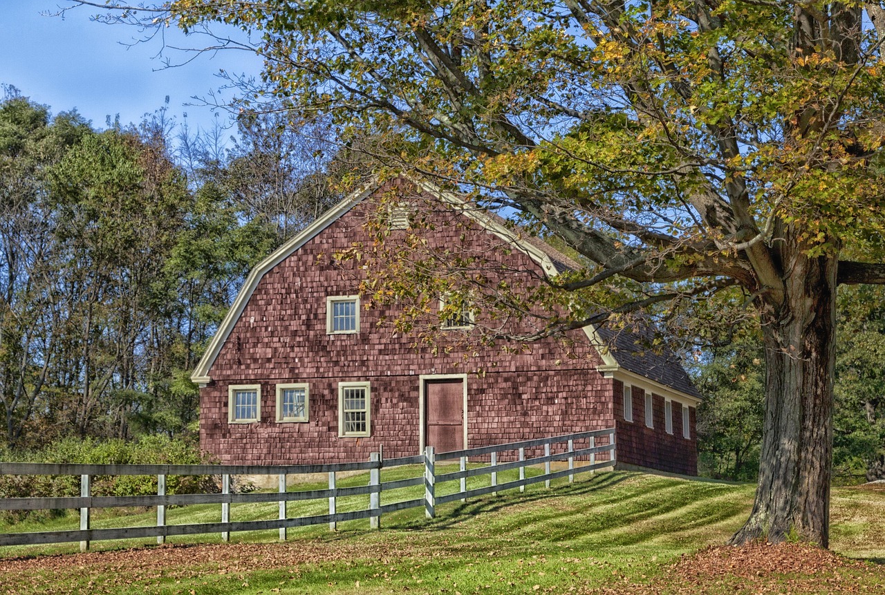
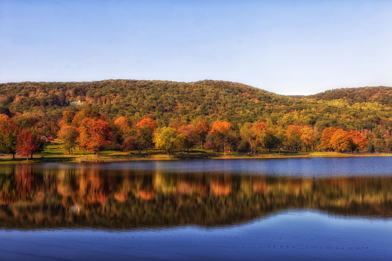
If you only know Connecticut from I-95, you don't know the state. In the northwest, the Litchfield Hills open onto a new picture around every bend: white churches on village greens, fly-fishers waist-deep in the Housatonic, water leaping over granite steps in Kent. The Appalachian Trail runs almost alongside the road here, and in the morning there is mist in the valley. In the Connecticut River Valley the scene changes to brick, the onion fields of Wethersfield and a castle of natural stone above the river. Far in the northeast, in the Quiet Corner, things go still: stone walls in the woods, farm stands, roads without a centre line, and so little light at night that you can see the stars from your sliding door. The route is winding, unhurried and, in autumn, a feast of red and gold.
Stage-by-stage plan
1Stage 1: Litchfield to Kent (approx. 50 km)
- The drive
- From Litchfield take US-202 west to New Milford, then US-7 north through the Housatonic Valley to Kent. Two-lane country roads with speeds of 35–55 mph (56–88 km/h), much slower in the towns; narrow stone bridges and tree-lined avenues, and slow leaf-peeping traffic in autumn. Driving time alone is about an hour, half a day with stops. Fuel stations and supermarkets in Litchfield, New Milford and Kent.
- Highlights & must-sees
- Litchfield: The village green with its white Congregational Church, Federal-style houses and the Litchfield Law School of 1773 is one of the best-preserved townscapes in New England. West of town lies the White Memorial Conservation Center, with lakes, wet meadows and hiking trails across about 1,600 hectares.
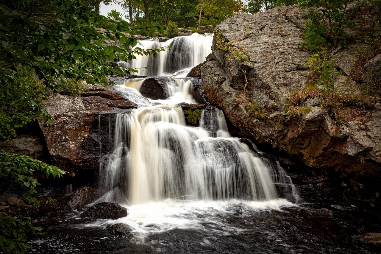
- Kent Falls State Park, just north of Kent: Falls Brook tumbles down in several steps for about 250 ft (just over 70 m); a short path leads up alongside the falls. Day-use park only, with a small car park right on US-7 that fills quickly in autumn and at weekends.
- Kent: a small town with galleries and cafés on the Housatonic. The Appalachian Trail crosses the road here and follows the river for a stretch, a flat section without any climbing, good for a stroll.
- CampingSpirit overnight tip
-
Official campsite or RV park: Macedonia Brook State Park northwest of Kent: a simple, wooded campground with 51 tent and vehicle sites, no hookups, no showers and no running water (portable toilets only); the season starts at the end of May. Access is along narrow park roads, and the park does not publish a length limit, so it is rather unsuitable for large motorhomes; if in doubt, ask the park beforehand. Pets are not allowed on the campground. Reservations are required (ReserveAmerica), no walk-ins. For larger vehicles it is better to go straight on to Housatonic Meadows (stage 2). Alternatively, there is White Memorial Family Campground (Point Folly) near Litchfield, a site run by the non-profit White Memorial Foundation; check season, vehicle suitability and facilities with the foundation first.
Free camping or nature tip (where legal): Wild camping is practically impossible in Connecticut: in State Parks and State Forests you may only stay overnight at designated campgrounds, and you may not sleep in town car parks or at the Appalachian Trail trailhead car parks either.
- Insider tip for campers
- On US-7 between New Milford and Kent there are stone bridges and overhanging trees; write your vehicle height (in feet) where you can see it in the cab. Head for Kent Falls early in the morning or on weekdays, when even the small car park is usually free; large vehicles with no room to manoeuvre are better parked on the road outside, where this is expressly permitted.
2Stage 2: Kent to Salisbury (approx. 75 km)
- The drive
- Continue north on US-7: Cornwall Bridge, West Cornwall, Falls Village. The road follows the Housatonic with tight bends, bridges and stone walls, speeds mostly 30–45 mph; near Falls Village and Salisbury you briefly join CT-41 and CT-44. Driving time alone is about 1.5 hours. Fuel stations in Cornwall Bridge, Canaan and Salisbury, few in between.
- Highlights & must-sees
- West Cornwall Covered Bridge: The red-painted wooden bridge of 1864 spans the Housatonic and can still be driven across, but with low clearance and a weight limit; visit it on foot in a motorhome rather than driving through.
- Housatonic Meadows State Park: The river is one of the best-known fly-fishing stretches in the Northeast (about three kilometres of fly-fishing-only water, catch and release, Trout Stamp required). The Appalachian Trail runs near the park, and hiking trails lead from the valley up into the hills.
- Bear Mountain near Salisbury: the highest peak lying entirely within Connecticut (about 2,300 ft, just over 700 m; the state's highest point is on the south slope of Mount Frissell on the Massachusetts border), reached via the Appalachian Trail from the car park on CT-41 (Undermountain Road); a steep climb, about four to five hours there and back. In clear weather there is a wide view over the Berkshires from the top. For a flat walk, try the Housatonic waterfalls at Falls Village.
- CampingSpirit overnight tip
-
Official campsite or RV park: Housatonic Meadows State Park Campground in Sharon, right on US-7 and the Housatonic: 61 wooded riverside sites with no electric or water hookups at the pitch, but with shower buildings with hot showers, drinking water and a dump station. The campground is open in summer only, roughly from the end of May to Labor Day in early September; it is closed in autumn. Reservations required through ReserveAmerica, no walk-ins; book early for summer weekends. Pets are not allowed on the campground. The park does not publish a length limit for the sites, so ask the park before booking. For autumn travellers there is still Lake Waramaug (stage 3) or American Legion State Forest.
Free camping or nature tip (where legal): Along the Appalachian Trail, camping is only allowed at the designated campsites and shelters; motorhomes have no business there. Wild camping on forest tracks is prohibited and checked.
- Insider tip for campers
- The campground lies between the road and the river: you can hear the train and the bridge traffic on US-7, and the riverside sites are the most popular. Start early for the hike up Bear Mountain, as the car park is small and can be full by mid-morning in autumn; there is only limited space for motorhomes.
3Stage 3: Salisbury to Lake Waramaug (approx. 65 km)
- The drive
- From Salisbury take CT-41/US-44 via Lakeville to Norfolk, then CT-272 south to Torrington and on country roads (including CT-4 and CT-45) to Warren and New Preston on Lake Waramaug. Winding country roads with hills, speeds 30–45 mph. Driving time alone is about 1.5 hours. The road around the lake is narrow, with no shoulder, with sharp bends and cyclists; large vehicles should drive slowly and anticipate what lies ahead.
- Highlights & must-sees
- Norfolk: a small town with a village green, the Norfolk Green and Haystack Mountain State Park, with a tower on the summit (Haystack Mountain Tower) and a wide view; in summer there are concerts in the Music Shed of the Norfolk Chamber Music Festival.
- Lake Waramaug: a natural lake of about 2.7 square kilometres in the hills, with a road running all the way round; swimming beach in the State Park, kayak and paddleboard hire nearby. Shops and cafés in New Preston and Washington Depot.
- Hopkins Vineyard on the lakeshore: a winery above the lake, with a tasting room and a view over the water (opening hours are seasonal, check beforehand).
- CampingSpirit overnight tip
-
Official campsite or RV park: Lake Waramaug State Park Campground (address Lake Waramaug Road, New Preston) on the north shore of the lake: 76 sites for tents and motorhomes, no electricity at the pitch; shower buildings with hot showers, drinking water, dump station and a swimming beach. Season roughly from the end of May to mid-October. Pets are not allowed on the campground or the beach. Reservations required through ReserveAmerica, no walk-ins; book early for autumn and summer weekends. Ask the park about vehicle length, as the park's website gives no limit.
Free camping or nature tip (where legal): Around the lake, overnight parking along the road is prohibited, as it is in the car park of Haystack Mountain State Park. There is no legal wild-camping option.
- Insider tip for campers
- The road around the lake is tight; it is best to cycle round from the campground rather than go by motorhome. Fill up in Torrington or Litchfield, as there are only a few fuel stations around Warren and New Preston.
4Stage 4: Lake Waramaug to Hartford / Wethersfield (approx. 85 km)
- The drive
- From New Preston take CT-45 and US-202 to Torrington, then CT-4 via Burlington and Farmington to Hartford; the last kilometres are on I-84, where traffic is heavy (Hartford is a commuter hub and prone to jams at rush hour). Then take I-91 or Wethersfield Avenue to the old town district of Wethersfield. Driving time alone is about 1.5 to 2 hours. Fuel stations and supermarkets plentiful.
- Highlights & must-sees
- Hartford: The Mark Twain House and the Harriet Beecher Stowe Center stand as neighbours on Farmington Avenue; both writers' homes can be visited on guided tours, check opening hours in advance. Also the State Capitol with its golden dome and Bushnell Park with its historic carousel.
- Wethersfield: founded in 1634 and so one of the oldest English settlements in Connecticut; the Old Wethersfield Historic District has hundreds of houses from the 17th and 18th centuries, including the Webb-Deane-Stevens Museum. The town was famous for its red onions.
- Wethersfield Cove: a small harbour on the Connecticut River, once a hub for trade and shipbuilding; a footpath leads along the shore.
- CampingSpirit overnight tip
-
Official campsite or RV park: There is no state campground in the Greater Hartford area. A fallback is American Legion State Forest in Barkhamsted (Austin F. Hawes Memorial Campground): 30 sites under pines on the Farmington River, hot showers, drinking water and dump station, no hookups at the pitch; season roughly from mid-April to mid-October, with no sanitary facilities at first in spring. The site is about 45 kilometres' drive northwest of Hartford and so off the route, a detour that is only worthwhile if you want to stay in the Farmington River Valley anyway. Pets are allowed here on a lead (unlike in the State Parks). Ask about length beforehand. Alternatively, continue to Devil’s Hopyard State Park (see stage 5).
Free camping or nature tip (where legal): In Hartford and Wethersfield, sleeping in your vehicle on streets and in car parks is prohibited. There is no wild camping.
- Insider tip for campers
- Hartford's old town is tight for large vehicles: parking on Farmington Avenue, with the homes of Mark Twain and Harriet Beecher Stowe, is difficult for large vehicles. It is better to leave the motorhome in Wethersfield, where the streets are quieter, and take a bus or taxi to Hartford.
5Stage 5: Wethersfield to Essex (approx. 70 km)
- The drive
- From Wethersfield take CT-99 to Rocky Hill and Dinosaur State Park, then CT-3 and I-91 to Middletown and CT-9 south to Essex; if you want to see Gillette Castle, take CT-82 via East Haddam and Hadlyme. The roads are flat and well built; CT-82 is winding. Driving time alone is about 1.5 hours. Fuel stations in Rocky Hill, Middletown and Chester.
- Highlights & must-sees
- Dinosaur State Park in Rocky Hill: Under a dome lie more than 750 dinosaur footprints about 200 million years old, most of them of the species Eubrontes giganteus, which can be seen from the visitor centre. The grounds with hiking trails and arboretum are freely accessible; the Exhibit Center is open Tuesday to Sunday and charges admission. Check opening hours in advance.
- Gillette Castle State Park in East Haddam: a castle-like house of natural stone that the actor William Gillette had built in 1914–1919 on a rock above the Connecticut River; described in detail in the guide “Steam trains, whalers and summer palaces: by camper along the Connecticut and Rhode Island coast”. Whether and when the interior of the castle can be visited should be checked with the park beforehand; the grounds with paths are accessible.
- Chester–Hadlyme Ferry: a small ferry across the Connecticut River between Chester and Hadlyme, with a view of the castle; it runs seasonally, vehicle size and weight are limited, so check beforehand.
- CampingSpirit overnight tip
-
Official campsite or RV park: Devil’s Hopyard State Park in East Haddam: a small, simple campground in the woods with no hookups; details of the site and the surroundings are in the coastal guide (title above). For larger vehicles, check access and length beforehand. Reservations through the Connecticut DEEP system.
Free camping or nature tip (where legal): Sleeping overnight is prohibited in the grounds of Gillette Castle State Park and at the ferry landing. Wild camping in the river valley is not possible.
- Insider tip for campers
- The access road to Gillette Castle is narrow and steep, and the car park is tight for large vehicles; arrive early. Dinosaur State Park is a good rainy-day stop: the visitor centre is air-conditioned, and admission to the grounds is free. Essex itself, with the Connecticut River Museum and the steam train, is built on the river like a coastal town and is described in the coastal guide; here it is just a starting point.
6Stage 6: Essex to Windham / Mansfield (approx. 85 km)
- The drive
- From Essex take CT-154 and CT-82 to Colchester, then country roads (including CT-66, via Hebron and Columbia) east to Willimantic (Windham) and on to Mansfield. Hilly country roads with speeds of 35–55 mph; Willimantic lies in the valley of the Willimantic River. Driving time alone is about 1.5 hours. Fuel stations and supermarkets in Colchester, Willimantic and Storrs.
- Highlights & must-sees
- Willimantic: the “Thread City”, once a centre of the textile industry. The Frog Bridge (Thread City Crossing) carries sculptures of four giant frogs on thread spools at its ends, a popular photo spot. The Windham Textile and History Museum in the old mill shows the industrial history.
- Mansfield Hollow State Park: a reservoir and hiking trails (including the Nipmuck Trail) in the valley of the Natchaug River, cycle paths on the old railway line; day-use area.
- Storrs: the University of Connecticut campus with the UConn Dairy Bar, home-made ice cream from its own dairy, a classic of the area.
- CampingSpirit overnight tip
-
Official campsite or RV park: No state motorhome campground in the Mansfield area. The nearest option: Salt Rock State Campground in Baltic (Sprague), about 20 kilometres southeast of Willimantic, a Connecticut DEEP site with 56 sites, showers and dump station; some sites have electricity and water, 13 even have electricity, water and sewer. Season roughly from the beginning of May to mid-October, reservations through ReserveAmerica. Pets are allowed. Alternatively, continue to Mashamoquet Brook State Park (stage 7), about 35 kilometres east; the campground there is smaller and open in summer only, so not an option in autumn.
Free camping or nature tip (where legal): In Willimantic and Mansfield, sleeping in your vehicle on streets and in car parks is prohibited, including the university car parks. Wild camping is not possible in the state of Connecticut.
- Insider tip for campers
- The town lies in the valley; the approaches are steep and narrow, so large vehicles should drive with care. Fill up and shop in Willimantic or Storrs, as after that there are only small shops in the northeast.
7Stage 7: Windham / Mansfield to Putnam (approx. 75 km)
- The drive
- From Mansfield take US-6 to Hampton, then CT-97 towards Pomfret and on to Putnam; if you want the quietest route, follow the CT-169 Scenic Byway from Pomfret through the Quinebaug Valley. Two-lane, lightly trafficked country roads with speeds of 30–45 mph, with stone walls and pastures at the roadside. Driving time alone is about 1.5 hours. Fuel stations in Willimantic, Brooklyn and Putnam. Check the exact routing on your sat nav beforehand.
- Highlights & must-sees
- Hampton: a small town with a white church, village green and stone walls, the Quiet Corner in its purest form: hardly any traffic, no tourism, dirt tracks and woods. The area is part of the Last Green Valley National Heritage Corridor.
- Mashamoquet Brook State Park near Pomfret: hiking trails through rocky woodland; in the Wolf Den, a rock cave, Israel Putnam is said to have killed the last documented wolf in Connecticut around 1742. The park is a popular destination for day hikes and picnics.
- Putnam: a town on the Quinebaug River with old mill buildings that now house antiques shops and cafés; Main Street can be explored on foot in an hour. In the surrounding area is Roseland Cottage in Woodstock, a pink Gothic Revival house with a garden, open to visitors in season.
- CampingSpirit overnight tip
-
Official campsite or RV park: Mashamoquet Brook State Park Campground (Wolf Den Campground) in Pomfret: 35 wooded sites with shower buildings and hot showers; electricity and water at one site only (surcharge), otherwise no hookups; according to DEEP the dump station was most recently out of service. Summer season only, roughly from the end of May to Labor Day in early September; closed in autumn. Reservations required through ReserveAmerica, no walk-ins. Pets are not allowed on the campground. Ask about vehicle length beforehand. In autumn, an alternative is private campgrounds in Windham County, which require reservations.
Free camping or nature tip (where legal): In the State Park car parks and on Main Street in Putnam, sleeping overnight is prohibited. Wild camping is not allowed in the Quiet Corner.
- Insider tip for campers
- CT-169 is a quiet road through pastures and horse paddocks; in autumn it is especially beautiful because of the foliage, but also narrow and without a shoulder, with cyclists and tractors about. In the evening it is so dark in the Quiet Corner that the starry sky stands out; a torch with a red light protects your night vision.
Camping practice & local rules
Wild camping & overnight parking
- In Connecticut, staying overnight outside designated campgrounds is prohibited practically everywhere: in State Parks and State Forests only on the assigned sites, and on streets and municipal car parks there are checks after complaints. There is no public land for dispersed camping in the West Coast style.
- Along the Appalachian Trail (about 80 kilometres through Connecticut) you may only camp at designated campsites and shelters; they are for hikers, not for vehicles.
- Rest areas on interstates such as I-84 and I-395 are only for a short break; observe signs on maximum parking time. Supermarket car parks only with the express permission of the store.
- Reservations: you book the state campgrounds through ReserveAmerica (link and telephone number on ctparks.com, Connecticut DEEP), up to eleven months in advance; walk-ins are not allowed at several campgrounds. Several sites (Housatonic Meadows, Mashamoquet Brook) close as early as Labor Day in September, others only in mid-October. During the foliage season (usually early to mid-October in the hills) the open campgrounds are booked up early at weekends.
- Wildlife: black bears occur in the Litchfield Hills and in the northeast. Lock food, rubbish and cool box inside the vehicle and leave nothing outside. Ticks are widespread in Connecticut and transmit Lyme disease: treat clothing with permethrin and check yourself in the evening.
- Hunting: in autumn there is hunting in State Forests and on private land; wear conspicuous blaze-orange clothing on hikes and check the hunting seasons with DEEP.
- Buy firewood locally and do not bring it from other regions, so that pests are not spread; rules on open fires vary in dry weather.
- Apps: iOverlander, Campendium, The Dyrt and the Connecticut DEEP website; Park4Night is little used in Connecticut.
Waste disposal & supplies
- The state campgrounds named here mostly have no hookups at the pitch: Housatonic Meadows, Lake Waramaug, Mashamoquet Brook (only one site with electricity and water) and American Legion offer hot showers, drinking water and a dump station (the one at Mashamoquet was most recently out of service); Macedonia Brook has no showers and no running water. Salt Rock has electricity, water and in part sewer at the pitches. For Devil’s Hopyard see the coastal guide. Private campgrounds, which you book by reservation, are also fully equipped.
- Drinking water: from taps at the campgrounds; tap water in Connecticut is drinkable. Fill your tank before arrival.
- Empty grey water and chemical toilets only at dump stations; discharging onto the ground, into streams or lakes is prohibited.
- Propane: filling stations, DIY stores and campgrounds fill US cylinders; European cylinders are generally not filled. There are no tunnels with a propane ban on this route.
- Electricity: private campgrounds offer 30 or 50 A; the state campgrounds, apart from Salt Rock (and one site at Mashamoquet Brook), mostly have no hookup. Plan with solar and a leisure battery.
- Fuel and shopping: supermarkets in Litchfield, New Milford, Torrington, Hartford, Middletown, Willimantic and Putnam; only small shops in the villages of the Litchfield Hills and in the Quiet Corner.
Vehicle size & traffic rules
- Speed limits: interstates in Connecticut mostly 55–65 mph, country roads 25–55 mph. Seat belts are mandatory, and using a phone at the wheel without a hands-free kit is prohibited.
- Tolls: Connecticut charges no tolls on roads and bridges. The parkways in the southwest and centre of the state (Merritt Parkway and Wilbur Cross Parkway, both CT-15) are not on this route; they have low bridges and commercial vehicles are banned on them, so avoid them with a tall motorhome and heed signs giving the clearance height.
- Clearances: stone bridges and railway underpasses (for example in Hartford and in the Housatonic Valley) are low; note down your own height in feet before driving (1 foot = 0.3048 m).
- Covered wooden bridges such as the one in West Cornwall have height and weight limits; visit them on foot in a motorhome.
- Park fees: in many State Parks, vehicles with out-of-state plates pay a fee at weekends and on holidays in peak season; check current amounts on ctparks.com. In day-use areas dogs must stay on a lead; pets are not allowed on the State Park campgrounds (they are in American Legion State Forest and at Salt Rock, on a lead).
- Autumn: peak foliage season is usually early to mid-October in the Litchfield Hills and the northeast; expect many day-trippers and full car parks.
- Emergency: 911. Mobile reception is patchy in places in the valleys of the Litchfield Hills and in the Quiet Corner; save maps offline beforehand.
CampingSpirit packing & preparation checklist
- Tick remover, permethrin spray for clothing and repellent with DEET or picaridin: ticks and the Lyme disease they transmit are a serious issue in Connecticut's woods and meadows.
- A lockable box or vehicle food cupboard for food and rubbish: black bears occur in the Litchfield Hills and in the northeast and visit campgrounds.
- Fly-fishing gear along with a fishing licence from Connecticut DEEP if you want to fish the Housatonic; fishing without a licence is prohibited.
- Offline maps and a vehicle-height sticker in feet: reception is patchy in the valleys, and stone bridges are low.
- A blaze-orange hat or vest for autumn hikes, when hunting takes place in State Forests.
- Walking poles and sturdy shoes for Bear Mountain and the sections of the Appalachian Trail: steep, rocky paths that are slippery in the rain.
As of 2026-10. Closures, fees and booking rules change: check official sources before you go.