



In-depth guide · CampingSpirit
From the Cherokee capital Tahlequah via Lake Tenkiller, Lake Eufaula and the outlaw hideout of Robbers Cave to the Talimena Scenic Drive and down to Beavers Bend and Idabel: just under 600 kilometres of forest, lakes and history of the Five Tribes.
The spirit of the route
If you only know Oklahoma as flat wheat country, this is where you learn otherwise. In the east, the Cookson Hills, the Sans Bois and finally the Ouachita Mountains fold into long, wooded ridges with clear rivers and dammed lakes lying between them. The route runs through the land of the Cherokee, Muscogee and Choctaw, whose capitals, courthouses and town signs in their own script you see along the way. In the morning, mist drifts over Lake Tenkiller; in the evening, the campgrounds smell of pine resin and wood smoke. On the crest of the Talimena Drive you look out of the sliding door over valleys where not a single light is burning, and in autumn oaks, maples and sweetgums turn the slopes red and yellow. At the end, the Mountain Fork River rushes cold beneath tall pines – trout in Oklahoma, that exists too.
Stage-by-stage plan
1Stage 1: Tahlequah to Lake Tenkiller (approx. 75 km)
- The drive
- Tahlequah lies in the Cookson Hills, the transition from the Ozark Plateau to the valleys of the Arkansas River. A detour north-east on OK-10 leads into the valley of the Illinois River, a protected river with gravel bars and bluffs, lined by one boat outfitter after another. Back in town, state highways take you south via Park Hill into the wooded hills on the east shore of Lake Tenkiller and down to the dam. Two-lane roads with crests and bends but no extreme gradients; pure driving time around 1.5 hours. Petrol stations and supermarkets in Tahlequah, only small shops at the lake.
- Highlights & must-sees
- Tahlequah, capital of the Cherokee Nation since 1839: the Capitol building of 1869 now houses the Cherokee National History Museum, alongside the Cherokee National Supreme Court Museum of 1844, regarded as Oklahoma’s oldest government building, and the Cherokee National Prison Museum. Street signs also carry Sequoyah’s syllabary.
- Illinois River: canoe, kayak and raft trips on the clear, shallow river are the classic of the area. On summer weekends the river is crowded and loud; on weekdays and in early autumn it is quiet.
- Park Hill: this is where the Cherokee Heritage Center stood, closed for years now (the Cherokee Nation is planning a new building on the same site; until then only the columns of the old seminary and the grounds can be seen), and Hunter’s Home, the Murrell family’s house from the 1840s, run by the Oklahoma Historical Society.
- CampingSpirit overnight tip
-
Official campsite or RV park: Tenkiller State Park at the south end of the lake near the dam (from Tahlequah via OK-82 and OK-100): several camping areas in oak woodland – Blue Jay Knob and Flying Squirrel with water and electricity (30 A), Fox Squirrel and Shady Grove with full hookups (50 A) – plus simple tent areas, toilet blocks with showers and two dump stations; cabins and boat ramp. Reservations via the Oklahoma State Parks reservation site (link on travelok.com), park fee see the practical section. Alternatives: the U.S. Army Corps of Engineers sites around the lake, such as Snake Creek or Strayhorn Landing, with electricity, via recreation.gov; check season and loops in advance, some close in winter.
Free camping or nature tip (where legal): Around Tahlequah and Lake Tenkiller there is no public land for dispersed camping. Overnighting is only allowed on campgrounds; at boat ramps, swimming areas and car parks of the Corps facilities it is prohibited. The access points on the Illinois River have simple sites; check rules and fees there on the spot.
- Insider tip for campers
- Fill up on water and food in Tahlequah. The boat outfitters on the Illinois River put you on the water with a shuttle – the motorhome stays in their car park, so you do not have to manoeuvre at the river. Lake Tenkiller is known for its visibility and is used by divers; a snorkel mask is worth bringing.
2Stage 2: Lake Tenkiller to Lake Eufaula State Park (approx. 105 km)
- The drive
- From the dam down to Gore in the Arkansas River valley, then via Webbers Falls onto I-40 west to Checotah and on OK-150 south to the lake. The interstate is four-lane and toll-free, the other roads flat to gently rolling. Pure driving time around 1.5 hours. Petrol stations and travel centres on I-40, shopping in Checotah.
- Highlights & must-sees
- Tenkiller Ferry Dam: from the dam and the viewpoints on the south shore you look over the lake and the valley of the Illinois River below; in the morning hours there is often mist on the water.
- Honey Springs Battlefield north of Checotah: site of the largest Civil War battle in what was then Indian Territory (1863), in which African Americans, Native Americans and white soldiers fought on both sides. Visitor centre of the Oklahoma Historical Society and loop trails.
- Lake Eufaula: the largest reservoir lying entirely within Oklahoma, with a shoreline of around 1,000 kilometres full of coves; sunsets over the water from the state park.
- CampingSpirit overnight tip
-
Official campsite or RV park: Lake Eufaula State Park on OK-150 south-west of Checotah: around 100 sites on the lakeshore with water and electricity (30 or 50 A), some full hookup, tent sites, toilet blocks with showers and dump station, reservations via the Oklahoma State Parks reservation site (link on travelok.com). On a peninsula near Canadian, north of McAlester, lies the Arrowhead area (formerly Arrowhead State Park) with around 90 further RV sites. The Corps of Engineers runs its own campgrounds around the lake, such as Belle Starr or Highway 9 Landing, via recreation.gov – usually electricity only, water taps sometimes shared between two sites, toilet blocks closed in winter.
Free camping or nature tip (where legal): At Lake Eufaula there is no land for free camping. Overnighting at ramps, shores and car parks of the Corps facilities is prohibited; rest areas on I-40 are for breaks only. Supermarket and travel centre car parks only with explicit permission.
- Insider tip for campers
- If you have half a day to spare, drive east from Lake Tenkiller first towards Sallisaw to Sequoyah’s Cabin, the log cabin of the creator of the Cherokee script, now run by the Cherokee Nation. Lake Eufaula is shallow and prone to wind; in strong spring winds it is hardly suitable for kayaking.
3Stage 3: Lake Eufaula State Park to Robbers Cave State Park (approx. 110 km)
- The drive
- Via the town of Eufaula and OK-9 east over a long causeway and a bridge straight across the lake, then on OK-2 south via Kinta and Quinton into the Sans Bois Mountains to Wilburton (easier alternative with a large vehicle: US-69 to McAlester and US-270 east). The landscape changes from pasture to wooded sandstone ridges; OK-2 is two-lane with some bends and crests, no problem for motorhomes. Pure driving time around 1.5–2 hours. Fuel in Eufaula or Wilburton; only small places in between.
- Highlights & must-sees
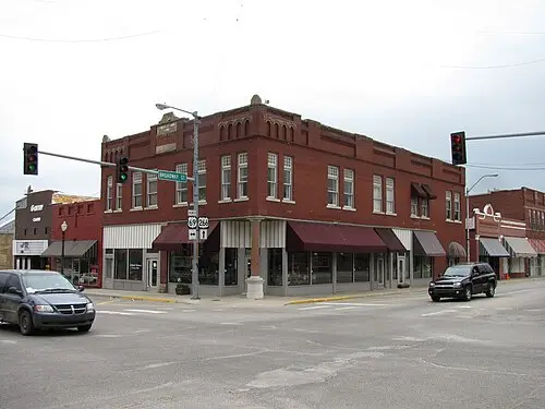
- Eufaula: small town of the Muscogee (Creek) Nation with a brick Main Street and views over the lake; a good opportunity for shopping and coffee.
- Robbers Cave: the cave in the sandstone is more of a rock overhang with crevices; according to legend, Belle Starr and Jesse James hid here. Short, steep climb over rock steps, sturdy footwear required.
- Lake Carlton and the park’s hiking trails: the Coon Ridge Trail and the Buzzard’s Roost Trail run over rocky ridges, the Rough Canyon Trail to Lost Lake. In autumn one of the most beautiful deciduous forests in Oklahoma.
- CampingSpirit overnight tip
-
Official campsite or RV park: Robbers Cave State Park north of Wilburton: for motorhomes the Whispering Pines (sites with water, electricity and some sewer) and Old Circle (water and electricity with 30 or 50 A, some full hookup) areas are best suited; the equestrian area also takes motorhomes. In addition, numerous simple tent and primitive sites, for example at Lake Wayne Wallace, Deep Ford or Younger’s Bend. Reservations via travelok.com; in October book early for weekends.
Free camping or nature tip (where legal): In the park, overnighting is only allowed on the campgrounds; backcountry sites (Coon Creek, Rocky Top, Lost Lake) only on foot and with a permit from the park office. There is no public land for dispersed camping in the surrounding area.
- Insider tip for campers
- The park road to the cave is narrow and the car park fills quickly on autumn weekends – walk from the campground or drive early in the morning. The rocks are slippery after rain; keep dogs on a lead. With a large vehicle, avoid the access roads to the primitive areas.
4Stage 4: Robbers Cave State Park to Talihina (approx. 100 km)
- The drive
- Via Wilburton on OK-2 south over wooded ridges towards Clayton, then on US-271 north-east through the wide valley of the Kiamichi River via Tuskahoma to Talihina. Two-lane, moderate gradients, little traffic, many logging trucks. Pure driving time around 1.5–2 hours. Fuel in Wilburton, Clayton or Talihina – there is none afterwards on the ridge.
- Highlights & must-sees
- Sardis Lake near Clayton: quiet Corps reservoir at the foot of the Kiamichi Mountains, with viewpoints at the dam.
- Choctaw Nation Capitol in Tuskahoma: the red brick building of 1884 was the seat of government of the Choctaw Nation and is now a museum; the grounds host the big Choctaw festival every year at Labor Day.
- Talihina: small town in the valley, western starting point of the Talimena Scenic Drive; information about the route is available at Talimena State Park and at the visitor centre at the start of OK-1 (seasonal, check opening hours).
- CampingSpirit overnight tip
-
Official campsite or RV park: Talimena State Park on US-271 north-east of Talihina, at the start of the Scenic Drive: small park with ten RV sites with water and electricity (30 A), seven tent sites with pads, toilet block with showers and dump station; the Ouachita National Recreation Trail starts here. Sites must be reserved online (Oklahoma State Parks reservation site, link on travelok.com); a park fee applies. Alternative at the lake: Corps sites at Sardis Lake, via recreation.gov.
Free camping or nature tip (where legal): North and east of Talihina the Ouachita National Forest begins; there, dispersed camping outside the recreation areas is generally allowed unless signed otherwise (see next stage). In the town itself and in car parks, overnighting is not intended.
- Insider tip for campers
- Fill the tank, fill fresh water and empty grey water in Talihina: along the entire Talimena Drive there are neither petrol stations nor drinking water. The tribal lands of the Choctaw Nation begin south of Wilburton already and extend to the Red River; treat museums and cultural sites with respect and ask before photographing at events.
5Stage 5: Talihina to Big Cedar (approx. 75 km)
- The drive
- The Talimena National Scenic Byway runs for around 87 kilometres (54 miles) between Talihina and Mena in Arkansas, in Oklahoma as OK-1 along the crest of Winding Stair and Rich Mountain. The road is well built but characterised by long, sometimes steep climbs and descents and tight bends; motorhomes and rigs with trailers manage it without problems if they go downhill in low gear and spare the brakes. The viewpoints (vistas) are numbered and signed. This stage follows the crest to just before the state line and returns to the junction with US-259, then down to Big Cedar. Pure driving time 2–3 hours with many stops. Fog, thunderstorms and ice in winter lead to closures. The continuation in Arkansas is described in the CampingSpirit guide “Bluffs, elk and hot springs – by camper through the Ozarks and Ouachitas of Arkansas”; that is also where Queen Wilhelmina State Park lies on Rich Mountain, a few kilometres beyond the border.
- Highlights & must-sees
- Viewpoints on the Oklahoma side: from the vistas on the crest you look north into Holson Valley and south into the valley of the Kiamichi River; the sections west of US-259 in particular offer wide views over unsettled forests.
- Horsethief Springs: historic spring with picnic area around ten kilometres west of US-259, according to legend a watering place for horse thieves; from here a hiking trail leads down to Cedar Lake.
- Robert S. Kerr Arboretum and Nature Center, a good two kilometres east of the junction with US-259: three short interpretive trails on the plants, forest competition and soil formation of the Ouachitas, free of charge; Emerald Vista next to Winding Stair Campground is a good spot for sunset.
- CampingSpirit overnight tip
-
Official campsite or RV park: Winding Stair Campground (Ouachita National Forest) right on the Scenic Drive, about three kilometres west of US-259: 23 sites with paved pads, fire rings, grills and vault toilets, no electricity and no drinking water – fill the tank beforehand; generators allowed outside quiet hours. Check availability and booking on recreation.gov, otherwise pay the fee on site. With electricity: Cedar Lake Recreation Area in Holson Valley, reached via US-259 north and Holson Valley Road, with several loops at the lake, some with electricity, showers and dump station; check the facilities of each loop in advance.
Free camping or nature tip (where legal): In the Ouachita National Forest, dispersed camping outside the developed recreation areas is generally allowed, usually up to 14 days; forest service roads away from the crest offer simple spots. At the vistas, picnic areas and trailheads of the Scenic Drive overnighting is not intended – observe the signs. In hunting season (autumn) wear orange and keep tracks clear. Observe fire bans in dry conditions.
- Insider tip for campers
- Drive from west to east in the morning: then you mostly have the sun at your back and clear light at the south-facing vistas. On autumn weekends during the fall colours (usually late October to early November) the pull-outs fill early and many motorbikes are out – drive on weekdays. In fog on the crest, better wait in the valley. A detour north leads to Heavener Runestone Park with a mysterious stone bearing runic characters.
6Stage 6: Big Cedar to Beavers Bend State Park (approx. 85 km)
- The drive
- On US-259 south through the Kiamichi Mountains: long straights through pine plantations, in between winding sections over ridges and bridges over the Kiamichi River and smaller rivers. Two-lane, with increasing traffic towards Hochatown in the south, partly widened there. Pure driving time around 1.5 hours. Fuel in Smithville, Hochatown or Broken Bow.
- Highlights & must-sees
- Big Cedar: at the junction of US-259 and OK-63 a monument commemorates President John F. Kennedy’s speech in October 1961 opening the road through the Ouachitas.
- Detour to the Glover River: it is regarded as Oklahoma’s last free-flowing river, with gravel bars and clear water; the access roads are partly gravel, scout ahead with large vehicles.
- Beavers Bend State Park: the Lower Mountain Fork River below Broken Bow Dam carries cold water all year round and rainbow trout; in addition the Forest Heritage Center Museum on the forest history of the region and the David Boren Hiking Trail along the river and lake.
- CampingSpirit overnight tip
-
Official campsite or RV park: Beavers Bend State Park: around 390 sites in eight camping areas beneath tall pines. In the river valley on the Mountain Fork River, Acorn (water and electricity, 50 A) and Cypress (water and electricity, 30 A) have the best motorhome sites, Fern has electricity only; Dogwood, Elm, Grapevine and Hickory are simple tent areas. On Broken Bow Lake lie Turkey (full hookup), Armadillo (50 A) and Quail (30 A). Toilet blocks with showers and dump station. Reservations via the Oklahoma State Parks reservation site (link on travelok.com); well in advance for weekends and holidays, check site length and slope when booking.
Free camping or nature tip (where legal): South of the Ouachitas there is almost only private forest, often owned by timber companies and not open to the public. In the park and in Hochatown, overnighting outside the campgrounds is prohibited. The nearest options for dispersed camping are in the Ouachita National Forest north of Smithville.
- Insider tip for campers
- With thousands of holiday cabins, Hochatown has become a weekend destination from Dallas and Oklahoma City; on Fridays and Sundays US-259 backs up. Do your shopping in Broken Bow, where the supermarkets are larger and cheaper. For trout, the Lower Mountain Fork has its own catch regulations and requires an Oklahoma fishing licence – check with the Oklahoma Department of Wildlife Conservation beforehand. When water is released from the dam, the river rises fast; take sirens and warning signs seriously.
7Stage 7: Beavers Bend State Park to Idabel (approx. 45 km)
- The drive
- On US-259 to Broken Bow and on south into the flat bottomland forests on the Little River and Red River to Idabel, the seat of McCurtain County. Flat, straight, little traffic; pure driving time under an hour, half a day with detours. Petrol stations and supermarkets in Broken Bow and Idabel.
- Highlights & must-sees
- Little River National Wildlife Refuge near Broken Bow: bottomland forests with bald cypresses and oxbows, bald eagles in winter; do not drive the unpaved tracks with the motorhome after rain.
- Museum of the Red River in Idabel: collection on the culture of the indigenous peoples of North America and a cast of the Acrocanthosaurus, a predatory dinosaur whose skeleton was found in McCurtain County.
- Red Slough Wildlife Management Area south of Idabel: wetland near the Red River, known for waterfowl and wading birds; observation towers, insect repellent required.
- CampingSpirit overnight tip
-
Official campsite or RV park: There is no state campground in Idabel. The simplest option is to stay another night in Beavers Bend and visit Idabel as a day trip. Alternative: the Corps of Engineers sites at Pine Creek Lake west of Broken Bow, via recreation.gov; check status and loops in advance.
Free camping or nature tip (where legal): In the lowlands on the Red River there is no public land for dispersed camping; wildlife management areas allow camping only in designated areas and usually only with a hunting or fishing licence or a Wildlife Conservation Passport. In Idabel and Broken Bow, overnighting on streets and in car parks is not intended.
- Insider tip for campers
- From Idabel it is only around 30 kilometres to Texas; if you want to continue south, US-259 takes you into Texas. If you would like to add the Wichita and Arbuckle Mountains in southern Oklahoma, you will find them in the CampingSpirit guide “Granite domes, bison and travertine springs – by camper through the Wichita and Arbuckle Mountains of southern Oklahoma”; the way there runs west on US-70.
Camping practice & local rules
Wild camping & overnight parking
- Oklahoma has no BLM land; public land for dispersed camping on this route exists only in the Ouachita National Forest between Talihina, Big Cedar and Heavener. There, free camping outside the recreation areas is generally allowed, usually up to 14 days, unless signed otherwise; not intended at the viewpoints of the Talimena Drive.
- At the reservoirs (Tenkiller, Eufaula, Sardis, Broken Bow, Pine Creek) the shore mostly belongs to the U.S. Army Corps of Engineers: overnighting only on the campgrounds, not at ramps or in car parks. Wildlife management areas: camping only in designated areas and usually only with a hunting or fishing licence or a Wildlife Conservation Passport.
- Towns and holiday resorts (Tahlequah, Eufaula, Hochatown, Broken Bow, Idabel) do not provide for overnighting in the vehicle on streets and in car parks; supermarket, travel centre and casino car parks only with explicit permission. Rest areas on interstates are for breaks.
- Tribal lands: the route runs through the reservation areas of the Cherokee, Muscogee (Creek) and Choctaw Nation, which the Supreme Court confirmed in 2020 (McGirt v. Oklahoma). For travellers little changes in everyday life, but tribal police may have jurisdiction. Respect cultural sites, cemeteries and ceremonies and ask before photographing.
- Fees and reservations: Oklahoma State Parks are reserved via the Oklahoma State Parks reservation site (links on travelok.com). The more heavily visited parks – including Tenkiller, Lake Eufaula, Robbers Cave, Talimena and Beavers Bend – charge a park fee per vehicle (day pass $10, multi-day and annual passes cheaper; vehicles with Oklahoma plates get a 20% discount); a camping booking includes the park pass for one vehicle for the duration of the stay. Corps and Forest Service sites via recreation.gov. Surcharges for visitors without US residence in national parks do not affect this route.
- Apps: iOverlander, Campendium, The Dyrt and Recreation.gov; Park4Night is hardly used in Oklahoma.
Waste disposal & supplies
- Dump stations at almost all state park campgrounds (Tenkiller, Lake Eufaula, Robbers Cave, Beavers Bend) and at many Corps sites; at Winding Stair Campground and along the entire Talimena Drive there are none.
- Drinking water at the taps of the campgrounds; on the Talimena Drive neither water nor petrol stations – fill up in Talihina or Mena.
- Empty grey water and chemical toilets only at dump stations; discharging into forest, streams or lakes is prohibited.
- Propane: travel centres, farm supply and DIY stores as well as many campgrounds fill US cylinders; European cylinders are generally not filled.
- Electricity: state park sites mostly 30 A, some 50 A. Summers are hot and humid, the air conditioning runs almost constantly; in winter it can freeze on the crest.
- Shopping and fuel: Tahlequah, Checotah, Eufaula, Wilburton, Talihina, Broken Bow and Idabel; in between small places with limited opening hours.
Vehicle size & traffic rules
- Speed limits: interstates mostly 70–75 mph, two-lane highways mostly 65 mph, considerably less in towns and parks; on the Talimena Drive lower, signed values apply in the bends. Observe the signs.
- Tolls: the Oklahoma turnpikes are cashless (PikePass or PlatePay by number plate at a higher rate). This route manages without turnpikes if you use I-40 and highways; with rental vehicles, clarify the toll arrangement in advance.
- Gradients: on the Talimena Drive long, sometimes steep descents – drive in low gear, do not overheat the brakes, use pull-outs for faster vehicles. No petrol stations along the route.
- Mobile phone: texting and typing at the wheel are prohibited in Oklahoma; phoning with the device in hand is not generally banned for adults, but hands-free is still advisable.
- Tornadoes and severe weather: main season roughly March to June, a second peak in autumn is possible. Receive National Weather Service warnings via weather radio or emergency alert (watch = conditions favourable, warning = danger imminent); in a tornado warning, leave the motorhome and seek a solid shelter – ask about storm shelters at the campground on arrival. Heavy rain makes streams and fords rise quickly.
- Ticks and wildlife: ticks (lone star tick, American dog tick) and chiggers are very common from spring to autumn; Oklahoma reports many cases of ehrlichiosis and spotted fever. Check yourself after every walk in the woods. Black bears live in the south-east – lock food and rubbish in the vehicle. Copperheads, cottonmouths and rattlesnakes at rocks and shores.
- Fire: in dry conditions the counties impose fire bans (burn bans), then no campfires on campgrounds either; check the status with Oklahoma Forestry Services and the Ouachita National Forest. Emergency: 911; mobile coverage in the Ouachitas and on the Talimena crest is patchy.
CampingSpirit packing & preparation checklist
- Tick repellent, tick tweezers and treated long clothing: ticks and chiggers are the most common nuisance in the forests of eastern Oklahoma.
- Weather radio or severe weather app with NWS warnings: in tornado season the lead time decides whether you reach the shelter in time.
- Large fresh water container: Winding Stair and the Talimena Drive have no drinking water.
- Chocks and levelling ramps: the sites in Robbers Cave, Beavers Bend and on the Talimena crest are often sloping.
- Waders or water shoes and an Oklahoma fishing licence: for trout in the Lower Mountain Fork and trips on the Illinois River.
- Binoculars: for bald eagles at the lakes, waterfowl in Red Slough and the distant views from the Talimena crest.
As of 2026-10. Closures, fees and booking rules change: check official sources before you go.