

In-depth guide · CampingSpirit
From Bentonville via Eureka Springs, the Buffalo National River and Highway 7 to Mount Magazine, on to Hot Springs and over the Talimena ridge to Queen Wilhelmina: around 800 kilometres of bends, limestone cliffs and oak forest.
The spirit of the route
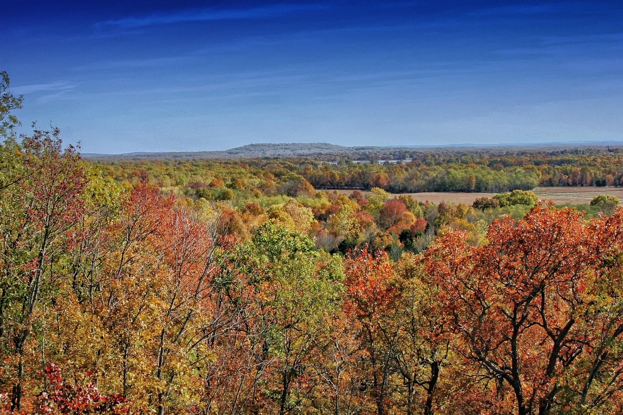
Arkansas is not a land of wide horizons but of folds. In the Ozarks, rivers cut deep valleys into the plateau, and on the Buffalo River ochre bluffs rise above green water, while in the morning elk graze in the mist of the Boxley meadows. Further south, Highway 7 climbs in hundreds of bends over ridges where oak, hickory and pine stretch to the horizon, red and gold in October. Then the Ouachitas: ridges that run not north to south but east to west, with quartz veins, clear creeks and a town where hot water flows out of the mountain. From the sliding door you see bluffs, flat-topped mountains and seas of forest; in the evening the cicadas chirp, at night the whip-poor-will calls. The route is slow, winding and often without signal – and that is exactly what makes it.
Stage-by-stage plan
1Stage 1: Bentonville/Rogers to Eureka Springs (approx. 80 km)
- The drive
- From Bentonville via Rogers, take US 62 east, past Garfield and along the northern edge of Beaver Lake to Eureka Springs. The first kilometres are four-lane and lined with commercial development; after that US 62 becomes two-lane, hilly and winding, with speeds mostly 45–55 mph (72–88 km/h). Pure driving time is around 1.5 hours. Large supermarkets, petrol stations and outdoor shops are found in the Bentonville–Rogers area – the last good place to stock up for several days.
- Highlights & must-sees
- Crystal Bridges Museum of American Art in Bentonville: a museum of American art set in a ravine, with walking trails and sculptures in the woods; at last report, the permanent collection was free to visit. Parking is in garages with only around 7 ft (2.1 m) of clearance – ask the museum in advance about where to leave a motorhome.
- Hobbs State Park–Conservation Area east of Rogers on Highway 12: the largest state park area in Arkansas, with trails across karst terrain and views of Beaver Lake; day use only, no campground.
- Thorncrown Chapel on US 62 west of Eureka Springs: a woodland chapel of wood and glass (1980, architect E. Fay Jones); the car park is small, so come outside peak times with a large vehicle.
- CampingSpirit overnight tip
-
Official campsite or RV park: Prairie Creek Park (U.S. Army Corps of Engineers) on Beaver Lake east of Rogers: lakeside sites, many with electricity and water, showers and a dump station; book via recreation.gov. Closer to Eureka Springs is Dam Site Lake Park at the Beaver Dam, reached from US 62 via Highway 187 (also Corps of Engineers, recreation.gov). Check season dates and vehicle lengths before booking.
Free camping or nature tip (where legal): There is no legal free camping in the Bentonville–Rogers area or in Eureka Springs; city ordinances prohibit overnight stays on streets and in many car parks. Whether a supermarket tolerates overnight parking is up to the individual store – ask first.
- Insider tip for campers
- Eureka Springs is unsuitable for motorhomes: the Historic Loop (US 62B) is steep, narrow and winding, and parking spaces are small. Leave the vehicle on the edge of town, for example at the trolley depot on US 62, and take the city trolley into the historic centre; check timetables and fares with the operator.
2Stage 2: Eureka Springs to Ponca and Jasper (Buffalo National River) (approx. 120 km)
- The drive
- Take US 62 to Berryville, then Highway 21 south via Kingston into the Boxley Valley and Highway 43 to Ponca; from there, Highway 74 to Jasper. From Kingston onwards the road is narrow and winding, with blind crests, speeds often 35–45 mph. Highway 74 between Ponca and Jasper has long, steep descents and tight bends – drive in a low gear and don't let the brakes overheat. Pure driving time is around 2.5 hours. Petrol stations in Berryville and Jasper, hardly anything in between.
- Highlights & must-sees
- Boxley Valley: valley meadows on the upper Buffalo River where wapiti (called “elk” in American usage) graze early in the morning and in the evening; only stop at designated pull-offs, as the fields are private land or leased.
- Lost Valley Trail: around 4 km out and back along Clark Creek to a natural rock bridge, Cob Cave and Eden Falls; at its best after rain. The car park is on Highway 43 north of Ponca and fills up quickly at weekends.
- Steel Creek: a riverside meadow below the more than 60 m high Roark Bluff, one of the best-known photo spots on the Buffalo; the access road from Highway 74 is steep and winding, so check in advance with long vehicles.
- CampingSpirit overnight tip
-
Official campsite or RV park: Ozark Campground near Pruitt on Highway 7 north of Jasper (National Park Service): 30 riverside sites, some suitable for basic RV camping without hook-ups, reached via around 3 miles of well-maintained gravel road, water from mid-March to mid-November, no dump station. Note: Steel Creek has only walk-in tent sites and equestrian sites – caravans, motorhomes and campervans are not allowed on the tent sites. Since the 2026 season (13 March to 15 November), Steel Creek, Ozark, Carver, Tyler Bend and Rush require a reservation via recreation.gov (up to six months in advance), and cash and cheques are no longer accepted; according to the park's announcement Kyles Landing and Erbie were to remain first-come, first-served, but the park's camping page lists reservations as required there too – check before you arrive.
Free camping or nature tip (where legal): In the Ozark National Forest, dispersed camping outside designated recreation areas is generally permitted (observe signs and stay limits); on the Buffalo National River, by contrast, there are only certain gravel bars for drive-in camping, such as Grinders Ferry and Gilbert on the middle section – with no drinking water or rubbish collection. On the upper river (Ponca, Steel Creek, Lost Valley), overnight stays in car parks are not allowed.
- Insider tip for campers
- Kyles Landing and the route to Hawksbill Crag (Cave Mountain Road) are off-limits for motorhomes: steep, rough gravel roads, and the park recommends four-wheel drive with high clearance for Kyles Landing. In heavy rain the Buffalo rises within hours; low-water bridges and access roads are flooded. Check river levels and warnings at nps.gov/buff and never drive through flooded crossings.
3Stage 3: Jasper to Russellville (approx. 110 km)
- The drive
- Head south on Arkansas Scenic Byway 7: beyond Jasper the road climbs onto the ridge, then runs through the Ozark National Forest via Pelsor (turn-off for Highway 16) and Dover to Russellville on the Arkansas River. The section between Jasper and Pelsor is a series of tight bends with climbs, descents and hardly any hard shoulder; there are plenty of motorcycles at weekends. Speeds often 25–45 mph. Pure driving time is around 2.5 hours. Petrol stations in Jasper, Pelsor (limited), Dover and Russellville.
- Highlights & must-sees
- “Arkansas Grand Canyon” south of Jasper: a viewpoint on Highway 7 over the wide valley of the Little Buffalo River; the pull-offs are short, so watch for oncoming traffic on bends when pulling out.
- Pedestal Rocks Scenic Area: from Highway 7 at Pelsor, a short way east on Highway 16; loop trails to mushroom-shaped sandstone pillars and bluffs in the Ozark National Forest. West of Highway 7, also reached via Highway 16, is the rock arch of Alum Cove Natural Bridge.
- Long Pool Recreation Area on Big Piney Creek near Dover (Ozark National Forest): a clear pool below rock walls for swimming; access partly narrow, check status and season in advance.
- CampingSpirit overnight tip
-
Official campsite or RV park: Lake Dardanelle State Park in Russellville: an Arkansas State Park on the Arkansas River reservoir with sites with electricity and water, some with lake views, showers and a dump station; book via the Arkansas State Parks reservation portal. In the forest, the alternative is the campground at Long Pool Recreation Area (Ozark National Forest), with more basic facilities; check season and reservations with the Forest Service.
Free camping or nature tip (where legal): In the Ozark National Forest along Highway 7, dispersed camping on forest roads is permitted unless signed otherwise; keep your distance from water and roads, and no campfires during fire bans. Many forest roads are narrow and unsurfaced – only drive in where you could also reverse back out.
- Insider tip for campers
- Only drive Highway 7 between Jasper and Pelsor in daylight: some bends are blind, and deer and rockfall are common. Pull over to the right at pull-offs in slow vehicles and let others pass. The side route over Mount Nebo (Highway 155) near Dardanelle, with its hairpins and gradients of up to around 18%, is unsuitable for long motorhomes; trailers and motorhomes over 24 ft (around 7.3 m) are not permitted in Mount Nebo State Park.
4Stage 4: Russellville to Mount Magazine State Park (approx. 100 km)
- The drive
- Take Highway 22 west along the south bank of the Arkansas River to Paris, then Highway 309 (Mount Magazine Scenic Byway) south, past Cove Lake and up onto the Mount Magazine plateau. Highway 22 is two-lane and undulating; the climb on the 309 is winding and steep. Pure driving time is around 1.5–2 hours. Petrol stations in Russellville and Paris, none on the mountain.
- Highlights & must-sees
- Signal Hill Trail: a short woodland path to the highest point in Arkansas (around 839 m); no distant views from the summit itself, but the walk is a classic for the record books.
- Cameron Bluff Overlook Drive: a scenic road along the southern edge with views over the Petit Jean Valley and Blue Mountain Lake; the hang-gliding launch is on the edge. When the wind is from the west, there's plenty going on here.
- Cove Lake Recreation Area on Highway 309 south of Paris (Ozark National Forest): a small mountain lake with a swimming beach and lakeside path; check the day-use fee and season in advance.
- CampingSpirit overnight tip
-
Official campsite or RV park: Cameron Bluff Campground in Mount Magazine State Park: a small campground on the plateau with 18 full hook-up sites (30 or 50 A electricity, water, sewer) and an accessible bathhouse with showers; with so few sites, book early (Arkansas State Parks reservation portal). The fallback is the campground at Cove Lake (Ozark National Forest), with more basic facilities.
Free camping or nature tip (where legal): Within the state park, overnight stays outside the campground are prohibited. In the surrounding Ozark National Forest, dispersed camping on forest roads is permitted unless signed otherwise; the roads on the mountain are in places very steep.
- Insider tip for campers
- On the plateau it is often 5–8 °C cooler than in the valley – an advantage in summer, chilly at night in autumn. Fog and cloud can shroud the mountain for days – save maps offline, as reception at the summit is patchy. Fill up with fuel and fresh water in Paris before the climb.
5Stage 5: Mount Magazine State Park to Petit Jean State Park (approx. 115 km)
- The drive
- Take Highway 309 south down to Havana, Highway 10 east via Danville, then Highway 7 to Centerville and Highway 154 up Petit Jean Mountain. The descent from Mount Magazine is steep and winding; the Petit Jean River valley is flat, with pastures and chicken farms. Highway 154 climbs the mountain in bends. Pure driving time is around 2 hours; check your navigation in advance. Petrol stations in Danville and Centerville.
- Highlights & must-sees
- Cedar Falls: a waterfall around 29 m high in a sandstone gorge; the Cedar Falls Trail runs around 3.5 km out and back, steeply down and back up again. From above, the Cedar Falls Overlook (a short walk from the car park) shows the falls without the descent.
- Mather Lodge: a 1930s stone lodge built by the Civilian Conservation Corps, with a terrace above Cedar Creek Canyon; parking for large vehicles is limited.
- Stout’s Point and Palisades Overlook: viewpoints on the eastern edge looking over the Arkansas River; at Stout’s Point is the grave of the legendary Petit Jean. Sunset at Palisades Overlook.
- CampingSpirit overnight tip
-
Official campsite or RV park: Campground in Petit Jean State Park: a sprawling woodland campground with sites in several classes of facilities, many with electricity and water, some with sewer, showers and a dump station; book via the Arkansas State Parks reservation portal, and book early in October because of the autumn colours. Check the vehicle length for each site when booking.
Free camping or nature tip (where legal): Petit Jean is a state park; overnight stays outside the campground are prohibited. The nearest legal spots in nature are in the Ozark National Forest north of the Arkansas River or in the Ouachita National Forest to the south (stage 6).
- Insider tip for campers
- The Rock House Cave Trail and the rock slabs of Bear Cave are short and ideal for an evening; after rain the sandstone slabs are slippery. Fill up with water for the onward journey in the park, as the shops on the mountain are small.
6Stage 6: Petit Jean State Park to Hot Springs (Gulpha Gorge) (approx. 140 km)
- The drive
- Take Highway 154 back to Centerville and Arkansas Scenic Byway 7 south via Ola, Hollis and Jessieville into the Ouachita Mountains to Hot Springs. From Ola the road becomes more mountainous: long winding stretches through the pine and oak forest of the Ouachita National Forest, creek crossings, speeds often 40–55 mph. Pure driving time is around 2.5 hours. Petrol stations in Ola and Jessieville, then none until Hot Springs.
- Highlights & must-sees
- Highway 7 through the Ouachita National Forest: east–west ridges with long views over seas of forest; vivid colours in autumn. Pull-offs are rare and some bends are blind.
- Bathhouse Row in Hot Springs: a row of historic bathhouses on Central Avenue; the Fordyce Bathhouse is the national park's visitor centre, and in some houses, such as the Buckstaff, you can still take a bath. Check in advance which bathhouses are open, opening hours and booking.
- Hot Springs Mountain Tower and Grand Promenade: an observation tower above the town and a footpath behind the bathhouses where the thermal water emerges in open pools.
- CampingSpirit overnight tip
-
Official campsite or RV park: Gulpha Gorge Campground (Hot Springs National Park): 40 sites in the woods on Gulpha Creek, all with full hook-ups (30/50 A electricity, water, sewer), no pull-through sites, toilets and showers (code in the booking confirmation); reservation via recreation.gov is required for all sites. Maximum 14 consecutive nights and 30 nights per calendar year; site lengths vary, so check when booking.
Free camping or nature tip (where legal): Sleeping in a vehicle is not allowed within Hot Springs city limits. In the Ouachita National Forest north of town, dispersed camping on forest roads is generally permitted unless signed otherwise; Iron Springs Recreation Area on Highway 7 near Jessieville is a basic Forest Service site (check status in advance).
- Insider tip for campers
- Leave the motorhome at the campground: from Gulpha Gorge, trails (Gulpha Gorge Trail, Goat Rock Trail) lead over Hot Springs Mountain down to Bathhouse Row. Parking downtown is scarce and parking garages have height limits. You can fill up with thermal water free of charge at the public fountains (jug fountains). At last report Hot Springs charges no entrance fee; the new surcharges for non-US visitors apply to other parks – check current rules at nps.gov.
7Stage 7: Hot Springs to Mena (approx. 135 km)
- The drive
- Take US 270 west, past Lake Ouachita, via Mount Ida and through the Ouachita National Forest, then US 71 to Mena. US 270 is two-lane, with hills, long forest stretches and few towns, speeds mostly 55 mph. Pure driving time is around 2.5 hours. Petrol stations in Hot Springs, Mount Ida and Mena.
- Highlights & must-sees
- Lake Ouachita: the largest reservoir entirely within Arkansas, clear water between wooded islands; swimming spots and boat ramps at the Corps of Engineers recreation areas and at Lake Ouachita State Park (turn-off at Mountain Pine).
- Mount Ida: a small town that calls itself the “Quartz Crystal Capital of the World”; in the surrounding area there are quartz mines where you can dig yourself for a fee. Check conditions with the operators.
- Caddo Gap and the Ouachita River: short detours to the river, popular for paddling and swimming; watch the water level after rain.
- CampingSpirit overnight tip
-
Official campsite or RV park: Lake Ouachita State Park at the eastern end of the lake: lakeside sites, many with electricity and water, some with sewer, showers and a dump station; book via the Arkansas State Parks reservation portal. Further west there are several Corps of Engineers campgrounds on Lake Ouachita (book via recreation.gov). At Mena itself, Queen Wilhelmina State Park is the destination of the next stage.
Free camping or nature tip (where legal): The Ouachita National Forest surrounds US 270 for long stretches; dispersed camping is generally permitted, except in recreation areas and where signed. Don't drive far along dirt roads after rain – red clay quickly turns into a slide.
- Insider tip for campers
- On the long forest stretch between Mount Ida and Mena there are hardly any services and in places no mobile signal. Fill up and buy supplies in Mena for the Talimena ridge: there are neither petrol stations nor drinking water anywhere along the scenic byway.
8Stage 8: Mena to Queen Wilhelmina State Park (Talimena National Scenic Byway) (approx. 25 km)
- The drive
- From Mena, take Highway 88, the Talimena National Scenic Byway, onto the crest of Rich Mountain to Queen Wilhelmina State Park. The byway is 54 miles (around 87 km) long in total and continues over Winding Stair Mountain to Talihina in Oklahoma; as an out-and-back from Queen Wilhelmina, that adds a good 130 km. Long climbs and descents, bends without a hard shoulder, guardrails not everywhere. Speeds 45 mph and less; ice in winter and frequent fog. Open year-round, no fee.
- Highlights & must-sees
- Queen Wilhelmina State Park: the current lodge stands on the site of the “Castle in the Sky”, opened in 1898, a hotel built with Dutch capital for the railway and named after the Queen of the Netherlands. View north over the Ouachita valley.
- Rich Mountain Fire Tower and Pioneer Cemetery: short turn-offs west of the lodge on the byway; a view and a cemetery from the settler era.
- Viewpoints on the Oklahoma side (e.g. Emerald Vista): panoramas over Holson Valley and Cedar Lake; pull-offs are signposted.
- CampingSpirit overnight tip
-
Official campsite or RV park: Campground in Queen Wilhelmina State Park: around 40 woodland sites on the ridge, most with electricity (30/50 A) and water, no sewer hook-ups, no pull-through sites, dump station at the entrance, bathhouse with showers from March to November; book via the Arkansas State Parks reservation portal. On the Oklahoma side there are Forest Service campgrounds such as Winding Stair Campground and Cedar Lake (Ouachita National Forest); check season and facilities with the Forest Service.
Free camping or nature tip (where legal): In the Ouachita National Forest dispersed camping is generally permitted, but not at the byway's viewpoints. When wildfire danger is high, fire bans apply; in autumn 2026 the Forest Service at times reported very high wildfire danger – check status and county burn bans at fs.usda.gov/ouachita before every night.
- Insider tip for campers
- Drive the byway westwards from Mena; in the late afternoon the sun then sits low in front of the windscreen – better to set off in the morning. Fog can reduce visibility to a few metres – slow right down and turn your lights on. If you turn around in Talihina, fill up there before heading back over the ridge.
Camping practice & local rules
Wild camping & overnight parking
- Arkansas has no general ban on sleeping in vehicles, but towns such as Eureka Springs and Hot Springs prohibit it on streets and in public car parks; private land is off-limits without permission, enforced by the sheriff and city police.
- Ozark and Ouachita National Forest: dispersed camping outside recreation areas is generally permitted; observe stay limits and Forest Service signs. Fire bans during dry spells are binding.
- Buffalo National River: drive-in camping only on designated gravel bars (e.g. Grinders Ferry, Gilbert), otherwise only at campgrounds; in high water, gravel bars become soft or flooded. 2026 season with mandatory reservations for Steel Creek, Ozark, Carver, Tyler Bend and Rush (recreation.gov).
- State parks: overnight stays only at the campgrounds; day-use areas and viewpoints are closed at night.
- Ticks and chiggers (harvest mites): very common in grass and leaf litter from spring to autumn; ticks transmit diseases including ehrlichiosis and Rocky Mountain spotted fever. Treat clothing with permethrin, tuck trouser legs into socks, check yourself in the evening. Venomous snakes (copperhead, cottonmouth, rattlesnakes) and black bears are present; keep food in the vehicle at night.
- Apps and websites: iOverlander, Campendium, The Dyrt, plus recreation.gov and the Arkansas State Parks reservation portal.
Waste disposal & supplies
- Dump stations are found in the state parks (Lake Dardanelle, Petit Jean, Lake Ouachita), at the Corps of Engineers campgrounds and seasonally at Tyler Bend; Ozark and Erbie on the Buffalo have none. Gulpha Gorge has a sewer hook-up at every site.
- Drinking water: at the campgrounds on the Buffalo only from mid-March to mid-November (Tyler Bend year-round); there is none on the Talimena byway. In Hot Springs, public thermal water fountains supply water free of charge.
- Don't release grey water onto the ground or into creeks; empty chemical toilets only at dump stations. On the gravel bars “pack in, pack out” applies, with no rubbish collection.
- Propane: petrol stations and farm supply stores fill US cylinders; European cylinders need adapters and are usually not filled.
- Fuel: Bentonville/Rogers, Berryville, Jasper, Dover, Russellville, Paris, Danville, Ola, Hot Springs, Mount Ida, Mena; long gaps on the mountain routes.
- Electricity: sites with hook-ups offer 20/30/50 A; rental motorhomes usually come with the right cable.
Vehicle size & traffic rules
- Speed limits: interstates in Arkansas up to 75 mph (signed sections), two-lane highways mostly 55 mph, on Highway 7 and the Talimena often 25–45 mph on bends; in towns 25–35 mph.
- Tolls: there are no tolls in Arkansas on the routes described.
- Dimensions: the usual maximum height is 13 ft 6 in (4.1 m); parking garages in Hot Springs and Bentonville have much lower entrances. Long motorhomes find Highway 74 and Highway 7 a challenge; vehicles over 24 ft are not permitted in Mount Nebo State Park.
- Traffic law: right turn on red permitted after a full stop, except where prohibited; texting while driving is prohibited, hands-free recommended; open containers of alcohol in the vehicle are prohibited. Several counties along the route are “dry” – no alcohol is sold there.
- Parks: at last report, Buffalo National River and Hot Springs National Park charge no entrance fee; since 2026, surcharges have applied in some heavily visited national parks for non-US visitors – check current amounts at nps.gov. Arkansas State Parks generally charge no entrance fee; camping costs vary by facilities.
- Weather: summers humid and hot (often above 32 °C), thunderstorms with heavy rain; spring with risk of tornadoes and flooding; autumn (mid-October to early November) with its foliage is the best time to travel. Ice possible on mountain roads in winter.
- Emergency: 911; mobile coverage is absent in places on the Buffalo River, on Highway 7 and on the Talimena byway.
CampingSpirit packing & preparation checklist
- Permethrin spray for clothing and a DEET or icaridin repellent: ticks and chiggers are the real pest in the Ozarks.
- Water shoes with a firm sole: for fords on the Buffalo, the Lost Valley Trail and swimming spots with limestone gravel.
- Offline maps and a printed sheet with your reservation numbers: on the Buffalo and in the mountains there is often no signal, and the parks no longer post reservation cards.
- A collapsible 20 l container for fresh water: Ozark, Erbie and the Talimena byway have no water points or only seasonal ones.
- Binoculars for elk in the Boxley Valley and birds of prey on the bluffs.
- A brake check before departure, plus levelling blocks: Highway 74, Highway 7 and the Talimena ridge involve long descents, and pitches in the woods are often sloping.
As of 2026-09. Closures, fees and booking rules change: check official sources before you go.