

In-depth guide · CampingSpirit
From Lucerne via Küssnacht, Vitznau and Brunnen into the Muotatal, along the Axenstrasse to Altdorf and through the Ybrig, Einsiedeln and the Ägerital to Zug: around 210 km along the lakeshore, on which boat, rack railway and funicular climb more metres than your motorhome.
The spirit of the route
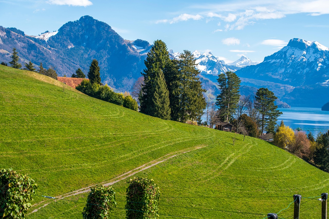
On Lake Lucerne the motorhome is often the slowest means of transport – and that is a good thing. From the campsite in Vitznau you hear the rack railway setting off for the Rigi in the morning, a paddle steamer moors at the shore, and beyond Gersau the limestone walls of the Urmiberg slant down into the water. At Brunnen the view opens onto the fjord-like Lake Uri, where the Axenstrasse clings to the rock face through galleries and, opposite, lies the Rütli meadow, where the Swiss Confederation places its founding myth. Here it smells of lake water, föhn wind and freshly mown hillside meadows, and in the evening the Fronalpstock glows above Schwyz. Behind lie the wild Muotatal with its enormous cave, the monastery domes of Einsiedeln by the raised bog and the quiet Lake Ägeri. The loop is short but dense: a lot of history in a few kilometres, narrow lakeshore roads, scarce parking. You will experience it best if you book early and leave the vehicle parked more often.
Stage-by-stage plan
1Stage 1: Lucerne to Vitznau (via Küssnacht and Weggis) (approx. 32 km)
- The drive
- Lucerne is only the starting point: from the lakeshore by the Swiss Museum of Transport on the main road along the north shore via Meggen and Merlischachen to Küssnacht am Rigi, well built but with lots of commuter traffic. From Küssnacht on a narrower lakeshore road via Greppen and the Hertenstein turn-off to Weggis and Vitznau: bends, bus stops in the carriageway and village through-roads where two wide vehicles can only pass each other slowly. Without stops just under an hour’s driving.
- Highlights & must-sees
- Chapel Bridge and Water Tower in Lucerne: the covered wooden bridge from the 14th century, rebuilt after the fire of 1993, with the gable paintings under the roof – best early in the morning on foot from the campsite.
- Hohle Gasse near Küssnacht: the cobbled sunken lane where, according to legend, William Tell shot the bailiff Gessler, with the Tell Chapel; today a quiet footpath away from the road. In the village the Queen Astrid Chapel commemorates the Belgian queen who was killed in an accident here in 1935.
- Weggis lakeside promenade: a lakeshore path with views of Pilatus and the Bürgenstock; the Weggis–Rigi Kaltbad cable car is an alternative to the rack railway.
- CampingSpirit overnight tip
-
Official campsite or RV park: In Lucerne, Camping International Lido Luzern lies on the lakeshore by the Swiss Museum of Transport – the only site within walking distance of the old town (a good half hour on foot along the shore, or by bus), with electricity and sanitary facilities; book early in summer. In Vitznau, Campingplatz Vitznau is a terraced site above the village, a few minutes' walk from the lake, with lake views, electricity, sanitary facilities and a heated swimming pool, open seasonally; the approach leads through narrow village streets, so large vehicles should check pitch size and access in advance.
Free camping or nature tip (where legal): Free overnight stays are practically not an option on the Lucerne and Schwyz lakeshores: lakeside car parks in Lucerne, Küssnacht and Weggis are short-stay pay car parks or not intended for motorhomes overnight, and no-camper signs are common. Plan every night at a campsite or a designated stopover.
- Insider tip for campers
- Parking in central Lucerne is hardly possible with a motorhome – multi-storey car parks have height restrictions, and street parking spaces are sized for cars. Leave the vehicle at the campsite and walk or take the bus into the old town. Do your big shop and fill up before Küssnacht; Weggis and Vitznau have only small shops.
2Stage 2: Vitznau to Brunnen (via Gersau) (approx. 17 km)
- The drive
- A short lakeshore stage on the Seestrasse below the southern slope of the Rigi: between Vitznau and Gersau several rocky sections and short galleries; the road is narrow and winding, and cyclists are often hard to overtake. From Gersau on along the shore below the Urmiberg to Brunnen. Pure driving time around half an hour – the day belongs to the Rigi, which you reach from Vitznau by train, not by vehicle.
- Highlights & must-sees
- Rigi on the Vitznau–Rigi railway: Europe’s oldest mountain railway, in operation since 1871, runs from the Vitznau boat station to Rigi Kulm at around 1,800 m. The Rigi cannot be reached by private vehicle – only on foot, by rack railway or by cable car from Weggis. A popular option: up by train, along the panoramic trail from Rigi Kulm via Staffel to Kaltbad and by cable car down to Weggis, then back by boat.
- Gersau: until 1817 the village was a tiny independent republic; the neoclassical town hall and the silk merchants' houses on the shore tell the story.
- Beckenried–Gersau car ferry: the ferry across the lake (room for around 40 cars) links the Schwyz and Nidwalden shores on a seasonal timetable – handy for a detour; check with the operator in advance whether your vehicle fits.
- CampingSpirit overnight tip
-
Official campsite or RV park: In Brunnen two campsites lie right on the lakeshore west of the town on Gersauerstrasse: Camping Hopfräben and Camping Urmiberg, both with electricity and sanitary facilities, open seasonally and quickly booked up in summer. Lakeside pitches are limited; if you are coming with a large vehicle, give its length and weight when booking.
Free camping or nature tip (where legal): The car parks at the Rigi valley station in Vitznau and on the Gersau shore are day car parks; standing overnight is not intended there. There is no legal free alternative on this stretch of the lake.
- Insider tip for campers
- Leave the motorhome at the Vitznau campsite and do the Rigi as a round trip by train and boat; only drive on to Brunnen in the afternoon, once the coach tours on the lakeshore road have gone back. With the Half Fare travelcard (Halbtax) or the Swiss Travel Pass, train and boat become considerably cheaper – check fares with Rigi Bahnen in advance.
3Stage 3: Brunnen to Muotathal (via Schwyz) (approx. 20 km)
- The drive
- From Brunnen on a well-built road to Schwyz, then up into the Muotatal: the road follows the Muota through a narrow, wooded valley step with a few bends and moderate gradients, after which the valley opens out around the village of Muotathal. No problem for motorhomes of any size, but watch for lorry traffic from the lime works and quarries. Around 30 minutes’ driving.
- Highlights & must-sees
- Museum of the Swiss Charters of Confederation (Bundesbriefmuseum) in Schwyz: here the Federal Charter of 1291 is kept together with other documents and banners of the early Confederation; the exhibition also shows how the founding myth emerged in the 19th century.
- Ital-Reding-Hofstatt in Schwyz: a 17th-century manor house with a Baroque garden; on the same grounds stands the Haus Bethlehem, a wooden house from the late 13th century and one of the oldest surviving wooden houses in Europe.
- Hölloch near Muotathal: one of the longest cave systems in the world, with over 200 surveyed kilometres. It can only be visited on a guided tour – from the short family tour to a multi-day expedition; sturdy shoes and warm clothing, as it is cool and damp inside all year round.
- CampingSpirit overnight tip
-
Official campsite or RV park: In the Muotatal, Erlebniswelt Muotathal offers a camping and parking area for motorhomes at its Husky Lodge, with electricity according to directories; ask Erlebniswelt about facilities, season and length in advance. Alternatively, go back to the lake at Brunnen (around 20 minutes).
Free camping or nature tip (where legal): In the Muotatal, meadows, alpine tracks and many car parks belong to private owners or corporations; no overnight stays without the owner's consent. In the upper valley there are wildlife rest zones and protected areas where camping is prohibited in principle.
- Insider tip for campers
- Better not take the Pragel Pass into the Glarus region with a motorhome: the road is mostly single-track, very steep, restricted to 3.5 t gross weight, closed to trailers, closed in winter, and at weekends there is a driving ban on the section down to Richisau. You reach the Glarus region and Lake Walen more comfortably via the motorway; more on this in the CampingSpirit guide through Appenzellerland, Toggenburg and to Lake Walen. In Schwyz the large supermarkets and petrol stations are on the edge of town – do your shopping before the Muotatal.
4Stage 4: Muotathal to Brunnen (via the Stoosbahn valley station and Morschach) (approx. 25 km)
- The drive
- Down the valley to the valley station of the Stoosbahn at Schlattli at the entrance to the Muotatal; after the excursion on via Schwyz and Brunnen up to Morschach: the mountain road climbs in a few hairpins to the sunny terrace above Lake Uri; it is two-lane, but narrow in the village. Back down to Brunnen in a low gear. A good 45 minutes’ driving without breaks.
- Highlights & must-sees
- Stoosbahn: the world’s steepest funicular with a gradient of up to 110 %, in operation since 2017; the round cabins rotate during the journey so that passengers stand level. The village of Stoos is car-free.
- Klingenstock–Fronalpstock ridge walk: the classic high-level trail above Stoos with a view of ten lakes, exposed in places and secured with ropes – only in dry weather and if you are sure-footed.
- Morschach: viewpoints above Lake Uri and the Mythen; from here a cable car also runs to Stoos, for walkers planning a traverse up top.
- CampingSpirit overnight tip
-
Official campsite or RV park: Back at one of the Brunnen lakeside sites (Camping Hopfräben or Camping Urmiberg); if you book two nights, you save yourself packing up and setting up and have the boats and Lake Uri on your doorstep in the evening.
Free camping or nature tip (where legal): No overnight areas for campers are designated on Stoos or in Morschach; the car parks at the Stoosbahn valley station are day car parks for railway passengers, not for the night.
- Insider tip for campers
- Take the Stoosbahn early on fine weekends – queues form around midday. Check in advance whether the valley car park takes vehicles of your size; it is easier with a small vehicle. If you are staying in Brunnen anyway, the bus via Schwyz is a more relaxed way to the valley station.
5Stage 5: Brunnen to Altdorf (via the Axenstrasse and Flüelen) (approx. 15 km)
- The drive
- The Axenstrasse runs a good 12 km from Brunnen along the east shore of Lake Uri to Flüelen: tunnels, galleries and rock cuttings, with the wall dropping almost vertically into the lake on the right. The road is two-lane and passable for motorhomes, but one of the routes in Switzerland most prone to rockfall and rockslides – after thunderstorms, heavy rain and föhn storms it is repeatedly closed at short notice, sometimes for several days. Between Brunnen and Sisikon the limit is 60 km/h; safety and construction work connected with the New Axenstrasse can bring night closures and traffic lights. The detour via Lucerne and the Seelisberg tunnel is a long way round. Without stopping, just under half an hour to Altdorf.
- Highlights & must-sees
- Tellsplatte and Tell Chapel: from the car park on the Axenstrasse a footpath leads down to the small chapel on the shore, where according to legend Tell leapt from the bailiff's boat.
- Rütli and Seelisberg by boat: from Flüelen or Brunnen the SGV scheduled boats sail to the Rütli meadow; walk up to Seelisberg and take the funicular down to Treib, then back by boat from there. If you want to walk further, follow a section of the Swiss Path (Weg der Schweiz) around Lake Uri.
- Tell Monument in Altdorf: the bronze monument of William Tell and his son on the town hall square, erected at the end of the 19th century; in nearby Bürglen the Tell Museum tells the story behind the myth.
- CampingSpirit overnight tip
-
Official campsite or RV park: In Flüelen, Camping Flüelen, run by Windsurfing Urnersee, lies right on the lake, simply equipped and popular above all with surfers. In Altdorf, Remo-Camping Moosbad at the sports and leisure centre offers motorhome pitches with electricity and sanitary facilities – check facilities and season in advance.
Free camping or nature tip (where legal): The car parks on the Axenstrasse and at the Tellsplatte are intended for short stops; spending the night on the rocky stretch is not a good idea if only because of rockfall. In the Reuss delta near Flüelen and Seedorf there is a nature reserve where camping is prohibited.
- Insider tip for campers
- Before setting off, check the status of the Axenstrasse with the Federal Roads Office (ASTRA) or in the traffic reports. Cycling is banned between Brunnen and Sisikon; a free bike shuttle has been set up – check operating times in advance. If you take the boat to the Rütli, leave the vehicle at the campsite – parking at the boat stations is scarce and sized for cars. Altdorf is also the gateway to the Klausen and the Gotthard; the passes are described in the CampingSpirit guide to the Susten, Grimsel, Nufenen and Gotthard.
6Stage 6: Altdorf to Einsiedeln (via Schwyz, Ibergeregg and Lake Sihl) (approx. 58 km)
- The drive
- Back along the Axenstrasse to Brunnen and Schwyz, then up to the Ibergeregg (a good 1,400 m): the pass road is narrow, with tight bends and steep sections, but it is also used by the PostBus and is manageable with medium-sized motorhomes – go easy on the brakes downhill to Oberiberg and Unteriberg in the Ybrig. From Unteriberg follow the shore of Lake Sihl via Euthal and cross the Willerzell viaduct or go round the southern end to Einsiedeln. A good 1.5 hours’ driving.
- Highlights & must-sees
- Ybrig: the scattered settlements around Oberiberg and Unteriberg below the Druesberg; only a short stop here, though in summer a ride on the Hoch-Ybrig mountain railways is worthwhile.
- Lake Sihl: Switzerland’s largest reservoir by area, with shallow shores, anglers' jetties and bathing spots; the Willerzell viaduct crosses the lake in the middle of the water.
- Einsiedeln Abbey: the Baroque Benedictine abbey with the Chapel of Grace and the Black Madonna, for centuries a destination for pilgrims on the Way of St James; the monks' Salve Regina in the late afternoon is open to all.
- CampingSpirit overnight tip
-
Official campsite or RV park: There are several campsites on Lake Sihl, including Camping Euthal on the south shore and the Grüene Aff site near Willerzell on the east shore, many with a large share of seasonal campers; ask about transit pitches in advance. In Einsiedeln itself, stopover directories list a motorhome stopover by the cemetery within walking distance of the abbey – check fees, water and waste disposal and permitted length of stay on site.
Free camping or nature tip (where legal): The car parks on the abbey square are intended for pilgrims and day visitors; the lakeshore roads on Lake Sihl carry parking and camping bans in many places. Around Rothenthurm and Einsiedeln lie raised bogs of national importance where camping is prohibited.
- Insider tip for campers
- In winter the Ibergeregg is the access road to the ski area and may require snow chains; in uncertain weather, drive via Sattel and Biberbrugg to Einsiedeln. In Einsiedeln don't miss the confectioners with Schafbock, the hard honey gingerbread of the pilgrims.
7Stage 7: Einsiedeln to Unterägeri (via Rothenthurm, Sattel and Morgarten) (approx. 30 km)
- The drive
- Via Biberbrugg and Rothenthurm along the edge of the great raised-bog plain to Sattel, on well-built main roads. From Sattel winding down to Schornen and Morgarten at the southern end of Lake Ägeri, then on the lakeshore road via Oberägeri to Unterägeri. Narrow village through-roads, otherwise straightforward. About 45 minutes’ driving.
- Highlights & must-sees
- Rothenthurm raised bog: the wide moorland landscape whose protection was enshrined in the Federal Constitution by referendum in 1987; boardwalks and information boards on the edge of the plain.
- Morgarten: at this narrow point between slope and lakeshore, the men of Schwyz defeated a Habsburg army in 1315. Places of remembrance are the battle chapel and the Letzi tower near Schornen, and the Morgarten monument on the shore.
- Lake Ägeri: a clear pre-Alpine lake with bathing spots and a lakeshore path; the scheduled boat takes you round the lake in a leisurely loop.
- CampingSpirit overnight tip
-
Official campsite or RV park: Camping Unterägeri lies right on Lake Ägeri and, according to Zug Tourism, is open all year round. At the southern end near Morgarten there is the small Naas-Sod site on the shore and Camping Neselen on a farm, both with lake access for guests only; check suitability for large motorhomes in advance.
Free camping or nature tip (where legal): The lakeside car parks on Lake Ägeri are heavily used during the day and not open to campers at night. A strict camping ban applies in the Rothenthurm moorland.
- Insider tip for campers
- In Sattel a gondola lift goes up to the Hochstuckli with the Skywalk pedestrian suspension bridge – a good stop to stretch your legs. On Lake Ägeri the bathing spots are full from midday on hot weekends; arrive early or swim in the evening.
8Stage 8: Unterägeri to Zug (approx. 12 km)
- The drive
- From Unterägeri down through the Lorze valley to Zug: a winding, well-built road with a marked descent, busy in the evening rush hour. In Zug itself stay on the ring road; the old town is not made for motorhomes. Just under 20 minutes’ driving.
- Highlights & must-sees
- Zug old town: the Zytturm clock tower with its colourful tiled roof, lanes of gabled houses right on the water and Zug Castle with the museum of the town's history.
- Lakeside promenade and Landsgemeindeplatz: the view across Lake Zug to the Rigi and Pilatus makes the sunsets here famous.
- Zugerberg: by bus and funicular onto the plateau above the town, with footpaths and views as far as the Bernese Alps.
- CampingSpirit overnight tip
-
Official campsite or RV park: There is currently no campsite in the town of Zug: the former site at Brüggli on the lakeshore no longer exists, and a new location is still only being planned by the town. The nearest site in the canton is Camping Unterägeri. Plan the last night in Unterägeri, or drive on after visiting the town – it is around 30 minutes via the motorway back to the starting point in Lucerne.
Free camping or nature tip (where legal): There are no legal overnight spots for motorhomes within the town; lakeside car parks are pay-and-display and time-limited.
- Insider tip for campers
- Multi-storey car parks in Zug have height restrictions. With a large vehicle, better park in an open car park on the edge of town, or leave the motorhome in Unterägeri and take the bus to the centre in a good 20 minutes. A slice of Zuger Kirschtorte is part of saying goodbye.
Camping practice & local rules
Wild camping & overnight parking
- In Switzerland the cantons and municipalities regulate overnight stays outside campsites; there is no general right to it. Where parking is permitted, a single night in the vehicle is tolerated or prohibited depending on the municipality – camping behaviour with table, chairs, awning or levelling jacks is off-limits outside sites. On this route (cantons of Lucerne, Schwyz, Uri and Zug) the lakeshores are so intensively used that practically every lakeside car park is either paid or explicitly excludes campers.
- On private land, alpine pastures and corporation land you need the owner's consent. Camping is prohibited in nature reserves, moorland landscapes of national importance (Rothenthurm, Einsiedeln), the Reuss delta, federal hunting ban areas and wildlife rest zones; violations are fined.
- Campsites on Lake Lucerne, Lake Sihl and Lake Ägeri are often booked up weeks in advance from June to August and on long weekends. Book early and give your vehicle length when booking – many lakeside pitches are small.
- You can find stopovers and farm pitches via Campercontact, park4night, Nomady and stopover directories; campsites via camping.ch and the TCS camping guide. User information on fees and seasons is often out of date – ask the operator directly.
Waste disposal & supplies
- Public water and waste disposal stations are rare on this route; empty grey water and the cassette at the campsites. Some service areas on the A2 also offer parking spaces; check in advance whether they have disposal facilities.
- Never empty grey water or the chemical toilet into drains, lakes or streams – the lakes are drinking-water reservoirs, and violations are prosecuted rigorously.
- Tap and fountain water is drinkable almost everywhere; avoid fountains marked “Kein Trinkwasser” (not drinking water) on alpine pastures and meadows.
- Gas: foreign exchange bottles are generally not swapped in Switzerland, and Swiss bottles have their own connectors. LPG filling stations are rare – arrive with full bottles or a full tank and carry a suitable adapter.
- Boats: the Lake Lucerne Navigation Company (SGV) links Lucerne, Weggis, Vitznau, Gersau, Brunnen, Rütli, Treib and Flüelen, in summer also with historic paddle steamers. Timetables are seasonal, with considerably fewer sailings in winter; the Half Fare travelcard and Swiss Travel Pass are valid.
Vehicle size & traffic rules
- Vignette: vehicles up to 3.5 t need the vignette on motorways and expressways, costing 40 francs, as an e-vignette linked to the number plate (officially via the “Via” portal of the Federal Office for Customs and Border Security) or as a sticker; it is valid from 1 December of the previous year to 31 January of the following year. A trailer needs its own vignette. The approach to Lucerne and Zug almost always uses sections requiring a vignette.
- Over 3.5 t: motorhomes and caravans pay the flat-rate heavy vehicle charge (PSVA) instead of the vignette. It applies on the entire road network and is purchased before entry via “Via” for individual days or longer periods – check rates and conditions there.
- Speed limits: motorhome up to 3.5 t 50 km/h in built-up areas, 80 outside, 100 on expressways, 120 km/h on motorways; over 3.5 t 100 km/h on motorways and expressways. Car-and-caravan combinations 80 km/h, 100 km/h on motorways and expressways only with a trailer approved for it. Lights on during the day, 0.5 per mille, phone only with a hands-free system. Speed cameras and average-speed checks are common, and fines are high.
- Dimensions: height up to 4.00 m, width up to 2.55 m, vehicle length up to 12 m, combination up to 18.75 m. On this route the bottlenecks are not the law but the lakeshore roads from Weggis to Gersau, the Ibergeregg and the Pragel Pass (gross weight up to 3.5 t, no trailers, weekend driving ban before Richisau, winter closure).
- Axenstrasse: rockfall and rockslide closures come without warning, and safety and construction work can at times bring night closures; between Brunnen and Sisikon a 60 km/h limit and a cycling ban apply. Check the current status with ASTRA or in the traffic reports.
- Winter: there is no general obligation to fit winter tyres, but anyone who obstructs traffic with unsuitable equipment is liable. Expect snow on the Ibergeregg, the Stoos access road and in the Ybrig from November to April; carry chains. If a load such as bikes on a rear carrier projects, it must be clearly marked. Dogs need a microchip and a valid rabies vaccination.
CampingSpirit packing & preparation checklist
- Half Fare travelcard (Halbtax) or Swiss Travel Pass: the Rigi railway, SGV boats, Stoosbahn and Zugerberg funicular are the real means of transport on this route – the motorhome mostly stays parked.
- Swiss gas adapter and two full bottles: exchange bottles from abroad are rarely swapped, and LPG is scarce.
- Warm jacket, hat and head torch for the Hölloch: even in summer heat it is cool and wet in the cave.
- Sturdy walking boots and trekking poles for the Klingenstock–Fronalpstock ridge and the Swiss Path between Rütli and Seelisberg.
- Folding bike or e-bike with a lock: lakeside promenades and shore paths can be explored this way without looking for parking – but not on the Axenstrasse between Brunnen and Sisikon.
- Smartphone with traffic and SGV apps: closures of the Axenstrasse and seasonal boat timetables often change your day plans at short notice.
As of 2026-10. Closures, fees and booking rules change: check official sources before you go.