

In-depth guide · CampingSpirit
From Belfast along the Ards Peninsula, on the little ferry through the Strangford Narrows, to the foot of the Mourne Mountains, along Carlingford Lough to Armagh and back via Lough Neagh: just under 300 km of Northern Ireland on which you will walk more often than you drive.
The spirit of the route
In the south-east of Northern Ireland everything lies close together and yet feels far apart. On Strangford Lough the scene changes with the tide: in the morning mudflats full of brent geese glisten, in the evening the water reaches right up to the drystone walls of the pastures. The ferry to Strangford takes eight minutes through a current you can see boiling at the bow. Beyond it rise the Mourne Mountains, dark granite with heather, and across the ridges a stone wall runs unbroken from summit to summit. From the sliding door you see fishing boats in Kilkeel, sheep on single-track roads and mist slipping off Slieve Donard into the sea. Then it gets quieter: orchards around Armagh, two cathedrals on two hills, a royal seat of earth and grass, and finally Lough Neagh, flat and so large that the far shore disappears into the haze. A route for people who like to stop.
Stage-by-stage plan
1Stage 1: Belfast to Portaferry (Ards Peninsula) (approx. 50 km)
- The drive
- From the Titanic Quarter via the A2/A20 to Newtownards, then on the A20 along the eastern shore of Strangford Lough via Greyabbey and Kircubbin to Portaferry. As far as Newtownards it is suburban traffic with lots of roundabouts – with left-hand traffic you enter clockwise and give way to traffic coming from the right. After that a well-built, flat shore road with views of islands, drumlins and mudflats. Pure driving time just over an hour.
- Highlights & must-sees
- Titanic Quarter in Belfast: the Titanic Belfast museum at the shipyard where the Titanic was built, plus the slipways and the historic tender SS Nomadic – half a day is enough.
- Scrabo Tower above Newtownards, a 19th-century viewing tower in Scrabo Country Park with a panoramic view over the whole lough as far as the Mournes.
- Mount Stewart (National Trust) with its almost subtropical-looking gardens on the lough shore, and a few kilometres further on the Cistercian ruin of Grey Abbey from 1193 in the village of Greyabbey.
- CampingSpirit overnight tip
-
Official campsite or RV park: A touring site for motorhomes in Portaferry itself is not reliably confirmed; ask Visit Ards and North Down in advance whether there are still pitches at the Exploris aquarium. The reliable option is the National Trust site at Castle Ward on the opposite shore (stage 2) – if you book there, you can also do the Ards Peninsula as a day trip.
Free camping or nature tip (where legal): There is no right to wild camp in Northern Ireland; without the landowner’s permission, overnight stays outside campsites are not provided for. The car parks at Mount Stewart, Scrabo and Grey Abbey are day car parks, and the National Trust properties are closed in the evening. The lay-bys along the shore on the A20 are narrow and not intended for overnight stays.
- Insider tip for campers
- Belfast has neither a low emission zone nor tolls. For a city visit, leave the camper at the site in Dundonald (stage 7) and take the Glider rapid bus (route G1) into the centre – multi-storey car parks in the city centre have height restrictions. Fill up and shop before the Ards Peninsula: Newtownards has large supermarkets with filling stations; on the peninsula they become scarce.
2Stage 2: Portaferry to Castle Ward (via Strangford) (approx. 12 km)
- The drive
- Take the Strangford ferry across the Narrows: a crossing of about eight minutes, with departures every half hour during the day; check the first and last sailings in the timetable on nidirect in advance. Then from Strangford on the A25 a few kilometres to the Castle Ward estate. A short stage – the time belongs to the estate.
- Highlights & must-sees
- The crossing itself: when the tide turns, the entire volume of water in the lough flows through the Narrows, and the ferry travels at a clear angle to the current – seals are often visible from the deck.
- Castle Ward (National Trust): an 18th-century country house with one classical and one Gothic façade, plus farmyard buildings, a mill and shoreline paths; the farmyard served as a filming location for Winterfell.
- Audley’s Castle, a small late-medieval tower house on the shore within the estate, with a view across the Narrows back to Portaferry.
- CampingSpirit overnight tip
-
Official campsite or RV park: The National Trust’s Castle Ward Caravan Park lies right on the estate by the shore: hardstanding pitches with electricity, toilets and showers, and a service point; open seasonally, book early for the summer holidays. Admission to the estate is often included or discounted for site guests – check when booking.
Free camping or nature tip (where legal): There is no room for overnight stays on the ferry slipway or in the lanes of Strangford and Portaferry, and the village of Strangford is very tight. The car parks at Castle Ward are also closed in the evening. Plan exclusively on campsites here.
- Insider tip for campers
- Wait at the slipway in the lane the staff assign you, and drive on slowly and straight when signalled; keep an eye on long rear overhangs and bike racks over the edge of the ramp. For very long motorhomes and caravan combinations, ask the ferry operator (Department for Infrastructure) in advance about restrictions and fares. In storms or with technical problems the service can be cancelled – then the only option is the detour around the lough via Newtownards, Comber and Downpatrick, around 80 km. TrafficwatchNI reports current disruptions.
3Stage 3: Castle Ward to Newcastle / Tollymore Forest Park (approx. 40 km)
- The drive
- On the A25 to Downpatrick, through the county town with one-way streets and tight bends by the cathedral, then on the A2 via Clough and Dundrum to Dundrum Bay and Newcastle; the last kilometres on the B180 to Bryansford and Tollymore Forest Park. Just over an hour of pure driving time, with the Mourne Mountains growing in front of the windscreen.
- Highlights & must-sees
- Down Cathedral in Downpatrick: in the churchyard a large granite boulder from the Mournes marks the grave of Saint Patrick; the Saint Patrick Centre below tells his story, and north of the town lies the ruin of Inch Abbey on the Quoile.
- Murlough National Nature Reserve (National Trust) near Dundrum: boardwalks through an ancient dune system to the beach, with the chain of the Mournes behind; seals rest in the inner bay.
- Tollymore Forest Park: stone bridges, grottoes and archways over the Shimna River, paths beneath old trees; a starting point for hikes into the high ground.
- CampingSpirit overnight tip
-
Official campsite or RV park: Tollymore Forest Park has a Forest Service touring and camping site in the forest with tarmac pitches, electricity, showers, fresh water and chemical toilet disposal; it is open all year (short closures possible in snow or storms) and is booked online. A second site lies in nearby Castlewellan Forest Park by the lake; it is run by Newry, Mourne and Down District Council. Plan two nights, which leaves a full day for Slieve Donard.
Free camping or nature tip (where legal): The forest parks close their gates at night; overnight stays are only permitted on the designated sites. The car parks on the Newcastle promenade and at Murlough are day car parks. At walkers’ car parks in the Mournes (Meelmore, Trassey, Carrick Little), sleeping in your vehicle is not provided for and is unpopular with residents; even if you want to camp in the high ground, you legally need the landowner’s consent.
- Insider tip for campers
- Slieve Donard (850 m, Northern Ireland’s highest mountain): from Donard Park in Newcastle up along the Glen River to the col at the Mourne Wall and along the wall to the summit, around 9 km there and back and 4–5 hours; start early, the weather in the high ground changes quickly. In Downpatrick don’t drive right up to the cathedral, but use a larger car park in the centre. Newcastle has supermarkets and filling stations – stock up before the Mourne back roads.
4Stage 4: Newcastle to Rostrevor / Kilbroney Park (approx. 50 km)
- The drive
- On the A2, the Mourne Coastal Route, between mountain and sea via Annalong to Kilkeel; a detour on narrow back roads into the Silent Valley. Then on along the A2 by Carlingford Lough to Rostrevor. The A2 is easy to drive, but the access roads into the high ground are often single-track with drystone walls right next to the tarmac: with left-hand traffic the wall is on your side, so go slowly, keep tight to the left and expect oncoming traffic over crests. Around 1.5 hours without breaks.
- Highlights & must-sees
- Silent Valley Mountain Park (Northern Ireland Water): a 1930s dam and reservoir beneath the summits of Slieve Binnian and Slieve Bearnagh, with walks along the water and up to the higher Ben Crom reservoir.
- The Mourne Wall: around 35 km of drystone wall, built between 1904 and 1922 to protect the water catchment, across 15 summits – easy to see from the Silent Valley and reachable on several paths.
- The harbours of Annalong (a small granite harbour with a restored corn mill) and Kilkeel, home port of Northern Ireland’s largest fishing fleet; buy fresh fish at the harbour.
- CampingSpirit overnight tip
-
Official campsite or RV park: Kilbroney Park in Rostrevor has a caravan site with around 50 pitches at the edge of the forest, not far from the village centre; check facilities, season and maximum pitch length in advance with Newry, Mourne and Down District Council. On the coast around Annalong and Kilkeel there are several holiday parks, some of which also offer a few touring pitches – call ahead, as many are mostly taken up by static caravans.
Free camping or nature tip (where legal): The Silent Valley grounds are only open during the day (depending on the season, until 4 pm in winter and until 9 pm in high summer), and the car park is pay-and-display and small; overnight stays are not possible there. Harbour areas in Kilkeel and Annalong belong to the fishing industry and are not for overnight stays. Here too: no wild camping without the owner’s permission.
- Insider tip for campers
- Crossing the Mournes on the B27 (Spelga Dam, Hilltown) or the Trassey Road is scenic, but narrow, steep and tricky in fog – with large motorhomes or caravan combinations, take the coast road instead. Check opening hours and the parking charge for the Silent Valley in advance on the NI Water website. Your headlights must be adjusted or taped for left-hand traffic, otherwise you will dazzle oncoming traffic on the dark coastal bends.
5Stage 5: Rostrevor to Gosford Forest Park near Armagh (approx. 55 km)
- The drive
- On the A2 along Carlingford Lough via Warrenpoint to Newry, then on the A28 through hill country with orchards to Markethill. Well-built roads, with roundabouts and town traffic in Newry. Around an hour. On the opposite shore of the lough already lies the Republic of Ireland with the Cooley Mountains.
- Highlights & must-sees
- Kilbroney Park: on foot or by bike to the Cloughmore Stone, a huge boulder high above the lough with a view as far as Carlingford; in the park there is a Narnia trail, as C. S. Lewis is said to have named the area as his inspiration.
- Narrow Water Castle, a 16th-century tower house right on the shore between Warrenpoint and Newry.
- Optional trip across the border: from Newry via Omeath to medieval Carlingford in the Republic of Ireland (around 25 km one way) – from the border on, km/h, euros and different speed limits.
- CampingSpirit overnight tip
-
Official campsite or RV park: Gosford Forest Park near Markethill, around 11 km south-east of Armagh, has a caravan and camping site in the forest run by Armagh City, Banbridge and Craigavon Borough Council; plus paths through the arboretum and along the mill ponds. Check facilities, season and booking with the council in advance.
Free camping or nature tip (where legal): If you take the detour to Carlingford: there is no right to wild camp in the Republic of Ireland either, and many local authorities prohibit overnight stays in car parks. So plan on campsites on both sides of the border.
- Insider tip for campers
- The border is open and usually only recognisable by the signs: speeds in mph change to km/h, prices and parking meters are in euros, check your mobile roaming. Have your insurance confirmation for both countries to hand before crossing the border. Depending on the exchange rate, diesel is sometimes cheaper on one side, sometimes on the other – Newry has large filling stations.
6Stage 6: Gosford Forest Park to Oxford Island (Lough Neagh) (approx. 55 km)
- The drive
- On the A28 to Armagh, through the city to the cathedrals and the planetarium, a short detour west on the A28 to Navan Fort, then via the A3 and Portadown to the southern shore of Lough Neagh near Lurgan. Wide country roads through apple orchards, with narrow streets and one-way systems around the two cathedral hills in Armagh. Just over an hour of pure driving time.
- Highlights & must-sees
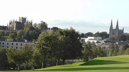
- Armagh’s two St Patrick’s cathedrals, Anglican and Catholic, on two neighbouring hills – Armagh is the seat of both Primates of All Ireland.
- Armagh Observatory and Planetarium with an astropark, an 18th-century observatory and planetarium shows.
- Navan Fort (Emain Macha), the grass-covered ring enclosure of the legendary royal seat of Ulster, around 3 km west of the city, with a visitor centre.
- CampingSpirit overnight tip
-
Official campsite or RV park: Kinnego Marina Caravan Park on Lough Neagh near Oxford Island (Armagh City, Banbridge and Craigavon Borough Council): touring pitches at the marina with electricity, toilets and showers, and a service point, a few minutes from the M1. Check season and availability in advance.
Free camping or nature tip (where legal): Oxford Island is a nature reserve with day car parks; overnight stays outside the campsite are not permitted. Armagh has car parks but no overnight areas for motorhomes.
- Insider tip for campers
- In Armagh don’t go looking for parking in the centre, but use a larger car park on the edge and walk the short distances; the planetarium has its own car park on College Hill. In recent years Lough Neagh has repeatedly been affected by blue-green algae blooms in summer and autumn: don’t swim, keep dogs away from the water and follow the notices on site.
7Stage 7: Oxford Island to Belfast (approx. 35 km)
- The drive
- Via the M1 past Lisburn to Belfast and through the city to Dundonald in the east, or straight to the ferry port. Motorway and well-signposted city roads, with rush-hour queues on the Westlink and in front of the port. About 45 minutes.
- Highlights & must-sees
- Oxford Island National Nature Reserve: shoreline paths through reeds and meadows, bird hides with waterfowl, especially in the winter half of the year.
- Lough Neagh, at around 390 km² the largest lake in the British Isles – from the Kinnego shore at sunset a wide, still scene.
- To finish in Belfast: the Titanic slipway in the evening light, the docks on the Lagan and, if you like, St George’s Market on a weekend morning.
- CampingSpirit overnight tip
-
Official campsite or RV park: Dundonald Touring Caravan Park in east Belfast next to the ice bowl (Lisburn and Castlereagh City Council): pitches with electricity, toilets and showers, and a service point; the Glider route G1 runs from Dundonald to the centre, and from there the G2 to the Titanic Quarter. A good last site before the ferry; check season and booking in advance.
Free camping or nature tip (where legal): There are no legal free overnight spots for motorhomes in Belfast; overnight stays on harbour roads or in supermarket car parks are not provided for and not advisable for safety reasons.
- Insider tip for campers
- Before the ferry, empty out and fill up at a service point: draining water saves weight, empty the cassette, turn off the gas cylinders and have your gas details ready at check-in. Follow the signs to Belfast’s ferry port and allow plenty of time for check-in.
Camping practice & local rules
Wild camping & overnight parking
- Northern Ireland has no right of public access: wild camping – with a tent or a motorhome – requires the landowner’s permission. Scotland’s rules do not apply here.
- Parking is allowed wherever it is not signposted as prohibited, but many council car parks, promenades and beaches prohibit overnight stays by bylaw or sign; forest parks and National Trust properties are closed in the evening. Height barriers at beach and walkers’ car parks are common.
- In the Mourne Mountains, too, there is no right to camp; you need the landowner’s consent. Sleeping in your vehicle at walkers’ car parks is not provided for, and residents and councils are sensitive about it.
- You can stay overnight legally at the sites in Tollymore, Castlewellan, Kilbroney and Gosford, at club and private sites, and at the National Trust site at Castle Ward. Useful apps and directories: park4night, Campercontact, the Discover Northern Ireland website, and the Caravan and Motorhome Club and the Camping and Caravanning Club.
- If you want to head further north: Donegal and the Causeway Coast are covered in the CampingSpirit guide to Donegal and the Causeway Coast.
Waste disposal & supplies
- Water and waste facilities (“Elsan point” for the cassette, grey water drain) are found almost only on campsites; public service points are rare. Some sites let passing travellers use their disposal facilities for a fee – ask first.
- Drinking water in Northern Ireland is good; on sites, don’t confuse the fresh water tap with the cassette rinse tap.
- Gas: Calor and Flogas are the usual brands; German exchange cylinders are not swapped, and connections differ. Arrive with full cylinders or use a refillable system; autogas (LPG) is only available at a few filling stations – look up locations in advance in an LPG app.
- Electricity: blue CEE sockets (230 V) on campsites, Type G plugs in everyday use; check the polarity at the hook-up.
- Midges are found on still evenings in the Mournes and at the forest sites too, mainly in summer and into autumn.
Vehicle size & traffic rules
- Left-hand traffic: roundabouts are driven clockwise, and traffic from the right has priority; on single-track Mourne roads, wait in passing places on your own (left) side or stop opposite one and let the other vehicle come through. Adjust or tape your headlights for left-hand traffic; an extra mirror for the right-hand side helps when overtaking.
- Speed limits in Northern Ireland (mph, signs take precedence): motorhomes up to 3.05 t unladen weight 30 mph in built-up areas, 60 mph on single carriageways, 70 mph on dual carriageways and motorways; heavier motorhomes 50 mph on single carriageways, 60 mph on dual carriageways, 70 mph on motorways; caravan combinations 50 mph on single carriageways, 60 mph on dual carriageways and motorways. In the Republic of Ireland km/h apply: motorway 120, national road 100, regional road 80, local road 60, built-up areas 50, with a trailer no more than 80.
- Entry: Northern Ireland is part of the United Kingdom, not the EU. EU citizens without an Irish passport need an Electronic Travel Authorisation (ETA) for the United Kingdom including Northern Ireland; the fee (check the current amount on gov.uk) covers two years. That the requirement also applies when crossing the land border from the Republic is only documented by secondary sources; there are exemptions for residents of Ireland with proof of residence – check the requirement and the fee on gov.uk before you travel. On the Cairnryan–Belfast (Stena Line) and Cairnryan–Larne (P&O Ferries) ferries, each a crossing of around two hours, and on Liverpool–Belfast, the ferry companies require photo ID.
- Insurance: whether a Green Card is required in Northern Ireland for your EU-registered vehicle has not been conclusively clarified. Get written confirmation from your insurer that the United Kingdom (including Northern Ireland) and the Republic of Ireland are covered, and carry this confirmation and, if needed, the Green Card. Pets: the rules depend on your route of arrival (via Great Britain or via the Republic of Ireland) – check in advance on gov.uk and nidirect.
- Dimensions and zones: motorhomes registered in Great Britain may be no more than 12 m long and 2.55 m wide, and from 3 m in height a height notice in the cab is mandatory. There are no tolls and no low emission zones on the route; Belfast has no Low Emission Zone.
- Alcohol: Northern Ireland 80 mg/100 ml of blood, Republic of Ireland 50 mg – best not to drink at all. Mobile phones only with a hands-free kit. Winter tyres are not mandatory; in the Mournes, fog, ice and storms can make the passes unpleasant in autumn and winter.
CampingSpirit packing & preparation checklist
- Tide table for Strangford Lough (app or printout): the mudflats, shoreline paths and the current in the Narrows all depend on the tide.
- Walking boots, a map of the Mourne Mountains and waterproof clothing: Slieve Donard and the paths along the Mourne Wall are quickly shrouded in fog, and waymarking is sparse.
- Headlight beam deflectors or adjustment for left-hand traffic, plus an extra mirror for the right-hand side of the vehicle.
- CEE-to-Type-G adapter and an extension cable with a polarity tester for the forest park sites.
- Small change in pounds and euros: for parking meters, the ferry and the detour across the border.
- Insect repellent and a head net for still evenings at the forest sites of Tollymore, Gosford and on Lough Neagh.
As of 2026-10. Closures, fees and booking rules change: check official sources before you go.