

In-depth guide · CampingSpirit
From Burgdorf via Gotthelf’s Lützelflüh, the Lüderenalp and Kemmeriboden-Bad to Sörenberg, over the Glaubenberg and up to the foot of the Napf: around 260 km on back roads where you will more often be driving behind a tractor than behind a coach.
The spirit of the route
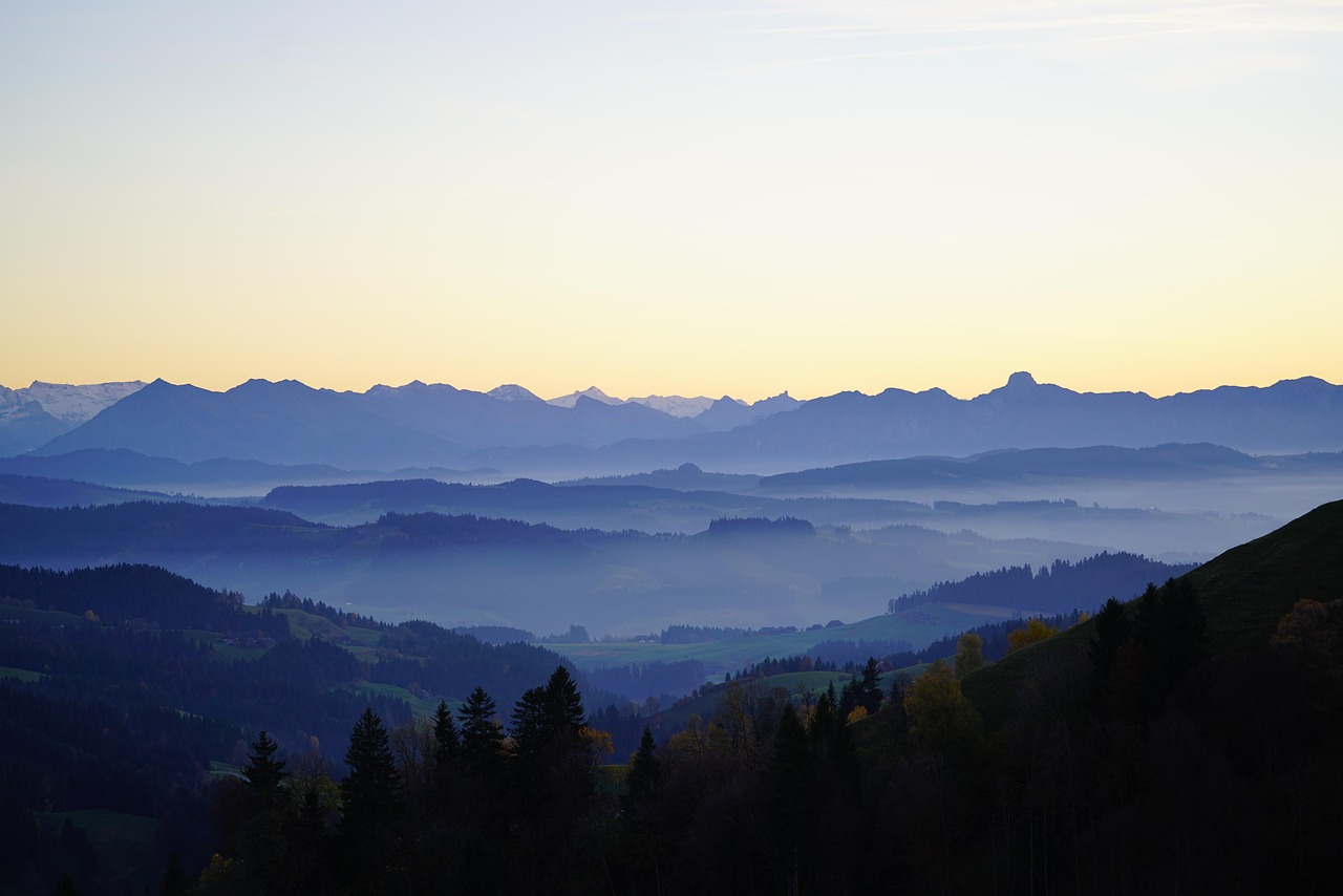
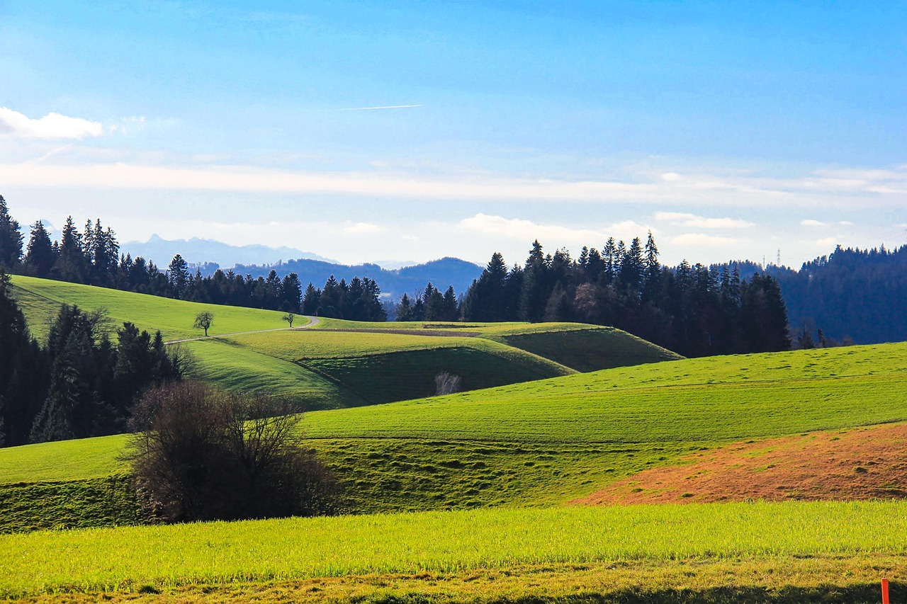
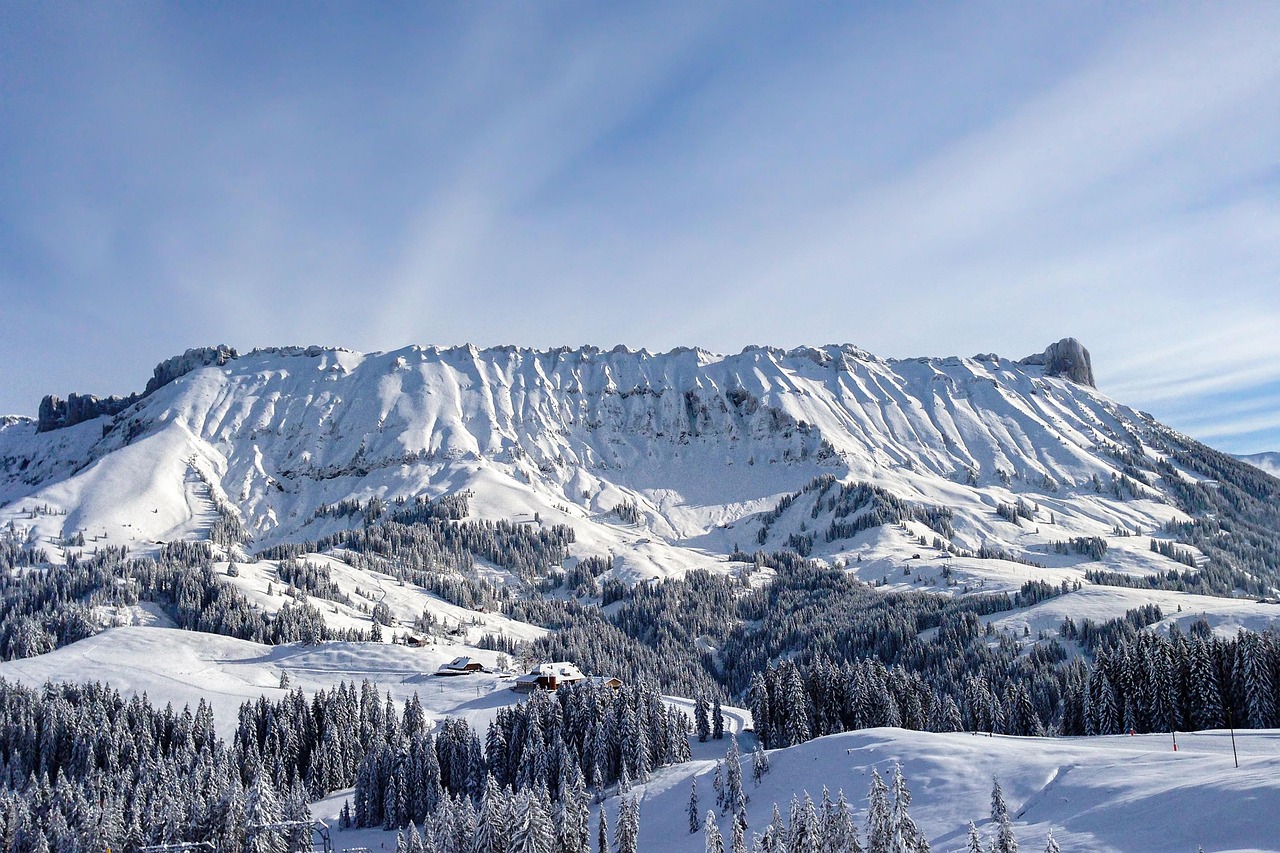
The Emmental is not a land of grand gestures. The road follows the Emme, turns off into a side valley, climbs over a ridge and drops down again, and behind every crest stands a farmhouse with a deep, low-slung hipped roof, geraniums in front of the galleries and a little retirement house, the Stöckli, beside it. It smells of freshly mown grass, wood smoke and sometimes of slurry. From the sliding door you see hills lying like crumpled green cloth, and above them, on clear days, the Eiger, Mönch and Jungfrau. Beyond Escholzmatt the country gets rougher: in the Entlebuch, raised bogs with cotton grass and mountain pines lie beneath the limestone pavements of the Schrattenfluh, and from the Brienzer Rothorn you look down on turquoise Lake Brienz. This route rewards slowness: short stages, a piece of cheese from the farm, a plate of meringue with Nidle cream – and in the evening a pitch on a farm instead of at the edge of the woods.
Stage-by-stage plan
1Stage 1: Bern to Burgdorf (approx. 25 km)
- The drive
- Bern is only the starting point here: out of the city via Bolligen and the edge of the Bantiger, then through the Krauchthal with its sandstone cliffs across to Burgdorf. Well-built country road, a few bends in the Krauchthal, no narrow sections; just under 40 minutes. If you are in a hurry, take the A1 to Kirchberg and drive into Burgdorf from the north (vignette required).
- Highlights & must-sees
- Burgdorf Castle: the Zähringen castle above the Emme now houses a museum, restaurant and youth hostel; from the courtyard you can see as far as the Bernese Alps on a clear day.
- Burgdorf’s upper town with arcaded lanes, the town church and Kornhausgasse – a few minutes’ walk from the castle.
- Gysnauflüe: sandstone cliffs above the Emme on the edge of town, a short walk with views of the old town and the river.
- CampingSpirit overnight tip
-
Official campsite or RV park: Camping Waldegg, a small site on the Emme on the edge of Burgdorf, with toilet and shower facilities and electric hook-ups; you can walk to the old town along the river. Check the season and pitches for longer vehicles with the operator in advance. As an alternative, farms in the area, such as the Kürbishof Oppliger in Oberburg, offer a few farm pitches. In Bern itself, if you plan a night there: Camping Eichholz on the Aare in Wabern.
Free camping or nature tip (where legal): Wild camping is not permitted in the canton of Bern: you need the landowner’s consent, and the municipalities regulate overnight stays in vehicles; it is not intended in the car parks of Burgdorf’s town centre. If you stay overnight on public land despite a ban, you risk a fine. Plan your first night at the campsite or on a farm with the owner’s consent.
- Insider tip for campers
- Burgdorf’s upper town is narrow and steep; multi-storey car parks have height restrictions. Leave the camper down by the Emme or at the campsite and walk up. Do a bigger shop and fill up before the Emmental: the side valleys do have village shops and farm shops, but hardly any large petrol stations.
2Stage 2: Burgdorf to Lützelflüh (via Affoltern im Emmental) (approx. 30 km)
- The drive
- From Burgdorf via Heimiswil up onto the heights near Kaltacker and on to Affoltern im Emmental – a narrow but well-surfaced hill road with climbs and blind crests. Then down through the Rüegsbachgraben to Rüegsau and Hasle on the Emme and upriver to Lützelflüh. Around an hour of pure driving time; farm traffic slows you down, so use the passing places.
- Highlights & must-sees
- Emmentaler Schaukäserei in Affoltern: you can watch Emmentaler AOP being made in the copper cheese kettle, plus historic dairy buildings, a shop and a restaurant.
- Old wooden bridge Hasle-Rüegsau: the wooden arch bridge with the longest span still standing in Switzerland (around 58 m), built over the Emme at Hasle in 1839 and moved a few hundred metres downstream to Kalchofen in the 1950s.
- Gotthelf Centre in Lützelflüh: Albert Bitzius, better known as Jeremias Gotthelf, was pastor here from 1832 until his death in 1854 and wrote “Uli the Farmhand” and “The Black Spider”; the church, the parsonage and his grave lie close together.
- CampingSpirit overnight tip
-
Official campsite or RV park: There is no large campsite in the middle Emmental, but there are farm pitches. According to map data, the Kläsihof in the Grüne valley between Grünenmatt and Trachselwald offers motorhome pitches; check facilities, electricity and booking directly with the farm. Pitch directories also list small private pitches in Affoltern; whether and on what terms you may stay overnight in the Schaukäserei car park, ask on site. You can find more farms via platforms for farm pitches such as Nomady or in Campercontact and park4night.
Free camping or nature tip (where legal): Field and forest tracks in the Emmental almost always belong to farmers or forest corporations. Staying overnight there is not allowed without the owner’s express consent – and asking for consent works surprisingly often if you do it during the day and politely. Normal parking rules apply in village car parks; there is no right to stay overnight.
- Insider tip for campers
- The old wooden bridge has a narrow carriageway and a weight limit – do not drive across it with the camper; park nearby and walk the few metres. In Affoltern, shopping in the dairy shop is worthwhile: Emmentaler of different ages keeps well in the camper’s fridge for the rest of the trip.
3Stage 3: Lützelflüh to Langnau im Emmental (via Trachselwald, Sumiswald and the Lüderenalp) (approx. 35 km)
- The drive
- Via Grünenmatt to Trachselwald, from there to Sumiswald and through the Grüne-Graben to Wasen. From Wasen, a narrow, winding mountain road climbs for around 6 km to the Lüderenalp at 1,144 m, with a ramp of over 10 % right after the village – hard work with large motorhomes and oncoming traffic, and the passing places are short. On the other side, equally small, winding roads lead down to Bärau and Langnau. A good hour of driving in total.
- Highlights & must-sees
- Trachselwald Castle on a terrace edge above the village: Anabaptists were held prisoner in the keep; the old prison in the tower can be visited, and in the former remand prison an exhibition tells the history of the Swiss Anabaptists (open seasonally, free admission).
- Lüderenalp: viewing terrace looking out over the Emmental ridges to the Bernese Alps; from here the ridge trail runs along the crest to the Napf and on to the Mettlenalp (around 13 km, just under 5 hours).
- Langnau: village centre with the Chüechlihus regional museum and, in the surrounding area, the mighty silver firs of the Dürsrütiwald.
- CampingSpirit overnight tip
-
Official campsite or RV park: Langnau and the surrounding area mainly have small farm pitches: according to a pitch directory, Oberkatzbach at around 850 m above Langnau offers a single pitch with electricity, water and waste disposal, limited to 7 m in length and a season from May to October – book in advance. More farms in the area via Nomady, Campercontact or park4night. If you need a fully equipped site, drive on to Bumbach the next day.
Free camping or nature tip (where legal): The Lüderenalp is a destination for day trips with an inn and a car park, but not an overnight spot for campers; if in doubt, ask at the inn rather than simply staying put. Hikers’ car parks on the ridges are often private land and not intended for motorhomes at night.
- Insider tip for campers
- Drive the road to the Lüderenalp in the morning, when milk and feed vehicles are about, rather than on a Sunday afternoon, when the day-trip traffic is coming back. Stay in a low gear on the way down. In Langnau you will find a large supermarket, petrol stations and the last station with long-distance trains before the Entlebuch.
4Stage 4: Langnau im Emmental to Kemmeriboden-Bad (Schangnau) (approx. 30 km)
- The drive
- On main road 10 through the Ilfis valley to Trubschachen, on to Wiggen and then south to Marbach and over the low saddle into the Schangnau. From Schangnau the road gets narrower and leads through Bumbach to the head of the valley at Kemmeriboden-Bad at the foot of the Hohgant. A good 45 minutes in total; the section beyond Bumbach is narrow but built for PostBuses.
- Highlights & must-sees
- Kambly in Trubschachen: alongside the factory, the biscuit maker runs a large shop with tastings – the Bretzeli are the Emmental original.
- Kemmeriboden-Bad: the inn at the head of the valley is known for its huge meringues with Emmental Nidle (cream).
- The young Emme above Kemmeriboden and the view of the rock faces of the Hohgant – a short walk along the river from the inn.
- CampingSpirit overnight tip
-
Official campsite or RV park: Camping Bumbach in Bumbach (municipality of Schangnau), a few kilometres before Kemmeriboden-Bad, with electric hook-ups and toilet and shower facilities; check the season and pitch lengths with the operator. From there it is just under four kilometres by bike or on foot along the Emme to the meringue.
Free camping or nature tip (where legal): The upper Schangnau lies on the border with the canton of Lucerne and the protected areas on the Hohgant; the car park at the inn is meant for guests and hikers. Stay overnight at the campsite or on a farm with permission – pastures and alp access roads are private land.
- Insider tip for campers
- Trubschachen has a railway station, a village shop and a petrol station on the main road; in the Schangnau, supplies become thin. The car park at Kambly is very busy at weekends – it is more relaxed during the week. Fill up with water at the campsite: there are no public service points at the head of the valley.
5Stage 5: Kemmeriboden-Bad to Sörenberg (via Escholzmatt and Schüpfheim) (approx. 42 km)
- The drive
- Back through the Schangnau to Marbach and into Escholzmatt in the canton of Lucerne, which sits on a broad saddle above the Ilfis valley. On main road 10 to Schüpfheim, then turn right into the Waldemme valley via Flühli to Sörenberg at around 1,160 m. Wide, well-built cantonal roads with a few climbs in the upper section; around an hour.
- Highlights & must-sees
- Escholzmatt: a village on the heights between the Emmental and the Entlebuch with wide views of the Schrattenfluh.
- Schüpfheim: main town of the Entlebuch and seat of the UNESCO Entlebuch Biosphere – information on moorland landscapes, karst and alpine farming, as well as hiking suggestions for the next few days, is available from the Biosphere and the tourist offices.
- Schrattenfluh: the bare limestone pavements above Flühli and Sörenberg, easy to see from the road and reachable on foot from Sörenberg.
- CampingSpirit overnight tip
-
Official campsite or RV park: Camping Rischli at the entrance to Sörenberg, between the Schrattenfluh and the Rothorn range, with a small number of pitches and tent spaces for spontaneous visitors; call ahead, as places are scarce. The village also has an official motorhome stopover (information from Sörenberg Flühli Tourismus); ask about facilities, fees and payment on site or at the tourist information office.
Free camping or nature tip (where legal): The Entlebuch Biosphere includes large moorland landscapes of national importance. Moorlands in Switzerland are protected by the constitution; wild camping is not allowed in moorland and wildlife protection areas, and wildlife quiet zones must be respected, especially in winter. In the rest of the municipal area, the Lucerne municipalities set their own rules on overnight stays – in Sörenberg, use the official stopover.
- Insider tip for campers
- Shop and fill up once more in Schüpfheim; Sörenberg has only village shops with mountain prices. The road from Sörenberg on over the Glaubenbielen to Giswil is a narrow panoramic road with its own rules – not needed for this route, and not recommended for large vehicles.
6Stage 6: Sörenberg to Entlebuch (with the Glaubenberg Pass) (approx. 60 km)
- The drive
- In the morning, up the Brienzer Rothorn without the vehicle. Then down the valley via Flühli and Schüpfheim to Entlebuch and from there through the Entlen valley up to the Glaubenberg Pass at 1,543 m: surfaced throughout, with gradients of up to 11 % and some narrow sections in the forest. Turn round at the top of the pass and drive back to Entlebuch. Around 1.5 hours of driving without breaks.
- Highlights & must-sees
- Cable car from Sörenberg up the Brienzer Rothorn (2,350 m): views of Lake Brienz, the Bernese Alps and across the Entlebuch to Pilatus; at the top, the rack railway comes up from Brienz.
- Raised bogs on the Glaubenberg with cotton grass, mountain pines and peat moss – bog trails and circular walks from the top of the pass, on marked paths only.
- Mettilimoos bog trail above Entlebuch: a circular walk from Entlebuch station through the moorland of the Finsterwald area, around 14 km and about 4.5 hours – especially colourful in autumn.
- CampingSpirit overnight tip
-
Official campsite or RV park: Stellplatz Hasle-Entlebuch between Schüpfheim and Entlebuch, with around 18 pitches according to map data; check electricity, water and waste disposal and the season with the operator. Alternatively, go back to Sörenberg to the same site as the previous night. You can find farm pitches in the Entlebuch via Nomady or Campercontact.
Free camping or nature tip (where legal): The Glaubenberg is a moorland and wildlife protection area: wild camping is not allowed there, drones are banned throughout the area, and dogs must be kept on a lead. On the Obwalden side, the cantonal camping law does allow a single night in a motorhome outside campsites, but only if no public or private interests are affected – which is not the case in protected areas. The army also regularly holds firing exercises at Langis and on the Glaubenberg, during which areas and hiking trails are closed.
- Insider tip for campers
- The Glaubenberg road is closed beyond Langis in winter (usually from November to April); on the Obwalden side it stays open as far as Langis. Check the army’s firing notices for Langis/Glaubenberg before you set off and observe closures on site. The Rothorn cable car has seasonal operating times with maintenance breaks and does not run in storms – check the operating times the day before and go up early, before cumulus clouds build up.
7Stage 7: Entlebuch to Napf (via Wolhusen) (approx. 40 km)
- The drive
- On main road 10 along the Kleine Emme to Wolhusen, the junction where the Entlebuch and the Lucerne hinterland meet. From there west into the Napf hills to Menzberg or Romoos – narrow, winding municipal roads with steep sections; starting points for the Napf hike. Around an hour of driving. From Wolhusen it is a good 20 km to Lucerne.
- Highlights & must-sees
- Hike up the Napf (1,408 m), the “Rigi of the Emmental”: for example as a tour of around 14 km from Menzberg over the Napf to Holzwegen near Romoos (a good 4.5 hours) on marked ridge paths; at the top, a mountain inn and an all-round view from the Jura to the Alps.
- Gold panning in the Napf streams: river gold is found in the streams around the Napf; gold panning courses are offered in the Napf area – ask about them in advance at Lucerne Tourism or the municipality of Romoos.
- Wolhusen on the Kleine Emme: railway junction and last supply stop before the Napf hills.
- CampingSpirit overnight tip
-
Official campsite or RV park: For the last night: the municipal campsite of Willisau on the northern edge of the Napf area (check the season and facilities in advance) or, as a link to Central Switzerland, the campsites in Lucerne (such as Camping International Lido on the lake). Farm pitches in the Napf area via the usual platforms. Expect to reach the Napf summit only on foot; the access roads to the starting points are narrow mountain lanes.
Free camping or nature tip (where legal): The Napf hills are a landscape of scattered farms, pastures and forest; almost every track is private or corporation land. Park in the hikers’ car park during the day, and stay overnight only with the owner’s permission. If you want to spend the night in a tent on the Napf: the summit lies below the tree line, so municipal and landowner rules apply.
- Insider tip for campers
- If you are continuing your trip, you will find the onward route towards Lake Lucerne and the Alpine passes in the CampingSpirit guide “Glacier water, granite and oncoming traffic” over the Susten, Grimsel, Nufenen and Gotthard; the Bernese Oberland with Brienz, Lauterbrunnen and Grindelwald is covered in the guide “Eiger, Aletsch and Matterhorn”. Take sturdy footwear for the Napf: the ridge paths are muddy and slippery after rain.
Camping practice & local rules
Wild camping & overnight parking
- Switzerland has no national wild camping law: cantons and municipalities regulate overnight stays outside campsites. For motorhomes, the usual stopping and parking bans apply as a rule, and the vehicle must stand in a sufficiently large parking bay; there is no right to stay overnight. Camping behaviour with table, chairs and awning is taboo outside sites.
- Canton of Bern (Emmental): wild camping is not permitted – you need the landowner’s consent, and the municipalities can restrict overnight stays in vehicles; violations can result in fines. Canton of Lucerne (Entlebuch, Napf): municipal rules; we could not confirm uniform fine amounts. Canton of Obwalden (south side of the Glaubenberg): camping outside approved sites is prohibited; a single night in a motorhome is allowed provided no public or private interests are affected.
- Moorland landscapes of national importance are protected by the Federal Constitution; wild camping is prohibited in moorland and wildlife protection areas, federal game reserves and wildlife quiet zones. In the Entlebuch Biosphere this affects large areas around Sörenberg, the Glaubenberg and the Schrattenfluh.
- On private land – and in the Emmental that means almost all pastures, farm tracks and forest lanes – you always need the owner’s consent. Farm pitches are the obvious solution here: you can find them via Nomady, Campercontact, park4night and pitch directories; directories for campsites are camping.ch and the TCS camping guide.
Waste disposal & supplies
- Water and waste disposal are available mainly at campsites and at individual municipal and farm pitches; public service stations are rare on this route. So plan to empty grey water and the cassette at every campsite or farm stop.
- Empty grey water and chemical toilets only at designated points – never into drains, streams or onto pastures. In the bog areas of the Entlebuch, even a little waste water harms the nutrient-poor habitats.
- Tap water is drinking water almost everywhere; many village fountains are labelled. Avoid fountains marked “Kein Trinkwasser” (not drinking water) on alps and pastures – this is often water for livestock.
- Gas: foreign exchange cylinders are generally not exchanged in Switzerland, and Swiss cylinders have different connections; Campingaz is available from specialist shops. LPG filling stations are rare, so arrive with full cylinders or a full gas tank and carry an adapter.
- Shopping: farm shops with cheese, meat and bread line almost every road, many with self-service and payment via an honesty box or Twint. Bring cash in francs for farm shops and mountain restaurants.
Vehicle size & traffic rules
- Vignette: vehicles up to 3.5 t need the 40-franc vignette on motorways and expressways. It is valid for 14 months, from 1 December of the previous year to 31 January of the following year, as an e-vignette (linked to the number plate, officially via the FOCBS “Via” portal) or as a sticker. A trailer up to 3.5 t needs its own vignette. Without a vignette you face a fine plus having to buy one.
- Over 3.5 t: the performance-related heavy vehicle charge (LSVA) applies to lorries carrying goods. Motorhomes and caravans over 3.5 t pay the flat-rate heavy vehicle charge (PSVA) instead: it applies on the entire road network and for every day of your stay, even if the vehicle is only parked, and is purchased for 1 to 30 days, 1 to 11 months or one year before entry via “Via”. Check the rates there.
- Speed limits: motorhomes up to 3.5 t 50 in built-up areas, 80 outside built-up areas, 100 on expressways, 120 km/h on motorways; over 3.5 t, 100 km/h on motorways and expressways. Vehicles with trailers 80 km/h, 100 km/h on motorways and expressways only if the trailer is approved for it. Dipped headlights or daytime running lights during the day; blood alcohol limit 0.5, mobile phone only hands-free.
- Dimensions: height up to 4.00 m, width up to 2.55 m, vehicle length up to 12 m, vehicle with trailer up to 18.75 m. On the back roads of the Emmental and the Napf area, the limit is not the law but the width of the road: for vehicles over 7 m, the roads over the Lüderenalp and into the Napf hills are hard going.
- Passes: the Glaubenberg Pass (1,543 m, up to 11 %) is closed beyond Langis in winter, and opening and closing dates vary with the snow; on army firing days, areas may be closed. Winter tyres are not compulsory, but if you obstruct traffic with unsuitable tyres you share liability; from October, expect snow in the Entlebuch at 1,100 m and above.
- If a load (such as bikes on the rear rack) sticks out, it must be clearly marked. Dogs need a microchip and a valid rabies vaccination; dogs must be kept on a lead in the moorland and wildlife protection area on the Glaubenberg.
CampingSpirit packing & preparation checklist
- Cash in francs and a Twint or card app: farm shops, cheese dairies and farm pitches often work with an honesty box.
- Cool box or a free fridge compartment for Emmentaler, Entlebuch alpine cheese and meringues – the shopping stops are all on the route.
- Levelling ramps: farm and mountain pitches in the Emmental side valleys are almost always on a slope.
- Full gas cylinders and an adapter set, because exchange cylinders are not exchanged in Switzerland and LPG is rare.
- Hiking boots with good tread and poles for the Napf, Lüderenalp and Rothorn – the clay paths get slippery after rain.
- Binoculars for chamois on the Rothorn and the view from the Napf, plus an offline map: mobile reception drops out in the side valleys.
As of 2026-10. Closures, fees and booking rules change: check official sources before you go.