



In-depth guide · CampingSpirit
From the Tešnjar bazaar street across the uplands of Divčibare and Zlatibor, the Šargan Eight and Tara National Park down to the Drina and on to the monasteries on the West Morava: around 580 kilometres through Serbia's green west.
The spirit of the route
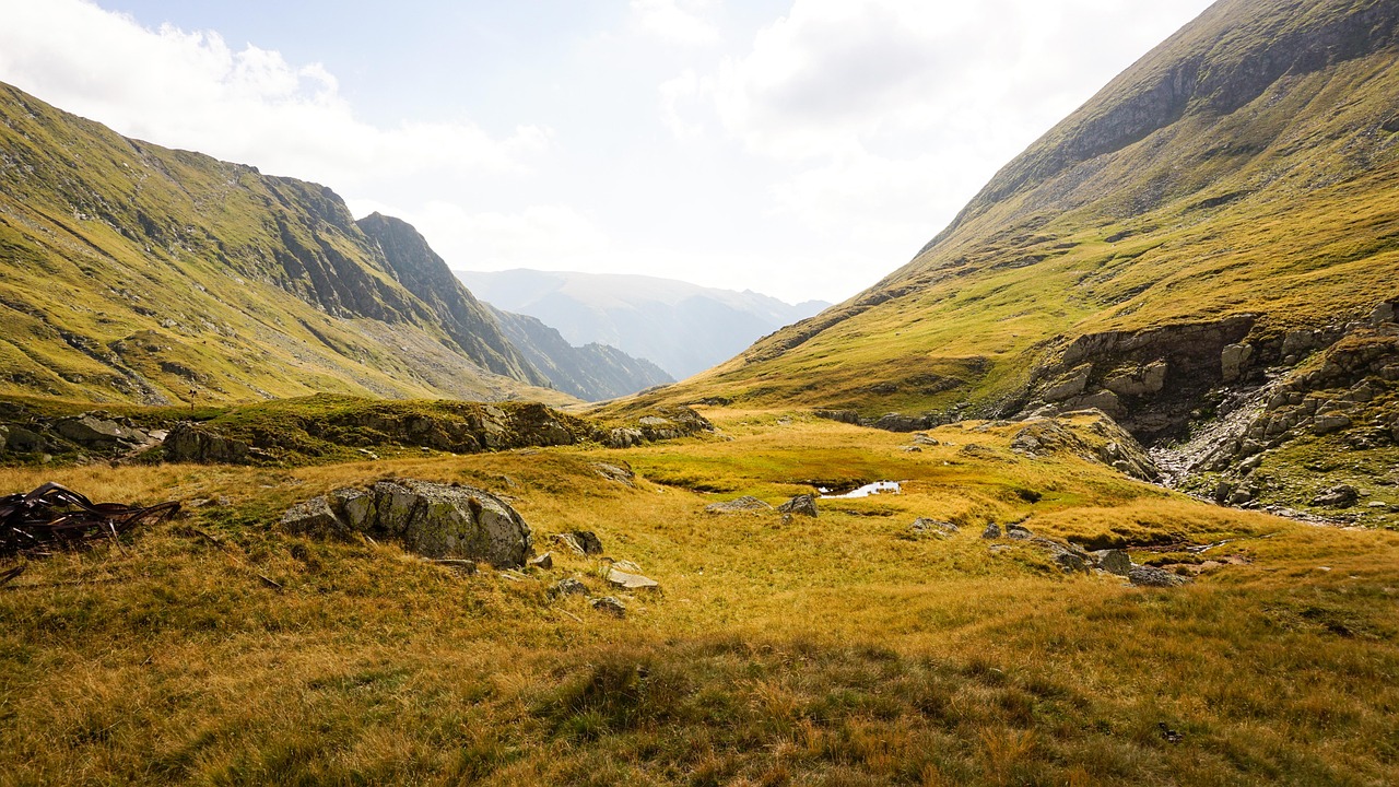
Western Serbia is a land of uplands. Beyond Valjevo the road climbs onto Maljen, and suddenly you are standing among black pines on mountain meadows where hay dries in conical stacks. On Zlatibor the mornings smell of wood smoke and smoked ham, in Sirogojno the floorboards of old log houses creak, and in Mokra Gora a steam locomotive whistles as it spirals up Šargan in a figure of eight. Then comes Tara: dark spruce forests where brown bears still live, and rocky pulpits from which you see the Drina a thousand metres below as a green ribbon between the cliffs – Bosnia already lies on the far bank. From the sliding door you look out on plum orchards, wooden churches and farmers selling kajmak and honey by the roadside. At the end, the West Morava winds its loops through the Ovčar-Kablar Gorge, on whose slopes monks have lived for centuries. No glossy finish, but plenty of hospitality.
Stage-by-stage plan
1Stage 1: Belgrade to Valjevo (approx. 100 km)
- The drive
- Belgrade is only the starting point: take the Belgrade motorway ring onto the toll A2 (“Miloš Veliki”) towards Čačak and leave at Lajkovac, then follow the state road through the Kolubara valley to Valjevo. Alternatively, go entirely toll-free via Obrenovac and Ub. Flat to hilly country with maize fields and plum orchards, village through-roads with tractors and horse-drawn carts. Around 1.5 hours.
- Highlights & must-sees
- Tešnjar in Valjevo: the old Ottoman-era craftsmen's and bazaar street on the bank of the Kolubara, with low houses, cobblestones and cafés.
- Muselimov konak, one of the oldest buildings in town and a museum of the First Serbian Uprising, plus the Nenadović Tower on the hill above the town.
- Brankovina a few kilometres north: a village ensemble with a church, an old school and the grave of the poet Desanka Maksimović.
- CampingSpirit overnight tip
-
Official campsite or RV park: No established campsite is known in Valjevo itself. If you start in Belgrade, spend the night before at Camp Dunav in Zemun (season roughly April to October) or at Kamp Beograd Avala in Ripanj south of the city and set off in the morning. For Valjevo and the surrounding area, check current pitches with hosts on park4night or Campercontact and phone ahead.
Free camping or nature tip (where legal): Wild camping is generally not permitted in Serbia; on private land you need the owner's consent. Do not stay overnight in Valjevo or in the Tešnjar car park. More polite and safer: ask at a guesthouse or a farm – with the owner's consent this is no problem.
- Insider tip for campers
- Foreigners must register with the police within 24 hours of entry; campsites, hotels and guesthouses take care of this, so raise it with private hosts. In Valjevo, withdraw dinars (RSD) from a cash machine and buy a local SIM – coverage in the mountains is patchy. Park the camper on the edge of the town centre; Tešnjar is a few minutes' walk away.
2Stage 2: Valjevo to Divčibare (approx. 40 km)
- The drive
- South out of Valjevo and up onto Maljen in long hairpins. A narrow but asphalted mountain road with some tight bends and gradients and hardly any hard shoulder; in the last section the upland opens out at just under 1000 m with pine forest and meadows. A good hour.
- Highlights & must-sees
- Kraljev sto, the highest point of Maljen, with wide views over the mountain ranges of western Serbia – on foot from Divčibare.
- Waterfalls and streams of the Crni Rzav running over mossy rock steps, reachable on waymarked hiking trails.
- The pine and meadow landscape around the village, with mountain flowers in early summer and clear long-distance views in autumn.
- CampingSpirit overnight tip
-
Official campsite or RV park: Divčibare is a mountain health resort with guesthouses and holiday homes; we have no confirmation of an official motorhome site. Some hosts let campers stay on their property for a fee, some with electric hook-up – check the current situation on park4night or Campercontact and ask in advance.
Free camping or nature tip (where legal): The upland is not a national park, but wild camping is not permitted here either; trailhead car parks are not overnight spots. Pastures and meadows are private land – do not drive onto them without permission. Avoid open fires in the pine forests in summer.
- Insider tip for campers
- Fill up and shop in Valjevo before the climb; Divčibare has only small shops. Ask hosts for fresh water; there is usually no disposal point for cassette and grey water – set off with empty tanks.
3Stage 3: Divčibare to Zlatibor (approx. 90 km)
- The drive
- Down from the plateau to Kosjerić, then on the main road to Užice and from there on the E763 up the hairpins onto the Zlatibor plateau. Narrow and winding as far as Kosjerić, wider after that, but with heavy traffic around Užice and lots of weekend traffic up to Zlatibor. Around 2 hours.
- Highlights & must-sees
- Užice Fortress (Stari grad) on a rocky spur above the Đetinja, with views over the town and the gorge.
- The hydroelectric power station on the Đetinja below the fortress, one of the oldest in Serbia, and the riverside path through the gorge.
- First views across the rolling grassy upland of Zlatibor with its islands of pine, which gave the area its name.
- CampingSpirit overnight tip
-
Official campsite or RV park: Kamp Zlatibor lies in pine forest at Tić polje on the main E763 road, not far from the centre, with a shared kitchen, barbecue area, electricity at the pitches and chemical toilet disposal; depending on the source, the season runs from April into October. Ask in advance about access for large vehicles. Stay two nights – the next stage is a loop.
Free camping or nature tip (where legal): The area is protected as Zlatibor Nature Park. Overnight stays are unwelcome in the centre (Kraljeve vode) and at the excursion car parks; in summer the municipal police carry out checks. On the plateau almost every meadow belongs to someone – ask at farms, many of which also sell kajmak and ham.
- Insider tip for campers
- Don't cross Užice through the town centre; follow the bypass towards Zlatibor. Zlatibor is a popular holiday resort for Serbs; in July, August and on public holidays the roads and car parks are full. There are large supermarkets and petrol stations in Čajetina and at the entrance to Zlatibor.
4Stage 4: Zlatibor to Zlatibor (loop via Stopića Cave – Sirogojno – Gostilje) (approx. 70 km)
- The drive
- A loop across the upland: north-east to Stopića Cave near Rožanstvo, then south to Sirogojno and on to Gostilje, returning via Ljubiš or Čajetina. Quiet, narrow country roads with many crests and blind bends, some without a centre line. Pure driving time a good 2 hours.
- Highlights & must-sees
- Stopića Cave (Stopića pećina): a river cave with large sinter pools inside, accessible via walkways and steps – guided tour; bring a jacket and non-slip shoes.
- Sirogojno, the “Staro selo” open-air museum: wooden houses, granaries and workshops from the region, plus the well-known hand-knitted jumpers made by the village knitters.
- Gostilje Waterfall: the Gostiljska reka plunges around 20 m over calcareous tufa, with paths to the cascades below.
- CampingSpirit overnight tip
-
Official campsite or RV park: Second night at Kamp Zlatibor. Alternatively, ask about offers for campers in and around Gostilje; simple eco-camps are being set up in the region, so check their status in advance.
Free camping or nature tip (where legal): Stopića Cave, Gostilje and Sirogojno have visitor car parks that close in the evening or are intended for day use only. For the night, return to the campsite or go to a host with their consent.
- Insider tip for campers
- The gondola (Gold Gondola) starts in the centre of Zlatibor and runs for around 9 km up to Tornik, the highest peak on Zlatibor. Best taken on a clear morning, then hike at the top. Arrive early at Stopića Cave; coach parties come at weekends. Have cash ready for entry to the cave, waterfall and museum.
5Stage 5: Zlatibor to Mokra Gora (approx. 40 km)
- The drive
- West via Šljivovica to Kremna and down into the Mokra Gora valley, which opens out between Zlatibor and Tara. The main road (E761 towards Višegrad) is well built but winding, with lorry traffic to the Bosnian border. Just under an hour.
- Highlights & must-sees
- Šargan Eight (Šarganska osmica): a 760 mm narrow-gauge heritage railway that winds up the mountain in a figure of eight with tunnels and bridges between Mokra Gora and Šargan Vitasi.
- Drvengrad (Küstendorf) on Mećavnik: a wooden village built by Emir Kusturica, with a church, a cinema and views of the railway line.
- Kremna with its wooden church and the meadows between the two mountain massifs.
- CampingSpirit overnight tip
-
Official campsite or RV park: The most reliable site is Camping Zip in Kremna on the Užice–Višegrad main road, around ten minutes from Mokra Gora, at the foot of Tara and Zlatibor: pitches with electricity and water, kitchens, a sanitary block, season roughly May to November. In Mokra Gora itself there are only simple options with hosts – check status and suitability for motorhomes in advance.
Free camping or nature tip (where legal): Mokra Gora is protected as Šargan-Mokra Gora Nature Park. The car parks at the station and at Drvengrad are not overnight spots. Avoid wild camping in the protected area; hosts in the valley often provide a space in their yard.
- Insider tip for campers
- The Šargan Eight runs only in season and to a timetable, and on summer weekends the trains book up quickly – buy tickets early at Mokra Gora station or online from the railway operator and check the current timetable. The access road to Drvengrad is steep; it's better to park large motorhomes below and walk up.
6Stage 6: Mokra Gora to Perućac (Tara National Park) (approx. 105 km)
- The drive
- Back to Kremna and on the national park road up onto the Tara upland to Kaluđerske Bare, with a detour west towards Mitrovac to the viewpoints. Then down many hairpins to Bajina Bašta and upstream along the bank of the Drina to Perućac. Narrow, winding forest roads, in places with poor surfaces and timber lorries; the descent to Bajina Bašta is steep – use engine braking. Around 3 hours' pure driving time.
- Highlights & must-sees
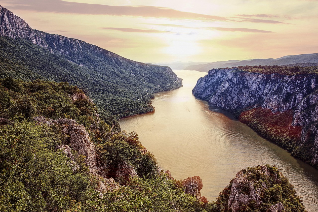
- Banjska stena: a rocky pulpit above Lake Perućac and the Drina gorge, reachable via a forest road and a short footpath – one of Serbia's best-known viewpoints, at its finest in the late afternoon.
- The dark forests of Tara with the endemic Serbian spruce (Pančić's spruce); brown bears live in the national park, so stay on the paths.
- Vrelo in Perućac: a spring-fed river only a few hundred metres long that drops over a cascade straight into the Drina.
- CampingSpirit overnight tip
-
Official campsite or RV park: Kamp Perućac lies on the right bank of the Drina in Perućac, about 13 km west of Bajina Bašta, near the Vrelo cascade and Lake Perućac. According to a camping portal there are pitches with electricity, water and waste water, chemical toilet disposal, a restaurant and a boat landing; season roughly May to September. The site also has a naturist area. Plan two nights.
Free camping or nature tip (where legal): In Tara National Park, overnight stays outside designated sites are prohibited, as are fires in the forest; the park administration and rangers carry out checks. The viewpoints are for day use only. On the bank of the Drina between Bajina Bašta and Perućac there are hosts and rafting bases that take campers – ask first.
- Insider tip for campers
- Fill the tank before driving up onto Tara – ideally already on Zlatibor – as there is no petrol station on the upland. The access roads to the viewpoints are narrow and tight for turning; vehicles over 7 m are better parked earlier, then walk. Maps with trails are available at the national park visitor centre.
7Stage 7: Perućac to Ovčar Banja (approx. 105 km)
- The drive
- In the morning, take a boat on Lake Perućac into the Drina gorge, then follow the Drina downstream to Bajina Bašta and cross the mountains to Užice. From there, take the E761 via Požega into the West Morava valley and the Ovčar-Kablar Gorge as far as Ovčar Banja. Winding and slow between Bajina Bašta and Užice, wider from Požega. Around 2.5 hours.
- Highlights & must-sees
- Boat trip on Lake Perućac into the Drina gorge, with sheer walls that close in at the narrowest point – excursion boats leave from Perućac.
- House on the rock in the Drina near Bajina Bašta (Kuća na Drini): a small wooden hut on a boulder in the middle of the river, visible from the bank.
- Bajina Bašta with its riverside promenade and views of the Bosnian side of the Drina.
- CampingSpirit overnight tip
-
Official campsite or RV park: In the Ovčar-Kablar Gorge the choice is small and changes; Ovčar Banja has guesthouses and hosts who take campers for a fee. Check the current situation on park4night or Campercontact and phone ahead. If you need a fixed site, stay a third night in Perućac and visit the gorge as a day trip.
Free camping or nature tip (where legal): The Ovčar-Kablar Gorge is protected as a “landscape of outstanding features”; wild camping on the bank of the Morava and at the monastery car parks is not intended. Monasteries are not overnight spots – even if the car park is empty, do not stay overnight without permission.
- Insider tip for campers
- The house on the rock is a photo subject; the rock itself cannot be accessed. A narrow access road leads to the bank; park large vehicles on the main road. Fill up and shop in Užice or Požega; there are only small shops in the gorge.
8Stage 8: Ovčar Banja to Čačak (approx. 30 km)
- The drive
- A short stage east through the gorge to Čačak, with detours to the monasteries on both sides of the Morava. The main road and the parallel railway line follow the river; the access roads to the monasteries are in places narrow, steep and single-track. From Čačak it is a good 1.5 hours on the A2 back to Belgrade.
- Highlights & must-sees
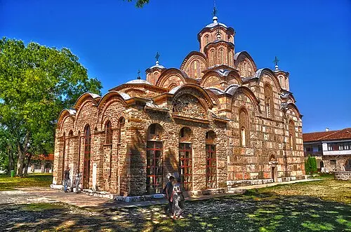
- The monasteries of the Ovčar-Kablar Gorge, often called the “Serbian Athos”: around ten small monasteries such as Blagoveštenje, Vavedenje and Nikolje, many dating from the 15th to 17th centuries.
- Hike up Kablar (just under 900 m) to the viewpoint over the meanders of the West Morava, which wraps in tight loops around the mountain – a sight especially in the morning mist.
- Guča in the municipality of Lučani, south of Čačak: home of the well-known Dragačevo trumpet festival, a quiet country town outside the festival days.
- CampingSpirit overnight tip
-
Official campsite or RV park: There are only a few sites around Čačak and in the gorge; hosts in Ovčar Banja and in the villages offer pitches in their yards. For the return drive to Belgrade, a final night at Kamp Beograd Avala in Ripanj is a practical solution.
Free camping or nature tip (where legal): The protection rules apply in the gorge; outside the protected area, ask farmers and wineries for a night. In high summer there is a risk of forest fires on the oak- and pine-covered slopes – no open fires.
- Insider tip for campers
- For the monasteries, bring long trousers, covered shoulders and, for women, a headscarf; photography inside only with permission. For Kablar, pack sturdy footwear and water; the climb is steep. During the festival every space in Guča is taken and the town is closed to traffic – if you want peace and quiet, visit outside those days.
Camping practice & local rules
Wild camping & overnight parking
- Serbia is not part of the EU. Wild camping is generally prohibited, and in protected areas camping is only permitted at designated sites. Staying on private land with the owner's consent is the usual way – ask at farms, guesthouses and hosts.
- Protected areas on this route: Tara National Park, Zlatibor Nature Park, Šargan-Mokra Gora Nature Park and the protected landscape of the Ovčar-Kablar Gorge. There: no wild camping, no fires outside fixed barbecue spots, stay on the paths. Brown bears live on Tara – lock food and rubbish inside the vehicle at night.
- Foreigners must register with the police within 24 hours of entry. Campsites, hotels and guesthouses handle the registration; insist on it with private hosts, otherwise register yourself at the nearest police station. Keep the confirmation until you leave the country.
- The campsite network in western Serbia is thin; many sites are small and family-run, the season is usually May to September, and online information is often out of date. Use park4night, Campercontact and Pitchup and phone ahead – phone and messenger apps work better than email.
Waste disposal & supplies
- Service points outside campsites are practically non-existent. Empty cassettes and grey water at campsites; if you are passing through, ask to do so for a small fee. Never empty anything into the terrain in the karst of Tara or in the catchment areas of reservoirs.
- Tap water in towns is generally drinkable; in the countryside and at springs, look out for signs (“pitka voda” = drinking water, “voda nije za piće” = not drinking water). Carry a water filter.
- Gas: German exchange cylinders are not swapped. Autogas (LPG, “autogas” or “TNG”) is available at many petrol stations; for refillable cylinders and gas tanks you will usually need the Dish adapter. Enter the country with full cylinders.
- The currency is the Serbian dinar (RSD). Euros are accepted at toll stations and sometimes in tourist resorts, with change given in dinars. Petrol stations and supermarkets take cards; small camps, cave ticket desks, farm stalls and car park attendants often take cash only.
Vehicle size & traffic rules
- Speed limits: 50 km/h in built-up areas, 80 km/h outside built-up areas, 100 km/h on expressways and 130 km/h on motorways for cars and motorhomes up to 3.5 t. Motorhomes over 3.5 t and vehicle-trailer combinations: 50 km/h in built-up areas, 80 km/h outside built-up areas, on expressways and on motorways. Drivers who have held their licence for less than a year must drive 10 km/h slower in each case. Dipped headlights or daytime running lights are required all year round, including in daylight.
- Tolls: no vignette. The motorways – on this route mainly the A2 Belgrade–Preljina–Požega – are tolled on a closed system: take a ticket at the entry, pay at the exit in cash in dinars or euros (change in dinars) or by card. An electronic tag (ENP) is optional for cars and motorhomes and gives a discount. On the Belgrade motorway ring only heavy vehicles in category IV (four or more axles including trailer, over 3.5 t) pay, and only by tag. Classification depends on the number of axles, height above the front axle, overall height and weight; motorhomes and vehicle-trailer combinations usually fall into category II or III – if in doubt, check with the operator Putevi Srbije. Most of the route runs on toll-free state roads.
- Documents: driving licence, vehicle registration document, nationality sticker. For vehicles from the EU, Switzerland, Norway and Iceland, Serbia no longer requires a Green Card; the number plate counts as proof of insurance, but carrying the International Motor Insurance Card is still recommended. If you are not the registered keeper, you need a letter of authorisation.
- Road conditions: state roads in the mountains are often narrow, without a hard shoulder, with potholes, timber lorries and grazing livestock. On Tara and Maljen, tight hairpins and short steep ramps are common; vehicles over 7.5 m should avoid minor roads. Do not drive at night – road markings are faint, and there are unlit vehicles and pedestrians about.
- Blood alcohol limit 0.2 ‰, 0.0 ‰ for novice and professional drivers. Phone calls only with a hands-free system. Carry a warning triangle, high-visibility vest and first-aid kit. From 1 November to 1 April, winter tyres (M+S, at least 4 mm tread) are mandatory in wintry road conditions and snow chains must be carried; studded tyres are prohibited. Expect snow on Zlatibor and Tara from late autumn.
- Fines are often collected on the spot, and traffic checks with laser speed measurement are frequent. Always report accidents to the police and ask for a confirmation – a vehicle with visible body damage may only leave the country with a police damage report.
CampingSpirit packing & preparation checklist
- International Motor Insurance Card, vehicle registration document and, if applicable, the keeper's letter of authorisation to hand in a folder – plus copies of the police registrations until you leave the country.
- Dinar cash in small notes for cave, museum and boat ticket desks, farm stalls and small camps, where cards are rarely accepted.
- Dish adapter for LPG filling stations and two full gas cylinders on entry – on Zlatibor and Tara the nights get cool even in summer.
- Offline maps and a hiking map for Tara and Zlatibor, plus a local SIM – coverage on the uplands and in the Drina gorge is patchy.
- Binoculars for Banjska stena, the Kablar meanders and the Šargan Eight as the train climbs the hairpins.
- A sealed, odour-proof rubbish container and a lockable cool box – brown bears live in Tara National Park.
As of 2026-10. Closures, fees and booking rules change: check official sources before you go.