

In-depth guide · CampingSpirit
Around 720 road kilometres and four ferries from Andenes via the Senja National Tourist Route, Kvaløya and Tromsø to the Lyngen Alps, through Signaldalen and Dividalen to Finnsnes – an island route where the timetable on the quay sets the day, not the clock.
The spirit of the route
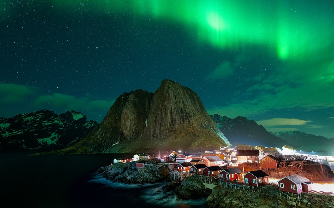
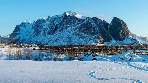
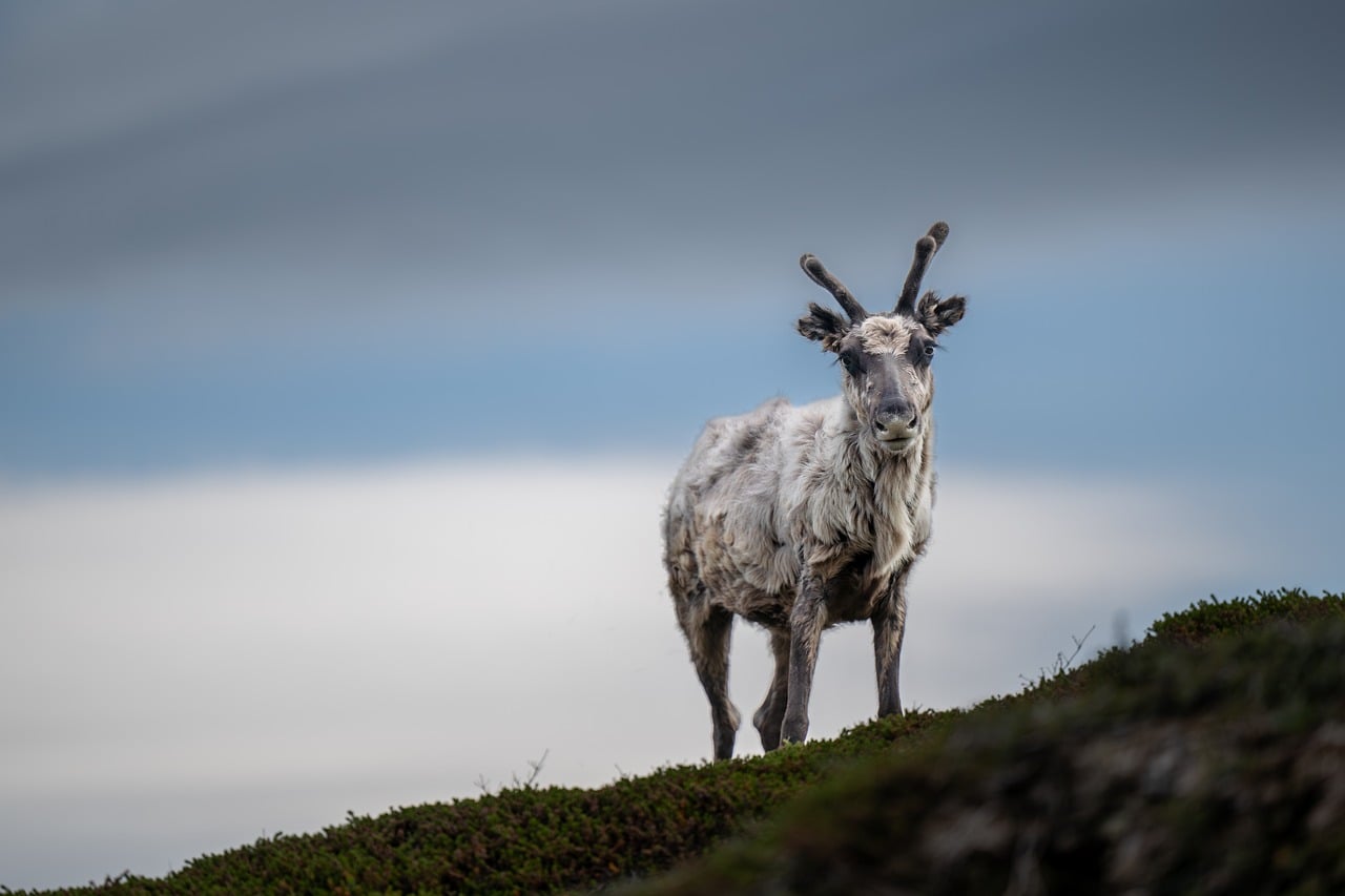
Senja is what Lofoten was thirty years ago: an island whose outer side breaks into the Norwegian Sea in jagged peaks, with fishing villages crouching beneath rock walls and roads that leap through narrow tunnels from one fjord to the next. From the sliding door you see Okshornan rising out of the water like a set of teeth, white beaches with water the colour of glaciers and, at midnight, the sun just above the horizon. Then the ferry crosses to Kvaløya, Tromsø slips briefly past with its bridges and the Arctic Cathedral, and before the Lyngen Alps fjords become routes again: two ferries, a view of a glacier, reindeer by the roadside. Inland it suddenly smells of pine, and in Dividalen the wilderness begins and runs all the way to the Swedish border. In autumn you trade the midnight sun for green northern lights over the fjord – and learn that here wind and ferry timetable set the pace.
Stage-by-stage plan
1Stage 1: Andenes (Andøya) to Skaland (Senja) (approx. 30 km)
- The drive
- In the morning, head to the ferry terminal in Andenes and take the summer ferry across the open Andfjord to Gryllefjord on Senja – a crossing of just under two hours that can get rough in a swell. The ferry only runs in the summer half of the year with few departures a day; according to the operator, advance booking was not possible most recently. From Gryllefjord the Senja National Tourist Route (Nasjonal turistveg Senja) begins: on Fv86 and Fv862 through rolling bog and rock country and short tunnels to Bergsbotn and down to the Bergsfjord. Short, but not fast – with waiting time for the ferry, half a day.
- Highlights & must-sees
- Crossing the Andfjord: from the deck you watch the Andøy coast fall behind and Senja’s west side with its peaks come into view; with luck, whales and white-tailed eagles.
- Gryllefjord: a small fishing harbour at the end of a narrow fjord, with rock walls right behind the houses.
- Bergsbotn viewing platform: the Tourist Route’s long wooden walkway above the innermost Bergsfjord, looking out at the steep peaks around Skaland – best in the evening light.
- CampingSpirit overnight tip
-
Official campsite or RV park: Skaland Camping in the village of Skaland on the Bergsfjord, listed on OpenStreetMap for tents and motorhomes with sanitary facilities; ask the site in advance about electricity, number of pitches and season. According to Nasjonale turistveger there is a service station in Skaland. If you don’t want to drive far after the ferry, there are further sites in the Torsken/Gryllefjord area, such as Senja Fjordcamp.
Free camping or nature tip (where legal): On Senja the general Norwegian principle applies: sleeping in your vehicle counts as parking and is only permitted where parking is allowed and not prohibited by a sign; camping behaviour with awning, table and chairs belongs on a campsite. The Bergsbotn platform is a viewpoint, not an overnight spot – the car park is small and constantly full during the day.
- Insider tip for campers
- Be at the quay in Andenes well before departure: without reservations, the order of arrival decides, and long motorhomes stand a poor chance when the ferry is full. Vehicles are charged via number-plate recognition – with an AutoPASS ferry agreement or a FerryPay account; according to the operator, foot passengers and cyclists travel free. Fill up and shop in Andenes beforehand, as the shops on Senja’s outer side are small.
2Stage 2: Skaland to Mefjordvær (approx. 40 km)
- The drive
- On Fv862 from the Bergsfjord to the Steinfjord, to the Tungeneset rest area and on to the Ersfjord, then on to Mefjordbotn and along the spur road Fv7868 into the fishing village of Mefjordvær. The stretch is short but narrow, with tight bends, passing places and several older, partly narrow and dimly lit tunnels – drive slowly when there is oncoming traffic. Pure driving time a good hour; with stops, a whole day.
- Highlights & must-sees
- Tungeneset: wooden walkways and rock slabs at the tip of the headland, looking out at the jagged Okshornan mountain range rising from the sea like teeth – under the midnight sun, the island’s best-known photo spot.
- Ersfjordstranda: white sandy beach in the innermost Ersfjord with the Tourist Route’s golden toilet building; in summer, a place for a cold swim.
- Mefjordvær and Senjahopen: fishing villages beneath steep rock walls; around Mefjordvær, hiking trails lead into the mountains above the Mefjord.
- CampingSpirit overnight tip
-
Official campsite or RV park: Camp Mefjord in Mefjordvær, listed on OpenStreetMap with motorhome pitches and sanitary facilities; check electricity, pitches and season directly with the operator. On the Ersfjord there is also a tent site set up by Midt-Troms friluftsråd, with no motorhome facilities. According to Nasjonale turistveger there are service stations in Senjahopen and Mefjordvær.
Free camping or nature tip (where legal): The Tourist Route rest areas – Tungeneset and Ersfjordstranda – are in high demand; staying overnight counts as parking where it is not prohibited by a sign, but space is tight, and according to Nasjonale turistveger the toilets are expressly not intended for emptying cassettes. Pitching a tent on the beach is possible under the right to roam on uncultivated land, at least 150 m from houses and for no more than two nights.
- Insider tip for campers
- The tunnels on this section are narrow: fold in your mirrors when a bus comes the other way, and better to wait before the tunnel. Shops and fuel are scarce on Senja’s outer side and have short opening hours, so fill up beforehand in Finnsnes or Andenes. For Tungeneset in the midnight sun, don’t arrive until around 11 pm, when the day visitors have gone.
3Stage 3: Mefjordvær to Sommarøy (Kvaløya) (approx. 105 km)
- The drive
- Back to Mefjordbotn and on towards Øyfjord, with two detours: through three tunnels to Fjordgård on the Ørnfjord, and along the spur road Fv7886 over a short causeway onto the island of Husøy. Then via Lysbotn to the ferry port of Botnhamn, the end point of the Tourist Route. The Botnhamn–Brensholmen ferry runs all year round and takes a good half hour; as far as we know, reservations are not offered. From Brensholmen it is only a few kilometres on Kvaløya to the bridge to Sommarøy. About 2 hours of pure driving time plus the ferry and waiting time.
- Highlights & must-sees
- Husøy: a fishing village that covers almost the whole of this small island in the Øyfjord, with a fish landing station, colourful houses and views of the fjord’s mountains.
- Fjordgård: starting point of the steep climb up Segla (639 m), whose rock nose stands vertically above the Mefjord; the alternative with a similar view and less exposure is neighbouring Hesten. Only in dry weather and with sturdy footwear.
- Sommarøy: skerries with pale sandy coves and turquoise water off Kvaløya, with views west over the open sea in the evening.
- CampingSpirit overnight tip
-
Official campsite or RV park: Sommarøy Camping & Marina on Sommarøy, listed on OpenStreetMap as a motorhome site with electricity and sanitary facilities; ask about season and facilities in advance, and arrive early in July. If you miss the last ferry, Fjordbotn Camping is a few kilometres before Botnhamn.
Free camping or nature tip (where legal): Parking space is very limited in Fjordgård and Husøy; hikers heading for Segla use the pay car park at the school in Fjordgård, not spaces in front of houses or at the fish landing station. Staying overnight there is practically impossible. At the ferry in Brensholmen, the waiting lane is not a place to stay.
- Insider tip for campers
- In summer the Botnhamn–Brensholmen ferry is the bottleneck of this route: places are allocated in order of arrival, and when the queues are long, vehicles get left behind. Travel early in the day or take a late departure; the fare depends on vehicle length, and an AutoPASS ferry agreement or a FerryPay account speeds up payment. Only make the detour to Fjordgård in a motorhome over 7 m when traffic is quiet.
4Stage 4: Sommarøy to Svensby (Lyngen Peninsula) (approx. 100 km)
- The drive
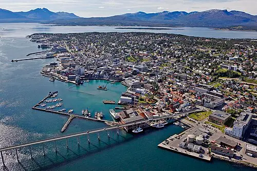
- On Fv862 across Kvaløya through valleys and past the inner Kaldfjord to Tromsø, over the Sandnessund Bridge onto the city island. After a short visit to the city, cross the Tromsø Bridge (Tromsøbrua) to the mainland and drive through Tromsdalen to the E8 and Fv91 to Breivikeidet, then take the short ferry across the Ullsfjord to Svensby. Good roads as far as Tromsø, narrower after that; in the city, underground tunnels with roundabouts. About 2 hours of pure driving time plus the ferry.
- Highlights & must-sees
- Arctic Cathedral (Ishavskatedralen) in Tromsdalen: the triangular church from the 1960s with its large glass mosaic; parking at the building is limited.
- Fjellheisen: cable car from Tromsdalen up to Storsteinen, with views of the city, the sound and Kvaløya; in a motorhome, better to park at the valley station than in the city centre.
- Ullsfjord crossing to Svensby: the Lyngen Alps rise above the water with snowfields and glaciers.
- CampingSpirit overnight tip
-
Official campsite or RV park: Svensby Tursenter right by the ferry terminal on the Lyngen Peninsula, listed on OpenStreetMap with electricity, water, sanitary facilities and waste disposal; check the season in advance. If you want to stay in Tromsø, use Tromsø Lodge & Camping in Tromsdalen near the Arctic Cathedral, often full in summer.
Free camping or nature tip (where legal): In Tromsø, sleeping in your vehicle in public car parks in the city centre is practically not an option; multi-storey car parks have height restrictions. On the Ullsfjord and the Lyngen Peninsula there are lay-bys that are used away from farms and at a distance from houses; farmland and grazing land (innmark) are off limits.
- Insider tip for campers
- Tromsø is the best supply stop on the route: large supermarkets, Vinmonopolet, petrol stations and garages. Drive slowly on Kvaløya – in summer, reindeer stand on the road there. The Breivikeidet–Svensby ferry is short and frequent but can be delayed by wind; as far as we know, it cannot be reserved.
5Stage 5: Svensby to Hatteng (Storfjord) (approx. 125 km)
- The drive
- On Fv91 over the pass between the Ullsfjord and the Lyngenfjord to Lyngseidet, then take the ferry across the Lyngenfjord to Olderdalen (around 40 minutes). Then on the E6 south along the east shore to Skibotn and around the head of the fjord to Hatteng, from where you make the detour into Signaldalen to the end of the valley and back. The E6 is well built; Signaldalen is a narrow valley road with little oncoming traffic. About 2.5 hours of pure driving time plus the ferry.
- Highlights & must-sees
- Lyngseidet: Lyngen’s 18th-century wooden church in the village centre; from here, a detour south to Furuflaten for the hiking trail into Steindalen, with a view of the tongue of the Steindalsbreen glacier.
- Lyngseidet–Olderdalen ferry: the Lyngen Alps from the water, in June with snow down to sea level.
- Signaldalen: the valley beneath Otertinden, a free-standing rock pyramid of around 1,360 m, with birch forest, waterfalls and pastures.
- CampingSpirit overnight tip
-
Official campsite or RV park: Lyngentourist in Storfjord, a few kilometres north of Hatteng, listed on OpenStreetMap as a campsite and motorhome site with electricity, water, sanitary facilities and waste disposal. Smaller alternatives: Hatteng Grillbar & Camping in Hatteng and, in Skibotn, Strandbu Camping on the fjord. Check season and opening times in advance.
Free camping or nature tip (where legal): There are a few hikers’ car parks in Signaldalen; staying overnight there counts as parking and is only possible where it is not prohibited by a sign and grazing land is not affected. The valley is farmed and narrow – no turning manoeuvres in farm driveways.
- Insider tip for campers
- Thanks to its dry inland climate, Skibotn is popular with aurora hunters from Tromsø: when it is raining on the fjord, it is often clear here. In autumn an evening on the fjord shore is worthwhile. Skibotn has a shop and a petrol station; check the timetable for the Lyngseidet–Olderdalen ferry the evening before.
6Stage 6: Hatteng to Målselvfossen (Bardufoss) (approx. 120 km)
- The drive
- On the E6 via Nordkjosbotn, where the E8 branches off to Tromsø, south through the Balsfjord valley into inland Målselv and to Bardufoss. Well built, with long stretches through pine and birch forest, mostly at 80 km/h. From Bardufoss, a short way upriver to Målselvfossen. Just under 2 hours of pure driving time.
- Highlights & must-sees
- Balsfjord: the long fjord, with views back to the mountains of the Lyngen Peninsula and the first pine forests of the interior.
- Målselvfossen: a wide, low waterfall on the Målselv river with a long salmon ladder, often called Norway’s “national waterfall”; in July the salmon leap.
- Bardufoss: transport hub and garrison town in the Målselv valley, with an airfield and good supplies.
- CampingSpirit overnight tip
-
Official campsite or RV park: Målselvfossen Feriesenter right by the waterfall, listed on OpenStreetMap as a campsite with space for caravans and motorhomes; check facilities and season with the operator. Further south on the E6 is Bardu Camping & Turistsenter in Setermoen.
Free camping or nature tip (where legal): According to Statens vegvesen, rest areas on the E6 are intended for breaks; stopping is possible where there is no prohibition sign, camping behaviour is not. In the forests of Målselv the fire ban from 15 April to 15 September is especially strict – dry pine heath burns quickly.
- Insider tip for campers
- In Bardufoss or Andselv, fill up with fuel, stock up on food and water and empty the cassette: after that there are no supplies on the way into Dividalen. On the E6 between Nordkjosbotn and Bardufoss, elk are more common than on the coast – slow down at dusk.
7Stage 7: Målselvfossen to Finnsnes (approx. 200 km)
- The drive
- Detour into Dividalen: via Øverbygd and Holt up the valley on a narrow road to Frihetsli and from there on a private toll road (bomvei) of around 6 km to the car park at the end of the road before Øvre Dividal nasjonalpark; the fee is paid at the entrance. Then back to Bardufoss and on Fv86 to the coast at Finnsnes on the Gisundet. Around 3.5 hours of pure driving time; with a hike in the national park, a long day.
- Highlights & must-sees
- Øvre Dividal nasjonalpark: pine and birch forest, bogs and fell all the way to the Swedish border; from the end of the valley, short walks into the valley or long tours on marked border trails.
- Dividalen: a remote valley of farms, river and forest – a landscape more reminiscent of Lapland than of the fjord coast.
- Finnsnes and the Gisund Bridge: the view across to Senja, where the journey began.
- CampingSpirit overnight tip
-
Official campsite or RV park: Finnsnes Feriesenter a few kilometres east of the centre of Finnsnes, listed on OpenStreetMap as a campsite; check facilities, electricity and season with the operator in advance. If you want to go back to Senja, Senja Camping is around ten kilometres beyond the bridge.
Free camping or nature tip (where legal): In Øvre Dividal nasjonalpark, camping is permitted under the right to roam and the park’s protection regulations; vehicles stay in the car park at the end of the valley. Whether you may stay there overnight is governed by the signs on site; quiet and consideration towards reindeer herding and wildlife go without saying. Driving off-road is prohibited.
- Insider tip for campers
- In upper Dividalen there is neither a shop nor a petrol station, and in places no mobile signal – take supplies and water and download offline maps. Mosquito season in July: net and repellent. Finnsnes has supermarkets, petrol stations and Vinmonopolet for the return journey south via the E6.
Camping practice & local rules
Wild camping & overnight parking
- Norwegian right to roam (allemannsretten, friluftsloven): camping is permitted on uncultivated land (utmark), at least 150 m from inhabited houses and cabins and generally for no more than two nights in the same place. On cultivated land (innmark) – meadows, pastures, farms – you need the owner’s permission.
- For motorhomes the right to roam does not apply across the board: sleeping in your vehicle counts as parking and is only permitted where parking is allowed and not prohibited by a sign. Driving off public roads is prohibited under the Motor Traffic Act (motorferdselsloven); awning, tables and chairs belong on a campsite. Ferry waiting lanes, passing places (møteplass) and farm driveways must be kept clear.
- From 15 April to 15 September, open fires in woodland and countryside are generally prohibited. Øvre Dividal nasjonalpark has its own protection regulations; on Kvaløya, the Lyngen Peninsula and around Skibotn, reindeer graze in summer – don’t disturb the herds, and keep dogs on a lead.
- On Senja the Tourist Route rest areas are small and very busy; according to Nasjonale turistveger, their toilets are not intended for motorhome cassettes. You can stay overnight legally on campsites, municipal motorhome car parks (bobilparkering) and farm pitches. Useful apps: park4night, Campercontact; the Nasjonale turistveger website lists service points along the Senja route.
Waste disposal & supplies
- A service station for water and waste is called a “tømmestasjon”. On Senja, Nasjonale turistveger lists stations in Skaland, Senjahopen and Mefjordvær; there are also many campsites, plus Tromsø, Bardufoss and Finnsnes. Never empty grey water or cassettes into drains or the sea; in late autumn some stations close because of frost.
- Tap water is of good quality. Fill up at campsites and in Tromsø, Bardufoss and Finnsnes; there are hardly any taps at the rest areas on Senja.
- Gas: Norway uses pure propane in its own cylinder systems; German exchange cylinders are not swapped, and foreign cylinders are only refilled in exceptional cases. Arrive with two full cylinders or use a Norwegian cylinder with an adapter. Autogas (LPG) is rare in northern Norway – don’t rely on refillable tanks.
- Petrol stations and large supermarkets: Andenes, Finnsnes/Silsand, Tromsø, Skibotn and Bardufoss; on Senja’s outer side and in Signaldalen and Dividalen, only small shops or nothing at all. Wine and spirits are only sold at Vinmonopolet, for example in Tromsø and Finnsnes; supermarkets sell beer up to 4.7% on weekdays until around 8 pm, for shorter hours on Saturdays and not on Sundays.
Vehicle size & traffic rules
- Speed limits: 50 km/h in built-up areas, generally 80 km/h outside them, often less on Senja and in Signaldalen as signposted. Vehicles over 3.5 t and vehicle-trailer combinations a maximum of 80 km/h, caravans without their own brakes a maximum of 60 km/h. Speed cameras and average-speed checks are common, and fines are very high. Dipped headlights are compulsory day and night.
- Tolls and ferries: no vignette; toll stations record number plates automatically (AutoPASS), keepers of foreign vehicles receive the invoice by post, and registering with Epass24 is optional. Vehicles over 3.5 t fall into tariff group 2 (base rate usually twice as high); motorhomes in vehicle class M1 over 3.5 t pay the rate for vehicles up to 3.5 t (group 1) only with a valid AutoPASS agreement and a toll tag, otherwise group 2. A toll tag is only mandatory for vehicles over 3.5 t that are registered to a company or used mainly for commercial purposes, not for privately used motorhomes. There are four ferries on this route: Andenes–Gryllefjord (summer only, few departures), Botnhamn–Brensholmen (all year), Breivikeidet–Svensby and Lyngseidet–Olderdalen. Fares are graded by vehicle length, and a trailer counts too; payment is via number-plate recognition, for foreign vehicles through an AutoPASS ferry agreement or a FerryPay account. As far as we know, reservations are not possible on these lines – check the timetable and season with the operator in advance.
- Tunnels: on Senja there are older, narrow tunnels with little light and oncoming traffic, and in Tromsø underground roundabouts. Drive slowly, keep your distance and take off your sunglasses before entering. Width up to 2.55 m, height up to 4.0 m; on the spur roads to Husøy, Fjordgård and into Dividalen, long vehicles are at a disadvantage; the toll road at the end of Dividalen is private.
- Winter and weather: in snow and ice, suitable winter tyres are compulsory; vehicles over 3.5 t need winter tyres from 15 November to 31 March and must carry chains. In Troms it can snow down to sea level from October, and on the coast storms and ice cause short-notice closures; check conditions with Statens vegvesen (phone 175 in Norway).
- Alcohol limit 0.2 per mille, mobile phone at the wheel only with a hands-free kit, carry a hi-vis vest and warning triangle. Animals on the road: reindeer on Kvaløya, the Lyngen Peninsula and along the E6, elk in inland Målselv, sheep everywhere; collisions with wildlife must be reported to the police.
CampingSpirit packing & preparation checklist
- Sleep mask and dark curtains for the windows – from about late May to late July the sun does not set in Tromsø.
- Mosquito net for the door and roof hatch, plus repellent: in July, Signaldalen, Dividalen and windless fjord shores are full of mosquitoes.
- Tripod and head torch with red light for the northern lights from September – Skibotn and the dark beaches on Senja are good spots.
- Sturdy hiking boots with grippy soles and rain gear for Segla, Hesten and Steindalen; the paths are steep and slippery when wet.
- Norwegian gas regulator or adapter for a rental cylinder, plus two full cylinders of your own when you enter the country.
- Offline maps and a ferry timetable app: in Dividalen and on parts of Senja there is no signal, and ferry times shape each day’s plan.
As of 2026-10. Closures, fees and booking rules change: check official sources before you go.