


In-depth guide · CampingSpirit
From the citadel at Port-Louis via the stone rows of Carnac, the Côte Sauvage of Quiberon and the islands of the Gulf of Morbihan to the castles and half-timbered lanes inland: around 370 km of southern Brittany on which you will consult ferry timetables and tide tables more often than the map.
The spirit of the route
In the Morbihan you are never far from the water with your camper – and never far from stones older than the pyramids. In the morning, mist lies over the fields of Kermario, thousands of menhirs in rows with sheep grazing between them. At midday the west wind whistles over heath and granite on the Côte Sauvage, and the surf boils in coves where nobody swims. In the afternoon the gulf drains and fills again, so fast that the buoys lean in the current and the little ferries fight against the stream. From the sliding door you see oyster beds, sailing boats on the mudflats, church towers above half-timbering and salt meadows in the evening light. The drives are short, the towns small, the car parks often not made for motorhomes. If you set off early, spend the nights on aires and explore the islands on foot or by bike, you will experience southern Brittany at its own pace.
Stage-by-stage plan
1Stage 1: Lorient to Étel (via Port-Louis) (approx. 50 km)
- The drive
- From Lorient across the Blavet estuary at Lanester and Kervignac to the eastern side of the roadstead, then on the D781 via Riantec to Port-Louis. Continue via Plouhinec to the Ria d’Étel, which you cross on the Pont-Lorois bridge, and down the eastern shore to Étel. Flat coastal hinterland, a short stage; it only gets tight in the harbour districts of Port-Louis and Étel. A good hour’s driving.
- Highlights & must-sees
- Lorient La Base: the former Keroman submarine base with the Cité de la Voile Éric Tabarly and the submarine “Flore”, which you can walk through.
- Citadel of Port-Louis: a 17th-century fortress at the entrance to the roadstead, housing the Musée national de la Marine and the museum of the Compagnie des Indes; walk round the ramparts with views of Lorient and Groix.
- Barre d’Étel: the notorious sandbar at the mouth of the ria, best watched from the waterfront promenade in Étel or from Magouër on the opposite side.
- CampingSpirit overnight tip
-
Official campsite or RV park: Port-Louis has two aires in the Camping-Car Park network: “Les Remparts” by the town walls and “Prairie” a few steps away, both with barrier, water and waste service and electricity, within walking distance of the citadel. In Étel, the campsite Camping de la Falaise sits above the ria, with a motorhome area and waste disposal; north of Étel near Belz there is the campsite Saint-Cado and an aire right next to the chapel island.
Free camping or nature tip (where legal): The beach and harbour car parks between Gâvres, Port-Louis and Étel are practically all subject to motorhome bans, height barriers or time limits at night. The municipalities have created aires instead – use them. On the Gâvres tombolo and in the dunes along the ria, coastal and nature protection applies; no camping there.
- Insider tip for campers
- Lorient itself is hard work with a camper: multi-storey car parks have height restrictions and there is little space at the harbour. Stay in Port-Louis and take the scheduled boat (Bateau-bus) of the Izilo public transport network across the roadstead to Lorient. The ferries to Groix leave from Lorient; vehicle spaces on Compagnie Océane ships are scarce and should be booked – for a day trip a bike is enough.
2Stage 2: Étel to Carnac (approx. 25 km)
- The drive
- From Étel on the D105 to Erdeven, then on the D781 through heathland, pine forest and hamlets with granite walls via Plouharnel to Carnac. Beyond Plouharnel the D196 turns off towards the stone rows; the road runs right past Ménec, Kermario and Kerlescan. Wide country roads, slow traffic before Carnac in summer. Pure driving time under an hour – the day belongs to the stones.
- Highlights & must-sees
- Chapel of Saint-Cado on its small island in the ria, reached by a causeway regardless of the tide; at its most beautiful at high water in the morning light.
- Alignements de Kerzerho near Erdeven, right on the D781: freely accessible stone rows with man-high menhirs, often almost deserted.
- Stone rows of Ménec, Kermario and Kerlescan in Carnac – part of the UNESCO World Heritage Site “Megaliths of Carnac and of the shores of Morbihan” since 2025; plus the Tumulus Saint-Michel with its chapel and panoramic view over the bay.
- CampingSpirit overnight tip
-
Official campsite or RV park: Carnac has a great many campsites, most of them between the stone rows and the beach: for example Camping Le Lac on the Kerloquet lake, Camping La Grande Métairie opposite the Kermario stone rows, Camping Les Druides or Camping de la Plage near the beach; electricity, sanitary facilities and waste disposal are standard, and most close in autumn. On the way, in Erdeven, the Aire de Kerhillio lies near the dunes.
Free camping or nature tip (where legal): Carnac directs motorhomes to a dedicated zone at the Kérabus car park north of the town; conditions and fees are posted on site. Overnight stays are not permitted at the car parks of Carnac-Plage and at the stone rows, and many have height barriers. The dunes of Erdeven and Plouharnel are protected – no wild camping on the beach.
- Insider tip for campers
- The stone fields of Ménec and Kermario are fenced; from April to September you can only enter on a guided tour, booked at the Maison des Mégalithes at Ménec. From October to March access is free. You also get the view over the rows from the fence and the path – early in the morning, before the coaches stop. The Menhir Géant du Manio is a few hundred metres’ walk into the woods behind Kermario.
3Stage 3: Carnac to Quiberon (Côte Sauvage) (approx. 30 km)
- The drive
- Via Plouharnel onto the D768, which leads along the narrow Penthièvre isthmus between the Atlantic and the bay to Quiberon – one road, no alternative route. After Saint-Pierre-Quiberon the coast road turns off to the Côte Sauvage and runs via Portivy, Port-Blanc and Port-Bara to Quiberon. The coast road is narrow, with many pedestrians and few lay-bys. A good 45 minutes without traffic jams.
- Highlights & must-sees
- Côte Sauvage on foot along the GR34: rock arches, grottoes and surf between Portivy and Port-Maria, particularly impressive at the rock arch of Port-Blanc.
- Pointe du Percho near Portivy with views of both sides of the peninsula and of Belle-Île.
- Day trip to Belle-Île: the citadel of Le Palais, the rock needles of Port-Coton and the harbour of Sauzon – by hire bike or island bus.
- CampingSpirit overnight tip
-
Official campsite or RV park: The Aire de Kerné on the Côte Sauvage above Port Kerné is the peninsula’s large motorhome site: according to the tourist office around 120 unmarked pitches on hard standing in four areas, water and waste service, no electricity, ticket from the machine. Right next to it is the municipal Camping de Kerné. Other municipal sites: Camping du Goviro in Quiberon, and Rohu and Penthièvre in Saint-Pierre-Quiberon, each with sanitary facilities and electricity in season.
Free camping or nature tip (where legal): On the Côte Sauvage the car parks are off-limits at night – motorhome bans, height barriers and checks are the rule. In Quiberon town and in Saint-Pierre-Quiberon, too, there is nowhere for motorhomes to stay overnight outside the aire and the campsites. Swimming is prohibited along the entire Côte Sauvage because of currents and surf.
- Insider tip for campers
- Don’t take the camper to Belle-Île. Compagnie Océane sails year-round from Port-Maria to Le Palais (just under 50 minutes); vehicle spaces are scarce, the fare depends on vehicle length, motorhomes must be booked in advance by phone or online, and on the island you should plan on a campsite for the night. Leave the vehicle at Kerné or on the campsite and board on foot. There is hardly any room for motorhomes in Port-Maria; in season buses run to the harbour. In summer (June to September, only at weekends at the beginning and end of the season) the regional train “Tire-Bouchon” also runs from Auray to Quiberon – the stress-free alternative to the congested D768 at weekends.
4Stage 4: Quiberon to Auray (via La Trinité-sur-Mer and Locmariaquer) (approx. 50 km)
- The drive
- Back across the isthmus to Plouharnel, on the D781 past Carnac to La Trinité-sur-Mer and over the high Kerisper bridge across the Crac’h river. Then on the D781 to Locmariaquer at the entrance to the gulf and on the D28 via Crac’h back to Auray. Good roads throughout, a narrow centre in Locmariaquer. Around 1.25 hours’ pure driving time.
- Highlights & must-sees
- Harbour of La Trinité-sur-Mer: one of France’s great sailing harbours, racing trimarans at the pontoons and a view over the estuary from the Kerisper bridge.
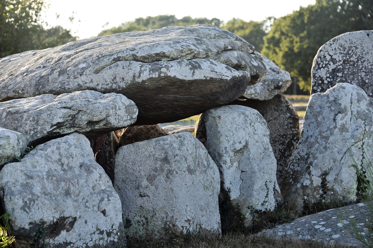
- Megalithic complex of Locmariaquer: the broken Grand Menhir, the Tumulus d’Er Grah and the Dolmen Table des Marchands with engraved stones.
- Saint-Goustan harbour quarter in Auray: a quay with half-timbered houses, steep lanes and the old stone bridge over the Loch.
- CampingSpirit overnight tip
-
Official campsite or RV park: Auray has a municipal aire and, on the Chemin de Bellevue above Saint-Goustan, another aire with water and waste service, within walking distance of the harbour. If you prefer a campsite: in Locmariaquer there is the municipal Camping La Falaise with an adjoining aire by the water; in Sainte-Anne-d’Auray there is an aire near the basilica.
Free camping or nature tip (where legal): At the harbour of La Trinité and in Saint-Goustan the quayside car parks have short time limits, some charge fees, and they are not meant for motorhomes at night. Motorhome bans also apply at the beaches of Locmariaquer and at the Pointe de Kerpenhir; the aires in town are the legal solution.
- Insider tip for campers
- You cannot reach Saint-Goustan with the camper – the lanes down to the quay are steep, narrow and partly one-way. Park in the upper town or at the aire and walk down. In La Trinité, shop early in summer; the through road by the harbour backs up from late morning.
5Stage 5: Auray to Vannes (via Baden, Île-aux-Moines and Arradon) (approx. 40 km)
- The drive
- From Auray on the D101 to Baden and down to the Port-Blanc landing stage, with a detour to Larmor-Baden at the tip of the peninsula. Then back via Baden and along narrow country roads through hamlets and oyster farms to Arradon and along the coast to Vannes. Small, partly narrow roads, demanding with oncoming traffic in villages. About an hour’s driving.
- Highlights & must-sees
- Île-aux-Moines: the largest island in the gulf, a few minutes by ferry from Port-Blanc; car-free for visitors, on foot or by bike to the cross, dolmens and viewpoints.
- Cairn de Gavrinis: a passage grave with richly engraved stone slabs on an island off Larmor-Baden, only by boat with a booked guided tour.
- Pointe d’Arradon: a shoreline path with views of the islands, oyster beds and the sailing boats in the current.
- CampingSpirit overnight tip
-
Official campsite or RV park: In Vannes, on the Conleau peninsula, is the Camping-Car Park Vannes-Conleau aire with water and waste service and electricity, and next to it the campsite Camping de Conleau, both with a bus connection to the old town. In Arradon there is a Camping-Car Park aire and the municipal Camping Parc Priol; in Baden the private Aire des Îles.
Free camping or nature tip (where legal): Overnight stays in a motorhome are not permitted at the Port-Blanc landing stage or at the car parks of Larmor-Baden and Arradon; the waterside car parks are often full during the day. The gulf has been a Regional Nature Park since 2014; salt meadows and shoreline zones are protected.
- Insider tip for campers
- Mind the tides: a causeway leads to the Île de Berder off Larmor-Baden that is only dry around low water – check the time window in the tide table beforehand and confirm on site whether the island is accessible. Very strong currents run in the gulf on the ebb and flood; if you bring a kayak or SUP, set off at slack water and keep away from the entrance between Locmariaquer and Port-Navalo. The car park at Port-Blanc fills early in season – be there by 9 a.m. or come by bike from the aire.
6Stage 6: Vannes to Presqu’île de Rhuys (Sarzeau – Port-Navalo) (approx. 45 km)
- The drive
- Out of Vannes on the N165 towards Nantes as far as Theix, then on the D780 onto the Rhuys peninsula via Saint-Armel to Sarzeau, with a detour to the south coast to the Château de Suscinio, and on via Saint-Gildas-de-Rhuys and Arzon to Port-Navalo at the tip. The D780 is well built; the side roads to the coast are narrow. A good hour.
- Highlights & must-sees
- Old town of Vannes: town walls with the gardens below, the old wash houses on the Marle, the Cathedral of Saint-Pierre and the half-timbered houses on the Place Henri-IV.
- Château de Suscinio: moated castle of the Dukes of Brittany between salt meadows and the Atlantic, its walls accessible from inside.
- Butte de Tumiac in Arzon: a burial mound with panoramic views over the gulf, islands and Atlantic; plus the abbey church of Saint-Gildas-de-Rhuys, where Abelard was abbot.
- CampingSpirit overnight tip
-
Official campsite or RV park: The peninsula has many aires: Camping-Car Park in Sarzeau, the Penvins aire on the south coast and in Arzon the municipal Aire du Kerver. There are also numerous campsites, including the municipal Camping Le Tindio in Arzon right on the gulf and the municipal Camping La Grée Penvins in Sarzeau.
Free camping or nature tip (where legal): Rhuys is densely built up and full in summer; beach car parks have height barriers or night-time bans for motorhomes. The salt meadows and dunes around Suscinio and Penvins are protected areas – wild camping is not an option here.
- Insider tip for campers
- For the old town of Vannes, leave the camper at the aire in Conleau and take the bus or a bike: there are hardly any motorhome parking spaces in the centre, and multi-storey car parks have height restrictions. The big open-air market is on Wednesday and Saturday mornings around the Place des Lices, and the market hall is open Tuesday to Sunday. Only foot-passenger boats shuttle between Port-Navalo and Locmariaquer – there is no car ferry across the entrance to the gulf.
7Stage 7: Presqu’île de Rhuys to Rochefort-en-Terre (approx. 75 km)
- The drive
- On the D780 back to Theix, then on country roads to Questembert and on to Rochefort-en-Terre. The coast gives way to forest, pastures and slate hills; easy driving throughout, the last kilometres winding. A good 1.25 hours.
- Highlights & must-sees
- Rochefort-en-Terre: granite and half-timbered houses with flower-decked balconies on a rocky spur, a Petite Cité de Caractère and voted the French people’s favourite village in 2016.
- Château of Rochefort-en-Terre with its park above the village and views over the Gueuzon valley.
- Market halls of Questembert: open 16th-century timber halls on the route.
- CampingSpirit overnight tip
-
Official campsite or RV park: The designated motorhome car park is on the Rue du Souvenir (D21, towards Malansac), around 100 m from the edge of the village: no water or waste service, charged per 24 hours, stays most recently limited to 48 hours. Water and waste service is available at the campsite Au Gré des Vents on the D21 towards Malansac, just under a kilometre from the village centre.
Free camping or nature tip (where legal): The other car parks in Rochefort-en-Terre are too small for motorhomes; overnight stays outside the designated car park and the campsite are not provided for.
- Insider tip for campers
- Don’t drive through the village centre: the lanes are narrow, partly reserved for pedestrians year-round and entirely in season, and turning is hardly possible. Coming from Questembert, take the bypass (D774) towards La Gacilly and head straight for the car park. If you want peace and quiet, come early in the morning or in the evening, when the day visitors have gone.
8Stage 8: Rochefort-en-Terre to Josselin (approx. 55 km)
- The drive
- North through the hill country of the Landes de Lanvaux to Malestroit on the Oust, then along the Nantes–Brest Canal on country roads to Josselin. Quiet, well-built roads through forest and pasture; a good hour.
- Highlights & must-sees
- Malestroit: a small town with half-timbered houses, a lock and canal bank, ideal for a lunch break.
- Château de Josselin: the Rohan family’s castle with three round towers reflected in the waters of the Oust – photo spot from the opposite bank by the canal.
- Basilica of Notre-Dame-du-Roncier and the lanes of Josselin’s old town.
- CampingSpirit overnight tip
-
Official campsite or RV park: By the canal in Josselin is the Camping-Car Park network aire with barrier, water and waste service and electricity, within walking distance of the castle; the town also has a municipal aire. The municipal campsite lies west of the town by the water.
Free camping or nature tip (where legal): Inland the situation is more relaxed than on the coast, but here too Josselin and Malestroit direct motorhomes to their aires; camping behaviour is not tolerated at canal car parks and locks. Around the castle, a Monument historique, the ban on wild camping within a 500 m radius applies.
- Insider tip for campers
- The towpath along the Nantes–Brest Canal is surfaced and flat throughout – by bike from your pitch you can reach Malestroit or Rohan as a day trip. In Josselin avoid the approach to the castle along the canal quay, as it is narrow; park at the aire and walk.
Camping practice & local rules
Wild camping & overnight parking
- Legally, France distinguishes between parking and camping: like any vehicle, your motorhome may stand wherever parking is permitted, including overnight and for at most seven days in the same place – as long as no municipal order (arrêté) prohibits it. Levelling jacks, awning, table and chairs or draining water count as camping and are only allowed on campsites and aires.
- On the Morbihan coast almost every municipality has issued such orders: motorhome bans on beach and harbour car parks, night-time parking bans, height barriers. A general ban covering an entire municipality is legally contestable, but the signs apply until a court decides otherwise – fines and towing are possible.
- Wild camping is prohibited in all cases on the seashore, in listed landscapes (sites classés), within 500 m of Monuments historiques – in this region that means around numerous megalithic sites, chapels and castles – and near drinking-water catchments. Dunes, salt meadows and land owned by the Conservatoire du littoral are protected; the gulf is a Regional Nature Park.
- The solution is the many municipal aires de camping-car (often with barriers and card payment, many in the Camping-Car Park network), campsites and private hosts in the France Passion network. In high season even the coastal aires are full by the afternoon. Apps: park4night, Campercontact, CampingCar-Infos; the Morbihan tourist board lists the aires with their facilities.
Waste disposal & supplies
- Service points for water and waste are found at almost all aires and at many supermarkets; payment is by card, token or coins. Grey water goes down the floor drain, the chemical toilet into the separate outlet – emptying into drains or the countryside is strictly prosecuted on the coast.
- Drinking water (“eau potable”) at the service points usually costs money and is time-controlled; bring a hose with various connectors, as threaded taps are rare.
- Gas: you can get French exchange cylinders (butane and propane) at filling stations and supermarkets everywhere; foreign cylinders are not exchanged. LPG pumps for filling refillable tanks are thin on the ground in Brittany – bring adapters (Dish/Euronozzle) and look up pumps in an app beforehand.
- On the Quiberon peninsula and on Rhuys, filling stations and supermarkets are very busy in summer; better to fill up and shop in Auray, Vannes or at the large supermarkets inland.
Vehicle size & traffic rules
- Speed limits: motorhomes and car-trailer combinations up to 3.5 t as for cars – 130 km/h on motorways, 110 km/h on dual carriageways, 80 km/h on country roads (90 only where signposted), 50 km/h in built-up areas; in rain 110/100/80. Motorhomes over 3.5 t: 110 km/h on motorways, 100 km/h on dual carriageways, 80 km/h outside built-up areas, 50 km/h in built-up areas, with a speed-limit disc on the rear. Combinations over 3.5 t: 90 km/h on motorways and dual carriageways, 80 km/h on other roads.
- Vehicles over 3.5 t – explicitly including motorhomes – must carry “Angles morts” (blind spot) stickers; if they are missing, it costs €135.
- Low-emission zones: the ZFE remain in place despite the attempt to abolish them, after the Constitutional Council struck down the repeal in May 2026; each city sets its own rules. Check with the relevant Agglomération for Lorient and Vannes before travelling. The Crit’Air sticker also applies to foreign vehicles and is ordered only at certificat-air.gouv.fr.
- Tolls: the N165 expressway from Nantes via Vannes and Lorient to Quimper is toll-free, as are the other roads on the route. Tolls only apply on the journey there, for example on the A11 or towards Nantes; class 2 applies up to 3.5 t at a height of 2 to under 3 m, class 3 for two-axle vehicles from 3 m in height or over 3.5 t. If you arrive via Normandy, tolls on the A13 and A14 are collected without barriers – pay online within 72 hours.
- Blood alcohol limit 0.5 (new drivers 0.2); a phone in your hand as well as earphones or a headset at the wheel are prohibited. High-visibility vest within the driver’s reach, warning triangle on board. In harbour towns and on peninsulas, no-entry restrictions for vehicles over 3.5 t or over 2 m wide are common – take the signs seriously; satnavs often do not know about them.
CampingSpirit packing & preparation checklist
- Tide table or tide app for the gulf – essential for the causeway to Berder, kayak trips and the sailing times of the small island boats.
- Bikes with a good lock: you explore Île-aux-Moines and Belle-Île without a car, as well as the old town of Vannes and the towpath to Josselin.
- Windproof jacket, hat and sturdy shoes for the GR34 on the Côte Sauvage – it blows hard there even in summer.
- Credit card with PIN and coins for barrier aires, water points and parking machines.
- Folding kayak or SUP only with a life jacket and knowledge of the currents; in the gulf the tidal streams at the entrance are very strong.
- Water hose with several connectors and an LPG adapter set for the French pumps.
As of 2026-10. Closures, fees and booking rules change: check official sources before you go.