


In-depth guide · CampingSpirit
Along the Seward Highway beside Turnagain Arm, to Girdwood and the gold-rush village of Hope, along the turquoise Kenai River via Skilak Lake Road to Soldotna and Kenai, and down the Cook Inlet coast via Ninilchik and Anchor Point to Homer: around 500 kilometres of fjord, salmon river and bluff-top coast.
The spirit of the route
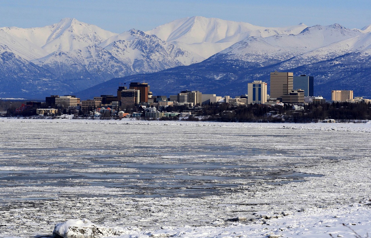
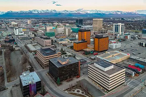
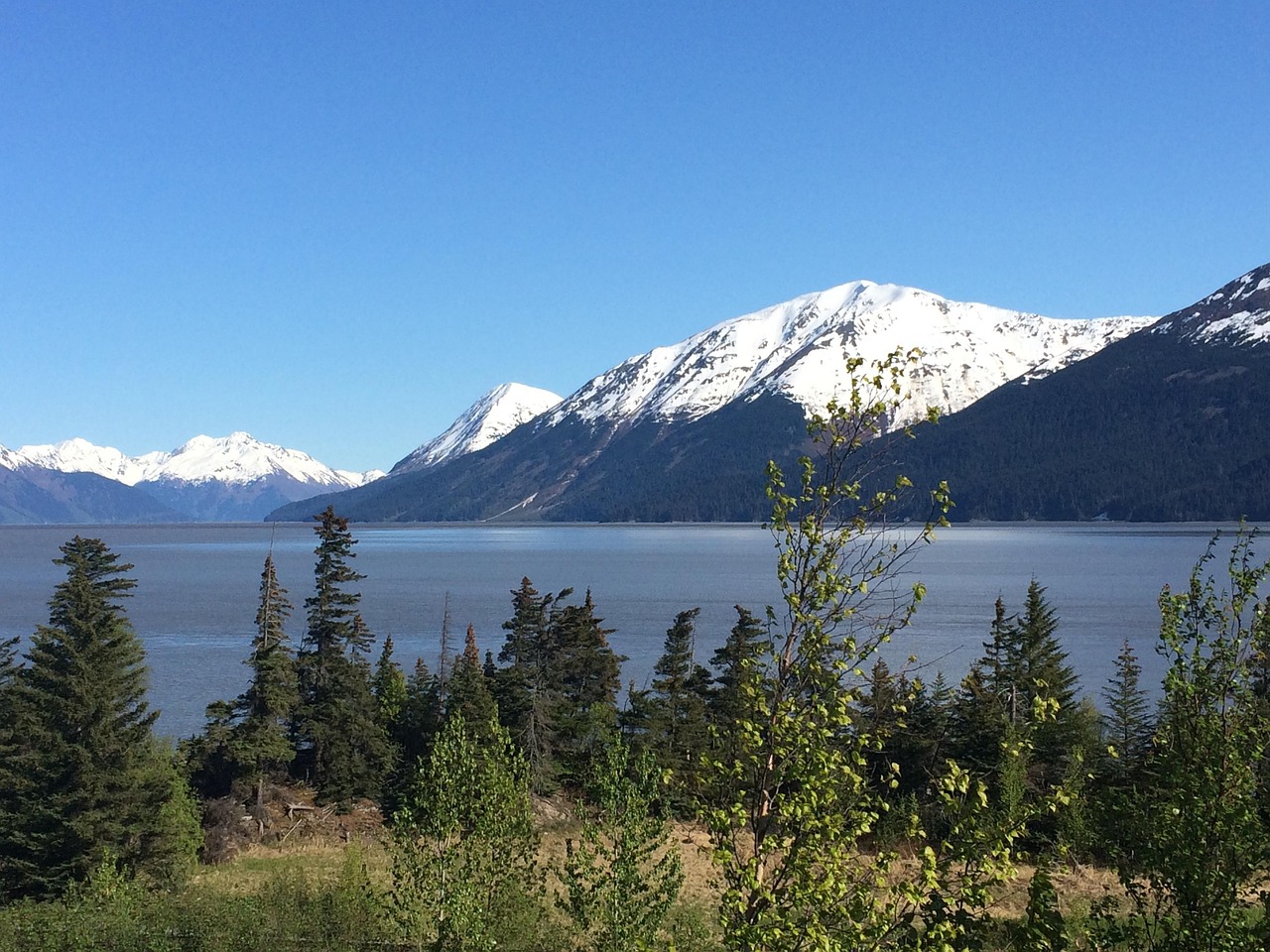
The Kenai Peninsula is Alaska in miniature, yet never small: just beyond Anchorage the highway squeezes between rock wall and mudflats, Dall sheep stand above the road, and on spring tides a wave rolls up Turnagain Arm. Then the Kenai River, so green-turquoise it looks as if someone had dyed glacial milk, with anglers in waders shoulder to shoulder when the sockeye run in summer. On Skilak Lake Road the gravel crunches, and from the sliding door you see spruce, bog lakes and sometimes a moose in the water. On the west coast Cook Inlet opens up: above the water stand the snow-covered volcanoes Redoubt, Iliamna and Augustine, and on the bluffs Russian Orthodox churches with onion domes. And because it hardly gets dark in June, at midnight you are still sitting on the beach at Homer, watching the fishing boats.
Stage-by-stage plan
1Stage 1: Anchorage to Girdwood (approx. 65 km)
- The drive
- The Seward Highway (AK-1) leaves Anchorage heading south, passes Potter Marsh and then follows the north shore of Turnagain Arm, wedged between the Chugach Mountains, the Alaska Railroad and the mudflats. Two lanes, lots of bends, few passing opportunities and heavy traffic on summer weekends; the section to Girdwood is signed as a Safety Corridor (increased fines, headlights on during the day too). The road between Indian and Girdwood is being upgraded in sections, so roadworks with waiting times are possible. Pure driving time just under an hour; with stops, half a day.
- Highlights & must-sees
- Potter Marsh and Beluga Point: from the boardwalk at Potter Marsh on the edge of the city you see waterbirds and often salmon in the creek; at Beluga Point (Mile 110) a large car park gives views over Turnagain Arm and, in late summer with luck, of belugas following the salmon.
- Bore tide: on spring tides the tidal bore runs up the arm as a breaking wave, usually a few hours after low water in Anchorage. Good spots are Beluga Point, the pullouts in between and Bird Point; check tide times beforehand and arrive early, as the car parks fill up.
- Bird Point Scenic Overlook (Mile 96): viewing platform with information boards on tides and glaciers; from here the paved Bird to Gird bike path runs along the water to Girdwood. In Girdwood itself the Alyeska Resort tram goes up Mount Alyeska, with views of seven glaciers on clear days.
- CampingSpirit overnight tip
-
Official campsite or RV park: Bird Creek Campground (Chugach State Park, Mile 101) on a wooded terrace above Turnagain Arm: a good two dozen basic pitches with table and fire pit, water pump, toilets, no hookups; no reservations, first come, first served, mind the length limit. Girdwood itself has no public RV campground; the nearest Chugach National Forest sites are in Portage Valley, about 20 kilometres south (Williwaw, Black Bear), bookable through Recreation.gov.
Free camping or nature tip (where legal): Girdwood is part of the Municipality of Anchorage, where sleeping in a vehicle outside campgrounds is prohibited. Many pullouts along Turnagain Arm are signed “No Camping” or “No Overnight Parking”; a proper campground is a must here.
- Insider tip for campers
- Never walk out onto the mudflats of Turnagain Arm: the glacial silt looks firm but grips your feet like quicksand, and the tide comes in faster than you can run – there have been fatal accidents here. In Anchorage fill up the tank, do a big shop and buy bear spray; it is not allowed on planes and is available in Anchorage outdoor shops.
2Stage 2: Girdwood to Hope (approx. 85 km)
- The drive
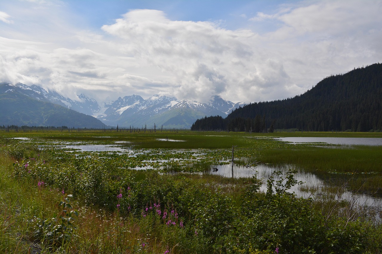
- Continue on the Seward Highway past the head of Turnagain Arm, across the Portage flats with their dead spruce (the land subsided in the 1964 earthquake), and then uphill over Turnagain Pass, where snow lies into June. At Mile 56 the Hope Highway branches off: just under 30 kilometres (17.8 miles) of paved, narrow, winding road through the Sixmile Creek valley to the south shore of Turnagain Arm. Driving time around 1.5 hours, with hardly any traffic on the spur road.
- Highlights & must-sees
- Turnagain Pass (around 300 m elevation): large car park with toilets, alpine meadows in bloom in summer, hiking trails and views of the Kenai Mountains.
- Hope Historic District: the gold-rush village of 1896, with log cabins, a small library and the Hope-Sunrise Mining Museum, sits quietly by the water; from the shoreline you can see the bore tide here too on spring tides.
- Gull Rock Trail: around 8 kilometres (5 miles) one way from Porcupine Campground on an old wagon road above Turnagain Arm to a rocky promontory with views across Turnagain Arm to the Chugach peaks on the north shore.
- CampingSpirit overnight tip
-
Official campsite or RV park: Porcupine Campground (Chugach National Forest) at the end of the Hope Highway, on a bluff above Turnagain Arm: a good 30 pitches under birch and spruce, tables and fire pits, toilets, water from a hand pump, no hookups; book through Recreation.gov and check the length limit there. Season roughly late May to September. The small Coeur d’Alene Campground on Palmer Creek Road is only suitable for tents and small vehicles.
Free camping or nature tip (where legal): In the Chugach National Forest dispersed camping is generally allowed wherever it is not expressly prohibited, usually for up to 14 days; around Hope, however, there is private land, mining claims on Resurrection Creek and signed prohibitions. Palmer Creek Road is steep and rough – unsuitable for large motorhomes. If you want to camp wild, ask the Forest Service in Girdwood or Seward and watch for property signs.
- Insider tip for campers
- Hope has only limited supplies; top up water and food in Girdwood before the turn-off. Seward lies around 90 kilometres south of the Hope turn-off and is covered in the CampingSpirit guide to the Seward Highway, Parks Highway and Denali Highway – if you want to include it, plan at least two extra days and go straight on at the Tern Lake Junction (Mile 37) instead of turning right onto the Sterling Highway.
3Stage 3: Hope to Cooper Landing (approx. 75 km)
- The drive
- Back to the Seward Highway, south to the Tern Lake Junction (Mile 37) and right onto the Sterling Highway (AK-1). From here the road follows Kenai Lake and the Kenai River westwards – two lanes, narrow at Cooper Landing, with anglers’ car parks, rafting outfitters and heavy traffic in July. A bypass north of the river (Sterling Highway Mile 45–60) has been under construction around Cooper Landing for years; it is not yet open, traffic still crawls through the village, and expect detours and waiting times at the roadworks. Driving time around 1.5 hours.
- Highlights & must-sees
- Tern Lake: at the junction of the two highways, with a lakeshore path and often loons, trumpeter swans and moose in the evening.
- Kenai Lake and Kenai River at Cooper Landing: the river leaves the lake in a milky turquoise colour that comes from glacial flour; viewpoints and boat ramps are right on the highway.
- Russian River Falls Trail: around 3.7 kilometres (2.3 miles) one way from Russian River Campground through forest to the cascades where sockeye salmon leap in summer. Brown bears and black bears fish here too – carry bear spray, talk loudly, keep your distance.
- CampingSpirit overnight tip
-
Official campsite or RV park: Russian River Campground (Chugach National Forest, Mile 52.8) at the confluence of the Russian and Kenai rivers: a large campground in several loops under spruce, drinking water, toilets, no hookups, reservations through Recreation.gov – booked up early during the sockeye season in June and July. Quieter and with lake views: Quartz Creek Campground on Kenai Lake (Mile 45) and the smaller Cooper Creek Campground on both sides of the highway on the Kenai River, both also through Recreation.gov.
Free camping or nature tip (where legal): Along the Kenai River around Cooper Landing there is practically no legal wild camping: riverbanks, car parks and pullouts are signed, and because of the high bear density overnight stays outside campgrounds are not tolerated. West of the Russian River the Kenai National Wildlife Refuge begins, where camping is only allowed in campgrounds or at least 400 metres (a quarter mile) from the road.
- Insider tip for campers
- On the Russian River anglers follow the rule “Stop, chop and throw”: clean your catch immediately, cut the carcass into pieces and throw it into the strong current, and carry fillets to the vehicle in closed containers – that way bears do not learn to associate people with fish. Russian River Campground charges a parking fee for day visitors too, and at the peak of the sockeye run the car park is full early in the morning. Fuel in Cooper Landing is expensive – better to fill up in Anchorage or Soldotna.
4Stage 4: Cooper Landing to Soldotna (approx. 85 km)
- The drive
- Around 16 kilometres west of Cooper Landing, Skilak Lake Road branches off at Jim’s Landing: just under 30 kilometres (19 miles) of gravel through the Kenai National Wildlife Refuge, with potholes and washboard, but easily driveable in a normal-sized motorhome; speed 25–35 mph. It rejoins the Sterling Highway at Mile 75, which then runs through flat bog and forest country via Sterling to Soldotna. Driving time with stops, half a day.
- Highlights & must-sees
- Skilak Lookout Trail: around 4 kilometres (2.5 miles) one way uphill to a rocky knob with views over Skilak Lake, the Kenai lowlands and, on clear days, as far as Cook Inlet; the Hideout Trail is shorter, with similar views.
- Hidden Lake and Upper Skilak Lake: lakes with boat ramps, picnic areas and lakeshore paths; moose, brown and black bears, bald eagles and trumpeter swans are regularly sighted in the refuge. Wildlife watching is most rewarding in the morning and evening.
- Kenai National Wildlife Refuge Visitor Center in Soldotna (Ski Hill Road): exhibition on the peninsula’s habitats, short nature trails and current information on bear activity and closed trails.
- CampingSpirit overnight tip
-
Official campsite or RV park: Hidden Lake Campground (Kenai NWR, Skilak Lake Road): paved loops in the forest by the lake, toilets, fire pits, dump station, hand pumps (water not guaranteed drinkable, boil or filter it), maximum stay 7 days; the Skyview Loop can be reserved through Recreation.gov, the other pitches are first come, first served (fee according to the refuge 15 dollars per night, Senior and Access Pass 50 percent). Likewise Upper Skilak Lake Campground, with pitches by the water. Smaller sites such as Lower Skilak, Engineer Lake or Lower Ohmer Lake are more basic and not suitable for large vehicles. In Soldotna: the city’s Centennial Park Campground and Swiftwater Park Campground on the Kenai River, with boat ramps and stairs down to the water.
Free camping or nature tip (where legal): In the Kenai National Wildlife Refuge camping outside campgrounds is only allowed in the backcountry at least a quarter mile (around 400 metres) from the Sterling Highway, Skilak Lake Road, Swanson River Road and Swan Lake Road – so not with a vehicle. Some small refuge campgrounds are free of charge; that is the legal alternative to wild camping.
- Insider tip for campers
- In the Skilak area campgrounds and trails are closed at short notice when there are bear problems; check the notices at the entrances and at the visitor center. Soldotna has large supermarkets, launderettes, filling stations and dump stations – stock up on supplies, water and propane here for the rest of the coast.
5Stage 5: Soldotna to Ninilchik (approx. 110 km)
- The drive
- Take the Kenai Spur Highway just under 20 kilometres to Kenai at the mouth of the Kenai River, then follow Kalifornsky Beach Road along Cook Inlet to Kasilof and continue south on the Sterling Highway. The road now runs through spruce forest and clearings on a high terrace above the coast, with occasional views across the water to the volcano chain. Well built, few bends, driving time around two hours without stops.
- Highlights & must-sees
- Old Town Kenai: the Holy Assumption of the Virgin Mary Russian Orthodox Church of 1895 with blue onion domes, a National Historic Landmark, and the bluff above the Kenai River mouth with views of the Redoubt and Iliamna volcanoes. At the river mouth you can watch belugas during the salmon season – the Cook Inlet belugas are strictly protected.
- Kenai Beaches: north and south beaches at the river mouth. In July the beaches fill with dipnetters; dipnetting, however, is reserved for Alaska residents, so visitors watch.
- Ninilchik: on the bluff above the old village stands the Holy Transfiguration of Our Lord Church of 1901 with a small cemetery; down by the river are fishing cabins from the Russian-Creole era, and across the inlet Iliamna and Redoubt.
- CampingSpirit overnight tip
-
Official campsite or RV park: Ninilchik State Recreation Area of Alaska State Parks: Ninilchik River Campground in the forest by the river, Ninilchik View Campground on the edge of the bluff above the village and Ninilchik Overlook on the bluff – basic sites with table, fire ring and toilets, mostly with water, no hookups. To the south, the Deep Creek State Recreation Area, with a large campground on the beach at the mouth of Deep Creek and two small ones above it. No reservations, first come, first served; fees at the self-pay box.
Free camping or nature tip (where legal): The beaches on Cook Inlet are partly open to the public, but access roads are often private or signed; in Kenai and Soldotna sleeping on streets and in car parks is prohibited. The state recreation areas are the reliable and inexpensive solution. Driving a vehicle onto the beach is risky: soft sand, boulders and a tide that rises several metres.
- Insider tip for campers
- The tidal range in Cook Inlet is among the largest in the world; on the beach at Ninilchik and Deep Creek always park above the high-water line. Digging for razor clams on the east-side beaches has been closed for years because of weak stocks – check the current status with ADF&G before buying a shovel.
6Stage 6: Ninilchik to Homer and Homer Spit (approx. 80 km)
- The drive
- Continue on the Sterling Highway via Anchor Point to Homer, where the road drops down Baycrest Hill to Kachemak Bay; then take Homer Spit Road around 7 kilometres out along the narrow spit to the harbour. Good road, driving time about an hour. If you have to return to Anchorage, allow a full day’s drive for the roughly 360 kilometres.
- Highlights & must-sees
- Anchor Point: at the end of Beach Road, at the mouth of the Anchor River, stands the sign for the most westerly point of the North American road system reachable by car; tractors tow fishing boats through the surf here.
- Baycrest Hill Overlook: car park on the highway above Homer with views of Kachemak Bay, the glaciers of the Kenai Mountains, the Spit and, on the other side of the inlet, Augustine volcano.
- Homer Spit: harbour with fishing boats and a halibut charter fleet, the Seafarer’s Memorial, the Fishing Hole for silver salmon and the small wooden building of the Salty Dawg Saloon; in town, the Islands and Ocean Visitor Center of the Alaska Maritime National Wildlife Refuge, and Bishop’s Beach at low tide.
- CampingSpirit overnight tip
-
Official campsite or RV park: The City of Homer runs the Fishing Hole Campground on the Spit with over 80 pitches, Mariner Park Campground at the base of the Spit and Karen Hornaday Park Campground in the forest above the town, plus a tent area on the beach. Season 1 April to 31 October, no reservations, first come, first served; you pay at the kiosk with your licence plate or by text message, and the receipt must be clearly displayed. Basic facilities, no hookups; the city dump stations open in frost-free weather. Quieter alternative 25 kilometres north: Anchor River State Recreation Area, with several campgrounds by the river and on the beach, also without reservations.
Free camping or nature tip (where legal): On the Homer Spit camping outside the designated, paid areas is prohibited; harbour staff and police carry out checks. Sleeping in car parks in town is not allowed either. If you want to save money, use the inexpensive city or state campgrounds.
- Insider tip for campers
- The Spit lies in a tsunami hazard zone: note the evacuation signs, and in a strong earthquake drive immediately towards town and higher ground. Against the constant wind on the Spit, park with the rear of the vehicle to the wind and keep the awning rolled up. For a trip to Kachemak Bay State Park, water taxis take hikers and kayakers across the bay from the harbour.
Camping practice & local rules
Wild camping & overnight parking
- Alaska has no statewide ban on wild camping, but on the Kenai Peninsula there is little legal space left: the Municipality of Anchorage (including Girdwood) prohibits camping outside campgrounds, as do the cities of Kenai, Soldotna and Homer. In the Kenai National Wildlife Refuge camping is only allowed in campgrounds or at least a quarter mile from the main roads.
- Chugach National Forest: dispersed camping is generally allowed wherever it is not prohibited, usually for up to 14 days; however, many areas along the highways and on the Kenai River are closed. Alaska State Parks and State Recreation Areas allow overnight stays only at designated sites. In between lies a lot of private land and land belonging to Alaska Native corporations.
- Reservations: Chugach National Forest campgrounds (Russian River, Quartz Creek, Cooper Creek, Porcupine, Portage Valley) and the Skyview Loop at Hidden Lake in the Kenai NWR through Recreation.gov; the city campgrounds in Homer and the Alaska State Parks sites (Bird Creek, Ninilchik, Deep Creek, Anchor River) without reservations, first come, first served. In high season from June to August, and especially during the sockeye season on the Kenai and Russian rivers, book early.
- Season: most campgrounds open in mid to late May and close in September; water supplies and dump stations are shut off before the first frost.
- Bears: brown and black bears are found across the whole peninsula, especially on salmon rivers. Keep food, cool box, rubbish, fish and toiletries in the closed vehicle or in bear-proof containers, never left out at your pitch. Carry bear spray on your body, within easy reach.
- Fishing: visitors need a sport fishing licence from the Alaska Department of Fish and Game (ADF&G), available online; king salmon requires an additional King Salmon Stamp, but king salmon fishing on the Kenai has been heavily restricted or closed for years. Rules change at short notice by emergency order – check adfg.alaska.gov before every day’s fishing. Dipnet fishing is reserved for residents.
- Apps: iOverlander, Campendium, The Dyrt and Recreation.gov; Park4Night is hardly used in Alaska.
Waste disposal & supplies
- Dump stations: in Anchorage, Soldotna and Homer (municipal and at filling stations), and at some campgrounds; in autumn many close when it freezes. Between Girdwood and Soldotna provision is thin; Hidden Lake Campground on Skilak Lake Road has a dump station.
- Drinking water: at taps and hand pumps at campgrounds, not available everywhere and in some places only seasonally; in Anchorage, Soldotna and Homer at filling stations and dump stations. River and lake water only filtered or boiled.
- Empty grey water and toilet tanks only at dump stations; draining at rivers or beaches is prohibited and harms the spawning waters.
- Propane: filling stations, DIY stores and camping suppliers in Anchorage, Soldotna and Homer fill US cylinders; European cylinders are not filled.
- Electricity: the public campgrounds on this route generally have no hookups; for power and showers you need private RV parks in Soldotna, Kenai or Homer. Solar and the leisure battery cope well in summer thanks to the long days.
- Fuel and shopping: large supermarkets in Anchorage, Soldotna, Kenai and Homer; in between, small shops and expensive filling stations, for example in Cooper Landing.
Vehicle size & traffic rules
- Speed limits: Seward and Sterling highways mostly 55 mph, up to 65 mph on upgraded sections; considerably less in towns; Skilak Lake Road 25–35 mph. The Seward Highway between Anchorage and Girdwood is signed as a Safety Corridor with increased fines.
- Slow-vehicle rule: in Alaska a slow vehicle with five or more vehicles queuing behind it must pull over at the next safe place and let them pass. On many sections headlights are required during the day too.
- There are no tolls on this route. The Anton Anderson Memorial Tunnel to Whittier (toll, alternating direction) lies off the route.
- Roadworks: there is construction on the Seward Highway along Turnagain Arm and on the Sterling Highway around Cooper Landing (bypass construction), and waits behind a pilot car are possible; check conditions on 511.alaska.gov.
- Moose: collisions are common, especially at dusk, which lasts a long time in summer. Adjust your speed and watch for animals at the roadside.
- Tides, earthquakes and tsunamis: never walk onto the mudflats of Turnagain Arm and Cook Inlet; in Homer and along the coast note the evacuation routes. Emergency number 911; mobile coverage is patchy on Turnagain Pass, on the Hope Highway and on Skilak Lake Road.
CampingSpirit packing & preparation checklist
- Bear spray with holster: buy it in Anchorage, as it is not allowed on planes; on the Russian River, at Skilak and on the Kenai River it belongs on your belt, not in the glovebox.
- Waders and wading boots without felt soles: felt soles are banned in Alaska’s fresh waters because they spread invasive organisms.
- Eye mask and blackout covers for the windows: in June it only gets briefly dusky on the Kenai Peninsula.
- Mosquito head net and repellent with DEET or picaridin: in the forest and by lakes and bogs the mosquitoes are thick in June and July.
- Tide table for Anchorage and Homer (app or printed): for the bore tide, for beach walks at Ninilchik and Homer and for parking safely on the coast.
- Rain jacket and a warm layer: even in high summer, wind on the Spit and rain on Turnagain Pass bring single-digit temperatures.
As of 2026-10. Closures, fees and booking rules change: check official sources before you go.