



In-depth guide · CampingSpirit
From Reykjavík via the Golden Circle, the south coast and Jökulsárlón into the East Fjords, on to Mývatn, Dettifoss and Akureyri and back via Borgarnes: around 1,560 kilometres on which wind, light and your choice of campsite set the rhythm.
The spirit of the route
In Iceland the landscape has the last word, not the timetable. The Ring Road draws its line between glacier tongues and black sand, across moss-covered lava fields and through fjords where the light still lies over the water at midnight. From the sliding door you see steam rising from the ground in the morning, icebergs drifting in a lagoon at midday and sheep waiting at a single-lane bridge in the evening. The wind travels with you: it flings doors open, pushes tall bodywork across the carriageway and sometimes decides that you won't be driving today. In return there is the calm of evenings on the campsite, when the cooking water hums on the gas stove and a waterfall roars behind the pitch. The island demands planning, respect for nature and patience with the weather – and gives back a sense of space that Europe hardly knows any more.
Stage-by-stage plan
1Stage 1: Reykjavík to Flúðir (via Þingvellir, Geysir and Gullfoss) (approx. 150 km)
- The drive
- Leave Reykjavík on Road 1 towards Mosfellsbær, then take the 36 across the Mosfellsheiði plateau to Þingvellir. Continue on the paved 365 (Gjábakkavegur) to Laugarvatn and via the 37 and 35 to the Haukadalur geothermal area with Geysir and on to Gullfoss. From there take the 35 and 30 down to Flúðir. Tarmac throughout, exposed to wind on the plateau; around 2.5 hours of pure driving time, a full day with sightseeing.
- Highlights & must-sees
- Þingvellir National Park (UNESCO World Heritage Site): walk through the Almannagjá, the rift at the edge of the North American Plate, to Öxarárfoss and the site of the old Althing.
- Haukadalur: Strokkur erupts roughly every five to ten minutes; the Great Geysir that gave its name to the phenomenon is quiet most of the time.
- Gullfoss: the Hvítá plunges in two offset steps into a narrow gorge; the lower path takes you close to the edge in spray and wind, so pack a rain jacket.
- CampingSpirit overnight tip
-
Official campsite or RV park: Tjaldmiðstöðin Flúðum on the edge of Flúðir, with toilets and showers, electric hook-ups and motorhome waste disposal; quietly set by the Litla-Laxá river. Alternatives along the way: the Laugarvatn campsite in the village and the site at Úthlíð between Laugarvatn and Geysir. In Þingvellir National Park there are the Leirar camping areas by the visitor centre and Vatnskot by the lake. Check opening seasons and electricity availability in advance; in summer only a few sites take reservations.
Free camping or nature tip (where legal): Overnighting in a motorhome, camper or caravan outside campsites is not permitted in Iceland under the Nature Conservation Act (Lög um náttúruvernd No. 60/2013) unless the landowner expressly agrees. This also applies to the car parks at Þingvellir, Geysir and Gullfoss, where overnight bans are signposted and enforced. The right of public access for one night in a tent does not apply to vehicles.
- Insider tip for campers
- Golden Circle car parks charge fees: at Þingvellir the fee depends on vehicle class, while at Geysir and other hotspots private operators collect via number-plate recognition, machines or apps such as Parka. Pay on the same day, otherwise a surcharge is added. Early in the morning or from late afternoon the coaches have gone. In Flúðir the Gamla Laugin (“Secret Lagoon”), one of the country's oldest outdoor pools, is worth a visit; you can stock up at the small Krambúð in the village, and the nearest big discounters, Bónus and Krónan, are in Selfoss.
2Stage 2: Flúðir to Vík í Mýrdal (approx. 160 km)
- The drive
- Take the 30 south to Road 1 east of Selfoss, then follow the Ring Road via Hella and Hvolsvöllur across the plain of Suðurland. At Seljalandsfoss turn briefly onto the 249, then continue below the Eyjafjöll to Skógar and past Pétursey to Vík. Well built and flat, but between Skógar and Vík notorious for downslope winds beneath the mountains. Around 2.5 hours of pure driving time.
- Highlights & must-sees
- Seljalandsfoss and Gljúfrabúi: a wet path leads behind the 60 m fall through the rock niche; 600 m further north, Gljúfrabúi hides in a rock cleft, reached via a stream.
- Skógafoss: stairs on the east side to the top edge and the start of the trail along the Skógá with a chain of further falls towards Fimmvörðuháls.
- Dyrhólaey and Reynisfjara: rock arch and lighthouse on the headland, plus the black basalt beach with its column cave. At Reynisfjara a light signal (yellow/red) linked to the wave forecast shows which zones of the beach must not be entered; on red, stay up on the beach ridge. Never stand with your back to the sea – sneaker waves have swept people away several times, sometimes fatally.
- CampingSpirit overnight tip
-
Official campsite or RV park: Tjaldsvæðið Vík í Mýrdal (Vík Camping) on the north-eastern edge of the village below the cliff, with toilets and showers, a kitchen room and electricity for motorhomes. In a northerly wind the site is calmer than the beach. Alternative with a waterfall view: the campsite right at the foot of Skógafoss, with simpler facilities. Between Hella and Hvolsvöllur there are further sites such as Hella Gaddstaðaflatir and the municipal site in Hvolsvöllur.
Free camping or nature tip (where legal): On the south coast overnighting in vehicles is prohibited and is enforced above all at Seljalandsfoss, Skógafoss, Dyrhólaey and Reynisfjara; “No overnight parking” and “No camping” signs are the rule. Dyrhólaey is also partly closed during the nesting season in early summer. There are no tolerated spots; if you are running late, head for the nearest campsite.
- Insider tip for campers
- Before driving to Vík, check the weather and wind on vedur.is and road conditions on umferdin.is: below the Eyjafjöll certain wind patterns produce gusts that push empty panel vans and tall overcab motorhomes out of their lane. Open doors only with a firm grip, otherwise they get torn off their hinges. Seljalandsfoss, Skógafoss and Reynisfjara charge for parking, and motorhomes usually pay more than cars. Vík has a supermarket, filling stations and the last larger shop before Höfn.
3Stage 3: Vík í Mýrdal to Skaftafell (approx. 145 km)
- The drive
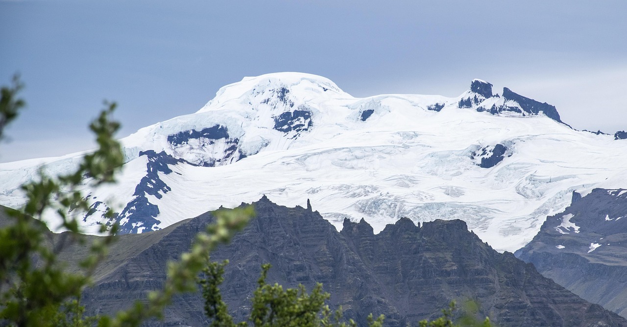
- East across Mýrdalssandur, the outwash plain below the Katla volcano, then through the moss-covered Eldhraun lava field to Kirkjubæjarklaustur. Beyond the village it gets lonely: across Skeiðarársandur with glacier views of Vatnajökull to Skaftafell. Tarmac, but several single-lane bridges; sandstorms are possible on the outwash plains in strong wind. Around 2 hours of driving plus detours.
- Highlights & must-sees
- Eldhraun: the lava field from the 1783 Laki eruption is covered in thick moss; stop only on marked paths and in car parks, as trampling damage lasts for decades.
- Fjaðrárgljúfur: just west of Kirkjubæjarklaustur, take the gravel road 206 (a few kilometres, passable by motorhome in normal conditions; its continuation, the F206, is not) to the pay car park at a canyon up to 100 m deep and around 2 km long; a path runs along the rim to viewpoints. In wet weather and during thaws, especially in spring, closures are possible.
- Skaftafell in Vatnajökull National Park: hike to Svartifoss beneath basalt columns (around 1.5 hours there and back) and to the glacier edge at Skaftafellsjökull.
- CampingSpirit overnight tip
-
Official campsite or RV park: Vatnajökull National Park's Skaftafell campsite by the visitor centre, a large site with toilets, showers, electricity on some of the pitches and a waste disposal station; check the season and booking options on the national park's website. On the way, Kirkjubær II in Kirkjubæjarklaustur is an alternative if you want to split the stage.
Free camping or nature tip (where legal): In the national park you must stay overnight only on designated campsites; car parks at the glacier and by the road are off limits. Between Kirkjubæjarklaustur and Skaftafell there are no tolerated pitches, and the outwash plains are also a nature reserve.
- Insider tip for campers
- Kirkjubæjarklaustur is the last place with a supermarket before Höfn; fill up there. After that there is only the small filling station at Freysnes just past Skaftafell, followed by a thinly supplied stretch to Höfn. At single-lane bridges (“Einbreið brú”), whoever reaches the bridge first has priority; slow down before the bridge and watch for oncoming traffic. If there is a sandstorm warning on safetravel.is or umferdin.is, do not drive across the outwash plains – sand damages paintwork and windows.
4Stage 4: Skaftafell to Höfn í Hornafirði (approx. 125 km)
- The drive
- On the Ring Road between Vatnajökull and the sea, past the glacier tongues of Öræfajökull and Breiðamerkurjökull, over the bridge at the mouth of Jökulsárlón and on past farms and lagoons to Höfn. Since June 2026 a new section of just under 19 km with four two-lane bridges (including one over the Hornafjarðarfljót) has shortened the Ring Road by around 12 km. Around 1.5 hours of driving, half a day to a full day with stops.
- Highlights & must-sees
- Fjallsárlón: a smaller, quieter glacier lagoon with icebergs and a direct view of the glacier tongue, a few minutes before Jökulsárlón.
- Jökulsárlón: icebergs drift out of the lagoon under the bridge into the sea; on the other side of the road, glittering chunks of ice lie on black sand at Breiðamerkursandur.
- Höfn: fishing harbour with views of the Vatnajökull glaciers; known for lobster (humar, actually langoustine) in the restaurants by the harbour.
- CampingSpirit overnight tip
-
Official campsite or RV park: Tjaldsvæðið á Höfn (Höfn Camping) at the entrance to town, with toilets and showers, electricity, motorhome waste disposal and a kitchen room; handy for shopping in town. Alternative east of town: Stafafell in Lón, quiet and simpler. Overnighting at the lagoon itself is not allowed.
Free camping or nature tip (where legal): Jökulsárlón, Fjallsárlón and Breiðamerkursandur are part of Vatnajökull National Park; sleeping in your vehicle is prohibited there and checks are frequent. The lay-bys on the Ring Road between the lagoons are not pitches either.
- Insider tip for campers
- Since 1 September 2026 the new Ring Road section near Hornafjörður has been tolled; vehicles under 3.5 t (gross vehicle weight) pay 1,500 ISK per single trip, vehicles from 3.5 to 7.5 t 2,100 ISK. The toll is collected fully automatically by the operator Spölur via number-plate cameras, and the bill goes to the registered keeper at the end of the month. How vehicles with foreign plates will be billed has not yet been published; check in advance with Vegagerðin or Spölur (spolur.is). The car park at Jökulsárlón charges a fee. Book boat tours on the lagoon in the morning – in high summer the departures from midday onwards are full.
5Stage 5: Höfn to Egilsstaðir (via the East Fjords) (approx. 275 km)
- The drive
- East through the Almannaskarð tunnel, past Vestrahorn and through Lón, then on the fjord road to Djúpivogur. The Ring Road follows the fjords via Breiðdalsvík and Stöðvarfjörður to Fáskrúðsfjörður, passes under the mountain to Reyðarfjörður in the Fáskrúðsfjarðargöng tunnel and climbs through the Fagradalur valley to Egilsstaðir. Paved throughout, but winding, with rockfall and narrow sections on the fjord sides; around 4.5 hours of driving.
- Highlights & must-sees
- Stokksnes and Vestrahorn: dune coast in front of the jagged mountain massif just beyond the Almannaskarð tunnel; access crosses private land, with admission paid at the café at the turn-off.
- Djúpivogur: fishing village with the open-air installation “Eggin í Gleðivík”, 34 granite eggs at the harbour, one for each bird species of the region.
- Stöðvarfjörður and Fáskrúðsfjörður: Steinasafn Petru with a private mineral collection, and the museum about French fishermen whose traces are visible in the bilingual street names.
- CampingSpirit overnight tip
-
Official campsite or RV park: Camp Egilsstaðir in the middle of town, with toilets and showers, electricity, kitchen and waste disposal, set up for motorhomes year-round (check winter opening times in advance). Quieter in the woods: Atlavík in Hallormsstaðaskógur on the Lagarfljót, around 25 km south, with basic facilities. Along the way there are municipal sites in Djúpivogur, Breiðdalsvík and Fáskrúðsfjörður.
Free camping or nature tip (where legal): There are plenty of roadside lay-bys in the East Fjords, but sleeping in your vehicle outside campsites is not allowed here either; landowners can give permission, but you need an explicit OK. The harbours of the fishing villages often have no-overnight signs.
- Insider tip for campers
- From Djúpivogur, satnavs like to suggest the shortcut over the Öxi (Road 939): the mountain road is largely gravel, very steep and tricky in fog, and closed in winter; with a large motorhome or a car and caravan, take the Ring Road round the fjords. The filling stations in Djúpivogur, Breiðdalsvík and Fáskrúðsfjörður are small, some card-and-PIN only; don't let the tank drop below a quarter before the turn-off to Egilsstaðir. If you take a rest day, drive from Egilsstaðir over the Fjarðarheiði to Seyðisfjörður (Smyril Line ferry port).
6Stage 6: Egilsstaðir to Reykjahlíð on Mývatn (with Dettifoss) (approx. 215 km)
- The drive
- West over the Fellabær bridge and up through Jökuldalur into the highlands: here the Ring Road crosses the loneliest plateaus of the route, with a detour to the Möðrudalur farm and on over the bridge across the Jökulsá á Fjöllum. Shortly after, turn north onto the paved 862 to the west bank of Dettifoss (around 24 km one way), return to the Ring Road and continue over the Námaskarð pass to Reykjahlíð. Well built, but exposed to wind and prone to snow in spring and autumn; around 3.5 hours of driving.
- Highlights & must-sees
- Möðrudalur á Fjöllum: one of Iceland's highest working farms, with a small church, café and filling station in the highland desert.
- Dettifoss and Selfoss: the glacial river Jökulsá á Fjöllum plunges into the Jökulsárgljúfur canyon; from the west car park a loop trail leads to both falls.
- Hverir and Námaskarð: mud pots and fumaroles below the pass; walk only on the roped-off paths, as the ground is thin and hot.
- CampingSpirit overnight tip
-
Official campsite or RV park: At Mývatn there is the Bjarg campsite right on the lakeshore in Reykjahlíð and the Hlíð site on the slope above the village, both with toilets and showers, electricity and motorhome waste disposal; Hlíð is often a little more sheltered in wind. Check the season in spring and autumn in advance.
Free camping or nature tip (where legal): The area around Mývatn is a nature reserve under its own law (the Mývatn and Laxá area); overnighting outside campsites is prohibited, and the car parks at Hverir, Dimmuborgir and Krafla are closed to overnight parking. There is no place to stay overnight on the 862 or at Dettifoss either.
- Insider tip for campers
- Between Egilsstaðir and Reykjahlíð there is practically no filling station apart from Möðrudalur (a few kilometres off the road) – around 165 km: fill up in Egilsstaðir. The east side of Dettifoss via the 864 is gravel and not well suited to motorhomes. At Mývatn, blackflies and midges swarm in summer; pack a head net. To round off the day, the Mývatn Nature Baths on the Ring Road – book tickets in advance in summer.
7Stage 7: Reykjahlíð to Akureyri (approx. 100 km)
- The drive
- On the Ring Road along the south shore of Mývatn via Skútustaðir, then west through heathland to Goðafoss and through Ljósavatnsskarð to the east side of Eyjafjörður. The Ring Road runs through the tolled Vaðlaheiðargöng tunnel (around 7.5 km) straight into Akureyri; the old pass road over Víkurskarð is toll-free, but steeper and trickier in winter. A short stage of around 1.5 hours, leaving time for the lake in the morning.
- Highlights & must-sees
- Skútustaðagígar and Dimmuborgir: pseudocraters on the south shore with a short loop trail, and the lava labyrinth on the east shore, both with well-marked paths.
- Goðafoss: the “waterfall of the gods” on the Skjálfandafljót lies right on the Ring Road; paths on both banks, and from the east bank a trail leads down to the pool.
- Akureyri: the Akureyrarkirkja church above the town centre, the Lystigarðurinn botanical garden with subarctic flora and the large outdoor pool.
- CampingSpirit overnight tip
-
Official campsite or RV park: Hamrar in Kjarnaskógur on the southern edge of Akureyri, a large site with toilets and showers, electricity and waste disposal, linked to the town forest by a woodland path. Quieter alternative in the forest east of the fjord: Vaglaskógur on the old road in Fnjóskadalur.
Free camping or nature tip (where legal): Akureyri has not permitted overnighting in motorhomes in public car parks or at the harbour; municipal parking areas are not pitches. Overnighting is not allowed around Goðafoss either.
- Insider tip for campers
- The Vaðlaheiðargöng tunnel toll is charged via number-plate recognition; you can pay for a single trip on veggjald.is (or tunnel.is) up to 24 hours before or after passing through, after which it is billed to the registered keeper. Campers under 3.5 t pay the car rate, and trailers and caravans cost nothing extra. In Akureyri you'll find the large supermarkets, outdoor shops and garages; gas bottles are available at larger filling stations. The town centre uses paid parking zones with a parking disc or app; large motorhomes are better parked on the edge of town.
8Stage 8: Akureyri to Reykjavík (via Borgarnes) (approx. 390 km)
- The drive
- The longest stage: up through Öxnadalur to Öxnadalsheiði (just over 500 m) and down to Varmahlíð in Skagafjörður, on via Blönduós and through the grazing land of the north-west to Holtavörðuheiði (around 400 m) and through Norðurárdalur to Borgarnes. From there across the Borgarfjörður causeway and through the toll-free Hvalfjarðargöng tunnel to Reykjavík. Around 5 hours of pure driving time; if you prefer a gentler pace, stay overnight on the way in Varmahlíð, Hvammstangi or Borgarnes and split the route.
- Highlights & must-sees
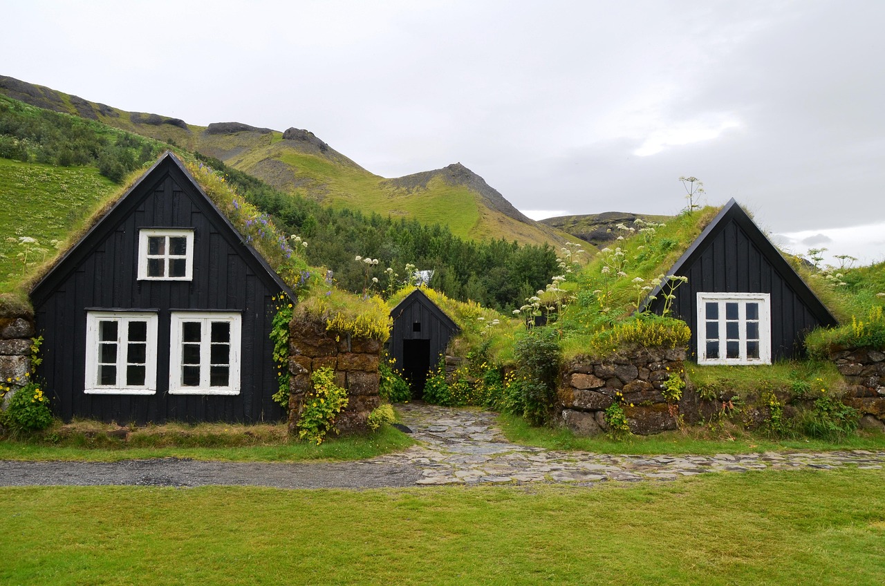
- Glaumbær near Varmahlíð: turf farmhouses with grass roofs as an open-air museum (Byggðasafn Skagfirðinga), one of the best-preserved farm complexes in the country.
- Grábrók: a short climb up wooden steps onto a scoria crater right on the Ring Road near Bifröst, with views over the Grábrókarhraun lava field.
- Borgarnes: Landnámssetur (Settlement Centre) with exhibitions on the settlement of Iceland and on Egils saga, on a peninsula in the fjord.
- CampingSpirit overnight tip
-
Official campsite or RV park: To split the stage: Tjaldsvæðið Varmahlíð on the slope above the village, the site in Hvammstangi or Tjaldsvæðið Borgarnesi in town. In Reykjavík, Reykjavík Campsite is in Laugardalur next to the outdoor pool and youth hostel, with toilets and showers, electricity, kitchen and waste disposal; east of the city is Camper Resort Reykjavík. Opening seasons and prices at the capital's sites have changed several times recently, so check in advance.
Free camping or nature tip (where legal): On the way back the same applies: sleep in your vehicle only on campsites. In Reykjavík, overnight parking with motorhomes on public streets and car parks is not permitted and is enforced; harbour areas and sights such as Hallgrímskirkja and Harpa are no alternative.
- Insider tip for campers
- Öxnadalsheiði and Holtavörðuheiði can bring sleet and icy roads as early as September; check umferdin.is and vedur.is before setting off, and road information is also available by phone on 1777. The Hvalfjarðargöng has been toll-free since 2018. Before returning the vehicle or catching the ferry, fill up in Reykjavík and use the waste disposal in Laugardalur or at one of the large filling stations on the edge of the city; don't empty cassettes in rest-area toilets.
Camping practice & local rules
Wild camping & overnight parking
- Legal position: under Nature Conservation Act No. 60/2013, overnighting in motorhomes, campers, caravans, folding trailers and roof tents outside campsites and built-up areas is not allowed unless the landowner agrees. Camping in a tent, by contrast, is allowed for one night on undeveloped land, provided there are no bans and no campsite nearby – this expressly does not apply to vehicles.
- Enforcement: police, rangers and landowners carry out checks above all on the south coast, in the Golden Circle, at Mývatn and in national parks; fines are possible, but current amounts are not documented. Many car parks have signs banning overnight stays; at car parks with number-plate recognition, long stays lead to high fees.
- Off-road driving is strictly prohibited nationwide and punished with heavy fines; tracks in moss and on lava ground remain visible for decades. F-roads (highland tracks) with fords are not suitable for motorhomes and two-wheel drive, usually open only in high summer and are generally excluded in rental contracts.
- Tools: safetravel.is for warnings and travel plans, vedur.is for wind and weather, umferdin.is (Vegagerðin) for road conditions and closures, and the “112 Iceland” app for emergency location. For pitches and waste disposal, park4night and Campercontact help; the “Útilegukortið” camping card covers a number of participating sites – check the conditions in advance.
Waste disposal & supplies
- Water and waste: almost all larger campsites have disposal for grey water and cassettes, plus stations at some filling stations. Never empty grey water into nature, drains or rest-area toilets; some sites charge non-guests for disposal.
- Drinking water is of very good quality everywhere; you can fill up with tap water without any concern. In many places hot water smells slightly of sulphur because it comes from geothermal sources – that's normal.
- Gas: propane bottles are available at larger filling stations and DIY stores, but connections and regulators don't always fit German systems. If you bring your own vehicle, bring full bottles and observe the ferry's gas regulations; LPG autogas is hardly available in Iceland, and refillable tank bottles cannot be filled reliably.
- Fuel: N1, Olís, Orkan and ÓB stations are often unmanned and work with card and PIN; without a PIN, the operators' prepaid fuel cards help. There are long gaps between Freysnes (near Skaftafell) and Höfn and between Egilsstaðir and Reykjahlíð. Supermarkets (Bónus, Krónan, Nettó) in the larger towns; wine and spirits only in the Vínbúðin shops.
Vehicle size & traffic rules
- Speed limits: 90 km/h on paved rural roads, 80 km/h on gravel, 50 km/h in built-up areas, often less in residential areas. Vehicles over 3.5 t and vehicle-trailer combinations are limited to 80 km/h outside built-up areas. Dipped headlights are compulsory around the clock, seat belts are compulsory in all seats; the blood alcohol limit is 0.2, and phones may only be used hands-free. Speed cameras are frequent and fines expensive.
- Kilometre charge since 2026: for temporarily imported vehicles entering from 1 January 2026 (for example on the ferry to Seyðisfjörður), a charge based on weight and length of stay is payable. Up to 3.5 t it is a flat 13,900 ISK for up to 10 days, 20,850 ISK for 11–20 days and 24,325 ISK from 21 days, payable on or before arrival; for stays of more than 30 days, 6.95 ISK per kilometre minus the flat rate is due on departure. Registration is via customs declaration E9 (vehicles.tollur.is); record the odometer reading on entry and exit. Heavier vehicles have their own rates (island.is).
- Tolls: no vignette. Tolls apply on the Vaðlaheiðargöng tunnel near Akureyri and, since 1 September 2026, on the new Ring Road section near Hornafjörður, both with number-plate recognition. Parking fees at hotspots (Þingvellir, Geysir, Seljalandsfoss, Skógafoss, Reynisfjara, Skaftafell, Jökulsárlón and others) are mostly collected via number plates, machines or apps, sometimes graded by vehicle class; pay promptly, as unpaid fees are claimed later with a surcharge of several times the tariff.
- Wind and weather: during storm warnings (yellow, orange, red) from vedur.is, don't drive tall, empty vehicles across outwash plains and passes. Open doors against the wind, and never leave an awning out unattended. Roads are closed at short notice in storms, sandstorms or snow; check the status on umferdin.is.
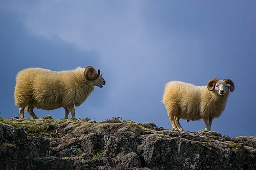
- Winter and vehicle: from October, snow and ice on passes are possible at any time, and winter tyres are compulsory in wintry conditions; studded tyres only in the set season from 1 November to mid-April, outside it only in wintry conditions. Single-lane bridges: whoever reaches the bridge first has priority. Sheep roam freely on the road in summer; damage to animals must be reported. Carry a warning triangle and first-aid kit.
CampingSpirit packing & preparation checklist
- Waterproofs and a windproof hooded jacket for everyone travelling – spray at Seljalandsfoss and Gullfoss, showers and cold wind are part of the deal even in July.
- Door check strap or a short ratchet strap for the driver's and sliding doors – gusts on the south coast yank doors open and can bend hinges.
- Sleep mask and thick thermal screens for the windows – between May and July it hardly gets dark at night, and the screens also keep the cold out.
- Head net against midges – at Mývatn midges and blackflies swarm in dense clouds in summer.
- Credit card with PIN and a prepaid fuel card – many filling stations are unmanned and accept cards only with a PIN.
- Swimwear and a microfibre towel – geothermal pools in almost every town are the best way to recover from wind and cold; showering naked before bathing is compulsory.
As of 2026-09. Closures, fees and booking rules change: check official sources before you go.