




In-depth guide · CampingSpirit
From Borgarnes around Snæfellsjökull, across Breiðafjörður on the Baldur ferry, to the cliffs of Látrabjarg, to Dynjandi and through the fjords of the Djúp as far as Hrútafjörður: just under 1,000 kilometres on which gravel, ferry times and the campsite season set the pace.
The spirit of the route
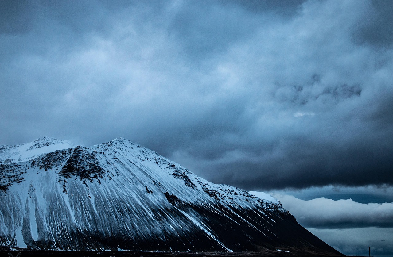
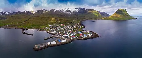
Beyond Borgarnes, Iceland grows quieter. On Snæfellsnes the glacier sits like a white cap above lava fields, fishing villages and black beaches, and in the evening the light falls low across Kirkjufell. Then the Baldur carries your camper across Breiðafjörður with its countless islands, and on the far shore begins a part of the country where the road follows every fjord right to its end. From the sliding door you see table mountains whose flanks drop to the sea in steps, eider ducks in the seaweed and seals on the skerries. At the Látrabjarg edge, puffins sit an arm’s length away, at Rauðisandur the sand glows reddish gold, and Dynjandi fans out over a rock staircase. The Westfjords demand time: gravel tracks, single-lane tunnel sections, long stretches without a filling station. In return you often meet more sheep than cars, and the evening light lasts until midnight.
Stage-by-stage plan
1Stage 1: Borgarnes to Arnarstapi (approx. 120 km)
- The drive
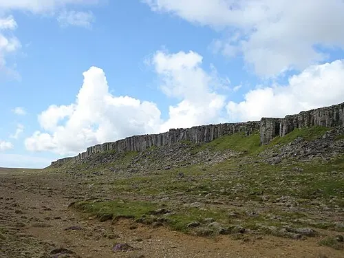
- From Borgarnes, take Road 54 north-west through the wide moorland and pasture of Mýrar, then along the south coast of Snæfellsnes beneath the basalt walls of Hafursfell and Stapafell. Paved throughout, little traffic, a few single-lane bridges; gusty on the open sections when the wind is from the south-west. Shortly before Arnarstapi, Road 574 branches off and leads around the western tip of the peninsula. Around 1.5 hours of pure driving time without detours.
- Highlights & must-sees
- Ytri Tunga: sandy beach with rocky skerries where seals regularly lie in summer – keep your distance and come at low tide.
- Búðir: the black-painted wooden church standing alone in the Búðahraun lava field, with the glacier in the background.
- Rauðfeldsgjá: narrow gorge in Botnsfjall that you can climb a little way into over stones in the stream bed; wear good footwear, and in early summer there is often still snow inside.
- CampingSpirit overnight tip
-
Official campsite or RV park: Tjaldsvæðið á Arnarstapa at Arnarstapi Center, a few minutes’ walk from the harbour and the rock arches: pitches for motorhomes and tents, electricity, sanitary facilities with showers, washing machine, restaurant next door. Seasonal operation, fills up quickly in high summer – arrive early.
Free camping or nature tip (where legal): Free camping in motorhomes is not permitted in Iceland (see Practicalities). The large car parks in Arnarstapi and Hellnar are day car parks; overnight stays are not intended there and are checked.
- Insider tip for campers
- Walk the coastal path Arnarstapi–Hellnar (around 2.5 km each way) in the evening: basalt columns, rock arches such as Gatklettur and nesting kittiwakes on the cliffs. Fill up in Borgarnes before setting off and shop at the supermarket – on Snæfellsnes there are shops only in the larger towns of Ólafsvík, Grundarfjörður and Stykkishólmur.
2Stage 2: Arnarstapi to Grundarfjörður (via the western tip of Snæfellsnes) (approx. 100 km)
- The drive
- On the paved Road 574 through Snæfellsjökull National Park: past Hellnar and Lóndrangar, over lava fields and moss to the western tip, then along the north coast via Hellissandur and Rif to Ólafsvík and beneath the steep slopes of Búlandshöfði to Grundarfjörður. Short spur roads to Djúpalónssandur and Skarðsvík. Around 2 hours of pure driving time; with stops, a full day.
- Highlights & must-sees
- Djúpalónssandur: black pebble beach with the fishermen’s four lifting stones, wreckage of the trawler Epine, stranded in 1948, and a short path to Dritvík cove.
- Lóndrangar and Saxhóll: the two basalt pinnacles on the coast, visible from the viewpoint on the 574, and the Saxhóll crater cone with steps up to the rim.
- Kirkjufell with Kirkjufellsfoss on the western edge of Grundarfjörður – the cascades in the foreground, the mountain in the evening light behind.
- CampingSpirit overnight tip
-
Official campsite or RV park: Grundarfjörður campsite on the edge of town, with electricity, sanitary facilities and motorhome disposal; shops, filling station and swimming pool in town. Alternatives on the north coast: Tjaldsvæðið á Hellissandi in the lava field on the edge of Hellissandur (electricity, showers, laundry facilities) and the site in Ólafsvík.
Free camping or nature tip (where legal): In Snæfellsjökull National Park, overnight stays with vehicles in car parks and at viewpoints are not permitted; driving off-road on lava and moss is strictly forbidden. The Kirkjufellsfoss car park is a day-only car park with a fee.
- Insider tip for campers
- The national park centre in Hellissandur provides information on trails, weather and guided tours; the Vatnshellir lava cave on the 574 can only be visited on a guided tour. At Kirkjufellsfoss there are coaches during the day – come early in the morning or late in the evening for photos. Fill up in Grundarfjörður or Stykkishólmur at the latest: after the ferry, the first small filling station is in Flókalundur, the next larger one in Patreksfjörður.
3Stage 3: Grundarfjörður to Patreksfjörður (via Stykkishólmur and the Baldur ferry) (approx. 100 km)
- The drive
- On Road 54 eastwards around Kolgrafafjörður and through the Berserkjahraun lava field, then on the 58 to Stykkishólmur (around 40 km, a good 40 minutes). Take the Baldur ferry across Breiðafjörður to Brjánslækur in about 2.5 hours, stopping on the island of Flatey depending on the timetable. From Brjánslækur, on the paved Road 62 along Barðaströnd and over Kleifaheiði down to Patreksfjörður, around 60 km or one hour.
- Highlights & must-sees
- Berserkjahraun: moss-covered lava field between Grundarfjörður and Stykkishólmur, crossed by the narrow gravel Road 558 – only with a smaller vehicle and slowly.
- Stykkishólmur: the basalt rock of Súgandisey with a small lighthouse above the harbour, and the Library of Water (Vatnasafn) on the hill above the town.
- The crossing itself: a maze of islands, currents and seabirds in Breiðafjörður; in calm seas, puffins and gannets from the upper deck.
- CampingSpirit overnight tip
-
Official campsite or RV park: Tjaldsvæði á Patreksfirði in town, with electricity, sanitary facilities, showers, washing machine and disposal; supermarket, filling station and swimming pool within walking distance. If you take the afternoon ferry, stay near Brjánslækur at the site by Hotel Flókalundur in Vatnsfjörður (according to the tourist board mid-June to early September, electricity, showers, filling station and mini-market next door). In Stykkishólmur the campsite is by the golf course at the entrance to town.
Free camping or nature tip (where legal): The harbour areas in Stykkishólmur and Brjánslækur are waiting areas for the ferry, not overnight spots. Along Barðaströnd with its sandy bays too, the rule is: overnight only at campsites.
- Insider tip for campers
- The Baldur takes only a limited number of vehicles; if you have a vehicle, be sure to book online in advance (ferja.is). The price depends on vehicle length: base fare up to 5 m, each additional metre costs extra. In summer (June to August) the ferry usually sails twice a day; on the winter timetable from September it does not go to Brjánslækur every day and does not sail at all on Saturdays – check the current timetable and be at the harbour in good time before departure. If the ferry is cancelled, the only option is the long overland route via Búðardalur and Road 60.
4Stage 4: Patreksfjörður to Breiðavík (via Látrabjarg) (approx. 70 km)
- The drive
- On the 62 around Patreksfjörður and on Road 612 west along the south side of the fjord, past the small airfield and Hnjótur. Beyond Hnjótur the road climbs over a pass to Breiðavík bay and on to the Bjargtangar lighthouse. The 612 is paved only in the first section; towards Breiðavík and Bjargtangar it is gravel with potholes, washboard and steep, winding ramps; 30–50 km/h is realistic. Around 1.5 hours to Bjargtangar, 15 minutes back to Breiðavík.
- Highlights & must-sees
- Látrabjarg: bird cliff around 14 km long and over 400 m high, with puffins, razorbills and guillemots; the breeding season runs roughly from May to August. Do not step up to the edge – the turf is undercut.
- Bjargtangar lighthouse: the westernmost point of Iceland and, by common reckoning, of Europe too.
- Museum in Hnjótur (Minjasafn Egils Ólafssonar) covering the history of fishing, farming and aviation and the story of the 1947 sea rescue at Látrabjarg; nearby, the wreck of the Garðar BA 64 on the beach at Skápadalur, the oldest steel ship in Iceland.
- CampingSpirit overnight tip
-
Official campsite or RV park: Campsite at Hotel Breiðavík on the pale sandy bay of the same name, around 12 km before the lighthouse: pitches, electricity, showers, laundry facilities and disposal, restaurant in the hotel. Open seasonally, check times in advance. If you want to head back early, stay another night in Patreksfjörður.
Free camping or nature tip (where legal): Overnight stays are not permitted at the Bjargtangar car park; the area is protected and looked after by rangers. You can still see the puffins in the evening: from Breiðavík the lighthouse is a quarter of an hour away.
- Insider tip for campers
- The birds are most active in the late afternoon and evening, when the day visitors have usually gone. Fill up and top up your water in Patreksfjörður – there is no filling station anywhere on the peninsula as far as Látrabjarg. Take a windproof jacket and gloves against the wind at the edge, even in July.
5Stage 5: Breiðavík to Bíldudalur (via Rauðisandur and Tálknafjörður) (approx. 125 km)
- The drive
- Back on the 612 towards Patreksfjörður, then on the gravel Road 614 for around 10 km over the pass at Skersfjall and down to Rauðisandur in steep, tight hairpins without crash barriers. At the bottom the road forks to Saurbær church and to Melanes campsite. Return to the 612 and via Patreksfjörður on the 63 over Mikladalsheiði to Tálknafjörður and on over Hálfdán to Bíldudalur on Arnarfjörður. Without Rauðisandur, everything is paved. Around 3 hours of pure driving time.
- Highlights & must-sees
- Rauðisandur: beach several kilometres long with reddish-golden shell sand, seals in the lagoon, the black wooden church of Saurbær and the café by the church (open during the day in summer).
- Pollurinn above Tálknafjörður: simple pools fed by hot spring water, with a view over the fjord; donation in the box.
- Skrímslasetrið in Bíldudalur, a small museum about the sea monster stories of Arnarfjörður.
- CampingSpirit overnight tip
-
Official campsite or RV park: Bíldudalur campsite by the sea at the Byltan sports hall, with toilets, hot water, electricity, washing machine and motorhome disposal; showers and hot pot in the sports hall. Alternatives: the site by the swimming pool in Tálknafjörður (according to the tourist board 1 June to 1 September, kitchen, showers, washing machine) or the simple Melanes site right on Rauðisandur.
Free camping or nature tip (where legal): At Rauðisandur, park at the church or at the campsite – driving on the sand and in the dunes is forbidden. Overnight only at Melanes campsite.
- Insider tip for campers
- In summer and in dry weather the 614 is usually well maintained, but steep and narrow: with long, heavy motorhomes or car-and-caravan combinations it is better to skip it, or drive it only in good visibility, in a low gear on the way down. A detour on the gravel Road 619 into Selárdalur to the naïve sculptures of the artist Samúel Jónsson is only worthwhile if you have time – dead end, around 25 km of gravel each way.
6Stage 6: Bíldudalur to Ísafjörður (via Dynjandi and Þingeyri) (approx. 150 km)
- The drive
- On Road 63 (Bíldudalsvegur) along Arnarfjörður and up to the plateau, where it meets the 60; down to Dynjandi. Continue on the 60 along the north shore of Arnarfjörður via Hrafnseyri and through the Dýrafjarðargöng tunnel, a good 5 km long (since 2020, replacing the old Hrafnseyrarheiði pass road), to Þingeyri. Then around Dýrafjörður, over Gemlufallsheiði into Önundarfjörður and through the Vestfjarðagöng to Ísafjörður. The 63 between Bíldudalur and Dynjandisheiði also still has gravel sections; check the current conditions on umferdin.is before you set off. On Dynjandisheiði (60) the third and final construction phase is under way, including the access road to Dynjandi; completion, planned for autumn 2026, is expected to slip to 2027 – expect gravel, roadworks and waiting times. Around 3 hours of pure driving time.
- Highlights & must-sees
- Dynjandi: waterfall around 100 m high that widens as it falls; the path from the car park leads past several smaller falls to the foot in about 20 minutes.
- Hrafnseyri: birthplace of the independence politician Jón Sigurðsson, with a small museum, a reconstructed turf house and a church.
- Skrúður near Núpur on Dýrafjörður: one of the oldest gardens in Iceland, laid out as a teaching garden in the early 20th century, with a whalebone archway.
- CampingSpirit overnight tip
-
Official campsite or RV park: Tjaldsvæðið Tungudal in the Tungudalur valley around 4 km above Ísafjörður, sheltered in the woods next to a waterfall: separate areas for tents and motorhomes, electricity, showers, kitchen, washing machine; according to user reports, fresh water and disposal are a little further down the valley. Season roughly mid-May to mid-September, vehicles up to 8 m according to Campercontact – check in advance. Alternative halfway along: Tjaldsvæðið Þingeyrarodda in Þingeyri with a new service building, electricity and disposal.
Free camping or nature tip (where legal): At Dynjandi there is a paid car park with toilets but no campsite: according to the Environment Agency, overnight stays are not permitted there. Here too: campsites only.
- Insider tip for campers
- The Vestfjarðagöng are partly single-lane with passing bays: if the bay is on your side, wait in it until oncoming traffic has passed; lights on, and do not stop in the bay if nobody is coming. Check road conditions on the 60 and 63 before you set off on umferdin.is or by phoning 1777. Filling stations in Bíldudalur, Þingeyri and Ísafjörður, nothing in between.
7Stage 7: Ísafjörður to Hólmavík (through Ísafjarðardjúp) (approx. 225 km)
- The drive
- On the Djúpvegur (61) out of Skutulsfjörður to Súðavík and then fjord after fjord along the south shore of Ísafjarðardjúp: Álftafjörður, Seyðisfjörður, Hestfjörður, Skötufjörður, Mjóifjörður, Ísafjörður (the fjord). Paved throughout, but narrow, with many bends on steep slopes and single-lane bridges. At the end, over the Steingrímsfjarðarheiði plateau (a good 400 m, often foggy) down to Hólmavík. Around 3.5 hours of pure driving time.
- Highlights & must-sees
- Melrakkasetur in Súðavík, the Arctic Fox Centre, with an exhibition and occasionally orphaned foxes in the enclosure.
- Hvítanes on Skötufjörður: seals on the shore rocks directly below the road, with a small car park; plus the Litlibær turf house, serving coffee in summer.
- Heydalur or Reykjanes on the Djúp: geothermal bathing pools as a break on the long stage.
- CampingSpirit overnight tip
-
Official campsite or RV park: Hólmavík campsite next to the swimming pool and sports centre, with toilets, electricity, washing machine and dryer; pay at the sports centre, no booking needed. If you want to split the stage: Hotel Heydalur in Mjóifjörður with a campsite (according to the tourist board June to the end of October, showers, plenty of electric hook-ups).
Free camping or nature tip (where legal): The many bays along the Djúp look deserted but are mostly private grazing and breeding land belonging to the farms. Without the landowner’s permission, overnight stays in a vehicle are not permitted – use lay-bys only for breaks.
- Insider tip for campers
- Fill up and shop in Ísafjörður (supermarkets and Vínbúðin in town): between Súðavík and Hólmavík there are almost 200 km with hardly any supplies. On days with cruise ships Ísafjörður is crowded – leave early then. The Museum of Sorcery and Witchcraft (Galdrasýning) by the harbour in Hólmavík has a café with a fjord view.
8Stage 8: Hólmavík to Borðeyri (Hrútafjörður, near the Ring Road) (approx. 95 km)
- The drive
- From Hólmavík south through the Strandir area: on Road 68, first along Steingrímsfjörður, then past the fjords of Kollafjörður and Bitrufjörður and south along the west shore of Hrútafjörður. Paved, quiet, with wide views over Húnaflói bay. From Borðeyri it is only a few kilometres to the Ring Road at Brú. Around 1.5 hours of pure driving time.
- Highlights & must-sees
- Drangsnes (detour of 30 km each way from Hólmavík): three freely accessible hot pots on the shore with a view of the island of Grímsey in Steingrímsfjörður.
- The Strandir coast with driftwood on its beaches – wood from Siberia that was traditionally collected here for building and firewood (do not take any, it belongs to the farms).
- Borðeyri: one of the smallest villages in Iceland, an old trading post with wooden houses on the fjord.
- CampingSpirit overnight tip
-
Official campsite or RV park: Camping Borðeyri by the small harbour, a simple site with sanitary facilities; check facilities and season in advance. With more comfort: Tjaldstæðið Drangsnesi in the village (if you make the detour) or Laugarhóll in Bjarnarfjörður with the Gvendarlaug thermal pool, both north of Hólmavík.
Free camping or nature tip (where legal): In Strandir too: overnight only at campsites or with the landowner’s permission. The large rest area on the Ring Road at Brú is a place for breaks, not a pitch.
- Insider tip for campers
- On the Ring Road at Brú/Staðarskáli there is a filling station, snack bar and disposal point; from here it is around 85 km back to Borgarnes.
Camping practice & local rules
Wild camping & overnight parking
- Legal position: under Nature Conservation Act No. 60/2013, overnight stays in motorhomes, campervans, caravans, folding trailers and roof tents outside campsites and built-up areas are not permitted unless the landowner agrees. Pitching a tent on uncultivated land is allowed for one night, provided there are no prohibitions and no campsite nearby – this expressly does not apply to vehicles.
- Protected areas on this route: Snæfellsjökull National Park, the Látrabjarg bird reserve and the Dynjandi natural monument are looked after by rangers; overnight stays in car parks and driving off the tracks are prohibited there. In the Westfjords, almost all land outside the towns is grazing and breeding land belonging to farms.
- Off-road driving is strictly forbidden nationwide and punished with heavy fines; tracks in moss and on lava ground remain visible for decades. Old, no longer maintained pass roads such as Hrafnseyrarheiði are unsuitable for motorhomes.
- Season: many campsites in the Westfjords open only in June and close at the end of August or in September; in autumn, ask about opening times in advance. Tools: safetravel.is, vedur.is, umferdin.is (Vegagerðin, tel. 1777), the “112 Iceland” app, park4night and Campercontact; the “Útilegukortið” camping card is valid only at participating sites.
Waste disposal & supplies
- Fresh water and disposal: most sites on this route (Grundarfjörður, Patreksfjörður, Breiðavík, Bíldudalur, Þingeyri, Ísafjörður) have disposal for grey water and cassettes; in between there are hardly any stations. Never empty grey water into nature, drains or rest-area toilets.
- Drinking water is of very high quality everywhere; you can fill up with tap water without concern. In many places the hot water smells slightly of sulphur – that is normal.
- Gas: propane cylinders are available at larger filling stations and DIY stores, but connections and regulators do not always fit German systems. With your own vehicle, bring full cylinders and observe the ferries’ gas regulations; LPG autogas is hardly available in Iceland, and refillable tank cylinders cannot be filled reliably. In the Westfjords, resupply is particularly difficult.
- Fuel and shopping: stations are often unmanned and work with card and PIN; without a PIN, the operators’ prepaid fuel cards help. On this route, fill up at every opportunity – there are long gaps on the Látrabjarg peninsula, between Bíldudalur and Þingeyri and between Súðavík and Hólmavík. There are supermarkets in Borgarnes, Ólafsvík, Grundarfjörður, Stykkishólmur, Patreksfjörður and Ísafjörður; wine and spirits only in the Vínbúðin shops.
Vehicle size & traffic rules
- Speed limits: 90 km/h on paved rural roads, 80 km/h on gravel, 50 km/h in built-up areas. Vehicles over 3.5 t and car-and-trailer combinations may drive at no more than 80 km/h outside built-up areas. On the Westfjords tracks, 80 km/h is rarely realistic: washboard, potholes and loose stones on crests and bends. Dipped headlights around the clock, seatbelts compulsory, blood alcohol limit 0.2, mobile phone only hands-free.
- Kilometre fee since 2026: for temporarily imported vehicles entering from 1 January 2026, a fee based on weight and length of stay is due. Up to 3.5 t, a flat rate of 13,900 ISK for up to 10 days, 20,850 ISK for 11–20 days and 24,325 ISK from 21 days, payable on or before arrival; for stays of more than 30 days, 6.95 ISK per kilometre minus the flat rate is due on departure. Register via customs declaration E9 (vehicles.tollur.is) and record the odometer reading on entry and exit. Heavier vehicles have their own rates (island.is).
- Tolls, tunnels, parking: there are no road or tunnel tolls on this route; Dýrafjarðargöng and Vestfjarðagöng are free. In single-lane tunnel sections, whoever has the passing bay on their side waits. At hotspots such as Kirkjufellsfoss, parking fees are collected by number-plate recognition, machine or app; pay promptly, as unpaid fees are reclaimed with a surcharge. The Baldur ferry charges by vehicle length.
- Wind and weather: when vedur.is issues storm warnings, do not drive high, empty vehicles over the plateaus (Kleifaheiði, Dynjandisheiði, Steingrímsfjarðarheiði); downdraughts along the fjord flanks are notorious. Open doors against the wind, and never leave the awning out unattended.
- Winter and vehicle: from October, snow and ice are possible on the plateaus at any time, and the 63 and 60 over Dynjandisheiði are not always cleared in winter. Winter tyres are compulsory in wintry conditions; studded tyres only from 1 November to mid-April, outside that period only in wintry conditions. Single-lane bridges: whoever reaches the bridge first has priority. Sheep roam freely on the road. Carry a warning triangle and first-aid kit.
CampingSpirit packing & preparation checklist
- Binoculars – for puffins and razorbills at the Látrabjarg edge, and seals at Rauðisandur and Hvítanes, without having to step up to the dangerous cliff edge.
- Jerrycan with 20 litres of reserve fuel (stowed in compliance with the rules) – between the few filling stations in the Westfjords lie gravel tracks, detours and occasionally closed sections.
- Stone-chip protection for the headlights and a windscreen repair film – on the 612, 614 and 63, oncoming vehicles throw up gravel.
- Tyre repair kit, compressor and tyre pressure gauge – drive on gravel with slightly lower pressure and pump back up before the tarmac; the nearest garage is often more than 100 km away.
- Printed Baldur booking confirmation and maps saved offline – there is often no mobile reception between the fjords.
- Swimwear and microfibre towel – hot pots such as Pollurinn, Drangsnes and Heydalur are part of everyday life in the Westfjords; shower naked before bathing in swimming pools.
As of 2026-09. Closures, fees and booking rules change: check official sources before you go.