

In-depth guide · CampingSpirit
From Brockenhurst and Lyndhurst via Winchester, Butser Hill and Arundel to Devil’s Dyke, Lewes and the chalk cliffs of the Seven Sisters and Beachy Head: around 350 kilometres of southern England, taking you from the edge of the forest up onto the ridge of the Downs and finally to the edge of the English Channel.
The spirit of the route
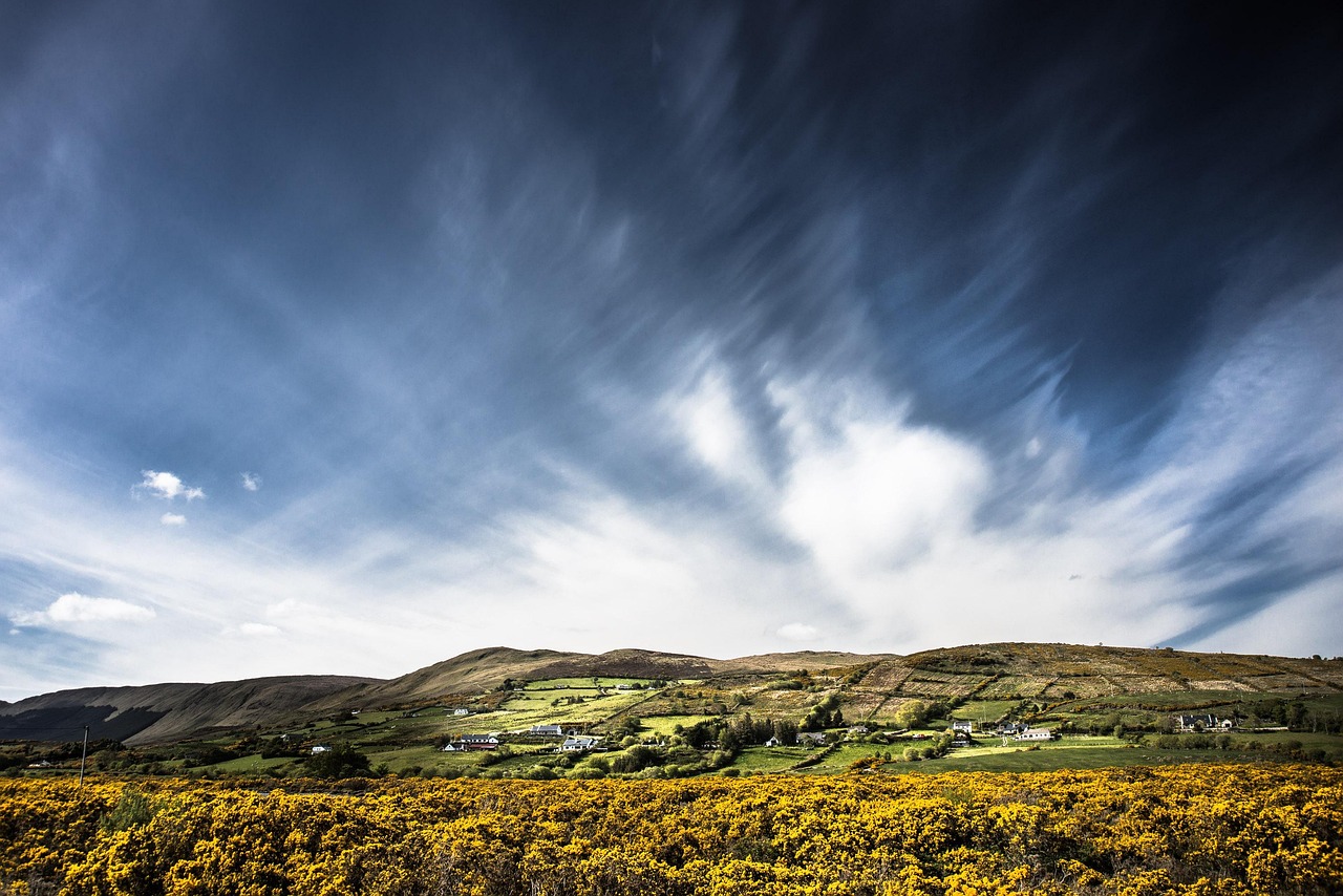
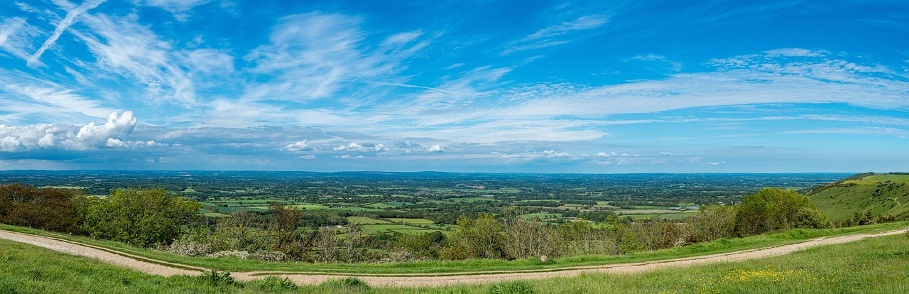
Here southern England shows itself in three landscapes that take over from one another. First heath and oak woodland, where ponies stand outside the village shop and give the road no right of way. Then the South Downs: gently rounded chalk ridges where the wind brushes over short grass, sheep keep the slopes mown and the ancient long-distance path, the South Downs Way, runs from Winchester to Eastbourne as a pale ribbon over the hilltops. From your open sliding door you see flint churches, sunken lanes, quarries and, far below, the Weald. At the end the land breaks off: at the Seven Sisters and Beachy Head the chalk drops sheer into the sea, white, fringed with green and silver or lead-grey depending on the weather. In between lie cathedral cities, a castle above the River Arun and lanes of timber-framed houses. The route demands driving on the left, narrow lanes and patience with car parks. It rewards you with evening light on chalk.
Stage-by-stage plan
1Stage 1: Brockenhurst to Fritham (northern New Forest) (approx. 40 km)
- The drive
- From Brockenhurst take the A337 to Lyndhurst, the main village of the Forest, then small roads via Minstead up to Fritham. The main roads are well built, while the lanes between Minstead and Fritham are narrow, with cattle grids and free-roaming animals. Many Forest roads have a limit of 40 mph or less; allow a good hour of driving time for the route, plus many stops for ponies and donkeys.
- Highlights & must-sees
- Brockenhurst: ponies and cattle stroll through the village, and the ford (Watersplash) and the heath at Balmer Lawn are a few minutes away – a railway station in the village makes walks without a car easy.
- Lyndhurst: the Verderers’ Hall in the Queen’s House, where the ancient Forest court of the New Forest still sits, and in the churchyard of St Michael’s the grave of Alice Hargreaves, the inspiration for Lewis Carroll’s “Alice”.
- Minstead: the small church of All Saints with the grave of Arthur Conan Doyle, and the village of Fritham with Eyeworth Pond at the edge of the oak woods, ideal for a walk at dusk.
- CampingSpirit overnight tip
-
Official campsite or RV park: Ocknell is a site on open heath near Fritham, spacious and simply equipped: it has electric hook-ups and a disposal point for motorhomes, but according to the operator only limited sanitary facilities. The season runs roughly from spring to the end of September, and the gate is locked at night. Ashurst lies on the eastern edge of the forest with a railway station nearby; visitor reports mention no electric hook-ups there, and the season starts in spring. You will find more sites in the New Forest and their particulars in the CampingSpirit guide “Ponies, chalk cliffs and ammonites”. In summer and school holidays, book early; minimum stays at bank holiday weekends are common.
Free camping or nature tip (where legal): Wild camping is not allowed in the New Forest: the Forest byelaws prohibit camping outside the designated sites, and overnight stays are forbidden in Forestry England car parks. You must not drive onto grass verges or lawns, because they feed the grazing animals.
- Insider tip for campers
- Ponies, donkeys, pigs and cattle have priority. Do not feed or stroke them – this is punished, and fed animals end up on the road. At dusk and at night, drive especially slowly: dark animals on the carriageway are the most common cause of accidents. In Lyndhurst the one-way system is often jammed around midday at weekends; park on the edge of the village and walk into the centre.
2Stage 2: Fritham to Winchester (approx. 55 km)
- The drive
- From Fritham back towards the A31 and via Romsey and the A3090 to Winchester. The section is mostly dual carriageway and quick to drive, with heavy traffic before Winchester. The city itself, with its narrow streets and one-way rules, is awkward for a motorhome; allow about 1.5 hours of driving time.
- Highlights & must-sees
- Winchester Cathedral: one of the longest Gothic naves in Europe, plus the graves of Jane Austen and several Anglo-Saxon kings.
- The Great Hall in the Castle: the medieval hall with the “Round Table”, which now hangs on the wall – the table dates from the 13th or 14th century and was painted later.
- Hospital of St Cross and the Itchen footpath: a walk along the water meadows to one of the oldest almshouses in England, where visitors can still ask for the “Wayfarer’s Dole”, a piece of bread and a cup of beer.
- CampingSpirit overnight tip
-
Official campsite or RV park: There is no site for motorhomes in the immediate urban area of Winchester. East of the city lies the Club site Morn Hill (Caravan and Motorhome Club), which according to the Club’s website also accepts non-members, is open all year and offers electric hook-ups and a disposal point for motorhomes. The maximum unit length is 10 m; do not follow the sat nav or the brown signs, but the site’s own directions. At weekends and in summer, sites around Winchester fill up quickly.
Free camping or nature tip (where legal): Overnight stays in a vehicle are not permitted in the city’s car parks. According to the city, the Park and Ride sites of Winchester impose a fine on vehicles over 2 tonnes unladen weight, on caravans and trailers and on stays of more than 24 hours without a permit. Motorhome bays are designated only at South Winchester and St Catherine’s, and there are few of them. At the Worthy Lane Coach Park, travellers report in forums that motorhomes may use the coach bays for up to 24 hours and must pay by phone, because the machine issues only a shorter time. We found no official confirmation; check the signage and payment on the spot.
- Insider tip for campers
- Leave the motorhome at your site or on the edge of town and take a bus or bike into the centre if your site is not within walking distance. Market stalls and the pedestrian zone fill the High Street at peak times. The South Downs Way begins at the statue of King Alfred on the Broadway – a good photo before you drive the first stages of the trail by road.
3Stage 3: Winchester to Butser Hill (Petersfield) (approx. 45 km)
- The drive
- From Winchester take the A272 through the Hampshire hill country via Cheriton and Bramdean to Petersfield, then the A3 south to Queen Elizabeth Country Park at the foot of Butser Hill. The A272 runs between hedgerows, villages and hilltops, in places narrow, with oncoming buses and vans. Around 1 hour of driving time.
- Highlights & must-sees
- Butser Hill (around 270 m): the highest point of the South Downs Way, a nature reserve with chalk grassland, orchids and butterflies; the climb from the Country Park takes a good 30 minutes.
- Queen Elizabeth Country Park with forest trails, cycle routes and a visitor centre – from here you walk a stretch of the South Downs Way.
- Petersfield: a market town with Heath Pond on its outskirts and a railway station, ideal for a quiet lunch break and some shopping.
- CampingSpirit overnight tip
-
Official campsite or RV park: There are few sites for large motorhomes around Petersfield and in the Meon Valley. According to map data, the site at the Sustainability Centre near East Meon is a tents-only site, so not intended for motorhomes. Near Droxford lies the campsite Grenville at Wallops Wood; we could not confirm whether motorhomes, electric hook-ups and disposal are possible there, so ask in advance.
Free camping or nature tip (where legal): In the South Downs National Park, as everywhere in England, there is no right to roam: sleeping in a vehicle needs the landowner’s permission. The Country Park car park is pay and display; overnight stays are not intended there. If you still want hill air in the evening, book a pitch on a farm, for example through one of the clubs.
- Insider tip for campers
- The weather on Butser Hill is much rougher than down in the valley: wind and low cloud move in fast. Take a jacket, even on warm days. The Butser Ancient Farm, a reconstructed Iron Age settlement, lies near Chalton a few kilometres to the south; check opening times and events with the operator beforehand.
4Stage 4: Petersfield to Arundel (via Midhurst and Chichester) (approx. 75 km)
- The drive
- From Petersfield take the A272 to Midhurst, then the A286 through Cocking and Singleton, past Goodwood, to Chichester and from there the A27 east to Arundel. The first part runs through woods and hilly villages, then the landscape turns flat and the A27 is usually busy. Driving time a good 2 hours with stops.
- Highlights & must-sees
- Midhurst: the ruins of Cowdray House, a Tudor manor house that burned down in 1793, at the edge of the park; quickly visited on a weekday.
- Chichester: the cathedral with its Chagall window, the Market Cross at the junction of the four main streets and the medieval city wall circuit, which you can walk on foot.
- Arundel: the castle above the River Arun, the Cathedral of Our Lady and St Philip Howard and the Wildfowl and Wetlands Trust reserve in the river valley.
- CampingSpirit overnight tip
-
Official campsite or RV park: Between Chichester and Arundel there are several touring parks. Map data list Maynards Caravan & Camping Park near Poling with pitches for caravans and electric hook-ups; ask whether motorhomes of every size are accepted. The Club site Slindon (Camping and Caravanning Club) west of Arundel is also a port of call. Both open seasonally; check admission of non-members, electric hook-ups and disposal before booking.
Free camping or nature tip (where legal): In Chichester and the coastal towns, overnight stays in a vehicle in council car parks are prohibited or at least not intended. In Arundel you must expect height barriers on the car parks by the river. The wetlands near Arundel are a nature reserve. If you are flexible, you can find a quiet pitch on farms through Britstops, often combined with a visit to the pub; Britstops requires membership.
- Insider tip for campers
- The A27 before Chichester and Arundel backs up at rush hour and on summer weekends; drive between 10 am and 3 pm. In Arundel, park on the edge of town and walk into the old town, because the road to the castle is steep and narrow. In Chichester there are pay-and-display car parks on the edge with height barriers; watch for the sign with the height in feet and inches.
5Stage 5: Arundel to Devil’s Dyke (near Poynings) (approx. 55 km)
- The drive
- From Arundel take the A27 via Worthing and Shoreham to Brighton, then small roads up to Devil’s Dyke. The coastal stretch is slow and urban; the last kilometres via Dyke Road or from Poynings lead narrowly up to the summit. The approach is tight for large motorhomes; driving time with traffic a good 1.5 hours.
- Highlights & must-sees
- Devil’s Dyke: the deepest dry valley in Britain, a V-shaped cut in the Downs with a view over the Weald to the hills in Surrey on a clear day.
- Poynings and the path to the church: a quiet village at the foot of the Downs with a pub and walking trails up to the ridge.
- Saddlescombe: a farm at the foot of the Dyke and the starting point of a popular circular walk back to the Dyke.
- CampingSpirit overnight tip
-
Official campsite or RV park: Saddlescombe Campsite lies near Devil’s Dyke on the grounds of Saddlescombe Farm and is quiet; we could not confirm whether motorhomes are accepted and how large they may be, so ask in advance. In the city of Brighton you will hardly find a pitch with a motorhome; move to the sites to the east near Lewes (see next stage).
Free camping or nature tip (where legal): The car park at Devil’s Dyke belongs to the National Trust and can be used during the day. Overnight stays in a vehicle are not intended there; follow the signage on site. Do not bother trying to wild camp on the Downs: it requires the landowner’s permission, and that is generally not granted.
- Insider tip for campers
- At Devil’s Dyke the wind is strong, even in summer. In a storm the sliding door jams, and roof boxes turn into sails. The approach climbs to the summit and is narrow; drive it in a low gear and with the water tank as empty as possible. Around Brighton parking is under pressure, and motorhomes are often shut out by 2 m barriers.
6Stage 6: Devil’s Dyke to Lewes (via Ditchling Beacon) (approx. 35 km)
- The drive
- From the Dyke via Poynings and Pyecombe to the windmills near Clayton, then via Ditchling and Westmeston to Lewes. The road up to Ditchling Beacon is very steep and narrow, in places with gradients well over 10 per cent, and not recommended for large motorhomes. If you feel up to it, drive up from the north via Westmeston; otherwise walk up to the Beacon. Driving time about 1 hour.
- Highlights & must-sees
- Ditchling Beacon (248 m): the highest point of the Downs in East Sussex, with a view over the Weald and out to the sea at Brighton.
- The windmills Jack and Jill near Clayton, a pair of white mills on the ridge, right on the South Downs Way.
- Lewes: the castle on the hill, the winding lanes of the old town and the Harveys brewery on the River Ouse.
- CampingSpirit overnight tip
-
Official campsite or RV park: Housedean Farm Campsite lies near Falmer on the Downs between Brighton and Lewes and is a farm site with pitches for tents and caravans; map data also list electric hook-ups. Southdown Way Caravan & Camping Park lies at the foot of the Downs near Clayton and lists pitches for caravans with electric hook-ups. At both, check in advance whether your motorhome fits, as well as the season and access.
Free camping or nature tip (where legal): According to its own statements, Lewes District Council has no bays for motorhomes in its car parks, does not allow sleeping in a vehicle and has height barriers in many car parks. At Ditchling Beacon overnight stays are not intended; the lay-by on the road is small and full in summer.
- Insider tip for campers
- If you want to visit Lewes, it is best to come from the campsite by bus or train; Lewes has a railway station, and many of the town’s car parks have height barriers. On Bonfire Night around 5 November, large parts of Lewes are closed off and the approach roads are jammed; then plan generously and expect diversions.
7Stage 7: Lewes to Beachy Head and Eastbourne (via Seven Sisters) (approx. 45 km)
- The drive
- From Lewes take the A27 east to the turning for Alfriston, from there via Litlington to the A259 and to Seven Sisters Country Park at Exceat, on via East Dean to Birling Gap and via Eastbourne to Beachy Head. Parts of the roads are narrow, and the car parks on the cliffs often admit only small vehicles. Driving time about 1.5 hours.
- Highlights & must-sees
- Seven Sisters: seven chalk cliffs in a row; you see them best from Cuckmere Haven with its river meanders, at low tide and in low light.
- Birling Gap: access to the beach via steps, a café and the National Trust’s coastguard cottages; the cliff edge is eroding, so stay on the paths.
- Beachy Head: at around 160 m the highest chalk cliff in England, with the red-and-white lighthouse down in the water and the coastal path to Eastbourne.
- CampingSpirit overnight tip
-
Official campsite or RV park: Best documented is Alfriston Camping Park, about 5 minutes’ walk from the village and a few kilometres from Seven Sisters Country Park: motorhome pitches can be booked, but campers must expect an unpaved access track, grass pitches without hardstanding and electric hook-ups only to a limited extent or not at all; the site opens seasonally from spring to autumn. Booking portals also list motorhome pitches near Seaford (Buckle Caravan Park) and near Polegate (Peel House Farm, Alciston Court Farm). Woodfire Camping at Chapel Field is more of a tent site. Check electric hook-ups, disposal and size before booking.
Free camping or nature tip (where legal): Eastbourne allows motorhomes during the day in the Downland car parks Beachy Head, Butts Brow and Warren Hill; overnight stays are not allowed. In the town there are 2 m barriers at several car parks, including Fisherman’s Green East, Princes Park, Redoubt and Sovereign (Langney Point). Seven Sisters Country Park closes its car parks in the evening; overnight stays are not intended.
- Insider tip for campers
- At Seven Sisters Country Park a 3 m height barrier applies at weekends, on bank holidays and in high season; the car parks fill up quickly and are locked in the evening (earlier in winter). Arrive early or use the bus from Seaford, Brighton or Eastbourne. For the journey home, the ferry port of Newhaven (connection to Dieppe) lies about 25 km west of Eastbourne; check with the operator beforehand whether and when the ferry sails.
Camping practice & local rules
Wild camping & overnight parking
- England has no right to roam. Wild camping and sleeping in a vehicle need the landowner’s permission. Parking is allowed where it is not prohibited, but Hampshire, West Sussex and East Sussex have night-time bans and height barriers in council car parks.
- New Forest: the Forest byelaws prohibit camping outside the designated sites, and overnight stays are forbidden in Forestry England car parks. Driving on grass and verges is also prohibited. More on this in the CampingSpirit guide “Ponies, chalk cliffs and ammonites”.
- South Downs National Park: the park has no wild camping right. The National Trust (Devil’s Dyke, Ditchling Beacon, Birling Gap) and the Country Parks do not provide for overnight stays in their car parks. Eastbourne admits motorhomes to the Beachy Head, Butts Brow and Warren Hill car parks during the day, but not at night.
- You can stay legally overnight on campsites, on Certificated Locations and Certificated Sites of the two big clubs, and on farms and at pubs via Britstops. park4night, Campercontact and the clubs’ apps help with the search.
Waste disposal & supplies
- You empty toilet cassettes at Elsan Points and grey water only at designated places. Both are found almost only on campsites. Public disposal stations are rare; fill up with water before you come down from the Downs.
- Tap water is drinkable. A short hose with a universal tap connector fits British taps.
- Gas: German exchange cylinders are not swapped. Calor Gas and Campingaz are available with a deposit from dealers and at some sites. Refillable tanks are filled at autogas (LPG) stations with an adapter. On the ferries, gas cylinders must be declared and turned off.
- Mains power on British sites comes through blue CEE plugs (16 A); household sockets are type G. A long cable is worthwhile on big fields.
Vehicle size & traffic rules
- Entry: Great Britain is not in the EU. German citizens need a passport and, in advance, an electronic travel authorisation (ETA), which carries a fee and is valid for several years or until the passport expires. Apply only through the official app or gov.uk. There are border checks at the ferry ports.
- Customs and animals: meat and dairy products from the EU may not be brought in. Dogs need a microchip, a valid rabies vaccination and the EU pet passport, which is recognised in Great Britain. In addition, a vet treats the dog against tapeworm 24 to 120 hours before arrival and records this in the passport. Carry the vehicle registration document, driving licence and proof of insurance; whether a Green Card is needed, clarify with your insurer.
- Driving on the left: at roundabouts you drive clockwise and give way to the right. Mask or adjust your headlights. On the narrow lanes of the Downs, whoever is closer to a passing place pulls in; a reversing camera helps.
- Speed limits (mph, according to gov.uk): motorhomes up to 3.05 t unladen weight 60 outside built-up areas, 70 on dual carriageways and motorways; heavier motorhomes 50 outside built-up areas, 60 on dual carriageways, 70 on motorways; vehicles with trailers 50 outside built-up areas, 60 on dual carriageways and motorways. In built-up areas the limit is usually 30. In the New Forest 40 mph or less applies in many places.
- Dimensions: a British-registered motorhome may be at most 12 m long and 2.55 m wide. Height barriers in car parks are mostly signed in feet and inches, and many are set at 2 m. A height sign in the cockpit helps.
- Low-emission zones and tolls: there are no tolls on this route. Portsmouth has a Clean Air Zone, which according to the Caravan and Motorhome Club does not affect the Club site Morn Hill; the route does not lead through Portsmouth and Southampton. Check on gov.uk before travelling whether Brighton has zone rules for your vehicle.
- Alcohol and phones: in England the limit is 80 mg per 100 ml of blood (35 µg in breath), and using a phone at the wheel is prohibited.
CampingSpirit packing & preparation checklist
- Windproof jacket and sturdy shoes: on Butser Hill, Devil’s Dyke and the chalk coast it blows hard even in summer, and the chalk path becomes slippery in the rain.
- Height sign in the cockpit with the vehicle height in feet and metres: car parks in Chichester, Lewes and Eastbourne have 2 m barriers that are hard to miss.
- Reversing camera or a guide to direct you: on the lanes of the Downs and in the New Forest you often have to reverse to the next passing place.
- Hose with universal tap connector and a long CEE cable: the sites on pastures and in the Forest are spacious, and taps and hook-up posts are often far apart.
- Binoculars and a plant identification guide: the chalk grassland of the Downs offers orchids, butterflies and breeding birds.
- Tide table: Cuckmere Haven and the beaches at Birling Gap are barely passable at high tide.
As of 2026-10. Closures, fees and booking rules change: check official sources before you go.