

In-depth guide · CampingSpirit
From the bastide of Mirepoix via Montségur, Foix, the caves of Niaux and Bédeilhac, the Col de Port and the Étang de Lers to Seix, Saint-Lizier and through the Grotte du Mas d’Azil: a loop of around 370 kilometres through the quiet heart of the Pyrenees, away from the big passes.
The spirit of the route
The Ariège is the corner of the Pyrenees where time runs no faster than it has to. Beyond Mirepoix the roads climb out of the rolling hills into valleys where castle ruins perch on rock teeth and morning mist hangs between the beech woods. From your sliding door you see slate roofs, cowbells and haze over the mountain lakes; at night it is so dark that the Milky Way stands above the Col de Port. The roads are narrow but rarely busy, the villages small, the markets real. Then there is the depth of the landscape: at Niaux and Bédeilhac, paths lead into mountains where people painted bison some 14,000 years ago, and at Mas d’Azil your camper rolls through a rock tunnel carved by a river. Anyone travelling here plans short stages, leaves time for a hike and is glad of the silence in the evening.
Stage-by-stage plan
1Stage 1: Mirepoix to Montségur (approx. 40 km)
- The drive
- From the bastide of Mirepoix via Léran and Laroque-d’Olmes to Lavelanet in the Pays d’Olmes, then up the D9 to Montségur. Wide country road; only the last few kilometres are winding and narrower. About 1 hour of driving; if you visit Mirepoix and the castle hill, it will take the whole day.
- Highlights & must-sees
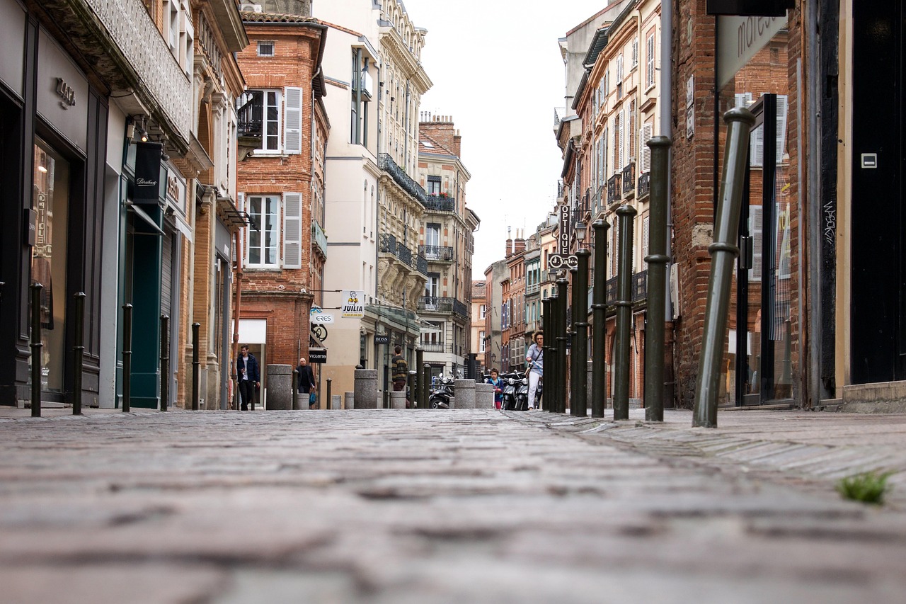
- Mirepoix: the Place des Couverts with its half-timbered houses and the carved heads on the beams, plus the Cathédrale Saint-Maurice with its very wide Gothic nave.
- Montségur: climb to the castle rock (Pog) with a view over the Pays d’Olmes; the castle and the history of the Cathars are described in the CampingSpirit guide “Rock bowls, hairpin passes and Cathar castles – by camper through the French Pyrenees from Pau to Ax-les-Thermes”, so here a mention of the small museum in the village is enough.
- The Sentier Cathare (GR 367) runs through Montségur: if you feel like it, walk a section and get picked up later.
- CampingSpirit overnight tip
-
Official campsite or RV park: Mirepoix has a municipal aire that, according to the tourist office, is for service only (fresh water and waste), not for overnight stays; for sleeping, Camping Les Nysades on the edge of town is a good choice (check the season in advance). Montségur has a municipal campsite on the edge of the village, and Lavelanet has Camping Le Pré Cathare. Ask in advance about the season and pitches for large vehicles.
Free camping or nature tip (where legal): The castle hill of Montségur is a monument historique; wild camping is banned within 500 m. A motorhome may park where parking is allowed – stabilisers, awning and chairs are not. In Mirepoix, according to the tourist office, the grass-grid parking areas are no longer open to motorhomes; permitted are, among others, the car park at the Minotiers, the Cours du Jeu du Mail and the gendarmerie car park (check the signs on site). No free camping in the town centre.
- Insider tip for campers
- Mirepoix holds its market on Mondays from 7 am to 1 pm, on the Place du Maréchal Leclerc and the Place Philippe de Lévis; arrive early or visit on another day, because around the market it is crowded and tight. Castles such as Quéribus and Peyrepertuse lie in the Aude département and are described in the CampingSpirit guide “Castles in the wind, vineyard slopes and fishing harbours – by camper through Cathar country to the Côte Vermeille”.
2Stage 2: Montségur to Foix (approx. 55 km)
- The drive
- Back to Lavelanet, then on the D117 via Montferrier to Foix. If you like, a detour to Bélesta for the Fontestorbes (about 15 km there and back from Lavelanet). Wide country road, heavy traffic in Foix itself. About 1.5 hours with the detour.
- Highlights & must-sees
- Fontestorbes near Bélesta: an intermittent spring that swells at irregular intervals and then subsides again; a short path leads to the spring.
- Gouffre de Labouiche near Foix: a boat trip on an underground river regarded as one of the longest navigable underground rivers in Europe.
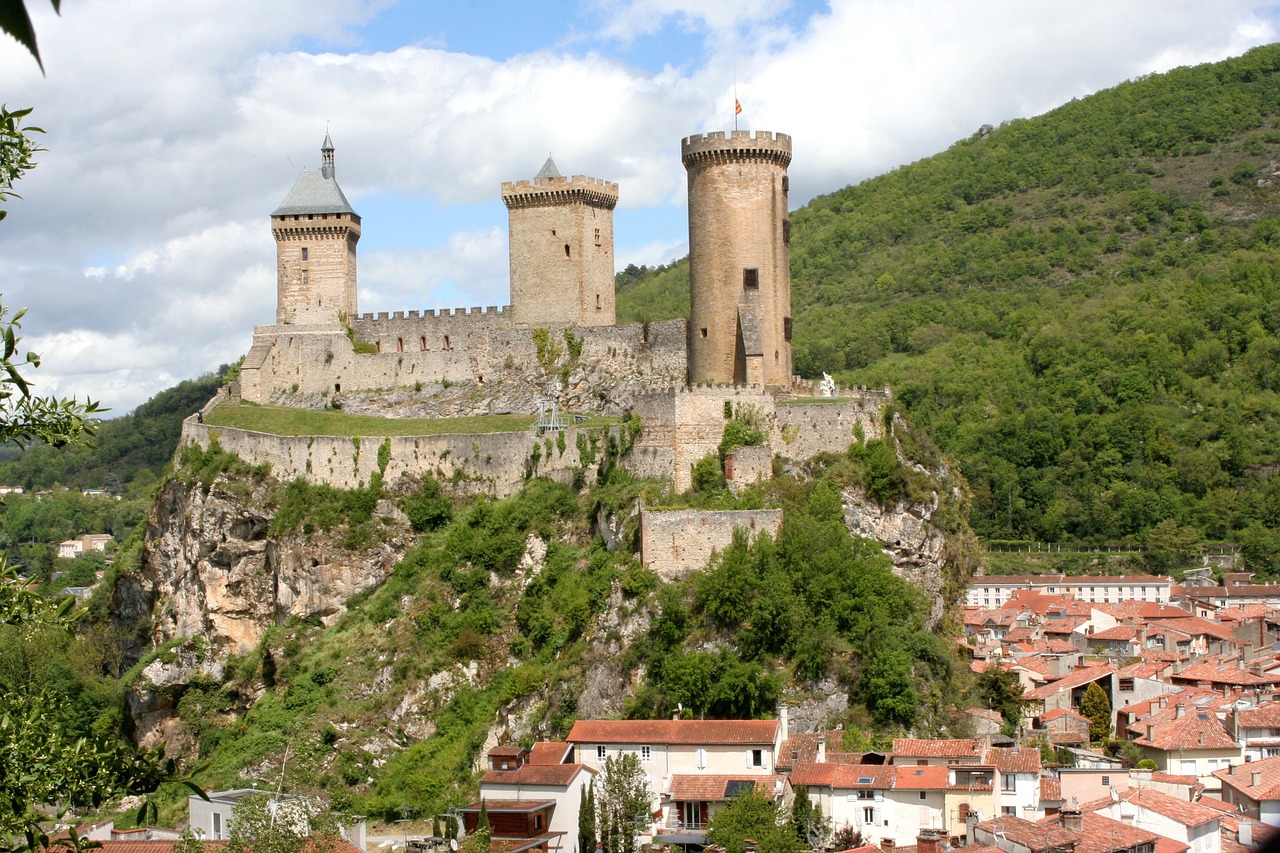
- Foix: old town with the three towers of the castle above the Ariège; castle and old town are described in more detail in the CampingSpirit guide “Rock bowls, hairpin passes and Cathar castles – by camper through the French Pyrenees from Pau to Ax-les-Thermes”.
- CampingSpirit overnight tip
-
Official campsite or RV park: Parking de la Vigne in Foix, a car park with a motorhome area below the old town (according to OpenStreetMap about 9 spaces, fresh water and waste disposal); check the conditions and fee in advance on the tourist office website. Campsites nearby: Camping du Lac on the edge of Foix and the municipal campsite in Cos.
Free camping or nature tip (where legal): In Foix and in the communes along the route there may be signs banning motorhomes; watch for the signage. The old town is a monument historique zone with a wild-camping ban within 500 m of the castle. Parking is lawful; camping is not.
- Insider tip for campers
- In Foix, park down by the Ariège, not in the old town: the lanes are narrow, and motorhomes over 2 m high do not fit into every car park. The best time to visit the Fontestorbes is in spring or after weeks of rain; in a dry summer the spectacle is weaker. Check opening times and admission in advance.
3Stage 3: Foix to Tarascon-sur-Ariège (approx. 35 km)
- The drive
- On the N20 through the Ariège valley south to Tarascon. Niaux lies about 4 km south-west of Tarascon, Bédeilhac a few kilometres west on the road to the Col de Port, and Alliat in between. Wide, well-built road; the side roads to the caves are narrow but without tight spots. About 45 minutes of pure driving time.
- Highlights & must-sees
- Grotte de Niaux: bison, horses and ibex in the “Salon Noir”; guided visit only with a reservation, conditions and details in the CampingSpirit guide “Rock bowls, hairpin passes and Cathar castles – by camper through the French Pyrenees from Pau to Ax-les-Thermes”.
- Grotte de la Vache near Alliat, a few minutes from Niaux: dwelling cave of the Stone Age hunters, find site of many engravings and bone tools.
- Grotte de Bédeilhac: one of the largest cave halls in Europe, used as an aircraft factory in the Second World War, with rock paintings and stalactites.
- CampingSpirit overnight tip
-
Official campsite or RV park: Aire pour camping-cars Les Cabannes south of Tarascon (according to OpenStreetMap about 30 spaces, water and waste disposal); check facilities and season in advance. Campsites in the area: Ariège Evasion near Tarascon, Camping des Grottes near Niaux and Le Sédour near Bédeilhac; ask about the season and pitch length.
Free camping or nature tip (where legal): Overnighting is not intended in the cave car parks. Wild camping in the forest is banned where nature protection or a municipal bylaw prohibits it; forest tracks are usually closed to vehicles.
- Insider tip for campers
- Book Niaux and Bédeilhac as soon as your date is fixed – the groups are small. If you want to go to Andorra, take the N20 from Tarascon via Ax-les-Thermes to the Col de Puymorens (tunnel) and on towards the border; that costs at least a day. Check winter equipment and pass conditions beforehand.
4Stage 4: Tarascon-sur-Ariège to Massat (with Étang de Lers) (approx. 55 km)
- The drive
- On the D618 from Tarascon via Bédeilhac and the Col de Port (about 1,250 m) to Massat, about 30 km in all; the climb is steady, winding in the upper part. From Massat a narrow departmental road (D18) leads to the Étang de Lers (about 12 km) and on to the Port de Lers (1,517 m); above the lake it is closed when there is snow, and according to user reports the lower sections are partly covered with grit. About 1.5 hours of driving plus the lake detour.
- Highlights & must-sees
- Col de Port: hiking trails to mountain pastures and viewpoints, beech woods.
- Étang de Lers: a mountain lake at about 1,260 m surrounded by meadows and forest, with hiking trails and fishing.
- Massat: Pyrenean village with a shepherding tradition; several hiking trails start right in the village.
- CampingSpirit overnight tip
-
Official campsite or RV park: Massat has an aire on the Route du Col de Port (according to OpenStreetMap data) and the municipal Camping du Pouech; check facilities, season and length in advance. At the Étang de Lers parking is limited; whether overnight stays are allowed there is not documented – watch for signs and, if in doubt, stay the night in Massat.
Free camping or nature tip (where legal): The Couserans is bear country; wild camping is banned or unwelcome in nature reserves and grazing areas, and dogs belong on a lead so that livestock guardian dogs (patous) do not cause conflicts. Sleeping in the vehicle is only intended on permitted areas.
- Insider tip for campers
- Drive the road to the Étang de Lers only in safe weather and check beforehand whether it is suitable for your vehicle: it is narrow and has few passing places. It is better to leave large motorhomes in Massat and go by bike or on foot. Fill up in Tarascon; in the valleys beyond, fuel gets scarce.
5Stage 5: Massat to Seix (approx. 75 km)
- The drive
- From Massat on departmental roads (first the D618) down the valley to Saint-Girons, then on the D618 to Castillon-en-Couserans, via the D4 to Les Bordes-sur-Lez and on the D17 through the Bethmale valley past the Lac de Bethmale and over the Col de la Core (about 1,400 m) down to Seix. The Col de la Core is the most winding stretch of the loop; on the Salat plain the roads stay wide. A good 2 hours of driving with breaks. If you shy away from the pass road, drive from Saint-Girons straight up the Salat valley to Seix (about 18 km).
- Highlights & must-sees
- Col de la Core (about 1,400 m): far views over the mountain ranges of the Couserans; on winding pass roads allow for oncoming traffic and cyclists.
- Lac de Bethmale in the Bethmale valley: a mountain lake in forest and pasture on the D17; the valley is known for its cheese and for clogs with an upturned toe.
- Seix: village in the Haut-Salat by the river, starting point for hikes to the mountain lakes of the area.
- CampingSpirit overnight tip
-
Official campsite or RV park: Camping Le Haut Salat near Seix by the river; check facilities and season in advance. In the valley there are other small sites, including Camping Les 4 Saisons and Camping de la Côte d’Oust; ask about the season and vehicle length.
Free camping or nature tip (where legal): In the Salat valley, as everywhere in France: a motorhome may park, but camping outside campsites is prohibited. There are signs in Seix and the neighbouring villages; forest and pasture tracks are mostly off limits. Better to use a campsite.
- Insider tip for campers
- Fuel up and shop in Saint-Girons, the last larger town before Seix. In the Salat valley there are trails to lakes (étangs) with several hours of ascent: bring water, rain clothing and sturdy shoes; there is often no phone reception in the side valleys.
6Stage 6: Seix to Mas d’Azil (via Saint-Lizier) (approx. 50 km)
- The drive
- Down the Salat valley to Saint-Girons and Saint-Lizier, then east on the D117 to Lescure and on along the D119 to the Grotte du Mas-d’Azil and Le Mas-d’Azil (about 25 minutes from Saint-Girons). The road through the cave (D119) is the special feature of the stage: a natural rock tunnel about 420 m long. Wide country roads, about 1.5 hours of driving in total with stops.
- Highlights & must-sees
- Saint-Lizier: Gallo-Roman town wall from the 5th century, two cathedrals and the Romanesque cloister, part of the UNESCO World Heritage site “Routes of Santiago de Compostela in France”; details on the town in the CampingSpirit guide “Rock bowls, hairpin passes and Cathar castles – by camper through the French Pyrenees from Pau to Ax-les-Thermes”.
- Grotte du Mas-d’Azil: the D119 road runs through the cave carved by the river Arize; the Azilian cultural stage is named after this site. You can only visit the cave itself with a guide.
- Maison de la Préhistoire in Mas d’Azil with finds and information about the cave.
- CampingSpirit overnight tip
-
Official campsite or RV park: Camping Le Petit Pyrénéen near Le Mas-d’Azil (electricity, sanitary facilities; check the season in advance). Near Saint-Girons, alternatives are Camping Parc de Paletes and Camping Parc d’Audinac. Ask on site about fresh water and waste disposal and about length limits for large vehicles.
Free camping or nature tip (where legal): In Saint-Lizier the 500 m ban on wild camping applies around the cathedral (monument historique). At the entrance to the cave there is a small car park on the D119 (according to user reports for about 10 vehicles); camping behaviour is not intended there. Ask the tourist office about overnight rules in Le Mas-d’Azil.
- Insider tip for campers
- We could not find an official height or width limit for the cave road; reports from motorhome drivers show that passage is possible. Even so, watch the signs before the portal, drive slowly and expect pedestrians on the path beside the road; stopping inside the cave is not allowed. If you are unsure about your vehicle’s height, ask the tourist office beforehand. The cave is open daily from April to October, in winter only on certain days; check reservations and prices in advance.
7Stage 7: Mas d’Azil to Mirepoix (approx. 60 km)
- The drive
- From Le Mas-d’Azil north-east through the Arize valley via Daumazan-sur-Arize to Pamiers, then on the D119 to Mirepoix. Mostly flat, well-built road. About 1.5 hours of driving.
- Highlights & must-sees
- Daumazan-sur-Arize and the Arize valley with meadows and rolling hills, suited to a calm final day.
- Pamiers: old town on the Ariège with cathedral and market; a stop for shopping or fuel.
- Mirepoix: an evening stroll through the bastide when the Place des Couverts is empty.
- CampingSpirit overnight tip
-
Official campsite or RV park: Back in Mirepoix: Camping Les Nysades (according to the tourist office, the municipal aire is for service only). Around Pamiers there are more campsites, for example Camping des Portes d’Ariège; check the season and facilities in advance.
Free camping or nature tip (where legal): Along the Arize and around Pamiers, river and lake banks are often protected or drinking-water protection zones: no wild camping, and local bans come on top.
- Insider tip for campers
- The route in from Toulouse is via the A66 (toll) to Pamiers; Toulouse itself has a ZFE. Fill up in Pamiers or Mirepoix before you start the journey home.
Camping practice & local rules
Wild camping & overnight parking
- In France a motorhome counts as a vehicle and may park where parking is allowed (a maximum of 7 days in the same place), provided no municipal order (arrêté) says otherwise. Camping behaviour – extended stabilisers, awning, table and chairs, draining waste water – is prohibited outside campsites and aires.
- Wild camping is banned in sites classés, within 500 m of monuments historiques (Montségur, Foix, Saint-Lizier), near drinking-water intakes and on seashores. Blanket bans for an entire municipality are open to legal challenge.
- The Ariège is part of the range of the Pyrenean bears. Encounters are rare. Do not leave food scraps lying around, seal your rubbish, keep dogs on a lead; in grazing areas, conflicts with livestock guardian dogs (patous) are a risk.
- Forest fires: the Ariège département publishes warning levels for the massifs at risque-prevention-incendie.fr/09; in summer, check before hikes and before lighting any fire.
- Useful apps: park4night, Campercontact, Camping-Car Park (network of motorhome aires).
Waste disposal & supplies
- Fresh water and waste disposal are available at aires (often municipal, sometimes by card or app) and campsites. Empty grey water and the cassette only there: in karst areas waste water seeps quickly into the groundwater, which many communes use as drinking water.
- Drinking water: village fountains are usually labelled “eau potable”; “eau non potable” is not drinking water.
- Gas: French exchange cylinders (butane/propane) are available everywhere; foreign ones are not exchanged. LPG pumps for refilling (Dish/Euronozzle adapter) are few and far between in the Pyrenees – look up pumps in advance with an app and fill up in the larger towns. At altitude and in the cold, propane is better than butane.
Vehicle size & traffic rules
- Speed limits: motorhomes and combinations up to 3.5 t as for cars (130/110/80, in rain 110/100/80; 90 km/h on signed sections, in some départements back on country roads). Combinations over 3.5 t: motorway 90, dual carriageway expressways 90, other roads 80. Motorhomes over 3.5 t up to 12 t: motorway 110, dual carriageway expressways 100, other roads 80, built-up areas 50; speed disc at the rear.
- Blind-spot stickers (“Angles morts”) have been compulsory since 2021 for vehicles over 3.5 t including motorhomes; fine €135.
- Tolls: the route itself runs on country roads. The A66 from Toulouse to Pamiers is a toll road. Péage classes: class 2 over 2 m and under 3 m in height up to 3.5 t; class 3 two axles and 3 m or more in height or over 3.5 t; class 4 three or more axles over 3.5 t or 3 m or more.
- ZFE and Crit’Air: Toulouse has a low-emission zone inside the Périphérique and the Rocade Arc-en-Ciel, round the clock; Crit’Air 4, 5 and vehicles without a sticker are excluded, including motorhomes. The sticker also applies to foreign vehicles. Check the current status with the Métropole before travelling.
- Winter: under the Loi Montagne, winter equipment requirements (winter tyres or chains) apply in designated communes from 1 November to 31 March; check the list for each département beforehand. Passes such as the Col de Port and the road to the Port de Lers can be closed in snow.
- A high-visibility vest is compulsory for the driver, as is a warning triangle. Using a phone at the wheel and drink-driving are severely punished; the alcohol limit is 0.5 per mille.
CampingSpirit packing & preparation checklist
- Torch/headlamp and a warm jacket: in Niaux and Bédeilhac it is only about 10 to 12 °C even in summer.
- Sturdy hiking boots and a water bottle for Montségur, the Col de Port and the Étang de Lers: the paths are stony, fountains are scarce.
- Bike helmet and a bike on the rear rack for the road to the Étang de Lers, if the motorhome should not go there.
- CEE cable reel with at least 25 m of cable: on small sites in the valleys the electricity posts are often far from the pitch.
- Levelling ramps and a short water hose set: aires and small sites in the Couserans are often on a slope, and taps are not always within reach.
As of 2026-10. Closures, fees and booking rules change: check official sources before you go.