

In-depth guide · CampingSpirit
From Lincoln through Franconia Notch, along the Kancamagus Highway to Conway, through Pinkham Notch to the foot of Mount Washington, past Twin Mountain and Bretton Woods through Crawford Notch and back to the Swift River: around 400 kilometres of granite passes, gorges and Forest Service campgrounds.
The spirit of the route
The White Mountains are not high mountains in the Alpine sense, but they feel like it: the roads follow the notches that glaciers planed into the granite, and walls of forest and rock rise on either side. Roll through the notches in a camper and you will soon be in low gear, learning that every bend has a car park with a waterfall on offer. In the morning there is mist in the Pemigewasset valley, by midday a cloud hangs over Mount Washington (it sits there more often than anywhere else), and in the evening a fire crackles at your riverside pitch while the Swift River glitters between the birches. Mobile reception on the Kancamagus Highway is the exception, and so are petrol stations. This route links the region’s four famous passes into a round trip of six stages. It is more demanding to drive than New England’s coastal routes, but every stage ends at a campground worth the effort.
Stage-by-stage plan
1Stage 1: Lincoln / Woodstock to Franconia Notch (approx. 30 km)
- The drive
- From Lincoln, take I-93 north. Beyond North Woodstock the valley narrows and the road becomes the Franconia Notch Parkway: one lane in each direction, no hard shoulder, no turning round, stopping only at the signed car parks, and a speed limit well below interstate level (follow the signs). There is no toll. Pure driving time is around 25 minutes; the day belongs to the stops. Fill up and shop in Lincoln or North Woodstock; there are no shops in the notch itself.
- Highlights & must-sees
- Flume Gorge at the southern end of the notch: boardwalks and stairs lead through a narrow granite gorge with waterfalls, covered bridges and boulders. The loop is around 3 kilometres long, admission is through the State Park, and it is best to check tickets online in advance. The visitor car park is designed for large vehicles but fills up early at weekends.
- The Basin: a round pothole washed into the rock by the Pemigewasset River, a few steps from the car park. Beyond it starts the Recreation Path, a cycle path through the whole notch (around 13 kilometres) that is easy to ride from the campground.
- Cannon Mountain and Echo Lake: the Aerial Tramway of 1938 was North America’s first passenger cable car and takes you to the summit in a few minutes, with views of the Franconia Ridge. Echo Lake has a small swimming beach; at Profile Plaza, steel profiles recall the Old Man of the Mountain, the rock face that collapsed in 2003.
- CampingSpirit overnight tip
-
Official campsite or RV park: Cannon Mountain RV Park at Echo Lake: a very small state-run site with only 7 pitches on the north shore of the lake, with water, electricity and sewer hook-ups from late May to Columbus Day (mid-October) and without water and sewer outside that period. Reservations are required (through the New Hampshire State Parks reservation system), vehicles must be self-contained with an onboard toilet, pop-up campers are not permitted and dogs are not allowed. The dump station in the car park at Echo Lake has at times been closed – check its status beforehand. Lafayette Place Campground in the notch (around 97 pitches without hook-ups, designed for tents, no dump station, reservations required, dogs not allowed) is not an option for motorhomes. An alternative base: Russell Pond Campground in the White Mountain National Forest on Tripoli Road near Woodstock, no hook-ups, reservations through Recreation.gov, mind the length limit.
Free camping or nature tip (where legal): In Franconia Notch State Park, overnighting in car parks and at viewpoints is prohibited, including at the I-93 rest areas. The legal alternative is the designated dispersed sites of the National Forest away from the notch (see stage 4).
- Insider tip for campers
- Dogs are not allowed on the campgrounds in Franconia Notch State Park; if you travel with a dog, switch to the Forest Service campgrounds or Dry River Campground (dogs on a lead). Visit Flume Gorge in the morning if you can, when the car park is still empty. Fill up completely before the notch.
2Stage 2: Franconia Notch to Jigger Johnson Campground (Kancamagus Highway) (approx. 60 km)
- The drive
- Back to Lincoln, then east on NH-112, the Kancamagus Highway (“the Kanc”), for around 55 kilometres with no village and no petrol station. The western ramp climbs in switchbacks and S-bends to Kancamagus Pass at about 870 metres, then runs downhill along the Swift River. There is hardly any mobile reception, and on the pass fog and wet weather can reduce visibility sharply. Pure driving time to Conway is about 1.5 hours; with stops, it takes a full day. The road is quite manageable for motorhomes, but drive slowly in the bends; follow the signs for speed limits and gradients.
- Highlights & must-sees
- Lincoln Woods Trailhead: a large car park with visitor information at the start of the Pemigewasset Wilderness. A suspension bridge crosses the East Branch Pemigewasset River onto a broad, flat path that follows a former logging railway bed. It is a good 5 kilometres each way to Franconia Falls. There is no campground here, day access only.
- Viewpoints on the western ramp and at the pass: from the overlooks you see the forested ridges of the White Mountains, a carpet of red and yellow in October.
- Sabbaday Falls: a short forest trail to a three-tier waterfall in a narrow gorge, doable in half an hour even with children.
- CampingSpirit overnight tip
-
Official campsite or RV park: Jigger Johnson Campground (White Mountain National Forest) in the Swift River valley: a large forest campground with several loops, toilets, drinking water and coin-operated showers, no hook-ups and no dump station. According to the Forest Service, pitches are allocated on a first come, first served basis only; the season runs from about mid-May to mid-October. Passaconaway Campground, also first come, first served, is nearby. Hancock Campground at the western end and Big Rock Campground (both partly reservable) are further options if Jigger Johnson is full.
Free camping or nature tip (where legal): The Kancamagus corridor is one of the National Forest’s protected zones: roadside camping is not allowed here, nor in the overlook car parks. If you have to move on, drive to Conway and use the designated sites there or a campground in the valley (see Practical information).
- Insider tip for campers
- A Recreation Pass is required on the Kanc and at many National Forest trailhead car parks (a day ticket from the machine, or an interagency annual pass such as the America the Beautiful Pass). Empty your tanks and fill up with water beforehand, as there is neither a dump station nor a petrol station on the highway. The big autumn loop through all of New England is covered in the CampingSpirit guide “Ahornrot, Birkengold und Hummerbojen”; here we look at the mountains in detail.
3Stage 3: Jigger Johnson Campground to Dolly Copp Campground (Pinkham Notch) (approx. 100 km)
- The drive
- Continue east on the Kanc to Conway, then north on NH-16 through North Conway, Glen and Jackson, where traffic gets slow at weekends, into Pinkham Notch. There the NH-16 climbs to the AMC visitor centre at around 600 metres and then drops north towards Gorham. Two lanes with bends, otherwise well built. Driving time about 2 hours without stops. Petrol stations and supermarkets in Conway, North Conway and Gorham.
- Highlights & must-sees
- North Conway: a town centre with the Conway Scenic Railroad station of 1874, a stop for shopping and food; the car parks on the edge of town are better suited to motorhomes than those on the main street.
- Glen Ellis Falls on NH-16: a short path leads through a tunnel under the road to a waterfall about 20 metres high. The roadside car park is small, and manoeuvring large vehicles is demanding.
- AMC Pinkham Notch Visitor Center: the starting point for the Tuckerman Ravine Trail to Mount Washington. The hike to the cirque wall takes time and weatherproof gear; wind and temperature change quickly on the mountain.
- CampingSpirit overnight tip
-
Official campsite or RV park: Dolly Copp Campground (White Mountain National Forest) on NH-16 north of Pinkham Notch: a large forest campground in several loops on the Peabody River, mostly without hook-ups (according to the Forest Service, a few pitches have a water or electric hook-up for an extra charge), coin-operated showers, reservations through Recreation.gov. Check vehicle length and dump station availability when you book. Nearby is Barnes Field, a small Forest Service site without comforts; check its status beforehand.
Free camping or nature tip (where legal): Pinkham Notch is a protected area, as is the Kanc; free camping along NH-16 is not possible. The nearest designated dispersed sites are further west in the National Forest (see stage 4).
- Insider tip for campers
- NH-16 north of Gorham is known as “Moose Alley”: moose cross there especially at dusk, so drive more slowly in the evening. Fill up with water and fuel in Gorham or North Conway; there is nothing in the notch itself.
4Stage 4: Dolly Copp Campground to Twin Mountain (approx. 85 km)
- The drive
- First back to NH-16 and the entrance of the Mount Washington Auto Road, then north to Gorham, west on US-2 through Randolph and Jefferson, and on NH-115 and US-3 to the edge of Twin Mountain. US-2 is a good country road with views of the Northern Presidentials, and the gradients are moderate. Pure driving time about 1.5 hours. Fuel up in Gorham, Jefferson and Twin Mountain.
- Highlights & must-sees
- Mount Washington Auto Road: 7.6 miles (around 12 kilometres) up New England’s highest mountain at 1,917 metres, with an average gradient of 12 per cent, 18 per cent in places and 22 per cent on the last stretch. The operator charges a toll and sets strict size and weight restrictions; whether motorhomes and combinations are admitted is not confirmed – don’t count on it and ask the operator in advance. Instead of driving yourself, the operator offers guided trips in its own vehicles. At the top is the weather observatory; in 1934 a wind speed record of 231 miles per hour was measured here.
- Jefferson and Randolph: quiet villages with views of the Northern Presidentials, small shops and roadside outlooks; a good break before you head west on US-2.
- Mount Washington Cog Railway: the cog railway to the summit has run since 1869 and starts at the Marshfield Base Station, reached from US-302 near Bretton Woods via Base Station Road (around 10 kilometres). Book tickets in advance; check operating days, timetables and parking for motorhomes beforehand.
- CampingSpirit overnight tip
-
Official campsite or RV park: Sugarloaf I and Sugarloaf II Campground (White Mountain National Forest) near Twin Mountain on Zealand Road: forest campgrounds without hook-ups, reservations through Recreation.gov; check facilities and status beforehand. An alternative is private campgrounds in Twin Mountain with hook-ups, such as Twin Mountain Campground, whose capacity is often tight in autumn.
Free camping or nature tip (where legal): In the area between Twin Mountain and Franconia there are a few designated dispersed sites in the National Forest on forest roads, for example on Gale River Loop Road. They are allocated on a first come basis and are taken early in autumn; check current maps and rules with the Forest Service.
- Insider tip for campers
- If the Auto Road is not approved for your vehicle, the Cog Railway or the guided trip is the more relaxed choice. The summit is often in cloud. If your schedule is flexible, wait for a clear day rather than paying for fog.
5Stage 5: Twin Mountain to Crawford Notch (Dry River Campground) (approx. 35 km)
- The drive
- East on US-302 through Bretton Woods and Fabyan, then up to Crawford Notch (around 540 metres at the summit) and down the other side in a long descent through the Saco River valley. The road is narrow, with no hard shoulder, a long descent and rockfall zones. Brake in a low gear and use the engine brake. The stretch is a highlight, but crowded in autumn and at weekends. Pure driving time about 45 minutes.
- Highlights & must-sees
- Mount Washington Hotel and Bretton Woods: the white grand hotel of 1902 in front of Mount Washington. The conference that created the post-war monetary system was held here in 1944. Access is no problem for motorhomes, and a photo from the car park is enough.
- Crawford Depot and Willey House Site: a small station at the top of the pass (visitor information) and the spot where a landslide struck the Willey family in 1826. Also Silver Cascade, a waterfall right by the road with a lay-by.
- Frankenstein Trestle: a high 19th-century railway bridge in the forest, reached via the Frankenstein Cliff Trail (a hike; it cannot be seen directly from the road).
- CampingSpirit overnight tip
-
Official campsite or RV park: Dry River Campground (Crawford Notch State Park): a state-run forest campground with around 36 pitches, toilets, showers, no hook-ups; dogs are allowed on a lead. Reservations through the State Parks reservation system, walk-ins welcome if pitches are free; the season runs from Memorial Day to Columbus Day (end of May to mid-October), and there is no water after mid-October. A dump station is not guaranteed – ask the park administration. Other campgrounds near Hart’s Location are privately run.
Free camping or nature tip (where legal): In Crawford Notch State Park, overnighting outside the campground is not allowed. The National Forest further north offers alternatives (see stage 4).
- Insider tip for campers
- Driving downhill from north to south is the more comfortable direction for motorhomes. In rain and fog the road is slippery from waterfalls at the edge. Arrive early at the campground, as the notch sites are quickly taken in autumn.
6Stage 6: Crawford Notch to Albany (Kancamagus Highway East) (approx. 85 km)
- The drive
- Continue downhill on US-302 to Bartlett and Glen, then south on NH-16 to Conway and on NH-112 into the Swift River valley. The long descent of Crawford Notch is behind you; after that come country roads with heavy weekend traffic around North Conway. Pure driving time about 1.5 hours. To finish, the route returns to the start of the Kanc, this time from the east side.
- Highlights & must-sees
- Arethusa Falls: the trail starts at the car park on Arethusa Falls Road (turn-off from US-302) and leads about 2 kilometres one way, a good two hours there and back, to one of the highest waterfalls in the state.
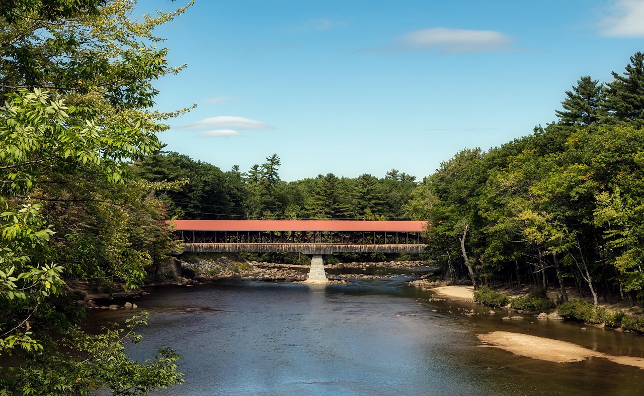
- Albany Covered Bridge and Rocky Gorge: the covered wooden bridge of 1858 over the Swift River (view it from the car park) and a gorge with swimming spots; in autumn the surrounding forests glow.
- Lower Falls on the Swift River: broad granite slabs with pools, a swimming spot in summer.
- CampingSpirit overnight tip
-
Official campsite or RV park: Covered Bridge Campground and Blackberry Crossing Campground (White Mountain National Forest) on the Swift River in the east of the Kancamagus Highway: riverside forest campgrounds, toilets, drinking water, no hook-ups. Covered Bridge is partly reservable, Blackberry Crossing is first come, first served; the season usually ends in mid-October, check details on Recreation.gov. Jigger Johnson and Passaconaway are nearby alternatives.
Free camping or nature tip (where legal): No roadside camping in the Kancamagus corridor. For designated sites see stage 4 and the Forest Service’s current maps.
- Insider tip for campers
- If you want to extend the tour, you will find suitable onward routes in the CampingSpirit guides “Seetaucher, Shaker-Scheunen und Hummerkörbe” (Lakes Region and coast) and “Ahornrot, Birkengold und Hummerbojen” (New England’s autumn loop). Empty your tanks before leaving: dump stations are rare in the White Mountains.
Camping practice & local rules
Wild camping & overnight parking
- The White Mountain National Forest allows dispersed camping only under Forest Service rules: not in the designated protected zones (Forest Protection Areas), which cover the Kancamagus corridor, Pinkham Notch and many riverbanks, and not in trailhead car parks. Violations of Forest Orders can carry heavy fines. Check current maps and rules with the Forest Service.
- In New Hampshire, overnighting in a vehicle at interstate rest areas, in State Park car parks and at the roadside is not allowed. Supermarket and department store car parks only with the express permission of the branch.
- Reservations: State Parks (Franconia Notch, Crawford Notch) through the New Hampshire State Parks reservation system, National Forest campgrounds through Recreation.gov. Some sites, such as Jigger Johnson, are first come, first served. In autumn and at weekends, arrive early.
- Federal land: visitors without US residence pay higher fees in some US national parks; the White Mountains belong to the Forest Service, not the NPS – check current rules and pass validity on the agency’s website.
- Wildlife: black bears and moose live in the White Mountains. Lock food and rubbish in the vehicle at night and leave nothing at the pitch. Moose step onto the road at dusk, especially on NH-16 and US-3. Ticks are common.
- Apps: Recreation.gov, Campendium, iOverlander, The Dyrt; the Forest Service website for closures and fire danger levels.
Waste disposal & supplies
- Dump stations are rare in the White Mountains: the Forest Service campgrounds on the Kanc have none, and State Park campgrounds offer them only in a limited way or not at all. Private campgrounds in Lincoln, Twin Mountain and North Conway sometimes take day visitors for a fee. Plan disposal points before you arrive.
- Drinking water: Forest Service campgrounds have hydrants or pumps that are shut off after the season (mid-October is usual). Fill up with fresh water in the towns.
- Gas: US cylinders and connections differ from EU standards; use an adapter or have a cylinder filled by a local dealer. There are no petrol stations or shops in the notches or on the Kanc, but there are in Lincoln, North Woodstock, Twin Mountain, Gorham and North Conway.
- Mobile network: reception is weak on the Kancamagus Highway and in the notches; download offline maps.
Vehicle size & traffic rules
- Speed limits: country roads mostly 35–55 mph, in the Franconia Notch Parkway well below the interstate level; follow the signs in the notches, and use the engine brake on descents.
- Dimensions: the US standard is 8.5 ft width (2.6 m) and generally 13 ft 6 in height (4.11 m); watch for signs at bridges and underpasses. The Mount Washington Auto Road has its own strict size and weight rules.
- Tolls: none on the public roads of this route, and no E-ZPass needed; only the private Mount Washington Auto Road charges a fee. Parking fees at National Forest trailhead car parks via Recreation Pass or Interagency Pass.
- Campfires: only in the fire rings of the campgrounds; check fire bans and fire danger levels in advance. Buy firewood locally and do not bring wood from far away (risk of pests).
- Leave No Trace: take all rubbish with you without exception, stay on the paths, keep your distance from animals.
CampingSpirit packing & preparation checklist
- Levelling ramps and a spirit level: many Forest Service pitches are sloping or gravelled, so make sure the vehicle is stable and the fridge level.
- Warm layers and a rain jacket, even in summer: on Mount Washington and the passes it can turn cool, wet and windy within hours.
- Coins (quarters): the showers at Jigger Johnson Campground are coin-operated.
- Offline maps and a paper plan of the route: there is no mobile reception on the Kancamagus Highway.
- Insect repellent with a head net for May and June: blackflies and mosquitoes are a nuisance then; later in the year, repellent and long clothing are enough.
- Binoculars and a head torch: moose and black bears show themselves at dusk, and main beam plus reduced speed protect you on night drives.
As of 2026-10. Closures, fees and booking rules change: check official sources before you go.