


In-depth guide · CampingSpirit
From Bismarck and Fort Abraham Lincoln via Knife River, Washburn, Garrison Dam and Lake Sakakawea to New Town, Williston and Fort Union, with a detour to Devils Lake: a good 1,200 kilometres of prairie, Mandan history and Lewis and Clark traces.
The spirit of the route
The Missouri has cut North Dakota in two, and anyone who follows it drives through the history of the Great Plains. The villages of the Mandan and Hidatsa stood on the bluffs above the river; their earth lodges can still be made out as round hollows in the grass. Lewis and Clark spent the winter of 1804/05 here, the cavalry was stationed at Fort Abraham Lincoln, and fur traders did business at Fort Union. Then comes the dam: Garrison Dam backs the river up into Lake Sakakawea, a lake that stretches across the prairie on the map like an arm. From your sliding door you see mist over the water in the morning, bald eagles on the sandbars, wheat stubble running right up to the cliffs and, in the evening, a sky with no end. The roads are empty, the wind is always there, and at night the stars hang thick.
Stage-by-stage plan
1Stage 1: Bismarck to Fort Abraham Lincoln State Park (Mandan) (approx. 30 km)
- The drive
- A short opening stage: from Bismarck over the I-94 bridge to Mandan on the west bank of the Missouri, then about ten kilometres south on ND-1806 to Fort Abraham Lincoln State Park. Two-lane, well-built road, 55–65 mph, with a view of the river floodplain towards the end. Actual driving time is 25–30 minutes; museums and the park fill the rest of the day. Fuel, supermarkets and water are plentiful in Bismarck and Mandan.
- Highlights & must-sees
- Bismarck: The 1934 State Capitol is a 19-storey Art Deco tower rising above the prairie – the city’s “Prairie Skyscraper”. Tours and the observation floor have their own hours, so check ahead. Next door is the North Dakota Heritage Center & State Museum, with exhibits on earth history, the peoples of the Plains and the settler era; check opening hours and admission at history.nd.gov.
- Fort Abraham Lincoln State Park: From 1872 the 7th Cavalry’s post stood on the bluff above the confluence of the Missouri and Heart River; from here Custer set out for the Little Bighorn in 1876. Blockhouses, barracks and the Custer House have been reconstructed, the latter open only on a guided tour; living-history tours run in summer, and the visitor centre has its own hours (check with the park ahead of time).
- On-A-Slant Village: The park has six reconstructed Mandan earth lodges, including a council lodge; the village once counted about 85 earth lodges and roughly 1,500 inhabitants and was abandoned after a smallpox epidemic in 1781. You can walk round on your own in summer; the historic sites open seasonally.
- CampingSpirit overnight tip
-
Official campsite or RV park: Fort Abraham Lincoln State Park Campground: a site on the plateau above the river with around 50 modern sites with electricity and water as well as basic sites with water, plus showers, a dump station and two seasonal camping cabins. Reserve through North Dakota Parks and Recreation (parkrec.nd.gov); sites can be booked up to 95 days ahead. Private campgrounds with full hookups in Bismarck are an alternative.
Free camping or nature tip (where legal): Free camping is not provided for around Bismarck–Mandan: overnighting outside the campground is not allowed in museum car parks, at the Capitol or in the park. Ask at supermarkets only with the store’s explicit permission and in line with city rules.
- Insider tip for campers
- Bismarck is the last big town before the thinly populated stretch along the lake – stock up on water, food and propane here. In the park, leave your vehicle at the campground and explore the fort on foot or by bike.
2Stage 2: Fort Abraham Lincoln State Park to Washburn (approx. 95 km)
- The drive
- Back through Mandan and over the I-94 bridge to Bismarck, then about 65 kilometres north on US-83. US-83 is a well-built highway here, 65–70 mph with little traffic, through fields of wheat and sunflowers. Shortly before Washburn it drops into the Missouri valley. Actual driving time is about 1.5 hours. Fuel in Bismarck, Wilton and Washburn.
- Highlights & must-sees
- Lewis & Clark Interpretive Center in Washburn: The State Historical Society’s visitor centre tells the story of the expedition’s winter with the Mandan in 1804/05, with exhibits on the expedition and on the history of the peoples along the river. Hours are seasonal, so check before you go.
- Fort Mandan: About three kilometres west of the centre stands a replica of Lewis and Clark’s winter camp, a triangular palisaded fort with living quarters and storerooms. The original site was lost to the river. Check admission and hours on the Fort Mandan Foundation site or at history.nd.gov.
- Missouri riverbank near Washburn: Below Garrison Dam the river still runs free, with gravel bars and cottonwood woods; in winter and spring you can see bald eagles here.
- CampingSpirit overnight tip
-
Official campsite or RV park: Washburn RV Park: an RV site in town (listed only in OpenStreetMap); check facilities, opening and operator ahead. Alternative: Cross Ranch State Park on the west bank of the river, about 40 kilometres away, a quiet spot in cottonwood forest. Check access, facilities and opening ahead in each case.
Free camping or nature tip (where legal): No legal free camping in town or at the fort. On city land, overnighting is banned outside designated sites.
- Insider tip for campers
- The Interpretive Center and Fort Mandan are close together and combine well in one afternoon. Save Knife River Indian Villages National Historic Site for the next morning, before you head for the lake.
3Stage 3: Washburn to Lake Sakakawea State Park (Pick City) (approx. 85 km)
- The drive
- From Washburn west on ND-200A, past the turn-off for ND-31 to Stanton (about 35 kilometres from Washburn to the town; Knife River Indian Villages National Historic Site lies just north of it). Then back to ND-200A as far as ND-200 east of Hazen, and east on ND-200 to Pick City, where you turn off for Lake Sakakawea State Park on the south shore. Garrison Dam follows a few kilometres to the east; ND-200 crosses the dam crest to Riverdale. Two-lane highways, 55–65 mph, hardly any traffic, wind mostly from the west. Actual driving time is 1.5–2 hours. Fuel in Washburn, Stanton and Hazen; fill up beforehand when options get scarce.
- Highlights & must-sees
- Knife River Indian Villages National Historic Site: Hidatsa and Mandan villages stood where the Knife River meets the Missouri; Sakakawea (Sacagawea) lived here with the Hidatsa when Lewis and Clark met her. You can see the hollows of the earth lodges, a reconstructed Hidatsa earth lodge and the National Park Service visitor centre. Visitor centre and earth lodge daily 9 am–5 pm (Central Time), trails from sunrise to sunset.
- Garrison Dam: The earthfill dam, completed in 1953, backs the Missouri up into Lake Sakakawea – by surface area one of the largest reservoirs in the USA. The water flooded the bottomlands of the Mandan, Hidatsa and Arikara, including the town of Elbowoods; this remains a defining issue in the region. A road runs across the dam crest with views of the power plant and the lake.
- Lake Sakakawea State Park: Beach, marina and fishing on the south shore; waterfowl in the bays and a view across the water to the horizon.
- CampingSpirit overnight tip
-
Official campsite or RV park: Lake Sakakawea State Park: campground on the south shore with around 140 modern sites (electricity and water), basic sites, a dump station, shower buildings and two camping cabins. Reserve through North Dakota Parks and Recreation, up to 95 days ahead. Alternative: U.S. Army Corps of Engineers campgrounds at Garrison Dam and on the north shore (e.g. Downstream, East Totten Trail); opening is seasonal, so check reservation rules and facilities on recreation.gov in each case.
Free camping or nature tip (where legal): On Corps land at Lake Sakakawea, camping is allowed only at designated sites; wild camping on the lakeshore, in car parks at the dam and on boat ramps is prohibited and enforced. There is no legal free-camping option at the lake.
- Insider tip for campers
- The wind at the lake can hit motorhomes hard from the side; retract the awning before you walk away from the vehicle. In summer, mosquitoes and midges by the water are a nuisance in the evening – keep screens on the windows and repellent handy. If you want to fish, you need a fishing licence from North Dakota Game and Fish.
4Stage 4: Lake Sakakawea State Park to New Town / Four Bears (approx. 140 km)
- The drive
- From Riverdale take ND-37 about 20 kilometres north to Garrison, then on west to ND-23 and along it through the Fort Berthold Reservation (MHA Nation land) via Parshall to New Town. Two lanes, 55–65 mph, hardly any settlements; west of New Town, ND-23 crosses the lake on the Four Bears Bridge. Check the exact connection between Garrison and ND-23 in your sat nav beforehand. Actual driving time is about 2 hours. Fuel in Garrison, Parshall and New Town; do not leave them in between without a full tank. Some lorry traffic in the oil field around the reservation.
- Highlights & must-sees
- Fort Stevenson State Park (Garrison): The park lies on the north shore of the lake on the site of the 1867 fort commanded by Colonel de Trobriand; you can see the guardhouse with information centre and museum, plus beach, marina and cycling and walking trails. The town of Garrison calls itself the “Walleye Capital” – fishing is a celebration here.
- Garrison Dam National Fish Hatchery: Below the dam near Riverdale, the facility raises fish for waters in the region; a visitor centre shows aquariums. Check seasonal opening hours.
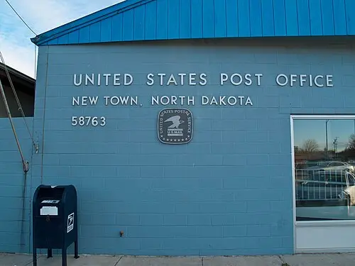
- Four Bears Bridge: The ND-23 bridge is named after two chiefs called Four Bears, one Mandan and one Hidatsa; it spans the lake in a long arc. Near New Town and Four Bears is the Three Affiliated Tribes Museum, with exhibits on the Mandan, Hidatsa and Arikara – check opening hours ahead.
- CampingSpirit overnight tip
-
Official campsite or RV park: Fort Stevenson State Park Campground near Garrison: around 48 premium sites with electricity, water and sewer, plus modern and basic sites, a dump station, showers and camping cabins; the most reliable campground on this stage and a good stop if you want to keep the day’s drive shorter. No reliably confirmed public RV campground is known for New Town and Four Bears; call ahead to find out whether MHA Nation businesses offer pitches. Alternative: Indian Hills Recreation Area on the south shore of the lake (according to OpenStreetMap a campground with hookups); check opening, facilities and access.
Free camping or nature tip (where legal): The Fort Berthold Reservation is tribal land of the Mandan, Hidatsa and Arikara (MHA Nation); camping outside campgrounds is not permitted without permission. Be polite and considerate when photographing people, ceremonies and burial sites.
- Insider tip for campers
- The MHA Nation expressly welcomes visitors; the MHA Nation tourism offices can answer questions about events and tours. Before continuing west, fill up and shop in Garrison or New Town – services thin out.
5Stage 5: New Town to Lewis & Clark State Park (near Williston) (approx. 170 km)
- The drive
- From New Town, minor roads through the reservation and the oil field lead north to US-2 near Stanley, then west on US-2 towards Williston; Lewis & Clark State Park lies about 30 kilometres east of Williston on the north shore. Check the approach in your sat nav beforehand. Partly four-lane, 55–70 mph, heavy lorry traffic from production in the Williston Basin. Wide and slow vehicles are normal here – stay patient. Actual driving time is about 2.5 hours; fuel in Stanley, Ray and Williston. Check the exact route in your sat nav beforehand, with current roadworks information.
- Highlights & must-sees
- Oil-field landscape: Between New Town and Williston, drilling pads, tank farms and pumpjacks stand beside wheat fields; production in the Williston Basin has shaped the region since the boom around 2010.
- Williston: The city in the heart of the Bakken oil field has had a new face since the boom around 2010 – production facilities, worker housing units and storage yards mark its outskirts. The centre has supermarkets, shops and workshops for camping supplies.
- Lake Sakakawea at its upper end: Here the lake runs out into the Missouri’s riverbed; driftwood, floodplain forest and birds at the inflows shape the landscape.
- CampingSpirit overnight tip
-
Official campsite or RV park: Lewis & Clark State Park on the north shore of Lake Sakakawea, about 30 kilometres east of Williston: a lakeside site with premium sites (electricity, water, sewer) and modern sites, a dump station, shower buildings and camping cabins (Scoria, Flint). The marina is usable depending on water level. Reserve through North Dakota Parks and Recreation; book early in high summer and in walleye season.
Free camping or nature tip (where legal): In the oil-field area around Williston, overnighting is prohibited on roads, at rest areas and in front of company premises; company sites and well pads are private property. No legal free camping in the city area.
- Insider tip for campers
- Around Williston, accommodation is often scarce because of the oil industry – do not arrive without a reservation. Buy food and water in Williston beforehand. In the oil field, watch for heavy traffic and dust clouds, and keep your distance.
6Stage 6: Lewis & Clark State Park to Fort Union Trading Post (day trip) (approx. 150 km)
- The drive
- A day trip, there and back: from the park to Williston and west on US-2, then left onto ND-1804 and about 40 kilometres south-west to Fort Union Trading Post, just before the Montana border. Two lanes, 55–65 mph, little traffic. Actual driving time is about 1 to 1.25 hours each way. Fuel in Williston; after that hardly any services, so fill up beforehand.
- Highlights & must-sees
- Fort Union Trading Post National Historic Site: The fur-trade fort of 1828 at the confluence of the Missouri and the Yellowstone was for decades the most important trading place on the upper Missouri, with trade between the American Fur Company and peoples such as the Assiniboine and Crow until 1867. Rebuilt are the palisaded yard, the Bourgeois House (the trading-post manager’s house) as visitor centre, the trade room and bastions. The site has seasonally changing hours, with closed days in winter; check hours and admission rules at nps.gov/fous.
- Fort Buford State Historic Site: Near the confluence lies the US Army fort where Sitting Bull surrendered in 1881; a few buildings survive.
- Missouri-Yellowstone Confluence Interpretive Center: The visitor centre explains the confluence and the history of the trading posts and forts; check seasonal opening hours.
- CampingSpirit overnight tip
-
Official campsite or RV park: Second night at Lewis & Clark State Park (see stage 5) as a base for the excursion to Fort Union. There is no public campground in the immediate vicinity of the fort; if you drive back in the evening, you will find the best supplies and water near Williston.
Free camping or nature tip (where legal): Around Fort Union and Fort Buford there is no designated free-camping spot; overnighting in the sites’ car parks is not allowed.
- Insider tip for campers
- Fort Union lies on the Montana border, and Montana is on Mountain Time; according to the NPS the site itself runs on Central Time, and your phone display may differ near the border. Once a year the fort holds a living-history rendezvous; nps.gov/fous gives the date. If you then continue south to Theodore Roosevelt National Park, you will find a link there to the CampingSpirit travel guide “Bison, badlands and scrap-metal giants – by camper through Theodore Roosevelt country in North Dakota”.
7Stage 7: Williston to Devils Lake (Grahams Island State Park) (approx. 580 km)
- The drive
- An optional long return drive or detour to the east: from Williston straight east on US-2 via Minot and Rugby to Devils Lake, then on to Grahams Island State Park south-west of the town. US-2 is four-lane in places, otherwise two-lane with hard shoulders, usually 65 mph, hardly any climbs. Actual driving time is about 6 hours – best spread over two days. Fuel is plentiful in Stanley, Minot and Rugby.
- Highlights & must-sees
- Rugby: A monument marks the geographical centre of North America, as the town interprets it; a quick photo stop.
- Fort Totten State Historic Site: The 19th-century fort is regarded as one of the better-preserved military posts in the region, with brick buildings around a parade ground on the south shore of Devils Lake, on the land of the Spirit Lake Nation. Check seasonal hours.
- Devils Lake: North Dakota’s largest natural lake has no outlet and has risen sharply since the 1990s – flooded roads, dead woods and new shorelines shape the scene. A good lake for walleye and perch.
- CampingSpirit overnight tip
-
Official campsite or RV park: Grahams Island State Park: according to the state, one of the few non-seasonal campgrounds in the area, on the south-west shore of Devils Lake, with premium sites (electricity, water, sewer), modern sites, a dump station, showers and camping cabins. Reserve through North Dakota Parks and Recreation. For a stopover on the way, municipal and private campgrounds in Minot are suitable; check their status beforehand.
Free camping or nature tip (where legal): At Devils Lake and on the boat ramps, overnighting outside campgrounds is prohibited. On Spirit Lake Nation land only with permission.
- Insider tip for campers
- The water level at Devils Lake has forced roads to be rerouted – use your sat nav and a road map with current information. US-2 has long stretches without fuel stations, so fill up in Minot and Rugby. The wind stays constant – allow for crosswinds and gusts on open stretches.
Camping practice & local rules
Wild camping & overnight parking
- North Dakota has hardly any public land for free camping along the Missouri: state parks and Corps land at Lake Sakakawea allow overnighting only at designated sites (Corps regulation 36 CFR 327). Towns such as Bismarck, Williston and Garrison do not tolerate sleeping in a vehicle on streets and public car parks.
- Dispersed camping exists in the national grasslands and on Forest Service land in the west of the state (see the CampingSpirit travel guide to Theodore Roosevelt country), not along the Missouri on this route. On the Fort Berthold Reservation, camping is possible only with the permission of the MHA Nation or at designated sites.
- Reservations: state parks through North Dakota Parks and Recreation (parkrec.nd.gov, up to 95 days ahead, check-in usually 4 pm, check-out 3 pm), Corps campgrounds and national park facilities through recreation.gov. In July and August and during walleye season, lakeside sites book up quickly.
- Federal sites: Knife River Indian Villages and Fort Union are NPS sites. Current admission rules, pass validity and any surcharges for visitors without US residence are on nps.gov.
- Respect for the land: the earth-lodge hollows, mounds and graves at Knife River, Fort Mandan and the villages are archaeological sites and part of a living culture; take nothing away, do not climb on the hollows, and stay on the paths.
- Apps: iOverlander, Campendium, The Dyrt and Recreation.gov; Park4Night is not widely used here.
Waste disposal & supplies
- Dump stations: at the state-park campgrounds Fort Abraham Lincoln, Lake Sakakawea, Fort Stevenson, Lewis & Clark and Grahams Island; not everywhere at Corps campgrounds.
- Drinking water: at taps on campgrounds and in towns; the tap water is drinkable, and in the oil-field area fill up beforehand if in doubt.
- Empty grey water and the chemical toilet only at dump stations; dumping onto prairie, fields or lakes is strictly forbidden.
- Propane: filling stations, hardware stores and campgrounds fill US cylinders; European cylinders are generally not filled. Bigger choice in Bismarck, Minot and Williston.
- Electricity: state-park sites usually offer 30, sometimes 50 amps; Corps sites are in part only 30 amps or have no hookup. Observe generator hours.
- Fuel and shopping: good supplies in Bismarck, Mandan, Washburn, Garrison, Williston, Minot and Devils Lake. Between Garrison, Parshall and New Town and on ND-1804 there are hardly any filling stations – fill up early.
Vehicle size & traffic rules
- Speed limits: interstates 75 mph, highways mostly 55–70 mph, towns 25–35 mph. No separate limits apply to motorhomes. Deer and livestock crossing at dusk are common.
- Tolls: there are no toll roads in North Dakota. The roads are in good condition; in the oil field there are roadworks and potholes.
- Dimensions: standard US motorhomes up to 8.5 ft (2.59 m) wide are permitted; observe height notices at underpasses and gates.
- Wind and weather: constant wind from the west; gusts and crosswinds on the open prairie are demanding for motorhomes. Thunderstorms with hail and occasional tornadoes from May to August; keep a warning app and weather radio ready. Roads can be closed in winter because of blizzards – travel from May to October.
- Phone at the wheel: texting is banned in North Dakota. Alcohol in the vehicle only sealed; blood alcohol limit 0.08.
- Time: the entire route lies in Central Time, including Knife River and Fort Union; Mountain Time applies only in south-west North Dakota and in Montana.
- Emergency: 911. Mobile coverage is good in towns, but patchy on the highways between towns and on the reservation.
CampingSpirit packing & preparation checklist
- Repellent and mosquito nets for door and windows: by the lake and in the river floodplains, mosquitoes and black flies are a nuisance from June to August.
- An awning that retracts quickly, and levelling ramps for soft pitches: the wind at Lake Sakakawea is steady and gusty.
- Binoculars for bald eagles, waterfowl and migratory birds at the lake.
- Fishing gear and, if you wish, a North Dakota Game and Fish fishing licence: the lake is regarded as a good walleye water.
- An extra water canister: between Garrison, New Town and Williston there are long stretches without services.
- A weather radio or National Weather Service warning app for thunderstorms, hail and tornado warnings on the prairie.
As of 2026-10. Closures, fees and booking rules change: check official sources before you go.