
In-depth guide · CampingSpirit
From the Mackenzie Highway in Alberta across the 60th parallel to Alexandra, Louise and Lady Evelyn Falls, on to Great Slave Lake, over the Mackenzie River and through the bison sanctuary to Yellowknife and the end of the Ingraham Trail: around 1,300 kilometres through the boreal north.
The spirit of the route
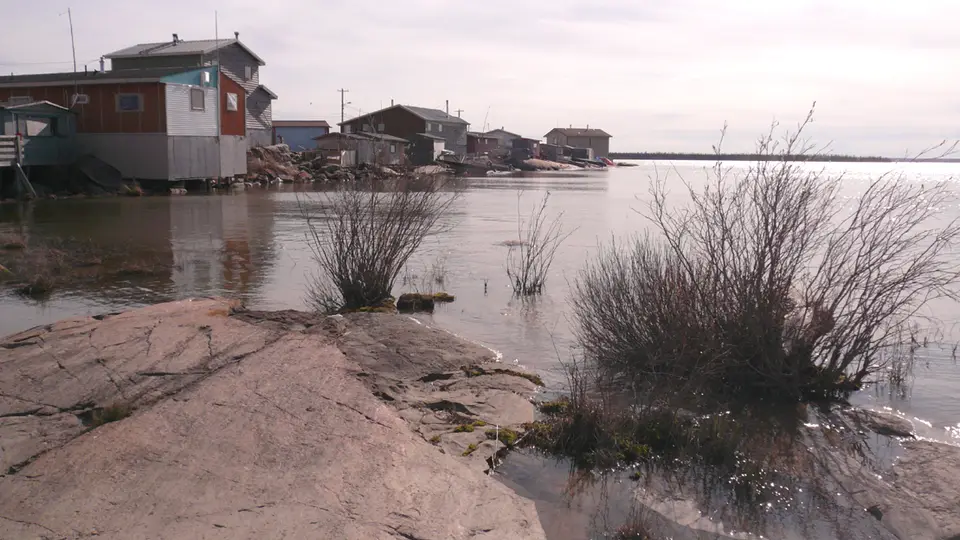
Beyond High Level the world grows quieter. Black spruce, thin as pencils, stretches to the horizon, with muskeg, beaver ponds and now and then a filling station that is café, post office and meeting place all in one. At the 60th parallel the territory begins, and suddenly the Hay River plunges into a limestone gorge, as if someone had sliced open the flat north. From the sliding door you see a beach on Great Slave Lake that smells of driftwood, and on the Mackenzie River a bridge over a river that only ends in the Arctic Ocean. In the bison sanctuary, hefty wood bison lie unhurried on the warm asphalt. Then granite, countless lakes and Yellowknife: houseboats in the bay, wooden shacks in Old Town, floatplanes every few minutes. In June it barely gets dark; from late summer, green ribbons dance above the motorhome roof.
Stage-by-stage plan
1Stage 1: Grimshaw to High Level (approx. 285 km)
- The drive
- In Grimshaw a milepost sign marks the start of the Mackenzie Highway (Alberta Hwy 35). The road is paved throughout, two-lane, mostly dead straight and with a good shoulder; the speed limit is 100 km/h. At first you roll through the last farmland of the Peace Country, with grain elevators and canola fields around Manning; after that the forest thickens and towns become fewer. Lots of truck traffic (timber, oil, supplies for the north) – overtake only on the long straights. Pure driving time is a good three hours. If you are coming from Grande Prairie or the Alaska Highway, you will find the approach through the Peace Country in the CampingSpirit travel guide to the Peace Country and the Alaska Highway.
- Highlights & must-sees
- Mile Zero marker of the Mackenzie Highway in Grimshaw: the starting point of the road that has linked northern Alberta with Great Slave Lake since the 1940s – a photo of your motorhome in front of the sign is a tradition.
- Notikewin River and Manning: the river valley near Manning is one of the last deep cuts in the flat land; in town you will find supplies and a small local history museum.
- High Level: Alberta’s northernmost sizeable town, with a supermarket, several filling stations, repair shops and the Mackenzie Crossroads Museum with visitor information – the last place for a big shop before Hay River.
- CampingSpirit overnight tip
-
Official campsite or RV park: Hutch Lake (Mackenzie County), around 35 kilometres north of High Level on Hwy 35: a simple lakeside campground in the forest with a day-use area, no hookups; check the season and facilities with Mackenzie County beforehand. If you want to stop earlier, the Twin Lakes Provincial Recreation Area campground lies around 65 kilometres north of Manning on Hwy 35: lakeshore, pit toilets, cook shelter, no hookups and no drinking water. High Level has private RV parks with power and showers.
Free camping or nature tip (where legal): On public land in Alberta, camping is allowed for up to 14 days; the Public Lands Camping Pass applies only to the Eastern Slopes in the Rockies, not to the north. Along Hwy 35, however, access is often lacking: much of the land is leased, fenced or industrial. Highway rest areas are meant for resting, not camping; on First Nations reserves only with permission.
- Insider tip for campers
- Fill up in High Level, refill your propane and buy supplies for several days. After that, Alberta offers only small stations such as the Trading Post in Indian Cabins, around 15 kilometres before the border – check beforehand whether fuel is available there; Meander River is not always open. People drive far too fast on the long straight – the police do check, and moose cross, especially at dusk.
2Stage 2: High Level to Twin Falls Gorge Territorial Park (approx. 265 km)
- The drive
- Continue on Hwy 35 through spruce forest and muskeg, past Meander River and Indian Cabins to the border at the 60th parallel. There Hwy 35 becomes NWT Highway 1 (Mackenzie Highway), still paved but with frost heaves and occasional construction zones with gravel and a pilot vehicle. From the border the Hay River accompanies the road. Around three hours of pure driving time; between High Level and Enterprise there are at most small filling stations that are not always open.
- Highlights & must-sees
- 60th Parallel Territorial Park: a visitor centre right at the border (open in the summer season) with information on roads, parks and the wildfire situation, brochures and coffee; plus a small campground on the Hay River. This is where you get the maps of all the territorial parks.
- Alexandra Falls: here the Hay River plunges around 32 metres over a limestone step; viewpoints at the top of the edge. In the afternoon the sun is well placed for rainbows in the spray.
- Louise Falls: about 3 kilometres downstream, a three-tiered waterfall with a spiral staircase down into the gorge. The forest trail along the rim of the gorge between the two falls and the viewing platforms along it are closed because of bank erosion; follow the signs on site.
- CampingSpirit overnight tip
-
Official campsite or RV park: Twin Falls Gorge Territorial Park, campground at Louise Falls: 28 powered sites, showers, toilets, dump station, cook shelters with firewood, drinking water in season. Reservations via nwtparks.ca. Alternative at the border: the small campground in 60th Parallel Territorial Park with nine sites without power, showers and dump station.
Free camping or nature tip (where legal): Within the territorial parks, only on designated sites; overnighting in the day-use car parks at the waterfalls is not permitted. Outside the parks, see Practicalities – the legal situation is less clearly defined than in the Yukon.
- Insider tip for campers
- The access roads to Alexandra Falls and Louise Falls are signposted separately; since the connecting trail is closed, drive to each car park separately – with a large motorhome, Alexandra Falls first, then on to the campground at Louise Falls. Stock up on water at the campground – there are hardly any public water points between the parks.
3Stage 3: Twin Falls Gorge to Hay River (approx. 45 km)
- The drive
- A short stretch on Hwy 1 to Enterprise, the junction on the edge of the Hay River escarpment, then just under 40 kilometres north on Hwy 2 to Great Slave Lake – paved, flat, through forest and along the river. Less than an hour’s driving, ideal as a rest day. Enterprise was hit hard by a wildfire; check beforehand whether the filling station and other services are open.
- Highlights & must-sees
- Vale Island beach: around a kilometre north of the campground lies a wide sandy beach on Great Slave Lake, the deepest lake in North America – no facilities; in high summer you can swim with care, and in the evening it stays light for a long time.
- Fisherman’s Wharf in Hay River: in summer, a Saturday farmers’ market with fish from the lake, baked goods and crafts; the harbour is home to the tugs and barges that carry freight as far as the Mackenzie Delta in summer.
- Hay River as a supply base: supermarket, repair shops, filling stations and the starting point for the side trip via Hwy 5 to Fort Smith and Wood Buffalo National Park (see tip).
- CampingSpirit overnight tip
-
Official campsite or RV park: Hay River Territorial Park on Vale Island: a campground near the lakeshore with 43 powered sites (plus group sites), showers, toilets, drinking water and dump station; the swimming beach is around a kilometre away. Reservations via nwtparks.ca; book early in summer.
Free camping or nature tip (where legal): Within the town of Hay River, overnighting on streets and in car parks is not intended; the territorial park is the obvious solution. Enter the land of the Kátł’odeeche First Nation on the south bank of the river only with permission.
- Insider tip for campers
- In Hay River, fill up, shop and deal with your fresh and waste water tanks – there is a water filling station for motorhomes at the Hay River visitor centre. From here to Yellowknife there are only small supply points such as Kakisa, Fort Providence and Behchokǫ̀. Optional side trip: Hwy 5 takes you to Fort Smith and Wood Buffalo National Park (Parks Canada) with salt plains, karst lakes and wood bison – allow two to three extra days for this extension and check road conditions.
4Stage 4: Hay River to Fort Providence (approx. 180 km)
- The drive
- Back to Enterprise and west on Hwy 1: long straights through aspen and spruce forest, with occasional views over the escarpment to the right. The access road to Lady Evelyn Falls and on to Kakisa is a gravel road around 7 kilometres long heading south, easy to drive but dusty. At the junction, take Hwy 3 north over the Deh Cho Bridge to the community of Fort Providence. Pure driving time around 2.5 hours.
- Highlights & must-sees
- Lady Evelyn Falls: the Kakisa River drops like a curtain in a wide semicircle over a limestone ledge. A staircase leads down to the riverbed; in late summer, when little water flows, you can walk across the slabs at the foot of the falls and spot fossils in the rock.
- Kakisa: a small Dene community on Kakisa Lake, a few minutes beyond the falls – quiet, with a view over the lake, a small filling station but no grocery store. Drive respectfully and do not take photos without asking.
- Deh Cho Bridge: the bridge over the Mackenzie River, around a kilometre long, opened in 2012 and replaced the ferry and the ice road; from the shoreline at Fort Providence you can see how wide the river already is here.
- CampingSpirit overnight tip
-
Official campsite or RV park: Fort Providence Territorial Park on the bank of the Mackenzie River, on Hwy 3 around 5 kilometres before the community: 32 large pull-through sites with power (plus group sites), showers, drinking water and dump station. An alternative right at the falls: Lady Evelyn Falls Territorial Park with 23 powered sites, showers and dump station – a quiet spot with the sound of the falls within earshot.
Free camping or nature tip (where legal): Between Enterprise and the Mackenzie River there are gravel pits and large pull-outs that travellers use for overnight stops (entries in iOverlander). These are not official sites: observe signs, no fires, leave nothing behind and keep your distance from the road. For the legal situation, see Practicalities.
- Insider tip for campers
- Private motorhomes pay no toll on the Deh Cho Bridge; the bridge fee applies to commercial vehicles. Fill up in Fort Providence or at the Hwy 3 junction even if your tank is still half full: around 200 kilometres without a reliable fuel stop follow until Behchokǫ̀.
5Stage 5: Fort Providence to Yellowknife (approx. 315 km)
- The drive
- Hwy 3 (Yellowknife Highway) heads north through flat forest and bog, first through the Mackenzie Bison Sanctuary. Paved, but with frost heaves, patches and rutted sections; bumps are marked with signs or flags. Beyond Behchokǫ̀ the landscape changes to the Canadian Shield: pink granite knolls, lakes, stunted pines. Around four hours of pure driving time, more likely longer because of the bison. Hardly any mobile coverage between Fort Providence and Behchokǫ̀.
- Highlights & must-sees
- Mackenzie Bison Sanctuary: this sanctuary north of the Mackenzie River is home to wood bison that like to lie on the warm asphalt or the shoulder. Drive slowly, stop, stay in the vehicle and wait – bulls weigh almost a tonne and are faster than they look.
- Behchokǫ̀: the largest Tłı̨chǫ community, on Marian Lake and the North Arm of Great Slave Lake; the old part of the community sits on rocks and islands a few kilometres off the highway. Take photos only with consideration, and respect the community’s alcohol rules.
- North Arm Territorial Park just beyond Behchokǫ̀: a rest area with picnic shelters on the North Arm of Great Slave Lake, a good place for your first encounter with the granite of the Shield.
- CampingSpirit overnight tip
-
Official campsite or RV park: Fred Henne Territorial Park in Yellowknife: on Long Lake next to Hwy 3 and the airport, a few kilometres from downtown; over 100 sites with and without power, showers, toilets, dump station, swimming beach and the Prospector’s Trail across the rocks. Very popular – reserve via nwtparks.ca.
Free camping or nature tip (where legal): Around Behchokǫ̀ and further north there is a lot of Tłı̨chǫ land; camping there without permission is not allowed. The rest areas on Hwy 3 are meant for breaks. If you get tired on the way, it is better to stop at a wide pull-out for a break and then drive on to the campground.
- Insider tip for campers
- Do not risk an encounter with bison at dusk: the dark animals are visible only late on dark asphalt. Do not honk, do not get out, do not drive between a cow and her calf. Check fuel availability in Behchokǫ̀ beforehand – the only safe calculation is Fort Providence to Yellowknife on a full tank.
6Stage 6: Yellowknife to Yellowknife (Old Town and Frame Lake) (approx. 25 km)
- The drive
- A city day in the capital of the Northwest Territories: from the campground it is a few kilometres to downtown; Old Town sits on a peninsula with narrow, steep and partly unpaved lanes. With a large motorhome, park in the modern downtown and continue on foot or by bike; the Frame Lake Trail links downtown, the museum and the Legislative Assembly.
- Highlights & must-sees
- Old Town: wooden shacks, floatplanes at the docks, Ragged Ass Road and, on the highest rock, the Bush Pilots Monument with a view over Yellowknife Bay. Out in the bay lie the houseboats, floating in summer, frozen into the ice in winter.
- Prince of Wales Northern Heritage Centre on Frame Lake: the territory’s museum, with exhibitions on the Dene, Inuit and Métis, on mining, bush pilots and life in the north. Next door is the Legislative Assembly building with tours – check opening times.
- Northern lights: Yellowknife lies beneath the auroral oval. In the bright nights around the summer solstice you see nothing; from late summer, as the darkness grows, and in winter they are very frequent. From the campground or the shore of Long Lake, a clear sky and a little patience are all you need.
- CampingSpirit overnight tip
-
Official campsite or RV park: Stay on at Fred Henne Territorial Park; book in good time for several nights. Yellowknife has no other public campground with hookups – the alternatives are the territorial parks on the Ingraham Trail.
Free camping or nature tip (where legal): The City of Yellowknife does not tolerate overnighting in motorhomes on streets and in public car parks; in Old Town there is no room anyway. Supermarket car parks only with the store’s consent.
- Insider tip for campers
- Yellowknife is the best place on the route for shopping, propane, repairs and tyre service. Drinking water and dump station at Fred Henne Park. Because of arsenic contamination from former gold mining, eat fish from lakes around the city only according to the advice of the NWT health authority.
7Stage 7: Yellowknife to Reid Lake (Ingraham Trail) (approx. 65 km)
- The drive
- The Ingraham Trail (Hwy 4) branches off on the edge of town, passes the remediation site of the former Giant Mine and then winds through the lake country of the Canadian Shield: short climbs, curves around rock knolls, bridges over river narrows. The road is only partly paved; the remaining sections are hard-packed gravel with dust and washboard. It ends after around 69 kilometres at Tibbitt Lake, where the winter ice road to the diamond mines begins. Pure driving time to Reid Lake a good hour.
- Highlights & must-sees
- Prelude Lake Territorial Park: around 30 kilometres from Yellowknife, a 16-kilometre-long forest lake with a boat launch, sandy beach and a nature trail over rocks and through forest; ideal for a day of paddling.
- Cameron Falls in Hidden Lake Territorial Park: from the car park on Hwy 4, a rocky trail of around a kilometre leads to the falls of the Cameron River. The footbridge above the falls has been closed at times – check the notices at the car park. Sturdy shoes needed; the trail is steep in places.
- Reid Lake: a lakeside campground with a beach and canoe launch, the starting point for paddling trips on the connected lakes. At the end of the road lies Tibbitt Lake, where the ice road north begins in winter.
- CampingSpirit overnight tip
-
Official campsite or RV park: Reid Lake Territorial Park: a large lakeside campground with beach, toilets, drinking water and cook shelter, but without power and without showers. Alternatively, Prelude Lake Territorial Park, closer to town, with showers, also without power. Check facilities on nwtparks.ca before booking. Both campgrounds are very popular with locals on summer weekends; reserve early.
Free camping or nature tip (where legal): Along the Ingraham Trail there are boat launches and day-use areas (e.g. Madeline Lake, Pontoon Lake) that are not open for overnight stays; many lakeshore plots are leased land with cabins. Overnight only at the territorial park campgrounds.
- Insider tip for campers
- Fill up in Yellowknife before you set off: there is no filling station on the Ingraham Trail. Drive slowly on the gravel and keep your distance – stone chips on the windscreen are common; in dry weather close windows and vents against the dust. Check the wildfire situation locally – the Ingraham Trail has only one way in and out.
Camping practice & local rules
Wild camping & overnight parking
- Northwest Territories: there is no general, explicit right to free camping as in the Yukon. According to the territorial government, short-term camping (two to three nights) is permitted on unallocated territorial land (Commissioner’s Land); leased land, First Nations land and parks are excluded. In territorial parks you overnight only on designated sites; day-use areas are not campgrounds at night. Gravel pits and large pull-outs along the highways are used by travellers but are not official sites – observe signs, respect fire bans, leave nothing behind.
- First Nations land and settlement areas (e.g. Tłı̨chǫ land around Behchokǫ̀, areas of the Dene communities on the Hay River and in Kakisa): only with the community’s permission. In the communities themselves, overnighting on streets and in car parks is not intended.
- Alberta: on public land, camping is allowed for up to 14 days in one place; the Public Lands Camping Pass applies only to the Eastern Slopes. Along Hwy 35, however, suitable, accessible public land is rare.
- Territorial parks: reservations online via nwtparks.ca or by phone; the booking window opens every spring, and the season runs roughly from mid-May to mid-September (park dates annually on nwtparks.ca). For Fred Henne, Prelude Lake, Reid Lake and Hay River, book early for July and August. Outside the season the campgrounds are closed.
- Wildlife: wood bison on Hwy 3 and Hwy 5, plus black bears, moose, foxes and wolves. Store food and rubbish bear-safe in the vehicle, give bison at least 30 metres’ distance and never approach them on foot.
- Apps: iOverlander and Campendium, with few but useful entries; Park4Night is hardly used in the north. For roads, the road conditions report of the NWT Department of Infrastructure (inf.gov.nt.ca, also by phone); for wildfires, the territorial government’s fire information.
Waste disposal & supplies
- Fuel is the key planning factor: reliable filling stations in Grimshaw, Manning, High Level, Hay River, Fort Providence and Yellowknife. In Indian Cabins, Enterprise, Kakisa and Behchokǫ̀, check beforehand whether fuel is available and the station is open. Rule of thumb: fill up at half a tank. Not every station sells diesel or premium, and opening hours may be limited.
- Dump stations: in the territorial parks Twin Falls Gorge, 60th Parallel, Hay River, Lady Evelyn Falls, Fort Providence and Fred Henne, plus in High Level. Empty grey water and chemical toilets only there.
- Drinking water: at the taps of the larger territorial parks in season; not always in small parks. Carry 20-litre containers. Water from lakes and rivers only filtered or boiled – and not from lakes around Yellowknife that are subject to arsenic advisories.
- Propane: in High Level, Hay River and Yellowknife; US and Canadian cylinders are filled, European cylinders usually not. Fill up in good time – there are hardly any alternatives.
- Power: many sites in the territorial parks along the highway have electrical hookups (Twin Falls Gorge, Hay River, Lady Evelyn Falls, Fort Providence, Fred Henne); 60th Parallel, Prelude Lake and Reid Lake have none. A solar panel or generator (observe quiet hours) for the nights without hookups.
- Shopping: larger supermarkets only in High Level, Hay River and Yellowknife; in small communities groceries are expensive and the selection limited. Firewood is provided at the parks’ cook shelters.
Vehicle size & traffic rules
- Speed limits: Alberta Hwy 35 mostly 100 km/h; on NWT highways the maximum is 100 km/h, less on some sections, and considerably less in construction zones and communities. There are no separate limits for motorhomes. In the NWT, low-beam headlights and seat belts are mandatory at all times.
- Distances and road conditions: between supply points there are often 150–200 kilometres without services. Asphalt with frost heaves, construction zones with gravel and a pilot vehicle; gravel on the Kakisa access road and the far section of the Ingraham Trail. In spring, gravel roads can soften – check road conditions.
- Tolls: none for private motorhomes; the fee at the Deh Cho Bridge applies to commercial vehicles.
- Wildfire season: from May to September, wildfires are part of the north. In bad years entire communities have been evacuated – in 2023 Hay River, Yellowknife and Fort Smith among others, and Enterprise largely burned down. Check fire information and road status daily, respect fire bans, always keep at least half a tank and supplies on board, and follow evacuation orders immediately.
- Insects: from June to August, mosquitoes, blackflies and large horseflies (known in the north as “bulldogs”), especially when there is no wind by lakes and rivers. Fly screens and a head net are no exaggeration.
- Mobile coverage and emergencies: signal mostly only in and around communities, with long gaps on Hwy 1 and Hwy 3. Emergency number 911; a satellite messenger makes sense for this route. Before stages without signal, leave your route and arrival time with someone.
- Winter: the highways are open year-round, but the territorial parks are closed; temperatures below −30 °C, short days, ice fog. Drive only with a winter-ready vehicle, block heater, emergency equipment and experience.
- Fishing: fishing in the NWT requires a sport fishing licence from the territorial government; Alberta requires its own licence. Alcohol: some communities have restrictions – respect the local rules.
CampingSpirit packing & preparation checklist
- Spare jerrycan for diesel or petrol (20 l), securely strapped outside: between High Level and Hay River and between Fort Providence and Yellowknife there are long stretches with uncertain fuel stops.
- Head net, fly screens for windows and sliding door, and repellent with DEET or picaridin: mosquitoes, blackflies and horseflies are present on every lakeshore in summer.
- Satellite messenger or your phone’s satellite function: large parts of Hwy 1 and Hwy 3 have no mobile coverage.
- Stone-chip protection for headlights, a tyre repair kit with compressor and a well-inflated spare: gravel on the Ingraham Trail, construction zones and truck traffic take their toll on the vehicle.
- N95 masks and air purifier filters for the interior: in wildfire summers, smoke hangs over the region for days.
- Blackout blinds for June and warm sleeping bags for September: around the summer solstice it barely gets dark; in late summer, night frosts and northern lights nights are common.
As of 2026-10. Closures, fees and booking rules change: check official sources before you go.