




In-depth guide · CampingSpirit
Around 310 kilometres from Chaumont via Langres, the Saône at Gray and the spa town of Luxeuil to the ponds of “Petite Finlande” and Le Corbusier’s chapel at Ronchamp – a route away from the through motorways, where you will see more herons than motorhomes.
The spirit of the route
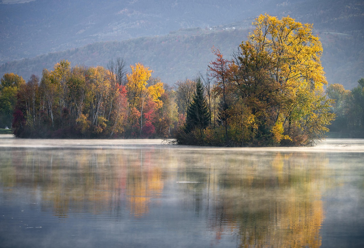
Between Champagne, Burgundy and the Vosges lies a country most people know only from the A31 motorway. Turn off, and you soon stand on the town walls of Langres, with the green Marne valley below you and the blue of the Lac de la Liez in the distance. Then the limestone plateau drops towards the Saône: willow-lined banks, towpaths, houseboats gliding past château parks at walking pace, villages with wash-houses of pale stone. Further north-east the soil turns acidic and granitic, the forest darker, and suddenly there is a pond behind every bend – hundreds of them, fringed by spruce, birch and peat moss. In the evening you hear frogs and cranes through the sliding door; in the morning mist hangs over the water. At the end, on a hill above old coal spoil heaps, stands a white concrete building with a curving roof that looks as if it has just landed. This route rewards slowness, country roads and municipal aires with a fountain.
Stage-by-stage plan
1Stage 1: Chaumont to Langres (approx. 35 km)
- The drive
- From Chaumont take the D619 (the former N19) up the Marne valley via Rolampont to Langres. A well-built, mostly straight country road with little traffic, running parallel to the Marne and the Canal entre Champagne et Bourgogne. At the end the road climbs onto the spur on which the old town of Langres sits. A good half-hour of pure driving time; if you arrive via the A5, leave the motorway at the Chaumont exit.
- Highlights & must-sees
- Chaumont viaduct: the stone railway viaduct of the Paris–Mulhouse line from the mid-19th century, around 600 m long and a good 50 m high, with three tiers of arches over the Suize valley. A footpath runs through the lower tier; the best photo is from the valley floor.
- Town wall walk in Langres: a good three kilometres on and along the ramparts, with towers, gates and wide views over the Marne valley to the Lac de la Liez – at its best in the late afternoon.
- Maison des Lumières Denis Diderot: a museum on the encyclopaedist born in Langres in 1713, a few steps from the Place Diderot with his statue by Bartholdi and from Saint-Mammès cathedral.
- CampingSpirit overnight tip
-
Official campsite or RV park: Camping Navarre lies right outside the town walls by the Tour de Navarre, a few minutes’ walk from the old town: electricity, toilets and showers, water and waste disposal, open seasonally. There is also the Aire camping-car du Grand Langres, a motorhome area for around 30 vehicles just under a kilometre south of the old town, with electricity and service point. In Chaumont itself there is an aire for about a dozen motorhomes north-east of the centre. Check fees and season in advance.
Free camping or nature tip (where legal): The old town of Langres, with its ramparts, gates and many buildings, is a protected heritage site – camping is prohibited within 500 m of Monuments historiques, and overnight stays in a motorhome on the car parks inside the walls are neither intended nor sensible. Use the aire or the campsite; during the day the aire also does for parking while you explore the town.
- Insider tip for campers
- Do not drive large vehicles into the old town of Langres: the gates are narrow, the lanes tight and partly one-way. Park below and walk up. Langres cheese – the one with the sunken hollow on top – is best bought from the cheesemakers in the surrounding countryside or at the market in the old town. Champagne, Reims and the Lac du Der are covered in the CampingSpirit guide to Champagne from Reims to the Côte des Bar.
2Stage 2: Langres to Lac de Villegusien (approx. 35 km)
- The drive
- A lakes loop south and east of Langres: first on the D284 to the Lac de la Liez, then along narrow municipal roads to Balesmes-sur-Marne and the source of the Marne, then south on the D974 and via minor roads into the Vingeanne valley to Villegusien-le-Lac. Quiet, partly winding roads across the plateau, with open views and wind turbines on the horizon; tight passages through the villages. Around an hour’s driving.
- Highlights & must-sees
- Lac de la Liez: the largest of the reservoirs that once fed the Canal entre Champagne et Bourgogne, with a bathing beach, boat hire and a path around the lake – a relaxed half-day by bike.
- Source de la Marne near Balesmes-sur-Marne: the Marne rises in a small rock grotto in the woods, a few minutes from the car park; next to it is the cave where, according to tradition, the Gallic leader Sabinus is said to have hidden. The source of the Seine is also on the Plateau de Langres, but already in Burgundy (Côte-d’Or) – a detour of around an hour’s drive each way.
- Lac de Villegusien (Lac de la Vingeanne): a reservoir with shallow banks, birdwatching in spring and autumn and a circular path that works well on foot or by bike.
- CampingSpirit overnight tip
-
Official campsite or RV park: On the Lac de la Liez is Camping de la Liez, a large, well-equipped site with electricity, toilets and showers, service point and a bathing area; book early in high season. Quieter and simpler is Camping de la Croix d’Arles on the D974 south of Langres. On the Lac de Villegusien the small Camping du Lac (Lac de la Vingeanne) lies on the shore; check operation, facilities and season in advance.
Free camping or nature tip (where legal): The lakes are popular day-trip destinations; overnight parking at the lakeside car parks is banned by municipal order in many places, and camping behaviour is prohibited anyway. South-west of Langres the Parc national de Forêts begins – its core zone has its own rules, and sleeping in your vehicle outside designated sites is off limits there. Plan for a campsite or a municipal aire.
- Insider tip for campers
- At the Lac de la Liez and the source of the Marne the car parks are full on summer weekends – go early. Take care of water and waste disposal in Langres before moving on; on the plateau the bornes are few and far between. For the source of the Seine and Burgundy, see the CampingSpirit guide to Burgundy from Dijon to Auxerre.
3Stage 3: Lac de Villegusien to Gray (approx. 50 km)
- The drive
- Via the D17 and D67 through hilly country with wheat fields, small woods and the odd vineyard to Champlitte in the Haute-Saône, then on the D70 through the Salon valley and on to Gray on the Saône. Wide, quiet country roads without significant gradients. A good hour of pure driving time.
- Highlights & must-sees
- Champlitte: in the Renaissance château, the Musée départemental Albert et Félicie Demard shows the folk culture and everyday life of the Haute-Saône; a second museum in the village is devoted to old crafts and farming techniques. A section in the château remembers the emigrants from Champlitte who left for Mexico in the 19th century.
- Vineyards around Champlitte: one of the few wine-growing areas of the Haute-Saône, with small cellars on the edge of the village.
- Gray: the town hall with its Renaissance roof of glazed tiles, the stone bridge over the Saône and the Musée Baron-Martin in the old château above the river.
- CampingSpirit overnight tip
-
Official campsite or RV park: Camping municipal Longue Rive lies on the bank of the Saône opposite the old town of Gray: electricity, toilets and showers, service point, open seasonally. Right next to it is a motorhome aire with around 25 pitches, water and waste disposal. In Champlitte there is a small campsite on the edge of the village. Check fees and season in advance.
Free camping or nature tip (where legal): On the Saône the towpaths and riverside paths are closed to motor vehicles; the boat stops (“haltes nautiques”) are reserved for boats. The château and old town of Champlitte and the riverside buildings in Gray are protected – at night, use the aire.
- Insider tip for campers
- Gray is a base for houseboats on the Saône, which in France you can hire without a boat licence after a briefing – a day on the water fits in nicely while the camper stays on its pitch. The bridge in Gray and the old-town lanes are narrow; with large vehicles use the bypass and walk across the bridge.
4Stage 4: Gray to Port-sur-Saône (approx. 55 km)
- The drive
- On minor roads along the left bank of the Saône upstream via Ray-sur-Saône and Soing to Scey-sur-Saône and on to Port-sur-Saône. The road follows the river’s meanders, mostly flat, with short climbs to the villages on the valley edges; some village passages are narrow. About 1.5 hours’ driving with photo stops.
- Highlights & must-sees
- Château de Ray-sur-Saône on a rocky spur above the river: owned by the département; the English-style park of around six hectares with terraces and views over the Saône valley is freely accessible, the interior can be visited on guided tours in season.
- Saint-Albin boat tunnel near Scey-sur-Saône: here the waterway cuts under a river meander through a tunnel around 680 m long – at the portals you can watch houseboats going in.
- Port-sur-Saône: harbour and lock right in the village, ideal for an evening stroll by the water.
- CampingSpirit overnight tip
-
Official campsite or RV park: In Scey-sur-Saône there is Camping La Saône Jolie on the river and a small municipal aire with water and waste disposal. In Port-sur-Saône, Camping La Maladière is a simple site near the river; in Soing near Ray-sur-Saône there is Camping La Louvière. Check facilities and season in advance – several sites on the Saône only open from spring to autumn.
Free camping or nature tip (where legal): Around Ray-sur-Saône and at the locks the rule is: parking by day yes, at night and with camping behaviour no – the château and village are protected, and lock grounds belong to the waterways authority. Parts of the Saône floodplain are Natura 2000 sites and can flood after rain; do not drive onto meadows or farm tracks.
- Insider tip for campers
- The Saône valley is a flood zone: after heavy rain, riverside roads and campsites are closed at short notice – check river levels on Vigicrues. A narrow, steep village street leads up to the Château de Ray – with large vehicles park down in the village and walk up.
5Stage 5: Port-sur-Saône to Luxeuil-les-Bains (approx. 45 km)
- The drive
- A short stretch on the N19 to Vesoul, then north-east on the N57 across the hills to Luxeuil-les-Bains. The N19 and N57 are well built and dual carriageway in places. A good hour of pure driving time.
- Highlights & must-sees
- Vesoul: a short stop in the old town with the church of Saint-Georges, or a walk up the Colline de la Motte with its chapel and views over the town; to the west lies the Lac de Vaivre with a lakeside path.
- Basilica of Saint-Pierre in Luxeuil: the abbey church of the monastery founded around 590 by the Irish monk Columbanus, one of the early spiritual centres of Western Europe, with a cloister and excavations on the square in front.
- Spa town of Luxeuil: baths in red sandstone buildings, the Tour des Échevins and the Maison du Cardinal Jouffroy in the Rue Victor-Genoux.
- CampingSpirit overnight tip
-
Official campsite or RV park: In Luxeuil-les-Bains, Camping-Car Park runs an aire with around 45 pitches, electricity, service point and card access, close to the centre. Alternatively, Camping du Domaine de Chatigny on the edge of town. In Vesoul, Camping International du Lac lies on the Lac de Vaivre, good for a quiet evening by the water. Check season and prices in advance.
Free camping or nature tip (where legal): The old town of Luxeuil and the abbey quarter are protected; wild camping is unnecessary here, as the aire is central. In the surrounding area, forest car parks often have barriers or height restrictions.
- Insider tip for campers
- Vesoul has no low-emission zone, nor does Luxeuil – you do not strictly need a Crit’Air sticker on this route, but it does no harm. On the edge of Luxeuil there is an air force base; expect aircraft noise during the day. In nearby Fougerolles kirsch is distilled – a detour to the Écomusée du Pays de la Cerise is worthwhile if you head north.
6Stage 6: Luxeuil-les-Bains to Faucogney-et-la-Mer (Plateau des Mille Étangs) (approx. 45 km)
- The drive
- From Luxeuil via Saint-Bresson onto the Plateau des Mille Étangs, then a loop on narrow municipal roads via Esmoulières, Écromagny and back to Faucogney-et-la-Mer. Many roads are single-track with passing places, winding, lined with forest and used by timber lorries; motorhomes up to about 7 m manage well, longer vehicles are better off staying on the main roads. 1.5 hours of pure driving time, a full day with walks.
- Highlights & must-sees
- The pond landscape of “Petite Finlande”: hundreds of hollows scoured out by glaciers and dammed into ponds, with peat moss, cotton grass and boggy margins – a Natura 2000 site in the Ballons des Vosges Regional Nature Park.
- Saint-Martin church hill above Faucogney, with views over the Breuchin valley and the plateau.
- Ermitage Saint-Valbert near Luxeuil and the hamlet museum of Château-Lambert (Musée départemental de la Montagne) on the edge of the Vosges. The Ballon de Servance (1,216 m) lies around 15 kilometres further east – its summit is military land and the access roads are narrow; for Vosges passes such as the Ballon d’Alsace, see the CampingSpirit guide to the Alsace Wine Route and Route des Crêtes.
- CampingSpirit overnight tip
-
Official campsite or RV park: The intercommunal aire in Faucogney-et-la-Mer is at the sports ground in the Rue des Chars: six pitches on firm gravel, parking free according to the operator, water and electricity for a fee at the bollard, grey and black water disposal. There is another small municipal aire in Écromagny. Campsites with more comfort only start again towards Ronchamp and Champagney.
Free camping or nature tip (where legal): Almost all the ponds are privately owned and used for fish farming: banks, dams and access tracks are not places to park up, and swimming and fishing are only allowed with permission. Forest roads (“routes forestières”) are mostly closed to motor vehicles. The communes on the plateau deliberately provide small aires with two to eight pitches – if you stay there, you are welcome; if you camp by a pond, you are not.
- Insider tip for campers
- Before heading onto the plateau, fill up with fuel, top up water and do your shopping in Luxeuil: up there are hardly any filling stations and only small shops. During the hunting season, from autumn to the end of February, driven hunts take place in the forests – take “Chasse en cours” signs seriously, wear brightly coloured clothing when walking, and at dusk expect deer and wild boar on the road.
7Stage 7: Faucogney-et-la-Mer to Belfort via Ronchamp (approx. 45 km)
- The drive
- Via Melisey down into the Ognon valley, then on departmental roads to Ronchamp and on the N19 to Belfort. After the little plateau roads, wide roads again; the access to the car park at the chapel in Ronchamp is narrow and steep. About an hour of pure driving time.
- Highlights & must-sees
- Notre-Dame-du-Haut in Ronchamp: Le Corbusier’s pilgrimage chapel of 1955 on the hill of Bourlémont, part of the UNESCO World Heritage site “The Architectural Work of Le Corbusier”, inscribed in 2016. Plus the gatehouse and Poor Clares’ convent by Renzo Piano; admission charged.
- Musée de la Mine in Ronchamp: a memorial to the coal mining that shaped the town until the 1950s – the chapel stands above a former mining landscape.
- Belfort to finish: Bartholdi’s Lion carved into the rock below the citadel, with views from there over the town to the Vosges.
- CampingSpirit overnight tip
-
Official campsite or RV park: Camping des Ballastières in Champagney, a few kilometres east of Ronchamp, lies by bathing lakes, with electricity, toilets and showers. In Belfort, Camping International de l’Étang des Forges lies on the northern edge of town by a pond, with electricity, service point and a cycle link to the old town. Check season in advance.
Free camping or nature tip (where legal): The chapel is a listed monument; the visitor car park on the hill is for parking during your visit, camping behaviour is ruled out – ask at the ticket office whether overnight parking is tolerated. If you want somewhere inexpensive, Lure has motorhome parking on the Esplanade Charles-de-Gaulle and the plateau has municipal aires; heading into Belfort, stick to campsites or designated motorhome areas.
- Insider tip for campers
- Come to Ronchamp early in the morning or late in the afternoon: then the light falls through the coloured window openings of the south wall, and the coaches have gone. For Alsace and the Vosges, see the CampingSpirit guide to the Alsace Wine Route and Route des Crêtes; for the Doubs and the Jura south of Belfort, the guide to the Jura and Doubs from Besançon to Dole.
Camping practice & local rules
Wild camping & overnight parking
- In France a motorhome counts as a vehicle: it may park wherever parking is allowed (for a maximum of 7 days in the same place), unless a municipal order says otherwise. Camping behaviour – levelling jacks, awning, table and chairs, emptying waste water – is prohibited outside campsites and aires. Blanket bans covering an entire municipality can be challenged legally, but signs at individual car parks do apply.
- Wild camping is prohibited in sites classés, within 500 m of Monuments historiques (on this route, for example, the old town of Langres, châteaux and churches in Champlitte, Gray, Ray-sur-Saône, Luxeuil and the chapel at Ronchamp), near drinking-water catchments and in nature reserves. In the core zone of the Parc national de Forêts south-west of Langres additional rules apply.
- On the Plateau des Mille Étangs the ponds are almost all private; forest roads are closed to motor vehicles. During the hunting season (autumn to the end of February), forest roads are temporarily closed for driven hunts – respect barriers and marshals.
- The Haute-Marne and the Haute-Saône are densely dotted with small municipal aires, often free or very cheap; France Passion offers overnight stays with producers (cheese, kirsch, wine in Champlitte). Useful apps: park4night, Campercontact, Camping-Car Park for the card-access aires such as the one in Luxeuil.
Waste disposal & supplies
- Water and waste disposal is called an “aire de services” or “borne”; bollards work with coins, tokens from the town hall or bakery, by card or via networks such as Camping-Car Park and AireServices. On the Plateau des Mille Étangs, water and electricity at the bollards are usually charged by time.
- Empty grey water and cassettes only at service points – this applies especially strictly at the reservoirs around Langres and at the ponds. In late autumn some small aires turn off the water when there is frost; on the plateau (500–600 m) frost comes earlier than in the Saône valley.
- Tap water is drinkable unless marked “eau non potable”; forest fountains and springs such as the source of the Marne are not designated drinking water.
- Gas: French exchange cylinders (butane/propane) are available at almost every supermarket; foreign cylinders are not exchanged. LPG pumps for filling refillable tanks (Dish/Euronozzle adapter) can be found at motorway service areas and larger supermarket filling stations, for example around Langres, Vesoul and Belfort; there are none on the plateau – search in a filling-station app beforehand.
Vehicle size & traffic rules
- Speed limits: motorhomes and car-and-caravan combinations up to 3.5 t as for cars – motorways 130 km/h (110 in rain), dual carriageways with separated lanes 110 (100 in rain), country roads 80 km/h unless 90 is signposted (the case on quite a few departmental roads in the Haute-Marne and the Haute-Saône; signage is decisive), built-up areas 50. Motorhomes over 3.5 t: motorways 110, dual carriageways 100, other roads 80 even where cars may do 90, plus a speed-limit disc on the rear. Combinations over 3.5 t: motorways and dual carriageways 90, other roads 80.
- Low-emission zones: there is no ZFE on the route itself – none of Chaumont, Langres, Vesoul or Belfort has a zone. The ZFE in France has not been abolished; each Métropole sets its own classes: Dijon (if arriving via the A31) formally has a ZFE but has so far imposed no driving bans; Reims (if arriving via the A4/A26) bans Crit’Air 4 and 5; Strasbourg excludes Crit’Air 4, 5 and unclassified vehicles. Check the current status before you travel. Order the Crit’Air sticker only via certificat-air.gouv.fr – it also applies to foreign vehicles.
- Tolls: the route itself (D619, N19, departmental roads) is toll-free. The feeder motorways A5 (Paris–Troyes–Chaumont–Langres) and A31 (Toul–Langres–Dijon) are tolled, as is the A36 if you continue towards Besançon. Motorhomes up to 3.5 t and under 3 m high travel in class 2, two-axle vehicles from 3 m high or over 3.5 t in class 3, three-axle vehicles over 3.5 t or from 3 m in class 4. Payment in cash, by card or with a Télépéage tag.
- Vehicles over 3.5 t need the “Angles morts” stickers (blind-spot warning) on the sides and rear, including motorhomes with foreign number plates; fine €135. Bike racks must not obscure number plates or lights.
- Winter equipment: 42 mountain communes on the edge of the Vosges in the Haute-Saône – including Faucogney-et-la-Mer, Esmoulières, Écromagny, Saint-Bresson, Servance-Miellin, Melisey, Ronchamp and Champagney – belong to the area where winter tyres (3PMSF) or carried snow chains or snow socks are compulsory from 1 November to 31 March – watch for signs at the village entrances. Blood alcohol limit 0.5 (new drivers 0.2), phones at the wheel and headphones prohibited, a hi-vis vest within the driver’s reach and a warning triangle on board.
CampingSpirit packing & preparation checklist
- Bikes or e-bikes – the lakeside paths around the Lac de la Liez, the towpaths along the Saône and the little roads between the Mille Étangs are best explored on two wheels.
- Coins and a credit card with PIN: the small aires on the plateau charge for water and electricity at bollards, and card machines at filling stations ask for the PIN.
- A bright jacket or vest for walks in autumn and winter – during the hunting season it makes you visible in the forest.
- Binoculars: herons, migrating cranes and waterfowl on the reservoirs and ponds.
- Insect repellent and a mosquito net for the sliding door: by the ponds and the Saône, warm evenings are otherwise uncomfortable.
- Frost protection: on the Plateau des Mille Étangs night temperatures drop below zero as early as October – antifreeze for the pipes and a heater with full gas cylinders.
As of 2026-10. Closures, fees and booking rules change: check official sources before you go.