
In-depth guide · CampingSpirit
From Umeå on the Gulf of Bothnia up the E12 via Lycksele and Storuman to the foot of the fells at Hemavan, then over the Vildmarksvägen to the Stekenjokk plateau and through Vilhelmina to Åsele: around 1,050 kilometres on which reindeer take right of way more often than cars.
The spirit of the route
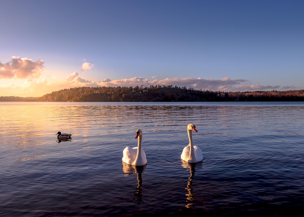
The “Blå vägen” gets its name because it follows the water: beyond Umeå the E12 runs alongside the Umeälven, then lakes line up like pearls on a string – Storuman, Gardiken, Överuman – until the road tips over into Norway beneath treeless summits. In between lies pine forest that seems never to end, a village with a petrol station, church and school bus, then thirty kilometres of nothing again. In the evening, from the sliding door, you look out on water lying so still that the fell range is doubled in it, and at eleven at night in June the sky is still light. Reindeer stand on the warm asphalt because there are fewer mosquitoes there. Church towns tell how settlers and Sami once came together here; on the Stekenjokk plateau the wind whistles over snowfields that linger into July. This route rewards those who drive slowly, refuel early and switch the engine off early in the evening.
Stage-by-stage plan
1Stage 1: Umeå to Vännäs (approx. 30 km)
- The drive
- A day in the city of Umeå, followed by a short drive: upriver out of town on the E12, past business parks, then through forest and fields to Vännäsby, where the Vindelälven flows into the Umeälven; Vännäs itself lies a few kilometres to the north. Well built, two lanes, partly with overtaking sections (2+1), half an hour’s driving.
- Highlights & must-sees
- Bildmuseet: Umeå University’s art museum in a striking wood-and-glass building on the Umeälven, with changing exhibitions of contemporary art and design on the Arts Campus by the river.
- Gammlia: a hill in the east of the city with the Västerbottens museum and an open-air museum of farmsteads, storehouses and a Sami section – a good introduction to the region you will cross over the coming days.
- The Väven cultural centre on the riverbank, built for the 2014 European Capital of Culture year: city library, exhibitions and the Kvinnohistoriskt museum (Museum of Women’s History). Holmön, one of the sunniest places in Sweden, out in the Gulf of Bothnia, is reached from Norrfjärden north of Umeå on Trafikverket’s free road ferry (Holmöleden, around 45 minutes’ crossing); vehicle spaces are scarce and are booked by phone, so it is better to leave the camper at the quay and cross on foot or by bike – check the timetable and booking with Trafikverket.
- CampingSpirit overnight tip
-
Official campsite or RV park: In Umeå itself, First Camp Nydala lies by the Nydalasjön swimming lake in the north-east of the city, close to the E4, with electricity, washrooms, fresh water and waste disposal, and open all year according to the operator. In Vännäs there is Vännäs Bad och Camping on the riverbank; check the season and facilities in advance, as smaller sites often close at the end of August.
Free camping or nature tip (where legal): In Umeå, staying overnight in a motorhome in public car parks is only possible where no sign prohibits overnight parking or camping – such bans are common along the riverbank and at the bathing spots, and car parks requiring a ticket are checked. In the city, a campsite is the more relaxed solution. In the countryside, municipalities and village associations offer small ställplatser; park4night and Campercontact show the current situation.
- Insider tip for campers
- Umeå is the last place on the route with a wide choice of supermarkets, garages, gas and camping supplies – stock up here on provisions, a spare cassette or insect repellent. The city centre is cramped and has many one-way streets; park the camper on the edge, for instance at Gammlia, and walk along the riverbank to Väven and Bildmuseet. A class 1 low-emission zone (miljözon) applies in the centre for heavy lorries and buses; in Sweden, motorhomes are usually classed as cars – with heavy vehicles, check the classification in the registration document and the rules with Transportstyrelsen.
2Stage 2: Vännäs to Lycksele (approx. 95 km)
- The drive
- Back onto the E12 and north-west along the Umeälven, which is dammed into reservoirs several times here. Long straights through conifer forest, gentle rises, small villages with a church and sawmill; timber lorries set the pace. Around 1.5 hours.
- Highlights & must-sees
- Vännäs: the railway junction where the line to Umeå branches off the main line through Norrland – the station shows how the railway made this place big in the first place.
- The confluence of the Vindelälven and Umeälven at Vännäsby: the Vindelälven is one of the few large Swedish rivers without hydroelectric dams.
- Gammplatsen in Lycksele: a peninsula on the Umeälven, about a kilometre from the centre, with a small nature reserve of periodically flooded pine forest, old buildings from southern Lapland, the Forest and Sami Museum (Skogs- och samemuseet) and an ethnobotanical garden with plants from Sami and settler tradition.
- CampingSpirit overnight tip
-
Official campsite or RV park: First Camp Ansia on the bank of the Umeälven in Lycksele: a large site with pitches with electricity, cabins, washrooms, fresh water and waste disposal, and a bathing spot. Busy in summer when the zoo is in season.
Free camping or nature tip (where legal): Gammplatsen is a nature reserve: tents, fires and dogs off the lead are prohibited there, and the large car park at the leisure area is for visiting, not for overnight stays. Along the E12 there are Trafikverket rest areas (rastplatser) where a night in a motorhome is tolerated as long as no sign forbids it – without chairs, awning or grey water on the ground.
- Insider tip for campers
- Lycksele Djurpark, by its own account the largest zoo in northern Sweden, shows Nordic species such as elk, bear, lynx, wolverine and reindeer – here you can see the animals you would rather not meet on the road. It is only fully open in summer; check opening times in advance. Fill up and shop in Lycksele: only small places follow until Storuman.
3Stage 3: Lycksele to Storuman (approx. 115 km)
- The drive
- On along the E12 north-west, the valley opens out and the lakes grow larger. Long, clear stretches through pine heath and bogs, little traffic, lots of reindeer between June and August. Just before Storuman the road crosses causeways and bridges to the long, narrow lake Storuman. Just under 1.5 hours.
- Highlights & must-sees
- Utsikten in Storuman: a viewpoint with a tower on the hill above the town, looking out over lake Storuman and, on clear days, as far as the first fells to the west.
- Järnvägshotellet on Stationsgatan: the former railway hotel built of brown-tarred logs, designed by SJ’s chief architect Folke Zettervall in the National Romantic style, with decorative paintings by Elis Tallmo. In 1979 it was converted into a library; the dining rooms, staircase and corridors have been largely preserved.
- The junction of the E12 with the Inlandsvägen (E45) in Storuman: to the north it leads via Sorsele and Arvidsjaur into Lapland – this route is described in the CampingSpirit travel guide on the Inlandsvägen through Swedish Lapland to Abisko.
- CampingSpirit overnight tip
-
Official campsite or RV park: Storumans Bad och Camping on the lakeshore, a few minutes from the centre: electric hook-ups, washrooms, cabins, bathing spot, fresh water and waste disposal. On the opposite shore lies Avasund Fiske & Camp, quieter and geared towards anglers; check the season of each in advance.
Free camping or nature tip (where legal): Around lake Storuman there are bathing spots and boat landings with car parks; many are intended for day visitors and carry overnight parking bans. Where there is no sign and you are not disturbing anyone, a night in the vehicle is generally not a problem – but not on private land or on forest roads behind barriers. Driving a vehicle off-road or onto the beach is prohibited by the Off-Road Driving Act.
- Insider tip for campers
- Storuman is the last place with full services before the fells: supermarkets, Systembolaget, several petrol stations. The E12 up to Tärnaby has only a few petrol stations – fill up. If you are considering a detour to Sorsele: it lies a good 70 kilometres north on the E45, with the Vindelälven right by the town.
4Stage 4: Storuman to Hemavan (via Tärnaby) (approx. 143 km)
- The drive
- The most impressive section of the E12: along lake Storuman to Slussfors, then following the lakes Gardiken and Gäutan. The fells draw closer, the forest thins out, bright with birch. Beyond Tärnaby the valley opens up beneath Laxfjället, until Hemavan sits at the tree line. About two hours’ pure driving, but plenty of photo stops; reindeer on the road are the rule here.
- Highlights & must-sees
- Tärnaby: a ski resort looking out over the Gäutan, home of several world ski champions. At Samegården you can learn more about Sami culture in southern Lapland.
- Fjällbotaniska trädgården in Hemavan: one of the world’s northernmost alpine botanical gardens, at around 600 metres, a good 100 metres below the tree line. In summer, mountain flowers bloom here, including the orchid Brudkulla (Gymnadenia runei), found only in this area; a loop path of around 400 metres leads through the garden.
- Start of the Kungsleden in Hemavan: Sweden’s best-known long-distance trail begins here on its way of more than 400 kilometres to Abisko. A day’s walk up into the Vindelfjällen nature reserve, one of the largest protected areas in Europe, is enough to get a feel for it; Naturum Vindelfjällen in Hemavan provides information on trails, weather and reindeer herding.
- CampingSpirit overnight tip
-
Official campsite or RV park: Tärnaby Camping on the edge of the village with electricity, washrooms and cabins; in Hemavan there is a paid motorhome area at the gondola’s valley station with water and toilets in the service building; according to the operator there is no electricity for motorhomes there. Check the season, prices and access before you arrive, and arrive early in high summer and on hiking weekends.
Free camping or nature tip (where legal): Above Hemavan the Vindelfjällen nature reserve begins, with its own rules shown on the boards at the car parks; driving off the roads is prohibited. At trailhead car parks with a “camping förbjuden” sign, this also applies to motorhomes. On the E12 between Tärnaby and the Norwegian border there are a few rest areas where overnight stays without camping behaviour are tolerated, as long as no ban is posted.
- Insider tip for campers
- If you are setting off on the Kungsleden, park at the designated trailhead car parks and leave details of your route; even in July the weather can turn to sleet. The border with Norway (Umbukta) is only a good 20 kilometres beyond Hemavan; if you carry on to Mo i Rana, you will need an account for the electronic tolls in Norway. Buy food for the next few days in Tärnaby and Hemavan.
5Stage 5: Hemavan to Vilhelmina (via Storuman) (approx. 213 km)
- The drive
- The only longer return leg of the tour: the E12 back to Storuman – in the opposite direction, with completely different light on the lakes – then south on the Inlandsvägen (E45) through forest and past lakes to Vilhelmina. Well built, long straights, hardly any villages. Around three hours’ pure driving; start early and take a break in Storuman.
- Highlights & must-sees
- Morning light over the Gäutan and the Gardiken: on the return drive you have the sun behind you if you set off early.
- Kyrkstaden in Vilhelmina: rows of small red wooden cottages around the church, where the inhabitants of the widely scattered villages used to stay overnight on church Sundays and market days. Some are now rented out as simple accommodation, the rest is lived-in cultural heritage – keep quiet.
- Volgsjön: the lake on the edge of town with a lakeside path and bathing spot.
- CampingSpirit overnight tip
-
Official campsite or RV park: Saiva Camping & Stugby on the Volgsjön in Vilhelmina: pitches with electricity, washrooms, cabins, fresh water and waste disposal, bathing beach. A good base before the Vildmarksvägen begins; check the season in advance.
Free camping or nature tip (where legal): In Vilhelmina itself, many car parks in the centre are time-limited; please do not stay overnight at the church town, which is a place of residence and remembrance. Rest areas along the E45 are the obvious alternative – observe the signs and do not put out furniture.
- Insider tip for campers
- Take care of everything for the Vildmarksvägen in Vilhelmina: fill up, top up water, empty the cassette and grey water, buy food and, if needed, visit Systembolaget. On the route into the fells there are only a few shops and petrol stations, and mobile coverage can drop out in the valleys – download an offline map.
6Stage 6: Vilhelmina to Saxnäs (approx. 120 km)
- The drive
- North-west on the Vildmarksvägen into the fell country of southern Lapland: first through forest and along lakes, then increasingly hilly, until the Marsfjällen massif appears above the Kultsjön. Two lanes, but narrower than the E12, with crests, blind bends and reindeer on the road. Around two hours.
- Highlights & must-sees
- First views of the Marsfjällen: the massif with the Marsfjällen nature reserve above the Kultsjön.
- Saxnäs: a small fell village on a spit of land between the Kultsjön and the Marsjön, a starting point for hikes and fishing trips.
- Shoreline paths along the Kultsjön with views north to the mountains, especially in the evening light.
- CampingSpirit overnight tip
-
Official campsite or RV park: Saxnäs Fjällcamping in the village: pitches with electricity, washrooms, cabins; check the season and facilities in advance, and book in high summer. As an alternative near the church town there is Fatmomakke Naturcamping, simpler and quieter.
Free camping or nature tip (where legal): The municipalities along the Vildmarksvägen state explicitly in their brochure that wild camping with a motorhome, caravan or roof tent is not permitted: stay on roads, rest areas and permitted car parks. Emptying chemical toilets in the countryside is strictly prohibited. Checks are rare, but the region lives on visitors who respect this.
- Insider tip for campers
- In the holiday season, a lot of motorhomes and motorcycles converge on the Vildmarksvägen; the rest areas at viewpoints fill up quickly in the evening. So plan on a campsite and use the rest areas for breaks. During fire bans in dry summers, even a gas stove outdoors is a sensitive matter – follow the Länsstyrelse’s notices.
7Stage 7: Saxnäs to Saxnäs (via Fatmomakke and Stekenjokk) (approx. 140 km)
- The drive
- A day trip without moving camp: first along a minor road through Kultsjödalen to the church town of Fatmomakke (largely asphalted in 2025), then west on the Vildmarksvägen via Klimpfjäll up onto the Stekenjokk plateau, crossed by Sweden’s highest paved road; the highest point is at 876 metres. At the top it is treeless, windy and cool, with snowfields into the summer; marker posts instead of crash barriers. The road is only open in the summer half of the year – usually from early June to mid-October, depending on snow and weather; in winter the section over the plateau is closed. Back the same way. A full day.
- Highlights & must-sees
- Fatmomakke: a Sami church town on the Kultsjön with a church, church cottages and traditional kåtor (turf huts), still a meeting place for the Sami community at church festivals in summer. A hiking trail leads from here towards the Marsfjällen.
- Trappstegsforsen: rapids that drop over broad rock steps like a staircase, with a car park right by the road and a summer café.
- Stekenjokk: a wide fell plateau between Västerbotten and Jämtland, remains of the Stekenjokk mine, which produced ore until the 1980s, reindeer herds and, on clear days, views as far as the Norwegian mountains.
- CampingSpirit overnight tip
-
Official campsite or RV park: Second night in Saxnäs. If you would rather move on, in Klimpfjäll you will find Klimpfjällscampingen, a small site beneath the fell; check facilities and season in advance.
Free camping or nature tip (where legal): On the Stekenjokk plateau there are car parks that invite you to get out and walk. During the calving and nesting season, usually from early June to mid-July, a stopping and parking ban applies along about five kilometres of road on the Västerbotten side – parking is then only allowed at the Stekenjokk and Tjåkkola car parks – and the Skåarnja bird protection area may not be entered away from the road and car parks; the notices are posted on site. The rule there: stay in the car park, keep your distance from reindeer, keep dogs on a lead. The Vildmarksvägen brochure prohibits wild camping with a motorhome here too.
- Insider tip for campers
- On the plateau it can be below ten degrees and foggy even in July; keep a jacket, hat and gloves to hand. Reindeer belong to reindeer herders and often cross the road in groups: stop, wait, do not sound the horn, do not drive between the animals. Fatmomakke is not a museum but a place in use – do not enter the kåtor, and photograph people only after asking. Continuing on the Vildmarksvägen via Stora Blåsjön and Gäddede to Strömsund in Jämtland is an option for travellers with more time.
8Stage 8: Saxnäs to Åsele (via Vilhelmina) (approx. 195 km)
- The drive
- Back to Vilhelmina on the Vildmarksvägen, then south-east on country roads through forest and lake country to Åsele on the Ångermanälven. Quiet, well-built roads with little traffic, but lots of wildlife crossing, especially at dusk. Around three hours.
- Highlights & must-sees
- A second stop in Vilhelmina for the church town in the morning, before anyone is about.
- Åsele: a small town on river and lake, with a church and local history museum, known for its summer market – a quiet finishing point inland.
- The expanse of the Ångermanälven valley beyond Åsele: forest lakes and timber-floating history.
- CampingSpirit overnight tip
-
Official campsite or RV park: Åsele Camping on the edge of town with electric hook-ups, washrooms and a bathing spot; check the season in advance, as many inland sites close early in autumn.
Free camping or nature tip (where legal): As along the whole route: overnight stays at rest areas without a ban sign are possible, camping behaviour is not. Forest roads are often private roads; respect barriers and signs (“enskild väg”, “privat”).
- Insider tip for campers
- From Åsele it is still around 170 kilometres on country roads to Örnsköldsvik on the coast – there you link up with the Höga Kusten, described in the CampingSpirit travel guide through Dalarna and Hälsingland to the Höga Kusten. The road back to Umeå runs via Bjurholm. Plan to drive in daylight: at dusk and at night the risk of a collision with an elk rises sharply.
Camping practice & local rules
Wild camping & overnight parking
- The right of public access (allemansrätten) allows hiking, picking berries and mushrooms, and pitching a tent for one or two nights away from houses. It is not a right to camp with a vehicle: motorhomes are subject to the traffic rules. You can stay overnight where parking is permitted and no sign prohibits camping or overnight parking, and at rest areas, which are often limited to 24 hours.
- Limits: on private land only with the owner’s permission; driving off-road or onto beaches is prohibited under the Off-Road Driving Act, and private forest roads may be closed. Chairs, a table, an awning and grey water on the ground count as camping behaviour and belong on campsites and motorhome pitches.
- Nature reserves such as Vindelfjällen, Marsfjällen and Gammplatsen have their own regulations (bans on tents, fires or driving, dogs on leads), shown on the boards at the entrances and available from the Länsstyrelse Västerbotten. Along the Vildmarksvägen, the municipalities point out that wild camping with a motorhome, caravan or roof tent is not permitted.
- Sami culture: reindeer pastures, calving grounds, kåtor and church towns such as Fatmomakke are places in use, not camping grounds. Keep your distance from herds, close gates, do not drive between the animals, and photograph people only after asking. Handicrafts bearing the Duodji mark are of Sami origin.
- Fire: in dry summers the Länsstyrelse and municipalities impose fire bans (eldningsförbud), which can also cover disposable barbecues. Useful tools: park4night, Campercontact, and Naturkartan for hiking trails and reserves.
Waste disposal & supplies
- Fresh water and waste disposal: campsites and many ställplatser have fresh water, a grey-water drain and cassette emptying (latrintömning); passing travellers can often use the station for a fee. Emptying chemical toilets in the countryside is prohibited, and this is stressed explicitly along the Vildmarksvägen.
- Tap water is good everywhere. Stream water in the fells looks clear but should be boiled or filtered. From September, smaller sites and rest areas turn off their water taps.
- Fuel: between Storuman and Tärnaby, on the Vildmarksvägen and between Vilhelmina and Åsele there are long stretches without a petrol station; many stations are unmanned card machines that do not accept every foreign card. Refill at half a tank at the latest, and always fill up in Lycksele, Storuman and Vilhelmina.
- Gas: Swedish Gasol cylinders run on their own deposit systems with different connections, German exchange cylinders are not swapped, and autogas (LPG) is hard to find in Västerbotten. Arrive with full cylinders or use a refillable tank cylinder and look up the few refilling points in advance.
- Shopping: wine, spirits and beer over 3.5 per cent only at Systembolaget, in larger towns such as Umeå, Lycksele, Storuman and Vilhelmina; closed on Sundays. Supermarkets in fell villages have shorter opening hours, in autumn sometimes only a few days a week.
Vehicle size & traffic rules
- Speed limits: motorhomes up to 3.5 t follow the signs (usually 40–50 km/h in built-up areas, 70–100 km/h on country roads, 100 km/h on some sections of the E12). Separate maximum speeds above 3.5 t exist only for heavy lorries (80 km/h, 90 km/h on motorways and expressways) and buses; for heavy motorhomes the classification in the registration document is decisive – if in doubt, 80 km/h. Vehicle combinations with a braked trailer at most 80 km/h. According to the published text, the trailer rule in the Trafikförordning, revised with effect from 1 December 2026, keeps 80 km/h for car and motorhome combinations; check the current position for later trips.
- Wildlife crossings: elk mainly at dusk and at night, reindeer at any time of day, in summer often on the asphalt. Slow down where reindeer are standing, and do not sound the horn. A collision with an elk, reindeer, deer, bear, wolf or other large wild animal must be reported to the police and the accident site marked – 112 if anyone is injured, otherwise 114 14.
- Dipped headlights are compulsory during the day too, the blood alcohol limit is 0.2, and using a hand-held mobile phone while driving is prohibited. Carry a warning triangle and a high-visibility vest.
- Dimensions: width up to 2.60 m, length 12 m for single vehicles; there is no general height limit, and low bridges and underpasses are signposted. Sweden has no vignette and no road tolls on this route; if you cross into Norway (Umbukta), the electronic tolls apply there.
- Winter and season: from 1 December to 31 March, winter tyres are compulsory in wintry conditions; in the fells, snow and ice often arrive as early as October. The section of the Vildmarksvägen over Stekenjokk is closed in winter and usually open from early June to mid-October.
- Light: the route lies south of the Arctic Circle – there is no true midnight sun, but in June it stays light all night. In December, conversely, it is light for only a few hours, though you will not experience a polar night here as you would further north. Mosquitoes, blackflies (knott) and horseflies are at their worst from mid-June to early August.
CampingSpirit packing & preparation checklist
- Mosquito head nets and fly screens for the door and roof hatch – in June and July, mosquitoes and blackflies are so dense by the lakes and in the fells that evenings without a net are hardly possible.
- Blackout blinds or sleep masks – in the light summer nights it barely gets dark, and sleep suffers.
- A refillable tank cylinder with the right adapters, or two full gas cylinders – German exchange cylinders are not swapped, and autogas is hard to find in Västerbotten.
- A warm layer, hat and gloves within reach in the cab – on Stekenjokk and at the tree line near Hemavan the weather changes in minutes.
- Binoculars for reindeer herds, elk at the forest edge and rough-legged buzzards over the fells – watch from a distance instead of getting out and going closer.
- Offline maps and a second payment card – mobile coverage drops out in the valleys, and unmanned fuel machines reject some cards.
As of 2026-10. Closures, fees and booking rules change: check official sources before you go.