

In-depth guide · CampingSpirit
From the colourful concrete blocks in Llanes harbour via dinosaur tracks, cider lanes and capes to the pebble beach below the cliffs of Castañeras: a good 300 kilometres of coast in short stages, where the tide table and where you can park matter more than driving time.
The spirit of the route
The Asturian coast is not a place for covering kilometres but for changes in the weather. In the morning orbayu, the fine drizzle, hangs over the pastures; at midday the north-easterly wind tears the sky open; and in the evening the limestone cliffs glow copper above a sea that is rarely completely calm. From the sliding door you see cows on meadows that run right up to the cliff edge, and behind them, in the distance, the grey peaks of the Cantabrian Mountains. Near Pría the sea hisses up into the air through rock chimneys, at Gulpiyuri a beach lies in the middle of a meadow, and in Lastres and Cudillero the houses are stacked above the harbours. In between it smells of apple pulp and grilled fish, and in the sidrerías the cider splashes into the glass from arm’s height. This route rewards those who drive short distances, park early, wait for high tide and walk to the sidrería in the evening.
Stage-by-stage plan
1Stage 1: Llanes to Garaña de Pría via Gulpiyuri (approx. 25 km)
- The drive
- From Llanes west on the N-634, parallel to the A-8 autovía, via Posada de Llanes and Naves; the detours to the coast follow narrow municipal lanes between stone walls and pastures, with oncoming traffic only at passing places. Pure driving time under an hour, half a day with walks.
- Highlights & must-sees
- Cubos de la Memoria: Agustín Ibarrola painted the concrete blocks of the Llanes harbour breakwater in bright colours; the best view of the ensemble is from above on the Paseo de San Pedro.
- Paseo de San Pedro: the grassy clifftop path above the Sablón beach, with benches and a view east along the coast.
- Playa de Gulpiyuri near Naves: a tiny beach some 100 m inland in a sinkhole, fed by the sea through an underground passage; most impressive at high tide, protected as a Monumento Natural.
- CampingSpirit overnight tip
-
Official campsite or RV park: Camping Palacio de Garaña near Garaña de Pría is only a few kilometres from the bufones, with pitches on grass, electric hook-ups and sanitary facilities; check season and vehicle length in advance. If you want to stay in Llanes: the Área de Llanes on the edge of town (just under 20 places, water and waste disposal, fee payable) or campsites at the beaches east and west of town, such as Playa de Troenzo in Celorio.
Free camping or nature tip (where legal): The coast between Llanes and Ribadesella is earmarked as the Paisaje Protegido de la Costa Oriental de Asturias (not yet formally designated); Gulpiyuri and the Bufones de Pría are protected as a Monumento Natural. Overnight stays on the beach and clifftop car parks are not permitted there, and many access roads are signposted against motorhomes or fitted with height barriers. Spend the night at áreas and campsites.
- Insider tip for campers
- The old town of Llanes is narrow and clogged in summer: leave the camper at the área or the parking areas on the edge of town – the harbour is a few minutes’ walk away. At Playa de Gulpiyuri there are only small parking areas on the access road near Naves, after which you continue on foot – in July and August you will only find space with a motorhome early in the morning; otherwise park on the edge of the village.
2Stage 2: Garaña de Pría to Ribadesella via the Bufones de Pría (approx. 20 km)
- The drive
- Short stage: from Garaña via Llames de Pría to the coastal plateau, back onto the N-634 and across the Sella to Ribadesella. The access roads to the coast are single-track, and the centre of Ribadesella has narrow one-way streets; the bridge over the Sella estuary links the old town with Santa Marina beach. Driving time under an hour.
- Highlights & must-sees
- Bufones de Pría: with a strong swell and high tide the sea forces spray up through the karst chimneys, often 20 metres high or more, accompanied by a hissing you can hear from far away. When the sea is calm, all stays quiet.
- Cueva de Tito Bustillo in Ribadesella: a cave with Palaeolithic paintings, part of the UNESCO World Heritage site of cave art in northern Spain; next to it the Centro de Arte Rupestre with an exhibition.
- Paseo de la Grúa at Ribadesella harbour, with ceramic panels by Antonio Mingote on the history of Asturias and a view of the Sella estuary.
- CampingSpirit overnight tip
-
Official campsite or RV park: The Área de Autocaravanas de Ribadesella is small (around five places, water and waste disposal) and fills up early in summer. Camping Ribadesella on the western edge of town above the centre offers more space, with electricity, sanitary facilities and a pool; Camping Playa de Vega lies at Vega beach west of town. Check season and reservations in advance.
Free camping or nature tip (where legal): At the bufones: park during the day, no overnight stays. The cliff edge is unsecured, the karst ground at the rim is crumbly, and stones can be hurled out of the chimneys – stay on the marked paths, never step up to the holes and do not go beyond the barriers. In Ribadesella, waterfront roads and beach car parks have time limits in summer; the municipality directs motorhomes to the área and campsites.
- Insider tip for campers
- Plan the bufones with a tide table and wave forecast: only high tide combined with a heavy sea brings the spectacle, most reliably in autumn and winter; in high summer, with a calm sea, often just a snort. The access via Llames de Pría is tight for large motorhomes – park in the designated areas by the village and walk to the cliffs on the waymarked PR AS-57 trail. The Tito Bustillo cave opens only seasonally and not on every day of the week, and the number of visitors per day is limited: check dates on the official website and book early. Around the Sella canoe descent at the beginning of August Ribadesella is packed – avoid the area or book well in advance. The Picos de Europa, Covadonga and the lakes are only half an hour inland; they are covered by the CampingSpirit travel guide to Green Spain with Cantabria, Asturias and the Picos de Europa.
3Stage 3: Ribadesella to Lastres (Colunga) (approx. 40 km)
- The drive
- West on the N-632 via Caravia, with views of the Sierra del Sueve; optionally from Colunga up the winding AS-260 to the Mirador del Fitu and back (around 25 km in total, many hairpins, hard work for large motorhomes). Then across the Rasa de San Telmo to the MUJA and down to Lastres. A good hour of pure driving time, more with the Fitu.
- Highlights & must-sees
- MUJA, the Jurassic Museum of Asturias near Colunga: a building in the shape of a dinosaur footprint with skeletons and finds from the “Dinosaur Coast”, large car park also suitable for motorhomes.
- Playa de La Griega in Colunga: on the rocky edge at the eastern end of the beach, large sauropod footprints, best seen at low tide.
- Lastres: fishing village on a steep slope with the church of Santa María de Sádaba and the Mirador de San Roque above the village; views of the harbour and the Sueve.
- CampingSpirit overnight tip
-
Official campsite or RV park: The Área de Autocaravanas de Colunga is in the town and offers water and waste disposal; there are several campsites near Lastres and at the beaches around Colunga, such as Camping Costa Verde near Playa de La Griega. Further east in Caravia, Camping Arenal de Moris sits above a beach. Check electricity, sanitary facilities and season in advance.
Free camping or nature tip (where legal): The parking areas at Playa de La Griega and the MUJA can be used during the day; overnight stays on beach car parks are not tolerated on this stretch of coast, and the car park at the Mirador del Fitu is small and not meant for a night.
- Insider tip for campers
- Do not drive your motorhome down into the centre of Lastres: the lanes are steep and narrow and end at the harbour with no good turning space. Park at the top on the edge of the village and walk down. The MUJA’s opening hours change with the season, and outside summer it is closed on some days – check the official website beforehand.
4Stage 4: Lastres to Villaviciosa via Tazones (approx. 35 km)
- The drive
- Continue west on the N-632 via Venta del Pobre to the Ría de Villaviciosa, then on the narrow road along the eastern shore of the ría to Tazones and back to Villaviciosa. Little room on the eastern shore for passing lorries; driving time around an hour.
- Highlights & must-sees
- Tazones: small harbour village at the mouth of the ría where, according to tradition, the young Charles I (Emperor Charles V) first set foot on Spanish soil in 1517; houses decorated with shells in the San Miguel quarter.
- Reserva Natural de la Ría de Villaviciosa: mudflats and salt meadows with herons, spoonbills and migratory birds in autumn, observation points along the shore.
- San Salvador de Valdediós, “El Conventín”: pre-Romanesque church from the late 9th century in a quiet valley a good 10 km south of Villaviciosa, next to the Cistercian monastery of Santa María.
- CampingSpirit overnight tip
-
Official campsite or RV park: The Área de Aparcamiento y Servicios para Autocaravanas de Villaviciosa is on the edge of town, with room for around eight vehicles, water and waste disposal – you can walk to the sidrerías without having to drive afterwards. There are campsites at the mouth of the ría near Rodiles and in the surrounding area, such as Camping Villaviciosa. Check the season in advance.
Free camping or nature tip (where legal): The car park at Playa de Rodiles lies within the ría nature reserve and is not meant for motorhomes at night; in Tazones there are only a few parking areas at the village entrance. For the night, use the área in Villaviciosa.
- Insider tip for campers
- Villaviciosa is the capital of the “Comarca de la Sidra”, and Asturian cider culture has been on UNESCO’s Intangible Cultural Heritage list since 2024. In the sidrería the waiter (“escanciador”) pours only a mouthful (“culín”) from arm’s height – drink it straight away, tip the rest onto the floor and hand the glass back. The El Gaitero cider works in Villaviciosa offers guided tours; check times and booking in advance. With a large motorhome, drive to Tazones in the morning, before the day-trippers arrive.
5Stage 5: Villaviciosa to Candás via Gijón (approx. 55 km)
- The drive
- Via the N-632 or the A-8 to Gijón, briefly into the city (seafront road along San Lorenzo beach, multi-storey car parks with height restrictions), then west out of the city through the port and industrial zone of El Musel and on country roads to Candás. City traffic in Gijón is slow, otherwise straightforward; driving time around 1.5 hours.
- Highlights & must-sees
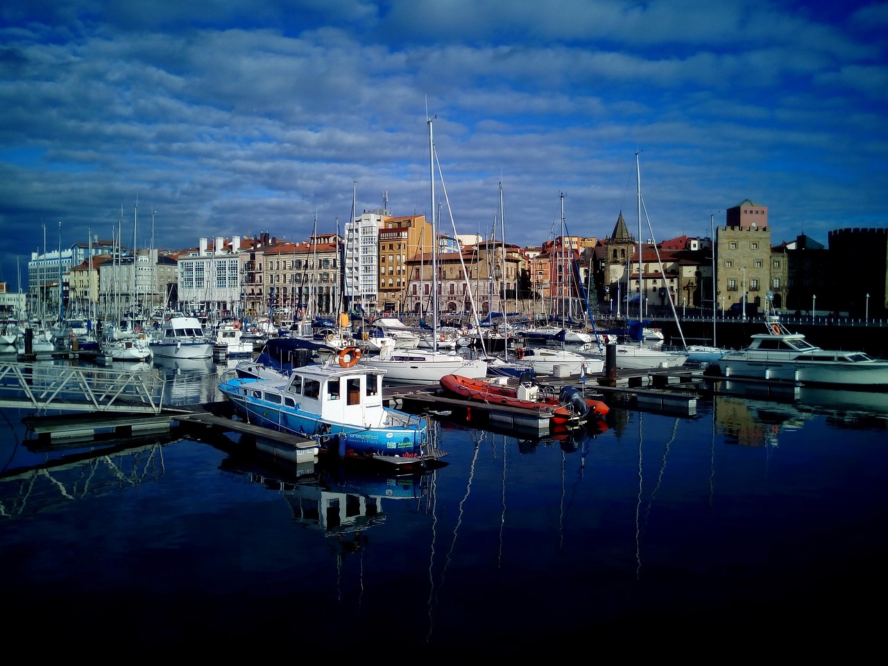
- Cimadevilla: Gijón’s old fishing quarter on the headland between harbour and beach, with sidrerías and narrow lanes.
- “Elogio del Horizonte” by Eduardo Chillida on the Cerro de Santa Catalina above Cimadevilla – beneath the concrete sculpture the wind roars like in a seashell.
- Candás: harbour town with a seafront promenade and Cape San Antonio, from where the view across the bay reaches as far as Gijón.
- CampingSpirit overnight tip
-
Official campsite or RV park: In Gijón the Área de autocaravanas is at El Arbeyal beach west of the centre (just under 20 places, water and waste disposal), with a shoreline path into the city. In Candás the Área de La Fuente de los Ángeles offers a few places with water and waste disposal; campsites in the area include Camping Buenavista near Perán. Check the current situation in advance.
Free camping or nature tip (where legal): Gijón and the neighbouring municipalities rely on their áreas; overnight stays on the seafront road and in beach car parks are not permitted and are checked in summer. Under Real Decreto 518/2026 a correctly parked motorhome may not be penalised solely because of its type, but time limits, parking zones and beach rules still apply.
- Insider tip for campers
- Only visit Gijón briefly: the El Arbeyal área is the most practical base, from where you can walk or take the city bus to Cimadevilla. As larger cities, Gijón and Avilés must set up low-emission zones (ZBE); Gijón has adopted an ordinance for the La Calzada district that applies only during air-pollution episodes, while in Avilés the ordinance is still going through the process. Fines will only be imposed in both cities in a few years – check the current status on the cities’ websites beforehand. The large supermarkets on the outskirts have car parks without height barriers – good for a big shop before the capes.
6Stage 6: Candás to Salinas via Luanco and Cabo Peñas (approx. 45 km)
- The drive
- From Candás on the coast road to Luanco, then on narrow country roads through pastureland north to the lighthouse at Cabo Peñas; back via Verdicio and the dunes on the western side of the cape to Avilés and on to Salinas. Winding, many cyclists, few passing places; around 1.5 hours.
- Highlights & must-sees
- Museo Marítimo de Asturias in Luanco: ship models, whaling and fishing on this coast.
- Cabo Peñas: lighthouse with an exhibition room about the sea, boardwalks along the cliff edge and views of the islands of La Erbosa and Sabín; Paisaje Protegido del Cabo Peñas.
- Playa de Verdicio: wide beach with dunes and surf waves on the western side of the cape.
- CampingSpirit overnight tip
-
Official campsite or RV park: In Salinas the Área de autocaravanas El Agüil (a few places, water and waste disposal) is close to the beach and the Museo de Anclas; Avilés and Corvera offer further áreas. Campsites on the cape include Camping El Molino near Bañugues.
Free camping or nature tip (where legal): In the Paisaje Protegido del Cabo Peñas overnight stays in vehicles are not permitted; the car park at the lighthouse is for daytime visitors. The Verdicio dunes are protected – do not drive on them, and walk only on boardwalks and paths.
- Insider tip for campers
- In a north-easterly or north-westerly wind it blows so hard on the cape that you should not open the sliding door or awning; hold doors with both hands. The lighthouse car park is small: come early in the day or late in the afternoon. Best to fill up with water and empty waste before the cape in Candás or afterwards in Salinas.
7Stage 7: Salinas to Cudillero via Avilés (approx. 30 km)
- The drive
- Briefly back to Avilés for a look around the town, then on the A-8 or N-632 across the bridge over the Nalón estuary near Muros de Nalón and down to Cudillero. From the main road a steep, winding access road leads into the village’s valley; driving time around 45 minutes without the town visit.
- Highlights & must-sees
- Centro Niemeyer in Avilés: Oscar Niemeyer’s white cultural centre on the ría with a dome, tower and open square; at its best in the evening light.
- Old town of Avilés: the arcaded Calle Galiana and the Sabugo quarter with squares and a market hall.
- Museo de Anclas Philippe Cousteau in Salinas: open-air collection of old anchors on the La Peñona headland.
- CampingSpirit overnight tip
-
Official campsite or RV park: On the edge of Cudillero the small Área de autocaravanas Avia-Cudillero offers a few places, according to users with electric hook-ups. Campsites in the area include L’Amuravela near the village of El Pito above Cudillero and WeCamp Cudillero to the east. Check facilities and season in advance.
Free camping or nature tip (where legal): The harbour area of Cudillero is off-limits at night; the municipality directs you to the área and campsites. On the coast between Avilés and Cudillero, beach car parks are often signposted against motorhomes; do not count on them for the night.
- Insider tip for campers
- In Cudillero do not drive the camper down to the harbour: the access road ends in the narrow village centre. Park at the top instead and take the stepped paths to the miradores above the rooftops – from the path to the lighthouse you look down on the amphitheatre of houses. Avilés is best in the morning, after which the car parks along the ría are full; motorhomes find more space on the edge of the old town than in the centre.
8Stage 8: Cudillero to Luarca via Cabo Vidío and Playa del Silencio (approx. 55 km)
- The drive
- West on the N-632 via Soto de Luiña, turning off via Oviñana to Cabo Vidío, back and on to the turn-off to Castañeras for Playa del Silencio; then via Cadavedo to Luarca. The dead-end roads to the cape and the beach are narrow, without centre lines and with little room to turn. Around 1.5 hours of pure driving time.
- Highlights & must-sees
- Cabo Vidío: lighthouse on an almost vertical cliff, with views west along the rugged coast to the bay of Castañeras.
- Playa del Silencio (Gavieiro): pebble cove in a ring of rock with offshore islets; from the car park at the viewpoint a steep path with stone steps leads down in 10 to 15 minutes, no facilities.
- Cadavedo: clifftop village with the La Regalina chapel on the headland and views of the coast to the east.
- CampingSpirit overnight tip
-
Official campsite or RV park: In Luarca there is Camping Los Cantiles on the cliff east of town and Camping Playa de Taurán to the west, both with electricity and sanitary facilities; plus the municipal Área de autocaravanas by the river. On the way, Camping La Regalina in Cadavedo offers a smaller site. Check the season in advance.
Free camping or nature tip (where legal): Playa del Silencio lies on a protected stretch of coast; there are no overnight stays at the Castañeras car park, and dogs are banned from the beach during the bathing season (usually June to September). At Cabo Vidío the parking area is small and intended for visits only.
- Insider tip for campers
- The car park at Playa del Silencio is full by mid-morning in July and August; extra areas nearby are opened in some summers, but not reliably. With a large motorhome, come outside the high season or early in the morning. Bring water and sturdy shoes: the beach is made of coarse pebbles. How the route continues west of Luarca to Ribadeo and into Galicia is covered by the CampingSpirit travel guides to Green Spain and to Galicia.
Camping practice & local rules
Wild camping & overnight parking
- The basic Spanish principle: sleeping in a legally parked vehicle is allowed, but camping with anything that extends beyond the vehicle’s outline is not. Since 1 October 2026 Real Decreto 518/2026 (new Art. 92.4 of the Reglamento General de Circulación) explicitly defines when a motorhome is correctly parked: no parts extending beyond the vehicle’s outline, resting only on its tyres (levelling chocks allowed), no discharge of liquids. Municipalities may still regulate parking times, zones and maximum stays, but according to the DGT may not penalise solely because of the vehicle type; rules for protected areas and coasts apply regardless.
- The Asturian coast is densely covered with protected areas: the Paisaje Protegido del Cabo Peñas, the Reserva Natural of the Ría de Villaviciosa and Monumentos Naturales such as the Bufones de Pría and Playa de Gulpiyuri; further stretches such as the Costa Oriental around Llanes and Ribadesella are earmarked as Paisaje Protegido. In the protected areas overnight stays in vehicles are not permitted and camping is prohibited.
- Coastal law (Ley de Costas): camping is prohibited in the protection strip behind the beach. Many beach and clifftop car parks between Llanes and Luarca have no-motorhome signs or height barriers of around 2 m; implementation of the new Real Decreto on the ground may take time – observe the signs.
- You can stay overnight legally at campsites and in the many municipal áreas de autocaravanas; Turismo Asturias lists them on its website. Useful apps: park4night, Campercontact; user comments on fees and closures are often more up to date than directories, but not always reliable.
Waste disposal & supplies
- Asturian áreas are mostly small (4 to 20 places), often free or inexpensive, some with coin-operated water machines; only a few offer electricity. In summer they are full by midday, and in winter the water is turned off at some service points.
- Empty grey water and cassettes only at service points – under Real Decreto 518/2026, discharging in car parks is explicitly a criterion for incorrect parking. Tap water is drinkable; at village fountains look out for “agua no potable”.
- Gas: foreign cylinders are not exchanged in Spain; Spanish butane and propane cylinders are only available with a contract and deposit. Fill refillable cylinders or gas tanks at GLP (LPG) filling stations in and around Gijón, Avilés and Oviedo – check locations in advance in an autogas app and carry adapters.
- Supermarkets with large car parks without height restrictions are on the outskirts of Llanes, Ribadesella, Villaviciosa, Gijón and Avilés; in the fishing villages themselves there are only small shops.
Vehicle size & traffic rules
- Speed limits: motorhomes up to 3.5 t 120 km/h on autovías and autopistas, 90 km/h on country roads; over 3.5 t and vehicle combinations 90 km/h on motorways and 80 km/h on country roads. 50 km/h in built-up areas, 30 km/h on roads with only one lane in each direction.
- The Autovía del Cantábrico (A-8) is toll-free in Asturias. If you arrive via León, you take the tolled AP-66 (Huerna) or the toll-free Pajares Pass (N-630), whose hairpins are demanding in fog and snow.
- Low-emission zones (ZBE): as cities with more than 50,000 inhabitants, Gijón, Avilés and Oviedo must set up Zonas de Bajas Emisiones. In Gijón (La Calzada) and Avilés no penalties are imposed yet; check boundaries, sticker requirements and the start of enforcement on the cities’ websites before you travel.
- Alcohol: 0.5 g/l in the blood (0.25 mg/l in breath), 0.3 g/l for novice drivers – do not drive after an evening of sidra. Mobile phones at the wheel only with a hands-free system.
- Mark projecting loads, such as bikes on a rear rack, with the V-20 warning panel; number plates and lights must not be obscured. According to the DGT, foreign vehicles still meet the warning requirement with warning triangles and a high-visibility vest.
CampingSpirit packing & preparation checklist
- Levelling chocks: the áreas on the coast are often sloping, and since Real Decreto 518/2026 chocks are explicitly allowed, whereas levelling jacks on public land are not.
- Tide and wave app: the Bufones de Pría, Gulpiyuri and the dinosaur tracks at La Griega all depend on the water level and swell.
- Rain jacket and umbrella: orbayu comes even in August, and in a north wind it is cool on the capes.
- Sturdy shoes with good tread for the stone steps down to Playa del Silencio, the wet clifftop paths at the bufones and the pebble beaches.
- Small change in coins for water machines at the áreas and parking meters in the fishing villages.
- A foldable cool bag for sidra bottles, cheese and fish from the market – the fridge in the camper fills up quickly.
As of 2026-10. Closures, fees and booking rules change: check official sources before you go.