

In-depth guide · CampingSpirit
From Missoula through the Bitterroot Valley over Lost Trail Pass into the Big Hole, on to Bannack, along the Pioneer Mountains Scenic Byway, past Georgetown Lake to Philipsburg and over gravel to the ghost town of Garnet: around 860 kilometres of south-west Montana away from the big national parks.
The spirit of the route
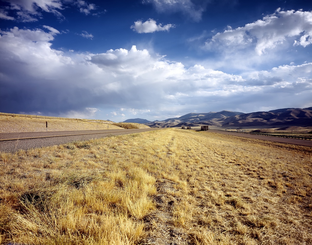
South-west Montana is the country between the famous parks – and that is exactly why it is so quiet. The route follows the Bitterroot River between two mountain ranges whose canyons cut into the granite wall like knife slashes, climbs over Lost Trail Pass and then opens out into the Big Hole: a high valley at almost 2,000 metres, so wide that the ranches on the horizon look like toys, with haystacks in beaverslide frames and moose in the willow thickets. From the sliding door you see frost on the grass in the morning, even in August, and in the evening the Pioneer Mountains in the last light. In between lie places where the gold rush is still standing: Bannack with its empty wooden houses, Garnet at the end of a gravel road, Philipsburg with sapphire sieves in the shop. Hot springs in Jackson and Elkhorn warm you up after cold nights, and in between you are often alone for hours with wind, forest and open space.
Stage-by-stage plan
1Stage 1: Missoula to Lake Como (approx. 105 km)
- The drive
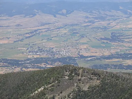
- From Missoula, US-93 leads south into the Bitterroot Valley: four lanes, flat, with heavy traffic as far as Florence and Hamilton. On your left the gentle Sapphire Mountains, on your right the rugged Bitterroot Mountains with their canyons. If you prefer it quieter, take the Eastside Highway (Route 203/269) from Florence via Stevensville to Hamilton – two lanes, through pasture and orchards. Driving time is around an hour and a half; Missoula itself is just the starting point for shopping and fuel. Beyond Hamilton, shortly before Darby, the paved access road to Lake Como branches off.
- Highlights & must-sees
- St. Mary’s Mission in Stevensville: founded by Jesuits in 1841, it is regarded as the nucleus of the first permanent settlement in what is now Montana. The simple wooden church from 1866, with Father Ravalli’s pharmacy and cabin, can be visited as a museum; opening times are seasonal, so check beforehand. On the edge of town is the Lee Metcalf National Wildlife Refuge with paths along the ponds.
- Daly Mansion near Hamilton: summer residence of copper baron Marcus Daly, with dozens of rooms in extensive grounds; guided tours in season. Daly founded Hamilton and Anaconda – the route meets him again at the end.
- Blodgett Canyon west of Hamilton: sheer granite walls, a creek with pools and a hiking trail that leads deep into the gorge within a few kilometres; the Blodgett Canyon Overlook Trail gives you the view from above. The access road is short but narrow, and parking at the trailhead is tight for large vehicles.
- CampingSpirit overnight tip
-
Official campsite or RV park: Three Frogs Campground at Lake Como (Bitterroot National Forest): a campground in pine forest above the reservoir, with drinking water, toilets, beach access and a loop trail around the lake; around 20 sites, pitches for trailers up to about 9 metres, no hook-ups; according to the Forest Service on a “first come, first served” basis, with the season mainly from late May to early September. At the upper end of the lake there is a smaller campground, and next to it the Rock Creek Horse Camp for riders. Alternatively, closer to Hamilton: Blodgett Canyon Campground at the canyon entrance, basic and small, only for short vehicles; or Charles Waters Memorial Campground on Bass Creek north of Stevensville.
Free camping or nature tip (where legal): In the Bitterroot National Forest, dispersed camping outside campgrounds is permitted unless signed otherwise: on existing spots along forest roads, with a time limit on your stay, and no vehicles off designated routes. At Lake Como itself and at the trailheads, overnight stays outside the campgrounds are not permitted. Usable spots can be found on the forest roads west of Darby; the forest’s Motor Vehicle Use Map (MVUM) shows where you may drive and park.
- Insider tip for campers
- Hamilton is the last major supply town before the Big Hole: supermarkets, propane, water and dump stations. In the Bitterroot National Forest a Food Storage Order applies every year from 1 March to 1 December – when you are not right there with them, store food, rubbish and scented items in a closed vehicle or in bear-resistant containers, also during the day and on the campground.
2Stage 2: Lake Como to May Creek (Big Hole) (approx. 95 km)
- The drive
- South of Darby, US-93 narrows to two lanes and follows the Bitterroot and, from Conner, the East Fork through an increasingly narrow forested valley. From Sula the road climbs in wide, well-built bends to Lost Trail Pass (2,140 m) on the Idaho border; gradients of around six per cent, crawler lanes for trucks. At the top of the pass, MT-43 branches off to the east and after a few kilometres crosses Chief Joseph Pass on the Continental Divide. Beyond it the road drops gently into the Big Hole – the forest ends and the open country begins. Driving time is under two hours.
- Highlights & must-sees
- Sula and the East Fork: a small store with a petrol station, and behind it larch and pine slopes where the traces of the big wildfire of 2000 can still be seen – an instructive look at how burned areas recover.
- Lost Trail Pass: Lewis and Clark crossed the Bitterroot Mountains here in 1805, at that time without a trail and in a snowstorm. In winter there is a small ski area here; in summer a good place for a break with a view into Idaho.
- Chief Joseph Pass: car park on the Continental Divide with information boards on the Nez Perce trek of 1877 and cross-country ski trails in winter. You can walk short sections of the Continental Divide Trail.
- CampingSpirit overnight tip
-
Official campsite or RV park: May Creek Campground (Beaverhead-Deerlodge National Forest): on MT-43 between Chief Joseph Pass and Big Hole National Battlefield, sites in open pine forest by the creek, toilets, drinking water in season; basic, no hook-ups. On the way there, in the Bitterroot, are Indian Trees Campground near Sula (large, old ponderosa pines) and Spring Gulch Campground on the East Fork along US-93 – both good alternatives if you want to split the stage.
Free camping or nature tip (where legal): On both sides of the pass, dispersed camping in the National Forest is permitted unless expressly prohibited. In the Beaverhead-Deerlodge, the maximum length of stay is as posted and shown on the MVUM; use only spots on existing access tracks, not on meadows. In fire season, campfires may be banned completely – check Stage 1 and Stage 2 restrictions daily.
- Insider tip for campers
- Lost Trail Pass is ploughed year-round, but in late autumn and spring it can snow at the top of the pass on a day when it is 15 degrees in Hamilton. There is hardly any mobile coverage in the Big Hole – save maps and campground information offline beforehand.
3Stage 3: May Creek to Bannack State Park (approx. 135 km)
- The drive
- After a few kilometres you reach the battlefield, then MT-43 runs dead straight through the Big Hole to Wisdom. There, turn south onto MT-278, through pasture to Jackson. Beyond Jackson, MT-278 swings east and climbs over Big Hole Pass and Badger Pass – broad, well-built passes with wide sagebrush slopes. Before Dillon a short access road leads south to Bannack, the last section gravel and dusty in dry weather. Driving time is just under two hours.
- Highlights & must-sees
- Big Hole National Battlefield: on 9 August 1877 the US Army attacked the camp of the Nez Perce here, who were fleeing to Canada with Chief Joseph; dozens of women, children and men died. Visitor centre with an exhibition, paths to the camp site by the river and to the siege area. A quiet, moving place – allow time.
- Wisdom: a few houses, a store, a petrol station and a reputation for regularly ranking among the coldest places in the USA. All around are the haystacks in wooden frames that gave the Big Hole its nickname, “valley of ten thousand haystacks”.
- Jackson Hot Springs: historic lodge with a large thermal pool in the village, a landmark of the valley; check bathing times and guest rules beforehand. Exactly what you need after a cold night in the Big Hole.
- CampingSpirit overnight tip
-
Official campsite or RV park: Bannack State Park: two campgrounds on Grasshopper Creek, Vigilante Campground and Road Agent’s Camp, with drinking water, toilets and fire rings, no electricity; there is also a tipi for rent. Reservations through the Montana State Parks reservation system; book early in summer and at weekends. Visitors without Montana licence plates may also have to pay a day-use fee.
Free camping or nature tip (where legal): Around Bannack there are extensive BLM lands where dispersed camping is permitted for up to 14 days, unless signed otherwise. Private ranch land in the Big Hole is off limits, even if no fence is visible; the onX map app or BLM maps show the boundaries.
- Insider tip for campers
- Bannack has no store and no mobile coverage. Fill up with water and diesel in Wisdom or Jackson; prices there are higher. In the ghost town the houses are open to walk into – pack a torch for dark interiors.
4Stage 4: Bannack to Pioneer Mountains (Wise River) (approx. 165 km)
- The drive
- First the short detour to Dillon on MT-278, then back west to the turn-off for the Pioneer Mountains Scenic Byway, around 40 kilometres west of Dillon. The byway runs north for about 79 kilometres (49 miles) to Wise River: at first through open grassland, then into the forest and along Grasshopper Creek and the Wise River. Mainly the northern section between Wise River and Crystal Park is paved; in the south, between MT-278 and Price Creek, the road is partly gravel, narrow and winding, and dusty in dry weather. Between Elkhorn Hot Springs and the Pettengill car park the byway is closed to cars from about December to mid-May. Driving time is around three hours including the Dillon detour.
- Highlights & must-sees
- Bannack State Park in the morning: Montana’s first territorial capital after the gold strike of 1862, with the Hotel Meade, schoolhouse, jail and the memory of Sheriff Henry Plummer, whom the vigilantes hanged in 1864. More than 50 buildings, free to walk into.
- Dillon: county seat with the Beaverhead County Museum and supermarkets – ideal for stocking up. To the north-east lies Clark’s Lookout State Park, a rock from which William Clark kept watch in 1805.
- Crystal Park: a mineral field in the forest where you may dig for quartz and amethyst crystals with a spade and sieve; open during daylight from about mid-May to mid-October, check fees on site, bring your own tools. A few kilometres further on is the historic Elkhorn Hot Springs with thermal pools and cabins, and by the roadside the turn-off to the ghost town of Coolidge.
- CampingSpirit overnight tip
-
Official campsite or RV park: Along the byway are numerous basic campgrounds of the Beaverhead-Deerlodge National Forest: Grasshopper Campground near Elkhorn Hot Springs (reservations via recreation.gov), Mono Creek, Little Joe and Price Creek in the middle section, and Willow, Boulder Creek, Fourth of July and Lodgepole on the Wise River in the northern section. Mostly drinking water in season and toilets, no hook-ups; lengths are limited, so for large vehicles choose Willow or Boulder Creek.
Free camping or nature tip (where legal): Along the Wise River there are simple riverside spots that may be used for dispersed camping outside the campgrounds, unless signed otherwise. Keep your distance from the water and do not create new fire rings. The Beaverhead-Deerlodge Food Storage Order applies here.
- Insider tip for campers
- The spur road to the ghost town of Coolidge is gravel, narrow and has a steep ramp – unsuitable for trailer rigs and large motorhomes; leave your vehicle at the bottom or skip it altogether. For Crystal Park, bring a folding spade, gloves and a coarse sieve.
5Stage 5: Wise River to Georgetown Lake (approx. 100 km)
- The drive
- From Wise River, take MT-43 a short way east through the narrow valley of the Big Hole River, then north onto MT-569 (Mill Creek Highway) over the heights of the Mount Haggin Wildlife Management Area to Anaconda: paved but narrow and winding, hardly any traffic, with snow and ice in winter – check conditions with the Montana Department of Transportation; upgrade works with roadworks are possible. Alternative via Divide, I-15 and I-90 through Butte. At Anaconda begins MT-1, the Pintler Veterans’ Memorial Scenic Highway, which climbs through a canyon to Georgetown Lake. Driving time is around two hours.
- Highlights & must-sees
- Mount Haggin Wildlife Management Area: open uplands with moose, elk and pronghorn; drive slowly in the morning and evening and keep your binoculars ready.
- Anaconda Smelter Stack: the 178-metre chimney of the former copper smelter, one of the tallest masonry structures in the world; viewpoint on the edge of town, the site itself may not be entered. In the old town is the art deco Washoe Theater cinema.
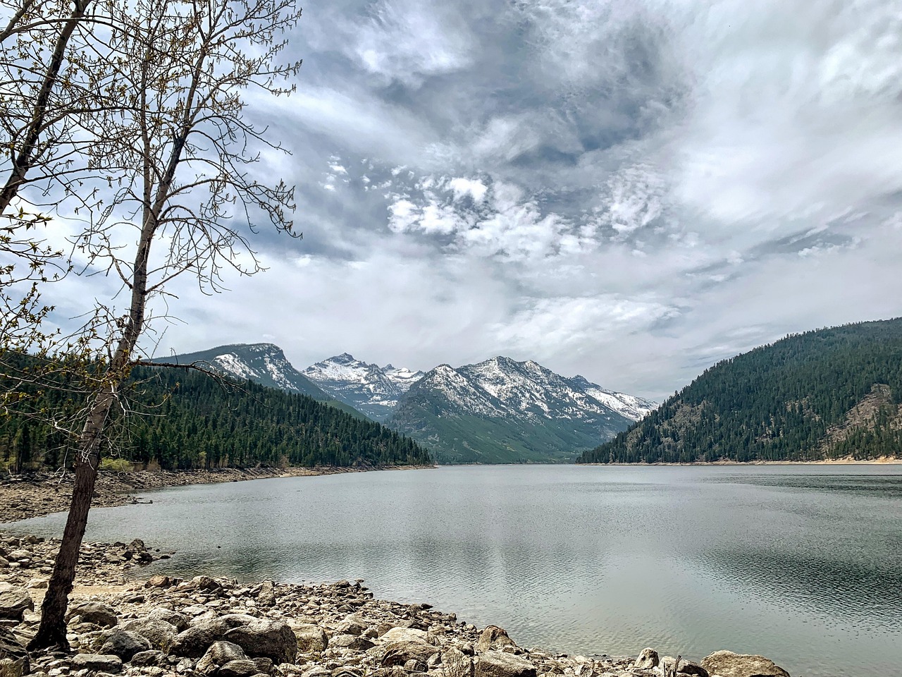
- Georgetown Lake: a reservoir at over 1,900 metres against the backdrop of the Anaconda-Pintler mountains, known for trout and clear evenings. Drive around the lake with detours to the shore access points.
- CampingSpirit overnight tip
-
Official campsite or RV park: At Georgetown Lake the Beaverhead-Deerlodge National Forest runs several campgrounds: Philipsburg Bay Campground with large loops near the shore, drinking water, toilets and boat ramp, no hook-ups, trailers up to about 10 metres recommended, and Piney Campground right on the water with drinking water and boat ramp; both open from about mid-May to late September and bookable via recreation.gov. On the way there is Spring Hill Campground on MT-1. Lost Creek State Park north of Anaconda has a waterfall and basic sites, but the access road is narrow – note the length limit.
Free camping or nature tip (where legal): On the forest lands around Georgetown Lake there are dispersed spots along the forest roads; directly on the lakeshore and in the picnic areas, overnight stays outside the campgrounds are not permitted. Parts of the lakeshore are privately owned – observe the signs.
- Insider tip for campers
- Fill up with fuel and water in Anaconda; there are few supplies at the lake itself. The lake is high up – even in July nights drop to near zero degrees, so your heating and gas should be working.
6Stage 6: Georgetown Lake to Blackfoot River (Clearwater Junction) (approx. 145 km)
- The drive
- MT-1 drops from Georgetown Lake into the Flint Creek Valley to Philipsburg and then follows the valley north to Drummond on I-90. Instead of taking the interstate to Missoula, head north on MT-271 to Helmville and on via MT-141 to the Blackfoot River and onto MT-200: two-lane country roads through cattle country with few towns. Driving time is around two hours.
- Highlights & must-sees
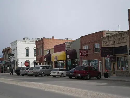
- Philipsburg: restored mining town from the 1880s with colourful brick façades. In shops on the main street you can buy bags of gravel from the region’s sapphire deposits and wash out sapphires yourself – finds can be cut and set on site.
- Granite Ghost Town State Park above Philipsburg: ruins of the silver town of Granite at over 2,000 metres. The access is a steep, narrow mountain road – not for motorhomes or trailer rigs, only with an off-road-capable vehicle.
- Blackfoot River: the river of Norman Maclean’s “A River Runs Through It”, with gravel bars, pine-lined banks and a recreation corridor in which federal and state agencies and landowners have created access points.
- CampingSpirit overnight tip
-
Official campsite or RV park: Russell Gates Memorial Fishing Access Site on MT-200 near Clearwater Junction (Montana Fish, Wildlife & Parks): basic site right on the Blackfoot River with toilets, no hook-ups; length of stay limited, fees as posted. More basic sites in the Blackfoot River Recreation Corridor (BLM) downstream, such as Ninemile Prairie and Corrick’s River Bend.
Free camping or nature tip (where legal): In the Blackfoot River Recreation Corridor, camping is only permitted at the designated sites, because much of the riverbank is private land with public access by agreement. Dispersed camping is available on BLM and forest lands north of MT-200; observe the local rules.
- Insider tip for campers
- Philipsburg is a good place for a lunch break, but the main street is steep and narrow. Leave large vehicles in the car parks on the edge of town. Fill up in Drummond, as there are hardly any petrol stations on the back route to Missoula.
7Stage 7: Clearwater Junction to Missoula (approx. 115 km)
- The drive
- Take MT-200 downstream to the west as far as the brown-signed turn-off for the Garnet Range Road between mileposts 22 and 23. The road is mostly gravel and climbs around 600 metres over roughly 19 kilometres into the Garnet Range. Feasible for mid-sized motorhomes in dry weather; with large rigs and trailer combinations, leave the trailer at the bottom. Other approaches to Garnet, such as through Bear Gulch, are steep, narrow and rough. Then back to MT-200 and through the Blackfoot valley via Bonner to Missoula.
- Highlights & must-sees
- Garnet Ghost Town (BLM): one of Montana’s best-preserved gold-mining towns, with a hotel, stores and log cabins from the 1890s; visitor centre from about late May to September; check on site whether a fee applies and how much. In winter, from January into spring, the Garnet Range Road is closed to wheeled vehicles and Garnet can only be reached on skis or by snowmobile.
- Johnsrud Park on the Blackfoot River (BLM): put-in and take-out for rafts and kayaks with gravel bars, good for a break by the water.
- Missoula to finish: the Waterfront Trail on the Clark Fork, the standing surf wave Brennan’s Wave right in the middle of town and a walk up to the “M” on Mount Sentinel.
- CampingSpirit overnight tip
-
Official campsite or RV park: In Missoula itself there are only private campgrounds; basic public alternatives are the BLM sites in the Blackfoot corridor downstream, such as Thibodeau, before you drive into town.
Free camping or nature tip (where legal): Camping is not permitted in the ghost town of Garnet itself. On the surrounding BLM lands, dispersed camping is permitted for up to 14 days unless signed otherwise; however, the roads there are narrow and unsuitable for large vehicles. In Missoula, sleeping in your vehicle on public streets is restricted.
- Insider tip for campers
- Before the Garnet Range Road, check your tyre pressure and drive slowly – potholes and washboard are normal. There is no water and there are no supplies in Garnet; bring food and take your rubbish back out with you.
Camping practice & local rules
Wild camping & overnight parking
- Montana permits dispersed camping on most National Forest and BLM land, as long as nothing else is signed. In National Forests the maximum stay is usually 16 days, on BLM land 14 days; after that, move on. On the ground, the Motor Vehicle Use Map is what counts: drive and park only on designated roads.
- Food Storage Orders: in the Beaverhead-Deerlodge National Forest an order applies every year from 1 March to 1 December under which food, drinks, rubbish and scented items must be attended, hung, stored in a bear-resistant container or kept in a closed vehicle; violations are criminal offences (Class B Misdemeanor) with heavy fines. The Bitterroot National Forest has its own order with the same rules and the same period; check the current version on fs.usda.gov.
- Bears: grizzlies are spreading in the Bitterroot, the Big Hole and the Pioneer Mountains, and black bears are everywhere. Carry bear spray within reach, make noise when hiking, and never leave food in the tent or out in the open at your site.
- Montana State Parks: visitors without Montana licence plates may have to pay day-use fees in addition to the camping fee; Fishing Access Sites have their own camping fees as posted. Reservations through the central Montana State Parks system; forest campgrounds partly via recreation.gov, partly on a “first come, first served” basis.
- US national parks and sites: visitors without US residency may face higher fees and surcharges at heavily visited parks; check current amounts on nps.gov. Big Hole National Battlefield is off the beaten track, quiet and charges no admission.
- Apps: iOverlander, Campendium, The Dyrt, recreation.gov and onX for land ownership boundaries; Park4Night is not widely used in Montana.
Waste disposal & supplies
- Dump stations: in Missoula, Hamilton, Dillon, Anaconda and at some state park and forest campgrounds; the basic forest campgrounds in the Big Hole and the Pioneer Mountains have none. Never empty grey water into creeks or onto the ground.
- Drinking water: at forest campgrounds usually only in season, often from late May to early September; outside that, bring full tanks. Only drink creek water filtered and boiled.
- Propane: hardware stores, farm supply stores and petrol stations in Missoula, Hamilton, Dillon and Anaconda fill US cylinders; European cylinders are generally not filled.
- Fuel: petrol stations are rare in the Big Hole and the Pioneer Mountains – fill up in Hamilton, Wisdom, Dillon and Anaconda. Diesel is not always available in small towns.
- Electricity: hardly any public campground on the route offers hook-ups. Solar and a well-charged leisure battery make sense; generators only during permitted hours.
Vehicle size & traffic rules
- Speed limits, unless signed otherwise: interstates 80 mph for cars, 70 mph for heavy vehicles (over one ton payload), 65 mph within the Missoula urban area; two-lane highways 70 mph by day and 65 mph at night, 65 mph for heavy vehicles. Watch the signs, especially on stretches with wildlife crossings.
- Montana has no statewide ban on phone use while driving, but cities such as Missoula prohibit using a hand-held phone. Hands-free is safer.
- There are no tolls in Montana. Trailer rigs need safety chains and working brakes, and above certain weights the trailer needs its own brakes.
- Wildfire season: July to September, often longer. Smoke can sit in the valley for weeks, and campfire bans and road closures come at short notice; check inciweb.nwcg.gov and the forests’ websites daily.
- Wildlife: deer, elk and moose cross especially at dusk. Drive carefully and reduce speed at night.
- Winter: Lost Trail Pass, Chief Joseph Pass and MT-278 are ploughed, but snow and ice are possible from October to May. The Pioneer Mountains Scenic Byway is closed between Elkhorn Hot Springs and Pettengill from about December to mid-May, and the Garnet Range Road is closed to vehicles from January into spring. Road information via the Montana Department of Transportation’s 511 system.
- Emergency: 911. Mobile coverage is patchy or absent in the Big Hole, in the Pioneer Mountains and around Garnet.
CampingSpirit packing & preparation checklist
- Bear spray (buy it in Missoula or Hamilton; it cannot be carried on planes): grizzlies are possible along the entire route.
- Bear-resistant cool box or container with IGBC certification: meets the Food Storage Orders when food cannot stay in the vehicle.
- Warm sleeping bag and a diesel heater or fan heater: in the Big Hole and at Georgetown Lake it freezes at night even in high summer.
- Folding spade, gloves and sieve: for crystals at Crystal Park and sapphires in Philipsburg.
- FFP2 masks and an air purifier for the interior: wildfire smoke can hang in the valleys for days in August.
- Offline maps and a land ownership app such as onX: mobile coverage is often missing, and private and public land alternate frequently.
As of 2026-10. Closures, fees and booking rules change: check official sources before you go.