

In-depth guide · CampingSpirit
From Limerick via Killaloe and Lough Derg to Clonmacnoise and Athlone, on to Lough Key, through the lake country of Leitrim to the Shannon-Erne Waterway, via Mullingar into the Slieve Bloom Mountains and back by way of Birr: around 620 kilometres through the quiet heart of Ireland, driving on the left.
The spirit of the route
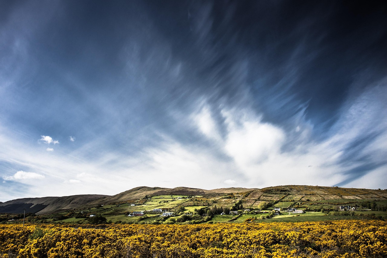
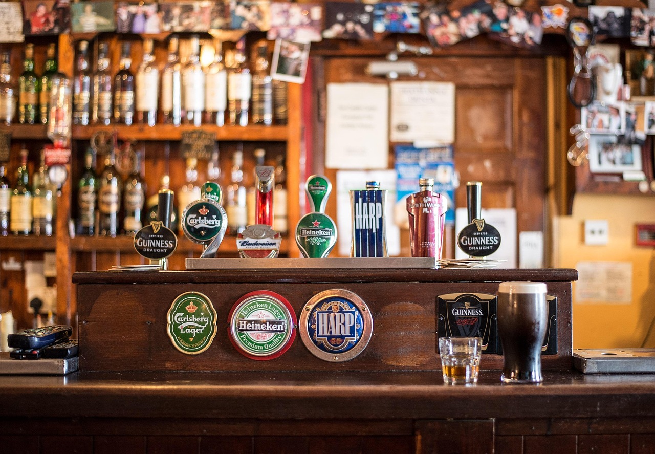
There are no cliffs and no Atlantic surf here, but there is water in every form. The Shannon flows broad and sluggish through pastures and bogs, swelling into lakes whose shores are lined with reeds, alders and small stone harbours. In the morning mist hangs over Lough Derg, a white-tailed eagle circles above Holy Island, and the first hire boats chug out of the harbour from the jetty. From the sliding door you see round towers above river meadows, cows belly-deep in grass, lock-keepers’ cottages and canals winding through Leitrim’s drumlins. In the Midlands Ireland is not loud: the smell of turf from chimneys, low-ceilinged pubs, a telescope from Victoria’s day in a castle park. The roads are narrow but rarely busy, the stages short. This route rewards slowness – and people who would rather watch the boats moor in the evening than chase the next photo spot.
Stage-by-stage plan
1Stage 1: Limerick to Mountshannon (via Killaloe/Ballina) (approx. 55 km)
- The drive
- From Limerick head north on the R463 along the Clare bank of the Shannon via Ardnacrusha and O’Briensbridge to Killaloe: two lanes, but winding and with hedges right up to the tarmac. Then take the R463 to Tuamgraney and the R352 along the western shore of Lough Derg to Mountshannon. Hilly, a few blind crests, with repeated views of the lake. Pure driving time a little over an hour.
- Highlights & must-sees
- Ardnacrusha: the hydroelectric power station of the Shannon Scheme, built by Siemens-Schuckert in the 1920s and at the time one of the largest in Europe; from the canal bank you can see the locks, tours only on request from the operator.
- Killaloe and Ballina: twin towns at the old arched bridge over the outflow of Lough Derg, with the 13th-century St Flannan’s Cathedral and the Thorgrim Stone, which bears an inscription in Ogham and in Norse runes; this was once Kincora, the seat of the High King Brian Ború.
- Mountshannon: in season, boats run from the small harbour to Holy Island (Inis Cealtra) with a round tower and the church ruins of an early Christian monastic settlement; for a good decade white-tailed eagles have been breeding above the shore again.
- CampingSpirit overnight tip
-
Official campsite or RV park: Lakeside Holiday Park on the lakeshore near Mountshannon: a site with pitches for motorhomes and tents right on Lough Derg, plus mobile homes; ask in advance about electricity, sanitary facilities, waste disposal and the season. If you want to stop at Killaloe already, Killaloe Camping, a few kilometres north of the town on the R463, is a smaller site – check facilities and suitability for larger vehicles beforehand.
Free camping or nature tip (where legal): There is no right to wild camp in Ireland. The harbour car parks around Lough Derg – Mountshannon, Dromaan, Garrykennedy, Dromineer – mostly belong to Waterways Ireland or the county councils and are intended for day visitors and boaters; in places, signs prohibit overnight stays in motorhomes. The absence of signs is not permission. Use the harbours for a break by the water, and sleep on the campsite.
- Insider tip for campers
- The old bridge between Ballina and Killaloe has been closed to vehicles since October 2025 and is now only a footpath and cycle path; traffic uses the new Shannon bridge of the Killaloe bypass about one kilometre south. The lanes of Killaloe get tight with long vehicles – park on the edge of town and walk across the old bridge. Before leaving Limerick, shop and fill up at one of the large supermarkets on the arterial roads: on the western shore of Lough Derg there are only small village shops.
2Stage 2: Mountshannon to Athlone (via Portumna and Clonmacnoise) (approx. 105 km)
- The drive
- Take the R352 via Whitegate to Portumna, then along the Galway bank via Eyrecourt to Banagher, cross the Shannon there and follow minor roads through flat bog and pasture to Shannonbridge. From there take the R444 to Clonmacnoise and on to Athlone. Mostly quiet regional roads; the narrow bridges in Banagher and Shannonbridge require attention. Around 2 hours of pure driving time – with the castle and the monastic city, a full day.
- Highlights & must-sees
- Portumna Castle: a fortified manor house from the early 17th century with a walled kitchen garden, next to it Portumna Forest Park with shoreline paths along Lough Derg, and the Irish Workhouse Centre in the former poorhouse.
- Shannonbridge: the Napoleonic-era fortifications at the river crossing, with the long stone arch bridge over the Shannon.
- Clonmacnoise: a monastic city above the Shannon meadows, founded by St Ciarán in the 6th century, with two round towers, church ruins and high crosses; the originals of the great crosses stand in the visitor centre, with copies outside.
- CampingSpirit overnight tip
-
Official campsite or RV park: Lough Ree East Caravan and Camping near Ballykeeran, a few kilometres north-east of Athlone on the shore of Lough Ree: pitches with electricity on gravel and grass for motorhomes and tents, and a pub within walking distance. Ask in advance about the season and waste disposal.
Free camping or nature tip (where legal): The car parks at Clonmacnoise and at the forts of Shannonbridge are visitor or day car parks; overnight stays are not intended. Harbour spots on the Shannon reported in parking apps can change: Waterways Ireland, which manages around 50 harbours on the Shannon alone, has for some time been working on a strategy for motorhomes staying overnight in its car parks, after local politicians complained about long-term campers. Signs on site take precedence over app comments.
- Insider tip for campers
- The Shannon bridge at Portumna is a swing bridge: when it opens for boats, traffic stops for a few minutes – important if you cross to the Tipperary bank for a detour. Arrive early at Clonmacnoise – from mid-morning the coaches roll in and the car park fills up. The evening outing to the centre of Athlone is best done by taxi or bike from the site, so that the pint in the pub does not become a problem with the drink-driving limit.
3Stage 3: Athlone to Lough Key Forest Park near Boyle (via Strokestown) (approx. 85 km)
- The drive
- After a morning in Athlone, head north on the N61 to Roscommon, then on regional roads through pasture and small villages to Strokestown and on towards Boyle. A wide national road, followed by typical Irish country roads with bumps and little verge. A good 1.5 hours of pure driving time.
- Highlights & must-sees
- Athlone: the castle on the Shannon with the exhibition on the siege of 1691, and right behind it Sean’s Bar, which claims to be the oldest pub in Ireland – with sawdust on the floor.
- Strokestown Park with the National Famine Museum: the estate of the Mahon family uses its own records to show how the Great Famine from 1845 drove out tenants; plus the house and walled garden. This is also the start of the Famine Way, a walking trail to Dublin following in the footsteps of emigrating tenants.
- Boyle Abbey: a 12th-century Cistercian abbey in the middle of town, plus the Georgian King House.
- CampingSpirit overnight tip
-
Official campsite or RV park: Lough Key Caravan & Camping Park in Lough Key Forest Park east of Boyle: according to the operator, around 45 pitches with electricity among old trees, water points, showers for a fee, laundry room and cooking area. Open roughly from March to October; current prices on the operator’s website. Arrival with motorhome or tent between 2 pm and 9 pm. Ask in advance whether there is a cassette disposal point.
Free camping or nature tip (where legal): Lough Key Forest Park is a woodland park with managed day car parks; staying overnight outside the campsite is not intended there. In Strokestown and Boyle there are also no tolerated overnight spots that could be reliably named.
- Insider tip for campers
- The Forest Park is worth a full day without the vehicle: the treetop walk, the old servants’ tunnels under the vanished mansion, the Moylurg Tower viewpoint and hire boats on the lake. In Boyle the town centre is tight; larger vehicles park at the supermarkets on the edge of town, which is also where to get diesel and supplies.
4Stage 4: Lough Key to Leitrim (Shannon-Erne loop via Carrick-on-Shannon and Drumshanbo) (approx. 70 km)
- The drive
- Take the N4 to Carrick-on-Shannon, then via Leitrim Village to Drumshanbo at the southern end of Lough Allen and on minor roads through the drumlin hills to the Shannon-Erne Waterway at Ballinamore. Back to Leitrim Village. From Carrick on, narrow, winding country roads with hedges and potholes; let oncoming traffic pass slowly on the bends. About 1.5 hours of pure driving time.
- Highlights & must-sees
- Carrick-on-Shannon: a riverside promenade with the hire-boat marina and the tiny Costello Chapel of 1879, one of the smallest chapels in the world.
- Acres Lake near Drumshanbo: a floating boardwalk around 600 m long across the lake, part of the Shannon Blueway, which links Drumshanbo, Leitrim and Carrick as a walking and cycling route.
- Shannon-Erne Waterway: the canal, around 60 km long with 16 locks, links the Shannon with Lough Erne in Northern Ireland from Leitrim Village; at the locks around Ballinamore you can watch the boats locking through.
- CampingSpirit overnight tip
-
Official campsite or RV park: Battlebridge Caravan & Camping Park at Battlebridge lock near Leitrim Village, right on the Shannon: motorhome pitches with electricity, sanitary facilities and a boat jetty; short distances to the Blueway. Ask in advance about the season and waste disposal.
Free camping or nature tip (where legal): The Waterways Ireland harbours and jetties on the Shannon and the Shannon-Erne Waterway are not motorhome stopovers. In Dromod, for example, users report signs against overnight stays. Some harbours have toilets, showers and water – but they are intended for boaters and can often only be used with the Waterways Ireland smartcard. If you still want to stand at a jetty, you need a clear sign that permits it; camping behaviour is off limits.
- Insider tip for campers
- In Carrick-on-Shannon traffic on the N4 backs up at the bridge; parking for long vehicles is easier to find at the supermarkets than on the promenade. Between Drumshanbo and Ballinamore there are hardly any filling stations – fill up in Carrick beforehand. Hire boats on the Shannon do not require a boating licence: a day on the water from Carrick is a real alternative to a driving day.
5Stage 5: Leitrim to Mullingar / Lough Ennell (approx. 95 km)
- The drive
- Back to Carrick and south on the N4 along the Shannon via Dromod and Rooskey to Longford, then on the N4 to Mullingar and on the N52 to Lough Ennell. A wide national road, partly with overtaking sections, 50 km/h through the towns. Around 1.5 hours of pure driving time.
- Highlights & must-sees
- Dromod and Rooskey: Shannon harbours on the N4, and in Dromod a small heritage railway on the route of the old Cavan & Leitrim narrow-gauge line.
- Mullingar: the Cathedral of Christ the King with mosaics by Boris Anrep.
- Belvedere House, Gardens & Park on the shore of Lough Ennell: an 18th-century country house, gardens and the Jealous Wall, an artificial ruin that the first Earl of Belvedere had built out of a quarrel with his brother – the largest garden folly in Ireland.
- CampingSpirit overnight tip
-
Official campsite or RV park: Lough Ennell Caravan & Camping Park near Tudenham on the eastern shore of Lough Ennell, only a few minutes from Belvedere: pitches under trees by the lake, electricity and sanitary facilities; open seasonally, check dates in advance.
Free camping or nature tip (where legal): The bathing spots and car parks at Lough Ennell and Lough Owel are day sites, heavily used in summer. The harbour car parks along the N4 are not reliable places to spend the night. You sleep legally on the site by the lake.
- Insider tip for campers
- At Belvedere the large visitor car park works well even for longer vehicles. Mullingar is a hub of the Old Rail Trail, a cycle path on an old railway line to Athlone, and of the Royal Canal Greenway – it is worth taking the bikes off the rear rack here.
6Stage 6: Lough Ennell to Roscrea (via the Slieve Bloom Mountains) (approx. 105 km)
- The drive
- Take the N52 to Tullamore, then via Clonaslee into the Slieve Bloom Mountains. In the mountains, narrow roads without a centre line, single-track sections with passing places, steep ramps and cattle grids; then over The Cut, the pass between Mountrath and Kinnitty, down to Kinnitty and on to Roscrea. Pure driving time a good 2 hours. Long vehicles and caravan outfits are better off staying on the roads along the edge of the mountains and approaching Clonaslee and Kinnitty separately.
- Highlights & must-sees
- Glenbarrow waterfall near Rosenallis: a loop walk through woodland along the young River Barrow to the stepped falls.
- Ridge of Capard: a viewpoint ridge above the Midlands, on a clear day with views far across Laois and Offaly.
- Kinnitty: a village at the foot of the mountains with a small pyramid serving as a tomb in the churchyard; starting point for stages of the Slieve Bloom Way, a multi-day circular walking route through the mountains.
- CampingSpirit overnight tip
-
Official campsite or RV park: Streamstown Caravan and Camping Park near Roscrea: a quiet rural site with pitches for motorhomes, electricity and sanitary facilities; ask in advance about the season and waste disposal.
Free camping or nature tip (where legal): The walkers’ car parks in the Slieve Blooms (Glenbarrow, Ridge of Capard, The Cut) are small and intended for day visitors; forest roads of the state forestry company Coillte are often closed with barriers and not open to vehicles. Overnight stays in a vehicle are not intended here.
- Insider tip for campers
- On the mountain roads navigation software is unreliable and likes to send vehicles along single-track farm tracks. Plan the route on the map beforehand and stick to signposted roads. Top up water and provisions in Tullamore; there are hardly any shops in the mountains.
7Stage 7: Roscrea to Limerick (via Birr) (approx. 105 km)
- The drive
- Take the N62 north to Birr, then the N52 via Borrisokane to Nenagh and the M7 to Limerick. Well-built national roads and a motorway without tolls, about 1.5 hours of pure driving time. If you have time, take a detour from Borrisokane to the eastern side of Lough Derg to Terryglass or Dromineer.
- Highlights & must-sees
- Birr Castle Demesne: the castle park is home to the Great Telescope, a reflecting telescope built by the third Earl of Rosse in the 1840s, which was the largest in the world for decades; plus a science museum, gardens with very tall box hedges, rivers and waterfalls. The castle is lived in; tours only in season.
- Roscrea: the castle and Damer House, an early Georgian town house, in the middle of town, plus a round tower on the main street.
- Birr: a small Georgian town with Emmet Square and the tree-lined Oxmantown Mall.
- CampingSpirit overnight tip
-
Official campsite or RV park: For the last night or as the starting point of the loop: Crokers Farm near Ballyneety, south-east of Limerick, a small touring site on a farm with hardstanding pitches, some with electricity and water; no tents. Book in advance.
Free camping or nature tip (where legal): Overnight stays in a vehicle are not tolerated within the city of Limerick or in the car parks by the castle park in Birr. Birr Castle has a visitor car park for day visitors.
- Insider tip for campers
- Visit Birr in the morning, when the castle car park is empty and the afternoon drive to Limerick is short. If you are continuing from Limerick to Shannon Airport or into Clare, use the tolled Limerick Tunnel on the N18 (barrier, payment in cash or by card).
Camping practice & local rules
Wild camping & overnight parking
- Ireland has no right of public access to land. Free camping is only permitted with the landowner’s consent; in public car parks the county councils (here Clare, Tipperary, Galway, Offaly, Westmeath, Roscommon, Leitrim, Longford, Laois) decide through bye-laws and signs whether motorhomes may stay overnight. Some councils have issued their own motorhome parking bye-laws; violations incur fines.
- Waterways Ireland manages harbours, jetties and locks on the Shannon and the Shannon-Erne Waterway. The car parks there are not motorhome stopovers: some harbours have prohibition signs, and the authority is working on rules for campers on its land. Without a sign that explicitly permits overnight stays, better not to stay overnight; awnings, chairs and grey water are off limits there in any case.
- In forest parks and on Coillte land: parking is for daytime, overnight only on the designated campsites. Barriers on forest roads mean no entry.
- You sleep legally on campsites and on private pitches at farms and pubs. In the Midlands the network is thin; many sites close in autumn and open around Easter – in October, phone ahead. Helpful: the Camping Ireland directory, Campercontact and park4night (read comments on harbour spots critically).
Waste disposal & supplies
- Disposal for cassettes and grey water is almost only available on campsites; public stations at filling stations are rare. The pump-out facilities at harbours are meant for boats, not motorhomes. So empty the cassette at every site, even if it is not yet full.
- Tap water is drinkable. The taps at Waterways Ireland harbours serve primarily to supply boats and sometimes only work with the smartcard; fill the tank on the campsites.
- Gas: Calor and Flogas are common in Ireland, and German exchange cylinders are not exchanged; Campingaz is available in outdoor shops and DIY stores. Autogas for refillable cylinders is offered only at individual filling stations – look up locations in advance on an LPG map and carry the right adapter.
- Campsites mostly have CEE sockets with 230 V. Large supermarkets with filling stations and spacious car parks are on the outskirts of Limerick, Athlone, Carrick-on-Shannon, Mullingar and Tullamore – good places to stock up.
Vehicle size & traffic rules
- Driving on the left: roundabouts go clockwise, and traffic already on the roundabout (from the right) has priority. On narrow country roads with hedges and walls, the left side of the vehicle is the critical one – keep mirrors foldable and stop at narrow points if in doubt. Adjust headlights for driving on the left or mask them.
- Speed limits according to the Road Safety Authority in km/h: motorways 120, national roads 100, regional roads 80, rural local roads 60 since February 2025, built-up areas 50, many residential areas and town centres 30. A reduction on the smaller national roads is planned – the sign always applies. With a caravan or trailer, a maximum of 80 km/h. Check separate limits for motorhomes over 3.5 t with the RSA before travelling.
- Tolls: the roads on this route are toll-free. However, barrier toll plazas with cash or card payment exist, for example, at the Limerick Tunnel (N18) and on sections of the M4 (towards Dublin) and the M6 (towards Galway). The M50 around Dublin charges without barriers by number plate; pay online with eFlow by 8 pm the following day.
- Drink-driving limit 0.5 (50 mg/100 ml of blood), 0.2 for novice and professional drivers – the pubs by the water are a reason not to drive any more in the evening. Phone use at the wheel only hands-free. Many bridges over the Shannon and the canals are narrow or single-lane with traffic lights, and some swing bridges open for boats.
- Ireland is in the EU but not in the Schengen Area: carry ID, vehicle registration certificate and proof of insurance. If you travel via Great Britain, as an EU citizen you need an ETA for the transit.
CampingSpirit packing & preparation checklist
- Bikes or a folding e-bike on the rear rack – for the Shannon Blueway, the Old Rail Trail and the paths in Lough Key Forest Park.
- Binoculars: white-tailed eagles above Lough Derg, waterbirds on Lough Ree and Lough Ennell, boats at the locks.
- An additional mirror for the left side and a 1:50,000 paper map for the Slieve Blooms, where satnavs lead onto single-track farm tracks.
- A Calor- or Flogas-compatible adapter or a refillable gas tank – foreign exchange cylinders are not exchanged.
- Wellies and a waterproof jacket: shoreline paths, monastery meadows and bog trails are almost always wet.
- Small coins and a card for showers and washing machines on the campsites.
As of 2026-10. Closures, fees and booking rules change: check official sources before you go.